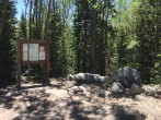
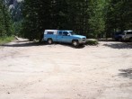
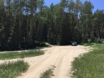
7/28/2008 Posted On: 7/28/2008 By: scotthsu Info: Large puddle mentioned below is still there as of July 27; it was more than a few inches deep. I‘d want at least AWD with better than average passenger car clearance; hi-clearance 4WD would be no problem. | ||||
7/19/2008 Posted On: 7/19/2008 By: Cody Info: There is a very large puddle a few inches deep with an exposed culvert about 3 miles from the parking area. All cars we saw were parked here. A 4x4 Xterra and Escape were able to make it in and out without problem. | ||||
6/29/2008 Posted On: 6/29/2008 By: covfrrider Info: Same as last report. | ||||
6/15/2008 Posted On: 6/15/2008 By: doumall Info: Trees have been cleared, trailhead is accessable with high clearance 2wd. | ||||
6/13/2008 Posted On: 6/13/2008 By: thatguy Info: A fallen tree blocks the road about 0.75 from the Huerfano and Zapata trailhead and 1.75 miles from the Lily Lake trailhead. | ||||
5/31/2008 Posted On: 5/31/2008 By: Ridge runner Info: There are several creek crossings and a couple large, deep puddles (one about a foot deep), but my Jeep made it through no-problem. We got stopped about 1/3 of a mile from the TH by snowdrifts. The snowdrifts were rapidly melting - another week of warm temps and you might be able to get all the way to the TH. | ||||
5/29/2008 Posted On: 5/29/2008 By: cftbq Info: As of 27 May, there is a large snowdrift, which will stop any vehicle, about halfway between the NF boundary and the actual trailhead. Beyond that, the road/trail has serious drifts in numerous places, but they are melting fast. The pool of muddy water (the drain culvert appears to be blocked) about a mile short of the forest boundary is only about 6 inches deep, and can actually be safely crossed by most vehicles. | ||||
5/4/2008 Posted On: 5/4/2008 By: DaveP Info: Climbed Lindsey via the North Couloir on Tuesday. The road is passable via passenger car to about 17 miles from the Redwing spur of Colorado 69. Four-wheel drive can make it to mile 18.5, then ice and densly consolidated snow drifts make it to treacherous to drive any further. | ||||
4/26/2008 Posted On: 4/26/2008 By: cpstoney Info: Intermitent snow drifts 3.2 miles short of trailhead - 1/4 mi. short of pond crossing (Chev. Tahoe could go no further). Solid snow cover (4‘+) from nat‘l forest boundary to trailhead. Estimate 2-3 weeks will be able to drive to nat‘l forest boundary, 5-8 weeks before you might be able to drive to trailhead. | ||||
11/26/2007 Posted On: 11/26/2007 By: wildbrookie Info: The road has consistent 3" snow coverage, and the water crossings are topped with about a 1 1/2" to 2" of good hard ice...mind your undercarriage. | ||||
11/3/2007 Posted On: 11/3/2007 By: burningthebushes Info: For those coming from the west over La Veta Pass, check out this link for a great shortcut -- http://www.summitpost.org/mountain/rock/150496/mount-lindsey.html -- I'm going this way today, so I'll give more info if needed | ||||
8/11/2007 Posted On: 8/11/2007 By: Gene913 Info: As if 08/09/2007 road is in great shape until reaching Singing River Ranch. After that, it becomes rough but passable for 4x2 Ford Ranger pickup or vehicles with similar clearance. About 2 miles past the Singing River Ranch there is a low water crossing that will present problems for low clearance passenger cars. | ||||
6/10/2007 Posted On: 6/10/2007 By: swm88er Info: Passable for 4wd cars all the way to the trailhead. | ||||
5/27/2007 Posted On: 5/27/2007 By: ClimbandMine Info: Still some snow banks near the top. Parking available at a campsite within a 10 minute walk from the trailhead. | ||||
5/30/2006 Posted On: 5/30/2006 By: luigi Info: This road is good all the way up. |


