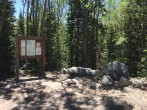
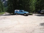
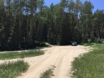
6/14/2021 Posted On: 6/16/2021 By: cdgibbons Info: Clear and dry to the trailhead. I found the large holes mentioned in the last post (about mile 17) challenging in an AWD with six inches of clearance. This location is still on private land. | ||||
6/13/2021 Posted On: 6/14/2021 By: seayachter Info: Road is in decent shape. Made it to 4wd trailhead in stock 4x4 truck staying in 2wd most of the way. There's some large holes in the 2wd section of the road that can be avoided with careful driving. Saw a Honda CR-V at the 4wd TH. | ||||
6/5/2021 Posted On: 6/7/2021 By: rosey33 Info: Upper trailhead accessible with 4wd. No snow to deal with. There was 3 or 4 large puddles but they are not deep. Seems like it got a little more rough compared to last year at this time. | ||||
5/27/2021 Posted On: 5/28/2021 By: joflyer22 Info: Made it to within 1/3 of a mile of the 4WD trailhead in a 4WD, but low clearance, Ford Expedition. A Tacoma had made it to about 1/4 of a mile with better clearance to deal with some snow. There are some larger snowbanks at the point I stopped but after that the road is dry and clear to the TH. There were 2 puddle crossings on the way up... the first one was shallow and had a rock bottom, the second was just mud that had warmed up and was very soft in the evening. I made it across with momentum but probably would have had more trouble if I was going slow. | 5 |
|||
5/15/2021 Posted On: 5/15/2021 By: supranihilest Info: Still blocked at the landslide by stubborn drifts. Once they're melted there's also one downed tree sticking halfway out onto the road en route to the lower trail head, which is one mile from the landslide. I did not investigate beyond the lower trailhead. There are no bathrooms at the landslide, but as you drive in there's a picnic area in Huerfano State Wildlife Area with multiple bathrooms. Note that these are miles from the landslide, so do your business before or after. | ||||
4/30/2021 Posted On: 5/1/2021 By: jmanner Info: Yesterday we parked 3.5 miles from the upper trailhead or 1.08 miles from the landslide. In a week or two youll be able to get the landslide, but itll probably by late May before it melts out enough to get to the upper trailhead. | 2 |
|||
10/20/2020 Posted On: 10/22/2020 By: RWSchaffer Info: Road free of snow to trailhead. As observed in recent reports, the 2WD section of the road contains an obstacle that is not friendly to 2WD vehicles. Here is a picture. This is about 0.9 miles above the Aspen Ranch entrance. My 2WD hatchback, which has a lift for just over 7 inches of clearance, made it through without scraping. But it also pitched and rolled, spinning wheels on the way up and chattering anti-lock brakes on the way down. | ||||
10/17/2020 Posted On: 10/21/2020 By: kiwiliam Info: Currently, if you can get a 2WD as far as the slip, meaning you got past the large potholes a couple of miles after Singing River Ranch, you can drive to within about 3/4 miles of the upper trailhead. About a 1/4 mile after the Huerfano and Zapata Pass trails cross the road, it turns right and starts up hill at a steeper grade. This is where the first bad spot is visible, and you'll probably want to start hiking. People parked on the corner and plenty of spots a little back down the road. BTW. If you are coming south from WESTCLIFFE on CO69 just after mile post 31 turn on right CR555. At the end of this road, turn right onto CR550 which is the road to Mosca Pass that turns to dirt in the description. You will cut off about 6 miles. From Westcliffe its 50 miles to 4WD trailhead: 30min on 69, 30mins on dirt roads to Singing River Ranch and 30mins of rough road to the trailhead. | ||||
10/2/2020 Posted On: 10/4/2020 By: areedhay Info: CR580 is dry to the Zapata trail (for California Peak's North Ridge route) 20.8 miles from Gardner turnoff on HWY 69. The various obstacles seem to have deepened since last I was one the road (in August) but still passable for most vehicles. 2020 Tacoma breezed. | ||||
9/23/2020 Posted On: 9/23/2020 By: Elitch21 Info: A very seasoned stock 2009 Ford Escape named Jeff made it to the upper 4WD trailhead. The road is in pretty good shape all around and as stated in other reports, there are basically 2 rough spots that require a bit of clearance and some maneuvering to avoid. Never spun out. Never seemed close to damaging the car. Google maps will take you only so far and then you will continue for roughly 50 mins to the upper trailhead, enjoy! | ||||
9/20/2020 Posted On: 9/20/2020 By: skidrye Info: Road completely snow free to the trailhead. There are a couple places where a good amount of clearance is required. My stock jeep Cherokee XJ made it up no problem without scrapes. | ||||
9/7/2020 Posted On: 9/9/2020 By: vandy Info: Reports of two rough spots are accurate - one fairly early on that is hard to avoid and one later on that is easier. I got up with only minor scrapes in my Subaru Crosstrek (that I probably could have avoided completely with a little more skill), but any vehicle with less ground clearance would have trouble I think. | ||||
9/4/2020 Posted On: 9/5/2020 By: nilaoire Info: Two sections of the road really chewed up prior to the trailhead. Did see a Subaru at the trailhead, good luck getting down. | 1 |
|||
8/10/2020 Posted On: 8/10/2020 By: ellenmseb Info: 1. The last 4ish miles of the road are all equally bad. In fact, the hardest difficulties are during the supposedly 2wd section. For the last 4 miles, an Outback-type vehicle is necessary and sufficient. Maybe a rental sedan. 2. There was plenty of parking at 8am on a Sunday. And the road is much easier to drive during the daylight. So no need to rush up the night before to get a spot. 3. In an Outback, I didn't make past the big rut at the very top, mentioned by the 8/8 report. Spent 15mins backing up instead. But this only caused me to hike ~200 yards extra. In hindsight I probably could have made it with the right line. 4. If you're coming from alamosa, google maps directions are bad. CR572 requires 4wd. Even if you have 4wd, it's so rough that it would probably be slower than going around. Take the highway via Walsenburg or CR520 (easy 2wd dirt) via Badito instead. 5. I saw a bear running along the road 5 miles below the trailhead. | ||||
8/8/2020 Posted On: 8/10/2020 By: MountainBuhn Info: Took a 2017 Crosstrek up to the main TH with minimal issues, but definitely tedious and white-knuckling. I would say a 2wd can make it up to the 2wd TH in the main description, but definitely with high potential for scraping. Heading up: about 1 mile past the main Singing River Ranch sign is a large rut in some steep terrain. I spun out once, but made it through accelerating into it a bit. If you do this in a 2wd, you need to make sure your line is perfect or youll bottom out really bad. Honestly past that first rut; theres only 1 or 2 smaller challenge areas to get to the FS boundary. 2 creek crossings, which were rocky, but not too deep. Then one steeper section just past the final Singing River Ranch sign "No Camping. No Parking". Which has small potholes, but nothing too crazy. If you have a 2wd, stop soon after, you will not make it that far past the FS boundary. If you attempt to go all the way you will damage your car if you have less than 7 inches. As for cars with more than 7 inches, there are 2 spots in particular, the last mile up, that present some challenge. One deep rut, which requires good maneuvering and some acceleration put into it. We spun out twice before making it past. Finally, the hole right before the top (I attached a picture, but not sure if itll help). Stay to the left and ride that side close to the trees and you'll be good. Your right tire will be lower, but you wont bottom out. Way down was much easier. All in all, Id say this is easier than Princeton, but still very sketch for those less experienced or in cars with less than 9 inches or so. Not to mention plenty of tire popping rocks from start to finish. Worth it in the end. |


