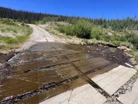
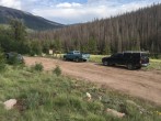
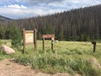
6/7/2018 Posted On: 6/7/2018 By: Wentzl Info: Road is clear of all downed trees and creek crossings very low. | 2 |
|||
5/25/2018 Posted On: 5/25/2018 By: schumi248 Info: Directions are spot on, as mentioned previously dead fall trees are out of the way, but I would take a saw or axe (tree chopping, ice not needed), in case new ones fall. Decently easy road, you would want something with some clearance, my 09 outback was more than enough. | 2 |
|||
5/21/2018 Posted On: 5/24/2018 By: CO Native Info: Road to trailhead is dry and deadfall trees have been cleared out of the way (unless you drive a really wide vehicle). | ||||
5/21/2018 Posted On: 5/24/2018 By: CO Native Info: Road to trailhead is dry and deadfall trees have been cleared out of the way (unless you drive a really wide vehicle). | ||||
5/18/2018 Posted On: 5/18/2018 By: WildWanderer Info: Open and clear of snow/mud. Beware of creeks rising during the day. | 2 |
|||
1/7/2018 Posted On: 1/8/2018 By: RyGuy Info: Iceflow as previously reported has gotten a bit bigger and is now hidden under snow. It's location is: 38.0385, -106.8599. The road from the gate to the Nutras TH is covered in 2-4 inches of snow. Chains were needed to get back out and over the iceflow from the TH. I'd expect the next storm will also probably shutdown road access and at some point the road will be gated. Stay in the ruts! | ||||
1/6/2018 Posted On: 1/7/2018 By: 14erAddict Info: There's a decent size (~50 ft long) ice flow that's unavoidable 2.4 miles before the trailhead. Bring chains or plan for the extra miles! | ||||
11/18/2017 Posted On: 11/19/2017 By: globreal Info: In spite of the Friday (11/17/2017) snow storm, the road is still passable all the way to the TH. If climbing San Luis in winter beware, the gates to this TH will eventually get closed and locked. | ||||
10/31/2017 Posted On: 11/3/2017 By: Slowoldhiker57 Info: Respectfully I believe the directions for coming from the San Luis Valley are incorrect, or the road numbers have changed. If you are coming out of the valley north on 114, you turn left on County Road 17GG, take an excellent dirt road 5 miles to 14NN, turn right on 14NN and then turn left on 15GG and follow the directions from there. Excellent road to 15GG and saves tons of time and miles, basically going around the south of Cochetopa Dome. By the way the Buffalo Pass Campground a few miles before the 17GG turn in an awesome campground for a small RV or tent. | ||||
9/10/2017 Posted On: 9/11/2017 By: ScottHendrick Info: We were able to make it to the Stewart Creek trailhead in a 2WD Chevy sedan, although it was not easy and required some careful driving to avoid high centering and manage some steeper sections. The two water crossings were manageable, but it was a good thing the water was not any deeper. We did have to stop and wade out into one of the water crossings to remove a few branches that might have caused us trouble. We camped overnight at the Eddiesville trailhead just past the Stewart Creek trailhead. | ||||
9/9/2017 Posted On: 9/28/2017 By: two lunches Info: just wanted to make a quick point: coming from Denver, 285S to 50, there was a distance of 65 miles from the LAST gas station to the trailhead. you need enough fuel to travel 130 miles RT. glad i stopped for gas in Salida, as 130 miles amounts to about half a tank of gas in my Wrangler | ||||
8/7/2017 Posted On: 8/8/2017 By: Misi197 Info: Had a similar experience to the 8/6 post below. Here are pictures of the creek crossings to give you an idea of how it looks. I was in an Outback and felt fine. Not sure I would take my Honda Civic to this trailhead. I found the most difficult stretch to be the last mile, which is a steep descent down to the trailhead. Coming back up that hill on the departure, especially given the rain on 8/6 and 8/7, was the toughest aspect of the drive. | ||||
8/6/2017 Posted On: 8/7/2017 By: ma1919 Info: The second stream crossing is running a little high due to recent weather, but my Outback made it just fine. Didn't see any low clearance vehicles past it though. I didn't think the road was especially rough. I took the last mile or so before the trailhead pretty slowly, but there really wasn't anything (other than the streams) that requires high clearance or 4WD/AWD in my opinion. The roads do get progressively worse as they go on, but even the last mile is in better shape than the Grays road in my opinion. I'm not an aggressive dirt driver, but I felt comfortable maintaining 20-25 on most of the 14DD up until the second stream crossing and faster on the other roads (14NN and 90% of 15GG are wide and smooth). It took about 2 hours to get from the US 50/CO 114 junction to the trailhead and maybe 15 minutes longer to US 285/CO 114 in Saguache on the way back. | ||||
7/4/2017 Posted On: 7/4/2017 By: JROSKA Info: There seem to be conflicting reports on whether this trailhead is accessible for a passenger car. I don't think so. It's not just the stream crossings. Beyond the first crossing, the road isn't in the best shape, lots of rocks and more than a few deep ruts. If you care about your car, I would not recommend taking a low-clearance vehicle past the first stream crossing even if it looks doable. The last ten miles of this road to the trailhead just aren't in great condition right now. | ||||
7/1/2017 Posted On: 7/2/2017 By: kayleenann8 Info: Clear and dry to the trailhead. One stream crossing that wasn't bad! Subaru Outback made it across fine. |


