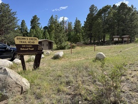
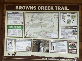
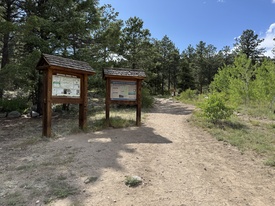
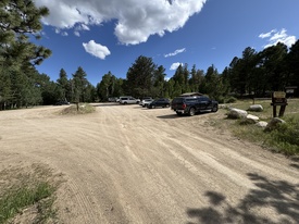
4/18/2025 Posted On: 4/18/2025 By: spoony Info: Roads are dry and parking lot is easily accessible as of 4/17/25. Today's snow should make it messy for a few days, but I doubt that it will be rendered inaccessible. | ||||
8/19/2024 Posted On: 8/19/2024 By: mtn14 Info: Popular trail for horses. Lots of horse poo all over the first mile or so of the trail. | ||||
10/15/2023 Posted On: 10/15/2023 By: aholle88 Info: Closed for the month of October for a controlled burn. Access to the trails in the area are closed as well. Looks like you can still access the CT if coming from the road to Antero or the Shav TH. That appears to be just barely outside the boundary. | 2 |
|||
7/21/2023 Posted On: 7/22/2023 By: cdgibbons Info: Dry and easily accessible by all vehicles. No camping at the trailhead, but lots of dispersed camping along the road. | ||||
12/4/2021 Posted On: 12/4/2021 By: angry Info: Dry to th. | ||||
11/26/2021 Posted On: 11/29/2021 By: Reg0928 Info: Road totally dry, bathroom open and stocked | ||||
11/24/2019 Posted On: 11/25/2019 By: KSU Wildcat Info: Made it to TH in Honda Civic with no trouble. Some very minor washboarding. Intermittently snow packed track. | ||||
5/24/2019 Posted On: 5/27/2019 By: Bigfoot Info: Road is clear and dry. Lots of traffic, any car can make it. | ||||
5/19/2018 Posted On: 5/19/2018 By: dwoodward13 Info: Road is dry and easy to get to in any vehicle. | ||||
11/20/2016 Posted On: 11/21/2016 By: alpinesnowdevil Info: Hiked up to Bicentennial Mt White and the trail was mostly clear the whole way. No gaiters, micro spikes, or other special equipment outside of cold weather gear was needed. a foot deep in the worst area where the snow had drifted, but that seemed to be an exception. | ||||
5/28/2016 Posted On: 5/28/2016 By: Jay521 Info: Clear and dry. Any car can make it | ||||
11/24/2012 Posted On: 11/25/2012 By: illusion7il Info: Road is in Great condition - 100% DRY | ||||
6/10/2012 Posted On: 6/11/2012 By: GermanLovesHiking Info: Took Browns Creek to Browns Lake to summit Antero 6/9-6/10. Forest Service has only cleared out about 1/10 of the trail at this point. Met 3 groups of hikers who turned back due to the mess of trees. The fallen tree section is about 2 miles long at this point and it takes a little bit of patience and a lot of determination to get through to the lake. I added some pictures of what pretty much all fallen tree sections currently look like. If you are headed to Browns lake, I suggest going up to the right around the tree mess until you get pretty close to the lake. Don‘t be fooled by some trail segments appearing, there are three separate sections of downed trees, so just stay higher up if you want to make a decent time to the lake. I counted the number of scratches I got on my legs and arms from navigating the trees...80+, so be prepared for some battle wounds. | ||||
5/28/2012 Posted On: 5/30/2012 By: thebeave7 Info: From the Brown Creek TH we took the CT to Little Brown Creek, it was in great shape and completely clear except for one 200ft section of blow down that wasn't too hard to navigate. Water is intermittent in the valley as it sinks underground periodically. | ||||
5/26/2012 Posted On: 5/26/2012 By: jeepdriver Info: Brown‘s Creek trail is only cleared up to about 4 miles from the TH off CR 272, at which point the trail disappears under downed trees. I spent 2 hours trying to get through these trees on 5/24, and only went 0.75 miles, and couldn‘t even find the lake. Not sure when it will get cleared, but it will take a lot of work. | 2 |


