| Report Type | Full |
| Peak(s) |
"Hassell Peak" - 13,223 feet |
| Date Posted | 07/21/2023 |
| Date Climbed | 07/17/2023 |
| Author | the_hare |
| Urad-venture: Hassell Peak |
|---|
|
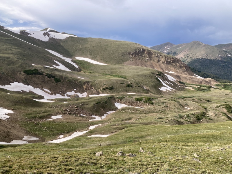
Hassel Peak from Urad Reservoir I’m not sure if people talk much about the 13er “bug” but I think it definitely exists. After doing the most near-to-Denver 14ers and not being a huge fan of long drives I decided to try some Front Range 13ers. And boy have I loved it so far—I’ve seen things on 13er trails that I never could have imagined after my time on 14ers (quartz boulders! high alpine giant red cricket colony! mountain spring! wildflower summit plateau! alpine slime mold! summit covered in white rocks like snow!) 13er Hassell’s easy ridgewalk definitely doesn’t feel the same as the scramblefest of nearby Pettingell, the Citadel & Hagar. It’s only 1 mi RT from its saddle with Pettingell, but that’s on top of an already packed day attempting the others in the group. But it’s ranked, and it’s so close, so it must be done, right? Well, yes, but after mostly recovering from a very out-of-the-blue brain injury I received earlier this year I just can’t force myself to just tick things off a list like that anymore. It’s cliche and all but it’s pushed me to do things out in the mountains most enjoyably, which for me includes planning interesting routes and exploring abandoned/historic places. There’s something grounding in discovering material things that have lasted for 40, 50, or 100 years or more—a unique sort of shameless, wonderful humbling. Here I am, holding a can or bone that’s several times older than I and it’s still here. That persistence of materiality & its attached stories leave an excess to think about that I’ll hopefully never fully unravel. Coincidentally, while scanning the Pettingell group area on satellite I noticed what looked like an old road coming up the Woods Creek gulch from the Urad reservoir towards the usual Herman Gulch/Jones Pass trail. There also seemed to be an eastern ridge that connected down from Hassell’s north ridge back towards Hassell lake above the Urad reservoirs. I plotted a loop on Gaia and saved that for a day like today, the 1st projected 100-degree day for Denver this summer when I’d need some natural air conditioning. I haven't seen any reports that mentioned coming up to the Pettingell group from the Urad side so I thought I’d make a trip report of what turned out to be a really pleasant adventure. 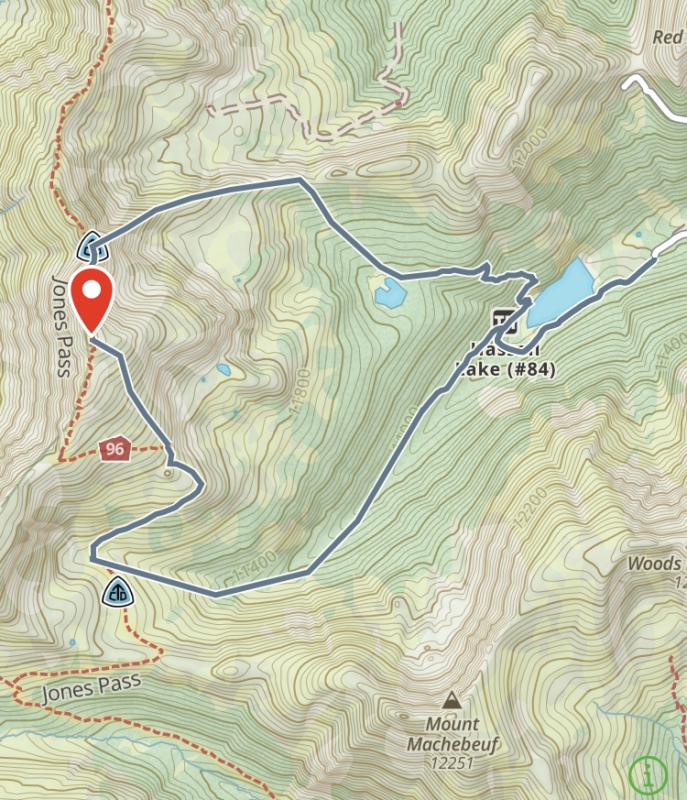
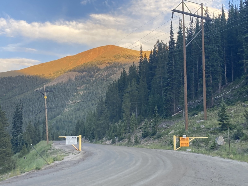
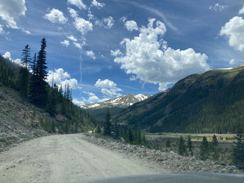
I didn’t look at the road conditions too much before I left but was relieved that it wasn’t an extreme 4WD road, just some smaller rocks on the first switchbacks and potholes past that, no large rocks to maneuver over. Unfortunately I don't think I would take a sedan or low-clearance vehicle on this road, some potholes seemed too deep and unavoidable. The parking area is between the upper & lower Urad dams at 10,600ft elevation. It looks like it can hold 15-20 cars. You might be jockeying for spots with fisherman who are trying to get early starts too—the lot was mostly full on a Monday around noon when I arrived. 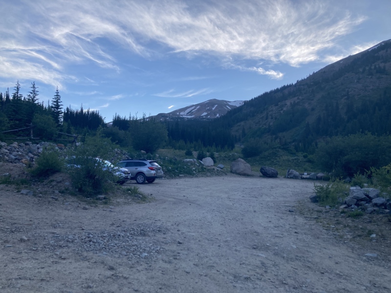

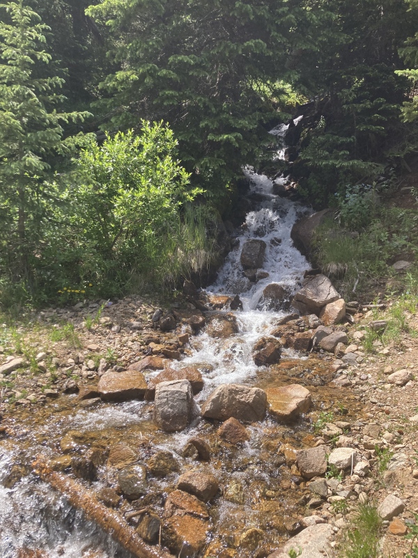
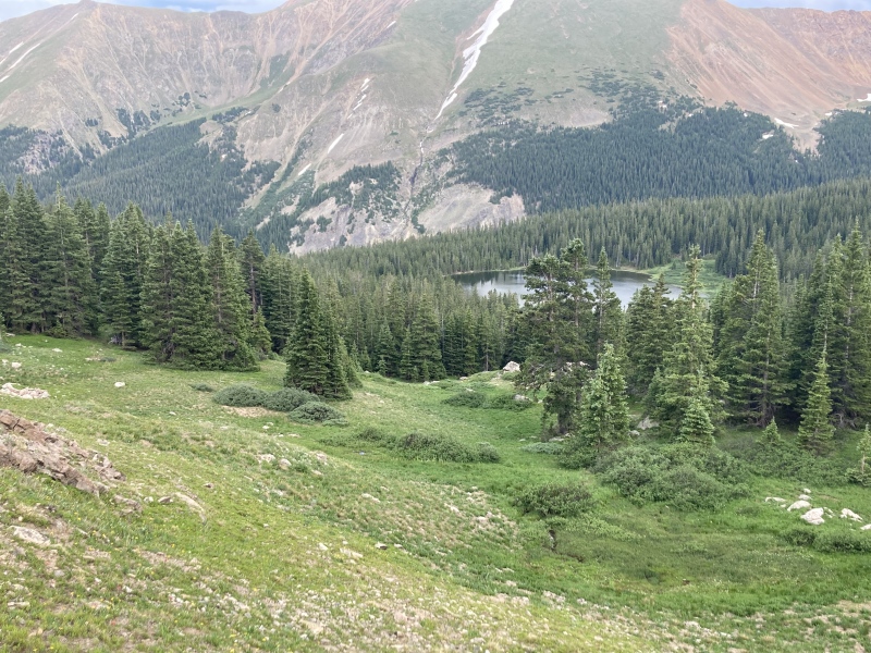
I considered staying on the road for its ease but the reservoir drew me in to walk along its shore. A fishermen's path leads all the way to the other side where I could easily access the road again. There's tons of beautiful trout in here--young troutlets darted away for the safety of the depths as my shadow passed over them while larger bespeckled specimens eyed me from afar. A calmer spell would have given a great reflection shot of Hassell Peak upon the reservoir. Not sure what the camping regulations are like here but there's plenty of nice cleared-out spots in the trees, some even neatly furnished with cut logs. 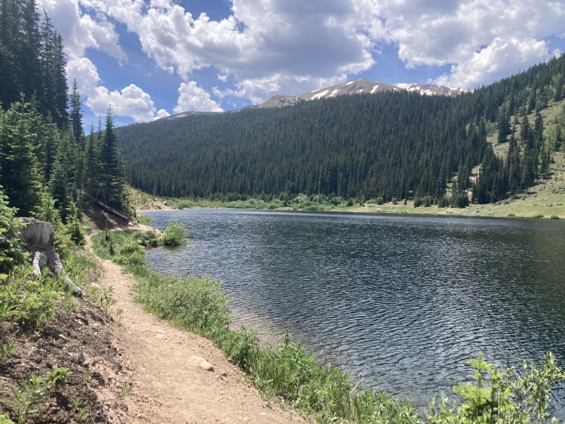
Very soon I came around to the start of the abandoned road that I saw on the satellite imagery. I'm still not sure what the road was originally used for, but it's clear that whoever manages it doesn't want it vehicle traffic on it anymore. There's enormous potholes dug out into the road seemingly to prevent vehicles from moving through. Pothole really doesn't do it justice, it's more like cauldron-hole and I could even see them from space on the satellite imagery. They also make foot traffic a little more difficult as there isn't always room for a foot path along the side and the dirt can be a little crumbly at times. I'm pretty sure I made the last 100 ft of elevation gain going up and down the rims of these craters to make this a 3000 ft gain route. At least it's pretty straightforward: just keep going up, straight down the gulch. 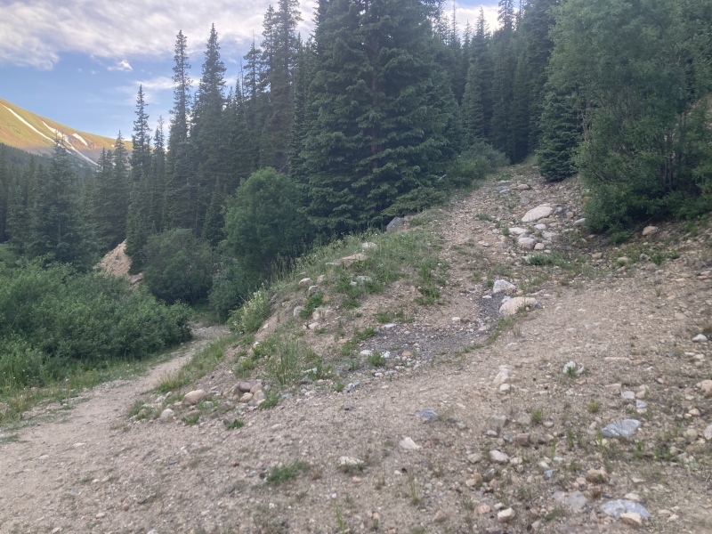
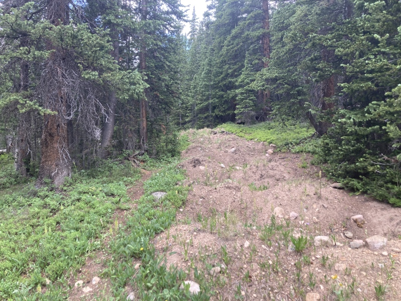

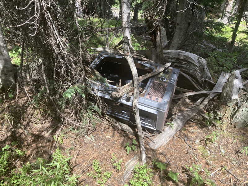
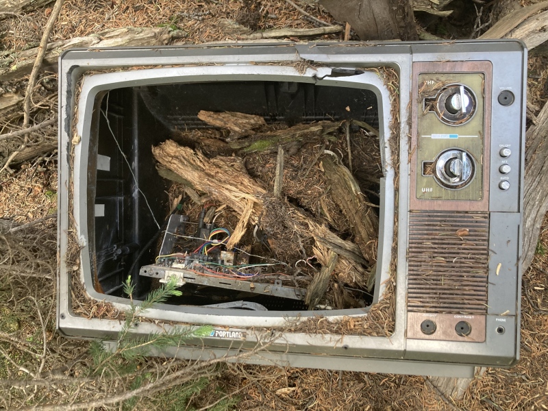
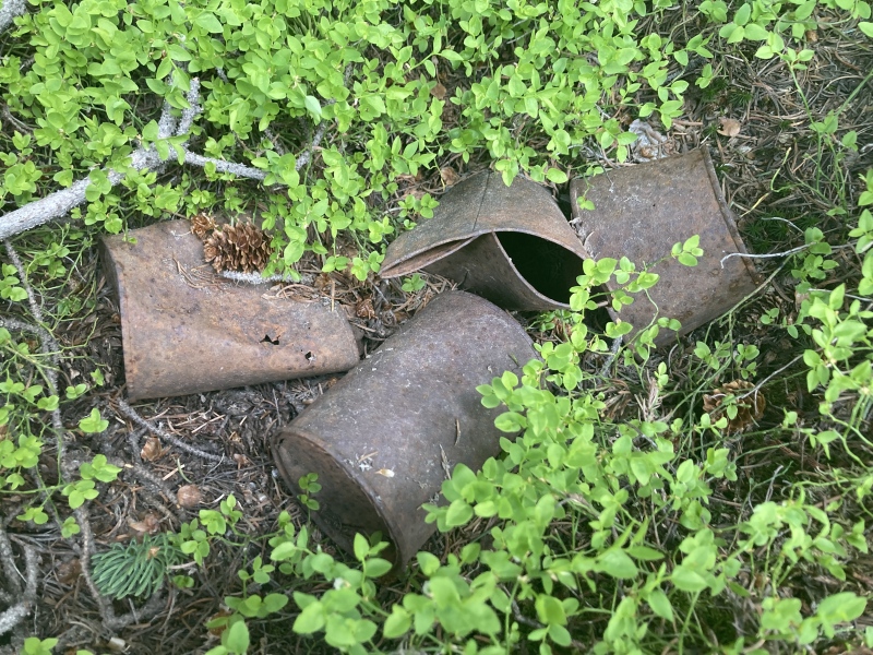
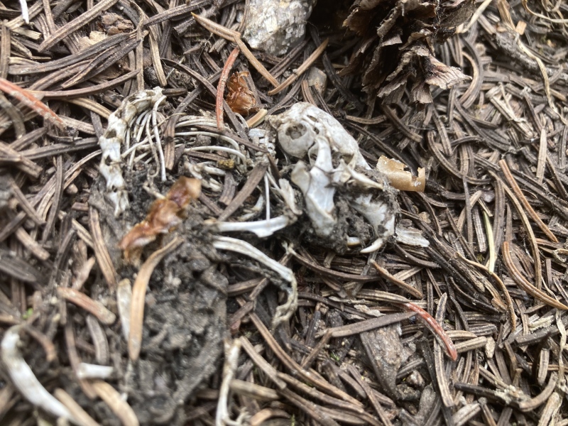
At a certain point the view to the southeast cleared, revealing the mottled ravines of Mount Machebeuf over a pristine lodgepole-laden slope. I stopped to examine the clearing off the road, remembering that similar sudden meadows off of old paths before often held ruins of long-decayed homesteads. I found nothing but rusted shotgun shells so I continued meandering among the trees up the road, hoping to find more clues. I saw several wide, cleanly cut stumps so old and grey they looked almost petrified--maybe this road was used for transporting lumber in the original Urad mining days? My musings halted when I saw a very peculiar yet familiar box shape under a tree. Of all things to find so far up the wilderness, a television. Even though I found more shotgun shells around here I don't think it was used for target practice--the buttons and knobs even worked still! 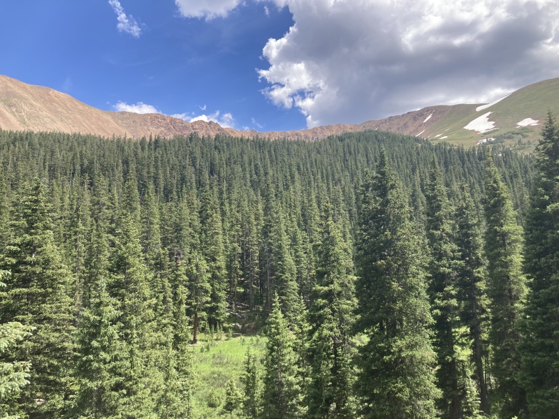
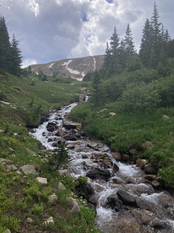
After not finding any more artifacts in the area I continued down the road for a short while until it turned and crossed the creek at 11,130 elevation. I had to search alongside the marshy banks for a bit until I found a halfway-decent place to ford it. The road continued from there up the gulch on the other side, still pot-holey as ever. 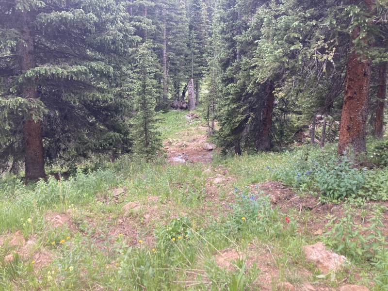
From the satellite imagery I knew the road stopped somewhere and didn't continue all the way up the gulch. When I found that point I was a bit confused as to why here--again no signs of dilapidated cabins or rusted metal equipment. It almost looked like the road continued up the side of the mountain to the south and blended into a talus gully. I wondered then if the road had been wiped out by an avalanche from the towers above years ago and then grown over, or maybe this was in fact just used for logging and they just quit here. Swarming mosquitoes prevented too much thought, however, so I looked ahead and saw a footpath leading out of the clearing. 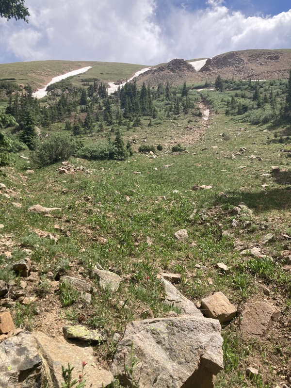
The footpath quickly disappeared into an open slope. Here I needed to make my own trail. I noted what looked like a cairn atop a rock just ahead--maybe the footpath would reappear soon. I knew that the trail to Jones Pass ran along the upper rim of the gulch so I couldn't miss it, all I needed to do was keep moving forward and I'd run into it at some point. Ultimately in the distance I ended up aiming for the thin vertical snow-filled couloir on the bluffs ahead since this pointed to the lowest point of the gulch. The terrain on this first slope was softer dirt interspersed with raised clumps of grass and didn't make for the easiest footing. After moving through some trees and sparse willows I came to a marshy willow thicket. The willows were shorter than average and seemed pretty manageable. At this point I was hoping for firmer ground for easiest movement so I navigated through the willows towards a dark grove of pines ahead of me. The forest overall in this gulch didn't have that much underbrush and proved for quick and efficient movement. 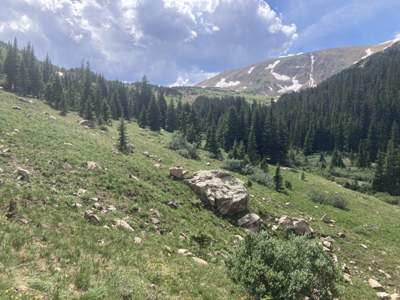
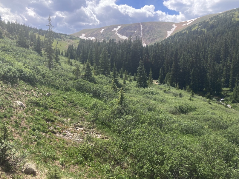
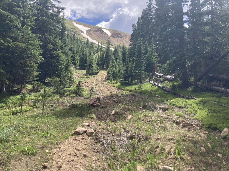
Once on the other side of the grove I could finally see the Jones Pass trail running up the other side of the gulch. The terrain was much mellower up here. There weren't any loose dirt patches like down lower and any willow patches I moved through were very squat and easily stepped through. The gulch clearly narrowed to a point ahead so I continued up until I met the trail. 
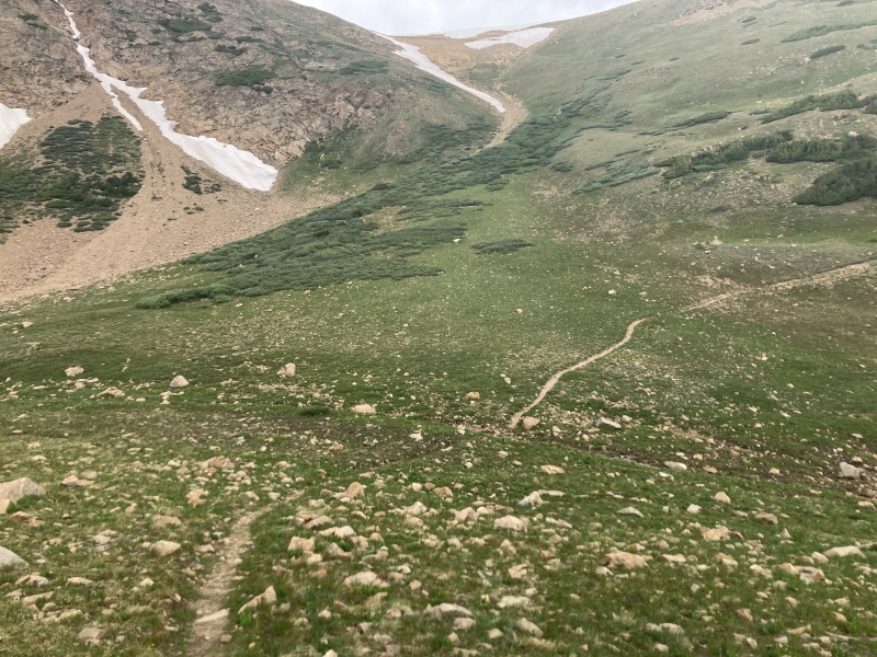
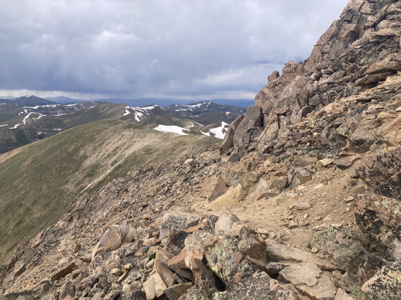
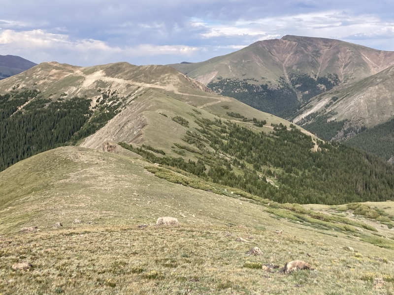
From here the trail goes easily up to the Hassell Peak summit. Some clouds above the ridge were giving me caution--one small cell earlier already rang off some soft peals of thunder and then passed east to darken the Bard Peak quartet but I hadn't heard anything since. I figured I'd still be safe making a quick return back the way I came into the gulch if any more activity developed so I continued on. I decided to rock-hop as best as I could cutting up the slope but that probably didn't save me much time. I just wanted to see what the clouds looked like on the other side of the ridge as soon as I could. 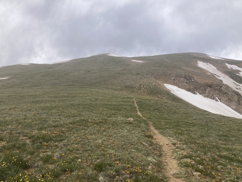
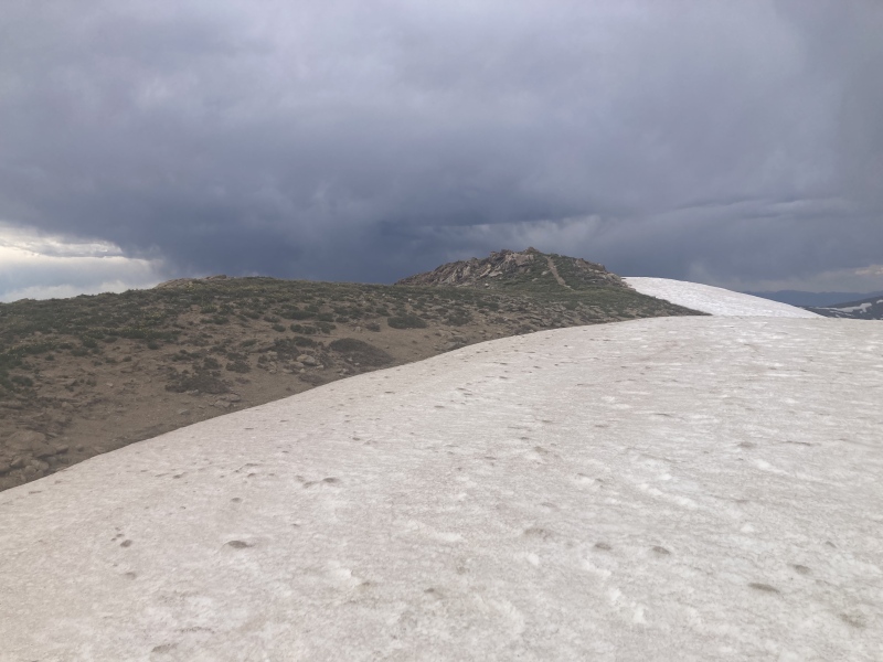
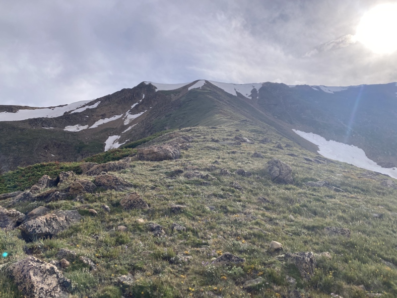
Summit! As with a lot of easily overlooked peaks, Hassell provided some stellar views of prouder nearby features, notably Pettingell's sweeping face to the south and the Gore range neatly laid out to the west. Didn't spend as much time here as I would have liked because of the nearby clouds. Now it was time to make a decision about the descent. I knew from the satellite view that my plan of continuing a little further north on the Jones Pass trail and then down an eastern ridge back to Urad went, but a bluff blocking my view of the initial descent off the ridge gave me pause. After wavering a bit I decided to trust my planning and go for it. 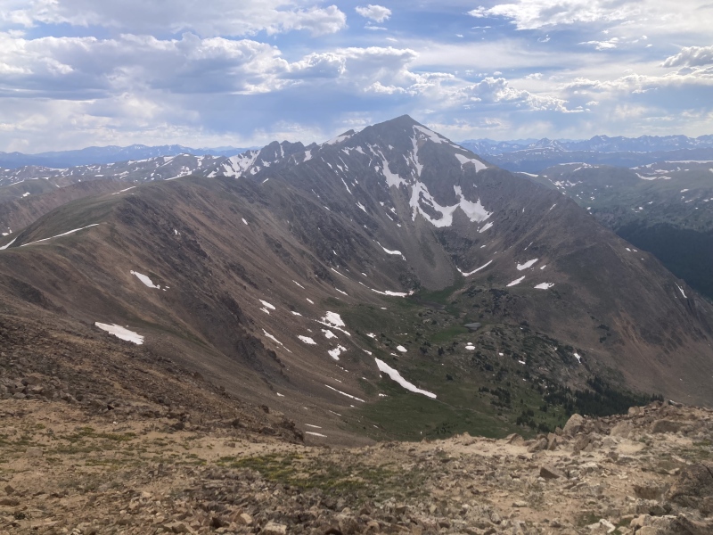

Peering over this bump in the ridge I got to see for myself if the ridge truly goes. It looked a little loose and certainly steep, but it definitely wasn't a straight cliff. I knew I could do this. I never bring them outside of winter but poles would have really helped with this initial descent down the ridge since the pebbles were so loose underfoot. Some rocks embedded into the earth made for solid footholds but they weren't there consistently which made movement pretty careful and tricky. I crossed a very thin snow patch and found safe and easy passage in a shallow bergschrund against the next apron of snow near the ridge proper. 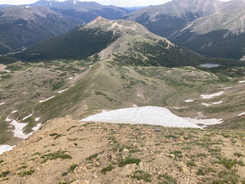
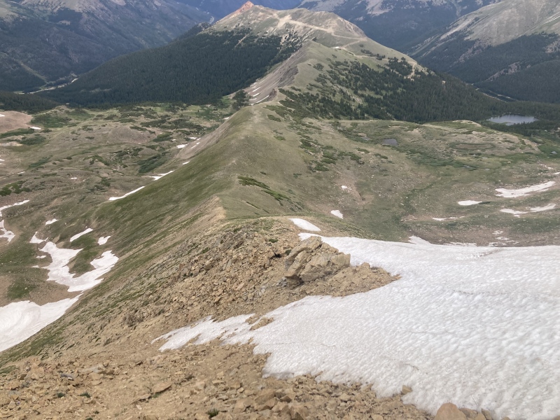
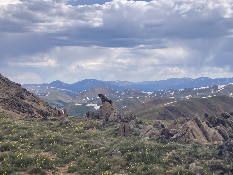
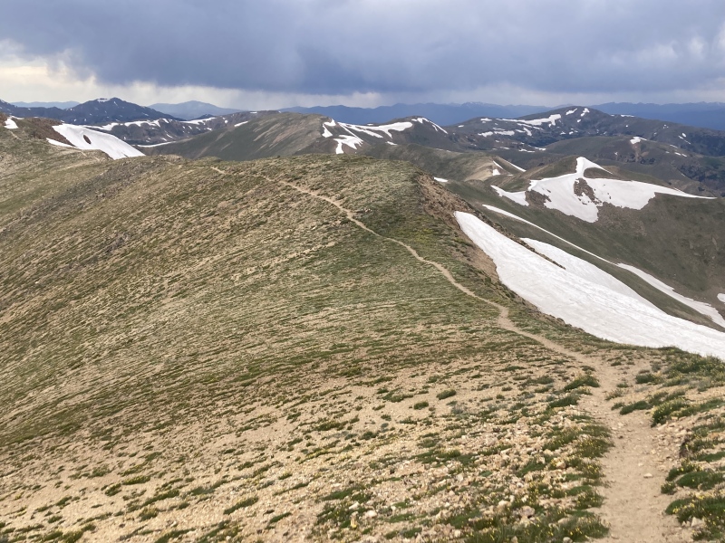
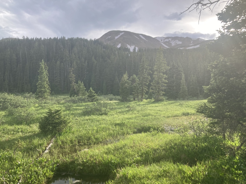
Once I was safely past this slipperiest and steepest section I discovered what looked like... a trail? I thought the descent to this point looked a little disturbed but I hadn't seen a trail like this on any maps I looked at. I took it as a good sign and kept descending. The dirt path kept reappearing and disappearing into the tundra as I went. I noticed some more trails going far up the basin to the north and wondered if those met up here on the ridge at some point. This gentle rolling ridge was a highlight of the hike with the summit behind me and the dark clouds from earlier having moved far to the north. A couple of unusually tawny chipmunks scurried about as I took in the open vistas of the mountain groups all around. 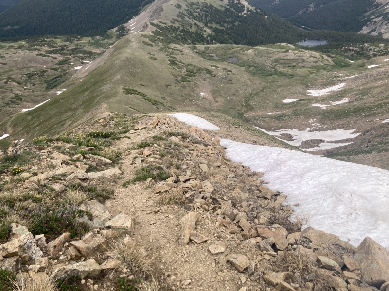
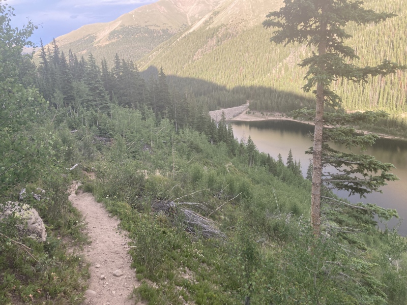
Just before a higher bump on this rolling ridge the trail suddenly ended. I was wondering if it headed all the way down to the lake but after searching the area a little more I realized that it continued down the opposite basin to the north. I pulled up Gaia and saw a trailhead in the basin: Jones Pass Trailhead. Well, that makes sense, having just come from the Jones Pass trail. Looks like it gets a little use at least but I'm not sure how the ascent up that last loose push to the upper ridge would go. Now I had to blaze my own trail once again and consider two options. I noticed a road snaking down from a 12200-ft point on the far end of the ridge and seeming to head towards Hassell Lake. I could scoot over the bump ahead of me to get to that road and see if that goes down, or I could head south straight down the slope from here towards Hassell Lake. I figured the road would be more boring and I didn't think it actually meet the lake down there, plus the dark wood around the lake enticed me once again. So down I went, tundra soon turning to sub-alpine grasses and scrappy pine clusters to towering evergreens. 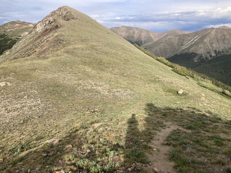
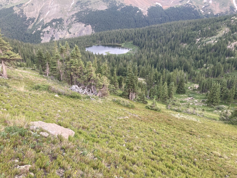
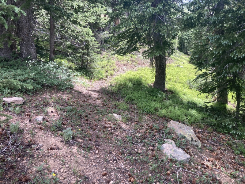
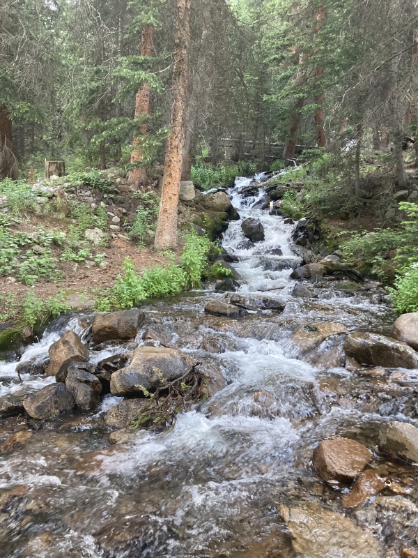
From Gaia I knew there was a trail that led from the Urad reservoir road up to Hassell lake so I figured there would at least be some social trails close to the lake that would take me back. When the forest obscured my view of the lake I kept a heading on Gaia for its north shore. The ground sloped towards the lake anyways and the sound of stream from Hassell's upper slopes does as well. In the forest I saw a deer with a distinctly orange-ish coat spot me and quickly bound away. I hadn't seen any larger animals, including humans, for this whole hike. Us two creatures witnessing each other after so long alone all day arrested me for a moment. The underbrush and obstacles increased as descended but it was never so much as to be a pain. Soon enough I found a trail running parallel to the shore. 
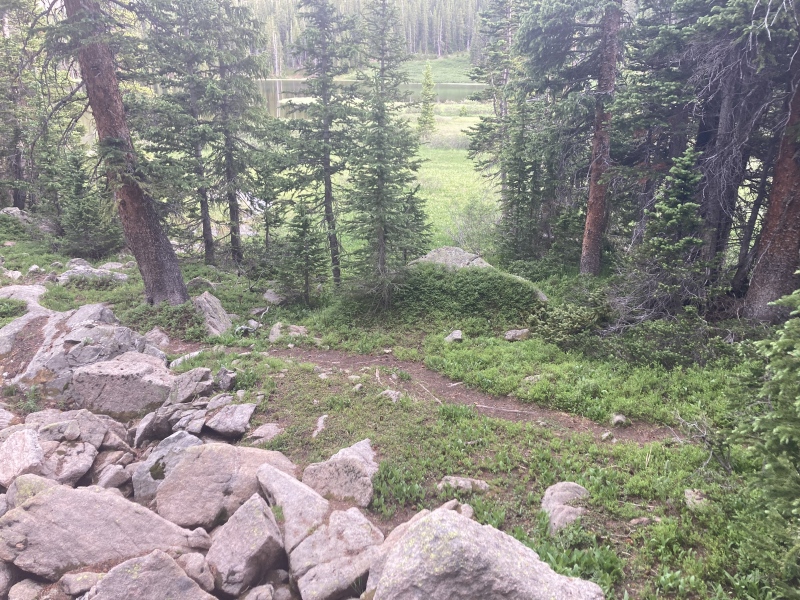
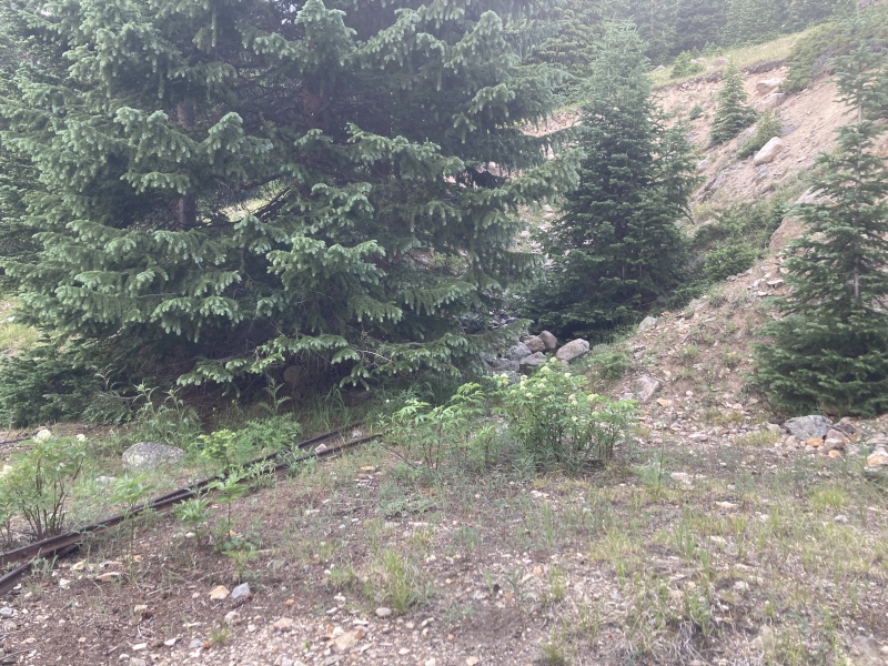
The views around the lake are really picturesque but they're a little hard to take in--any time I stopped I got swarmed with mosquitoes. As a Louisianian I am all too familiar with doing the hokey pokey to ward off mosquitoes from landing on me so I can snap my pictures in peace. The trail down from here is well kept as an official forest service trail. It contours back down towards the upper Urad reservoir offering some great reflections of Woods Mtn above. I noticed a sort of odd cave-in with rock debris below the trail at one point and spied what looked to be a rail track. Upon closer inspection I found two rails leading into the debris and some rusted rail spikes. 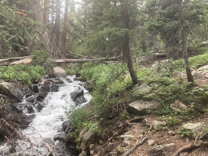
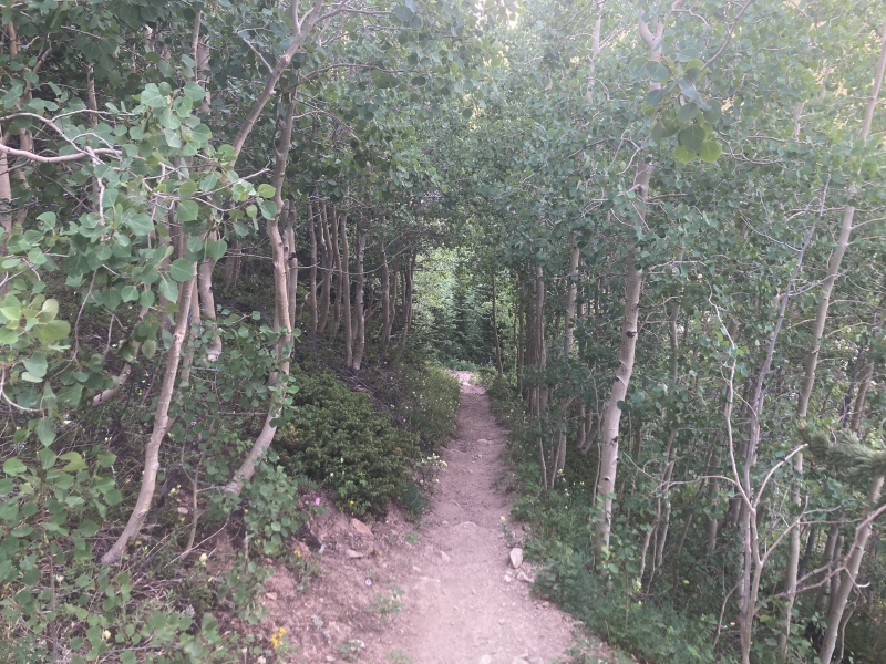
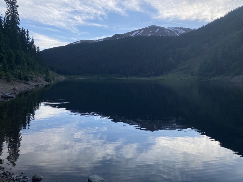
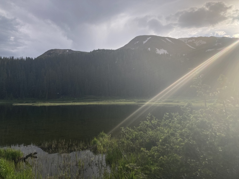
The rest of the trail was easy enough to follow back to the road that led to the trailhead. I returned again along the reservoir shore, this time welcomed back by fish jumping all across the surface of the water hungry for the evening bug swarm. All the fishermen were gone by now but this really looked like the right time to get some good hits! I couldn’t help but stay at the far end of the reservoir across from Hassell as both I and the mountain left our last reflections on the day, punctuated by pervasive ripples. I had a really great time on this hike. The Urad reservoir trailhead is less central and a a bit less accessible to the Pettingell group as Herman Gulch but the large lakes here really add to the scenery. The basins around the rolling ridge I descended from were more spacious as well and offered great views of nearby 14er & 13er groups. The off-trail navigating wasn't bad at all as far as bushwhacks go and the only spicy part was the loose dirt coming off the Jones Pass ridge. If you're looking to break up the Pettingell group or go for a scenic, less-travelled 13er I'd have to really recommend this route! GPX route is approximate: Thumbnails for uploaded photos (click to open slideshow): ")
")
")
")
")
")
")
")
")
")
")
")
")
")
")
")
")
")
")
")
")
")
")
")
")
")
")
")
")
")
")
")
")
")
")
")
")
")
")
")
")
")
")
")
")
")
")
")
")
")
|
| Comments or Questions | |||||||||
|---|---|---|---|---|---|---|---|---|---|
|
Caution: The information contained in this report may not be accurate and should not be the only resource used in preparation for your climb. Failure to have the necessary experience, physical conditioning, supplies or equipment can result in injury or death. 14ers.com and the author(s) of this report provide no warranties, either express or implied, that the information provided is accurate or reliable. By using the information provided, you agree to indemnify and hold harmless 14ers.com and the report author(s) with respect to any claims and demands against them, including any attorney fees and expenses. Please read the 14ers.com Safety and Disclaimer pages for more information.
Please respect private property: 14ers.com supports the rights of private landowners to determine how and by whom their land will be used. In Colorado, it is your responsibility to determine if land is private and to obtain the appropriate permission before entering the property.