Download Agreement, Release, and Acknowledgement of Risk:
You (the person requesting this file download) fully understand mountain climbing ("Activity") involves risks and dangers of serious bodily injury, including permanent disability, paralysis, and death ("Risks") and you fully accept and assume all such risks and all responsibility for losses, costs, and damages you incur as a result of your participation in this Activity.
You acknowledge that information in the file you have chosen to download may not be accurate and may contain errors. You agree to assume all risks when using this information and agree to release and discharge 14ers.com, 14ers Inc. and the author(s) of such information (collectively, the "Released Parties").
You hereby discharge the Released Parties from all damages, actions, claims and liabilities of any nature, specifically including, but not limited to, damages, actions, claims and liabilities arising from or related to the negligence of the Released Parties. You further agree to indemnify, hold harmless and defend 14ers.com, 14ers Inc. and each of the other Released Parties from and against any loss, damage, liability and expense, including costs and attorney fees, incurred by 14ers.com, 14ers Inc. or any of the other Released Parties as a result of you using information provided on the 14ers.com or 14ers Inc. websites.
You have read this agreement, fully understand its terms and intend it to be a complete and unconditional release of all liability to the greatest extent allowed by law and agree that if any portion of this agreement is held to be invalid the balance, notwithstanding, shall continue in full force and effect.
By clicking "OK" you agree to these terms. If you DO NOT agree, click "Cancel"...
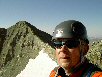
After dragging my friend up and down several 14ers, he suggested payback by joining him on a backpacking trip. After a bit of research, we settled on the Four Pass Loop. The details are below, it was a great, but tiring trip. A few bits of advice up front, then pics and details
- There are tons of mosquitoes at camp. Either bring spray, or plan on spending time in the tent
- To be down from the passes before any afternoon storms, we found ourselves at camp between 2-4pm, so plenty of downtime in the afternoon/evening. Bring a book or something
- There were a ton of campsites between Snowmass Lake and Buckskin Pass. If you want to avoid the crowds at Snowmass Lake, pressing on a bit should be fine.
- The double pass first day was long, but seemed reasonable. It would seem to be too easy to stop short of Maroon Pass on day 1, but it did require an early start.
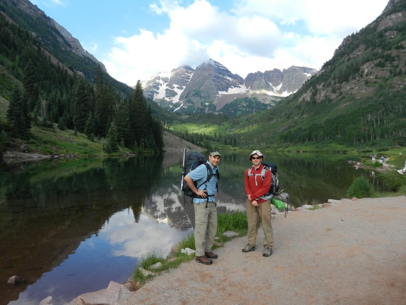
Day 1 - Maroon Lake to Fravert Basin (11.4 miles & 8.5 hrs including breaks)
Depart Maroon Lake: 7:30am
West Maroon Pass: 12:30pm
Frigid Air Pass: 2:00 pm
Camp below falls: 4:00 pm
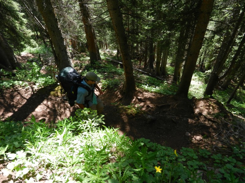
Here we are fresh at the trailhead. Note that I had gear strapped to my pack. There are a lot of willows to bash, a fully contained pack would probably be better.
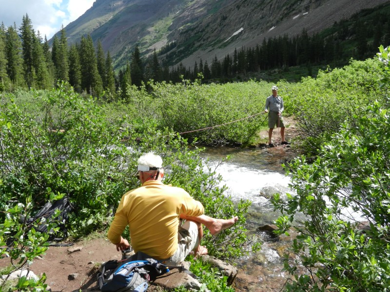
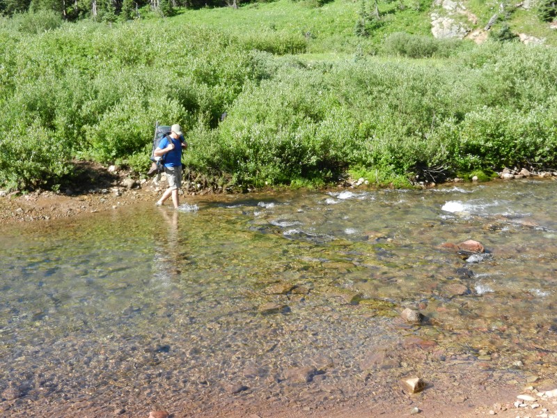
I didn't get a picture of the first stream crossing, but it was crossable by some creative rock hopping (I was about 50 feet upstream of the true crossing. This is the second; we couldn't find a dry way across, so water shoes on. This guy carried a bunch of gear on a day hike; I think he was just playing around with the rope.
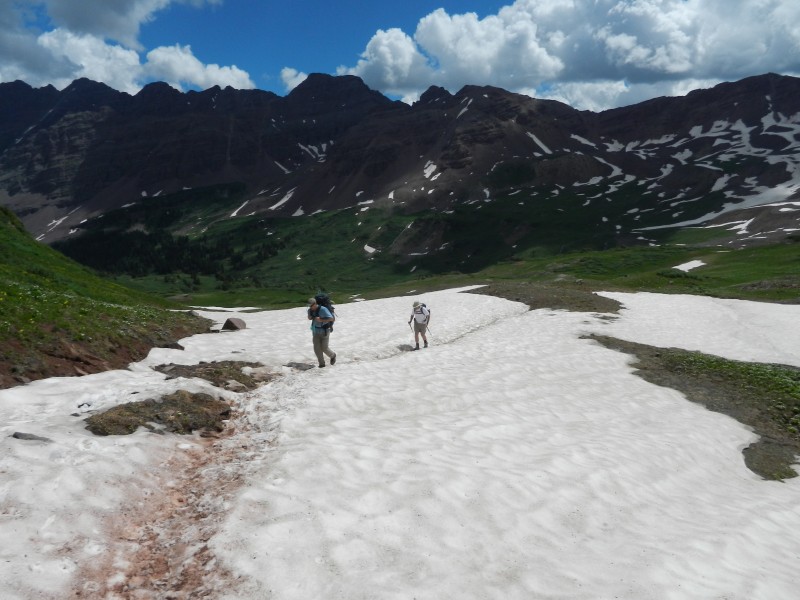
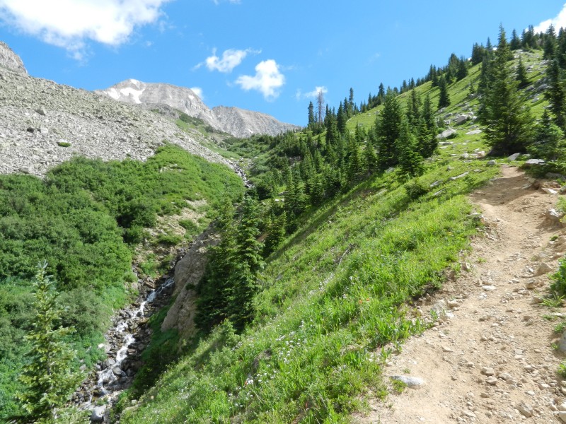
Not too far away from that creek crossing, finally able to see West Maroon Pass. A few easy snow crossings.
Looking back at the snow
Looking back on another easy snow crossing
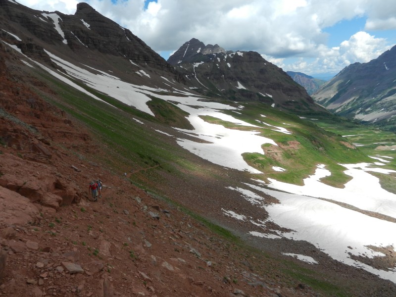
Very near West Maroon Pass, looking back on the trail as it comes up out of the drainage. Mostly avoiding the snow.
Looking down from the pass at the final switchback, with a bit of snow to avoid.
Looking down the west side,
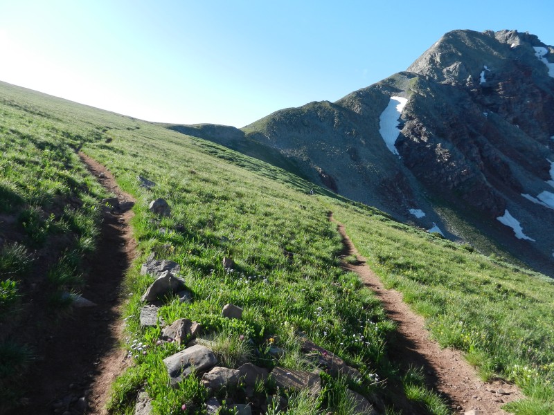
A bit after the junction with the Frigid Air Pass, looking up toward Point 12,648
Looking back from near Frigid Air Pass, showing the false trail to the saddle left of Point 12,648.
Looking back from Frigid Air, pretty steep up toward the top
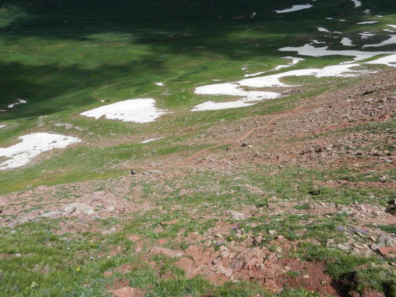
And down the northern side, crossed some of these easy snowfields
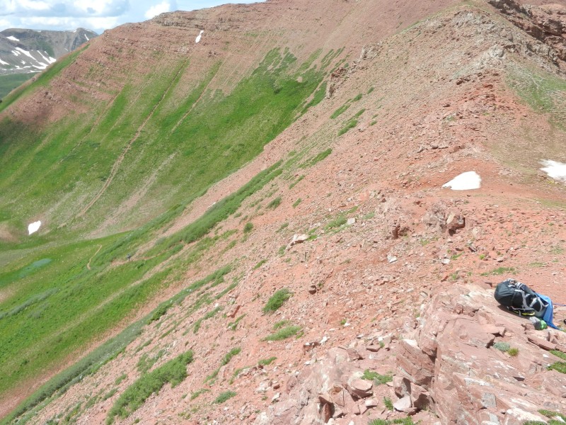
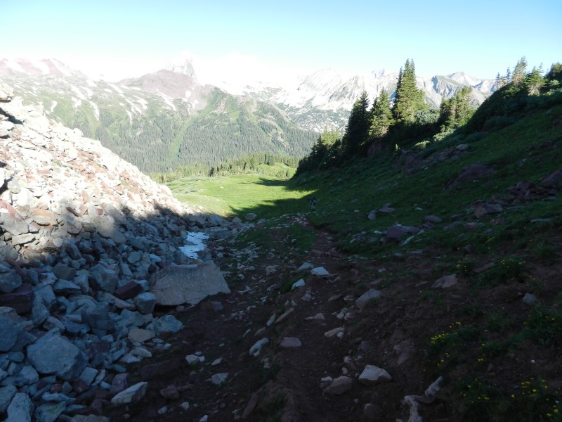
Coming down the steep switchbacks next to the falls. Camped at the first spot below the falls.
Day 2 - Fravert Basin to Snowmass Lake (6.6 miles & 5 hrs including breaks)
Depart Fravert Basin: 9:00am
Trail Rider Pass: 12:00pm
Snowmass Lake: 2:00 pm
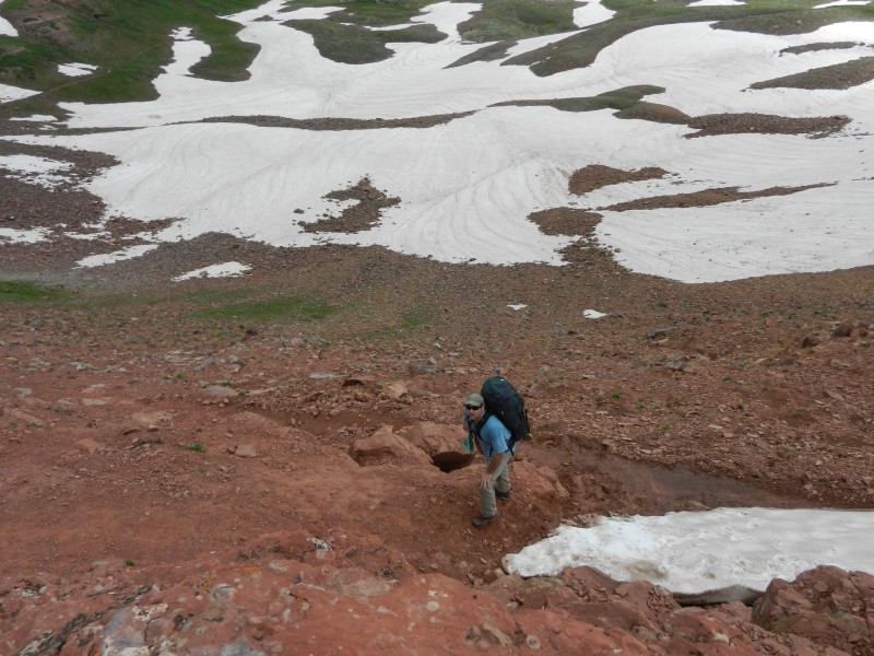
The river crossing in Fravert Basin; nice way to get alert shortly after leaving camp
The climb out of Fravert Basin was tough, probably the toughest on the loop for me. Here is a bit of the tough stuff above tree line
Looking up shortly afterward, still plenty of elevation to go
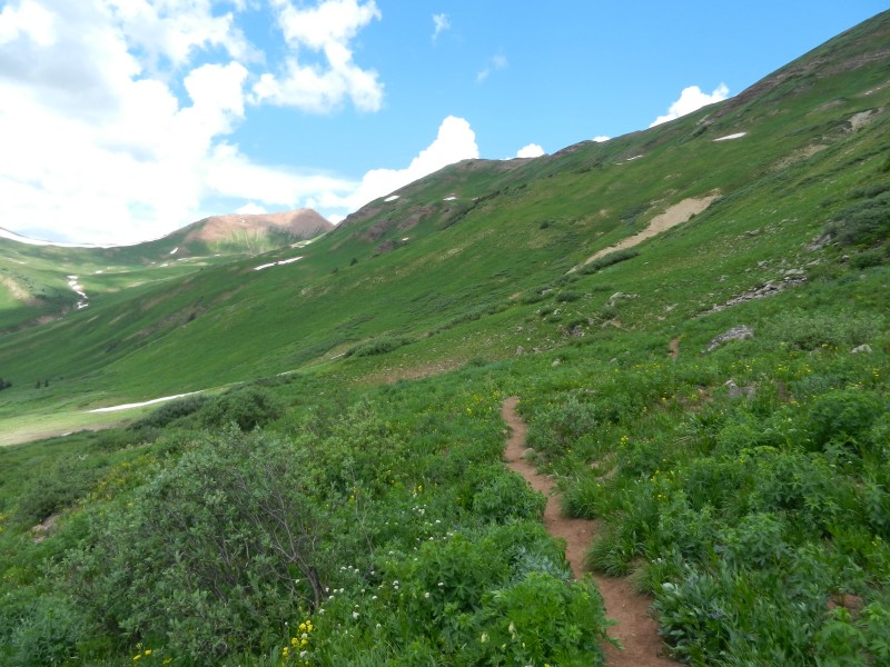
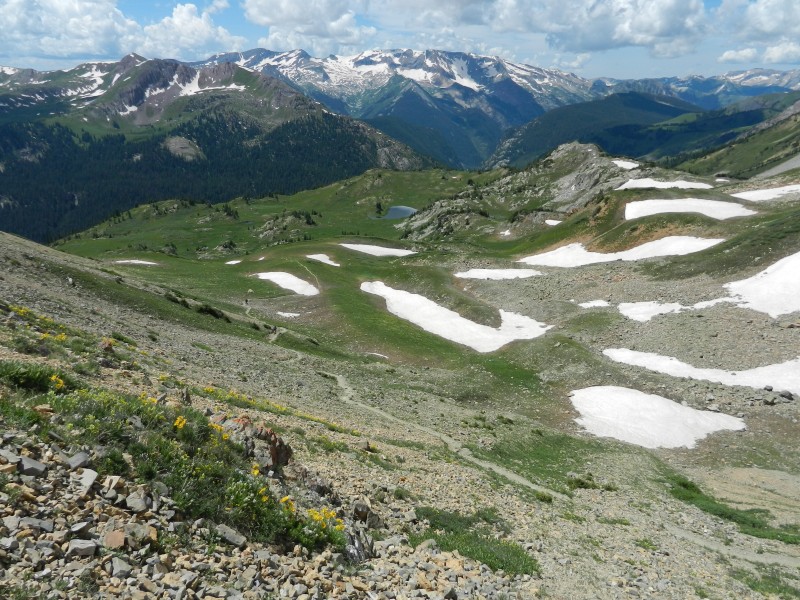
Finally near tree line, and some easy trail ahead. Trail Rider is the pass visible on the left of center
A little down the trail, still easy going
The last push up to Trail Rider Pass, not too difficult
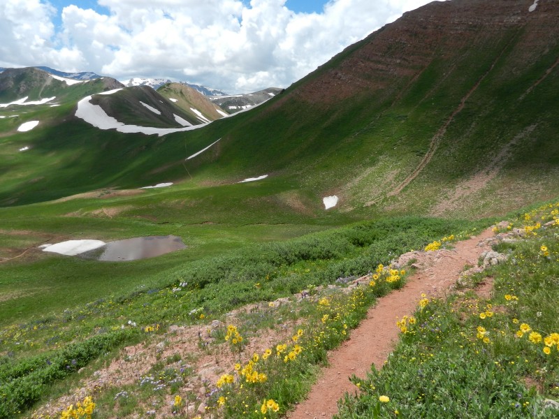
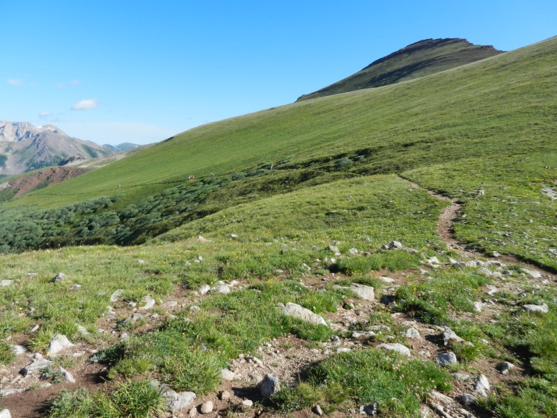
Looking back from Trail Rider, across the easy basin
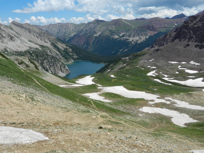
And down the Snowmass Lake side. Some of the snowfields that must be crossed
Across the upper basin, and coming down into the lake, some of the rocky, snowy, muddy spots
Probably the toughest spot on the loop for us, not that the snow traverse was steep, but the runout was rocky. Could probably have gone down and around.
Plenty of company at Snowmass Lake. We built in a rest day there, so we opted to camp near the lake (more crowds), but I could attempt Snowmass Mountain and Ryan could fish. Otherwise, probably would be wise to continue on the trail down toward Snowmass Creek.
Day 3 - "Rest Day" and climb of Snowmass Mountain
Day 4 -Snowmass Lake to Maroon Lake (8.0 miles & 5 hrs including breaks)
Depart Snowmass Lake: 6:30am
Buckskin Pass: 9:00am
Maroon Lake: 11:30 am
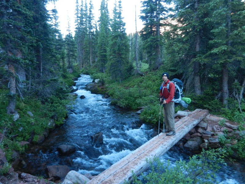
We departed camp early to try to get back to Aspen by lunchtime. A great bridge crosses Snowmass Creek
The climb up from Snowmass Creek wasn't too bad. We got to tree line quickly. Here is looking back from a bit more than half way up.
As you get closer to Buckskin Pass, it looks like the trail is going to switchback up this gully.
But you get to enjoy a long switchback to the north, above tree line and with great views to the west. Very enjoyable stretch
Looking back on the long switchback, from just below the pass
From just above Buckskin Pass on the north, showing the cornice and the trail on both sides
And down the trail from the pass
After 3 days on the trail, we were cruising back to the car (with sore legs and hungry stomachs) We didn't take many photos, but soon began to see day hikers, then Maroon Lake crowd, then the car. Perhaps the longest stretch was from Maroon Lake to the overnight lot.
Thumbnails for uploaded photos (click to open slideshow):
I'll be doing the loop in a couple weeks and can't wait. I asked this on the main forum but haven't gotten any responses... how cold did it get at night?
Tough to say; there are the few designated spots near the bent tree turnoff to Maroon, then if my memory serves, there were some decent level spots above tree line, but not improved or designated. I don't recall any/many designated ones after the bent tree, but we weren't looking either. There also seemed like several flat areas on the other side of Maroon and before Frigid Air, but all above tree line. Some of those spots looked very nice.
I'm doing this hike (and bagging Snowmass, Maroons, and Pyramid) in about three weeks. I'll be coming in from Denver on the 25th and arriving late. Is it possible to throw down a quick and dirty campsite within the first mile of the trail? I'd like to avoid sleeping in the parking lot if possible.
I've been on lots of backpacking trips, this one was the most picturesque, and probably the toughest. I thouroughly enjoyed it... It was great hiking with you Mike.
We are doing the Four Pass Loop counter clockwise... If we start from a campsite at Snowmass lake, do you consider sumiting Snowmass mt. from the East slop and descending on the West slope, trail to Geneva lake, and onto the Basin camp site a reasonable task for a day? I thought "Might as well throw in the 14er cause the pass is 12500 anyways". We are going late late July BTW.
Caution: The information contained in this report may not be accurate and should not be the only resource used in preparation for your climb. Failure to have the necessary experience, physical conditioning, supplies or equipment can result in injury or death. 14ers.com and the author(s) of this report provide no warranties, either express or implied, that the information provided is accurate or reliable. By using the information provided, you agree to indemnify and hold harmless 14ers.com and the report author(s) with respect to any claims and demands against them, including any attorney fees and expenses. Please read the 14ers.com Safety and Disclaimer pages for more information.
Please respect private property: 14ers.com supports the rights of private landowners to determine how and by whom their land will be used. In Colorado, it is your responsibility to determine if land is private and to obtain the appropriate permission before entering the property.


")
")
")
")
")
")
")
")
")
")
")
")
")
")
")
")
")
")
")
")
")
")
")
")
")
")
")
")
")
")