Download Agreement, Release, and Acknowledgement of Risk:
You (the person requesting this file download) fully understand mountain climbing ("Activity") involves risks and dangers of serious bodily injury, including permanent disability, paralysis, and death ("Risks") and you fully accept and assume all such risks and all responsibility for losses, costs, and damages you incur as a result of your participation in this Activity.
You acknowledge that information in the file you have chosen to download may not be accurate and may contain errors. You agree to assume all risks when using this information and agree to release and discharge 14ers.com, 14ers Inc. and the author(s) of such information (collectively, the "Released Parties").
You hereby discharge the Released Parties from all damages, actions, claims and liabilities of any nature, specifically including, but not limited to, damages, actions, claims and liabilities arising from or related to the negligence of the Released Parties. You further agree to indemnify, hold harmless and defend 14ers.com, 14ers Inc. and each of the other Released Parties from and against any loss, damage, liability and expense, including costs and attorney fees, incurred by 14ers.com, 14ers Inc. or any of the other Released Parties as a result of you using information provided on the 14ers.com or 14ers Inc. websites.
You have read this agreement, fully understand its terms and intend it to be a complete and unconditional release of all liability to the greatest extent allowed by law and agree that if any portion of this agreement is held to be invalid the balance, notwithstanding, shall continue in full force and effect.
By clicking "OK" you agree to these terms. If you DO NOT agree, click "Cancel"...
A friend of mine that wanted Mount of the Holy Cross and I decided to make a go of it this past week, and we spent a few days in HCW.
I have done the standard route via Half Moon, and the Halo Ridge Route (Notch Mtn) in the opposite direction twice, the second time I descended via the 'Bailout Route' just after PT13831 in to Upper Tuhare Lake. I had never done this route from Upper Tuhare ascending up. With the Tigiwon Road closure, the viable option was from Holy Cross City. I posted briefly about this route here;
When we arrived Thursday, we found that both FR 704 & FR 727 had been washed out.
Road closed as of 8/6/11 Road closed as of 8/6/11
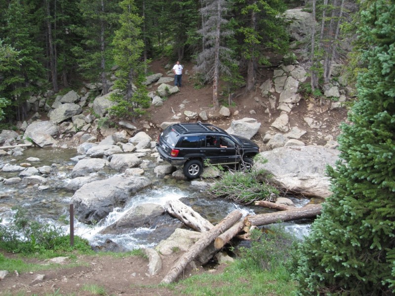
With the roads washed out, this left the HCC 4x4 road just past the Gold Park Campground as our only option. If you take a stock 4x4 up this road, you will not come back with it.. As you can see in this pic.
Do not take a stock vehicle up HCC Road
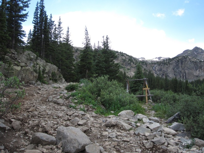
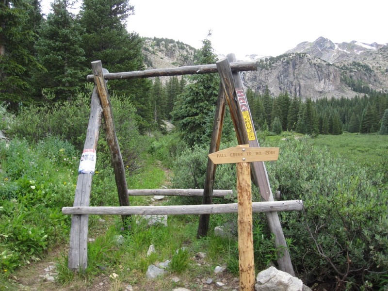
Where the road hairpins to Holy Cross City, you will follow the trail (to the right) as seen in pic.
The road heads to HCC, you will break right here. TH For Fall Creek Pass
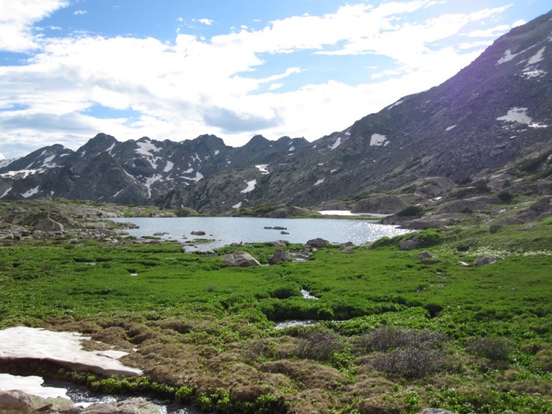
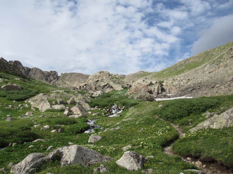
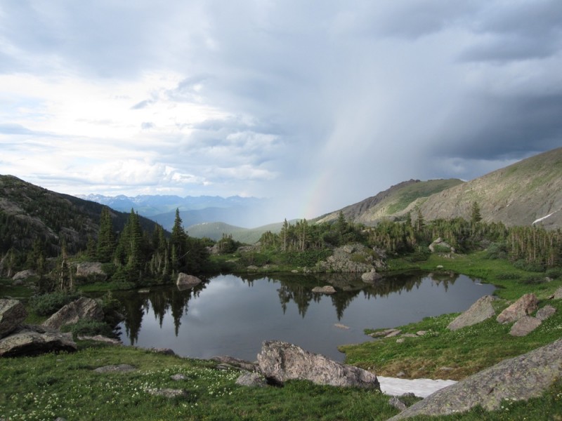
Pass Hunky Dory Lake (wilderness permits are at the Wilderness boundary at Hunky Dory) and follow the trail up the Seven Sister lake chain to the top of Fall Creek Pass. From this point you can get a view of the Tuhare Lakes. We opted to descend down following the trail to the convergence of "Tuhare Lakes Trail" and set up camp in this area. Seven Sisters Lake Chain Seven Sisters Lake Chain Seven Sisters Lake Chain Looking down from the top of Fall Creek Pass toward Lake Constantine far distant
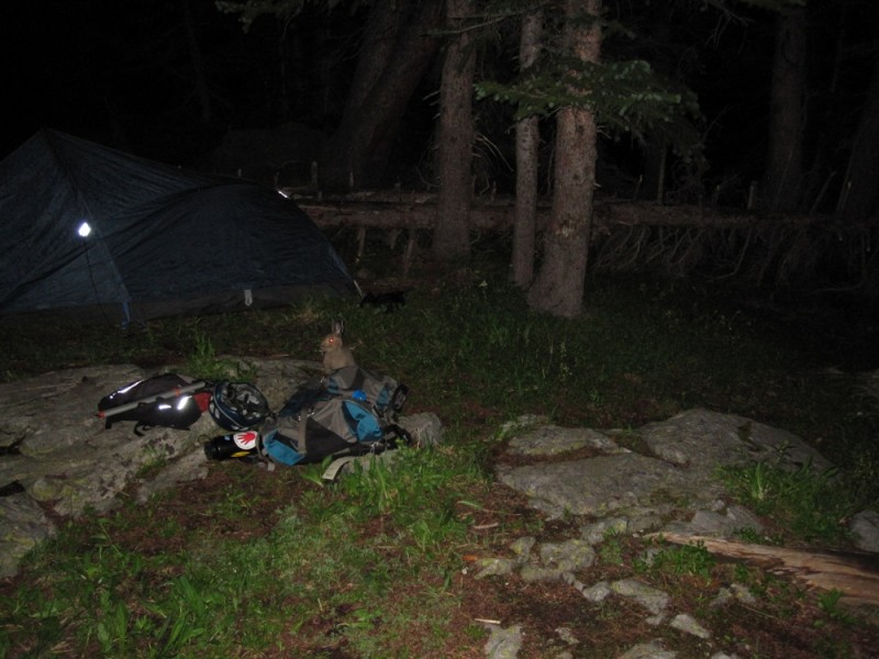
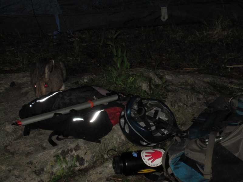
We were visited by a hare that evening exploring our equipment as we switched some gear from the larger backpacks to the smaller day packs for the trek up to Holy Cross the next morning.
Our visitor Gear Junkie Hare
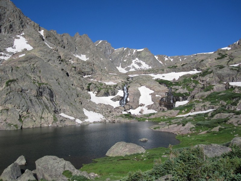
The following morning we followed the trail up to Lower Tuhare, and after some snowfields (Axe!) up to upper Tuhare Lake.
Next morning - Lower Tuhare Lake Upper Tuhare Lake
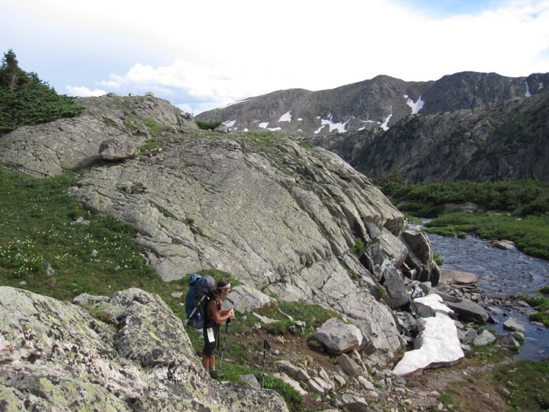
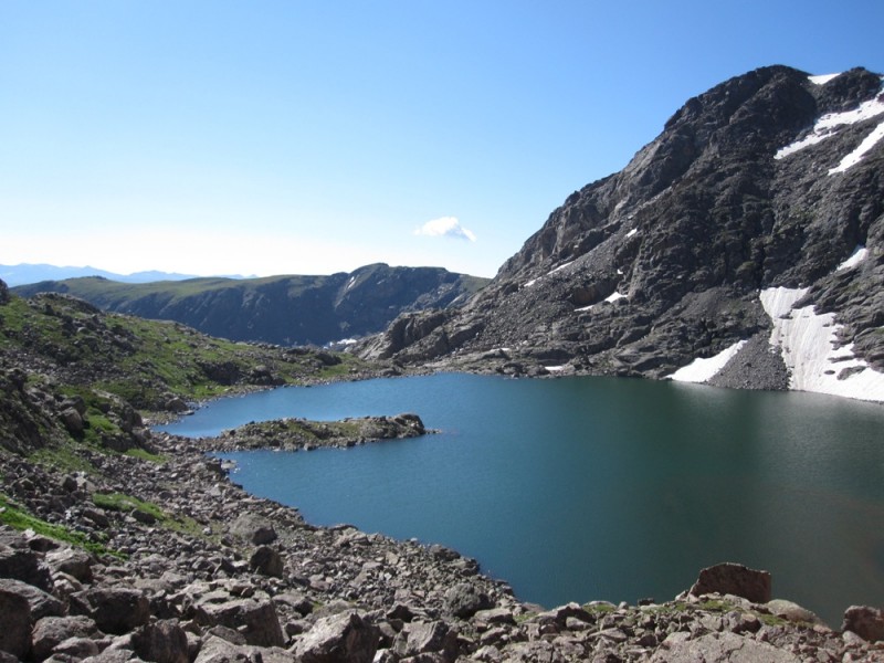
From there you start boulder hopping until you reach the far end of Upper Tuhare - and go past it about 100 yards. From this point there is no route.
The route looking from Upper Tuhare Lake toward Cross Ridge
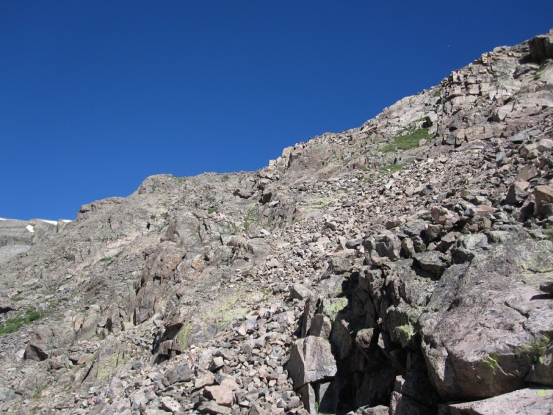
You will have to route find up some steep talus - much of it is loose. There is some definate Class 3 and 4. It is very easy to get in to Class 5 along the cliff bands - so do some careful route assessment. If you take your time you should be able to stay in Class 3. I would highly advise a helmet on this leg of the route.
The entire area has gotten a lot of rainfall recently. Be aware that the ground is saturated and is extremely unstable beneath the talus. Objectively, if you are hiking up - stagger yourselves encase of rockfall. We noticed entire zones that had recently slid.
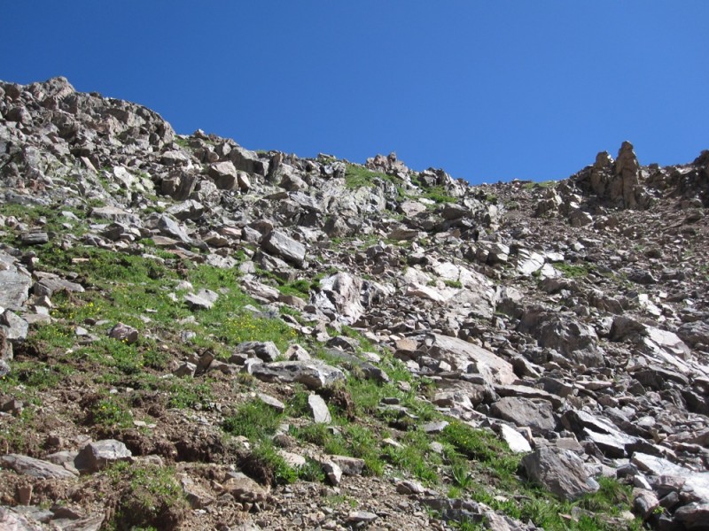
The route as you approach the top toward the ridge
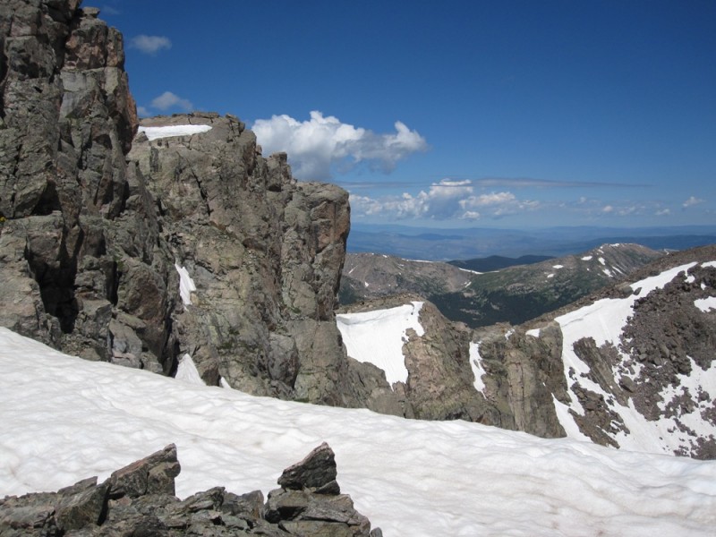
You will reach the ridge - just prior to PT13831 - from here on you are basically on the Halo Ridge route to MOHC.
Cross Ridge Looking across the ridge to MOHC
We did place about a dozen cairns up the route from Tuhare. I would highly advise placing a marker where you came up - it is very deceptive going down. I would not recommend this route to anyone that is not familiar with Holy Cross, and at a minimum some varying Class 3, but if you are familiar with the area, this is a very good option and cuts several hours off the Halo Ridge route from Notch Shelter, and the standard Half Moon Pass route.
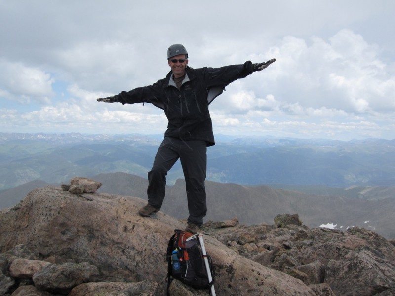
Summit poses Summit poses
We did s'mores by the camp fire that evening, and a hike around Constantine the following day. Of course our visitor came again that night to check us out.
My GPS Tracks on Google Maps (made from a .GPX file upload):
For posting this!
Your forum post re: this route was helpful a few weeks ago, as well, and I've been meaning to tell you thanks!
A summit was not in the cards that day as the roads had just washed out and we took a fair amount of time in the early a.m. exploring and calculating mileage on alternate routes - hiking up the HC jeep road was the ONLY option. Ultimately it looked too long for a day hike, much better suited for a backpack in, as you've demonstrated. We hiked up to the Hunky Dory Lake and chilled out - very serene.
Thanks for putting this info out there!
It's a gorgeous area.
Strong work! :D
Doc - I'm really not sure. Another jeep arrived with a winch and they were using rockbars, jacks, etc (no tires were touching - it was completely high centered on that rock). We continued on. Upon our return they were gone, so I guess they were able to free it up. I am surprised they made it as far as the did. Would to hate see the under carriage. I believe the sign at the beginning of the road states 33” tires minimum.. To give you an idea.. http://14ers.com/forum/viewtopic.php?f=3&t=26991&start=15#p318054
Caution: The information contained in this report may not be accurate and should not be the only resource used in preparation for your climb. Failure to have the necessary experience, physical conditioning, supplies or equipment can result in injury or death. 14ers.com and the author(s) of this report provide no warranties, either express or implied, that the information provided is accurate or reliable. By using the information provided, you agree to indemnify and hold harmless 14ers.com and the report author(s) with respect to any claims and demands against them, including any attorney fees and expenses. Please read the 14ers.com Safety and Disclaimer pages for more information.
Please respect private property: 14ers.com supports the rights of private landowners to determine how and by whom their land will be used. In Colorado, it is your responsibility to determine if land is private and to obtain the appropriate permission before entering the property.

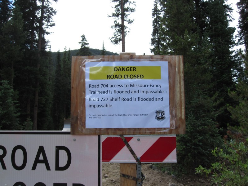


 Road closed as of 8/6/11")
 Road closed as of 8/6/11")
 Do not take a stock vehicle up HCC Road")
 The road heads to HCC, you will break right here.")
 TH For Fall Creek Pass")
 Seven Sisters Lake Chain")
 Seven Sisters Lake Chain")
 Seven Sisters Lake Chain")
 Looking down from the top of Fall Creek Pass toward Lake Constantine far distant")
 Our visitor")
 Gear Junkie Hare")
 Next morning - Lower Tuhare Lake")
 Upper Tuhare Lake")
 The route looking from Upper Tuhare Lake toward Cross Ridge")
 The route as you approach the top toward the ridge")
 Cross Ridge")
 Looking across the ridge to MOHC")
 Summit poses")
 Summit poses")