Download Agreement, Release, and Acknowledgement of Risk:
You (the person requesting this file download) fully understand mountain climbing ("Activity") involves risks and dangers of serious bodily injury, including permanent disability, paralysis, and death ("Risks") and you fully accept and assume all such risks and all responsibility for losses, costs, and damages you incur as a result of your participation in this Activity.
You acknowledge that information in the file you have chosen to download may not be accurate and may contain errors. You agree to assume all risks when using this information and agree to release and discharge 14ers.com, 14ers Inc. and the author(s) of such information (collectively, the "Released Parties").
You hereby discharge the Released Parties from all damages, actions, claims and liabilities of any nature, specifically including, but not limited to, damages, actions, claims and liabilities arising from or related to the negligence of the Released Parties. You further agree to indemnify, hold harmless and defend 14ers.com, 14ers Inc. and each of the other Released Parties from and against any loss, damage, liability and expense, including costs and attorney fees, incurred by 14ers.com, 14ers Inc. or any of the other Released Parties as a result of you using information provided on the 14ers.com or 14ers Inc. websites.
You have read this agreement, fully understand its terms and intend it to be a complete and unconditional release of all liability to the greatest extent allowed by law and agree that if any portion of this agreement is held to be invalid the balance, notwithstanding, shall continue in full force and effect.
By clicking "OK" you agree to these terms. If you DO NOT agree, click "Cancel"...
This is a climb both my wife and I enjoyed very much. Her favorite of the year!
We car camped at the parking area with the bathrooms. Here we met jonzalj. He was planning to solo the Southwest Ridge. We talked, and he said he would love our company on the ridge. So this was the plan, but that would change with the weather the following day.
Ahhh! Nothing like an early morning start and the sight of headlamps on the trail.
Below, jonzalj on the trail at twilight.
As the sun rises, we realize weather may be a factor today. We decided to take the standard route.
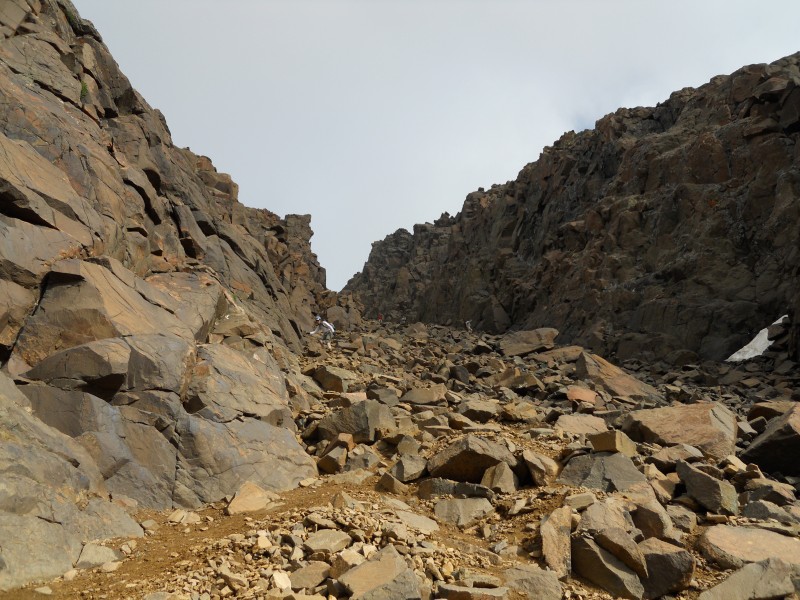
The picture below skips forward a bit. We had entered the upper gully. The lower gully went fairly fast as we mainly stayed on the talus just to the left of the scree.
Zooming in you can see my wife as she enters the upper gully.
The view out of the gully is awesome!
About half way up the gully is a small side gully that exits left. It is very evident that it has seen a lot of traffic. We decided to exit here; and in hind site, this may not have been the best of ideas. It wasn't all that steep, but there were very limited holds. Better to go up it then down it. We came back down the standard route.
Below you can see my wife exiting the small side gully in the center of the photo.
The good news is that it meets right back up with the main route.
At 9am we were on the summit, but we would stay only for a short time. Rain was on the horizon and moving our way.
My wife taking in this wonderful summit.
She asked me to add this summit photo of me. She really likes it.
Coming down the upper portion with dark skies behind us.
If you blow up the photo below, you could see over 15 people on the way up the lower gully. Lightning was striking all over this area the previous evening. I was glad we were on the way down.
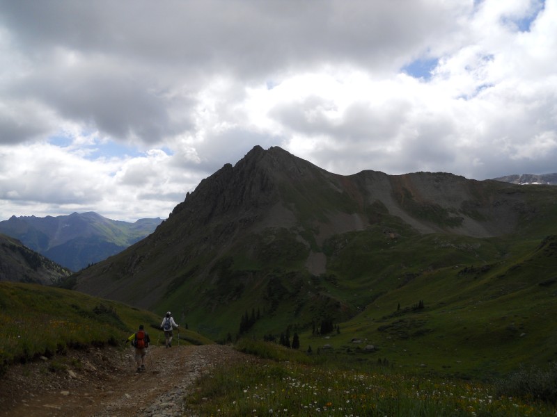
We got to enjoy the beauty of Yankee Boy Basin which we had missed on the way up in the dark.
The flowers were still out in plenty this late in the year.
With the price of gold and silver these days old mines look pretty good as well.
As we near the car, a light rain begins; my wife picks up the pace.
The shelf road adds to the adventure of this trip. It is a wonderful approach to the basin.
The town of Ouray is a must see. We stopped at Maggie's Kitchen for a very good burger. The 4WD mountain touring machine was very cool. It loaded up with tourists and was off shortly after this photo. I can picture it painted brown with 14ers.com logos on it taking members up to trailheads on spring, fall, and girls climbs. Just a thought 8) !
We love the San Juan Mountains. With the short approaches, beautiful basins, cool towns, and awesome peaks. They make for wonderful adventures and lasting memories.
My GPS Tracks on Google Maps (made from a .GPX file upload):
Nice report, looked like a good climb. Your pic # 16 looks like there is some evil animal caged up in there that comes out at night. :-D
Caution: The information contained in this report may not be accurate and should not be the only resource used in preparation for your climb. Failure to have the necessary experience, physical conditioning, supplies or equipment can result in injury or death. 14ers.com and the author(s) of this report provide no warranties, either express or implied, that the information provided is accurate or reliable. By using the information provided, you agree to indemnify and hold harmless 14ers.com and the report author(s) with respect to any claims and demands against them, including any attorney fees and expenses. Please read the 14ers.com Safety and Disclaimer pages for more information.
Please respect private property: 14ers.com supports the rights of private landowners to determine how and by whom their land will be used. In Colorado, it is your responsibility to determine if land is private and to obtain the appropriate permission before entering the property.


")
")
")
")
")
")
")
")
")
")
")
")
")
")
")
")
")
")