About a year ago, I started selling a Glacier trip to Lord Helmut. And I was selling it pretty hard. I went so far as to tell him that Glacier National Park made Glacier Gorge up in Rocky look like Gary, Indiana. He fired back and said Gary, Indiana was a sh**hole. I told him to trust me and he did.
We extended some invites but didn't get any takers. Sarah initially said there is something wrong when you can't get people to take a trip to Glacier. But it is a 1,000 mile drive and a week plus commitment. Throw in the fact that we all have a finite time on this planet with everybody chasing their own alpine dreams and it becomes perfectly understandable.
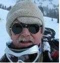
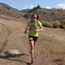
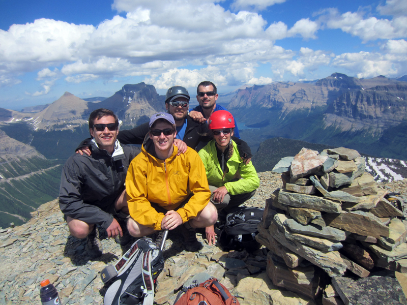
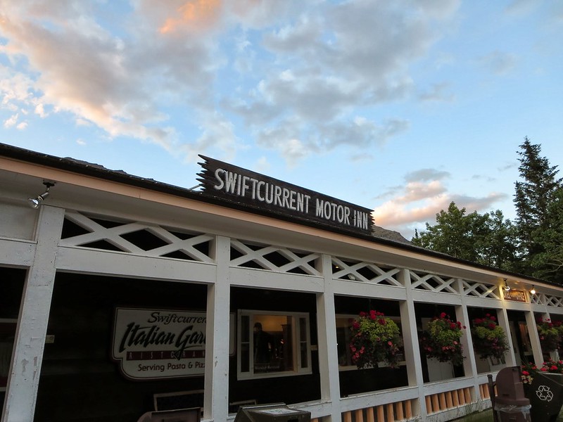
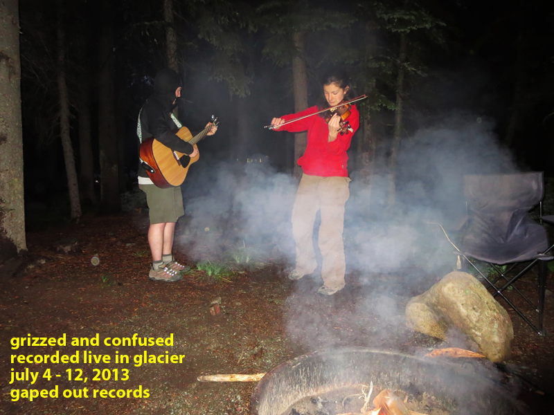
We arrived as a band of five - Lord Helmut, Sarah, Svet, Mark, and I. Svet is a friend of Lord Helmut's from back east. Of Bulgarian descent, he said he read Fire and Ice and was sold on this trip instantly. Mark is a friend of Svet's from Seattle. He jumped on board a week prior, bought a plane ticket to Kalispell, Montana and got to climb his first peak. We added a sixth the first night - Virginia, a violinist also from Bulgaria. She is currently the Swiftcurrent Motor Inn babe in residence. While her work schedule did not allow her to hike/climb with us, she and many other female employees of the lodge hung out with us quite a bit. Virginia even gave a wee hour concert from our site one night. How we didn't all end up in a Blackfeet jail cell I'll never know.
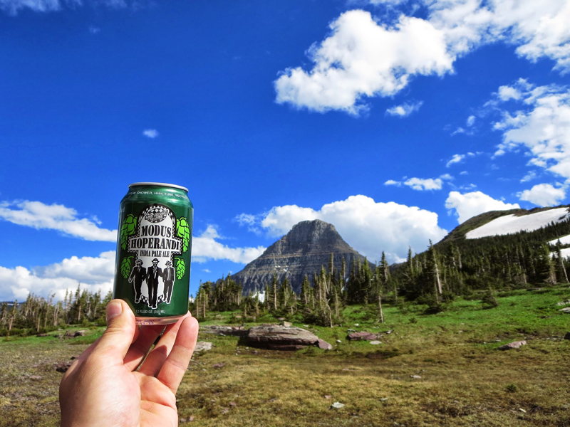
When the grizz dust and canned IPAs finally settled, we spent eight days in the park. Eight unreal days. It was the best vacation I have ever taken. If I could go back and do it again, I would in a heartbeat. Same crew. Same everything.
We did not climb every day because we all wanted a break from *The Game*. But when we did it was pretty special. Rather than give you a blow by blow of our entire trip - the good, the bad, the lascivious - I'd prefer to concentrate on the climbs. After all, this is a mountaineering forum. So without further adieu...
GRIZZED AND CONFUSED
We got together, and we cashed in our sweeps
Gave 'em to a beggar who was mumbling through the streets
Ain't no escaping from his snowy white dreams
Born lookin' lonesome, on'ry and mean
- Waylon
*Peak names and elevations courtesy of the Glacier Mountaineering Society.
Day 2: Get Yer Ya Ya's Out
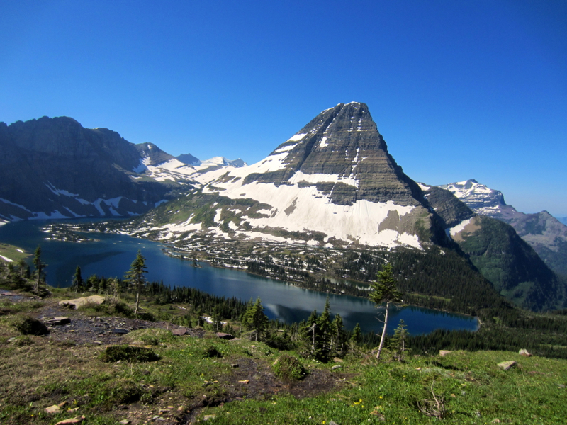
Reynolds Mountain
9,125 feet
11 miles
Climb Glacier National Park Volume 1 by Blake Passmore
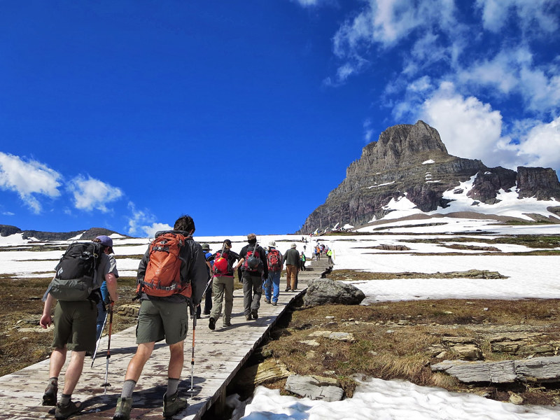
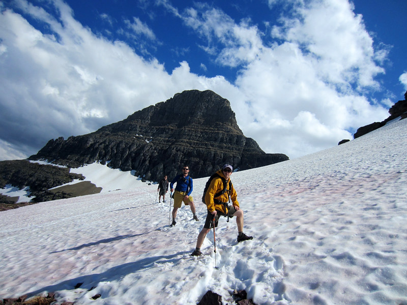
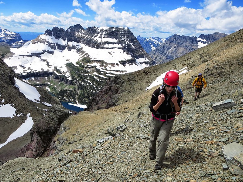
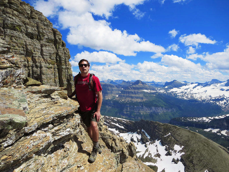
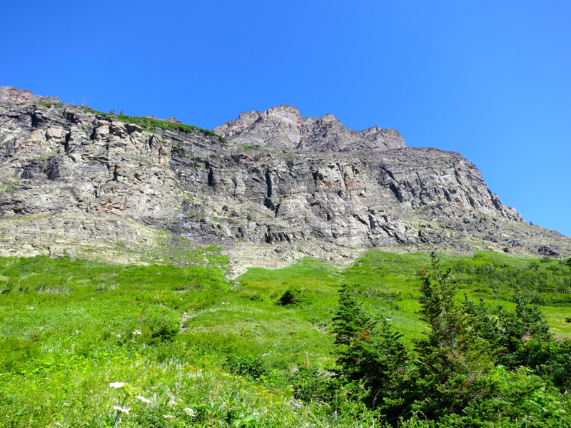
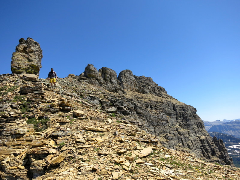
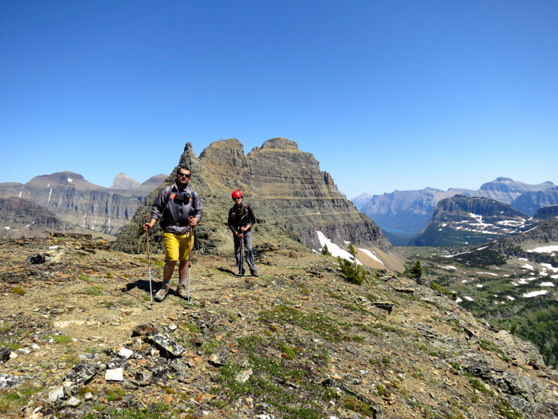
Oberlin was supposed to be the opening act. It is considered the easiest peak in Glacier National Park and I thought it would be a good warmup for Mark and Svet who haven't done a whole lot of mountaineering. From Logan Pass it is maybe 4 miles roundtrip with not a heck of a lot of vertical. It isn't a walkup but pretty darn close.
Over beers (as usual) the night before, Helmut and I discussed taking a shot at Reynolds instead. It was on our bucket list for the week. The stats and route description looked pretty tame by our Colorado standards so we shifted our plans believing it was within everyone's skill set.
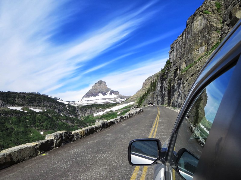
Taking Going-to-the-Sun road in the morning was an ascent into the most dense fog I have ever experienced. None of the peaks were visible. The abyss to driver's left was an opaque swirling cauldron. We arrived at Logan Pass and could not see out of the parking lot. I was not about to set off hiking in this. I mean, think of the grizz!
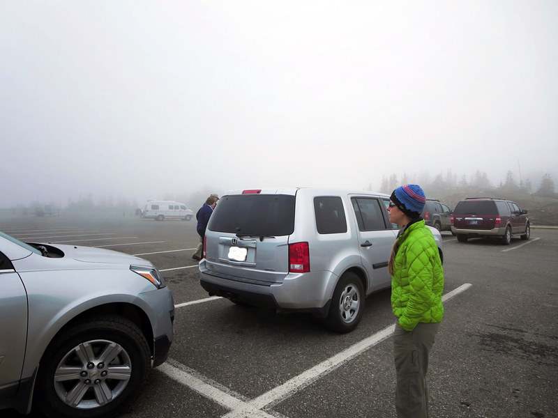
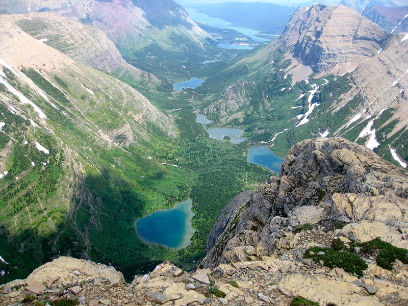
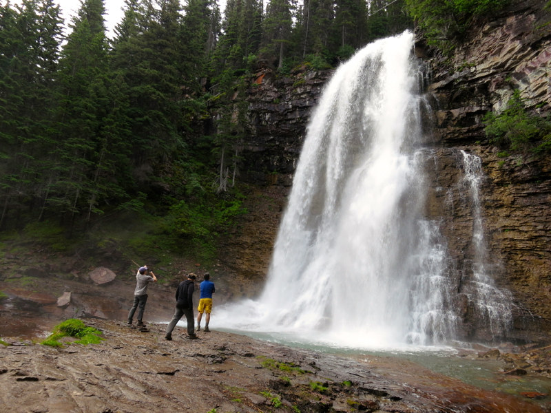
The forecast was not calling for any precip, so we figured we just needed to wait for this stuff to burn off. So we drove back down the road a few miles and hiked out to an awesome waterfall. Two hours later, we were back at Logan Pass and hoofing it up to the Hidden Lake Overlook.
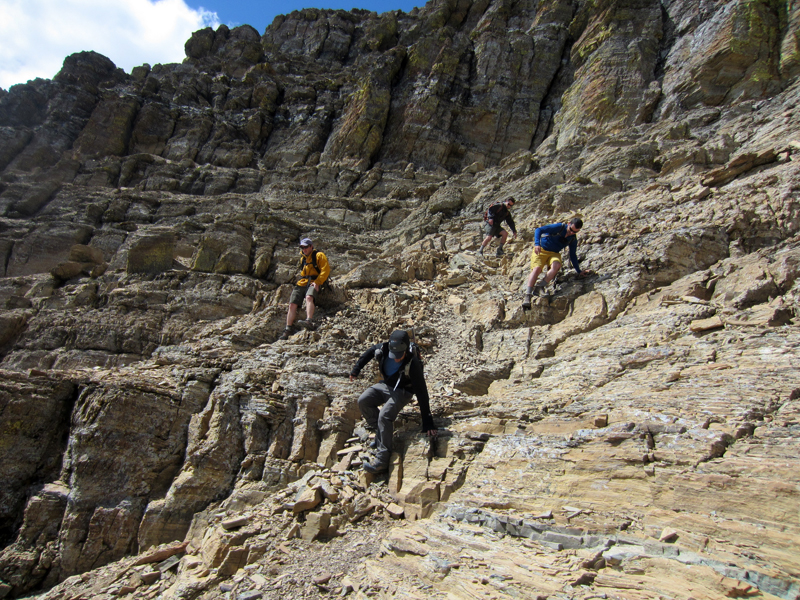
A climber's trail shoots off to the left after about a mile and then snakes its way to the Reynolds-Dragon's Tail saddle. There was a ridge a couple hundred feet above us. We figured we could scramble up to it, take in the views on the other side and then run it to the saddle.
But contours in Glacier are like contours in the San Juans or Elks - they harbor secrets. We were stopped by a steep notch and had to backtrack and find a bail route to the obvious trail below. I was worried about Svet and Mark on the junky talus descent but they did fine. All told it cost us a couple hundred vert and maybe an hour but looking up at the sky we knew we had all day.
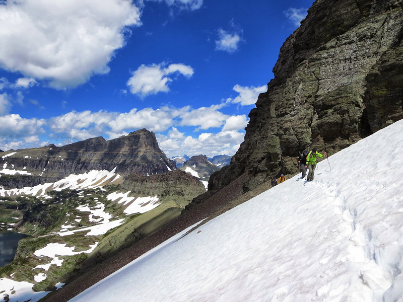
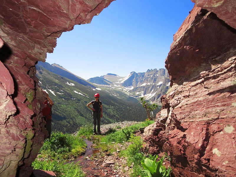
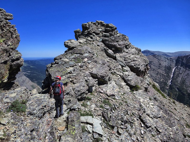
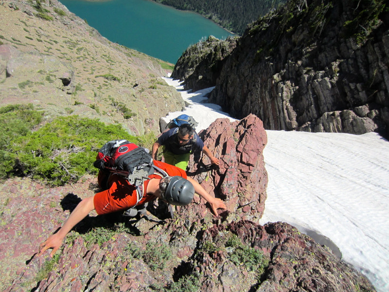
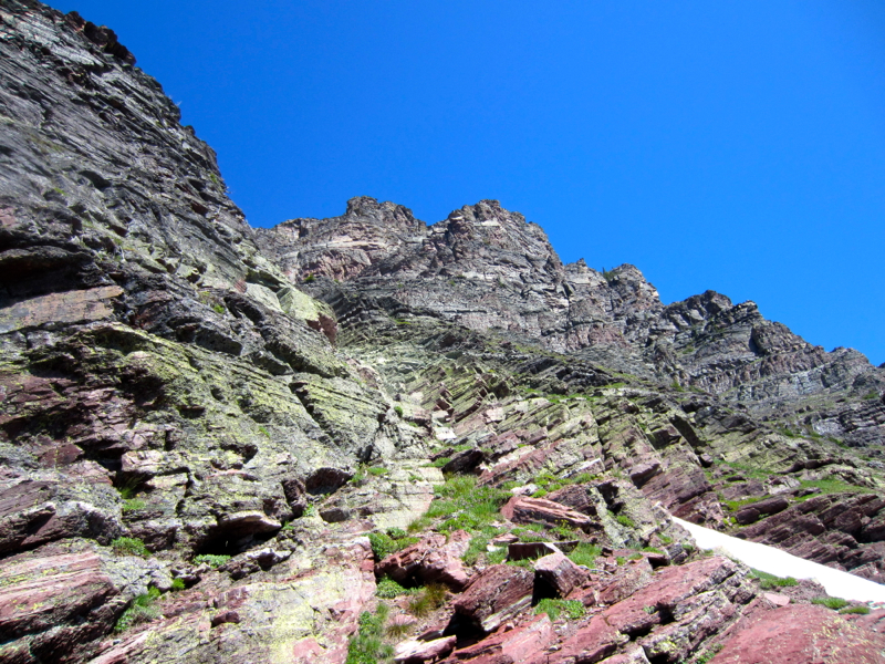
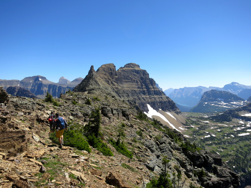
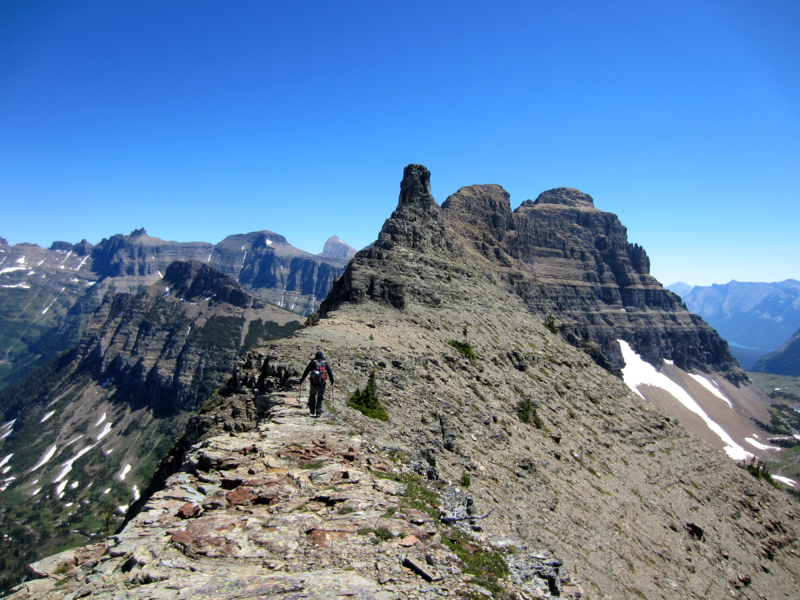
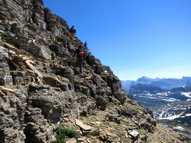
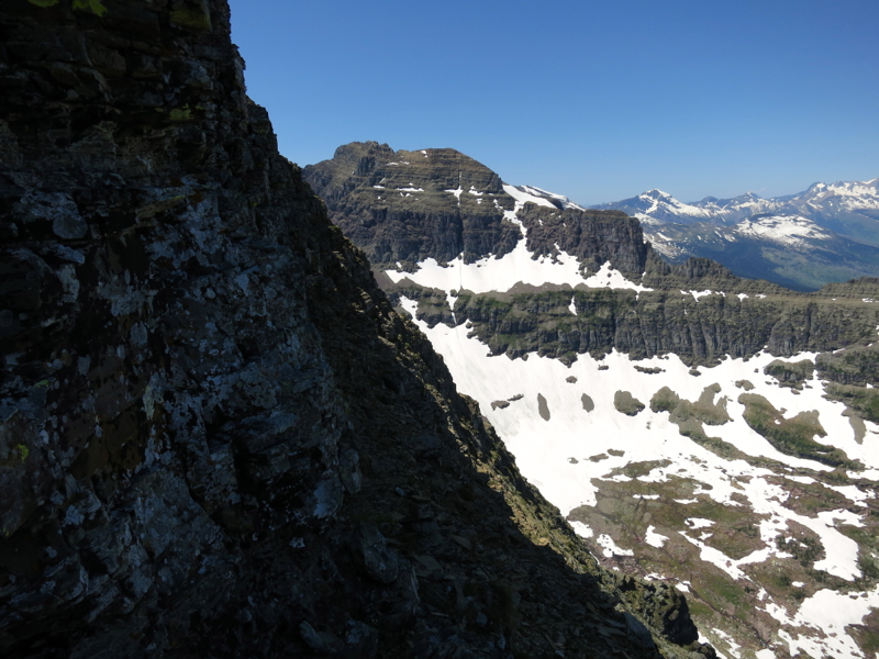
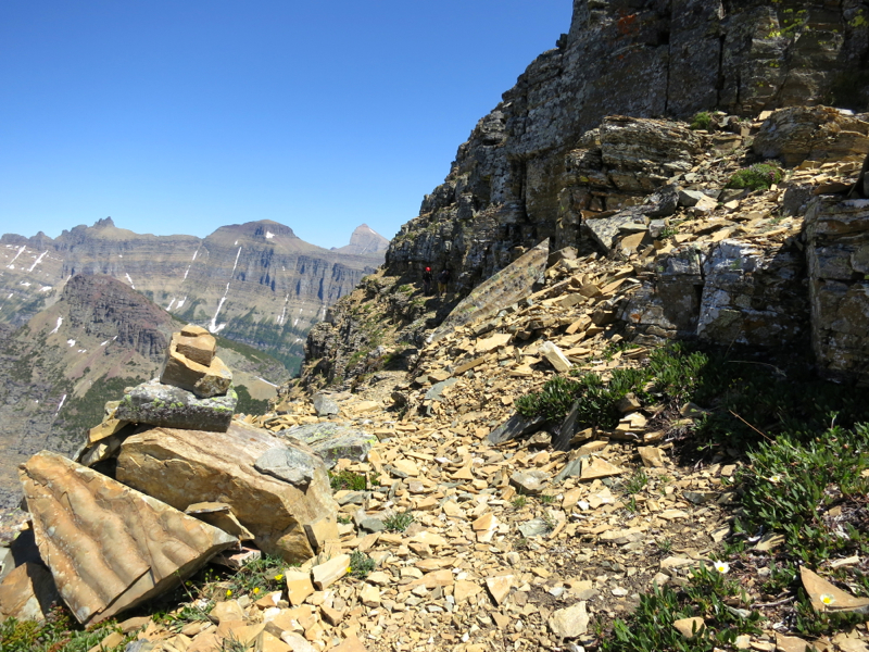
We soon reached the Reynolds-Dragon's Tail saddle and began the climb. A lot of rubble ledges and a little bit of Colorado class 3. We then reached a giant scree field. Classic San Juan garbage. The kind of stuff that gets in your teeth and your chest hair. From here we persevered up and up and up to the base of the summit cliffs.
We spotted some cairns and began navigating. Glacier climbing is a lot like Elk climbing - ledgy - and after a couple of moves that seemed like they flirted with easy 4th class we found ourselves on a goat trail which is another Glacier staple. It gradually wound its way around the mountain and to the summit. There were intense views of glaciated peaks and pretty significant exposure the entire way.
An older guy moving very quickly caught up to us at the summit. His name was Rick. He was like a grizzled chicagotransplant (if Mike ever decides to take his act up north). He knew every peak on the horizon, pointed out routes, ski tours, bail options, threw in some history (a banker who pissed off the Luciano family was evidently pushed off a nearby summit years ago), etc. We could have talked to this cat for hours.
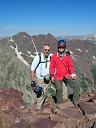
He took our picture and we began the descent.

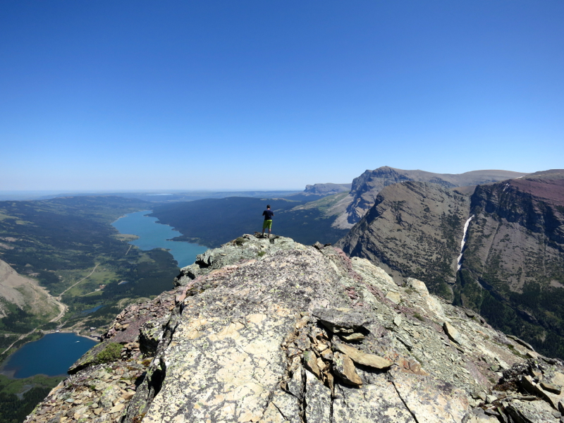
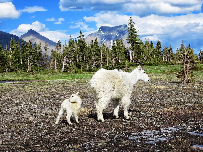
Back on the trail it was easy street to the Hidden Lake Overlook. We kept our distance from the tourists and got to watch a dozen or so people glissade and boot ski without any means to self-arrest. At the bottom of the runout were several large rocks the size of cars. It was definitely must see TV. Even the goats took sanctuary with us and watched the show. Reynolds was Mark's first ever summit. I told him if he wanted to retire from mountaineering, he had earned the right.
DAY 5: Unranked But Iconic
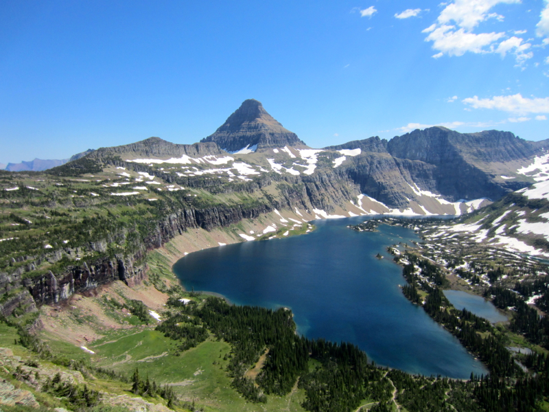
Grinnell Point
7,600 feet
5 miles
A Climber's Guide to Glacier National Park by J. Gordon Edwards
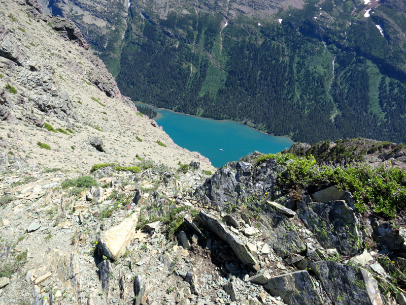
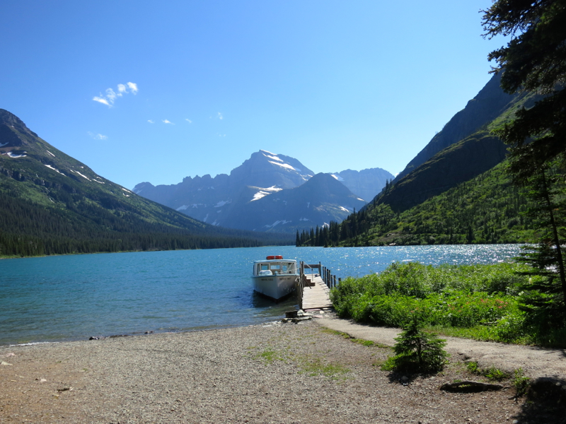
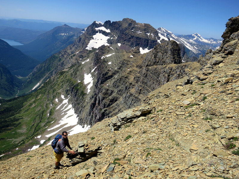
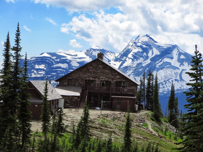
Mark had a plane to catch so he and Svet did a little fishing in the morning at Duck Lake with a Blackfeet guide by the name of Buckskin (no, I did not make that up). Helmut, Sarah and I grabbed our packs and walked to the Grinnell Glacier TH. One of the perks of staying at Many Glacier Campground is you can walk right from camp to numerous trailheads. No need for the car, no need for the chaos.
A black bear was frequenting the area so we made noise and kept our eyes peeled as we booted it to the shores of Josephine Lake.
We needed to look for a small pond and then a waterfall to our right. This would be our jumping off point per the Edwards book. Well, we passed the pond and the waterfall because we thought it was too early and had to backtrack. We finally found the right spot and stared up at the cliff band searching for a weakness.
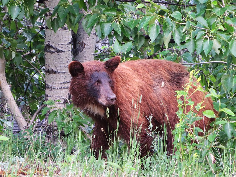
There was a grassy ramp to climber's right that appeared to lead around a bend and up a gully which we could not see but thought would go. Everything else looked vertical. To get to the ramp we had to ascend 300 feet of heavy grizz area. There were thickets to our left and right and an opening in the middle which we obviously took. I got the feeling on several occasions that we were being watched.
If we were in Colorado, we would've put our heads down and slowly plodded our way up to the cliffs. But because of the grizz we were forced to not only keep a constant eye on our surroundings but also make a sh**load of noise. Sarah had a whistle which she hit every 5-10 seconds and Helmut and I yelled periodically:
"HO!"
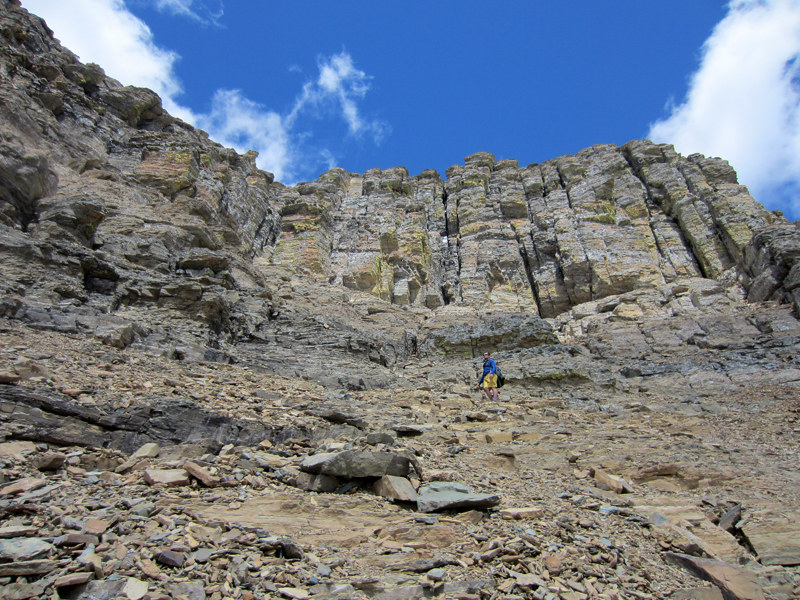
By the time we got to the cliff band I thought my lungs were gonna explode. We traversed right to the grassy ramp where Sarah and I stashed our sandals (for some reason I got it in my head that we had a creek crossing to contend with). SH** CALL.
We strapped our poles and began to pick our way up. The climbing started out class 3 and morphed into loose 4. A lot of rubble ledges and shaky holds. Near the top was a very questionable horn that was not solid at all. We utilized it very delicately to gain a platform above. In retrospect, I can't believe it held.
From here we cruised on a wide grassy ramp that swept through a little cirque to the left and then climbed up and to the right. Our next objective was the Josephine Mine and a giant snowfield. We ascended easy class 2 and 3 on grass and ramps and short rock sections for a few hundred feet. Foliage got thick in spots so we had to stay cognizant of our surroundings and make a lot of noise again.
I checked our location on my phone and we were nowhere near the Josephine Mine. This was very disheartening. But the route description and pictures (especially of the mountains across the way) made it seem like we were on track. So we continued up hoping for the best.
I spotted a gray tailing pile to our left next to a very steep snowfield. Could this be the Josephine Mine? We traversed over to check it out.
With our spirits lifted we gazed up at the remaining 1,200 feet to the ridge line. It looked ugly and complex.
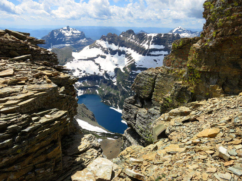
We climbed up the rocks to the right of the snowfield and it was more of the same - class 2 and easy 3. Suddenly cairns began to appear and we followed them through the jumbled mess all the way to the ridge. This section was probably the easiest of the day. From the top of the ridge we hung a right and navigated some ledges and catwalks all the way to the large summit cairn. Exposure to the right was not terrible but exposure to the left was extreme. Let's just say there were consequences on both sides.
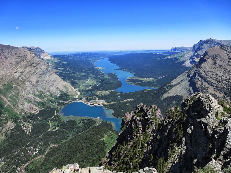
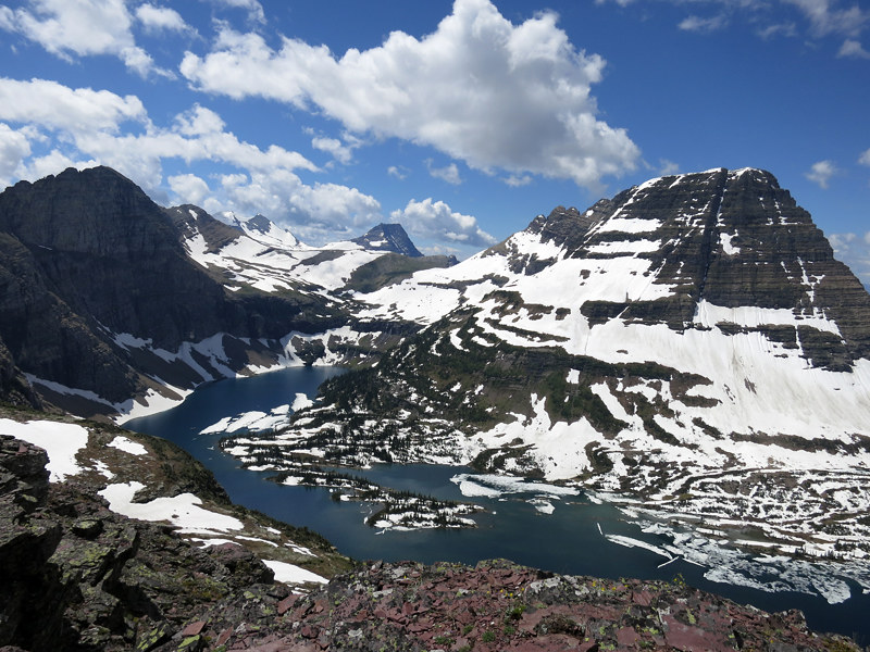
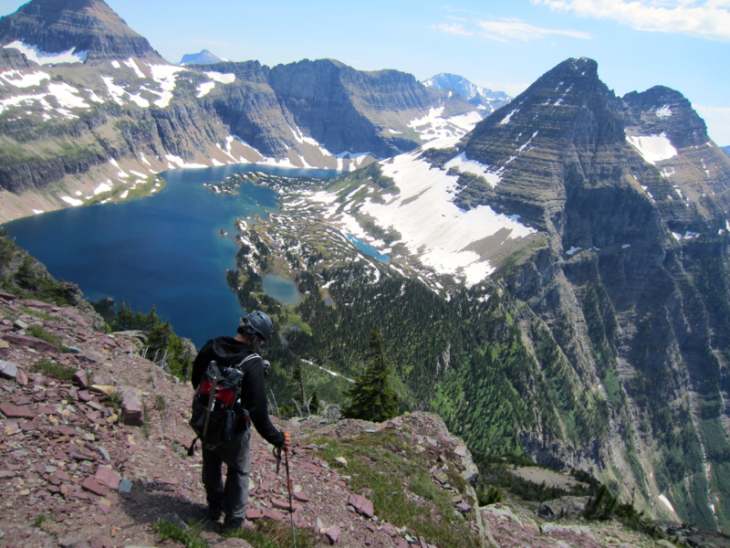
We hung out next to the giant summit cairn for a while, taking in the surrounding peaks. Grinnell Point had stared down at us in the parking lot of the Swiftcurrent Motor Inn countless times during our visit and it felt pretty good to be up here doing the staring for once. If only there was a bell up here to ring our ascent. Man, it was a long ways down. A long ways down to the tourists and the general store, the bustling lobby, restaurant chatter and the huckleberry soft serve ice cream machine. A long ways down to safety. If only we had a 2500 foot scree surf to the parking lot. But we didn't so we had to hit the bricks.
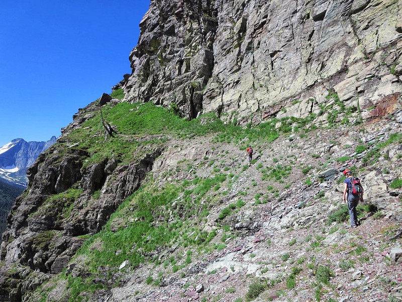
We made quick time to the mine. I wonder if it is mismarked on the quadrangle? Our next objective was to locate the grassy ramp which would take us to the sketchy downclimb. This was tricky and we had to backtrack a few times before we found it. Thankfully, we did. I don't know if there are other weaknesses along that side of the mountain but bailing in Glacier is not like bailing in the Sawatch. Routes that go are few and far between.
At the top of the sketchy downclimb, I told Helmut we had to keep an eye on the deck because we were re-entering grizz terrain. The last thing you want to do is downclimb dicey class 3/4 and land with your feet on the back of a sow with cubs. To say your day would end poorly is a gross understatement.
So we scanned the grass and trees and Sarah hit the whistle. We found a better option than the loose horn. There were a couple of nervous moves mainly because the ledges were not scrubbed of pebbles but within ten minutes we were out of the no fall zone.
Without hesitation we moved very quickly through the grizz sanctuary, reached the trail and encountered some people. Moments later, we were chilling next to a dock on Josephine Lake, beers in hand, safe in the shade, listening to the waves ride into the shore.
From there it was a mile to the trailhead which was crawling with activity. We looked up at Grinnell Point from the parking lot, smiled and laughed. Another one in the books. Some guy yelled across to us from 50 yards away:
"Did you just scale that?"
There were now 40 sets of eyes on us.
"We did."
DAY 6: Strike While the Iron is Hot
Clements Mountain
8,760 feet
9 miles
Climb Glacier National Park Volume 1 by Blake Passmore
Svet was supposed to join us for a climb and that damn Oberlin was on the docket again. Nothing against Oberlin, it is a nice peak, but nothing compared to its neighbors. If Oberlin were a chick, on a scale of 1-10, she would probably be considered a "Hot 4". It is what it is.
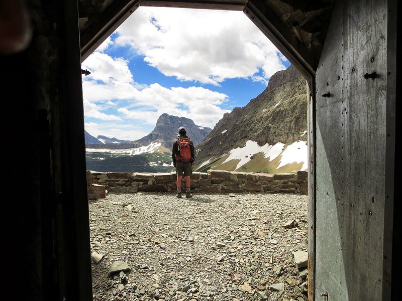
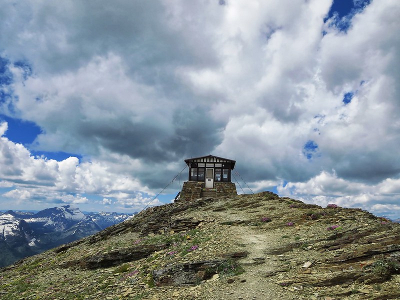
Svet had spent the last few days listening to Helmut, Sarah and I talk about our long serpentine hike up the Swiftcurrent valley to the fire lookout on Swiftcurrent Mountain (16 miles, 3500 vert), and decided it was something he had to experience before he left Glacier. So Svet was out.
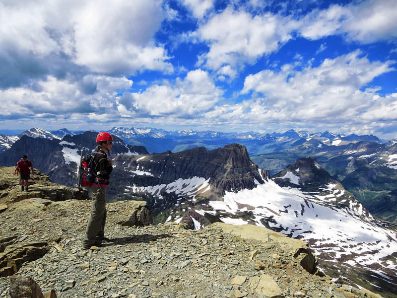
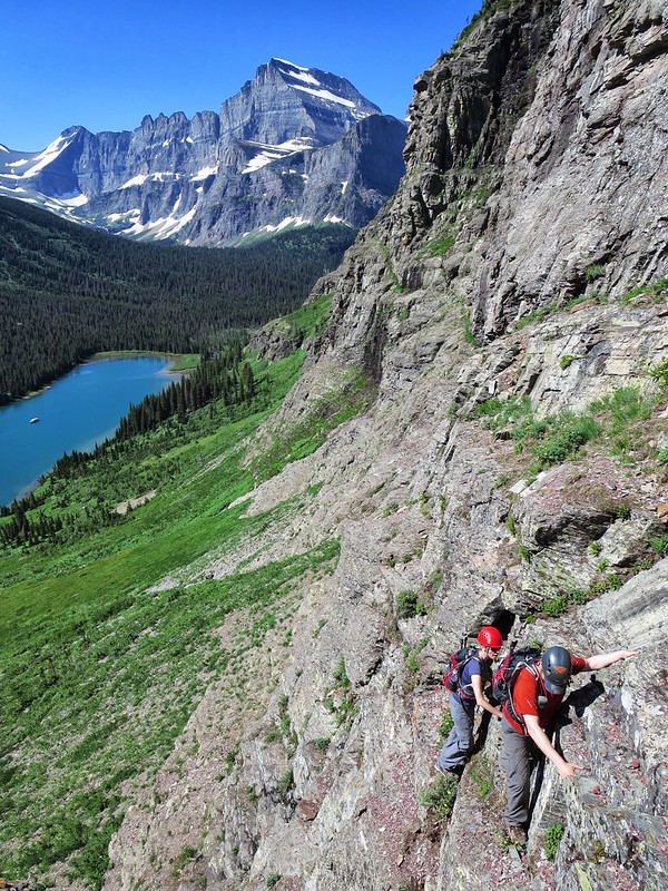
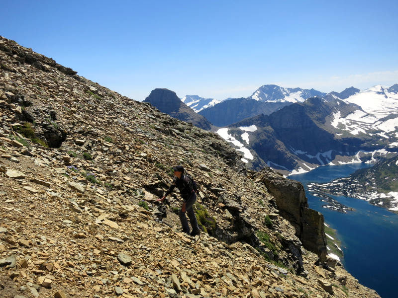
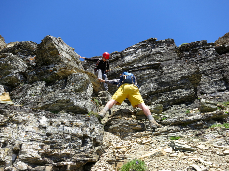
Over beers (as usual), I told Helmut we should strike while the iron was hot and take a run at Clements Mountain instead of Oberlin. The only hitch was the fact that Clements has a 0.2 mile exposed goat trail traverse on its north face with well over 1,000 feet of holy shit below you (I think 2,000 feet of holy shit actually). If we were to encounter snow along this stretch it would definitely be a showstopper. But I figured if we failed, we could pick up Oberlin on the way back to the car and the day wouldn't be a total loss. Helmut agreed and Clements was on.
We departed Logan Pass and made our way to the Hidden Lake Overlook again. The area had experienced a significant snowmelt since Saturday. Instead of going left near the Overlook we took a solid trail to the right and descended a few hundred feet. It was pleasant to escape the masses so quickly.
Near the bottom of a small snowfield, we picked up a climber's trail known as Bird Woman Pass. Our goal was to do an ascending traverse on this trail before reaching a section where we would climb straight up to the ridge leading to Clements.
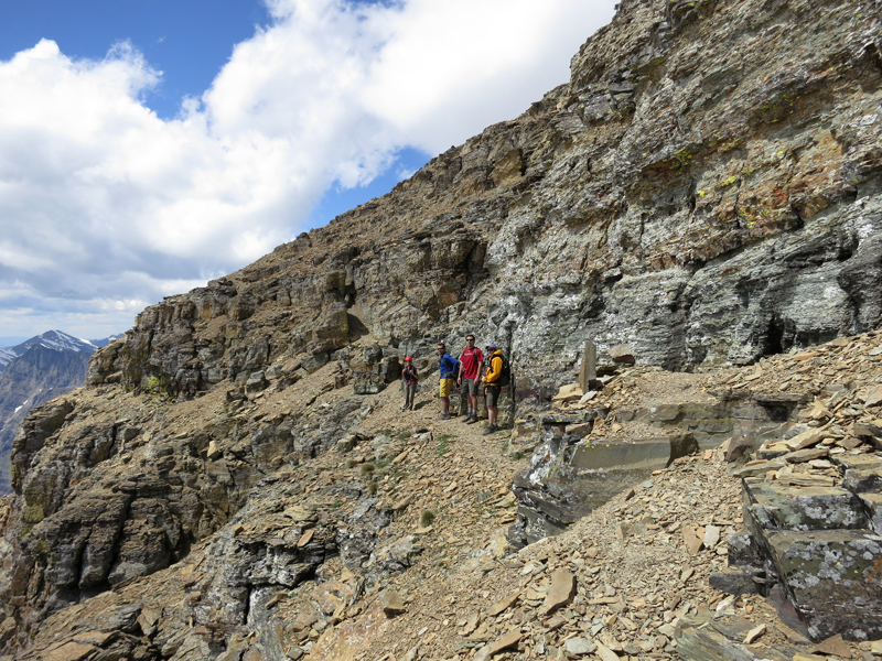
This turned out to be a steep hot grunt. We had to make noise here and there once again but we persevered and eventually topped out on the long west ridge of Clements. I expected a nice flat stroll from here to the start of the goat trail. WRONG.

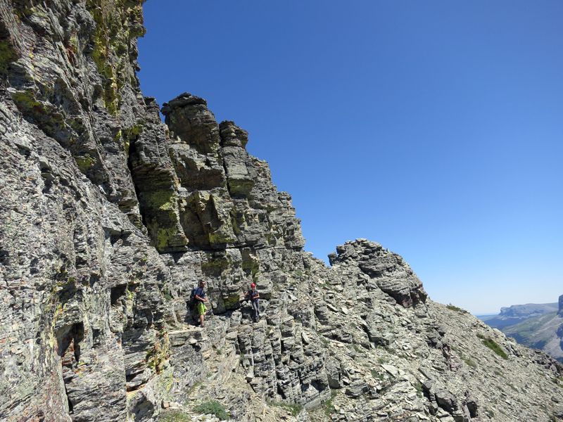
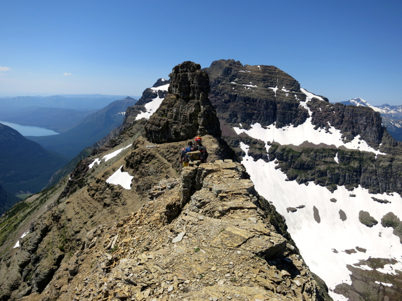
We stayed on the south side of the ridge where the faintest trail was still visible. The terrain was unforgiving hardpan with just enough of a slant to keep you honest. Twenty feet to our right was the abyss. It reminded me of the early stages of the standard route on North Maroon. Class 2 with consequences.
There were three cairns now in front of us and the cairns led to the north side of the ridge. Could this be the start of the goat trail? We all took a look and prayed it wasn't. First off it was shady to the point where it looked like dusk. Second, it was very, very narrow. Third, the drop was extreme.
I checked the south side and no dice. This was it. Tell my wife and kids I love them kind of stuff. To be perfectly honest, I seriously considered bailing here.
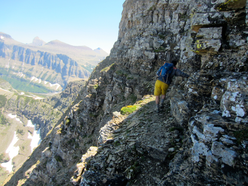
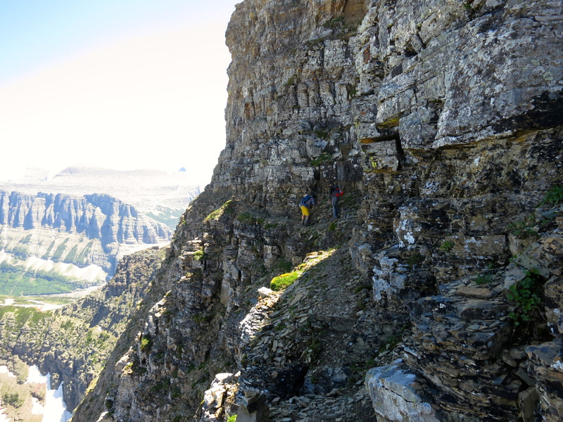
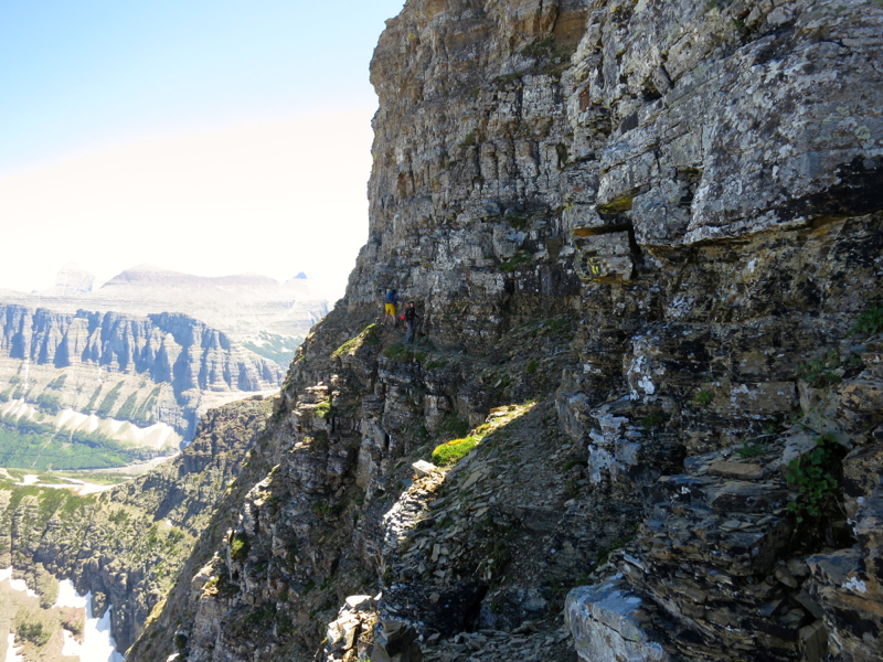
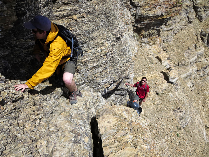
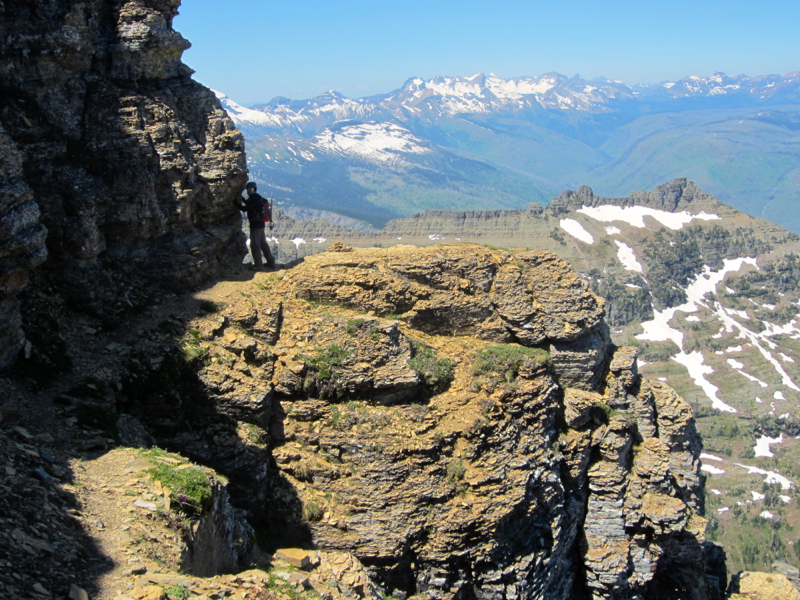
Amazingly, there was no snow despite the lack of sunlight. The goat trail was 12-24 inches wide almost the whole way. In a few spots it widened but sloped down on grass to the edge. We hugged the wall and shuffled most of the way. The route was scrubbed of loose rock and the handholds were solid, but the exposure meant that total focus was an absolute must. I don't know about the others but I looked down twice.
Upon exiting the goat trail, we let out a cacophony of profanities. But we still had work to do - a few more ledge traverses and one short class 3 section, before cruising up dinner plate talus to the summit. F*** yeah!
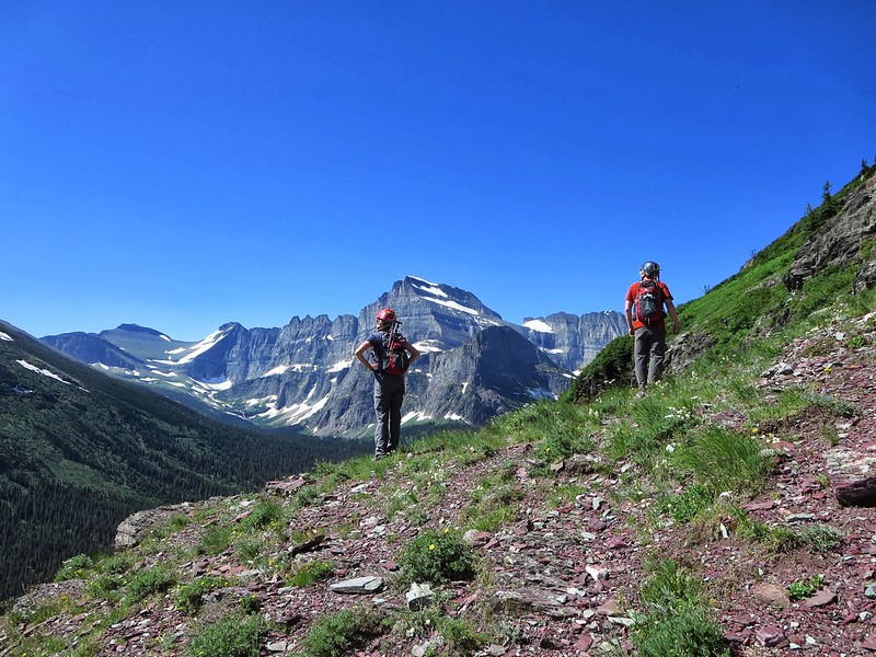
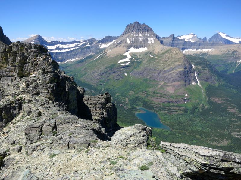
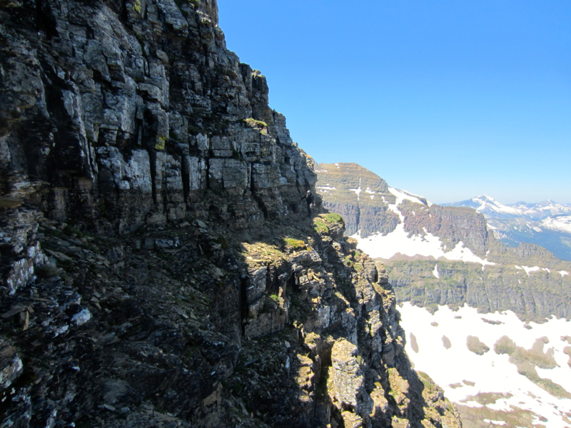
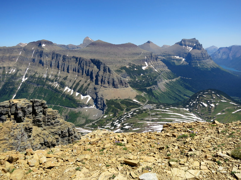
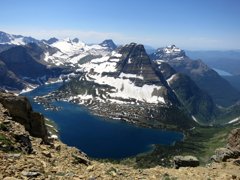
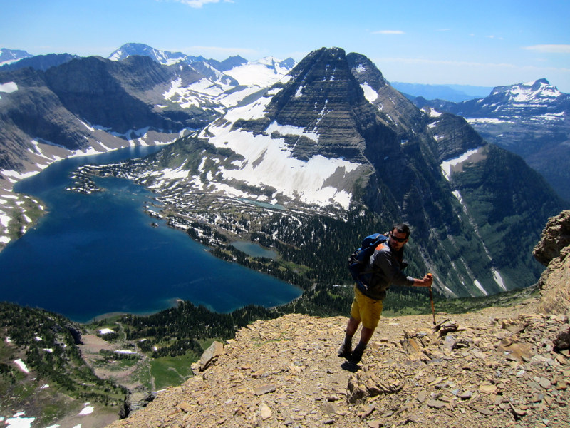
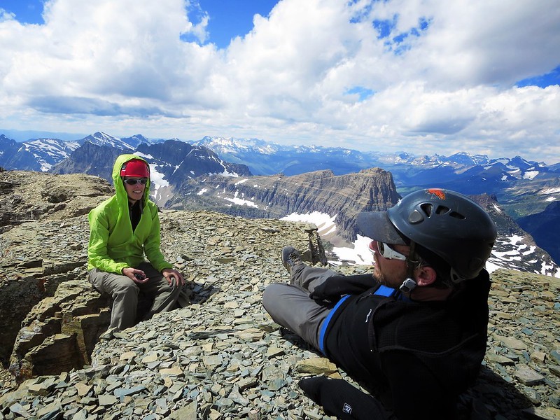
The summit felt damn good and the views were incredible - Reynolds, Bearhat, Cannon, The Garden Wall, Going-to-the-Sun Road, Heaven's Peak, Mount Jackson...
We had a hard time relaxing though because of the goat trail. We nibbled on a sleeve of Pringles, looked down on the Logan Pass parking lot, took a few pics and began the inevitable descent. The goat trail arrived quickly (almost too quickly).
Subtle upclimbs on the way out morphed into short but daunting downclimbs on the way back where the landing on a one-foot wide ledge had to be stuck with the precision of a gymnast. There were two of these sections where looking down at the valley floor was inevitable. I chose to not hesitate (not even for a second) in both spots. I think if you paused and really started looking and thinking about what you had to do, you might be up there for a while. I found myself getting into a nice rhythm. But whenever I paused to look back at Sarah and Helmut or take pics, I would lose it. And those first few steps on the restart were always shaky. It was definitely no place for a nervous person.
18 minutes later we were off the goat trail and navigating the hardpan traverse. It was not nearly as bad the second time around. I felt completely alive. So alive that I forgot to pick up my trekking poles on the way down. Only one word can describe that type of behavior: GAPER MOVE.
An hour later we were on the Hidden Lake trail, walking tall one last time.
As always, thanks for coming along for the ride...
|