Download Agreement, Release, and Acknowledgement of Risk:
You (the person requesting this file download) fully understand mountain climbing ("Activity") involves risks and dangers of serious bodily injury, including permanent disability, paralysis, and death ("Risks") and you fully accept and assume all such risks and all responsibility for losses, costs, and damages you incur as a result of your participation in this Activity.
You acknowledge that information in the file you have chosen to download may not be accurate and may contain errors. You agree to assume all risks when using this information and agree to release and discharge 14ers.com, 14ers Inc. and the author(s) of such information (collectively, the "Released Parties").
You hereby discharge the Released Parties from all damages, actions, claims and liabilities of any nature, specifically including, but not limited to, damages, actions, claims and liabilities arising from or related to the negligence of the Released Parties. You further agree to indemnify, hold harmless and defend 14ers.com, 14ers Inc. and each of the other Released Parties from and against any loss, damage, liability and expense, including costs and attorney fees, incurred by 14ers.com, 14ers Inc. or any of the other Released Parties as a result of you using information provided on the 14ers.com or 14ers Inc. websites.
You have read this agreement, fully understand its terms and intend it to be a complete and unconditional release of all liability to the greatest extent allowed by law and agree that if any portion of this agreement is held to be invalid the balance, notwithstanding, shall continue in full force and effect.
By clicking "OK" you agree to these terms. If you DO NOT agree, click "Cancel"...
I drove from Crested Butte to Westcliffe Friday night after work a little later than expected. A friend got a job in Moab for the offseason so we met up for a quick going-away party before I set off. I got to the Lower South Colony TH a little before 10:30 and it was already quite full. I organized my pack with all the essentials for a get-up-and-go start in the morning. I set my alarm for 3:00 despite knowing full well that I'd probably continue to doze for a while before actually setting off. Even as I lay there waiting to drift off, a few more cars arrived at the TH and at least one party set off hiking in the dark.
As my alarm goes off at 3:00, I'm not ready to go yet and continue to doze as expected. I don't set off until 4:45. The slog up the road in the dark wasn't too bad, but I knew I'd absolutely hate it on the way down. I'd told myself I'd avoid hiking up roads if I could avoid it after approaching Castle from West Brush Creek, but without a high clearance vehicle, there was really no other option. Two hours after setting off, I reached the trail junction for the Crestones and Humboldt. Taking a quick snack break here, I continued up the South Colony Lakes trail. Here, I was treated to views of Broken Hand and the Crestones the whole way to Bear's Playground. Gerry Roach's book led me to believe (incorrectly) that there would be a trail up to Bear's Playground on the ridge's south side. I'd recommend going up to the Humboldt Saddle trail to reach Bear's Playground.
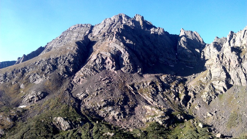
Broken Hand PeakNorth Colony Lakes
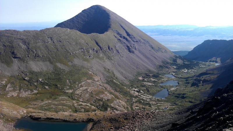
Crestone Peak from Bear's PlaygroundCrestone Needle from Bear's Playground
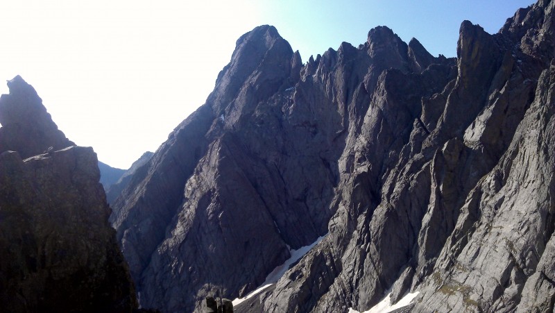
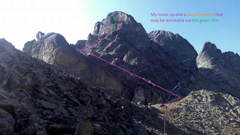
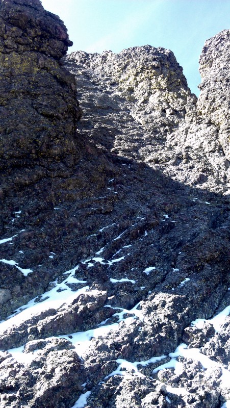
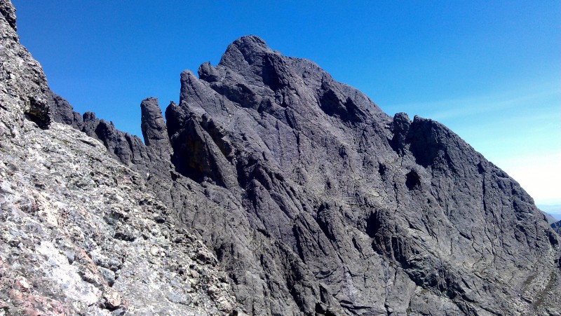
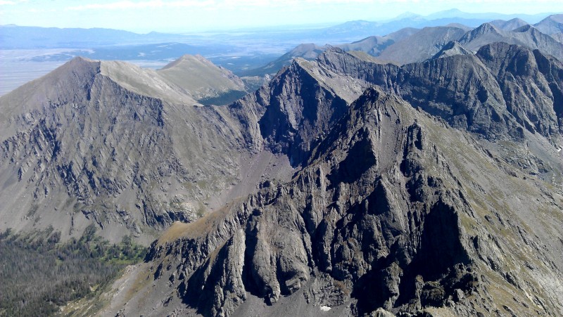
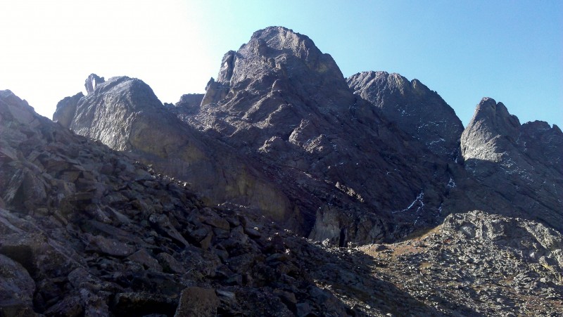
I was then face to face with the North Buttress at about 9:30. From the base, you can pretty much pick out your entire route. Do as much routefinding as you can here and memorize important features so you're not finding yourself in overly difficult terrain while on the route. It looked dry the whole way up and success on the route looked promising. There's an obvious route up several gullies most of the the way, but following it led to a Class 4 pitch on the west face close to the summit that may or may not have been avoidable. I continued up it, but it may be worth it to take the time to backtrack and look for an easier way up. The conglomerate was less knobby and secure here than anywhere else on the route for 30'(ish). According to Gerry Roach, you should stay on the west side of the ridge, but the ridge isn't very well defined, and I found myself on easy terrain on the east side (where I could look down at South Colony Lakes) quite often. I stress careful and patient routefinding for parties less comfortable on Class 4/5 terrain. Soon enough you'll find yourself on the summit of Northeast Crestone. Take time to enjoy the view, fuel up, compose yourself and what have you; the most precarious part of the day is to come.
My route up and an alternative. Section of the green line held snow.
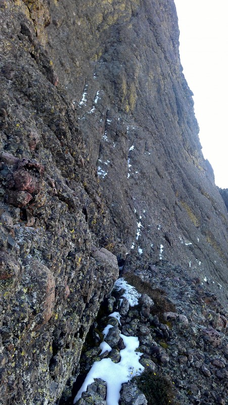
Top of the first pitchClass 4 section up and to the left that can be avoidedLast pitch to the summit. Left behind the tower side is easier, but held snow
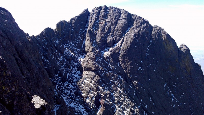
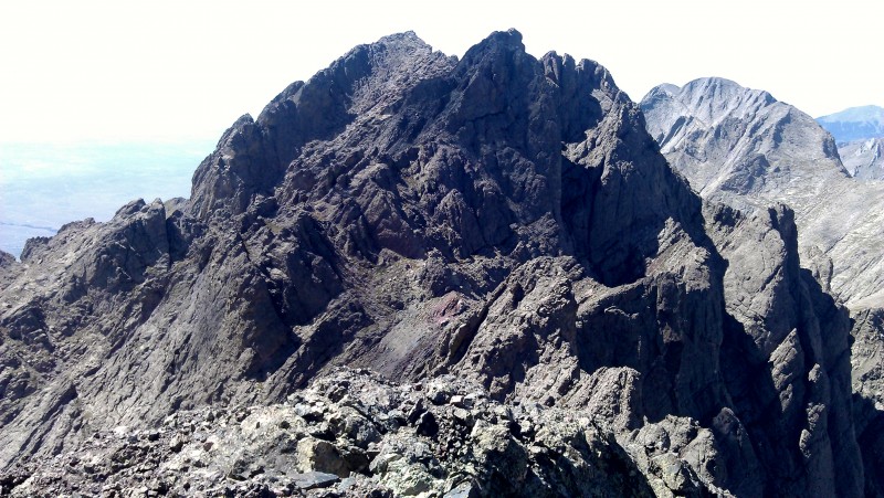
Peak from Northeast CrestoneNeedle from Northeast Crestone
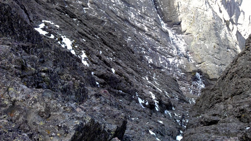
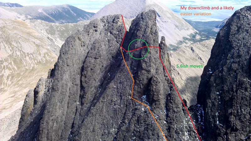
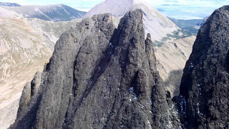
The first look at the traverse to the Red Notch is daunting. Gerry Roach describes it as "a tricky class 5.0 downclimb" and "a tricky, exposed Class 4 traverse across unprotected slabs." I downclimbed about 20' down to a notch between Northeast Crestone and a subsummit. Holds were plentiful and it felt easy to me. From here though, I wasn't sure exactly how to proceed. I thought I was I was done with the downclimbing and had to traverse to continue on the route. I ended up traversing straight across and made at least one or two super exposed 5.6ish moves on the traverse before getting to the second notch where the Red Notch was visible. I wish I had taken more pictures to share, but I was utterly focused on the climb, and I REALLY wished I had my rock shoes. For these reasons, I wouldn't recommend this route unless you've had a fair bit of rock climbing experience or are with someone who's done it before. From here, traversing down to the Red Notch felt more like Class 4 (down)climbing Once you get down below the Red Notch, the climbing eases to class 3. The takeaway here; continue to descend on your traverse past the initial downclimb. The summit of Crestone Peak awaits.
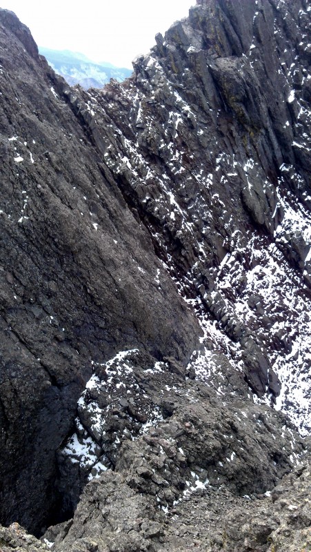
A look down the gully of the downclimb to the first notch. Continue to descend as you traverse here.View of the Red Notch from high above the second notch.
My route and what I believe to be an easier line. Take with a grain of salt.
I briefly questioned my sanity and then reveled in the view. I saw a group of people on the crux pitch of the Needle in the distance, which I would come to find was nowhere near as difficult as the traverse from Northeast Crestone. Since the 14ers site already has an excellent guide for this, I won't say much more here, other than it is well cairned up to the red gully (not the same as the Red Gully route). I was glad to have the photos to reference on my phone, and made the traverse in under two hours with no small contribution from them. As I said before, the even the crux pitch is cake compared to what you have to do to get from Northeast Crestone to Crestone Peak. Still, do not take it lightly. I'll leave you here with a few more pictures from the traverse and summits.
Crestone Needle from PeakThe Needle awaits
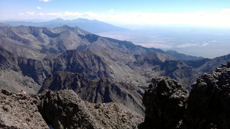
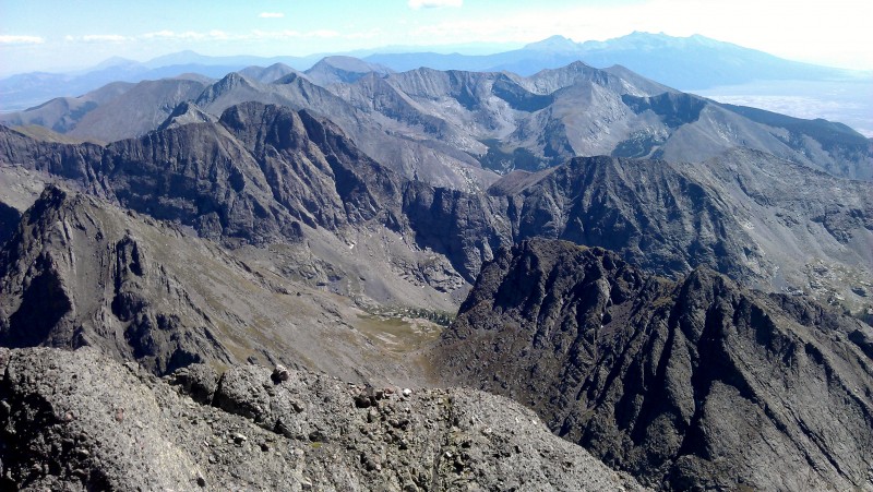
Crestone Peak from NeedleLooking south toward the Great Sand Dunes. Blanca Group in the distance. I'm coming for ya!
More of Blanca GroupLooking southeast
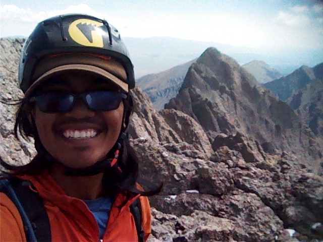
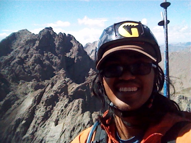
Shameless Summit Selfie Shameless Summit Selfie part 2
Trip Totals
2WD TH to Base of North Buttress: ~5 hours to summit of Northeast Crestone: ~1.5 hours to summit of Crestone Peak: ~1 hour to summit of Crestone Needle: ~ 2 hours to 4WD trailhead (where I hitched a ride with some friendly dudes): ~3.5 hours
(Rant: Don't take the long way around, it's only an extra ~0.5 mile, but it felt like an eternity. I had some homemade chili waiting for me in my car )
PS - I've left the unedited versions of the route outlines for your convenience. Enjoy!
North ButtressNortheast Crestone
Thumbnails for uploaded photos (click to open slideshow):
I'm totally with you. I remember the route up the N Buttress was much less obvious than Roach had described. I think we ended up keeping it mostly class 3, but it was a wandry line. Also, that traverse pitch over toward Crestone Peak was totally the hardest part of the traverse and I'm pretty sure we were on route. Nice work keeping cool through that scary-looking route line you drew in!
Awesome report, pictures and beta! One slight critique - the peak above your green circle is NE Crestone, and the downclimb Roach is referring to is actually the one from this peak to the notch on the right. The rest of your downclimb in red from the right of the circle is spot on.
Hmm, so does that mean I didn't actually summit NE Crestone? Totally didn't even realize that side was higher. Now I feel silly.
Would also explain that anchor at the top of that peak (above my first downclimb) that seemed to be out of place. When I got down to that first notch, the traverse just filled my mind and I didn't think anything of it so just pushed it out of my head in preparation.
I'll just have to come back and do it again :) Still counting it though haha
Thanks guys!
Edit: I KNEW that downclimb was too easy
Caution: The information contained in this report may not be accurate and should not be the only resource used in preparation for your climb. Failure to have the necessary experience, physical conditioning, supplies or equipment can result in injury or death. 14ers.com and the author(s) of this report provide no warranties, either express or implied, that the information provided is accurate or reliable. By using the information provided, you agree to indemnify and hold harmless 14ers.com and the report author(s) with respect to any claims and demands against them, including any attorney fees and expenses. Please read the 14ers.com Safety and Disclaimer pages for more information.
Please respect private property: 14ers.com supports the rights of private landowners to determine how and by whom their land will be used. In Colorado, it is your responsibility to determine if land is private and to obtain the appropriate permission before entering the property.


 Broken Hand Peak")
 North Colony Lakes")
 Crestone Peak from Bear's Playground")
 Crestone Needle from Bear's Playground")
 North Buttress")
 My route up and an alternative. Section of the green line held snow.")
 Top of the first pitch")
 Class 4 section up and to the left that can be avoided")
 Last pitch to the summit. Left behind the tower side is easier, but held snow")
 Peak from Northeast Crestone")
 Needle from Northeast Crestone")
 A look down the gully of the downclimb to the first notch. Continue to descend as you traverse here.")
 View of the Red Notch from high above the second notch.")
 Northeast Crestone")
 My route and what I believe to be an easier line. Take with a grain of salt.")
 Shameless Summit Selfie :)")
 Crestone Needle from Peak")
 The Needle awaits")
 Shameless Summit Selfie part 2")
 Crestone Peak from Needle")
 Looking south toward the Great Sand Dunes. Blanca Group in the distance. I'm coming for ya!")
 More of Blanca Group")
 Looking southeast")