Download Agreement, Release, and Acknowledgement of Risk:
You (the person requesting this file download) fully understand mountain climbing ("Activity") involves risks and dangers of serious bodily injury, including permanent disability, paralysis, and death ("Risks") and you fully accept and assume all such risks and all responsibility for losses, costs, and damages you incur as a result of your participation in this Activity.
You acknowledge that information in the file you have chosen to download may not be accurate and may contain errors. You agree to assume all risks when using this information and agree to release and discharge 14ers.com, 14ers Inc. and the author(s) of such information (collectively, the "Released Parties").
You hereby discharge the Released Parties from all damages, actions, claims and liabilities of any nature, specifically including, but not limited to, damages, actions, claims and liabilities arising from or related to the negligence of the Released Parties. You further agree to indemnify, hold harmless and defend 14ers.com, 14ers Inc. and each of the other Released Parties from and against any loss, damage, liability and expense, including costs and attorney fees, incurred by 14ers.com, 14ers Inc. or any of the other Released Parties as a result of you using information provided on the 14ers.com or 14ers Inc. websites.
You have read this agreement, fully understand its terms and intend it to be a complete and unconditional release of all liability to the greatest extent allowed by law and agree that if any portion of this agreement is held to be invalid the balance, notwithstanding, shall continue in full force and effect.
By clicking "OK" you agree to these terms. If you DO NOT agree, click "Cancel"...
Time: 9 hrs 50 min
Distance: 10 mi
Elevation Gain: 5300 ft
Climbers:
Colin "jenkscolin" Jenks
Adam "Chad Henne" Mayer
We set out to hike Mt. Lindsey, which is named for a 6/10 girl I went to high school with, and because the weather was so good, we added in the Iron Nipple (named after aforementioned high school girl), and Huerfano, which is spanish for "Orphan Boy"*
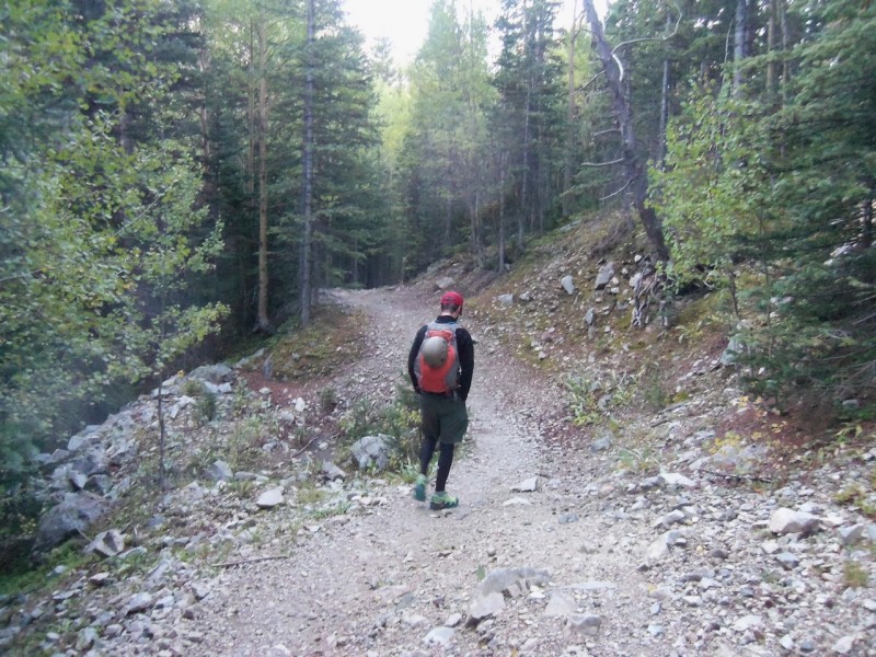
We left Denver at 4:30 AM, and after a long boring drive, got to the trailhead around 8. Started the hike around 8:10 AM, which made us a bit uneasy. By far the latest start I've gotten on a 14er, but the forecast looked good, and our only plan was Lindsey for the day.
The trail starts off with about 100-200 feet of elevation loss and 4-5 stream crossings.
You get your first view of Blanca very soon into the trail.
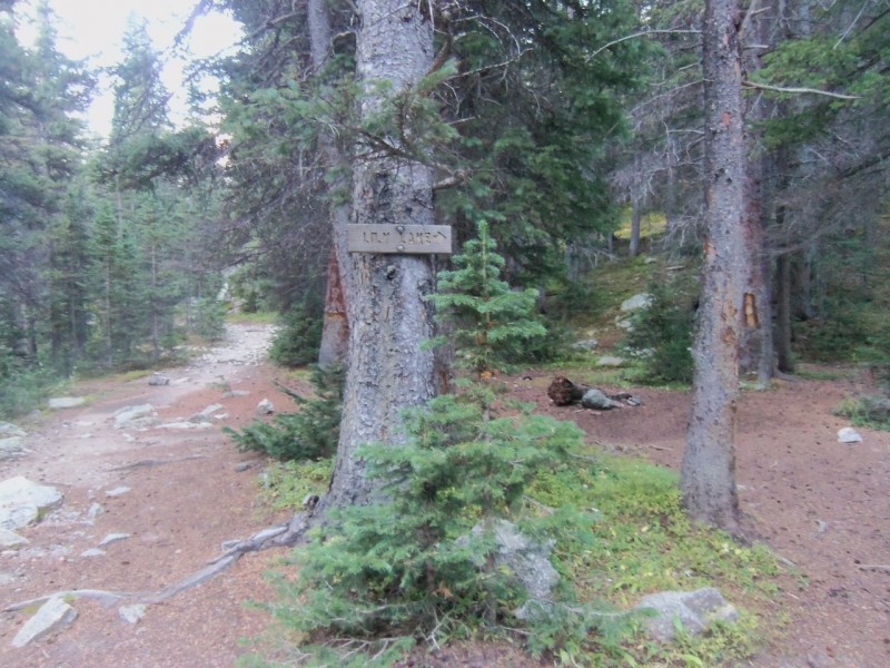
Once you reach the sign for the Lily Lake Trail, KEEP LEFT. Apparently this can be confusing for people. Especially the heavyset couple we found starting up the trail around 4:30 PM
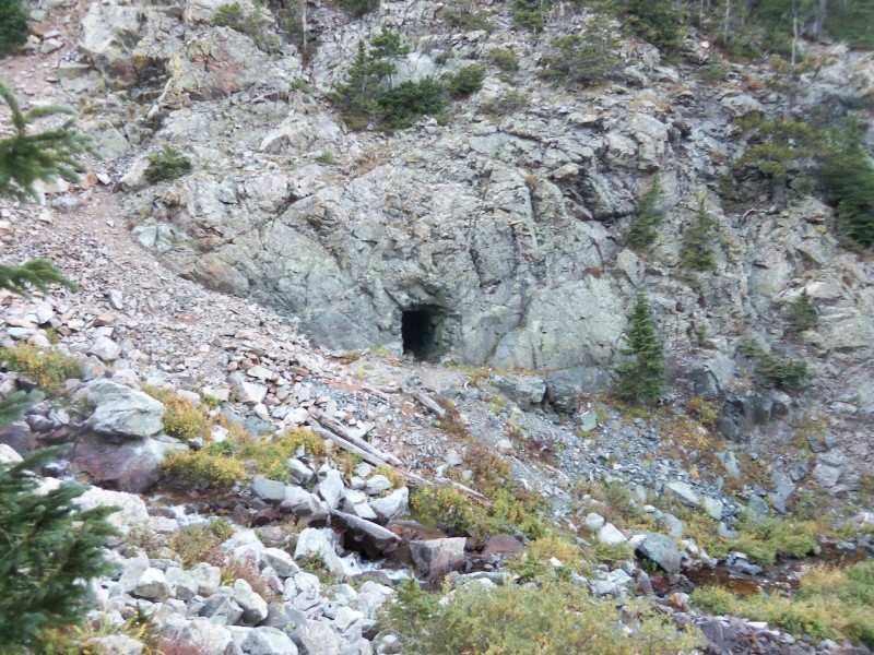
After about an hour into the hike, you'll be on the left side of the river for good. Looking to the right, there is an old mine.
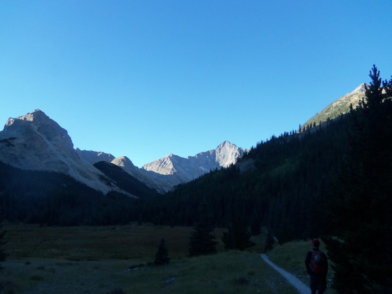
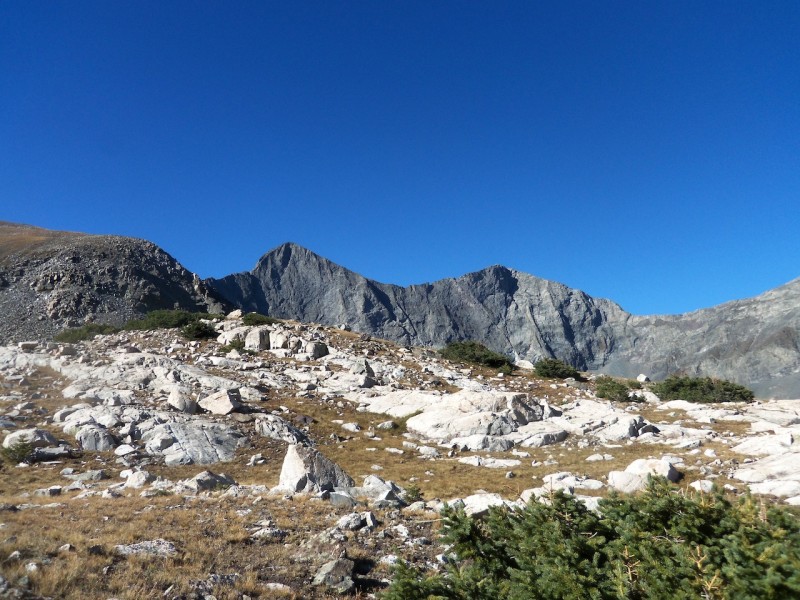
After breaking through treeline, we were in a meadow with excellent views of Blanca and Ellingwood, as well as a lot of crickets/grasshoppers.
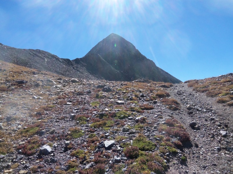
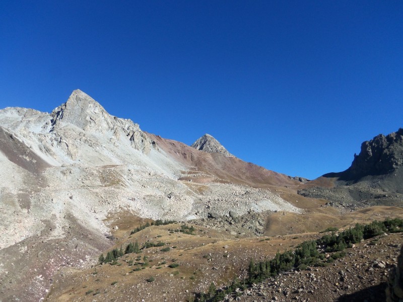
First look at Lindsey
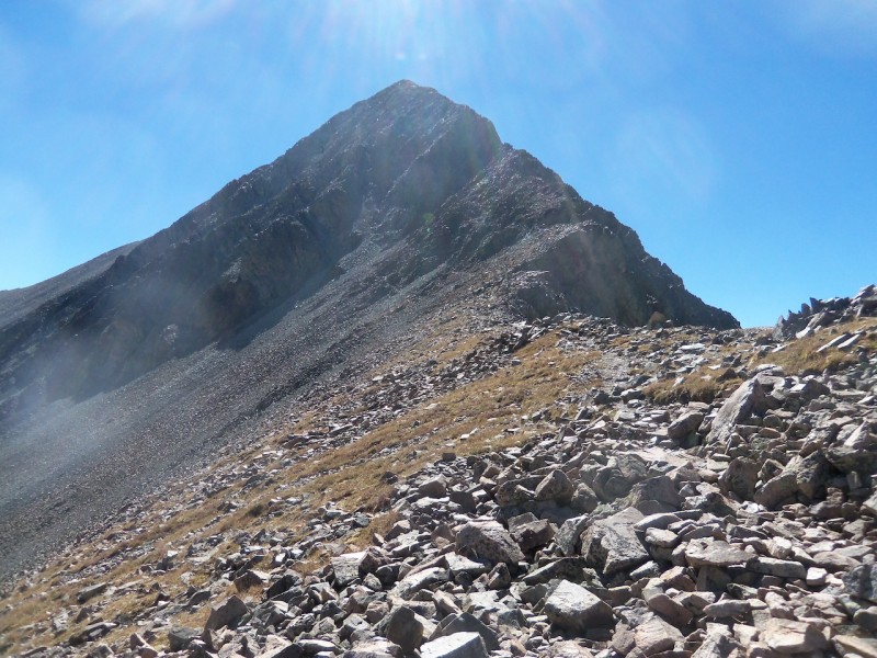
A closer look up the ridge
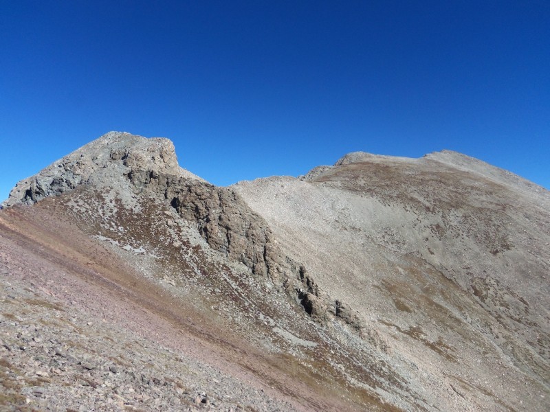
Looking north to Iron Nipple (left) and Huerfano (right)
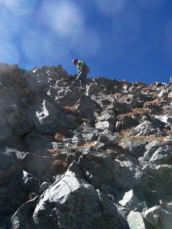
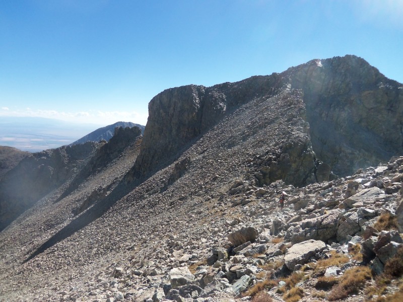
From here the goal is to stay basically ridge proper, but drop to your left if things get too hairy. Here's what the beginning of the ridge was like, still class 2 at this point.
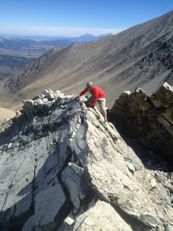
From here the terrain steepens quite a bit. If you're looking to take the brief class 4 pitch up the crack in the crux wall, try to locate a small, narrow gully down to climbers left (if you are close to ridge proper)
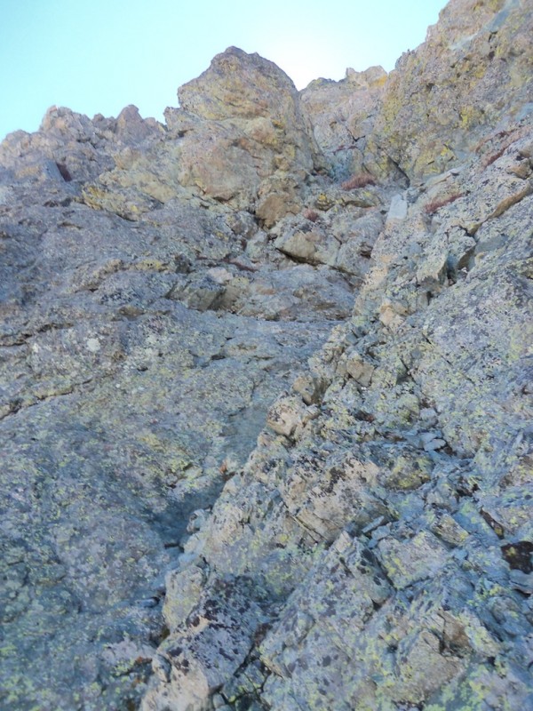
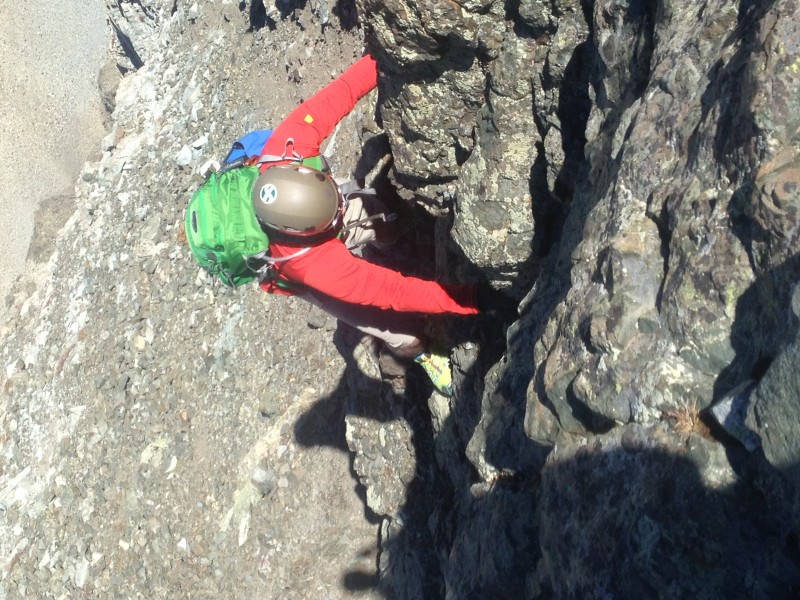
The goal now is to find your way to a bit of a U shaped notch. This is the beginning of the crux wall. You wont notice that your on the wall until about halfway up.
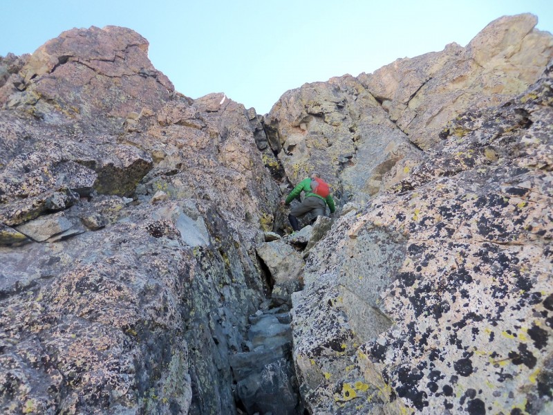
We chose to head left from the picture of where the climber is. It seems that going directly up the crack is closer to a low class 5 move. On this website, bill describes three routes around this wall. We took the "middle" class 4 line, which was no more than 10 feet of climbing.
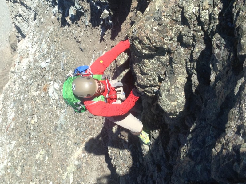
View from the top of the crux pitch
After rounding the rib from the top of the crux wall, the exposure comes into play. For me this was a bit more than Wetterhorn, Longs, and the Sawtooth.
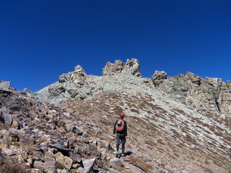
From the top of the wall/corner, most of the rest of the scrambling route comes into view
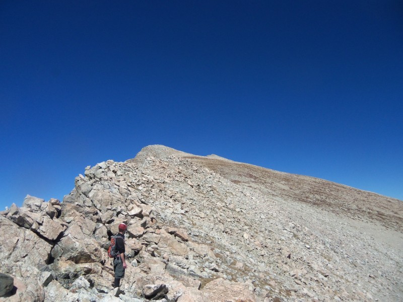
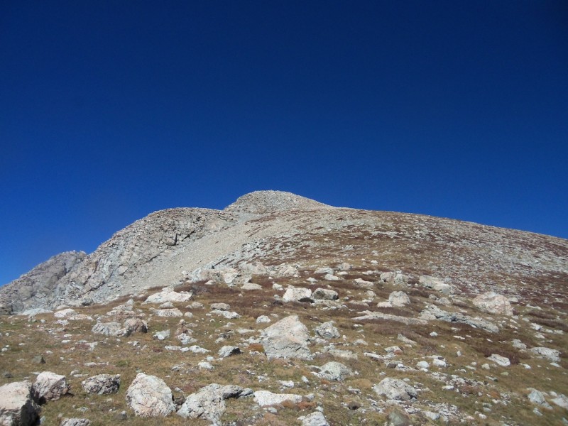
From here, its a relatively easy hike to the summit, with a couple false summits involved
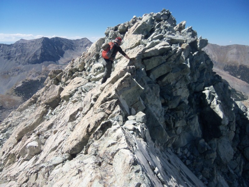
On the descent
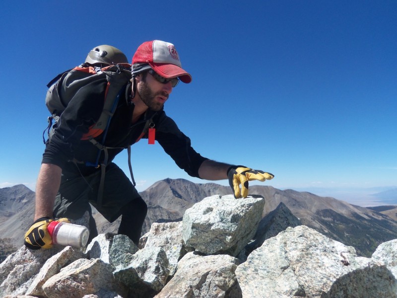
Jenks looking longingly at the nipple, per usual.
Headed up to the nipple, aim for the low point of the notch on the left
After the notch, the route to the nip is loose in a lot of places. There are definitely some solid spots, but you need to look carefully for them. There are very few cairns, but we tried to place a few up and down. Iron Nipple has a pretty exposed knife edge. I've never been on Capitol, but considering this knife edge was at least 15 feet long, I assume that its far more brutal and exposed than Capitol. If you aren't comfortable with Annapurna, do not cross this area.
Jenks doing what you should do with the nipple
After returning back over the knife edge, head down the saddle towards Huerfano. The lower you get, the looser the rock is, so try to stay relatively high on the traverse. It can get pretty airy at times.
Final route up Huerfano, no more than class 2 but the route is not cairned at all. Just head for the high points...couple false summits.
Looking back at Lindsey from just below the summit of Huerfano
We really wanted to skirt the Iron Nipple coming down from Huerfano, but after investigating a couple different options (far to the left drops down too far below the Lindsey/Nipple saddle, and was loose as hell. Just to the left of the cliff face was too loose and didn't save any elevation gain), we decided to go to the right of the cliff face in the picture below. Basically, we resummited the nipple.
Coming back down the way we ascended the nipple, we got to the saddle and followed the class 1 trail the whole way down. Final look back at Lindsey from about 12,000.
Annnnnd finally time for the drive back to Denver. What 3.5 hr drive from the Sangres would be complete without Pueblo's best: Little Ceasars.
Time ordered: 8:05 PM
Time finished: 8:20 PM
*Mt. Lindsey is named after Malcom Lindsey, CMC president from 1943-1946. It was his favorite 14er
*Try as I might, I cant find what Iron Nipple is named for
*Huerfano literally means "Oprhan boy" in spanish.
My GPS Tracks on Google Maps (made from a .GPX file upload):
I would like to point out that I spent most of this day with ”I gotta feeling” by the black eyed peas stuck in my head. So add that to the overall difficulty/awesome factor.
Us, I believe, named for its appearance. From just the right spot on the highway coming nortg toward Alanoaa, it actually does look like one. Good work bagging all three.
this TR! I'm about to head back to that area and this report is spot on regarding Lindsey's ridge! I am STOKED for the 13ers now, too! :D thanks for an awesome write-up!
Caution: The information contained in this report may not be accurate and should not be the only resource used in preparation for your climb. Failure to have the necessary experience, physical conditioning, supplies or equipment can result in injury or death. 14ers.com and the author(s) of this report provide no warranties, either express or implied, that the information provided is accurate or reliable. By using the information provided, you agree to indemnify and hold harmless 14ers.com and the report author(s) with respect to any claims and demands against them, including any attorney fees and expenses. Please read the 14ers.com Safety and Disclaimer pages for more information.
Please respect private property: 14ers.com supports the rights of private landowners to determine how and by whom their land will be used. In Colorado, it is your responsibility to determine if land is private and to obtain the appropriate permission before entering the property.


")
")
")
")
")
")
")
")
")
")
")
")
")
")
")
")
")
")
")
")
")
")
")
")
")
")
")
")