Download Agreement, Release, and Acknowledgement of Risk:
You (the person requesting this file download) fully understand mountain climbing ("Activity") involves risks and dangers of serious bodily injury, including permanent disability, paralysis, and death ("Risks") and you fully accept and assume all such risks and all responsibility for losses, costs, and damages you incur as a result of your participation in this Activity.
You acknowledge that information in the file you have chosen to download may not be accurate and may contain errors. You agree to assume all risks when using this information and agree to release and discharge 14ers.com, 14ers Inc. and the author(s) of such information (collectively, the "Released Parties").
You hereby discharge the Released Parties from all damages, actions, claims and liabilities of any nature, specifically including, but not limited to, damages, actions, claims and liabilities arising from or related to the negligence of the Released Parties. You further agree to indemnify, hold harmless and defend 14ers.com, 14ers Inc. and each of the other Released Parties from and against any loss, damage, liability and expense, including costs and attorney fees, incurred by 14ers.com, 14ers Inc. or any of the other Released Parties as a result of you using information provided on the 14ers.com or 14ers Inc. websites.
You have read this agreement, fully understand its terms and intend it to be a complete and unconditional release of all liability to the greatest extent allowed by law and agree that if any portion of this agreement is held to be invalid the balance, notwithstanding, shall continue in full force and effect.
By clicking "OK" you agree to these terms. If you DO NOT agree, click "Cancel"...
| Report Type |
External |
| Peak(s) |
La Plata Peak - 14,344 feet
|
| Date Posted |
07/13/2015 |
| Modified |
07/25/2017 |
| Date Climbed |
07/11/2015 |
| Author |
alexhenes |
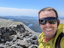
| Big Day on Ellingwood Ridge |
he route description for Ellingwood Ridge reads 10 miles, 5900ft, class 3. Given complex route finding and numerous snow issues our day was 10.8 miles, 6500ft vertical and took roughly 13 hours. We travel at a moderate pace but this route was a big day and some of the snow climbs and crossings made a few sections feel sketchy. The snow was too soft to support climbing and the dirt was completely saturated making slide risk significant in a few areas. Looking for alternative routes was also time consuming. The weather was good most of the day with clouds building then dispersing with no real threat. However when we reached the summit a massive storm appeared to the west... it was evident we were going to get hammered. So we immediately started our hike down the class II northwest ridge. Mid way down the summit pitch is when the storm hit us. There was snow, rain and high winds but no thunder or lightning. We were cold and wet and had a hard time seeing with the wind whipping against us. It was uncomfortable but we were thankful to be descending the class II standard route as opposed to still being on the chanellenging maze of Ellingwood Ridge. This route was long and physical and seemed to go on forever. However we had a fantastic day and a true adventure. I won't forget it any time soon and hope to climb this route again. Pictures and commentary from our trip can be found at...
La Plata's Ellingwood Ridge
My GPS Tracks on Google Maps (made from a .GPX file upload):
|
Caution: The information contained in this report may not be accurate and should not be the only resource used in preparation for your climb. Failure to have the necessary experience, physical conditioning, supplies or equipment can result in injury or death. 14ers.com and the author(s) of this report provide no warranties, either express or implied, that the information provided is accurate or reliable. By using the information provided, you agree to indemnify and hold harmless 14ers.com and the report author(s) with respect to any claims and demands against them, including any attorney fees and expenses. Please read the 14ers.com Safety and Disclaimer pages for more information.
Please respect private property: 14ers.com supports the rights of private landowners to determine how and by whom their land will be used. In Colorado, it is your responsibility to determine if land is private and to obtain the appropriate permission before entering the property.