Download Agreement, Release, and Acknowledgement of Risk:
You (the person requesting this file download) fully understand mountain climbing ("Activity") involves risks and dangers of serious bodily injury, including permanent disability, paralysis, and death ("Risks") and you fully accept and assume all such risks and all responsibility for losses, costs, and damages you incur as a result of your participation in this Activity.
You acknowledge that information in the file you have chosen to download may not be accurate and may contain errors. You agree to assume all risks when using this information and agree to release and discharge 14ers.com, 14ers Inc. and the author(s) of such information (collectively, the "Released Parties").
You hereby discharge the Released Parties from all damages, actions, claims and liabilities of any nature, specifically including, but not limited to, damages, actions, claims and liabilities arising from or related to the negligence of the Released Parties. You further agree to indemnify, hold harmless and defend 14ers.com, 14ers Inc. and each of the other Released Parties from and against any loss, damage, liability and expense, including costs and attorney fees, incurred by 14ers.com, 14ers Inc. or any of the other Released Parties as a result of you using information provided on the 14ers.com or 14ers Inc. websites.
You have read this agreement, fully understand its terms and intend it to be a complete and unconditional release of all liability to the greatest extent allowed by law and agree that if any portion of this agreement is held to be invalid the balance, notwithstanding, shall continue in full force and effect.
By clicking "OK" you agree to these terms. If you DO NOT agree, click "Cancel"...
Report Type
Full
Peak(s)
Great White Throne - 6744
West Temple - 7810
Kinesava - 7285
Kinesava, West Temple, Deertrap, Great White Throne, and Island in the Sky
Pardon me for breaking the 14th Wall.
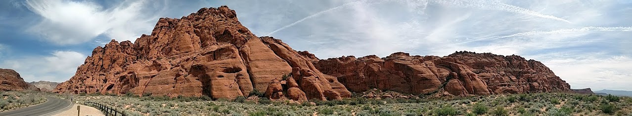
The West Temple
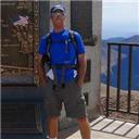
I tend to get antsy every once in a while, perhaps every other day or so. This particular bout of antsyness saw a last minute message to a dozen prospects with a score of potential destinations. And only one reply: Abe.
Initial thought: "shit." I kind of imagined a nice relaxing lounge in the shade with a casual hand on a belay and the other on a selfie stick. But Abe? That usually means a fast-paced, grunge-filled sweat fest with brief interludes of sitting in a tiny rental car groaning of perpetual soreness while eating dinner in a grocery store parking lot in Methville, USA. Bit of a mouthful.
And so it was.
Borrowing a phrase from my favorite singer, Zion hit me like a wrecking ball. Once a hook is set, I binge to excess, smash, grab, and flounder unmotivated by the leavings. I've been trying to ration Zion. A trip a year. Maybe two. Maybe three. Perhaps four. Let's stop there: trip number four-in-a-year.
Kinesava and West Temple
Route: Cowboy Ridge to the SW Ridge (class 5.7, ~8 mi/6K ft, 10 hrs?)
TH: Pullout on Anasazi Way about 3 mi south of Springdale (37.167, -113.027). Potentially illegal.
Gear (recommended): 60 m twin, 1x C4 #3, 2x C4 #1, a couple medium nuts, handful of draws.
We woke up in a familiar dirtbag spot about a mile up the Kolob reservoir road to the sounds of a front end loader making all sorts of noise. A few lazy yet warranted offhand remarks about Abe's mother by way of a good morning, and we drive on up Anasazi Drive, ignoring the signs telling us to park at the highway. We drive a bit past the approved Petrified Forest trailhead to BLM trailheads. We suspect these are fair game, but due to low capacity, people are asked to park down lower.
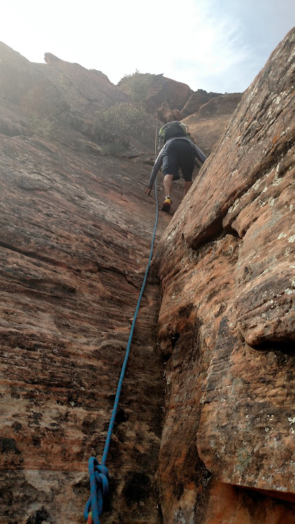
In general, we follow the prominent wash on up towards the lizard tail-esque Cowboy Ridge and gain the left side of the wash to bypass the first headwall. Hook a right and bypass the next headwall by a 4th class weakness. Slog on up the slopes until a weakness is presented on the east side of the ridge.
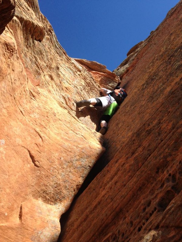
The ridge itself consists of airy and exposed scrambling on positive holds. Not too much of that friction stuff, but crumbly dinner plate eolian sandstone bedding to be careful of. In general, stay on top or follow right side ledges, well-traveled, keeping the difficulty to less than easy 5th.
Note: Zion scrambles are hard and quite serious, punctuated by sharp cactus barbs, flakey rock, brush, friction slab, and steep game-changer walls from 10-ft tall to a couple thousand. And there's your warning.
Cowboy
A few more-interesting variations are possible, but eventually reach an obvious handcrack. The first ten feet are protected by the #3 and then it's possible to walk the #1s up the rest. Bush up top for belay. It is a very secure and well-protected 40-ft handcrack, which surprises me as it's considered the crux. Some of the lower stuff felt spicier.
A bit more scrambling and the peak levels off for a bit. The true summit is another few hundred feet of class 3 scrambling up the facing-right side.
Once upon a time, I joined Sarah and Dominic Meiser and Giles and Julie Wallace for West Temple. Despite the Meisers having done the route before and the cairned social trail, we bumbled our way back and forth, up and down, and round and round prior to finding the route. A bit of the same this go around.
The descent off Kinesava's east side follows a SE-trending weakness from a small buttress, class 3 and perhaps a move of 4 near the top. Look for cairns and signs of passage. They're there, so avoid getting sucked into a bad drainage. Rapping directly to the saddle is tempting; I knew it went with double ropes and would probably go with a single 70, though a few bush anchors would be suspect. However, no point in leaving webbing and links when there's a ready trail.
Around 6200' we find the cairned and subtle trail branch which follows a ledge weakness up to the Kinesava/W Temple saddle, generally class 2-3.
From Nov. '14 trip:
West Temple SW Ridge is one of my favorite scrambles ever and I was excited to show it to Abe. He thought it was "meh." So screw that guy and throw in a few more offhand remarks about his mother. (sweet lady, really).
The route is essentially a narrow roadway in the sky with exposure all around and a few deep potholes to rumble through. Even so, the route finding is not trivial. Stay on top, generally by climbing the left side of notches until gaining "Wussy Peak." Aptly named, forward or back. Forward involves downclimbing down the ridge and using a right-side weakness to a well-polished tree.
Continue on up the ridge until a short 10-ft step. This spot is 5.8 with friction feet and slopey hands. But let's be honest. 10 ft of 5.8 isn't worth pulling out climbing shoes, so most plug a nut in, clip a draw, and step on up. I usually just jump on the way down, but this isn't recommended. There's a webbing/bush rap station available or partner assist.
From Nov. '14 trip:
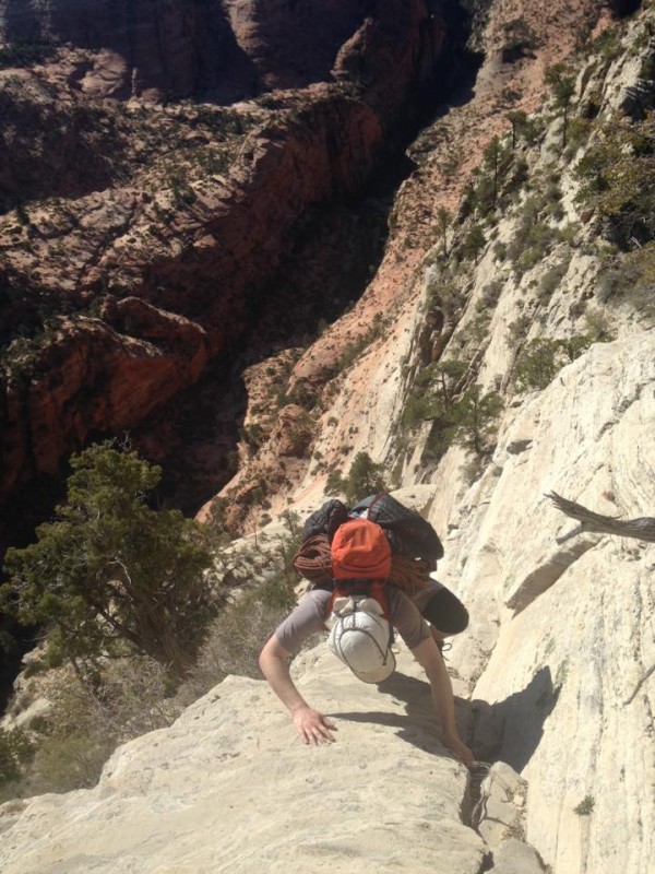
Continue scrambling up as the road pitches to a cliff and a steep right side weakness. 5.6 (5 bolts) to bolted anchors. Abe takes the lead. Leave the rope for the 70-ft rap.
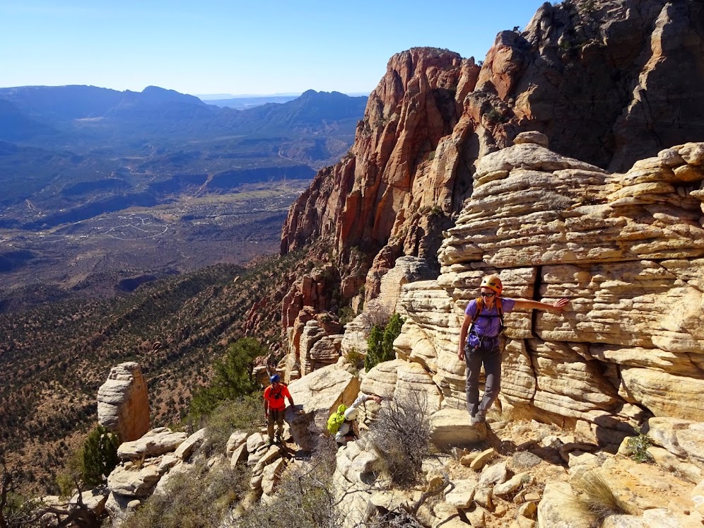
A half mile stroll along the plateau to the obvious weakness in the 100-ft cap and head on up to the radio tower. An oddity about Zion is that the summit views normally are lacking. Flat bushy plateaus inundated with lightning tinged trees obscuring the cross-cut deep canyons. The views are there, but one must walk around to find them.
The descent takes almost as long as the ascent, given the bumpy road. Once off the peak, we remember the lowest two cliffbands and hope to find a way around. Our ascent was a bit spicy and the obvious flank out to the east would go, but we hope for something more direct. On down the flank until stopped by a cliff around 4800'. We figure a rap is needed, but some delving shows an interesting alternative: on the descender's left side of the flank where the cliff is smallest (40 ft), drop down a tension crack, tunnel toward the face, step right a few feet on a slab until above a chimney. The chimney goes with some stemming. One last cliff band immediately below that goes via a weakness slightly further right. Stroll on out to the car, which is fortunately still there and unmolested.
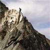
The route follows the left side of the ridge to the highpoint center right. The Three Marys are far right.
Deertrap and the Great White Throne
Route: South Buttress to the South Face Diagonal (class 5.8 A0 or 5.9, PG-13, ~19 mi/6.1K ft, 16 hrs)
TH: Upper Pine Creek pullout 0.4 miles east of the Carmel-Zion tunnel.
Gear (recommended): double ropes, 1 ea C4 #1-2, 8 draws.
The notorious Great White Throne, famously ascended in the 1920s by H. Evans. The subsequent descent saw the park's first major rescue operation, which located the critically injured Evans after several days high up in Hidden Canyon.
We've done a few climbs with the Zion guidebook author CP and know he has a lot of cool route ideas, such as using Deertrap to approach GWT, which has the advantage of a trailhead accessible by our rental. CP also has a notoriously select memory, which is fun. Case in point: his Deertrap description.
The approach is scenic and short. From the pullout, hike up the canyon a couple hundred yards until one can climb out a slabby drainage on left (class 3). Contour around to the base of Deertrap's south buttress.
Climb the first several hundred feet on slabs center left (class 3-4) until reaching a flat, narrow section, somewhat knife edgey.
After the narrow spot, curl around right as the sheep do with an interesting exposed downclimb prior to finding your way up the east side of the south buttress. A bit bushy and convoluted with exposed, LOOSE scrambling split by ledges. Follow the sheep and eventually pull a mantle onto the summit plateau. It's pretty hard to describe the route-finding here, so trial and error. Apparently, there are bolts anchors somewhere and a number of trees have slings to rap the trickiest steps.
DT
East Temple
The actual summit is a stroll to the north (East Temple and Twin Brothers)
We keep on moving north until intersecting the Overlook trail and hook a right. Brief up and down, refill water bottles with convenient snow piles, and veer off trail north, aiming for the northwest trending gully (class 2-3 slab) which takes us to the base of the Great White Throne's south face.
Abe runs up and down Flatirons 20 times a day, so my idea was to give him the harder slab pitches. He doesn't like that idea, so I get the odds and he gets the evens. Zion slab is quite a bit sandier than the beloved Flatties. A breakdown of the route:
Pitch 1: up and right, slab with minor ledges, clip bolts in various states of disrepair, but mostly good every 20 ft or so. Generally 4-5.easy, with a few harder spots on each pitch from 5.6-5.8
Pitch 2-6: See above. Cruxes on pitch 3 between last bolt and anchor and on pitch 5 past the old piton. A #1 can be placed after the first bolt on pitch 4.
The pictures do it full justice. Or not. It certainly doesn't look 5.9 PG13:
A 7th pitch up 3rd class terrain is unnecessary. Once above, hook a left and follow a class 3 route up to the plateau. Walk on north to the 20-ft tall summit hoodoos for more shenanigans.
We encircle the hoodoos, eyeing various lines, until it becomes obvious the west side is the key (5.6?). From a notch, Abe handtraverses left on slopey feet until reaching a jug. A spot would've been nice, but I figured I'd check Facebook instead. The rock gives with a POP and Abe winds up beside me, head over heels in the bush. Maybe we'll get out the rope...
On descent, harder than it looks:
I traverse over to the spot that blew on Abe. It's possible to protect it with a #2 and a 0.3 up higher. Instead, I opt for lassoing a friendly small bush up above and using it for moral support. A brief awkward lieback and we're up.
Down goes smoothly enough, short bush rap off the hoodoo, two single rope 35 m raps and then 3 double rope 70 m raps down. Slog back up to the plateau.
GWT
And here's where it gets stupid. A smart person would descend Deertrap via a few raps or pretty much any other route. We aren't smart and thought a tour of the park and a quick shuttle would be great. So out we go to the Overlook trail to the Cable Mountain Trail to Stave Springs to Echo Canyon to Weeping Rock, finally arriving around the pleasant hour of 9PM or so with the shuttles long gone and knees sore from slapping on slickrock and asphalt.
A plodding road hike to the Lodge where SAR is busy extracting a lady with a broken ankle off Angel's Landing and about to head over to the Subway to round up some lost hikers. Apparently, it's a nightly ritual for them.
A newly-arrived park biologist gives us and a few other hikers a ride the 5 miles out to the highway, where we're confident we'll be able to hitch a ride. Not so. Most certainly not so. Despite our best efforts at testing the psychology behind hitchhiking (hypothesis A - be a female - went untested), the few cars to pass gave us a wide berth. It was a long couple hour hike up the road and through the tunnel until Abe decided to run the remaining mile and pick a weary gent up.
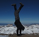
Island in the Sky Traverse, Snow Canyon, UT
Route: north to south (class 5.4ish, ~2 mi/less than 1K ft, 2 hrs)
TH: Just past the sand dunes lot
Gear (recommended): probably a short rope just in case.
6AM rolls around as it tends to and Abe pretends he wants to climb East Temple. I call his bluff, mention his mother, and go back to sleep.
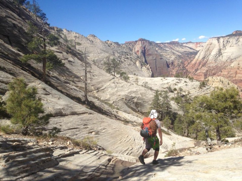
The Island in the Sky is supposed to be high quality, short, and on the way. And so it was.
Start at the northeast end and scramble up ledges and ramps until the summit. Ignore the rope trash.
It gets a bit more interesting for the second third: gain high ground and scout out your route. It's a bit of a convoluted maze. I believe we stuck to either the center or slightly on the west side. For the last third, work your way down to the southwest corner. There are a few bolts and rap anchors throughout the formation, but they aren't necessary with careful routefinding.
It is near impossible for a lover of outdoor adventure, of hiking, climbing, scrambling, and canyoneering, to not develop a fondness for Zion, for Zion has it all. I believe a poster on here once called Zion a "lifetime national park," rather than a day trip national park. That, I would vehemently agree with. But for now, back to your regularly scheduled 14ers.
Thumbnails for uploaded photos (click to open slideshow):
If the Great White Throne, Kinesava, or W Temple were CO 14ers, there would be 10% or less of the number of current finishers. Lots of intricate, exposed, routefinding in Zion. Great work, guys!
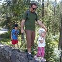
I'm glad you wrote this b/c when I asked Abe, "Yo, how was Zion?" I didn't get quite as much detail however to his credit and based on his recommendation Marc and I went up Mountain of the Sun on my 40th, yay! I found the navigating much more exciting than the climbing. No manicured trails in Zion (except the gapers paradise on Angels and co, wink wink and is definitely a place where cars are more likely to get molested, better them than you...haaaa!).
Looks like some long days, but they probably weren't since you were there. I would've thought a Zion TR would be done best from an uncomfortably biblical perspective, but I guess this was pretty good too.
K Baker - Interesting. I'm guessing moki steps and via feratta setups would be installed to keep the numbers up, though certainly not as many.
Matt - you should check the area out. Some fantastic peaks in there away from the whole Angel's Landing thing (which is still pretty cool). The canyons are interesting too, if not particularly challenging anchor-wise.
Money - If I had the money, I'd pay for Abe's snip and tuck operation.
Amy - Mountain of the Sun looks pretty cool. Did you see the petroglyphs? Good you got Aires too; fun one.
Mister Jagged - the Zion crowd at any one time mostly consists of 89% Asians, 10% Californians, and 1% else. Not terribly religious. We actually saw some FLDS women at a coffee shop in Hurricane. It was kind of odd watching them order fancy drinks.
"fast-paced, grunge-filled sweat fest with brief interludes of sitting in a tiny rental car groaning of perpetual soreness while eating dinner in a grocery store parking lot in Methville, USA"
I laughed out loud, like really out loud, for at least 5 minutes. This is every outing I have ever had with Abe, only it's my kind of outing too. MISS YOU ABE!
Also, excellent write up.
Caution: The information contained in this report may not be accurate and should not be the only resource used in preparation for your climb. Failure to have the necessary experience, physical conditioning, supplies or equipment can result in injury or death. 14ers.com and the author(s) of this report provide no warranties, either express or implied, that the information provided is accurate or reliable. By using the information provided, you agree to indemnify and hold harmless 14ers.com and the report author(s) with respect to any claims and demands against them, including any attorney fees and expenses. Please read the 14ers.com Safety and Disclaimer pages for more information.
Please respect private property: 14ers.com supports the rights of private landowners to determine how and by whom their land will be used. In Colorado, it is your responsibility to determine if land is private and to obtain the appropriate permission before entering the property.


 GWT")
 Cowboy")
 DT")
 IITS")
 Kinesava route")
 GWT route")