Download Agreement, Release, and Acknowledgement of Risk:
You (the person requesting this file download) fully understand mountain climbing ("Activity") involves risks and dangers of serious bodily injury, including permanent disability, paralysis, and death ("Risks") and you fully accept and assume all such risks and all responsibility for losses, costs, and damages you incur as a result of your participation in this Activity.
You acknowledge that information in the file you have chosen to download may not be accurate and may contain errors. You agree to assume all risks when using this information and agree to release and discharge 14ers.com, 14ers Inc. and the author(s) of such information (collectively, the "Released Parties").
You hereby discharge the Released Parties from all damages, actions, claims and liabilities of any nature, specifically including, but not limited to, damages, actions, claims and liabilities arising from or related to the negligence of the Released Parties. You further agree to indemnify, hold harmless and defend 14ers.com, 14ers Inc. and each of the other Released Parties from and against any loss, damage, liability and expense, including costs and attorney fees, incurred by 14ers.com, 14ers Inc. or any of the other Released Parties as a result of you using information provided on the 14ers.com or 14ers Inc. websites.
You have read this agreement, fully understand its terms and intend it to be a complete and unconditional release of all liability to the greatest extent allowed by law and agree that if any portion of this agreement is held to be invalid the balance, notwithstanding, shall continue in full force and effect.
By clicking "OK" you agree to these terms. If you DO NOT agree, click "Cancel"...
Trailhead: Grizzly Lake TH
Route: North Couloir
Length: Approx 9 miles
Vertical: About 3500 feet
Partners: Solo
I just had to try and squeeze in one last snow climb before summer (and life) gets in the way. After reading Snow Alien's excellent (TR here ), and exchanging a few PM's with her for guidance, I was set.
A couple observations about this hike. I grossly underestimated the time it would take me to get from Parker to the TH. Even taking the last 7 miles on the dirt road rather fast in my FJ, it still took me 4 hours to make the trip. Plus, it took me longer than I expected to make it to the bottom of the couloir. Leaving Parker at 2:30 put me at the TH at 6:30. Took me almost 3 hours to get to the base of the couloir so I was starting up at 9:30 (topped out just before 11:30) and the snow was getting really, really soft. Looking back, I should have left home at midnight. Lesson learned. Maybe....
But - at least I was able to take some nice photos right from the start!
Just before the TH, you pass Grizzly Reservoir. I spotted some fishermen on my way out. The Portal Campground is just past this spot.
Like Bill's TH description says, almost any 2WD vehicle can make it. My FJ with its little sister
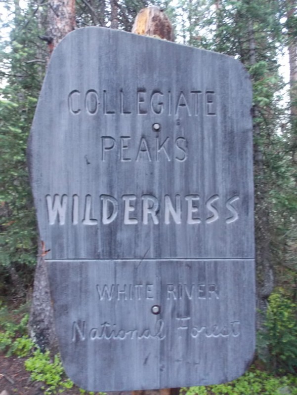
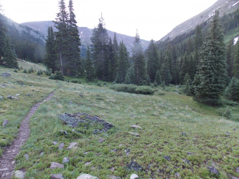
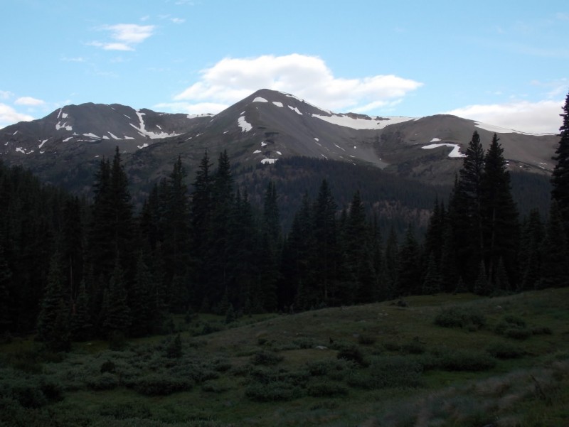
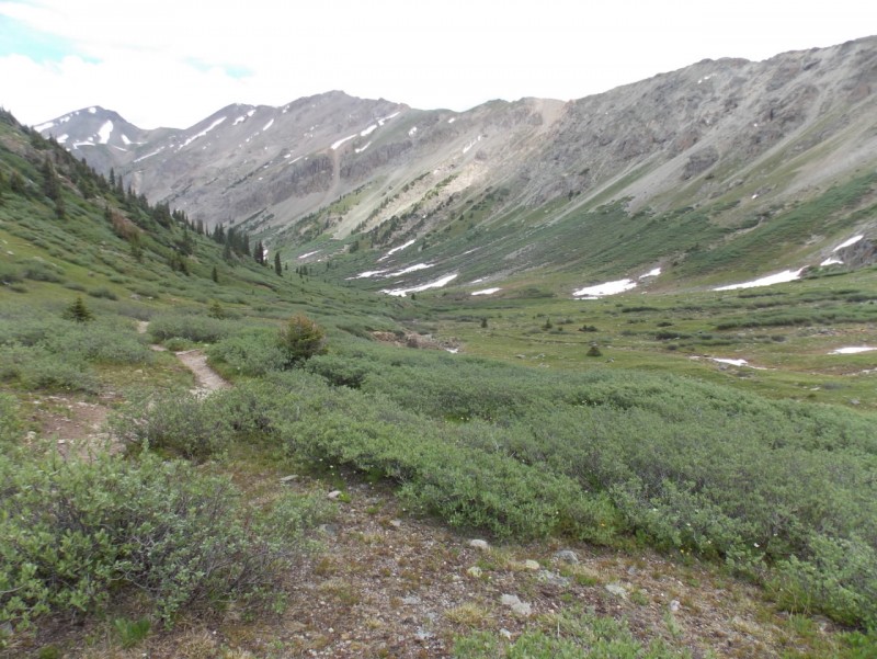
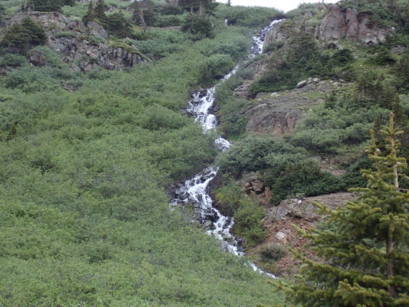
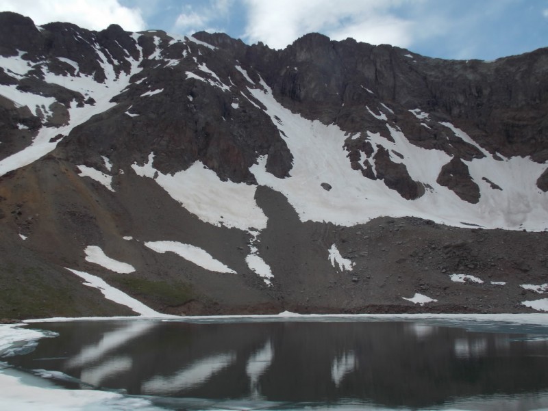
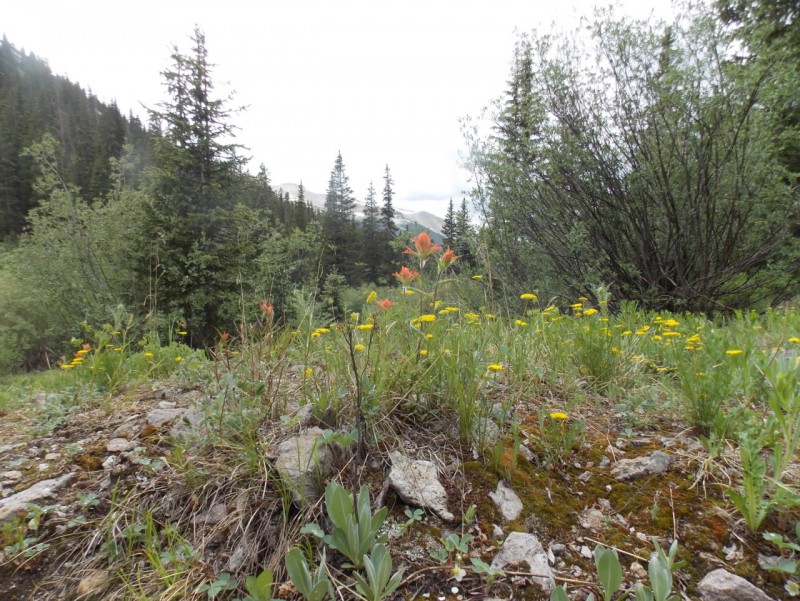
Even if you aren't into snow climbs, the hike to the lake is absolutely gorgeous - a little reminiscent of the Ice Lake basin area. Didn't realize this was part of the Collegiate Peaks WA One little snowbank to cross on the way.
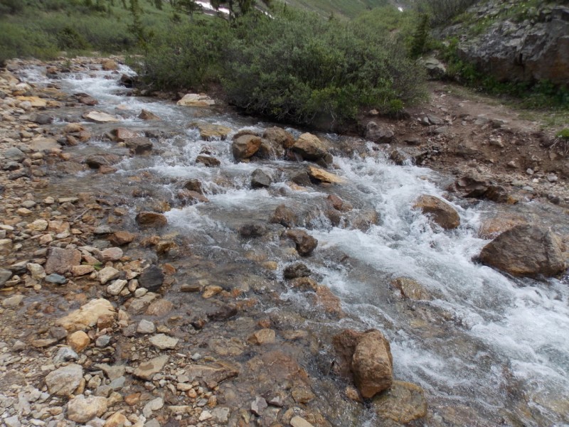
The crux of the day might have been this creek crossing - somehow I managed to keep my feet dry and didn't need the extra pair of socks in my pack. I guess it's like a spare tire on a car - if you have one and it's in good shape, you don't get a flat. Potential for wet feet.
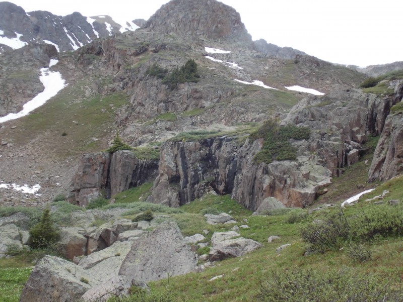
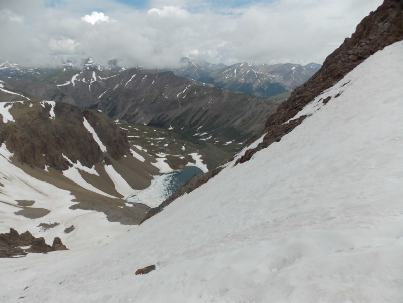
The scenery just keeps getting better as you get closer to the lake. Looking back down a ways after crossing the creek Water everywhere Reminds me of Ice Lake Basin
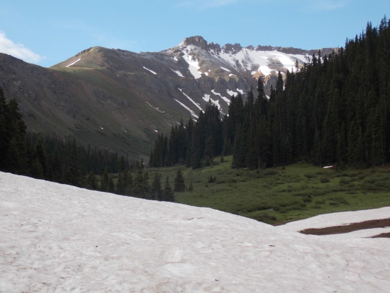
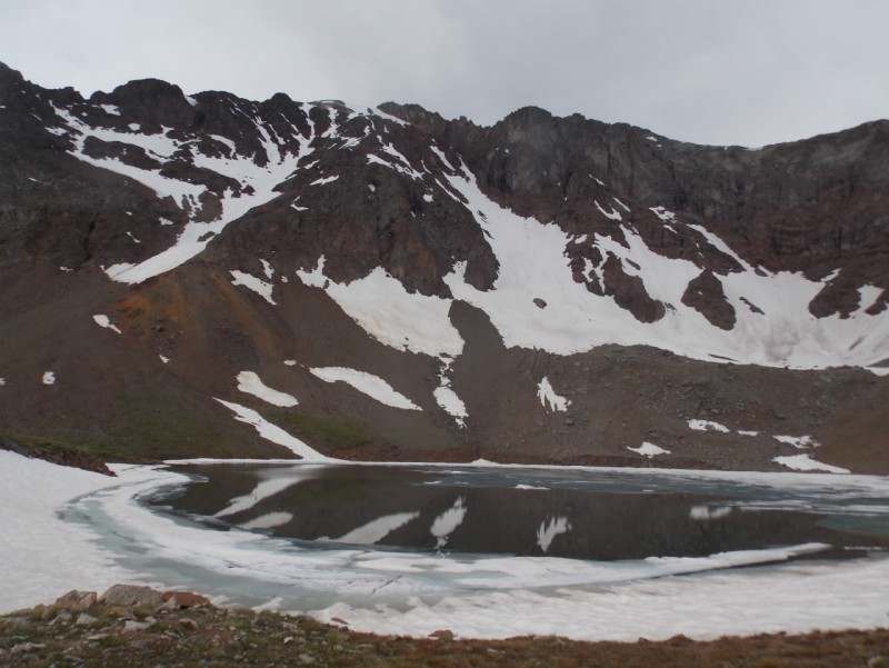
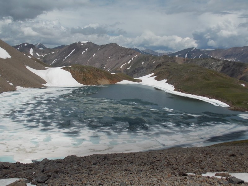
And then you finally get to the lake - As Snow Alien said - this is becoming one of my favorite lakes in Colorado, too.
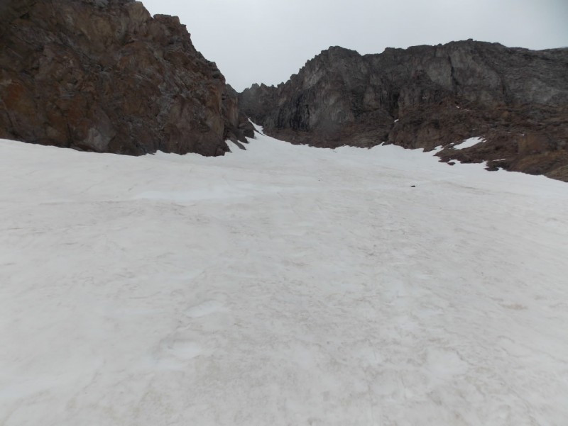
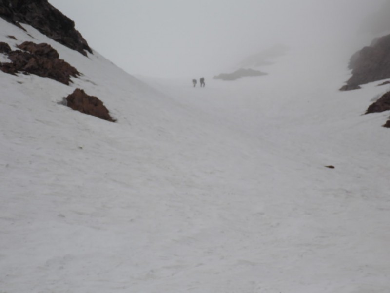
The couloir cilmb is pretty straight forward. Just go up until you run out of up. Starting up.
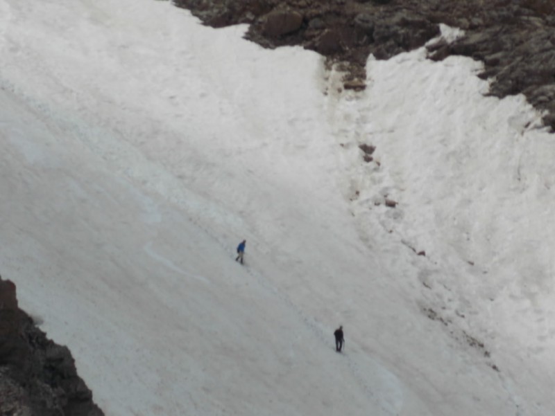
I was fortunate that there were two strong climbers ahead of me. We Senior Citizens appreciate the kick steps! About half way up.
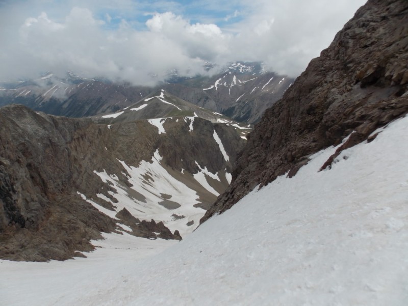
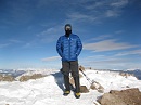
The weather was turning south fast. And then you hit the top.
As visibility was nil on the summit and snow conditions were getting worse, I just started straight back down. And (naturally) the weather then started improving.
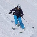
Heading down.. Which was not fun in the soft snow. I didn't consider a glissade as there were a lot of rocks strewn throughout the couloir. But I did get a couple unintentional self arrest practice sessions..... Memo to self - either leave earlier or learn how to ski...
A couple vids taken as I was going down.
And a short vid taken from just above the lake.
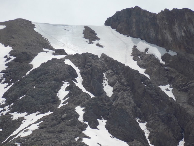
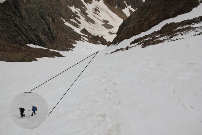
A look back at the couloir from my lunch spot. And a zoom on the two climbers coming back down
On the way out, the weather just continued to get better and better. A last look back at the top of the coiloir
And a zoom on the top. If you look closely, you can see my tracks on the right and the other climbers tracks on the left.
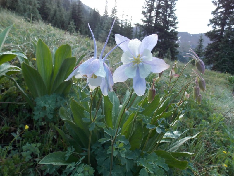
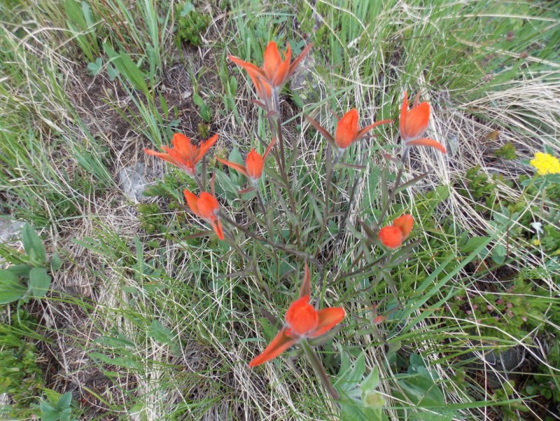
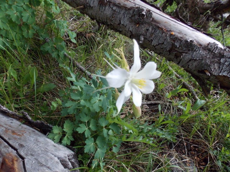
And what's a TR this time of year without a few wildflower shots?
Thanks for taking the time to read this and please be careful out there!
Thumbnails for uploaded photos (click to open slideshow):
I was driving your "little sister" that day. I was too cheap to upgrade with the rental company, and I'll admit that road was about the limit of what I would be willing to attempt with that car. I was up ahead of the other two hikers you show: Nice report!
Blazin - Yep, I'm in touch with my wildflower side!
Hunter - The descent was a pain in the butt. Didn't like that at all.
Natalia - Not sure that this old dog can learn a new trick :) But I do wish I'd taken up skiing 50 years ago...
Brad - Yeah - that musta been a fun drive in "little sister". I'm kinda surprised I didn't see you descend as I was going up unless you somehow circled around me near the lake on your way down?
All - thanks for the likes and the comments. I really do appreciate your input and feedback. Makes doing these TR's worthwhile.
Jay - Ah yes I forgot to mention, I made the circle tour. I went up the couloir, but down the ridge between Grizzly and Garfield and down to the Lincoln Creek Road via the west face, which is why we never crossed paths. It was probably easier to descend than the couloir, but still steep and tedious bush-whacking down to the bottom.
:lol: True... But it seems like I am more than 10 years older than 99% of the people I meet on the mountain. :)
Caution: The information contained in this report may not be accurate and should not be the only resource used in preparation for your climb. Failure to have the necessary experience, physical conditioning, supplies or equipment can result in injury or death. 14ers.com and the author(s) of this report provide no warranties, either express or implied, that the information provided is accurate or reliable. By using the information provided, you agree to indemnify and hold harmless 14ers.com and the report author(s) with respect to any claims and demands against them, including any attorney fees and expenses. Please read the 14ers.com Safety and Disclaimer pages for more information.
Please respect private property: 14ers.com supports the rights of private landowners to determine how and by whom their land will be used. In Colorado, it is your responsibility to determine if land is private and to obtain the appropriate permission before entering the property.


")
 The Portal Campground is just past this spot.")
 My FJ with its little sister")
 Didn't realize this was part of the Collegiate Peaks WA")
")
")
")
 Potential for wet feet.")
 One little snowbank to cross on the way.")
")
 Looking back down a ways after crossing the creek")
 Water everywhere")
 Reminds me of Ice Lake Basin")
")
")
 Starting up.")
 About half way up.")
 And then you hit the top.")
")
")
")
 A look back at the couloir from my lunch spot.")
 And a zoom on the two climbers coming back down")
")
 A last look back at the top of the coiloir")
 If you look closely, you can see my tracks on the right and the other climbers tracks on the left.")
")
")
")
")

 Nice report!