| Report Type | Full |
| Peak(s) |
Pico de Aneto - 11168 |
| Date Posted | 07/28/2016 |
| Date Climbed | 07/19/2016 |
| Author | Fr3ako |
| Pico de Aneto, roof of the Spanish Pyrenees |
|---|
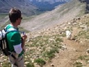
Summer hasn't really started in the North West of France. Between the rare days of sunshine, temperatures unable to overcome the mid 60F, terrorists attacks and the national soccer team losing the final of the Euro championship, I immediately thought about Mike. He is neither a terrorist nor a soccer lover but he now lives in Barcelona, Catalonia in a lovely Mediterranean climate! July 19, 2016 General weather: Sunny & Hot Stats: ~ 9 mi/ Ascent: 1,603m - 5,260 ft vert Time to complete: ~ 10 hours return All related data can be found HERE Route: Pico de Aneto (3,404m - 11,168') from "Parking La Besurta" Mulhacen (3.482m - 11,413') from Hoya del Portillo I first met Mike in the plane between Moscow and Mineralnye Vody on our way to climb Elbrus in 2009. We were sitting next to each other during the flight and were served vodka shots by one local couple in front of us. It was a good way to break the ice. He left New York 1 year ago to settle down in Spain for his early retirement and is still dying to be out there on the mountain. He called me in June to see if I was interested in hiking the 2 highest mountains in mainland Spain: Pico de Aneto in the Spanish Pyrenees and Mulhacen in la Sierra Nevada. Off course I was in! I drove the 775 miles to Barcelona to pick him up before heading to the Spanish Pyrenees and Benasque, a lovely mountain village not far from the Aneto peak. We started our hike the day after around 7am. We were supposed to drive to the parking de la Besurta but a gate was closed few miles prior to it and had to park our car at the Hotel Hospital de Benasque. It would add 3 miles each way to a already presumed long day. Even though Aneto Peak is only 11,168' high, we start the climb at 6,250' which makes more than 5,000' gain in a day. We were planning on a 8 to 12 hours day. Fortunately after 5 minutes, a farmer (authorized to get through the gate) picked us up and dropped us at the parking lot. These first few miles are not the most scenic so we thought why not getting a bit closer! 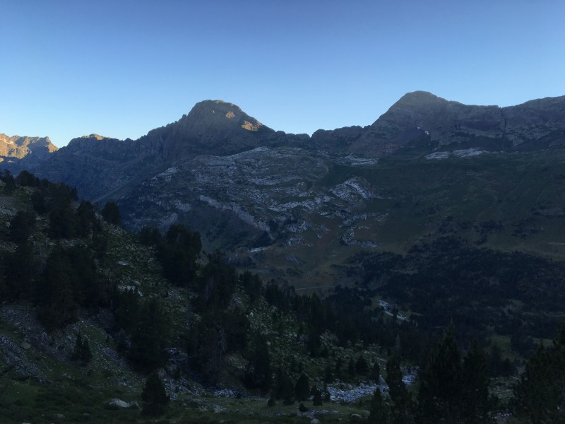 Temperatures were already above 70F at 7am in the shade but the first 1/2 hour to the Refugio de la Renclusa were quite refreshing, not too steep with a pretty well marked trail. 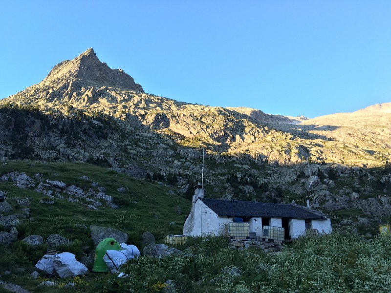 After 1 hour or so, the slope got a bit steeper and boulders were getting bigger. We met with Ignacio from Carthagene, South East of Spain who lost his 2 friends because he was too slow. When we asked where he was going, he pointed us to few people climbing up the snowy gulley far west. We were not sure it was the official path, I loaded the route into my Suunto watch before leaving and was not convinced at all. He insisted to come with us to catch up with his friends who were already mid way up the gulley. Mike finally convinced me to go up this way as he prefered to walk on snow with crampons/spikes rather than climbing up big boulders. 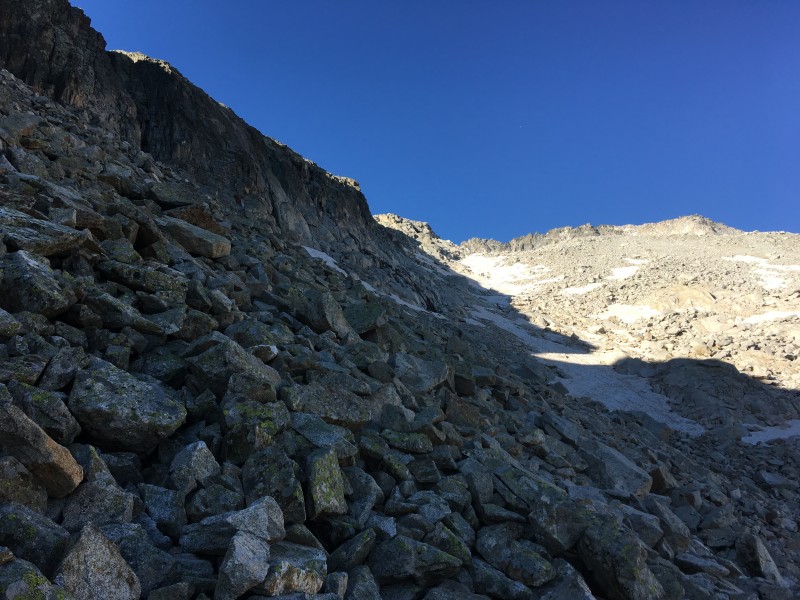  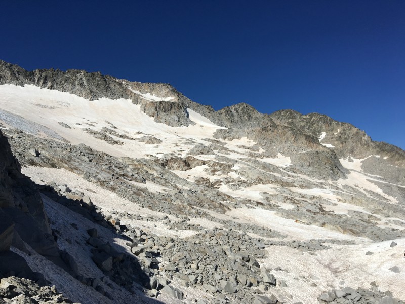 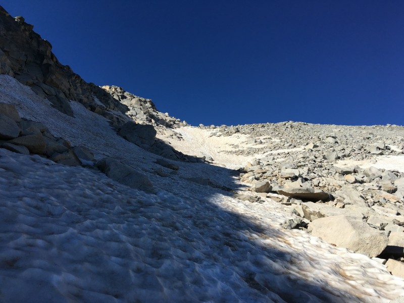 When we finally reached the summit of the gulley, we of course realized that we ended too far west. To make the junction between Maladeta & Aneto glacier, we first had to back track for 30 minutes and face a big wall of solid rocks with some class 3 moves. At least we were not the only ones lost as we could see few more people above us. Ignacio at this time was too tired to keep going and decided to take a long break as temperatures were approaching the 80s. 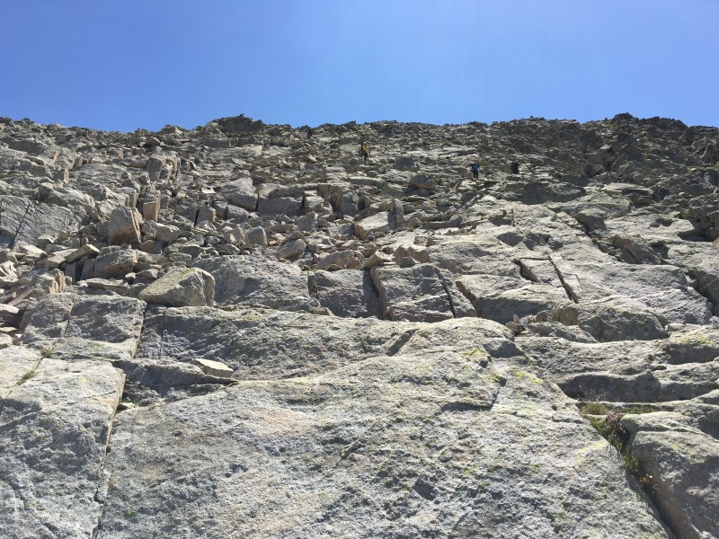 After 30 minutes of rock scrambling, we could finally see the official path up the Aneto glacier. We lost quite a bit of time but at least we knew we were in the right direction.  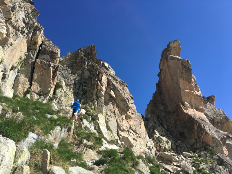 The Aneto glacier is a nice gentle slope leading to the summit but crampons/spikes were very welcomed. I rented some spikes in Benasque as I didn't bring my Kathoola with me. Big mistake! My spikes were surely the most terrible spikes ever. They were either coming off every 30 secondes or getting stuck in the slushy snow. You burn a lot of energy trying to put them back every minute or having to track back because you realize you lost one! 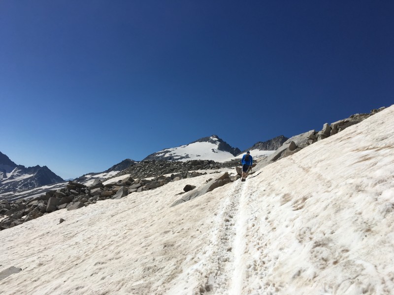  El Pico de Aneto is quite a popular mountain all year round and we were around 40 people up the mountain with guided groups or solo hikers but you don't feel like it's congested. 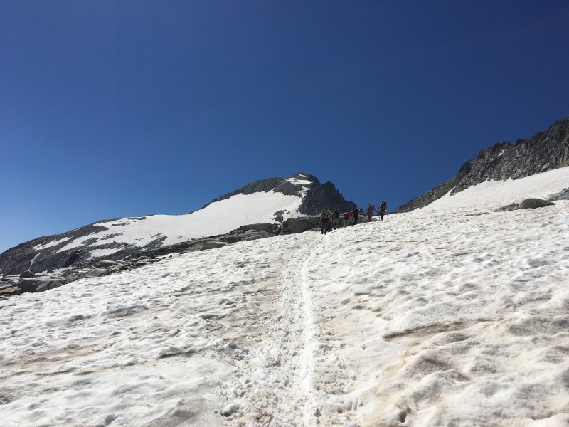  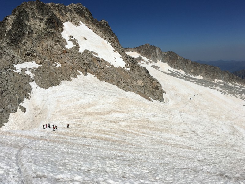 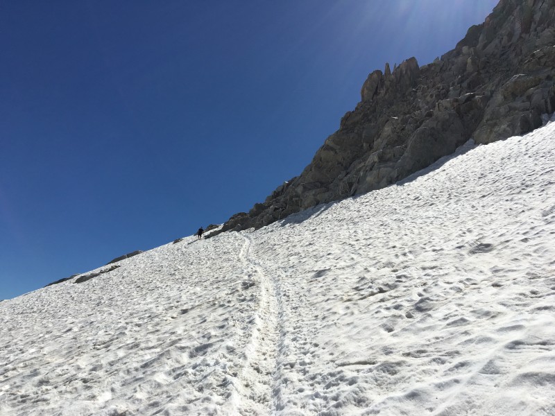 We spent more than 2 hours crossing the glacier without difficulty before reaching the false summit. The only difficulty of the peak is concentrated in the last 40m at the Paso de Mahoma (very narrow pass) between the false summit and the real summit.   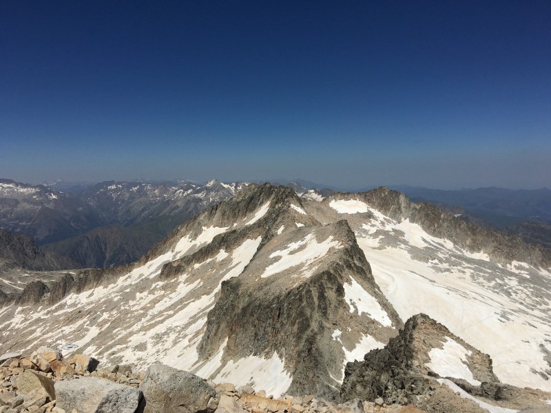 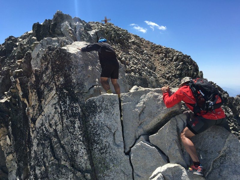  We finally reach the summit in 5h45. Temperatures were approaching 85F even at the top, no need for any extra layer! We were rewarded with a fantastic view of the Pyrenees. We stayed at the top for half hour chatting to people and eating/drinking. People were stripping off their clothes, smoking weed, dancing...well, nothing different than from being on top of a Colorado 14er!   The way down was even tougher as we could feel our knees working on these big boulders while temperatures were approaching 100F in the valley.  We stopped at the parking de la Besurta where a free shuttle brought us back to our car. We spent very little time in Benasque "village center" that night as we were so exhausted. Two beers were enough to make us sleep like rocks. We also knew we had to wake up early the day after as we were planning to drive down to the south of Spain to climb Mulhacen, the highest mountain in mainland Spain. It is 11h drive from Benasque (620 miles) through Madrid and Cordoba-Granada. You add a broken air conditionning system in a little Volkswagen Polo for 2 guys taller than 6ft1 and you can mentally visualize the road trip. I still remembered a joke that a spanish friend told me a long time ago. A spanish couple is in bed when the woman asks her lover to tell her something hot. The lover answers: Cordoba!! I never fully understood the joke until I saw the forecast for the day in Cordoba: 105F! We stayed in a small village called Capileira, perched on the cliffs of the Sierra Nevada and started our walk in the morning from Hoya del Portillo. From there we realized that this mountain is completely different from Aneto, more like a Culebra style.   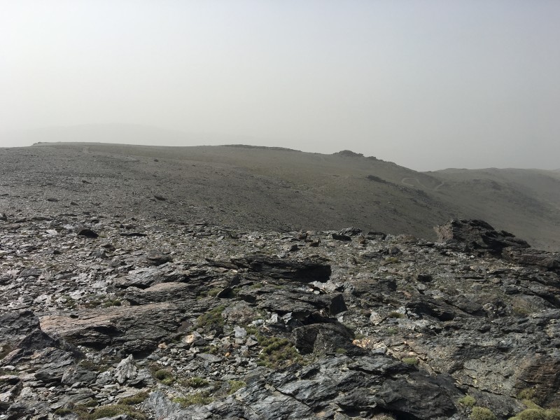 Temperatures were high in the valley but a very strong wind was blowing all day which tend to cool temperatures down during the hike. It was also very hazy so views were not great but we would at least escape sunburns. At the end of the day, the hike was very easy and not very challenging. By clear weather you can have a great view on Africa from the top.  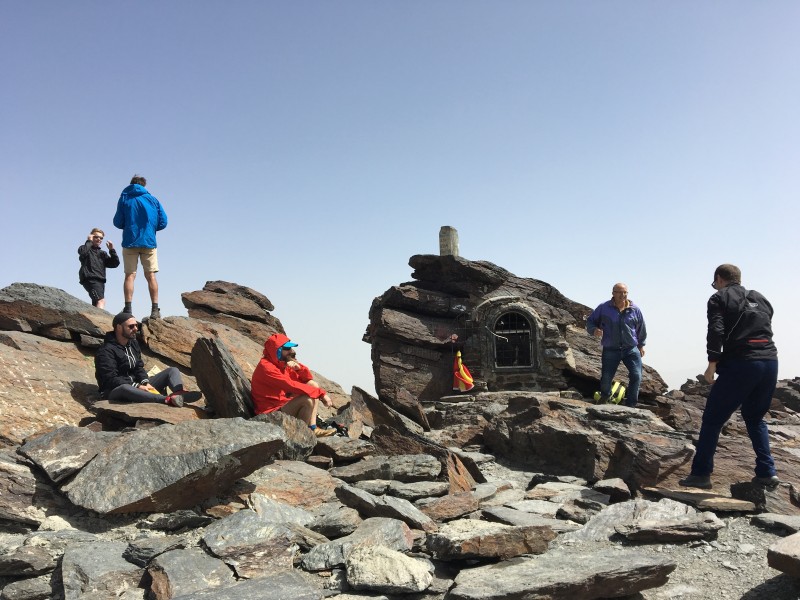  It took us a bit more than 3 hours to get to the top on a very gentle rocky slope. We were still feeling our legs from Aneto so it was a perfect day to relax and summit a mountain. We wandered in Capileira that night, got few beers and an incredible meal to top the day. 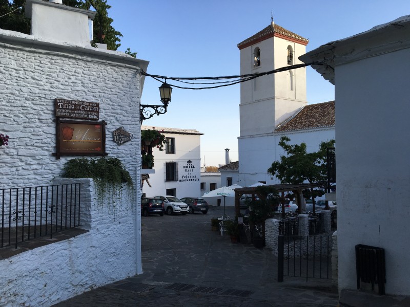 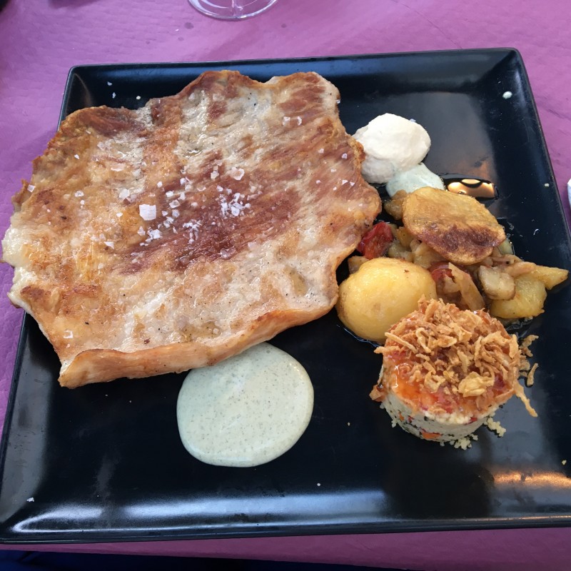 Great trip through Spain, nothing technical but a good few days to discover more of Spain. We drove back to Barcelone by the east coast, stopping at Murcia, Alicante & Valencia. Back in Barcelona, it was sangria and paella all over again under the glorious catalonian sun! Thumbnails for uploaded photos (click to open slideshow):  Early morning in the valley")
 Blue sky in Barcelona, as always!")
 Arriving at Refugio de la Renclusa")
 Looking at the gulley towards Maladeta glacier")
 Looking back on the valley")
 Snow and rocky patches in the gulley")
 View of the Aneto Glacier and Aneto summit")
 Down the crux to join the Aneto glacier")
")
 Looking back at the glacier")
")
 What's better than walking on snow towards a mountain?")
 Break for a spanish group before the last summit slope")
 Turn right after the rocks, go up and you reach the summit")
 Paso de Mahoma")
 A little bit of exposure to spicy the climb")
")
 Not everybody is comfortable with exposure")
 People at the false summit who didn't want to risk el Paso de Mahoma")
 Standing on the roof of the Pyrenees")
 View of the Pyrenees")
 Steep wall to connect to the glacier")
 View back down on the valley")
 Mulhacen, looks like an easy walk in the park")
 A well marked trail leads to the summit")
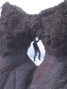
 Volcanic style mountain")
 Ridge before the summit")
 Top of Mulhacen")
 Wild horses chilling out in Mulhacen valley")
 Typical village of Andalousia")
 oh man that was good, was sweating to finish it!")
 Going up the gulley on Maladeta")
|
| Comments or Questions | ||||||
|---|---|---|---|---|---|---|
|
Caution: The information contained in this report may not be accurate and should not be the only resource used in preparation for your climb. Failure to have the necessary experience, physical conditioning, supplies or equipment can result in injury or death. 14ers.com and the author(s) of this report provide no warranties, either express or implied, that the information provided is accurate or reliable. By using the information provided, you agree to indemnify and hold harmless 14ers.com and the report author(s) with respect to any claims and demands against them, including any attorney fees and expenses. Please read the 14ers.com Safety and Disclaimer pages for more information.
Please respect private property: 14ers.com supports the rights of private landowners to determine how and by whom their land will be used. In Colorado, it is your responsibility to determine if land is private and to obtain the appropriate permission before entering the property.