Download Agreement, Release, and Acknowledgement of Risk:
You (the person requesting this file download) fully understand mountain climbing ("Activity") involves risks and dangers of serious bodily injury, including permanent disability, paralysis, and death ("Risks") and you fully accept and assume all such risks and all responsibility for losses, costs, and damages you incur as a result of your participation in this Activity.
You acknowledge that information in the file you have chosen to download may not be accurate and may contain errors. You agree to assume all risks when using this information and agree to release and discharge 14ers.com, 14ers Inc. and the author(s) of such information (collectively, the "Released Parties").
You hereby discharge the Released Parties from all damages, actions, claims and liabilities of any nature, specifically including, but not limited to, damages, actions, claims and liabilities arising from or related to the negligence of the Released Parties. You further agree to indemnify, hold harmless and defend 14ers.com, 14ers Inc. and each of the other Released Parties from and against any loss, damage, liability and expense, including costs and attorney fees, incurred by 14ers.com, 14ers Inc. or any of the other Released Parties as a result of you using information provided on the 14ers.com or 14ers Inc. websites.
You have read this agreement, fully understand its terms and intend it to be a complete and unconditional release of all liability to the greatest extent allowed by law and agree that if any portion of this agreement is held to be invalid the balance, notwithstanding, shall continue in full force and effect.
By clicking "OK" you agree to these terms. If you DO NOT agree, click "Cancel"...
Report Type
Full
Peak(s)
Montgomery Peak - 13441
Boundary Peak - 13143
Mustang Mountain - 10340
Mount Dana - 13057
Point 12,565 - 12565
Mount Gibbs - 12773
Montgomery Peak 13,441
Boundary Peak 13,143 (un-ranked, NV state highpoint)
"Trail Canyon Peak" 11,340
Mustang Mountain 10,340
Horseshoe Rock 10,220 (un-ranked)
Kennedy Point 10,140 (un-ranked)
July 26, 2016
~11.8 Miles, ~5,600 Gain
TH: Top of 4x4 road above Morgan and Queen Mine (high clearance recommended)
~1 hour drive from Bishop
Max difficulty: Class 2
Fortunately, the drive the second day was much shorter and more interesting than the drive to GBNP. A fairly decent road led to the saddle between Kennedy Point and Boundary Peak where a Subaru was parked with a state high pointer and his grandson. They were camping and planning on doing Boundary Peak but not Montgomery.
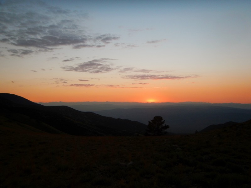
Sunset.
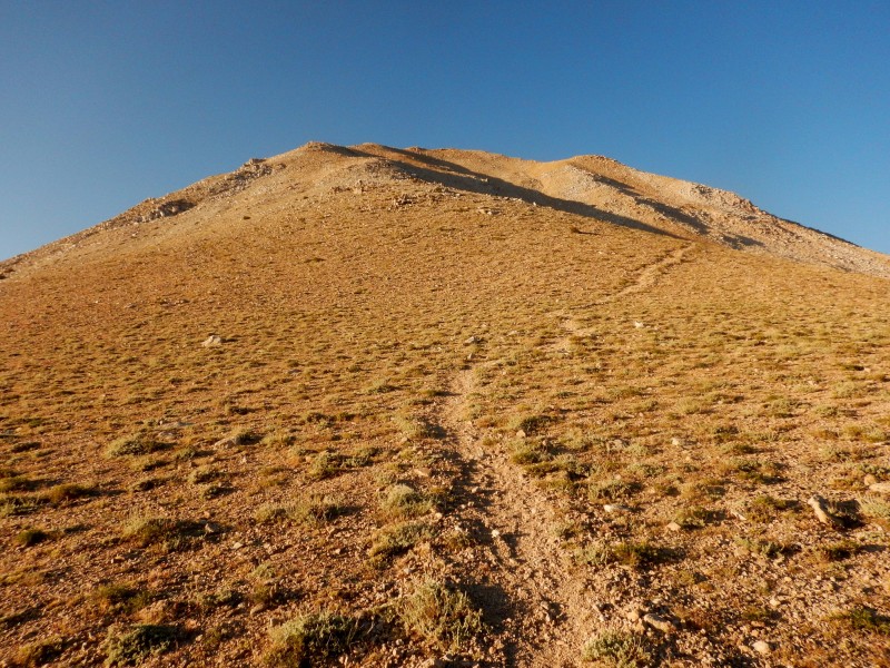
I began hiking at 5:45 AM. From the saddle the road continues another 0.1 mile up the south side of the saddle before turning into an easy-to-follow trail. The trail bypasses "Trail Canyon Peak" by skirting its southern edge to Trail Canyon Saddle. Once at Trail Canyon Saddle, the trail turns into a long somewhat loose talus slog eventually gaining the north rib of Boundary's east ridge.
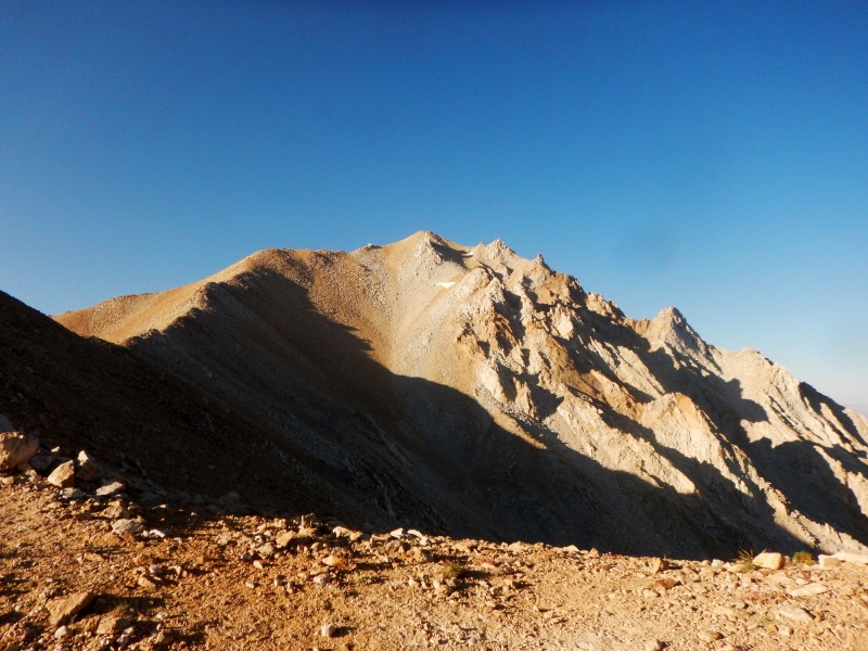
Boundary Peak
Boundary from Trail Canyon Saddle
Boundary Peak
More talus guided me to the top of Nevada where I arrived on Boundary's summit at 8:10 AM. From the summit of Boundary, Montgomery looked fierce. My summit stay was short and I quickly descended to the Montgomery-Boundary saddle which involved loose class 2 talus.
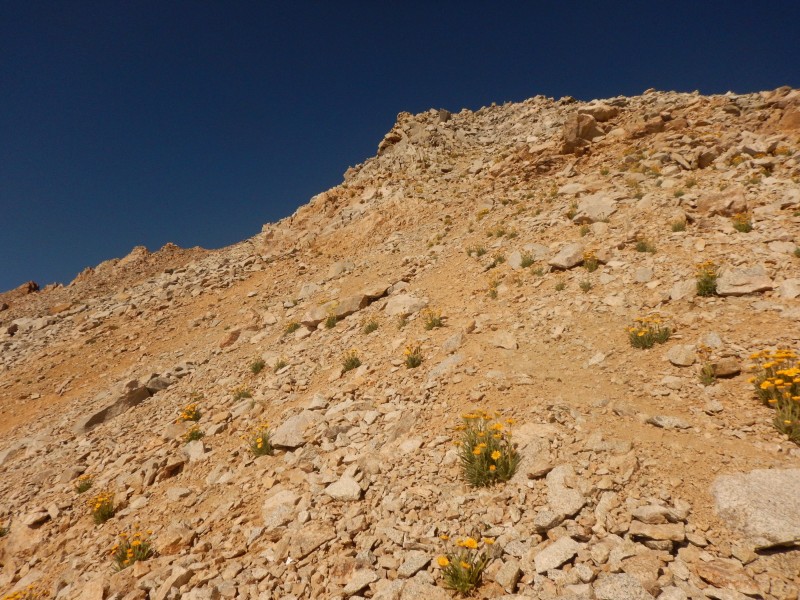
To avoid the difficulties of Montgomery's northeast ridge, I was able to stay below the ridge crest (~50-150 feet) on the east (left) side of the ridge. Following loose talus and a faint trail, I was able to keep the climbing at class 2 to the summit of Montgomery where I arrived at 8:45 AM.
Montgomery Peak
Looking back at Boundary; staying the east side of the ridge.
Class 2 garbage to the summit of Montgomery.
The register on Montgomery had about a quarter of the names listed in Boundary and went back to 1968! I quickly returned back to the Montgomery-Boundary saddle. I tried to avoid unnecessary gain by skirting the east side of Boundary but the talus was astonishingly loose and arduous. I can't recommend it.
Once back at Trail Canyon Saddle, I took a short break before starting up the south slopes of "Trail Canyon Peak" - a ranked 11er. A short, steep slog led me to the summit. I descended off "Trail Canyon Peak's" east ridge and re-intersected the Boundary Peak trail.
I arrived back at the car at 11:20 AM. Since I had so much daylight left, I decided to knock out Mustang Mountain - a ranked 10er - which shares the same parking area for Boundary Peak. Reaching Mustang Mountain required a quick jaunt over un-ranked Kennedy Mountain where I was surprised to find a register with some familiar names. Staying on the ridge between Kennedy and Mustang resulted in some obnoxious bushwhacking which I was able to avoid more strategically on my return by staying on some loose scree on the west side of the ridge.
Register on Kennedy Point.
A nice bushwhack led to the summit of Mustang where the views of Boundary were enjoyable. Before returning to the car, I made a quick side trip to Horseshoe Rock which appears impressive from the west but required nothing more than a class 2 hike to reach the top. A crappy hike back led to the car; I should have probably left Mustang off the list. Now that it was extremely hot, even at 9,800, I decided to change my plans from Doubois by driving deeper into the Sierras to seek some cooler temperatures.
Boundary from Horseshoe Rock.
Topo.
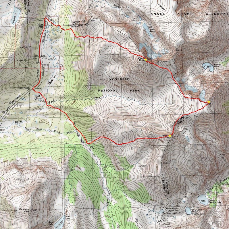
Mount Dana 13,057
Point 12,565
Mount Gibbs 12,773
July 28, 2016
~10.6 Miles, ~5,100 Gain
TH: Just outside the east entrance to Yosemite National Park
~1.3-1.5 hours from Bishop
Max difficulty: Minor Class 3 (Class 1 if only climbing Dana)
Cooler temperatures were welcomed as it was over 100 degrees in the Owens Valley. I thought I found a singular parking spot to sleep in my car only to discover someone setting up their tent behind my car around midnight. They were not quiet and I was glad to return the favor at 4:45 AM. I'm learning quickly that the camping is much more condensed and harder to find compared to Colorado (outside campgrounds).
A short drive led me to Yosemite's east entrance at Tioga Pass where I parked on a large dirt shoulder just before entering the park. From having explored my parking options the afternoon prior, I knew access to the Dana Meadows parking area (the trailhead for Dana) near the entrance station would only be a conglomerate of congestion when I finished my hike.
I began hiking east across a meadow at 5:15 AM and quickly intersected the Mount Dana Trail (un-official trail) which guided me upwards. The sunrise on the nearby peaks was quite beautiful as I made slow progress up the trail.
Early morning on Dana.
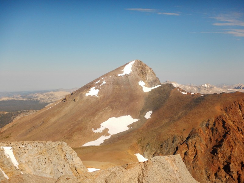
The stiffness from the previous two days was starting to catch up with me. I arrived on the summit of Dana at 7:30 AM where there were excellent views of Mono Lake. After a short break I left the graces of a well maintained trail and started down Dana's steep, talus southeast ridge to the Dana-12,565 saddle. More gentle terrain mixed with some larger boulder hopping guided me to the summit of 12,565 where I arrived at 8:30 AM. I found the views on 12,565 to be better than Dana's.
Sunrise in the Sierras
Mono Lake from the summit of Dana.
Suncups.
Dana from the Dana-12,565 saddle.
Dana from 12,565.
I walked down easy tundra off 12,565's southwest ridge and bypassed a large hill in the ridge on the west side of the ridge before reaching the 12,565-Gibbs saddle. The rock on Gibbs' north ridge had a change of character and reminded me of some peaks in the San Juans. There was a short section of very minor class 3 scrambling near the top of Gibbs' north ridge before I arrived on the summit at 9:20 AM. To my surprise, there was a large number of names entered in the summit register.
Gibbs from near the Gibbs-12,565 saddle.
Nearing the summit on Gibbs.
Point 12,565 from Gibbs.
Reports had shown folks usually access Gibbs from Mono Pass but I didn't want to extend my hiking distance so I started my descent down Gibbs' west ridge. Small, loose, disgusting talus led me downward off the south face of Gibbs' west ridge as I should have stayed on the ridge proper. Steep terrain and a cliff band around 10,600 made obtaining the Mono Pass trail somewhat difficult.
Dana from Gibbs.
Once I found a weakness in the cliff, steep grassy terrain led me to the Mono Pass Trail. On my hike back west towards the Tioga Pass road, I was badgered by three separate Yosemite Park rangers asking if I was day hiking. I've never seen that many rangers in a single day hiking at RMNP. Did it look like I had an overnight pack? Wtf.
Unfortunately the last 1.5 miles back north to Tioga Pass from the Mono Pass trailhead completely sucked as there was little to no shoulder to hike on along with a constant barrage of cars rolling down the hill. As suspected, the east entrance gate was a complete goat rodeo and I was glad I didn't park at the Dana Meadows parking area. I arrived back at my car 11:10 AM and counted over 50 cars waiting in line at the east entrance as I made the drive back towards Mammoth Lakes. Now I understand and appreciate why I have never climbed at Yosemite.
Topo.
Thumbnails for uploaded photos (click to open slideshow):
I always wanted to climb Montgomery as well as Boundary when I lived in Nevada. Thanks for the report and pictures! Is there anyway you can send me your topo map from the Boundary report? It would be an awesome reference for when I get the chance to climb these mountains.
Brings back fun memories of doing Boundary+Montgomery the day after Wheeler last year...though the later trip took most of a day! Montgomery was definitely worth the side trip.
Looking forward to seeing more of your adventures from this trip. Keep it up!
Caution: The information contained in this report may not be accurate and should not be the only resource used in preparation for your climb. Failure to have the necessary experience, physical conditioning, supplies or equipment can result in injury or death. 14ers.com and the author(s) of this report provide no warranties, either express or implied, that the information provided is accurate or reliable. By using the information provided, you agree to indemnify and hold harmless 14ers.com and the report author(s) with respect to any claims and demands against them, including any attorney fees and expenses. Please read the 14ers.com Safety and Disclaimer pages for more information.
Please respect private property: 14ers.com supports the rights of private landowners to determine how and by whom their land will be used. In Colorado, it is your responsibility to determine if land is private and to obtain the appropriate permission before entering the property.


")
")
")
")
")
")
")
")
")
")
")
")
")
")
")
")
")
")
")
")
")
")
")
")