Download Agreement, Release, and Acknowledgement of Risk:
You (the person requesting this file download) fully understand mountain climbing ("Activity") involves risks and dangers of serious bodily injury, including permanent disability, paralysis, and death ("Risks") and you fully accept and assume all such risks and all responsibility for losses, costs, and damages you incur as a result of your participation in this Activity.
You acknowledge that information in the file you have chosen to download may not be accurate and may contain errors. You agree to assume all risks when using this information and agree to release and discharge 14ers.com, 14ers Inc. and the author(s) of such information (collectively, the "Released Parties").
You hereby discharge the Released Parties from all damages, actions, claims and liabilities of any nature, specifically including, but not limited to, damages, actions, claims and liabilities arising from or related to the negligence of the Released Parties. You further agree to indemnify, hold harmless and defend 14ers.com, 14ers Inc. and each of the other Released Parties from and against any loss, damage, liability and expense, including costs and attorney fees, incurred by 14ers.com, 14ers Inc. or any of the other Released Parties as a result of you using information provided on the 14ers.com or 14ers Inc. websites.
You have read this agreement, fully understand its terms and intend it to be a complete and unconditional release of all liability to the greatest extent allowed by law and agree that if any portion of this agreement is held to be invalid the balance, notwithstanding, shall continue in full force and effect.
By clicking "OK" you agree to these terms. If you DO NOT agree, click "Cancel"...
I had been thinking of Oxford's East Ridge for a few years since I discovered Pine Creek Basin. After two visits to this incredible area, it worked out for an attempt of Oxford via the East Ridge. I hadn't seen that much information on that route, so.....
My friend Debbie, her daughter, and I packed in to the east side of the basin, right where the Colorado Trail crosses Pine Creek. By my GPS, it was approximately 4.5 miles from the trailhead to the intersection. NOTE: As is mentioned in the TH information, there is an honor system payment to walk across the private land to access public land. $1 per person and $2 per critter. The walk from the trailhead to the intersection is fairly easy, gaining about 400' in the first two miles, then about 930' in the last two miles. It took us around 2 hrs to reach the bridge. There are several good campsites on both sides of the creek; we camped right at the intersection of the Pine Creek trail and the Colorado Trail (northbound)
We started up the CT at approximately 4:30 am. It took us about 45-50 minutes and about 1.4 miles to hit the ridge and the place to leave the CT and head west on the ridge. We did leave a bit early and saw we were too far south so backtracked a bit. There is a small (1' ish) cairn where we finally turned off the trail. NOTE: the general rule of the day is tend right (north) on any decision of where to go.
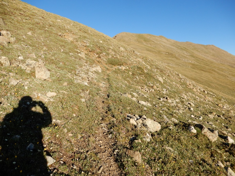
The route to tree line is pretty mellow, albeit steep in some places. We never had to climb over any logs, and rarely had to debate much about the best way through. This is pretty typical of the terrain below tree line
Soon enough, the trees thin out.
And you start to get a good view of Harvard
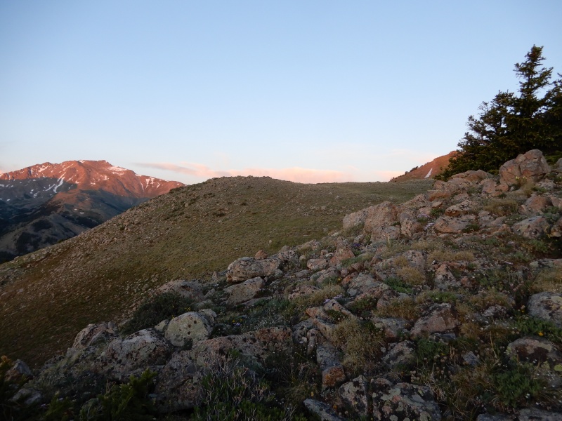
As you gain elevation, you get a sense of the gentle rolling nature of the east ridge. I think the point in the distance is Waverly.
The overall terrain is pretty easy walking, mostly grass with a few small rocks.
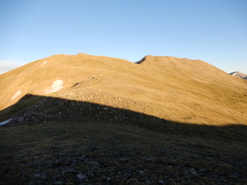
Looking back along the ridge, with our campsite in the valley below at the end of the clearing
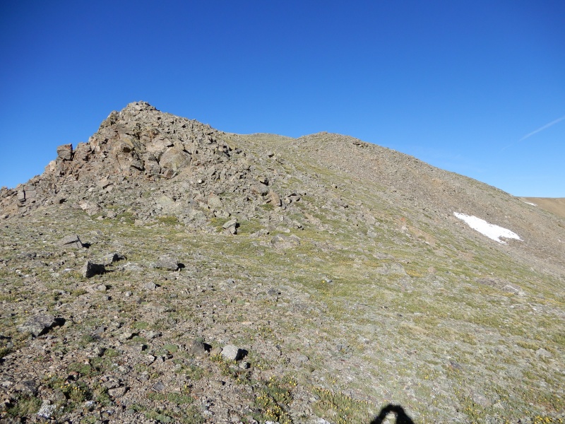
These are a few more lumps on the ridge. Here we were debating to stay on the ridge or tend right toward the saddle. We noticed a faint trail over near the rocks left of center. Again, seems the easiest way is to tend farther right than you would think (if you want the easier/efficient path)
We did an ascending traverse and eventually joined the trail. The trail came and went, and when we lost it and re-found it, it was always climbers right (north) of where we were.
This is in the saddle below Waverly. Supposedly there was a traverse across this face to save the up and over. We didn't see anything appealing and the gain up Waverly wasn't too much.
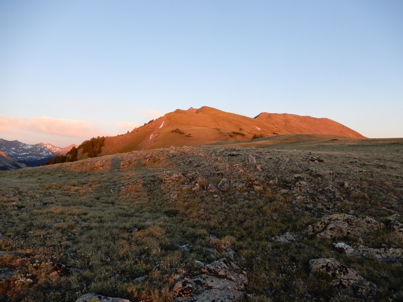
On top of (south) Waverly, with plenty of work left. We are a bit short of 4 miles at this point and roughly 1000' higher to go. Oxford is in the center, above the small spot of snow. Many false summits left.
Looking back on Waverly
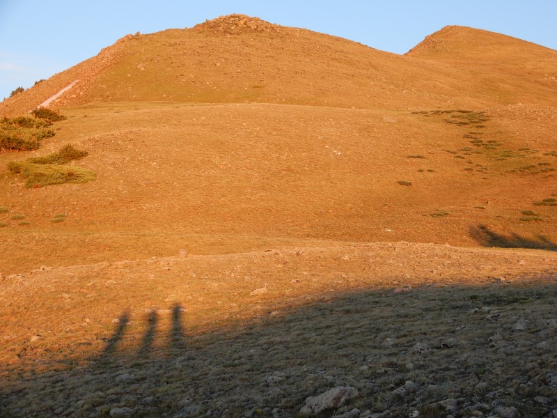
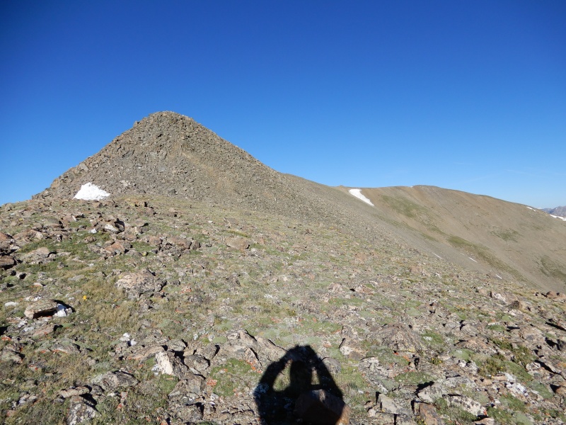
One of the more interesting false summits. All class 1 (off trail) to this point, and a faint trail down and to the right, but probably class 2 or easy class 3 over this hump if you want it.
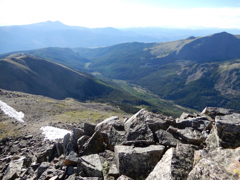
One last look back; our campsite looks a long way down the valley.
And the last little push to the summit. Oxford is generally the peak tucked in the middle. Note the still very grassy route and the faint trail on the right side. Consistent with most of the route.
Oxford summit was about 5 miles from camp, took us approximately 3:40 from camp to summit. We went over to Belford and hit that summit at about 4:30 total time. On Belford, we debated whether to go back over Oxford or come down via Elkhead Pass and Pine Creek. We chose the latter. took us about 8 hours round trip, so 3:30 down and a RT of 15.9 miles total. We clocked Belford at about 7 miles, so an extra 2 miles, but much easier walking and no significant elevation regain. We were back around 12:30 and decided to pack out. That 4.5 miles back down to the trailhead with a full pack was rough after the hike.
All in all, it was an enjoyable route. The ridge was very enjoyable, mellow, but with many false summits. I enjoy the walk back via Elkhead and Pine Creek but back along the ridge would have been fun too.
My GPS Tracks on Google Maps (made from a .GPX file upload):
I just saw your report on this route after I put mine up. That timing is interesting, especially for a route that is apparently climbed so seldom that I didn't even see anyone else. I enjoyed your pictures.
Thanks for posting this! My wife and I are going to be hiking this section of the CT next month. While working on our route planing, I spotted a trail following this route on several (but not all) maps. It looked like a great way to get to Oxford but, until your and Lucas's posts, we couldn't find any info on the difficulty of the route. We will have the time and would love to add this ascent to our trip. We have the gear, physical training, route finding and backpacking experience but lack "mountain" experience. I know this is a difficult question to answer, but can this route be done by two newbies from the flatlands of Iowa?
Thanks and Happy Trails!
Caution: The information contained in this report may not be accurate and should not be the only resource used in preparation for your climb. Failure to have the necessary experience, physical conditioning, supplies or equipment can result in injury or death. 14ers.com and the author(s) of this report provide no warranties, either express or implied, that the information provided is accurate or reliable. By using the information provided, you agree to indemnify and hold harmless 14ers.com and the report author(s) with respect to any claims and demands against them, including any attorney fees and expenses. Please read the 14ers.com Safety and Disclaimer pages for more information.
Please respect private property: 14ers.com supports the rights of private landowners to determine how and by whom their land will be used. In Colorado, it is your responsibility to determine if land is private and to obtain the appropriate permission before entering the property.


")
")
")
")
")
")
")
")
")
")
")
")
")
")