| Report Type | Full |
| Peak(s) |
San Miguel Peak - 13,756 feet "Lake Point" - 13,508 feet Sheep Mountain - 13,196 feet |
| Date Posted | 07/08/2018 |
| Modified | 07/08/2019 |
| Date Climbed | 06/10/2017 |
| Author | Boggy B |
| Additional Members | Kylie |
| San Miguel SW Face, Lake Point, Sheep Chute |
|---|
|
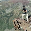
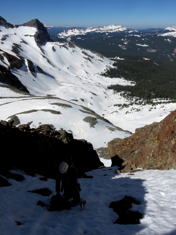
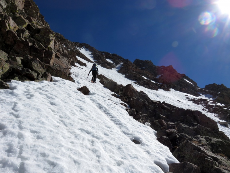
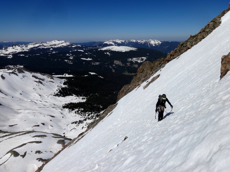
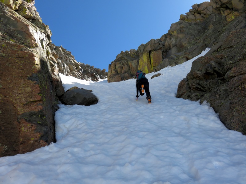
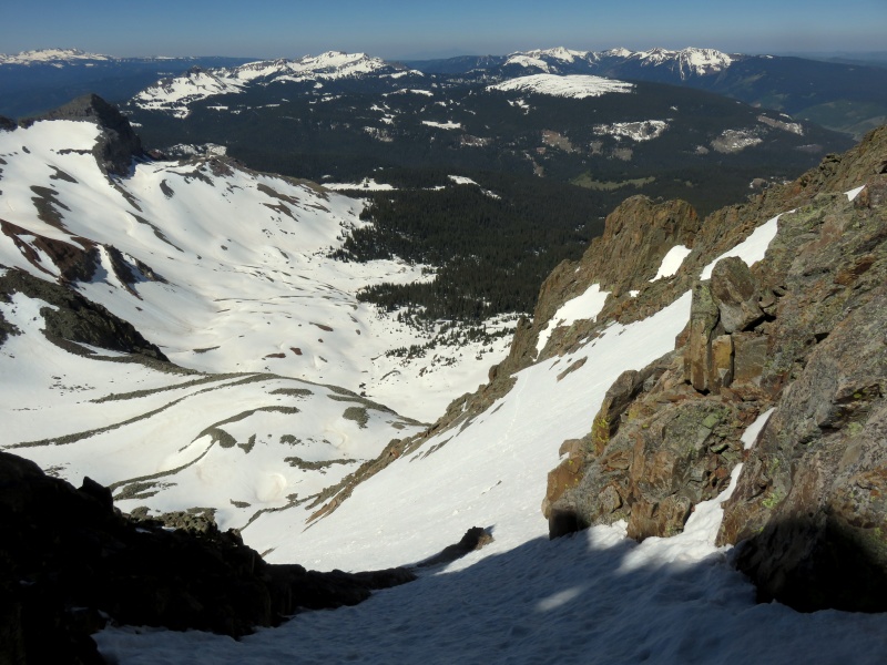
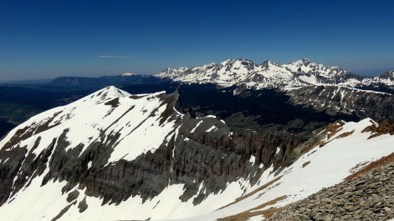
This report is for some routes we did last year (2017). We climbed Sheep several weeks after San Miguel but I've put them together because of their proximity, my own laziness, and so that no one has to read a whole TR dedicated to an unranked 13er (Sheep; but I'm joking--I love unranked 13ers. For a better TR on Lake Point, see here). San Miguel Peak Southwest Face, M3/Mod. Snow 06/10/17 - Nurturing a longstanding curiosity about the south face of San Miguel Peak, and in particular the possibility of a snow climb thereon, we decided to have a look during last year's banner spring. We left Montrose at the usual hour. Minutes into the drive we were stopped by a CSP officer who, unsurprisingly, did not actually care that I was going 7 mph over but rather had seized the opportunity to learn what more stop-worthy vehicular crimes we might be committing at 2 am on a Saturday morning. After a brief chat which left him visibly puzzled, we were on our way. The trailhead is on an unmarked road labeled "204 A" on the Forest Service map, 1/8 mile east of the Cross Mountain trailhead (Lizard Head), on the east side of Hwy 145. A short drive up the rough dirt road leads to a small meadow and a gate with official signage indicating the road is open to hiking. We parked in the meadow and took a short nap before starting up the road. Our headlamps illuminated prints in the mud indicating the road had been traveled recently by a little bear and a big bear. After 1.8 miles we encountered another gate, this one with "No Trespassing" signs. We left the road and skirted the mile-long northern boundary of the private land, passing beneath the south slopes of Sheep Mountain on the far end. We continued southeast through open meadows at the edge of the forest, making our way eventually up to the bench under the south face of San Miguel. The proper start of our proposed route is a steep gully on the western end of the face which boasts a difficult-looking chockstone. It appeared we could get around it by scrambling left; but we had brought the gear (a 30m rope and light set of nuts), so we figured we might as well do it. We built an anchor for the belay and I scrambled up the initial 3rd class rock band to the chockstone which overhangs the gully. This offered a surprisingly fun little M3 climb to the right which protected well. I built a good anchor in seams on the wall above, and Kylie took the lead up the next rock step. Above this we put the rope away and climbed on firm snow, traversing right across the face and up a snow ramp which provides access to a couloir leading to the summit. At the top of this upper couloir, we found ourselves between the twin summits with easy access to both. We scrambled up to the south summit, then the north, where we took a break and enjoyed the sunshine and views. 
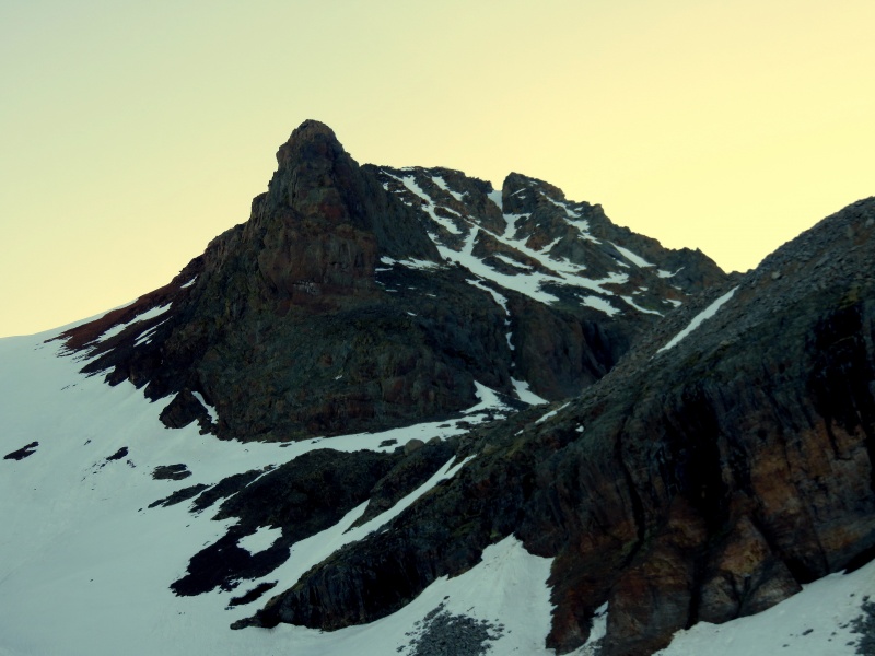


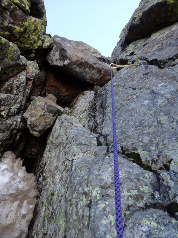


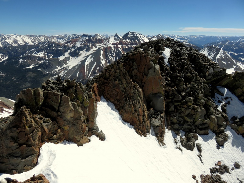


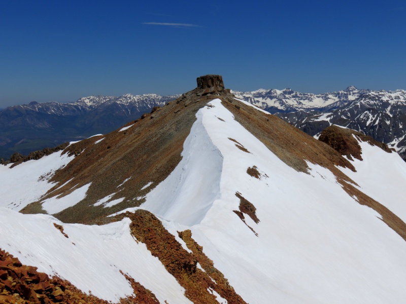
Lake Point Southeast Chimney, 5.2 From the summit of San Miguel, we descended the northwest ridge to the Lake Point saddle. The last hundred feet or so was steep and quite loose. A snow-capped ridge led to a chossy headwall to gain the 13,491' point, and from there a gentle ridge led to the business of Lake Point, a 20-foot knob resembling a giant cheese wheel. There looked to be a few options to climb up the south side, but we circled right around to the north side, which revealed a weakness. I scrambled up an exposed dihedral and topped out on the cheese wheel. I thought Kylie might find an easier, or at least less exposed, route and had her circle back around to the west side of the tower. There she made a few tricky moves to a reach a ledge and easy scrambling to the top. These two short routes were probably in the 5.4 range. We had brought up the rope and a harness in case we wanted to rappel, but it seemed an easier descent might be offered by a chimney on the southeast side, where a big slice of cheese had been cut from the wheel and set below. We stepped down to small ledge and then stemmed down the short chimney at 5.2 or so. To descend, we hiked south back over 13,491' and wallowed down the slush south to the forest, following our tracks back to the road. 


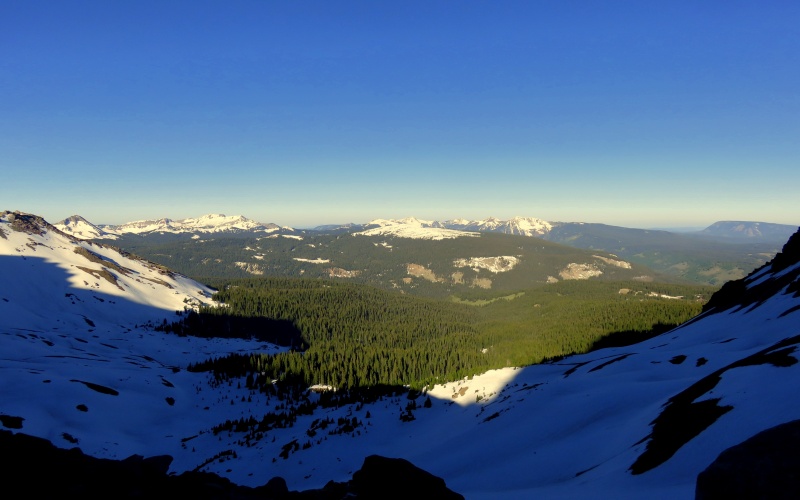
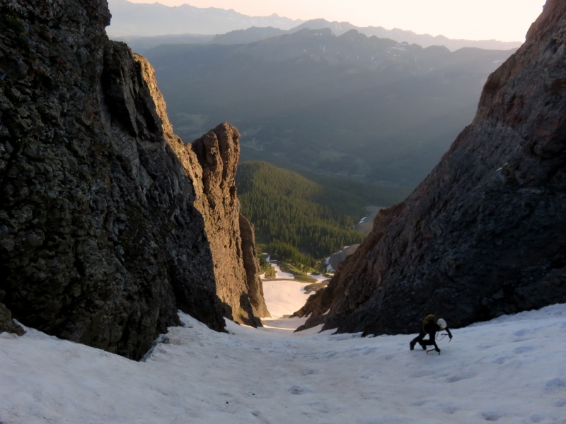
A parting word of caution: There may be big pockets of subsurface water under the road near the trailhead.  Sheep Mountain Sheep Chute, Mod. Snow 06/29/17 - Sheep Mountain is a bulky mountain as seen from the Lizard Head area. It is unranked by San Miguel Peak (and, otherwise, Lake Point) to the east. In the springtime, standing upon many a Sneffels range peak and looking to the south, one might be struck by a big, diagonal couloir off in the distance. This is the north couloir of Sheep Mountain, known as "Sheep Chute." Having plotted a fairly short round-trip from Trout Lake, we decided to tackle this hike before work on a Thursday and left home around 2:30am. By 4:30 we were bushwhacking up forested slopes in the dark. After circumventing (by GPS) some private property at the start, we angled southeast to meet the toe of the massive rock glacier that spills down the Sheep-Lake Point cirque. Following its western border at the edge of the forest, we made faster progress up to the base of the couloir. The climb itself is summed up in my notes follows: Epic cramponing up to 45 deg. Dirty w/some rockfall at sunup. Gaining the ridge, we turned right and walked along a snowy catwalk to the summit benchmark. With work commitments, we didn't stay long to enjoy the beautiful, cloudless blue morning. Not seeing any obviously easier routes to descend north, we reversed the couloir and retraced our path through the forest, arriving at the truck at 8:50. 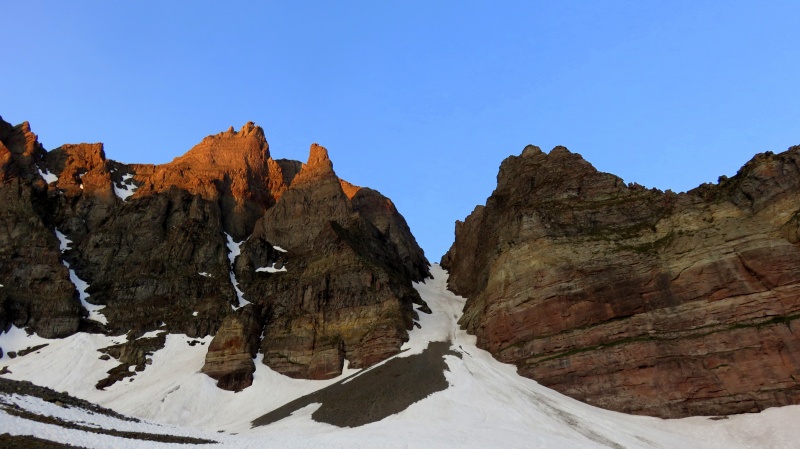


Thumbnails for uploaded photos (click to open slideshow): ")
")
")
")
")
")
")
")
")
")
")
")
")
")
")
")
")
")
")
")
")
")
")
")
")
")
")
")
")
")
")
")
")
")
")
")
")
")
")
")
")
")
")
")
")
")
")
")
")
")
|
| Comments or Questions | |||
|---|---|---|---|
|
Caution: The information contained in this report may not be accurate and should not be the only resource used in preparation for your climb. Failure to have the necessary experience, physical conditioning, supplies or equipment can result in injury or death. 14ers.com and the author(s) of this report provide no warranties, either express or implied, that the information provided is accurate or reliable. By using the information provided, you agree to indemnify and hold harmless 14ers.com and the report author(s) with respect to any claims and demands against them, including any attorney fees and expenses. Please read the 14ers.com Safety and Disclaimer pages for more information.
Please respect private property: 14ers.com supports the rights of private landowners to determine how and by whom their land will be used. In Colorado, it is your responsibility to determine if land is private and to obtain the appropriate permission before entering the property.