Download Agreement, Release, and Acknowledgement of Risk:
You (the person requesting this file download) fully understand mountain climbing ("Activity") involves risks and dangers of serious bodily injury, including permanent disability, paralysis, and death ("Risks") and you fully accept and assume all such risks and all responsibility for losses, costs, and damages you incur as a result of your participation in this Activity.
You acknowledge that information in the file you have chosen to download may not be accurate and may contain errors. You agree to assume all risks when using this information and agree to release and discharge 14ers.com, 14ers Inc. and the author(s) of such information (collectively, the "Released Parties").
You hereby discharge the Released Parties from all damages, actions, claims and liabilities of any nature, specifically including, but not limited to, damages, actions, claims and liabilities arising from or related to the negligence of the Released Parties. You further agree to indemnify, hold harmless and defend 14ers.com, 14ers Inc. and each of the other Released Parties from and against any loss, damage, liability and expense, including costs and attorney fees, incurred by 14ers.com, 14ers Inc. or any of the other Released Parties as a result of you using information provided on the 14ers.com or 14ers Inc. websites.
You have read this agreement, fully understand its terms and intend it to be a complete and unconditional release of all liability to the greatest extent allowed by law and agree that if any portion of this agreement is held to be invalid the balance, notwithstanding, shall continue in full force and effect.
By clicking "OK" you agree to these terms. If you DO NOT agree, click "Cancel"...
The road past the La Plata Trailhead is 4WD the entire way to the upper trailhead. In fact, I felt the second 4WD portion was easier in many places than the early 4WD portion. Only one area gave me pause, about half a mile from the 394 junction. The dip in the road was bigger than it looked, wasn’t anticipated and caught me off guard.
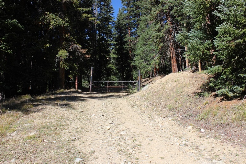
I parked in a grassy area just before reaching the gate and started out at 5:45am.
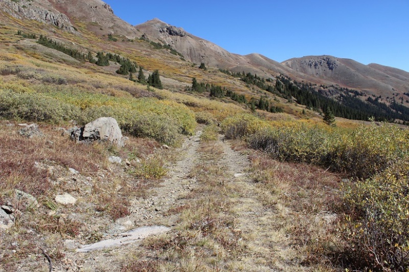
The gate was locked and it didn’t look like anyone had driven on the road past the gate in quite a while. This is where the trail starts.
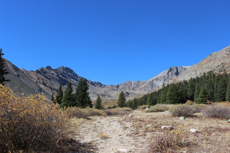
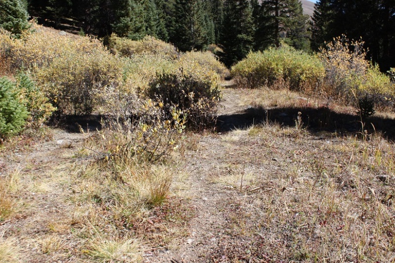
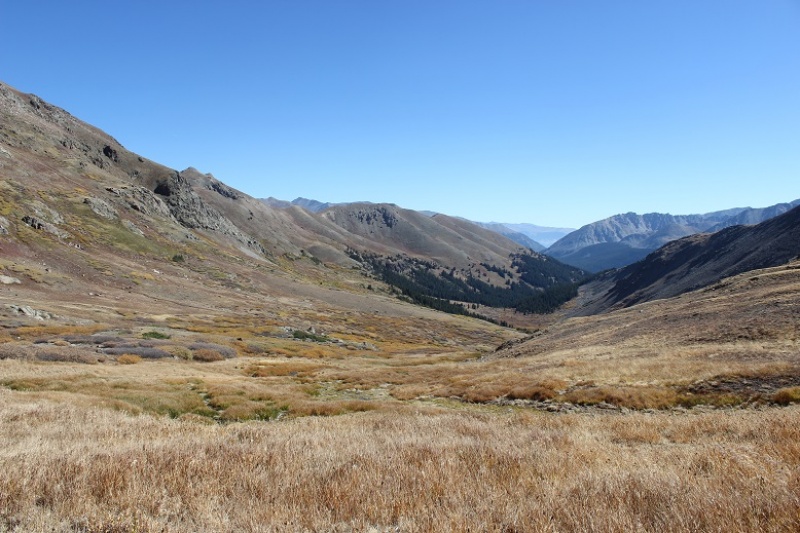
Follow the road west into McNasser Gulch. Almost all of this trail is above treeline, but until you make it to the mine you’re on a trail overgrown with willows.
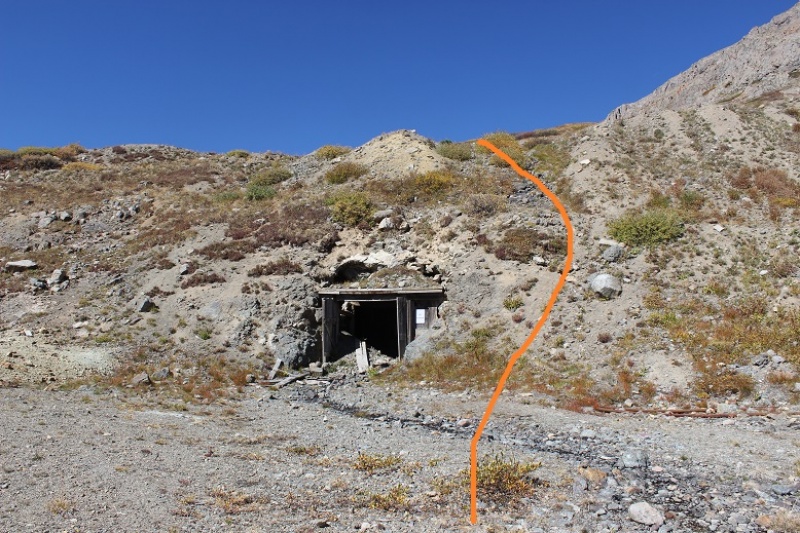
The mining area is at 12,100’. It’s boarded up pretty well, but still looks neat (and operational?).
The trail in this area gets kind of fuzzy, but it picks back up again directly over the mine (so make your way around it and head west/northwest/right).
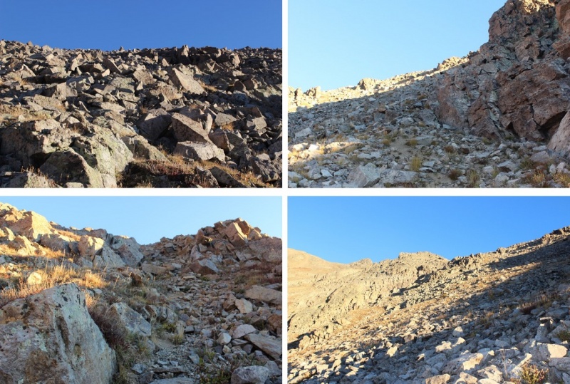
From here there is no trail. Head northwest through the basin towards Grizzly Peak.
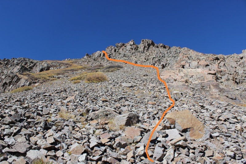
After rounding the basin and heading northwest (right) you aim for this bump:
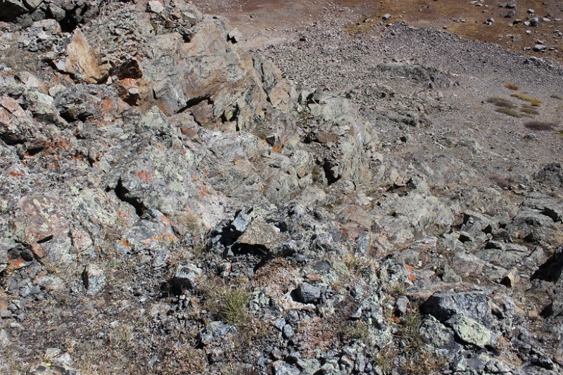
The terrain is much steeper and rockier than it looks. The ground was full of loose sand/scree.
Once you make it to the saddle turn left (west and follow the ridge).
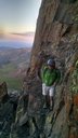
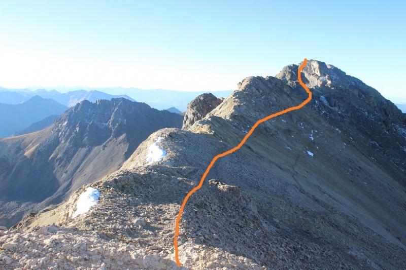
This is done by initially sticking to the ridge crest and then skirting the 3 gendarmes to the left before regaining the ridge and following it to the top. Here’s the view looking back at the route so far
There was just a little bit of snow at the top
The rest of the route to Grizzly is only .2 miles. I followed the ridge to the south. There was an established trail here.
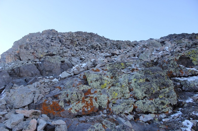
The final pitch was loose and made up of bowling ball sized unstable rocks but easy to navigate
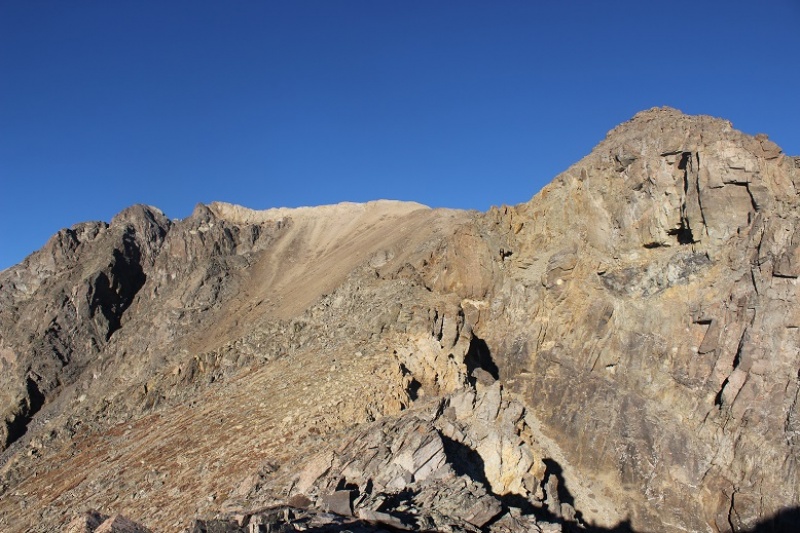
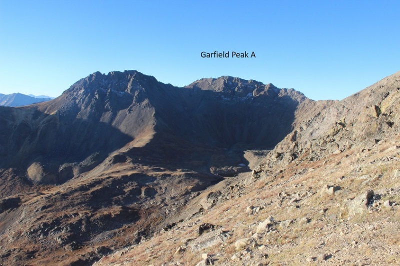
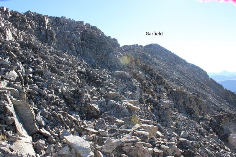
Here’s a view from Garfield looking at the route up Grizzly
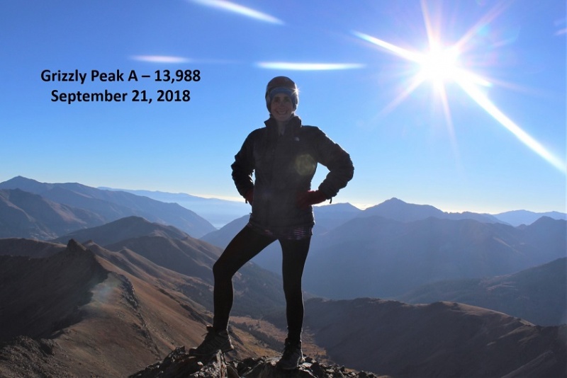
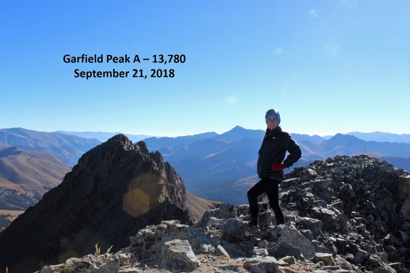
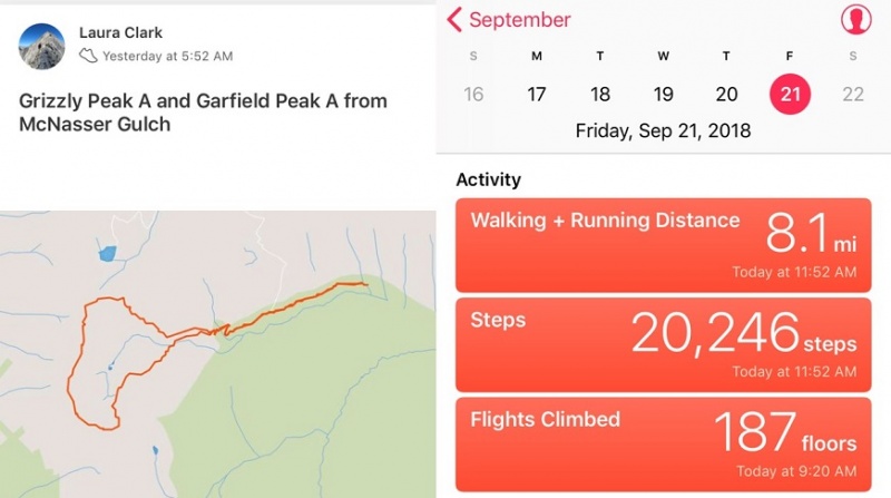
I summited Grizzly Peak A at 8:10am
Here’s a picture of Garfield from the summit of Grizzly.
To get there you need to re-trace your steps, but not far. Head back the way you came and about 20 steps down from the summit you’ll turn left (south).
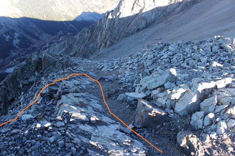
I had to do one class 3 move to get down this part of the ridge, and after completing it realized there was an easier way. Here’s the route from the Grizzly/Garfield Saddle
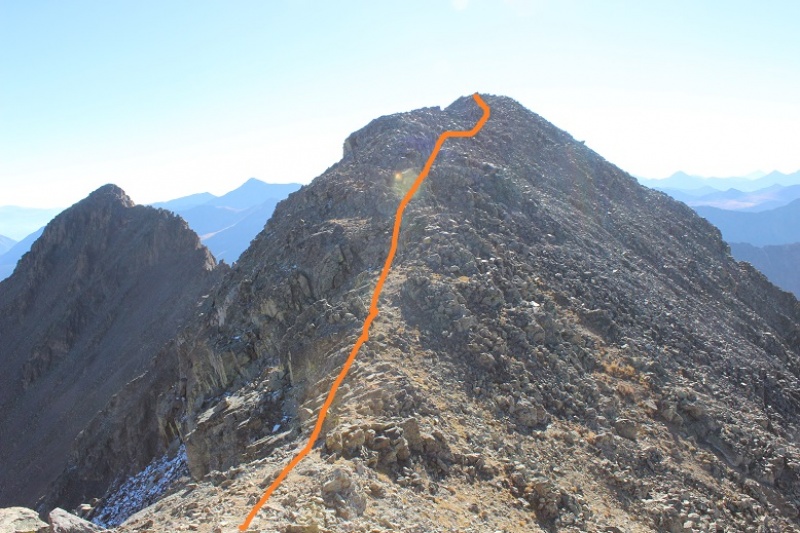
I followed the trail along the ridge and behind point 13,650. After rounding 13,650 (to the right) I followed another trail around the south slopes and gained the ridge.
From the ridge I climbed to the summit (no trail on this part)
I summited at 9:20am
I was done summiting both peaks for the day, but from here the route actually became more difficult. I had a hard time finding a decent path off the summit of Garfield. I’m sure it was a height thing on my part. I could tell where I was supposed to downclimb, but it was a class 4 downclimb I needed a few more inches to be able to achieve. This was very frustrating. I had to backtrack and look for an easier way to Garfield’s Gully. Here’s where you’re supposed to leave the ridge
I eventually made it to the saddle. From here you strap on your microspikes and head straight down. There are a lot of trails down, and they all lead into the basin.
This was some of the worst scree I’ve ever encountered. I was so glad I’d chosen to do Grizzly First: there’s no way this would have been enjoyable trekking up (in the snow however it might be easier). If you’ve done the gully on Pyramid or the decent off Bross, this is worse.
It descends 1000’ to a small lake, but just when you think you’re finished with the scree you gain a small ledge and there’s tons more (so don’t get too excited the first time you think the scree’s over).
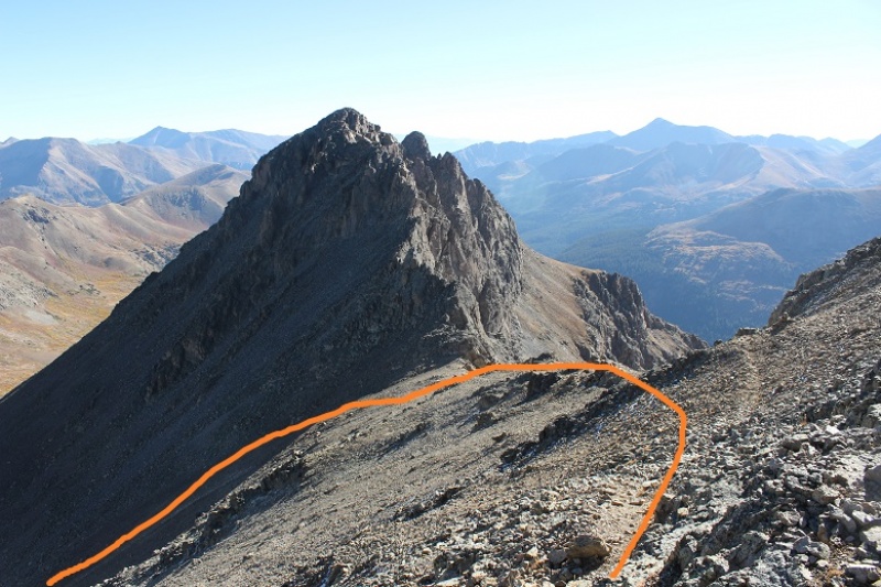
My advice is to aim (right/northeast) for the rocks near the grassy area. The rocks are stable, where nothing in the gully was. I took the gully and had large rocks tumble down from above me and I had to take cover several times (no one else was out there today, these rocks were just free falling from above). Here’s the route I took (as seen from Grizzly).
When you reach the grassy basin your troubles aren’t over yet. There’s more scree to traverse, or you can choose to downclimb rock ledges. I’d had it with the scree, so I downclimbed the class 3 & 4rock (which led to more loose talus)
Here’s a look back at what I downclimbed
And a closer look at the climbing
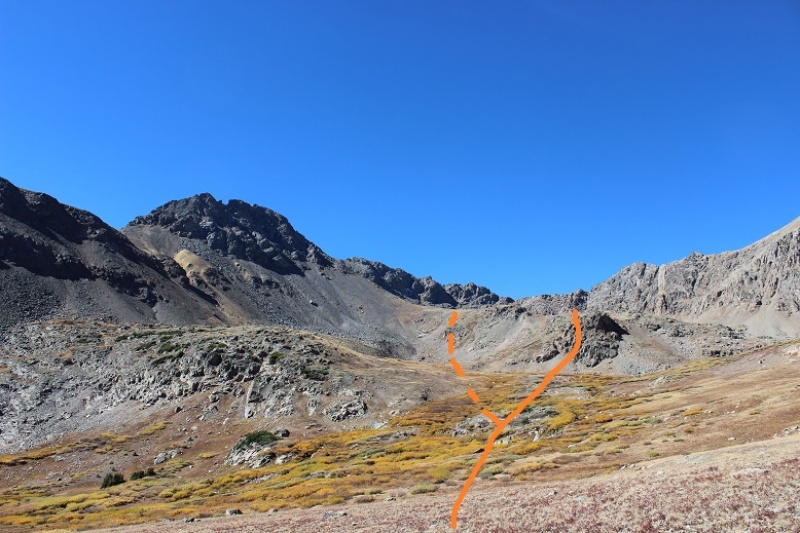
Here’s another look at how I came out of the basin. I took the solid orange line (rocks) over the scree route (dotted)
The good news is after this the hike got really easy! I just crossed the stream and followed the basin back to the mine, where the 4WD road picked back up.
Here’s a look back at the basin
35
I made it back to my truck at 11:30am, making this 8 mile climb in just over 6 hours
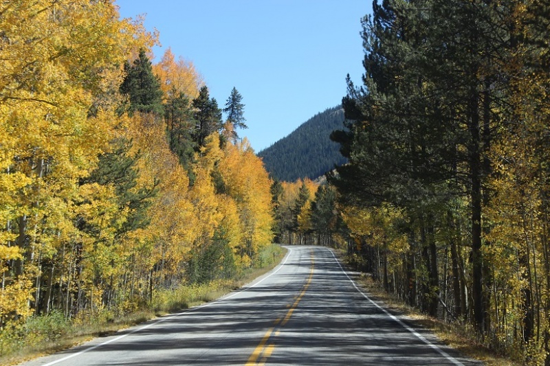
Oh, and the drive home was beautiful!
Thumbnails for uploaded photos (click to open slideshow):
You're making the rounds. Curious how specific a plan for your route you have when you start, i.e. do you have a track you're following or just a general idea?
No track, but more than a general idea 9/23/2018 9:52am
I bring a GPS track loaded onto my phone if there's one available but I don't use it (I have it as a safety net because I think it'd be stupid not to have one when available).
If the route's a class 1-2 I usually look through through guides and maps to get a general idea of the terrain, where I'm supposed to go and what major obstacles to avoid and go from there. I really like using a topo map and compass and figuring things out on my own... its more fun that way! In the beginning it was challenging because I'm type A and like to triple check I'm in the right place but I've learned a lot about route finding and now I trust myself more to just go with it.
If it's a class 3-4 route or above I do all the same things but triple my effort and research, and usually study as many past trip reports as I can find.
I've become accustomed to loading and following a track. It saved my ass on the traverse between Harvard and Columbia when I found myself in a dicey situation and realized I was only about 100 yard off track (when I finally looked).
Bill, I use the .gpx tracks from here often and appreciate those and everything you've put together.
Caution: The information contained in this report may not be accurate and should not be the only resource used in preparation for your climb. Failure to have the necessary experience, physical conditioning, supplies or equipment can result in injury or death. 14ers.com and the author(s) of this report provide no warranties, either express or implied, that the information provided is accurate or reliable. By using the information provided, you agree to indemnify and hold harmless 14ers.com and the report author(s) with respect to any claims and demands against them, including any attorney fees and expenses. Please read the 14ers.com Safety and Disclaimer pages for more information.
Please respect private property: 14ers.com supports the rights of private landowners to determine how and by whom their land will be used. In Colorado, it is your responsibility to determine if land is private and to obtain the appropriate permission before entering the property.


")
")
")
")
")
")
")
")
")
")
")
")
")
")
")
")
")
")
")
")
")
")
")
")
")
")
")
")
")
")
")
")
")
")
")
")