| Report Type | Full |
| Peak(s) |
Jagged Mountain - 13,833 feet |
| Date Posted | 09/09/2019 |
| Modified | 03/24/2023 |
| Date Climbed | 09/03/2019 |
| Author | HikerGuy |
| Additional Members | macgyver, hr011242 |
| Forty Miles for The Finish |
|---|
|
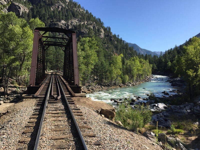
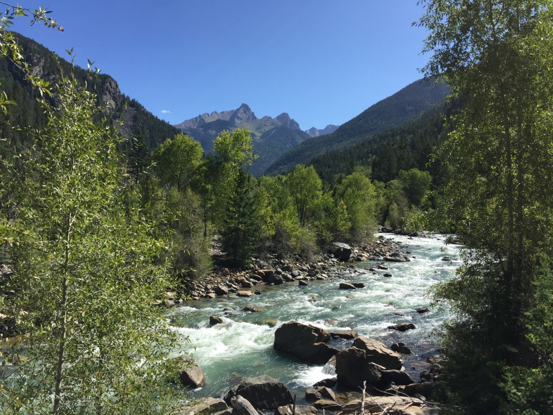
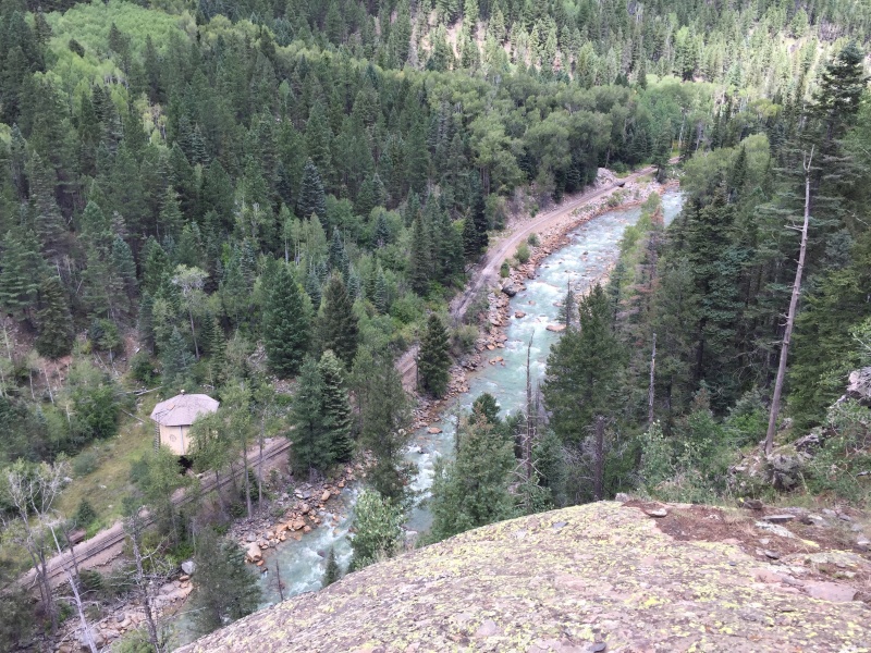
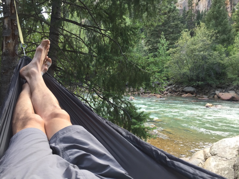
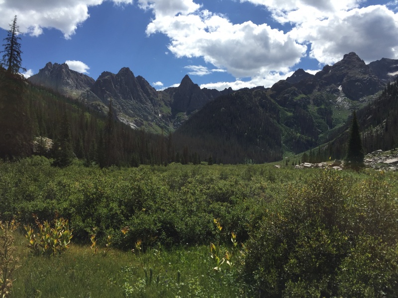
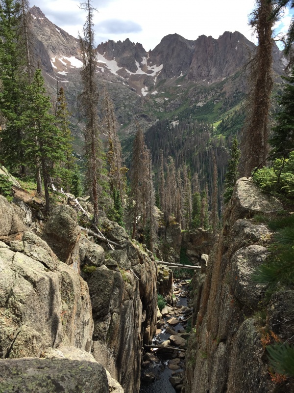
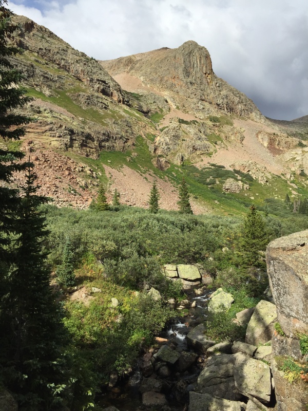
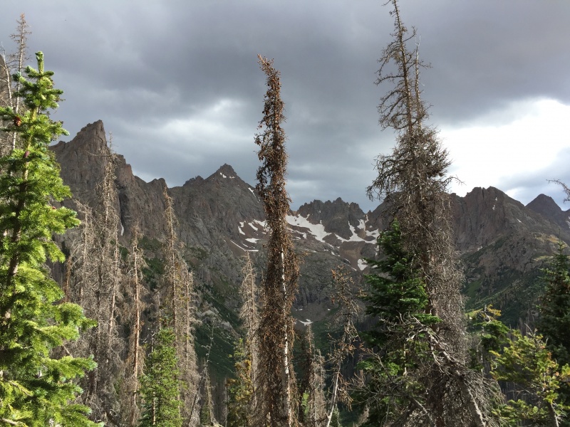
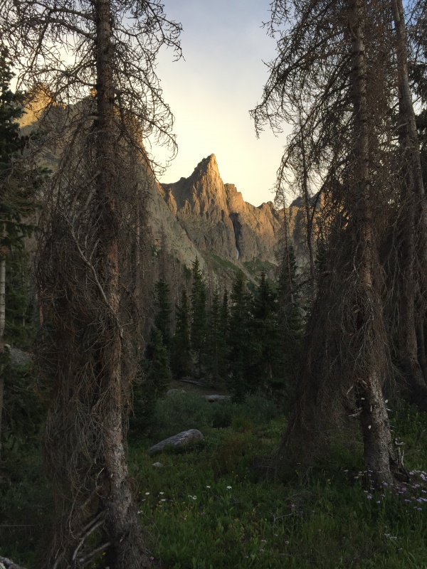
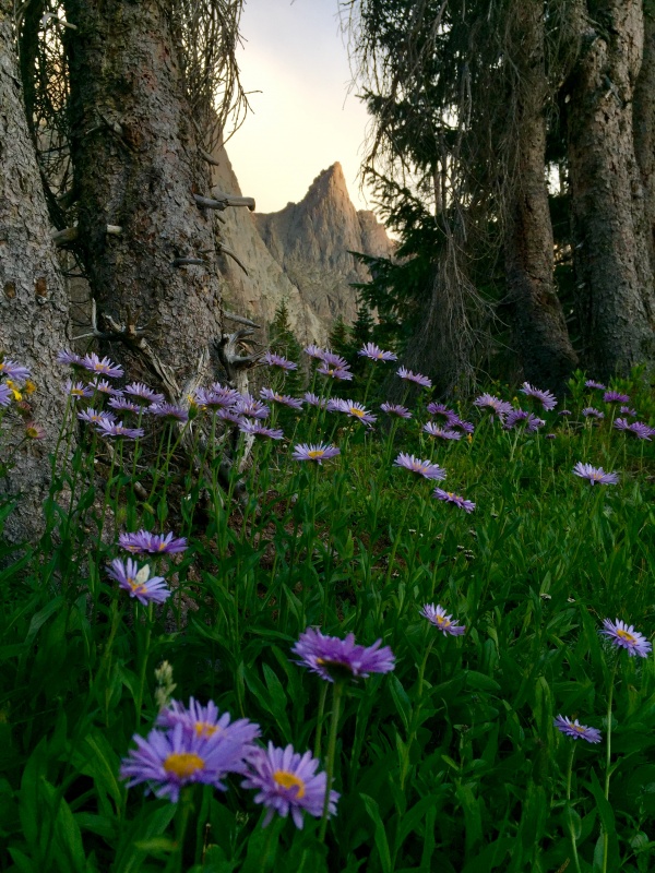
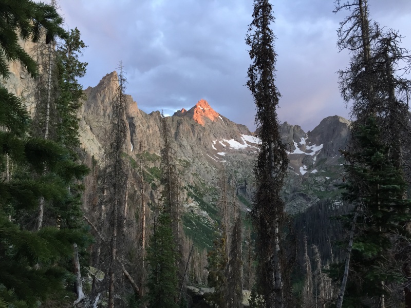
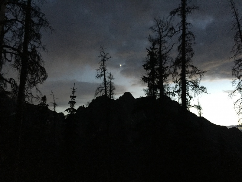
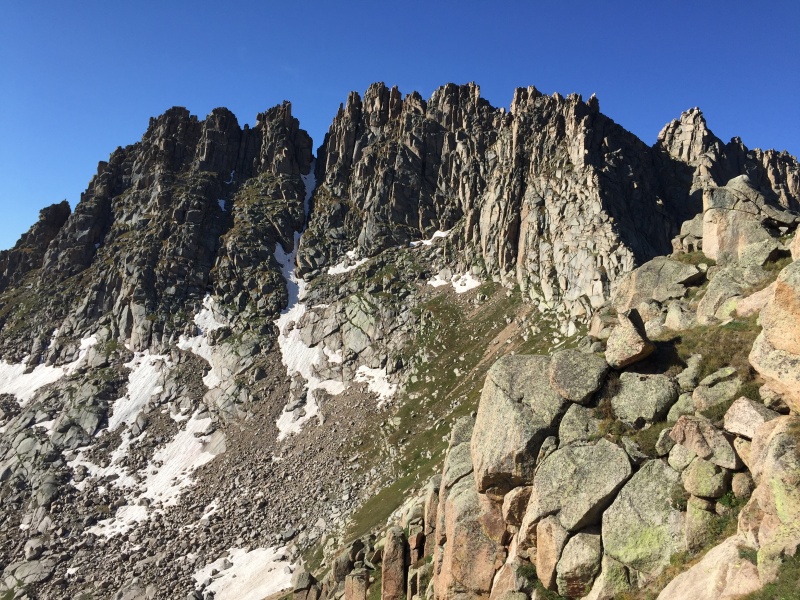
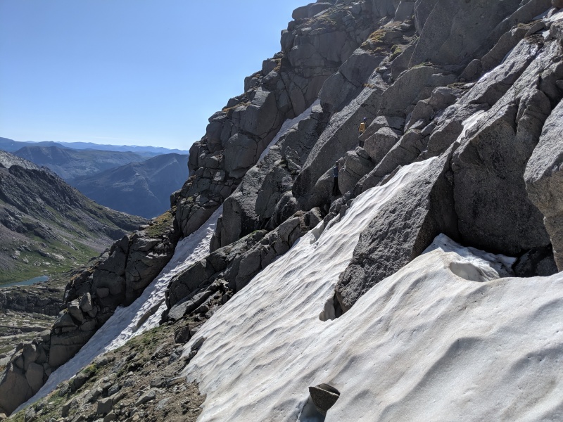
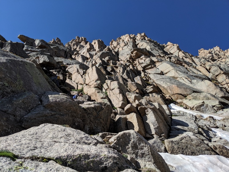
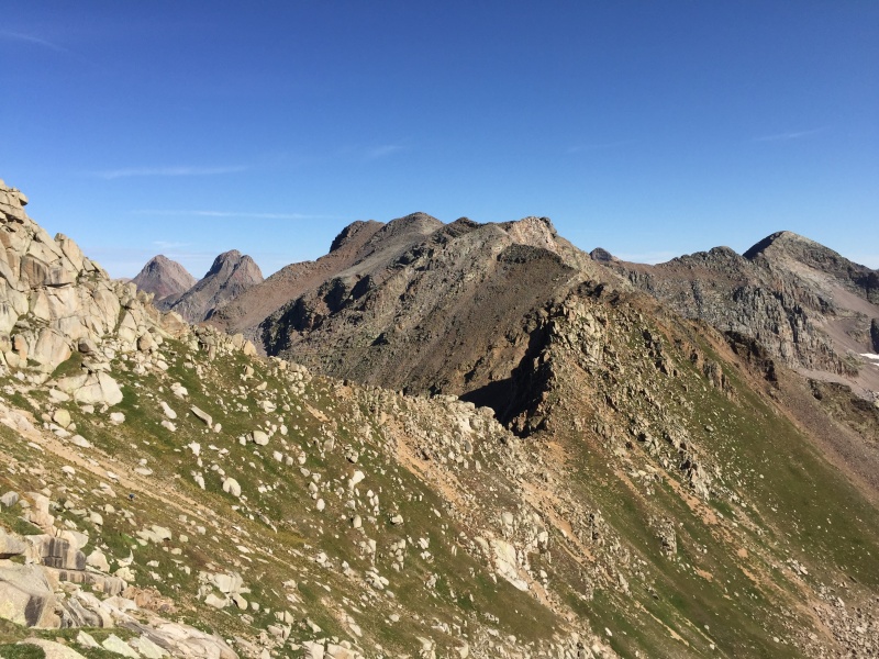
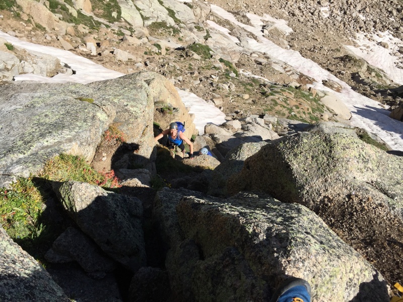
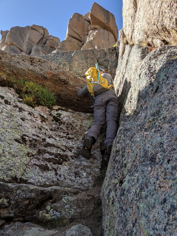
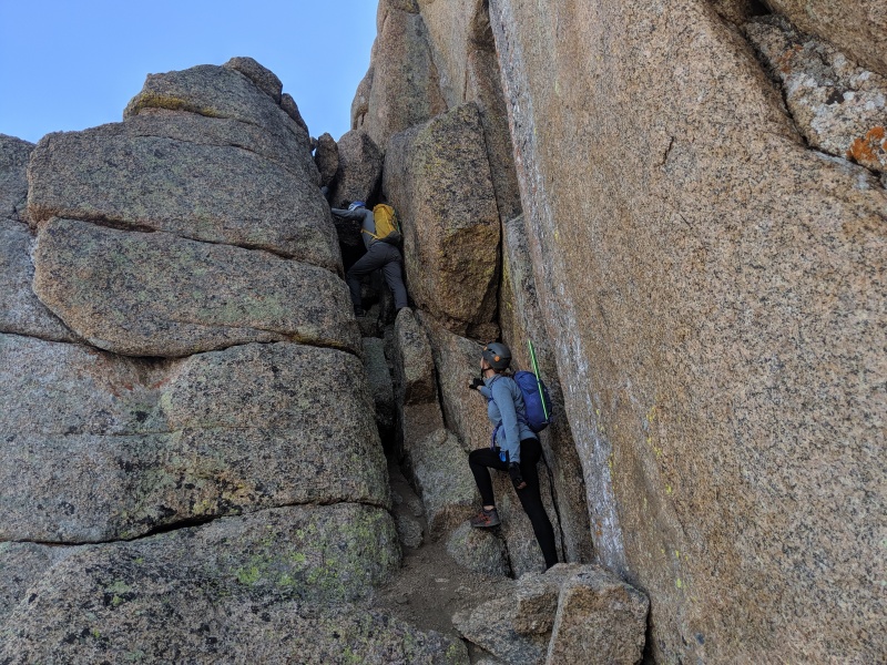
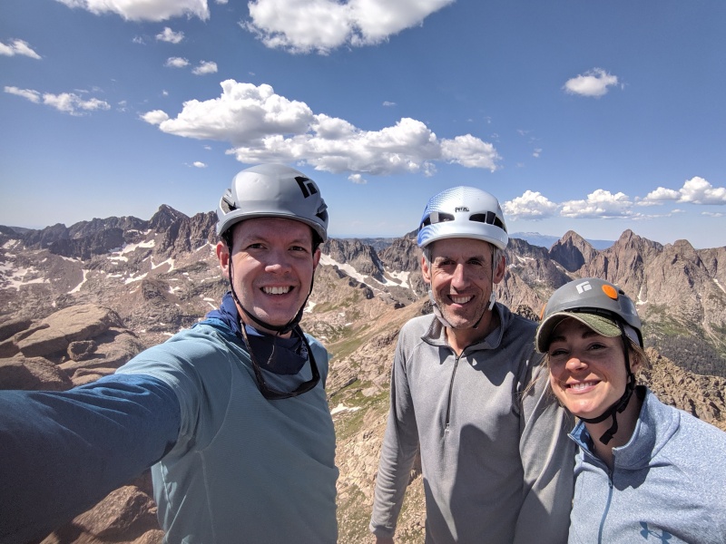
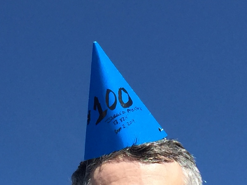
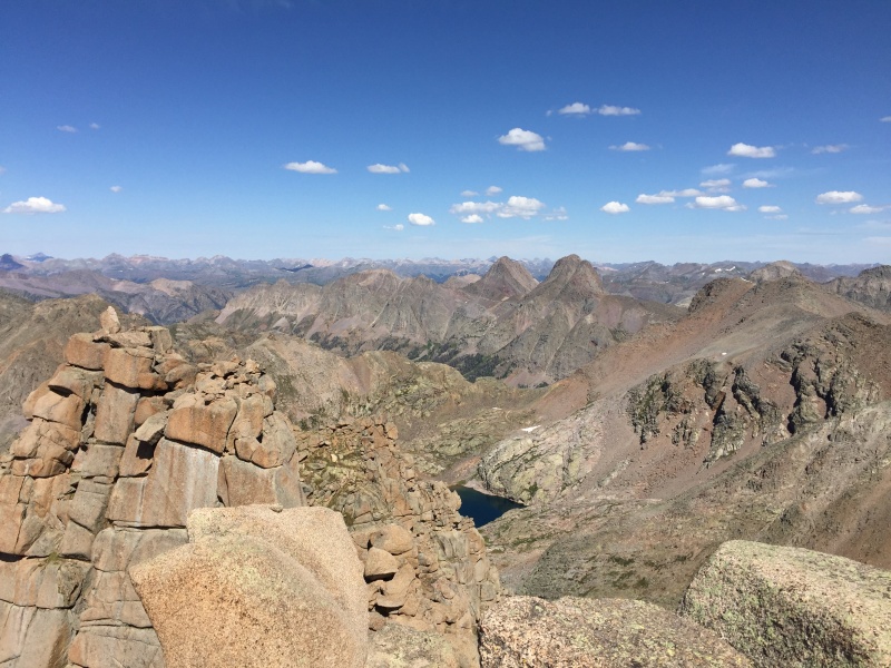
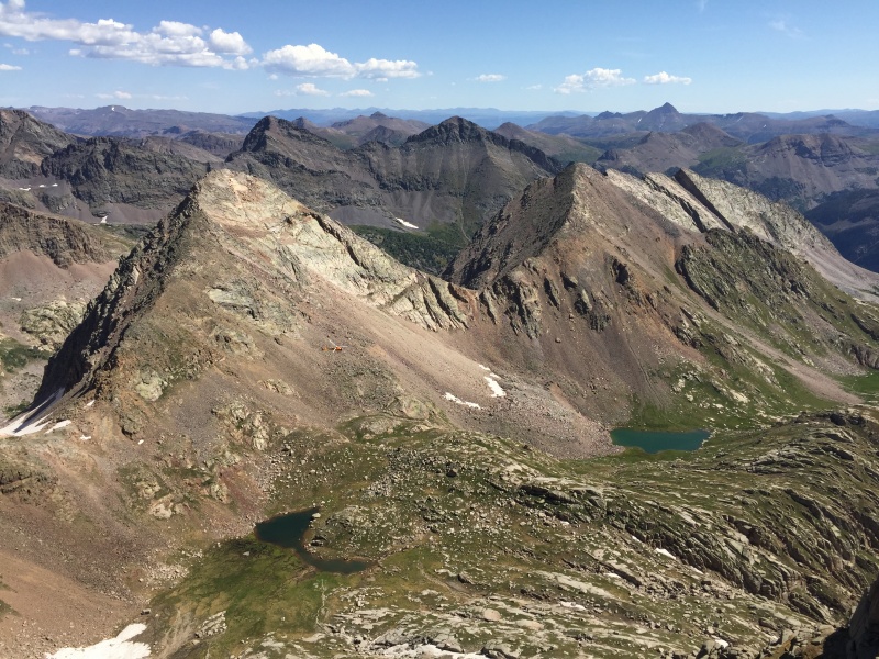
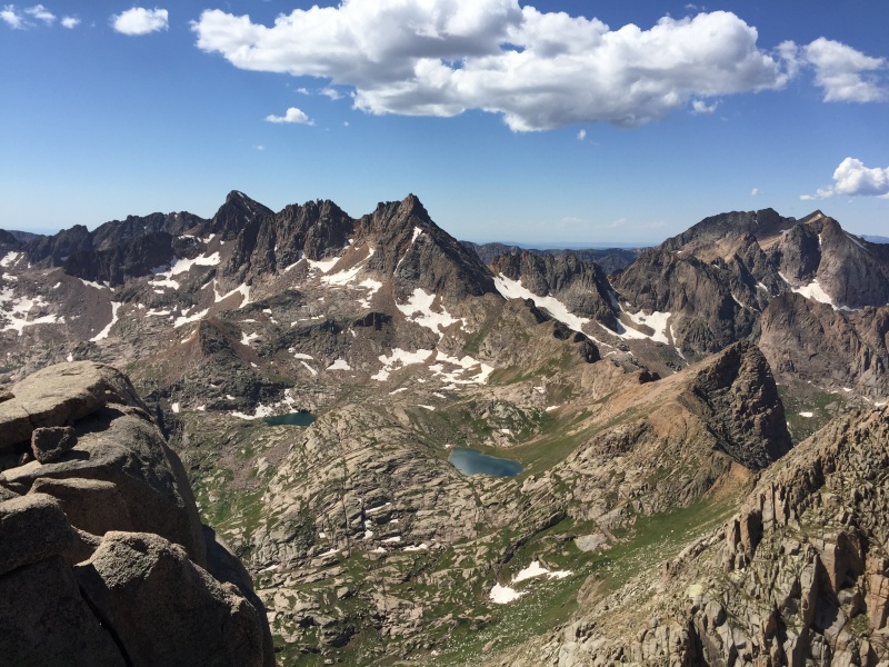
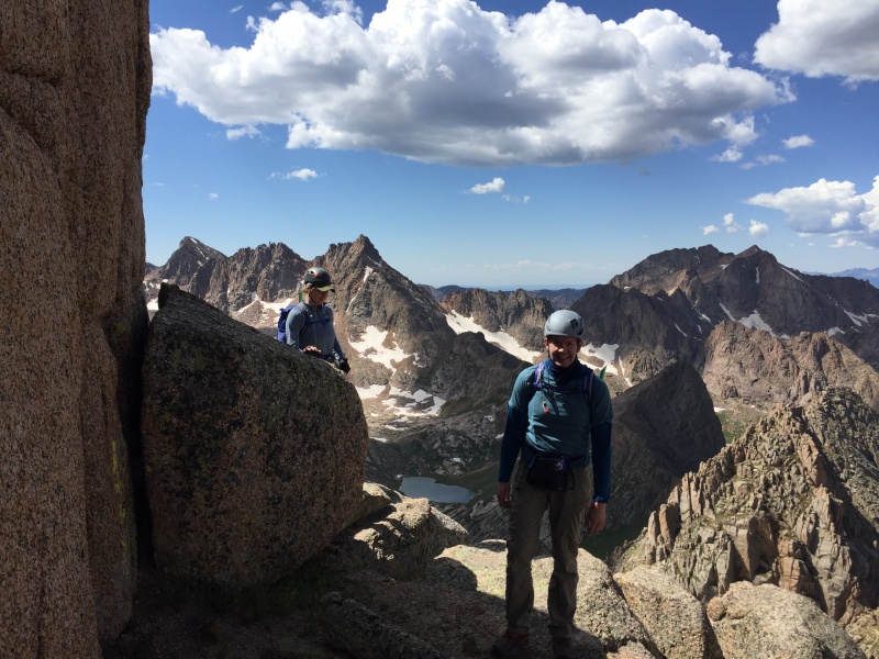
STATS Dates: 9/1/19 to 9/4/19 (4 days, 3 nights) ITINERARY Day 1 - Hiked in from Purgatory and camped at Noname Basin turnoff (5h 40m/12.98 miles) OVERVIEW I completed the 14ers in 2015 after starting in 2005 and had no intention of pursuing another list. Somehow I caught the bug again in May 2018 and decided to go for the Top 100. At the time I had 7 out of 47 completed. Last summer I was able to knock out 34 leaving me 6 to finish this summer. The big snow year changed some plans, but eventually I had whittled the list down to one...Jagged Mountain. Redemption on Dallas Peak a week earlier had me excited to finish up the Centennials. The plan all summer long had been to join up with Rick and Heather. They were going to climb Jagged then move over to Vestal Basin to finish the Top 100 on Wham Ridge (they did! congrats to them!!). Jagged is a peak of many distinctions, one of them being logistics. This mountain is remote and difficult to reach. I'm staunchly anti-train. I love to see the choo choos go by and totally get a kick out of it, but for some reason it doesn't seem right to ride one to approach a peak. Rick and Heather are decidedly pro-train. I settled on the Purgatory-Noname approach after initially considering the Vallecito-Sunlight approach. I was concerned about fording Vallecito Creek and the other option, Beartown, required a tough 4wd approach. The Noname approach would also allow me to hike in from Needleton with my partners. Unfortunately, they had trouble getting a reservation for our original itinerary and that altered my plans (earlier start time for trailhead parking reasons) so I ended up packing in ahead of them meeting up at an 11,800' camp. Normally I would leave Boulder early, drive down to Purgatory, park and pack in during the afternoon. It being Labor Day weekend, I was concerned about finding a parking space at the trailhead. So, I decided to drive down the evening before and sleep in the Santa Fe Inn. That way the day hikers would be gone and hopefully a few folks had packed out and I would get a parking spot. Turned out to be a good call as I got the last parking spot! Or at least the last spot I was comfortable leaving my car at for four days. The next morning I awoke and began the hike down to the Animas River. This is my third time hiking in from Purgatory and I always enjoy it. The water in Cascade Creek is so freaking clear! Then you cross the Animas River and it's a beautiful stroll up to Needleton. The rushing river, grassy meadows, passing trains and distant peaks, just gorgeous. With my altered schedule I did most of my hiking during the cool morning hours and spent my afternoons resting in my hammock. The only notable feature on the hike from Needleton to the Noname Basin turnoff is Water Tank Hill. It is super steep and somewhat loose, but it is also very short. I thought it was overhyped, don't worry about it if you approach this way. I reached my campsite just past the Noname turnoff after about 13 miles. My pack was only 35 pounds, so I was not too tired. I proceeded to make camp and relax the afternoon away. However, I forgot to pack my bug spray and the flies were terrible. Not sure spray works on them anyways. My only respite was swinging in my hammock. I started making my way up Noname Basin the next morning. I noticed that a group had settled in near me during the night. Up until this point, the only people I had seen were train riders headed up Chicago Basin. I chatted them up hoping for some beta on Jagged, but they had only descended Noname after coming from Chicago Basin. However, they did give me good info on the best way to navigate the avalanche debris. A little bit later on I would pass two more hikers who did attempt Jagged, but they never got on route so still no beta. Sounds like they climbed Gray Needle or the prominent point next to Knife Point. They also told me the best way to get through the avalanche area. The easiest way through the avalanche debris is to cross over to the right (south) side of the creek and continue until you are through the slide paths, then cross back over to the left (north) side of the creek to continue on the trail. Btw, the trail up Noname is excellent. Once past the the slides, I arrived at Jagged Cabin. I wasn't expecting much, but I was expecting more, there is not much left. This is where the views started to become impressive. Upper Noname is easily in my top 5 basins, fighting it out with Ruby for the top spot. The last steep section prior to 11,800 was brutal. I had enjoyed cool morning hiking until this point and now it was full sun, no shade and no breeze. When I topped out and saw the nice camping area, I was done. It's a nifty campsite with a small gorge off to the side and 360 degrees of peaks. Once again I ended up spending the afternoon swinging in my hammock, this time it was mosquitos. Rick and Heather showed up at sunset, wiped out from their heavy packs. We agreed on an easy start time and went to bed. Summit day! After a leisurely start we made our way up to Jagged Pass. Well, sort of. The trail is still surprisingly good with some helpful cairns along the way. For some reason, I wandered straight instead of veering slightly right to what is obviously Jagged Pass and we ascended the north saddle. Doh!! Not only was it looser, but it was an extra 200' feet of gain. We didn't lose much time though and the view of Jagged's north face was even more impressive from our accidental perch. After a short fun little scramble over to the real Jagged Pass, we were back on route and ready to climb. Rather than describe the climb in detail, check out the photos and captions below. We each soloed all of the cruxes. We downclimbed the summit chimney and made three rappels with a 60 meter rope. Jagged is a fantastic mountain! I said goodbye to Rick and Heather when we got back below Jagged Pass. They headed towards Balsam Lake on their way to Vestal and I headed back down, packed up camp and descended back to the Animas River. I managed to make camp and finish dinner as the sun set. The hike back out to Purgatory was uneventful. I only wish I could say the same for the drive home on I-70. I swear I am done with that road. What's up next? The Bicentennials, 25 down, 75 to go! DAY 1 - Pack to Noname Basin turnoff 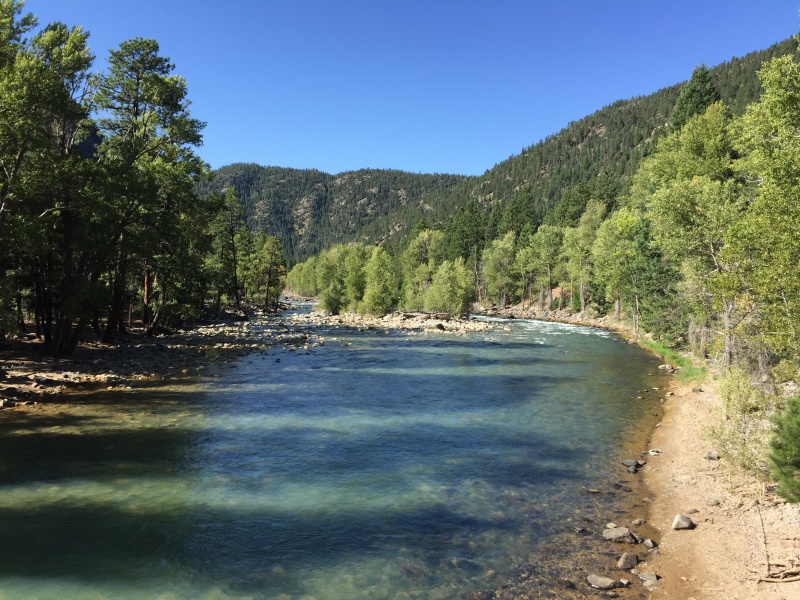

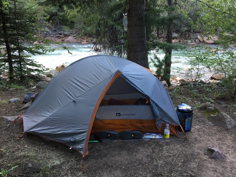
DAY 2 - Pack up to 11,800 in upper Noname Basin 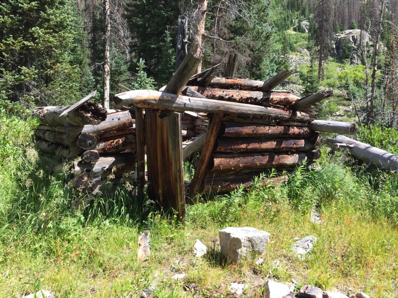

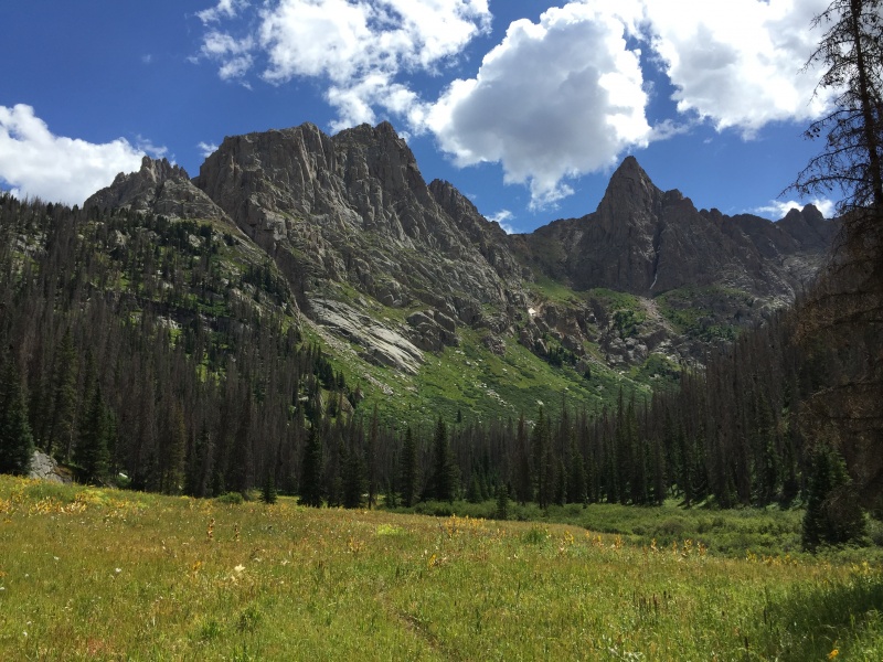


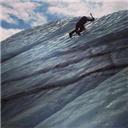
DAY 3 - Summit and return to Noname Basin turnoff 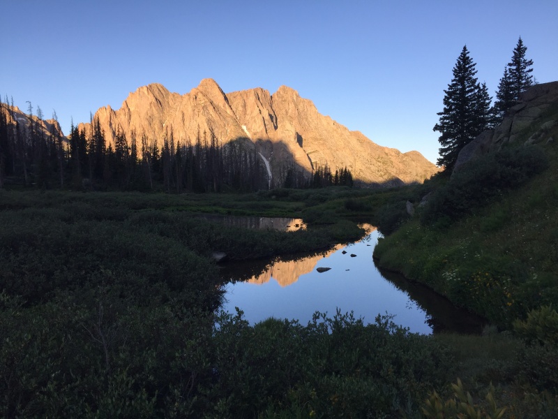
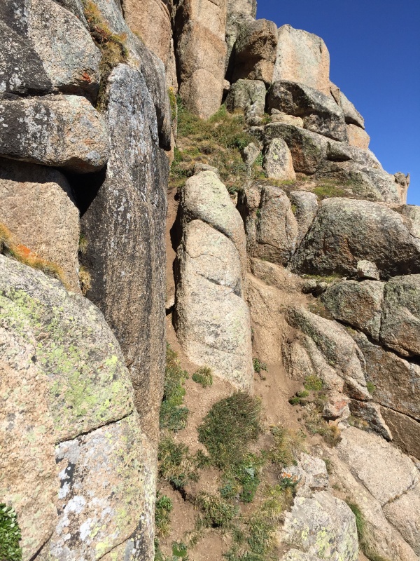
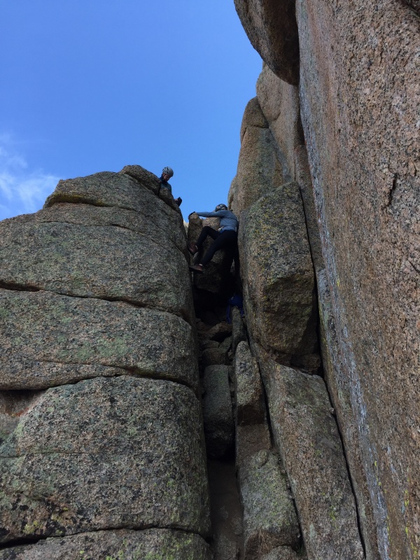
at a bypass of sorts. The rappel drops down/over to the immediate left of this photo (out of frame). 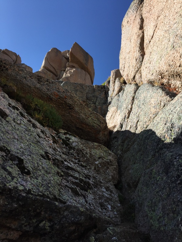
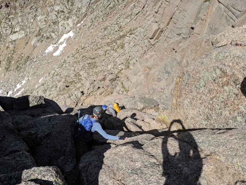
are up or down past the rock blocking easy passage. We did have to take our packs off, but they were easily handed up and down from one person to another. (photo by Rick Howell). 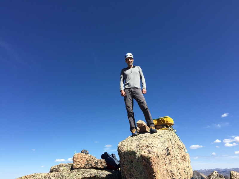


DAY 4 - Pack out to Purgatory TH 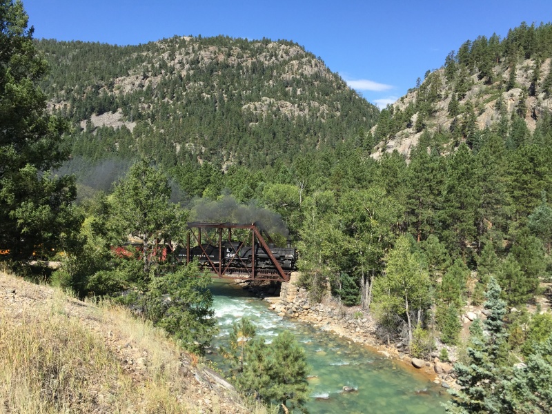
Thumbnails for uploaded photos (click to open slideshow): ")
")
")
")
")
")
")
")
")
")
")
")
")
")
")
")
")
")
")
")
")
")
")
")
")
")
")
")
")
")
")
")
")
")
")
")
")
")
")
")
")
")
")
")
|
| Comments or Questions | ||||||
|---|---|---|---|---|---|---|
|
Caution: The information contained in this report may not be accurate and should not be the only resource used in preparation for your climb. Failure to have the necessary experience, physical conditioning, supplies or equipment can result in injury or death. 14ers.com and the author(s) of this report provide no warranties, either express or implied, that the information provided is accurate or reliable. By using the information provided, you agree to indemnify and hold harmless 14ers.com and the report author(s) with respect to any claims and demands against them, including any attorney fees and expenses. Please read the 14ers.com Safety and Disclaimer pages for more information.
Please respect private property: 14ers.com supports the rights of private landowners to determine how and by whom their land will be used. In Colorado, it is your responsibility to determine if land is private and to obtain the appropriate permission before entering the property.