Download Agreement, Release, and Acknowledgement of Risk:
You (the person requesting this file download) fully understand mountain climbing ("Activity") involves risks and dangers of serious bodily injury, including permanent disability, paralysis, and death ("Risks") and you fully accept and assume all such risks and all responsibility for losses, costs, and damages you incur as a result of your participation in this Activity.
You acknowledge that information in the file you have chosen to download may not be accurate and may contain errors. You agree to assume all risks when using this information and agree to release and discharge 14ers.com, 14ers Inc. and the author(s) of such information (collectively, the "Released Parties").
You hereby discharge the Released Parties from all damages, actions, claims and liabilities of any nature, specifically including, but not limited to, damages, actions, claims and liabilities arising from or related to the negligence of the Released Parties. You further agree to indemnify, hold harmless and defend 14ers.com, 14ers Inc. and each of the other Released Parties from and against any loss, damage, liability and expense, including costs and attorney fees, incurred by 14ers.com, 14ers Inc. or any of the other Released Parties as a result of you using information provided on the 14ers.com or 14ers Inc. websites.
You have read this agreement, fully understand its terms and intend it to be a complete and unconditional release of all liability to the greatest extent allowed by law and agree that if any portion of this agreement is held to be invalid the balance, notwithstanding, shall continue in full force and effect.
By clicking "OK" you agree to these terms. If you DO NOT agree, click "Cancel"...
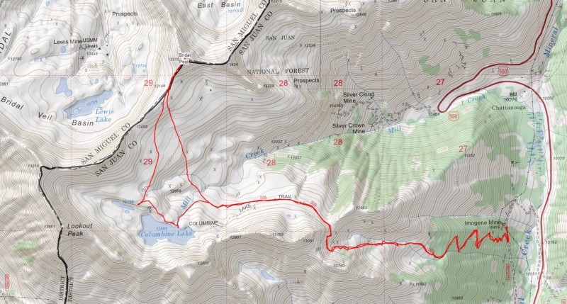
Bridal Peak aka “T 11” (13,510', Colorado #250) Dates: 27 August 2019 Climbers: Mark and Hoot Trailhead: Imogene Mine on FR 820 (Columbine Lake Trailhead) Distance: 8.7 miles Elevation gain: ~3100' Difficulty: Mostly Class 1 with a little easy Class 2 below the summit
After a fun climb of bicentennial Lookout Peak to start off the day, Mark and I headed to our next objective, tricentennial Bridal Peak, just 1.32 miles north of Lookout. As the direct route did not look practical, we drove back down Ophir Pass Road, headed a little north on US 550 and then pulled off onto FR 820 where we stopped for an early lunch and a change of gear. I decided to wear trail runners for my first time on a Colorado 13er. As soon as we started driving up FR 820 paralleling 550, we ran into a ginormous snowball filled with trees sitting completely across the road. We sure didn’t expect that at the end of August! A look up and across 550 revealed the snow came from a big avalanche that ran across 550 in the spring. (US 550 between Ouray and Silverton was closed for 19 days this past March due to deep snow and many avalanches across the highway.)
A quick check of the map showed an alternative approach to the Imogene Mine from where FR820 connects with Ophir Pass Road about 0.4 miles in from 550. We followed narrow but not too rough FR820 north from Ophir Pass Road for less than a mile to the Imogene Mine where we parked in one of the few remaining spots on the side of the road. We started hiking at 11:30 am under a beautiful blue and clear sky. From where we parked near the mine, we walked about 500 feet back down the road to a short cutoff spur just above were the Columbine Lake Trail starts at the road. The trailhead is easy to miss if you are not looking for it.
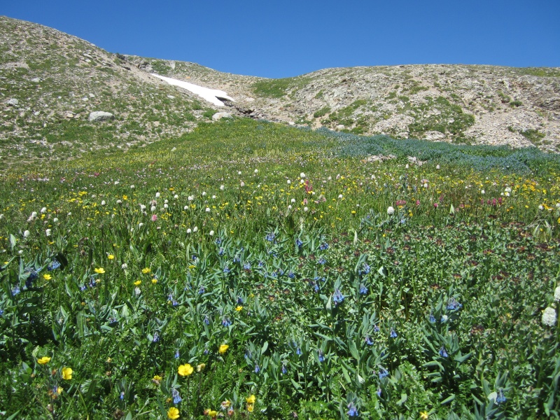
The well-traveled Columbine Lake Trail begins with a bunch of switchbacks that climb through the trees. We quickly climbed 1200’ before reaching treeline and a beautiful flower-filled alpine basin.
Columbine Lake Trail above the trees and switchbacks
We continued on a good trail through a minor saddle and then entered the Mill Creek drainage with Columbine Lake on its upper south side and Bridal Peak on its north side.
Looking back to the east provided a nice view of the Grenadiers and Wham Ridge
Mark and I passed a dozen or so hikers and one intrepid mountain biker on their way back down from the lake.
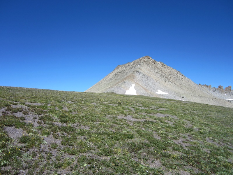
Our first view of Bridal from the trail (leftmost peak)
At about 12,520’ we left the trail a little short of Columbine Lake and continued hiking north down across Mill Creek and then up toward Bridal’s southwest ridge.
Our off-trail route across the Mill Creek drainage to Bridal’s southwest ridge
The beautiful basin was filled with wild flowers and an occasional cairn along our route.
On route to a weakness through the small cliff band below the ridgeLots of flora ...... and even some fauna
As we climbed, our view south toward Lookout Peak further justified our decision not to try hiking from Lookout to Bridal.
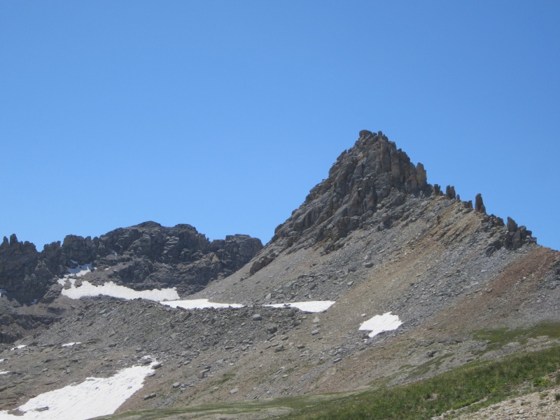
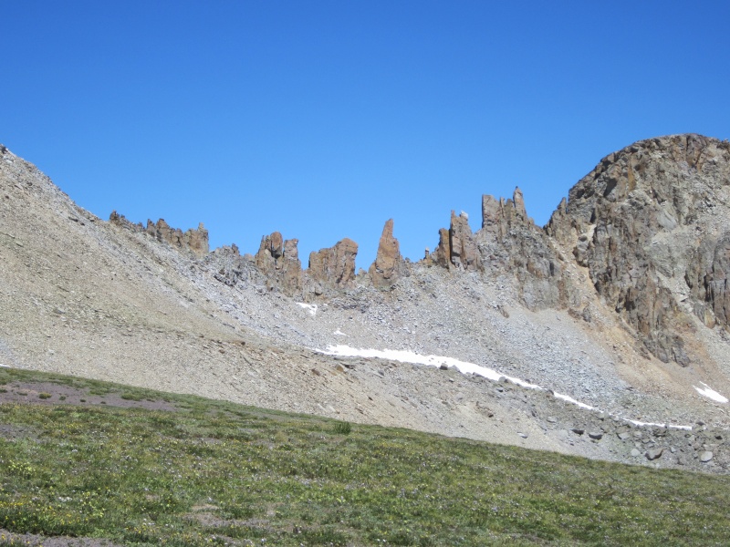
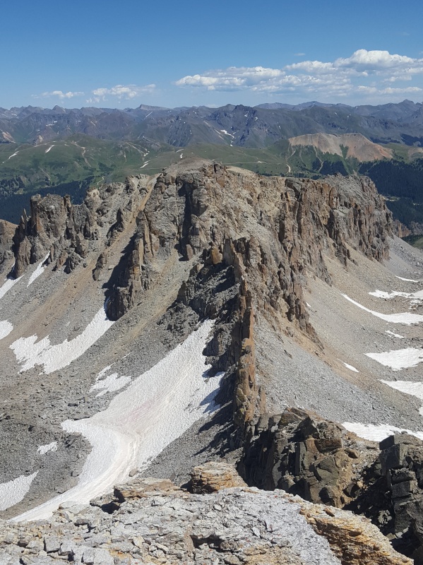
Lookout Peak on the left and a difficult ridge toward “T 12” (not visible) on the rightApproaching Bridal Peak and its southwest ridgeBridal’s jagged east ridge
We gained Bridal’s southwest ridge above its 13,058’ saddle with “T 12” and climbed about 300 feet up easy talus to Bridal’s broad 13,510’ summit.
Bridal’s easy Class 2 southwest ridge
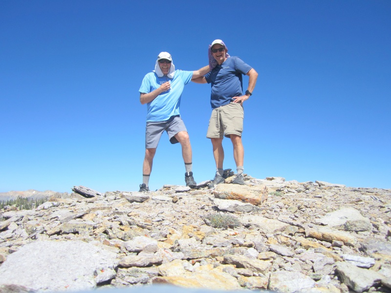
Mark and I reached the summit a little before 2:30 pm, about 2 hours and 50 minutes from the trailhead.
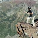
Mark and me on Bridal Peak’s broad summit
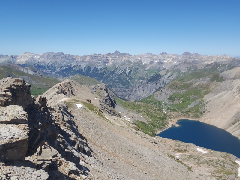
Bridal’s summit under clear skies provided amazing 360-degree views, easily among the best views I’ve had from any Colorado peak.
Looking west over Lewis Lake toward the Wilsons and Lizard HeadLooking northwest over Blue Lake toward TellurideLooking east at Bridal’s narrow jagged east ridgeLooking south toward Columbine Lake
We enjoyed Bridal’s summit for quite a while. The weather was gorgeous. On our way back down we couldn’t resist the draw of a closer view of Columbine Lake. Once below the ridge, we followed a gradually descending route toward the west end of Columbine Lake.
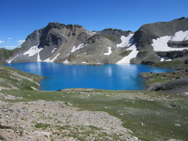
Columbine Lake from the northwest
We then descended along the lake’s north side crossing its Mill Creek outlet to reach the lake’s edge.
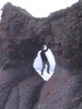
Despite its reflected bright blue color, Columbine Lake’s water was very clear
Surveying Lookout’s north face and east ridge from the lake did not reveal any likely routes for descending off Lookout to the north. The most likely route would be to scramble along Lookout’s northwest ridge toward “T 12” (13,614) and then descend the slopes east of “T 12” toward Columbine Lake, ideally on good snow.
Lookout Peak (center) from Columbine Lake
After enjoying the lake and talking with another hiker, we headed back down the Columbine Lake Trail, quickly rejoining our ascent route. We got back to the Imogene Mine at 5:38 pm after hiking just over five hours. The relatively easy climb of Bridal Peak turned out to be the most enjoyable hike of the ten peaks I climbed during my Colorado visit. Whether or not you have any interest in climbing Bridal, I highly recommend the hike up to Columbine Lake - in trail runners!
Bridal Peak Topo
My GPS Tracks on Google Maps (made from a .GPX file upload):
That lake is amazing! Now I want to go back and repeat this one, it was frozen when I did Bridal.
Caution: The information contained in this report may not be accurate and should not be the only resource used in preparation for your climb. Failure to have the necessary experience, physical conditioning, supplies or equipment can result in injury or death. 14ers.com and the author(s) of this report provide no warranties, either express or implied, that the information provided is accurate or reliable. By using the information provided, you agree to indemnify and hold harmless 14ers.com and the report author(s) with respect to any claims and demands against them, including any attorney fees and expenses. Please read the 14ers.com Safety and Disclaimer pages for more information.
Please respect private property: 14ers.com supports the rights of private landowners to determine how and by whom their land will be used. In Colorado, it is your responsibility to determine if land is private and to obtain the appropriate permission before entering the property.


")
")
")
")
")
")
")
")
")
")
")
")
")
")
")
")
")
")
")
")