| Report Type | Full |
| Peak(s) |
Unnamed 13350 - 13,350 feet Unnamed 13323 - 13,323 feet "Mt. SoSo" - 13,421 feet Irving Peak - 13,216 feet "North Irving" - 13,017 feet Unnamed 13058 - 13,058 feet Mt. Oso - 13,689 feet Unnamed 13144 - 13,144 feet "Weminuche Peak" - 13,240 feet Point 12,961 |
| Date Posted | 12/14/2020 |
| Modified | 12/15/2020 |
| Date Climbed | 07/12/2020 |
| Author | supranihilest |
| Additional Members | Garrett, whileyh |
| Eight Days in the Weminuche, Days 1-3: The BIG Rocks of Rock Creek | ||||||
|---|---|---|---|---|---|---|
Table of ContentsIntro and Full Trip Statistics When Garrett invited Whiley and I on a planned nine day backpacking trip into the Weminuche Wilderness to climb the thirteeners of Rock Lake, then move across the Vallecito Creek to Sunlight Lake and climb Jagged Mountain, among other peaks, we of course had to say yes. Planning commenced, and on such a big trip there were details to work out like how many days would we be in there? Which trailhead would we start at? Which peaks would would we want or need rock climbing gear for? Jagged was the obvious big one, but there were other possible technical climbs in Sunlight Creek that we could do. The details slowly got worked out, and since I now live out of a van the climbing gear question was easily answered: show up at the trailhead with everything I have and we'll sort it out there, which is exactly what we did. Everything else was more easily answered with a "bring whatever makes you comfortable." Comfortable for a planned ten day backpack in Colorado's largest and most rugged wilderness, that is, which basically is a meaningless metric since we'd all be suffering under huge packs regardless. Of our planned ten days we ultimately did eight and only orphaned two unranked peaks, so we were very efficient overall. We met up the night before our official departure and drove up to Stony Pass. Or, well, tried to. I got 90% of the way there and then the 4x4 system on my Sprinter went kaput, making a horrendous screeching noise whenever it was engaged. This thing is less than a year old so that shouldn't happen. With the 4x4 disabled we limped it back down to Silverton in 2WD, which fortunately worked fine. I was worried about the van, given that I wouldn't have otherwise had any issue getting to Beartown, or at least close. I slept fitfully that night, opting to make my final go/no go decision in the morning. My decision, of course, was go. Over the course of the trip we did all of the things. Since people like seeing big numbers, here you go, getchu some statz. Number of days: 8 Friday, July 10, 2020: Day 1 - Approach from Beartown to Rock Lake We slept down low near Silverton then drove back up and over Stony Pass in the morning, then to Beartown and Hunchback Pass Trailhead. At the trailhead we sorted out group gear and repacked, then donned our massively overweight packs, replete with nine days of food and climbing gear for Jagged Mountain, and began trudging up the pass. 
The trail to the pass is rather pleasant and goes at a low angle, though it mattered little with my 60+ pound pack on. I was going slower than molasses and Garrett and Whiley quickly pulled ahead. 


When I reached the pass Garrett and Whiley said they were going to leave their packs and climb Hunchback Peak, an easy thirteener off the pass. I told them to go ahead, I'd continue on towards Rock Creek as they were way faster and could catch up. 

I headed down alone, plodding along slowly and enjoying the scenery. I passed the trail to Nebo Creek and then copious deadfall began to cover the trail. Sometimes there were bypasses around the downed trees and sometimes they required scrambling over top, which wasn't all that fun with the heavy pack. A few people were going up the drainage and one fellow told me that a trail crew was coming up from Vallecito and clearing the trees as they went, but the deadfall went all the way to Rock Creek. We never saw evidence of any trail crew, even over a week later as we went back to Beartown. Go figure. 
My two compatriots met up with me near the Rock Creek turn off and then once again went ahead. Along the way we scoped out the end of the Peters traverse which we'd climb later in the week. 
It was hotter than hell and we were all moving slow, but the peaks around us were magnificent. We could only see a few of the Rock Creek peaks we'd be climbing but what we could see were all something else. 

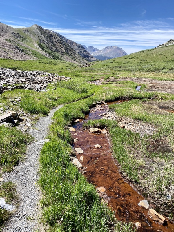
The last couple of miles on the trail felt like they took hours. The heat was incredibly oppressive but I knew we'd reach the lake soon. The trail got steep and switchbacked for a short while, and I came across a marker the other two had left so I would find camp a short distance off the trail on top of a small bench overlooking the valley but below the lake. They'd already setup their tent and I quickly established my own camp a bit away and began shoving my face with calories, thankful the torturous approach was over. It was mid-afternoon and the approach had taken us most of the day. All three of us were tired but we had an agenda to stick to so we went to bed early to try and get rest for what was to come. 
Day 1 StatisticsClimbers: Ben Feinstein (myself), Whiley H., Garrett M. Splits: no splits for the first five days, as all data on my watch was corrupted. Summary data and GPX tracks are courtesy of Whiley. Day 2 - A "SoSo" Day: "Mount SoSo", Irving, and Unnamed Thirteeners Despite the awful brutality of the previous day we were up early. There were peaks to climb. Our goals for today were to climb the six peaks west and south of (and including) Mount Oso. These would end up being the farthest peaks from our camp on this segment of the trip, as well as the biggest overall day of the trip. We were up early and on the trail to Rock Lake and eventually the pass to the south, which would take us into Lake Creek drainage (as always, a very creative name). There's a good trail up what otherwise looks like it would be a pretty tough hump to the pass. 

Once on the pass we continued on the trail dropping about 1,000 feet past Half Moon Lake and then Moon Lake, which we contoured around the west side of on talus. 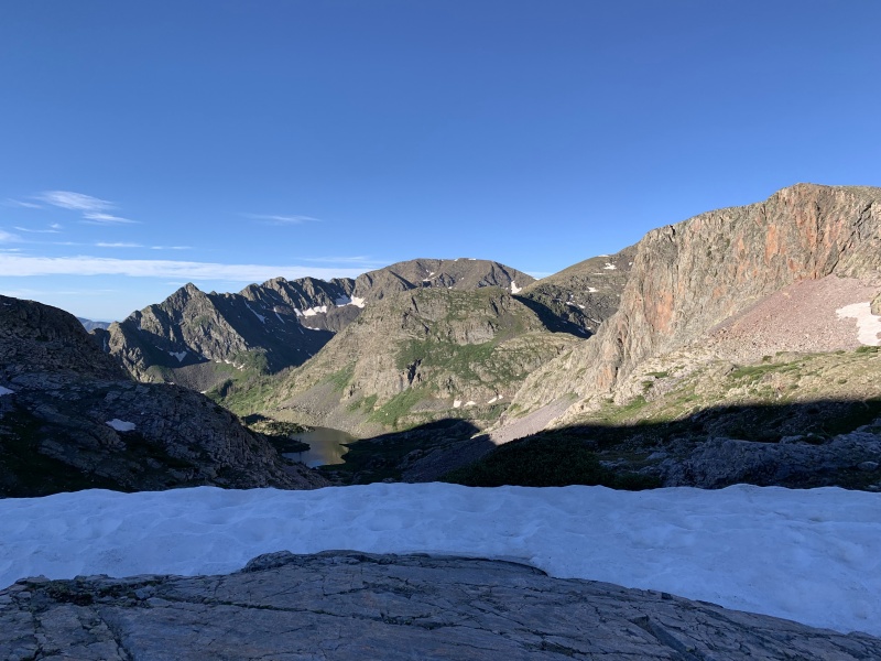
From Moon Lake we went south-southeast, then southwest into a high, unnamed basin. The western wall of the basin consisted of the three peaks we'd do from here: Point 13,340 B, Point 13,310, and "Mount SoSo" (south to north). There was a short bushwhack from the bottom of the basin to treeline, and then things opened up. 

We crossed the basin and the route to the 13,340 B/13,310 saddle became obvious: ascend a set of grass, dirt, and talus ramps to climber's right of the saddle, which still had snow (we weren't sure if we'd have to make a short climb over top of it), and then easy grass slopes to each peak. We were able to walk around the lingering snow and from there made quick ascents up both peaks. 

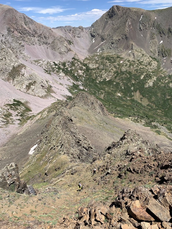
From the summit of 13,310 the ridge to "SoSo" wasn't clear. The far side ascending to "SoSo"'s summit ridge looked steep and scrambly but 13,310's north ridge was hidden. Our other option besides the ridge was to drop back into the basin and head over to "SoSo"'s east ridge, which looked like a walkup from our position. We didn't want to lose and re-gain the elevation in the basin, so we started down the eastern side of the ridge, which was a steep slope of incredibly loose talus with a cliff at the bottom. 
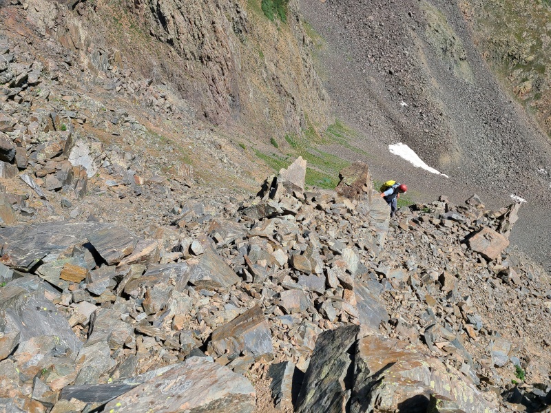
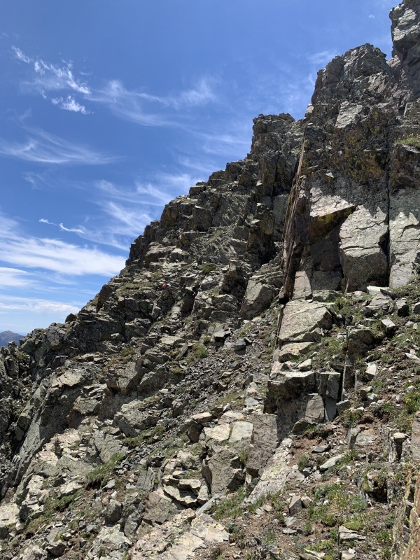
The slope quickly went from Class 2 to Class 3, and absolutely nothing could be trusted. We were aiming for a ledge that traversed over towards the saddle, but after descending about 200 feet Whiley and I didn't want to take the risk anymore. We were right above the cliff and with everything shifting we figured we'd rather just take the elevation loss and re-gain, so that's exactly what we did. We reascended and then switchbacked down ledges into the basin while Garrett continued towards the saddle. He said the rock didn't improve until he was near the saddle and then the ascent up "SoSo" went at "hard Class 4". Meanwhile Whiley and I had an easy time getting into and across the basin and then had a blast climbing up "SoSo"'s east ridge, which actually turned out to be a super fun Class 3 scramble on jagged, and more importantly solid rock. It was reminiscent of parts of the Sangre and was an absolute delight, not to mention far safer than the 13,310/"SoSo" connecting ridge. 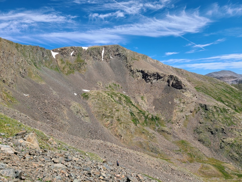

The extra elevation was worth it for "SoSo"'s spectacular east ridge, and it barely took us longer than it took Garrett to get to the summit - only about ten minutes more. We lounged for a few minutes to collect some energy, since we'd already had a huge day and it was brutally hot once again, before dropping north towards the Oso/"SoSo" saddle. This down climb was very similar to the 13,310/"SoSo" down climb, in that it was steep, exposed, and loose, but it was also shorter and there was at least some solid rock. It was mostly Class 3 down climbing with a couple of Class 4 moves traversing across a ledge in an inset gully. Exposure was highest here, and the feet were questionable, but the handholds were solid, thankfully. 
A hundred or so feet of down climbing took us to gentler, talus-laden slopes and then to the Oso/"SoSo" saddle. We turned west and picked our way down a massive talus slope that led into Irving Lake basin. As tedious as it was it was a walk in the park compared to the previous scrambles. 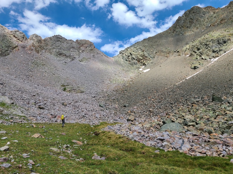
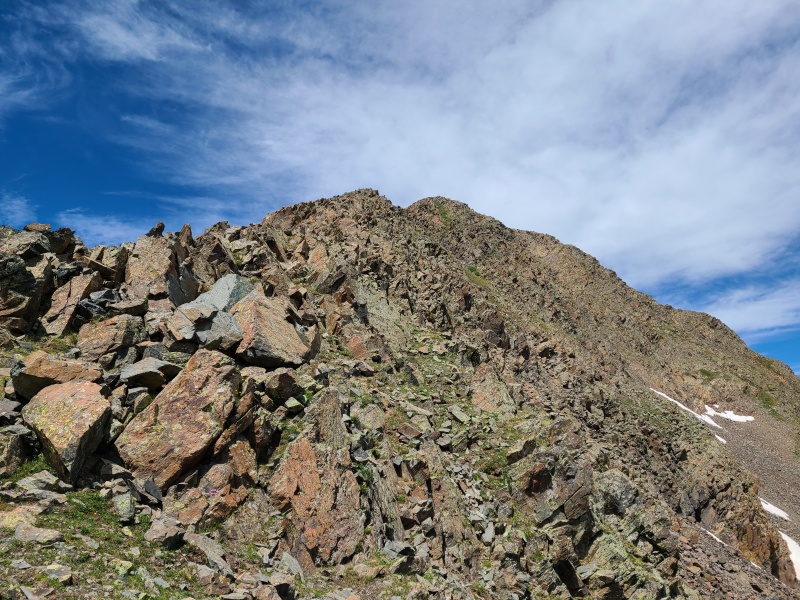
We made a high traverse across the basin to avoid losing elevation. Irving's northeast ridge was our goal. 
Most of the traverse consisted of stable talus and steep grassy rollers. Irving's northeast ridge looked juicy from afar and only got better as we got closer. 
We started up the ridge, which was a mix of good scrambling on what seemed like a mix of granite and quartzite interspersed with easy, interconnected gullies. 
Most of the scrambling was Class 2+ or Class 3, though harder rock lurked nearby if one wanted it. 
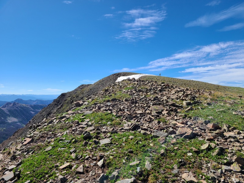
The ridge was all too short and soon we were on the summit ridge. I wished the scrambling would have just kept going and going. Irving was just a short talus hop away, and before we knew it we were done with peak number four for the day. 

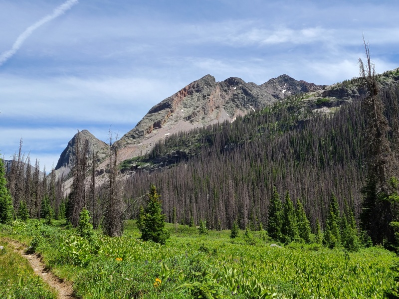
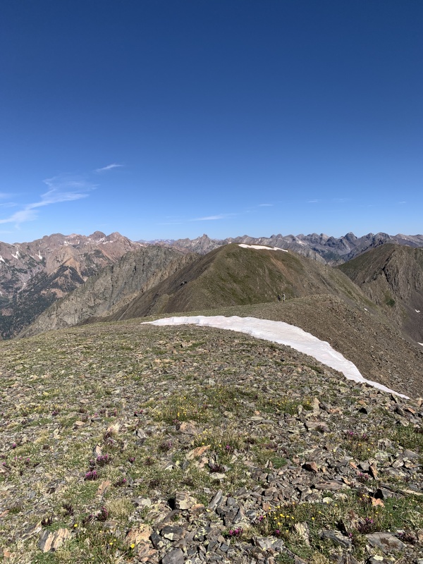
From Irving Peak, poised on the eastern side of the Vallecito Creek's massive valley, the views were immaculate. This was only my third time to the Weminuche, and my first to the heart of the wilderness in nearly four years. The Weminuche never disappoints. 
By now it was nearly 2:20pm. There was only one more peak to go, albiet an easy one, but we still had to go back up and over the Oso/SoSo saddle and then drop down and reascend to the pass near Rock Lake, which would account for close to 2,000 more feet of gain, all told. We returned to where Irving's northeast ridge joins the Irving/"North Irving" connecting ridge and then to "North Irving", which was a simple and uninspiring walkup. 

Though soft-ranked Point 13,030 was nearby we just didn't have the energy to navigate what looked like a difficult ridge, so we left it behind. We still had tons of work to do to get to camp so we began to descend once again. Instead of taking our ascent ridge back to the basin we took a set of steep and not altogether pleasant gullies down. While there was no scrambling of note in these particular gullies the usual loose garbage appeared again. Care was taken to not turn them into a luge, as both gullies went and both gullies sucked. 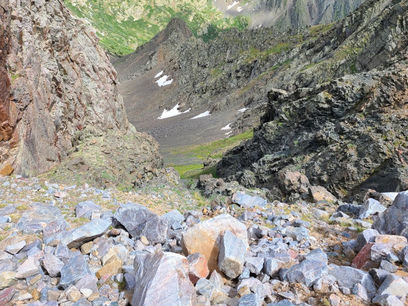


The long, ascending traverse across the basin felt like it took forever, and the afternoon heat was absolutely crushing. The combined effect of these two days plus their heat was beating us to a pulp. We opted to skip Oso for the day, knowing that it would completely wreck us if we tried to tack it on at the very end, so we made our way back to the saddle. We reached the bottom of the talus and steeled ourselves for the ascent. We ascended more stable black rock on the right side of the talus cone, which was steep enough to go at Class 2+. What seemed like an hour later, but was only a short amount of time, we found ourselves huffing on top of the saddle. The route back to our camp could go one of two ways: descend east into the basin and take broad slopes past Point 13,060 C (an unranked thirteener we would climb the next day), a route which we didn't know if it would connect or not, or descend even farther back to the trail that goes past the Moon Lakes and take that back to camp. We chose the former, as it was far more direct, and we hoped to gain beta on a more efficient route to Point 13,060 C and Mount Oso for the following day. 
This of course necessitated another drop on more loose talus and then further re-gain back to the pass. This talus was stable, and it went quickly, and we raced across the basin. We attempted to skirt right around a bulbous dome on a wide ledge that eventually cliffed out, so we went back around and went above the pass. This was all Class 2 off-trail hiking and led us close enough to the trail that we were able to pick it up and hike back down to Rock Lake, where we threw ourselves in our tents and began chugging water and inhaling food as fast as we possibly could. We were exhausted and every drop and calorie counted. It was well into the evening by now and we turned in early after gorging ourselves. It had been a massive day and a massive success, and there were many more of both to come! Day 2 StatisticsClimbers: Ben Feinstein (myself), Whiley H., Garrett M.
Splits: no splits for the first five days, as all data on my watch was corrupted. Summary data and GPX tracks are courtesy of Whiley. Sunday, July 12, 2020: Day 3 - Mount Oso to "Weminuche Peak" (Plus Bonus Twelver) We woke up early again today, despite having an easier day planned. We wanted to beat what could either be insane heat in the afternoon, or thunderstorms. Perhaps both, if we were unlucky. We quickly ascended to the pass and instead of dropping towards the Moon Lakes like we did yesterday we took a hard right and went up easy, grass-and-boulder slopes towards unranked Point 13,060 C. 

Along the way we found a neat fault. Garrett, being a geologist, explained its formation. I don't think I'll ever cease to be amazed by geology! 
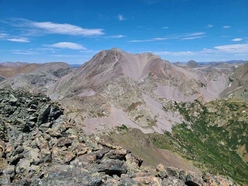
The rock on Point 13,060 C was quite good, though there was no scrambling. It mostly consisted of solid quartzite, a preview for when we'd climb the Peters Traverse the next day. 13,060 C itself wasn't much to write home about but like most Weminuche peaks it had excellent views of the surrounding area. 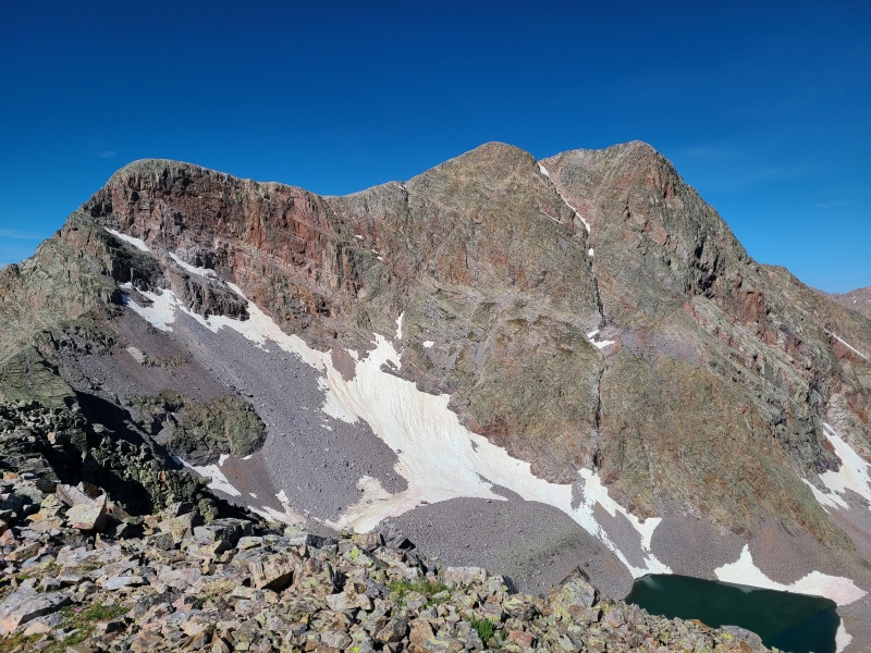

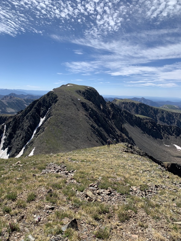
Our route off 13,060 C consisted of a steep but easy slope down into the basin, and instead of heading towards the Oso/"SoSo" saddle we noticed a talus gully higher up Oso's south ridge which looked like it would give us access to the upper mountain. 

To get to this gully we traversed across an open talus slope, which was somewhat loose, and then scrambled right up the gully at Class 2+ish. 
We skirted the snow capping the gully and then had access to the upper mountain. From "SoSo" it looked like a purely Class 2 talus hop up Oso, but we found ourselves scrambling on Class 3 rock of questionable quality, sometimes the kind of rock-and-dirt sandwich that leaves you wondering if any of the holds you're using are actually attached to anything. 


A few hundred feet of semi-sustained scrambling took us to the summit blob, which I call a blob because it wasn't really a ridge nor a plateau, but kind of a mix of both. 
Faint trails through the talus led us to the summit of Mount Oso, which had an ammo box for a register. The register was dedicated to Abel Palmer, who was killed in an avalanche near Silverton in 2018. 

Clouds were beginning to build so we stayed long enough to read some of the tributes to Abel, then began our descent. This time we found a loose Class 2 gully to take down instead of the scramble, and then traversed across relatively stable talus and over some improbable looking ribs (Class 2+) to the Oso/"SoSo" saddle. Though farther it was far less steep than the gully we ascended and would probably be just as fast while being safer. 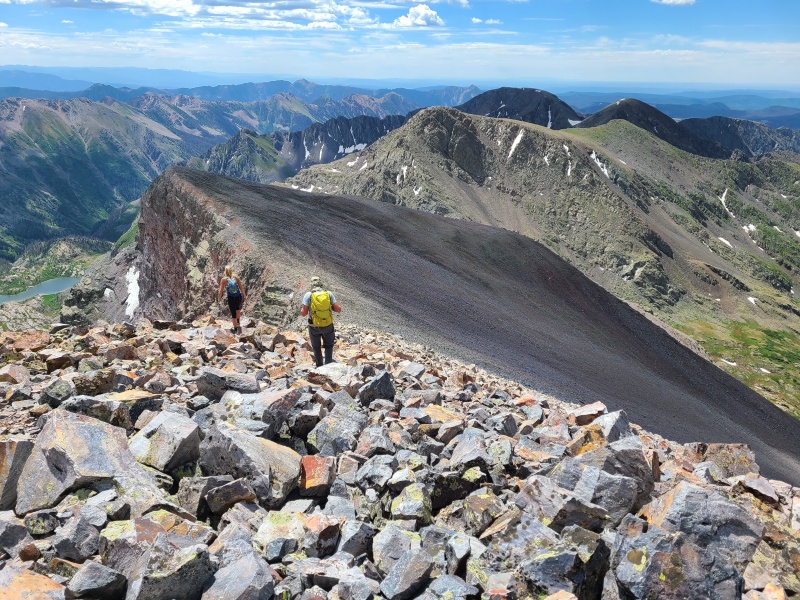


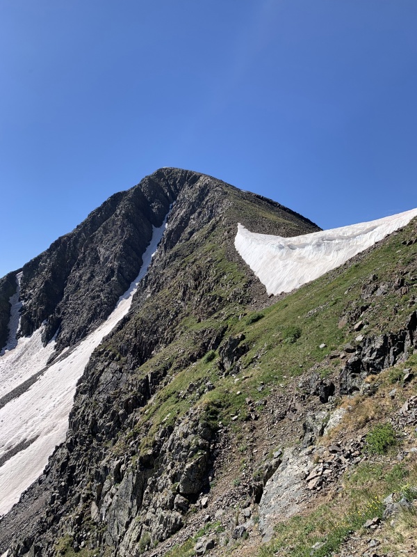
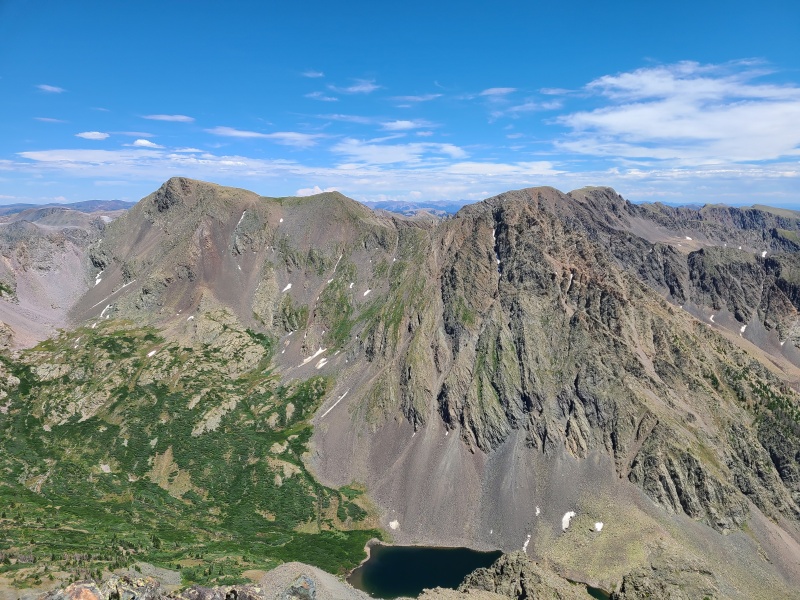
We reversed yesterday's route down and across the basin, then up and around the dome and back to the pass. The rain had ceased by this point but the dark clouds remained, looking ominous. We figured we had time for 13,140 C and "Weminuche Peak" if we went quickly. Instead of taking the direct west ridge, which looked like an awful mess, we took a route that skirted 13,140 C's south side. There was still a large, rock hard cornice on the south side of the pass that necessitated a 10-foot Class 3 down climb, and then we traversed around the bowl to a saddle with loose, gray rock. 

From the saddle we ascended straight up 13,140 C's south slopes, which was nothing more than steep Class 2 talus. 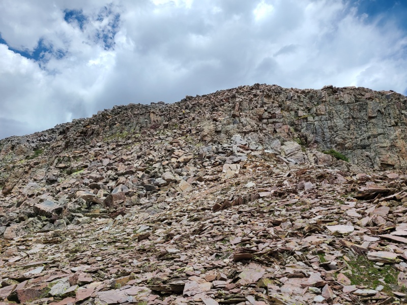

Things were getting darker by the minute so we immediately scooted over to "Weminuche Peak", which was a simple down-and-up on talus. 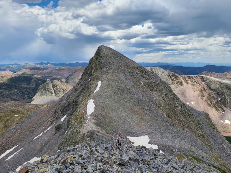


Whiley wanted one more peak - Point 12,961, a (barely) ranked twelver - so we descended back to the bowl between "Weminuche" and 13,140 C and traversed under the latter back to the gray rock saddle. From this saddle a direct south line on more talus took us to 12,961's unexciting summit. Hey, at least we got it, and it's a high twelver too! A final trip back to the gray rock saddle and a traverse across the bowl led us once again to the snow, which we stemmed up against rock this time. 
Our return to camp was uneventful and we once again stuffed ourselves. No doubt we still weren't getting enough calories for our level of expenditure. We planned to do the Peters Traverse - Peters Peak, Point 13,222 A, and "P 3" through "P 1" the next day, so we had to eat what we could. And boy, what a truly amazing traverse Peters was! Day 3 StatisticsClimbers: Ben Feinstein (myself), Whiley H., Garrett M.
Splits: no splits for the first five days, as all data on my watch was corrupted. Summary data and GPX tracks are courtesy of Whiley. Version history:
Thumbnails for uploaded photos (click to open slideshow): ")
")
")
")
")
")
")
")
")
")
")
")
")
")
")
")
")
")
")
")
")
")
")
")
")
")
")
")
")
")
")
")
")
")
")
")
")
")
")
")
")
")
")
")
")
")
")
")
")
")
")
")
")
")
")
")
")
")
")
")
")
")
")
")
")
")
")
")
")
")
")
")
")
")
")
|
| Comments or Questions | |||||||||||||||||||||||||||
|---|---|---|---|---|---|---|---|---|---|---|---|---|---|---|---|---|---|---|---|---|---|---|---|---|---|---|---|
|
Caution: The information contained in this report may not be accurate and should not be the only resource used in preparation for your climb. Failure to have the necessary experience, physical conditioning, supplies or equipment can result in injury or death. 14ers.com and the author(s) of this report provide no warranties, either express or implied, that the information provided is accurate or reliable. By using the information provided, you agree to indemnify and hold harmless 14ers.com and the report author(s) with respect to any claims and demands against them, including any attorney fees and expenses. Please read the 14ers.com Safety and Disclaimer pages for more information.
Please respect private property: 14ers.com supports the rights of private landowners to determine how and by whom their land will be used. In Colorado, it is your responsibility to determine if land is private and to obtain the appropriate permission before entering the property.