| Report Type | Full |
| Peak(s) |
El Diente Peak - 14,175 feet Mt. Wilson - 14,256 feet Wilson Peak - 14,021 feet |
| Date Posted | 08/12/2020 |
| Date Climbed | 08/08/2020 |
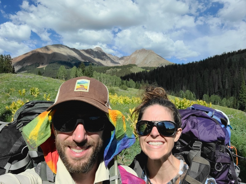
| Author | little_castaldo |
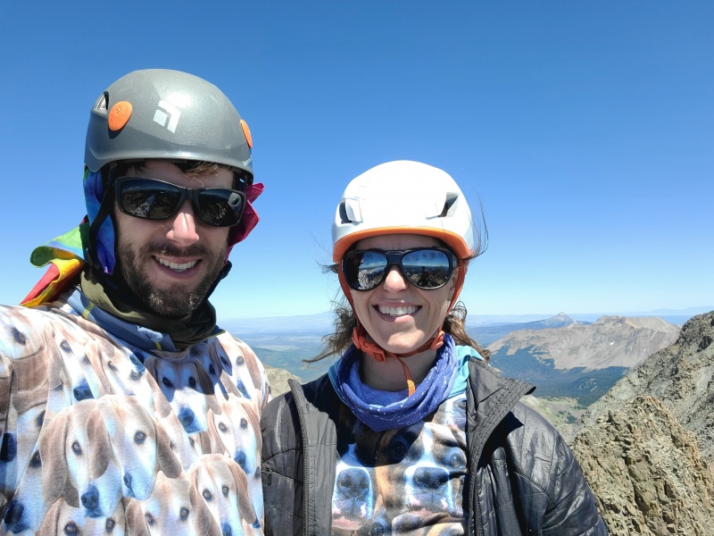
| Additional Members | joemcglinchy |
| Wilson Group including North Buttress and Traverse, from Navajo Lake |
|---|
|
Wilson Group Backpacking Trip 8/5/20-8/9/20 Partner: Joe McG (joemcglinchy) Approach: Navajo Lake Trail Base Camp: East Navajo Lake Peaks: El Diente Peak via North Buttress, Mount Wilson via Traverse from El Diente and descent via North Slopes, and Wilson Peak via Southwest Ridge Rocks: Tertiary San Juan Formation, Silverton Volcanic Group, Microgranogabbro, Granodiorite, and Porphyritic adamellite; ~3-30 million years old Mileage: 23.9 miles Gain: 8471ft Hiking Time: 27 hours 15 minutes Gear: 85L backpack for approach, 22L backpack for summits, helmet, microspikes, poles, rain gear, 2-person tent, bear cannister, hammock Food: Clif Bloks, nuun tablets, snickers, Sour Patch Kids, Trader Joe's Summer Sausage, beef stroganoff, kathmandu curry, chicken gumbo, breakfast skillet, kodiak cakes maple and brown sugar protein oatmeal, backpacking smoked salmon, two coors light tall boys (8/5 we drove from Denver to Gunnison and got some Zzzs at the Sherpa Western Inn) Day One 8/6: The Approach We left Gunnison at around 4am and made our way down past Telluride and up into the Lizard Head WIlderness. We parked at the Navajo Lake Trailhead and started hiking a little after 8am (at least I did...Joe napped for a quick 20 minutes to give me a head start). 


After an hour, I found a rock suitable for eating, and Joe caught up with me. 
The trail was a gentle slope and very pleasant until the last half mile to gain the lake. 

It was now time to find a campsite and set up "base camp." We opted to go around to the East side of the lake to reduce mileage on summit days...and to get away from the "crowds" of maybe 5-6 groups (really not that bad, although there was a rumor that a party of 12 was lurking somewhere...). 
Day Two 8/7: A Grand Traverse We left camp the next morning a little after 4:30am. Breakfast was protein oatmeal...it was actually pretty tasty and filling. 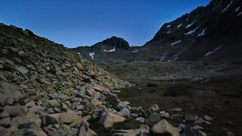
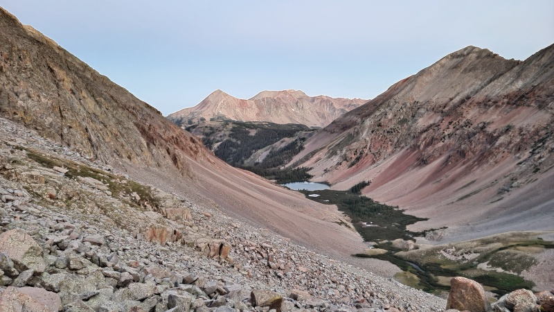
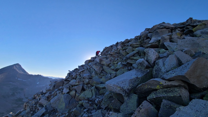
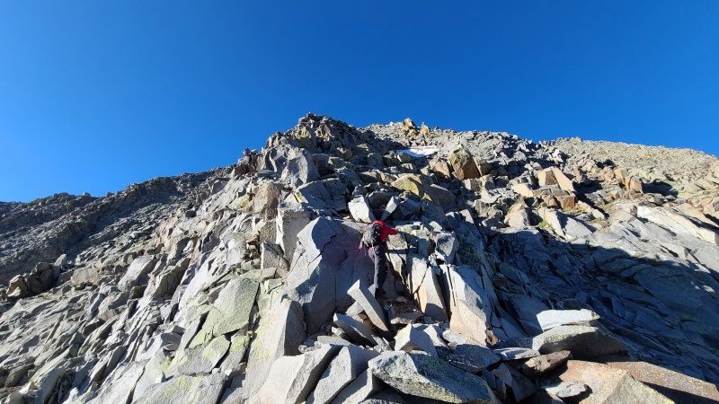
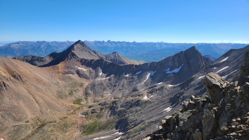
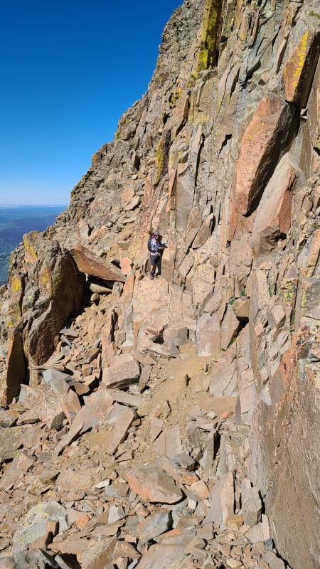
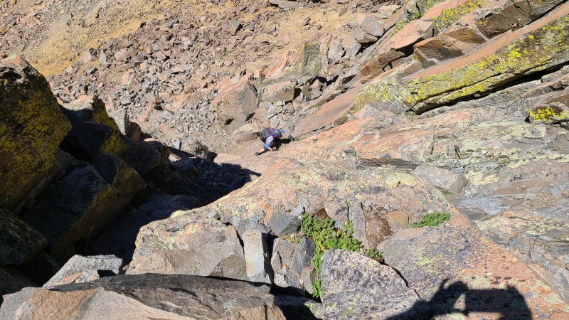
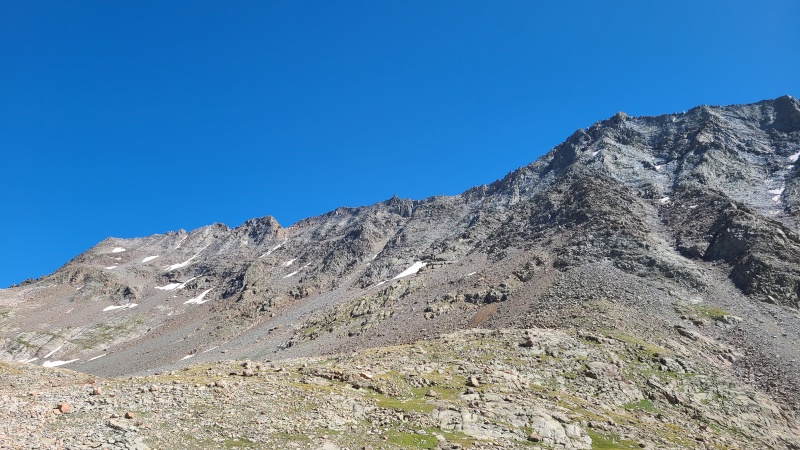
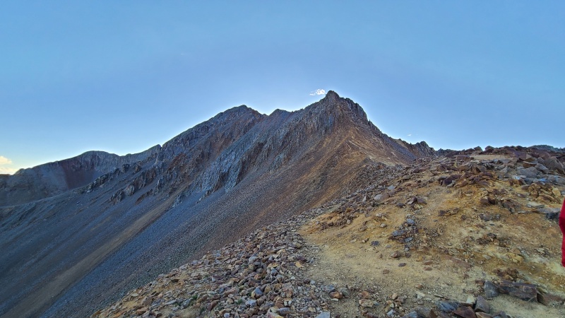
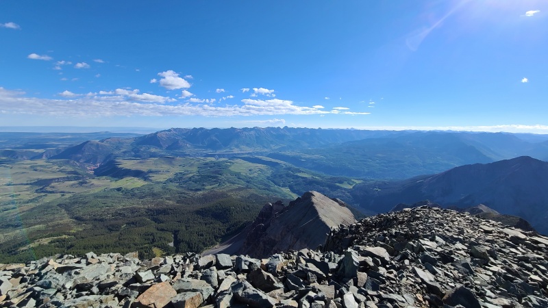
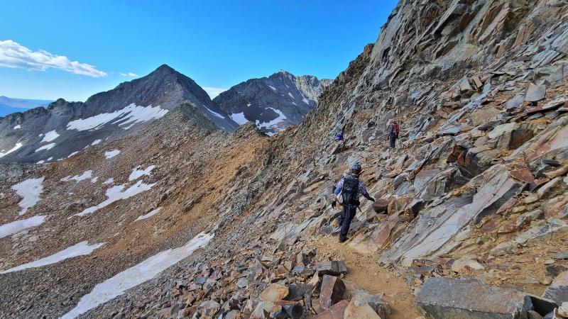
We followed our gpx and left the trail at about 11,800ft to hop over to the base of the North Buttress. We saw a group over on the North Slopes and another group on the buttress but already 1000ft up. We were very concerned about rock fall, but after a quick discussion, we decided we could start ourselves. The buttress angles from climbers right to left, so they were not even close to directly over us. Looking at the route, we were confident that anything dislodged from them would miss us by a few hundred feet. 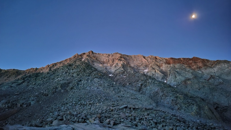
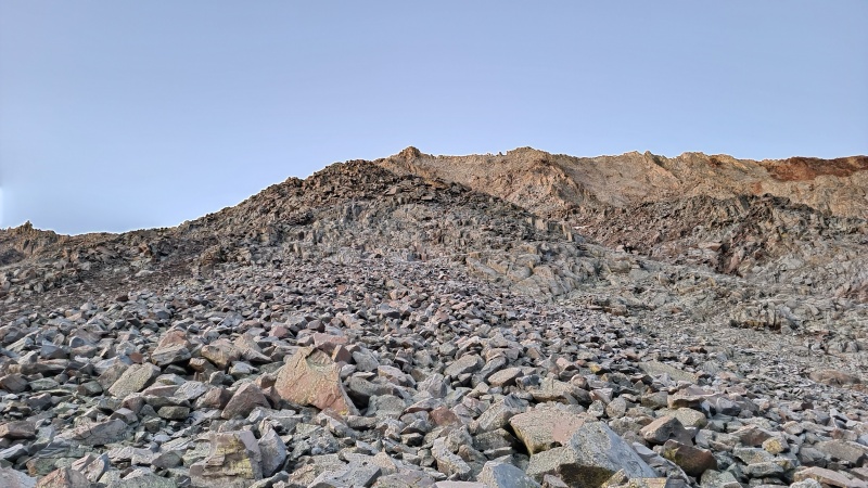
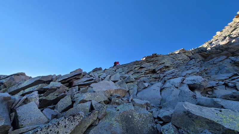
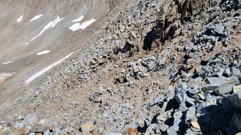
There are several sections to the route - the first being the slabs, which were solid and fun. Then next came the Jumble and the Hump. The Jumble and Hump both were devious. Rocks and boulders were loose, so we went VERY slow and tested every single hand- and foot-hold. A little exhausting, but we still believe it was the better choice over the North Slopes route, as we heard rockfall more than once to the East. 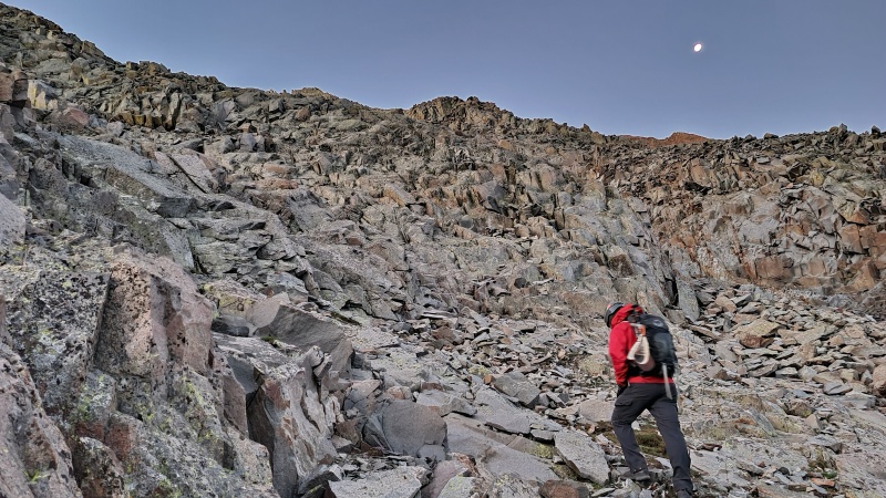


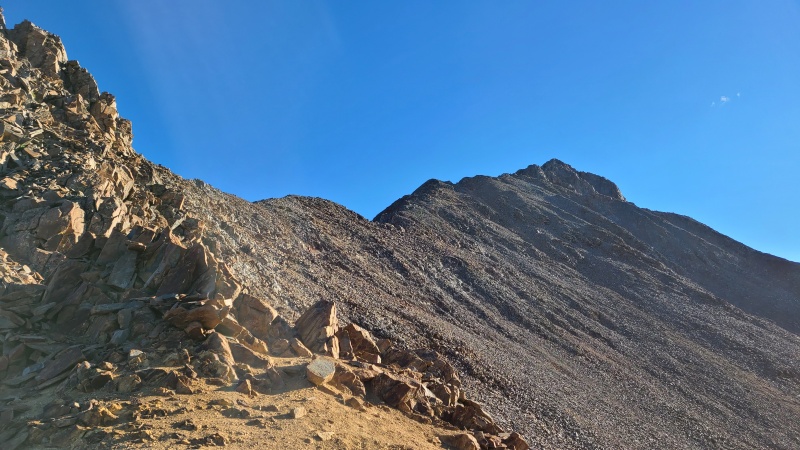
I will say, when reading the route description, the photos of the "benches" were a little confusing to me. Everything looked like a pile of rocks. Well, when actually on the route, trust me, there are benches, and you know when you're on one. 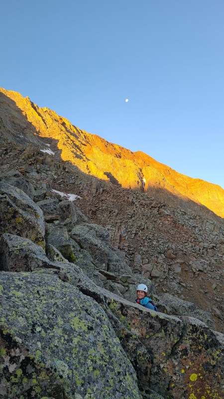
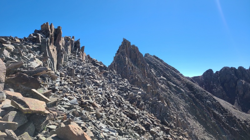
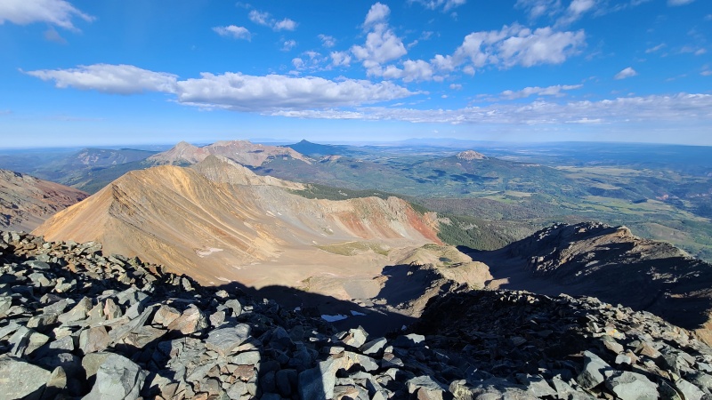
We got through the Jumble and the Hump. The "V" snowfield patch came into view. 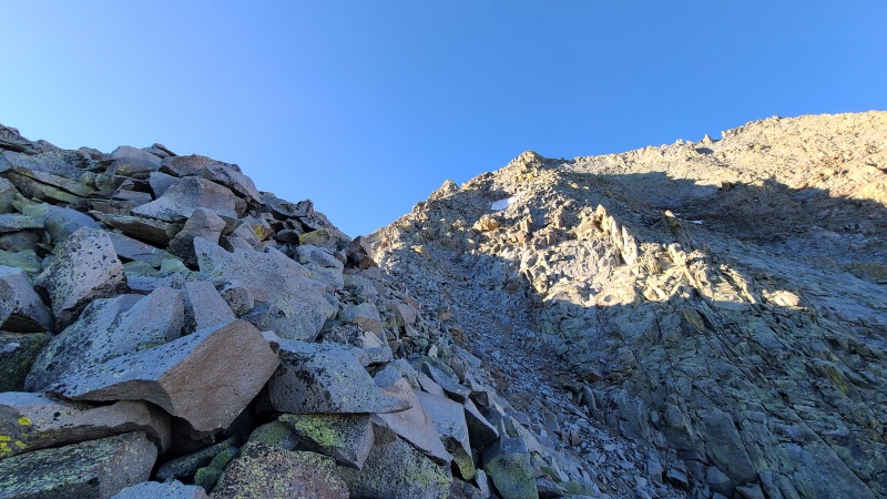
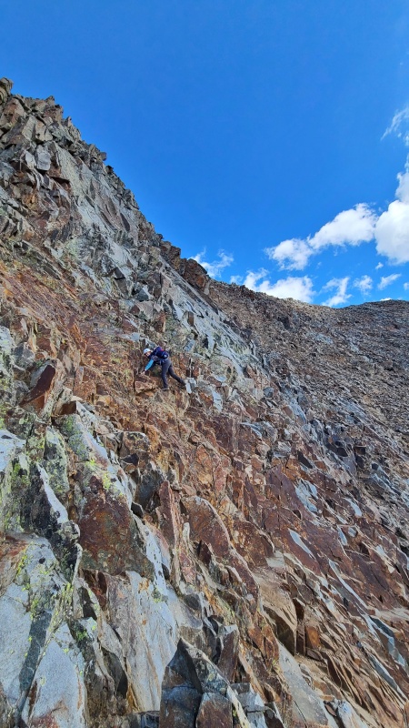
The inclined catwalk was the most solid rock of the day, which was a much need break. 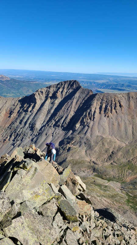
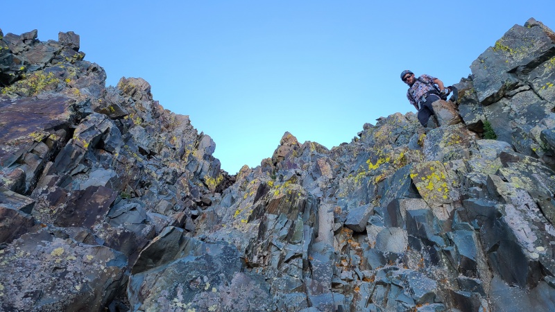
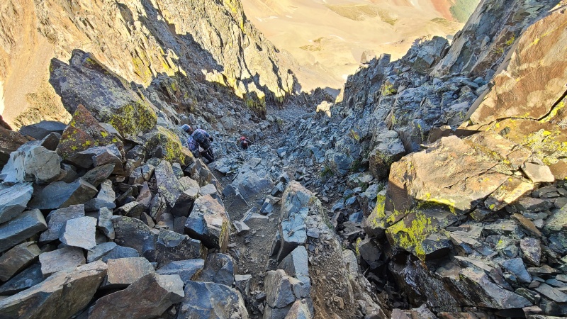
We decided to forego the chimneys to avoid the loose rock at the top. We instead took the variation, which was mostly solid class 4 climbing. 
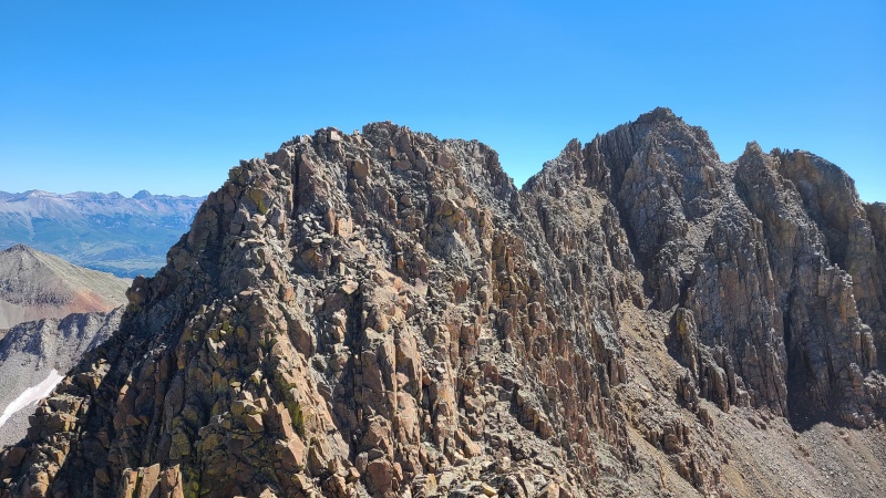
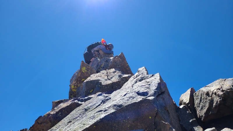
Then we scrambled up the summit, where we joined a group who had gone up the North slopes and were in agreement it was not great in its current condition. 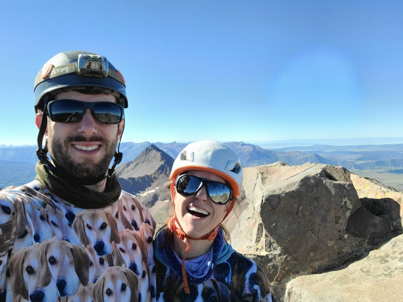

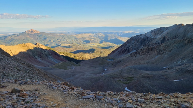
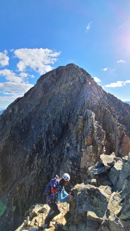
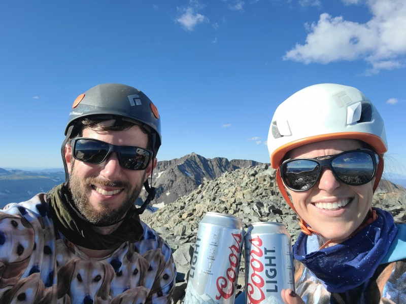
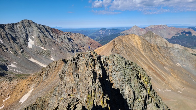
And now...the best part of the day...one of the great 14er Traverses! Super excited for this. I was going over the route by memory in my sleeping bag the night before, complete with little hand gestures and waves. 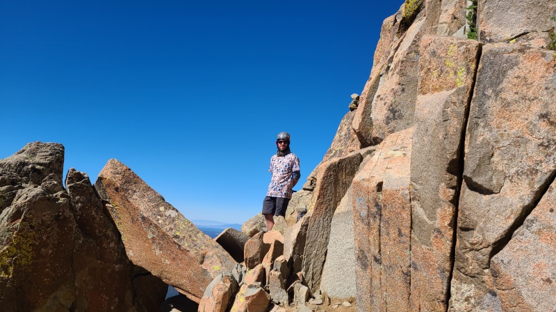
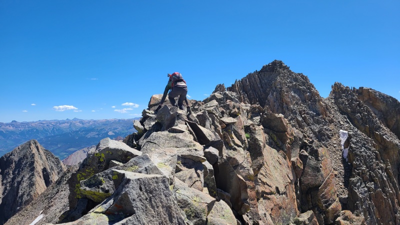
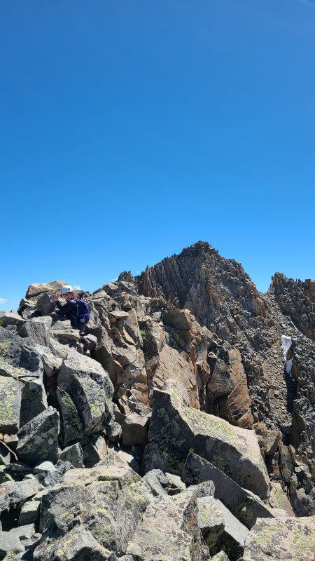

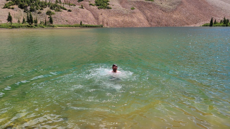
Well after almost 12 hours, we got back to camp pretty tired. It was time for beers, smoked salmon, and another dip in the lake. We then retired early to the tent for reading and rest. Day Three 8/8: The Mountain that Coors Made Famous We slept in until 4am the next morning (3:15am and 3:45am the previous nights) and had a lovely backpacking skillet scramble for breakfast. It was pretty good and filling. Then we started off for Wilson Peak; our third, and last objective of the trip. 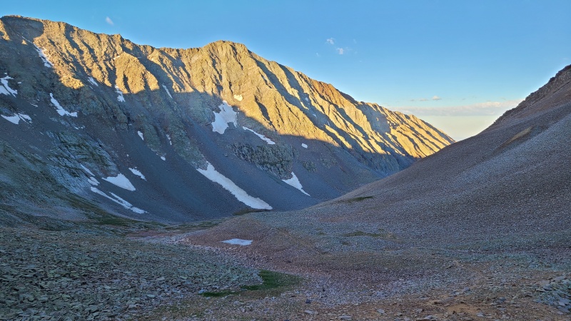


We stopped at Navajo Lake to break down our campsite and change clothes (best decision ever). And then we headed back down to the trailhead. 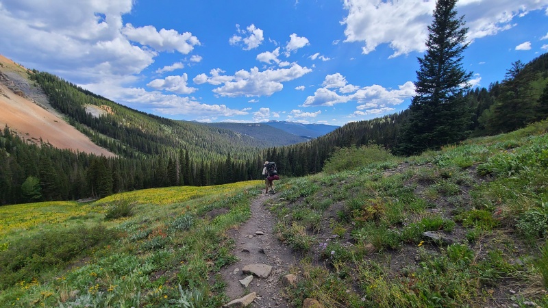
We were stoked to arrive at the car, and even more excited to grab a burger and tacos in Telluride. Then we made our way to Montrose for a hotel stay. Oh man did that bed and shower feel like the bees nees. Then the next morning (8/9), we made the remaining drive back via I-70 instead. All in all, this was a great trip. We did learn some things - the rock quality on the North slopes of this areas is definitely suspect without snow, and we might want to climb that peak in the spring when snowfields can stabilize the mountainside more; 8 hours of class 3-4 terrain is mentally draining, and for the first time since trying class 3, I actually was looking forward to a class 1 trail; and finally, bring paper and a pen with you in case someone leaves their dogs at 12,000 with no water while they do an all-day hike and you want to leave them a note. Thanks for reading! Thumbnails for uploaded photos (click to open slideshow): ")
")
")
")
")
")
")
")
")
")
")
")
")
")
")
")
")
")
")
")
")
")
")
")
")
")
")
")
")
")
")
")
")
")
")
")
")
")
")
")
")
")
")
")
")
")
")
")
|
| Comments or Questions | ||||||
|---|---|---|---|---|---|---|
|
Caution: The information contained in this report may not be accurate and should not be the only resource used in preparation for your climb. Failure to have the necessary experience, physical conditioning, supplies or equipment can result in injury or death. 14ers.com and the author(s) of this report provide no warranties, either express or implied, that the information provided is accurate or reliable. By using the information provided, you agree to indemnify and hold harmless 14ers.com and the report author(s) with respect to any claims and demands against them, including any attorney fees and expenses. Please read the 14ers.com Safety and Disclaimer pages for more information.
Please respect private property: 14ers.com supports the rights of private landowners to determine how and by whom their land will be used. In Colorado, it is your responsibility to determine if land is private and to obtain the appropriate permission before entering the property.