| Report Type | Full |
| Peak(s) |
Twilight Peak - 13,162 feet North Twilight Peak - 13,084 feet South Twilight Peak - 13,105 feet West Needle Mountain - 13,060 feet |
| Date Posted | 08/17/2020 |
| Date Climbed | 08/12/2020 |
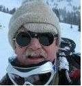
| Author | bergsteigen |
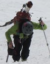
| Additional Members | Brian Thomas |
| Entering the Twilight Zone |
|---|
|
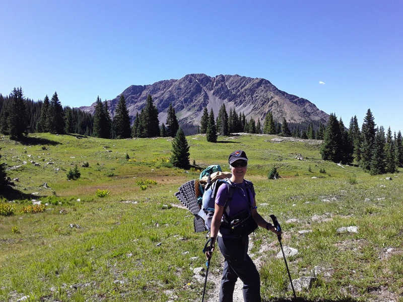
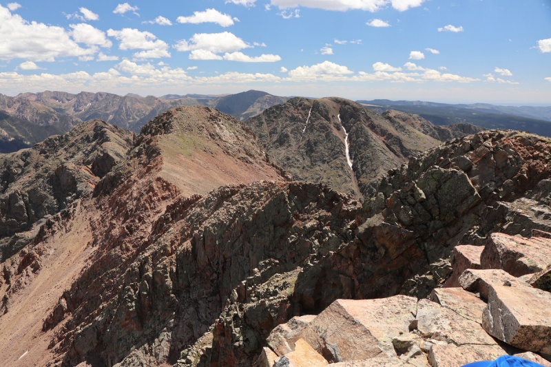
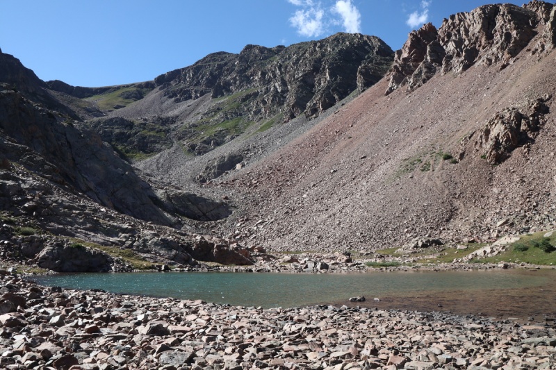
West Needle Mtn, South Twilight, Twilight, North Twilight
You're traveling through another dimension, a dimension not only of sight and sound but of mind. A journey into a wondrous land whose boundaries are that of imagination. That's the signpost up ahead— your next stop, the Twilight Zone! After hiking South Snowden last fall, I became quite interested in the Twilight group. I figured the views of the Weminuche to the east would be spectacular, and I was not disappointed. Even better, I was able to convince Brian to accompany me, since this route in summer, is quite scramble and route finding intensive. Plus the distance was enough, another backpacking overnight was also a good idea. Be sure to check this route out, before someone holds your hand with photos with red lines on them. Keep low 13ers ADVENTUROUS! We camped nearby and showed up at the trailhead fairly early in the morning, hoping to beat the worst of the days heat, and get a parking spot at this popular lake. So we had breakfast and coffee while packing up our bags, trying to keep them as light as possible. Other than a couple of backpackers, we didn't see anyone on the trail beyond the split to Snowden. We even met one guy who did a through hike over the Twilight group from Purgatory! We kept an easy pace, since we had all day, and also didn't want to tire ourselves out for tomorrow. 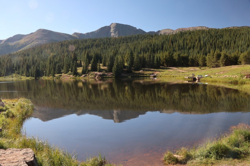
Andrews Lake with Snowden behind 


We set up camp, filtered water, ate lunch and then relaxed playing cards. Gin Rummy, Kings in the Corner and some violent game called Egyptian Rat Smash or something similar. For those who don't know, Brian counts cards. So he's dangerous. I won maybe 30-40% of the time. Thankfully we didn't keep track too well. After a relaxing afternoon, we ate dinner in the sun at the lake, and then retired to our respective tents to read ourselves to sleep. Since the route finding would begin fairly fast on the route, I didn't want to get up to the pass above the lake before I could see the way ahead. The only other TR's on this site involve snow climbs of the peaks, and so we would have to do all the summer/dry style route finding. A fairly nice sunrise awaited us on the pass with a little tarn on top. From there we could get an idea of the terrain to take to the saddle between the 2 12ers on the ridge. 
The first section was mostly in a forested area till we hit a section of side hilling talus. We could spy the route we wanted to take to bypass the unranked 12ers ridge that split the valley like a fin. On the way up we would take the talus gulley to the right/north of the trees, and then contour into the valley between the 12ers, while on the return we found a use trail in the trees. 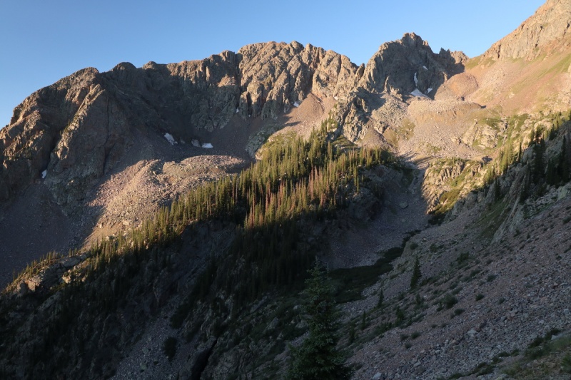

Before we traversed into the trees to our ascent valley, we confirmed our descent from North Twilight would "go". Always nice to have confirmation! 
Once we were into the valley to take us up between the 2 12ers, we were again comforted to know that the route would go. You can stay high up on the right/north side as long as you want. One section we dropped down below a cliff band to make sure we wouldn't get cliffed out, but the way above was just very steep grass. 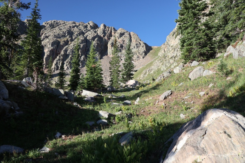
On the saddle, we were treated with a nice strong breeze to cool us down after the ascent. After a quick perusal of our surroundings, we found a good use trail that would take us in the direction of West Needle Mountain, our first objective of the day. This zone must see a bit of traffic for a trail to be that good from the saddle. We had been seeing a few small cairns already, and would see a few through the day, but pretty sparse, so that's nice. Don't like to lose adventure to nanny nation! 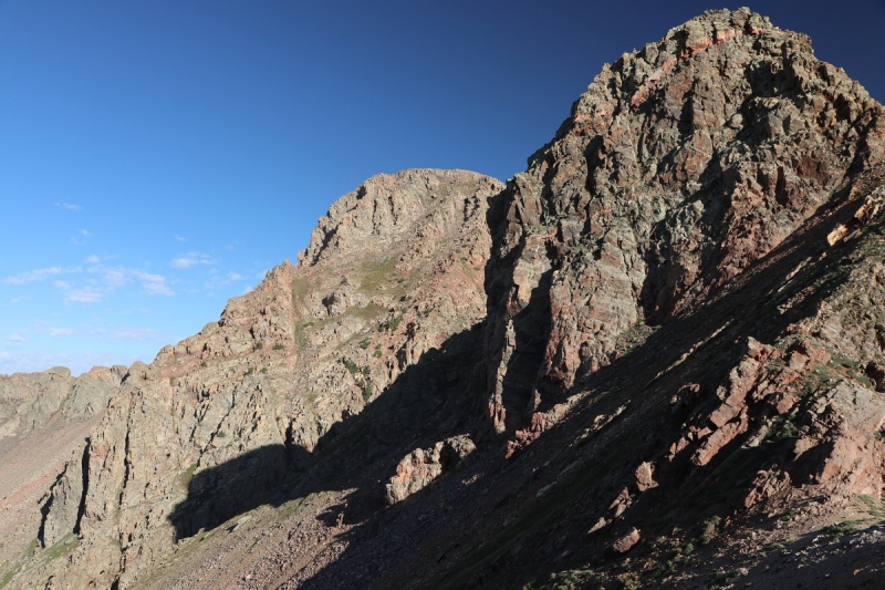


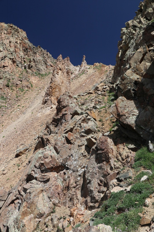
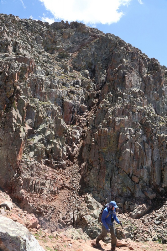
Half way to West Needle's NE ridge, the trail disappears into a talus field. From there we had to decide how to reach the saddle. The 2 gendarmes on the ridge looked pretty intimidating, but the 2nd one looked solid and semi tame. But as we got closer, the potential to get cliffed out looked too high to take the chance, so we skirted high around it, in a loose talus gully, one at a time. When we reached the saddle, the 2nd gendarme does cliff out, so it was good we didn't waste time scrambling up it. We would get plenty of scrambling today anyway! 
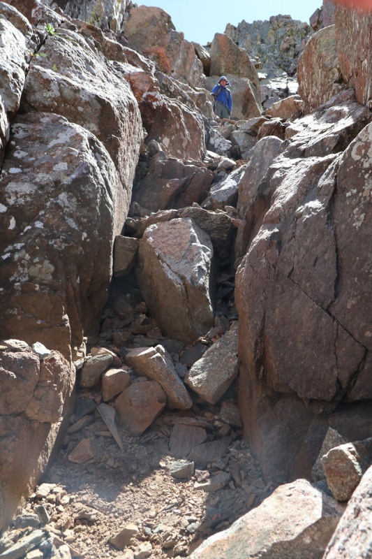
Once we got to the NE ridge of West Needle, the super fun scrambling begins instantly! Furthermore said this was the highlight of the route, and I whole heartedly agree! This was a super fun route with lots of scrambling and route finding, and none of it was super exposed. You wouldn't want to fall, but nothing was like some of the airy drops I've seen elsewhere. We started off simul-scrambling side by side, since Brian forgot his helmet, and there were that many options to choose your own scramble adventure! The route we took, started off in a steep grassy slope up to the ridge, then traversing around to a notch, then back up to the ridge. Nothing is really cairned here, so you have to have the skills ready and willing. Only one spot had anything. 


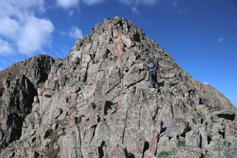
On the way up, we traversed for a bit longer before getting to the first notch, since I saw some rocks above that didn't look friendly, but on the descent we stayed on the ridge for longer, and dropped down the first 2 mini gullies simultaneously. Sometimes you can't get a good idea of what's above from below, and we decided to play it safe. Both ways go! 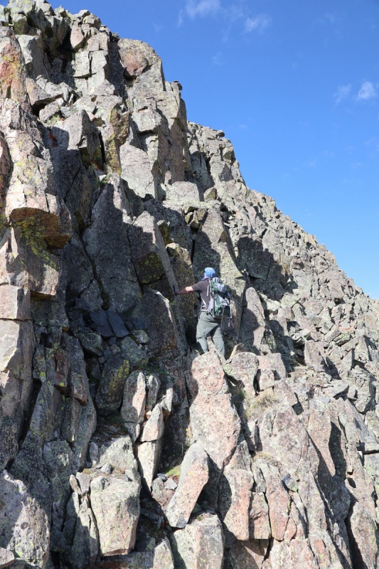

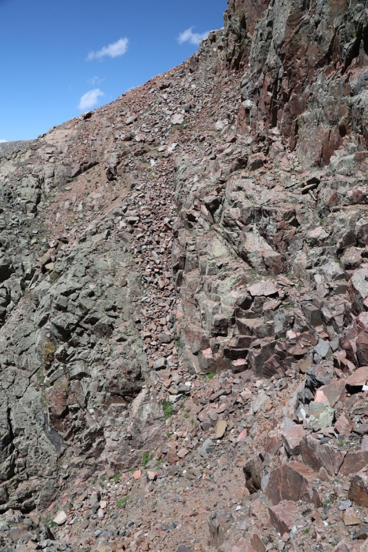
Once back up onto the ridge, we could see the next difficulty in the notch. It wasn't bad at all. Brian slid down a ramp, and I dodged to the right/north. On the return I went up the ramp. Beyond the notch was a scramble up to the summit area with maybe a cairn or 2. The difficulty eased from then out to the smooth summit. 

The summit was well received, even if it was the farther bump. A quick break to snap picks, and we were off again. It was going to be a long day! 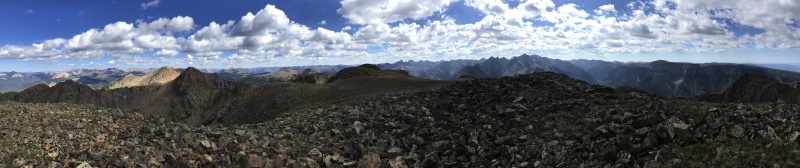
As I mentioned before, we stuck on the ridge for a bit longer before dropping to the north before the lower ridge difficulty, staying in our of chosen scramble paths. Back at the saddle, I went down the loose talus first, and Brian followed as soon as it was safe. Back on the talus and trail, we made quick work back to the original saddle area. Before the path goes up to the saddle, I spotted an animal use trail that skirted the unranked 12ers lower cliff bands and we made quick work in that traverse. We aimed for a tree on the far side, and got a view up the scree gully between the unranked 12er and 13er. At first we were going to go up to the ridge, but I spotted a nice ramp below the first gully gendarme on the left, since the saddle up South Twilight looked a bit too class 5ish. 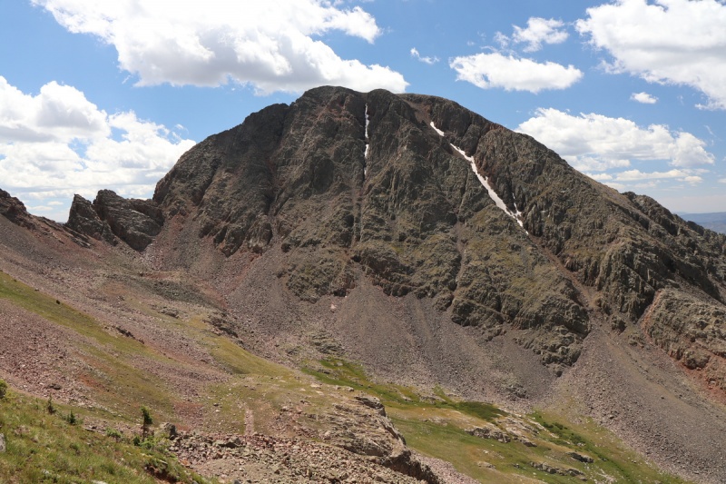
Once onto the the south face of South Twilight, it was a very steep ascent on blocky solid talus with some trees around, up to the summit. Steep! 


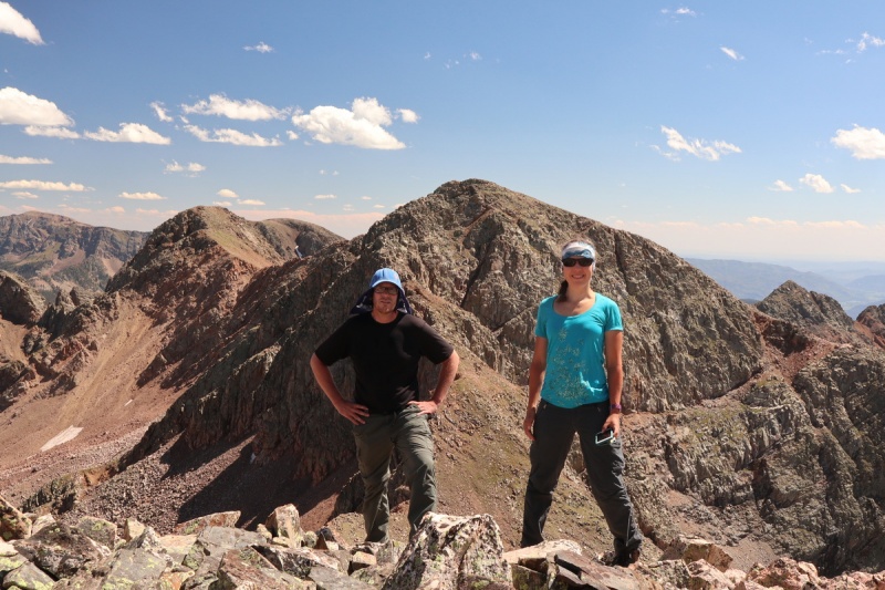
Short pause on the unranked 13er before moving on the short distance to Twilight Peak. All easy terrain here. 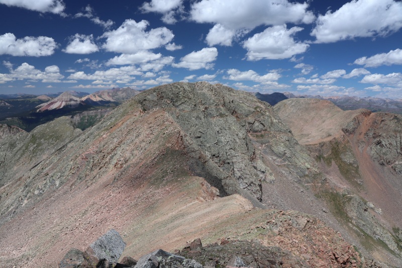
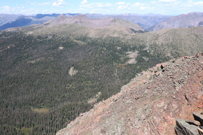
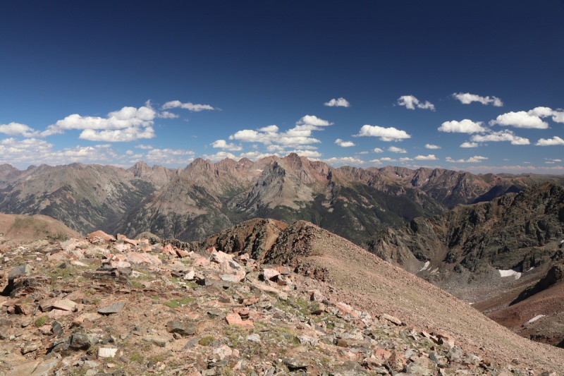
Took a much longer pause on Twilight, since the views of the Wemi to the east were spectacular, now that the sun was illuminating them better. 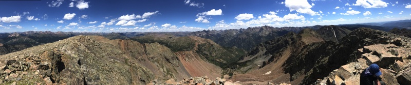
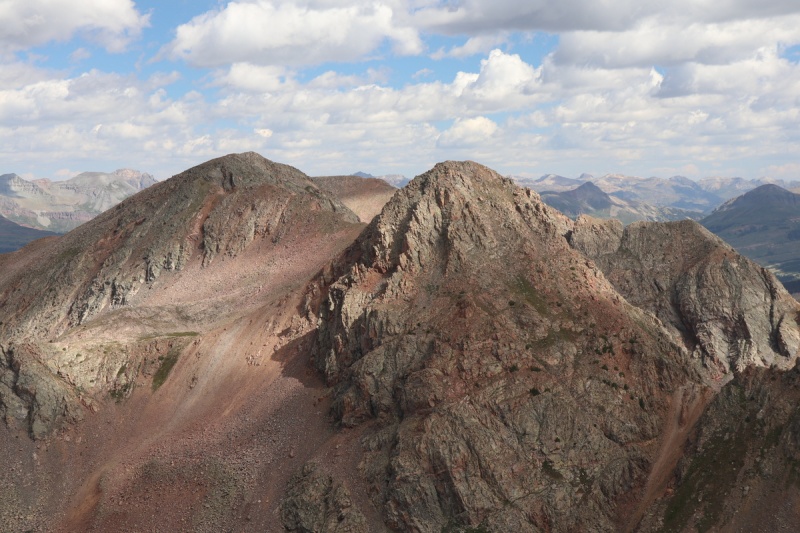
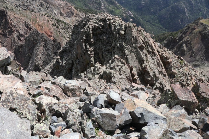
From Twilight to North Twilight would involve more difficult route finding. Furthermore had a bit of snow to deal with, so we couldn't be sure what aid or detriment that gave him. From above, it was very difficult to say if the route would go. There were too many hidden parts, till we got closer. We zig zagged down the initial slope from the ridge above, and I inspected the gully. It went, with a series of class 3 "waterless waterfalls". From above, these didn't looks good, but once on top of them, I could see the descent. We again went one at a time, since this gully is complete JANK! Butt Scoot Alley! 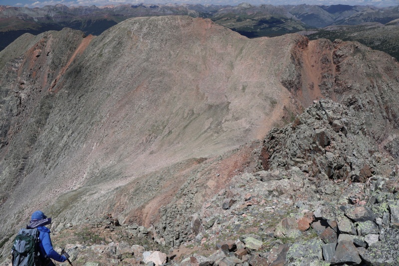


Obviously if one does the route in reverse, finding a more stable option to the immediate left of the gully could be possible. Down climbing unknown class 3/4 is tricky, and we went with the fastest/safest option with the Butt Scoot Alley. Once back up the ridge, the route over to North Twilight was very easy. A nice finish to the day, looking down at the lake we were camped at. 

After a nice break, we headed back to the saddle and down the valley to meet up with our ascent route. 

On our descent I had planned to take the same talus gully down to the willow bash, to the talus traverse to the tarn saddle above Carter Lake, but we got distracted by a use trail that took us into the trees. I had been peeking at my GPS and noted when we met up with our ascent trail, but Brian distracted me, and I wasn't checking my GPS often, so we kept following the trail. By the time we realized, the way down to the talus gully was a cliff, so we continued through the very steep trees. We were deposited in the valley below without any willows and then even found a use trail through the talus! This use trail is below our track on the way up. It made fast work of the hot afternoon traverse over to the tarn saddle. From the tarn saddle, we went around Carter Lake on the other side, and got a great view from above. 
Since I didn't bring enough food for another night, we had to pack out. So much for "light packing". With more food, it would have been better to stay the extra night, since it was well into mid afternoon before we got back to camp. After snacking, water filtering and a short rest, we were packed up and on the trail out. I had hoped to make it out before sunset, but the trail is so mellow, we couldn't make up much time on the exit. We had to finish by headlamp. Arriving at the trailhead, there was a large family making a lot of noise. Since I was going to camp nearby at the overnight lot, I wasn't sure how long they were going to be there, or even why. Since it was dark enough, I wanted to get a shot of the Milky Way with Snowden off to one side. A nice end shot for the trip. That's when I realized that this was the peak of the Perseid meteor shower! A nice surprise to end a very fun enjoyable trip!
Too bad life gave me a huge sucker punch on the drive home, rather deflating the natural mountain high I had just experienced. C'est la vie! Thumbnails for uploaded photos (click to open slideshow): ")
")
")
")
")
")
")
")
")
")
")
")
")
")
")
")
")
")
")
")
")
")
")
")
")
")
")
")
")
")
")
")
")
")
")
")
")
")
")
")
")
")
")
")
")
")
")
")
")
")
|
| Comments or Questions | ||||||||||||||||||
|---|---|---|---|---|---|---|---|---|---|---|---|---|---|---|---|---|---|---|
|
Caution: The information contained in this report may not be accurate and should not be the only resource used in preparation for your climb. Failure to have the necessary experience, physical conditioning, supplies or equipment can result in injury or death. 14ers.com and the author(s) of this report provide no warranties, either express or implied, that the information provided is accurate or reliable. By using the information provided, you agree to indemnify and hold harmless 14ers.com and the report author(s) with respect to any claims and demands against them, including any attorney fees and expenses. Please read the 14ers.com Safety and Disclaimer pages for more information.
Please respect private property: 14ers.com supports the rights of private landowners to determine how and by whom their land will be used. In Colorado, it is your responsibility to determine if land is private and to obtain the appropriate permission before entering the property.