Download Agreement, Release, and Acknowledgement of Risk:
You (the person requesting this file download) fully understand mountain climbing ("Activity") involves risks and dangers of serious bodily injury, including permanent disability, paralysis, and death ("Risks") and you fully accept and assume all such risks and all responsibility for losses, costs, and damages you incur as a result of your participation in this Activity.
You acknowledge that information in the file you have chosen to download may not be accurate and may contain errors. You agree to assume all risks when using this information and agree to release and discharge 14ers.com, 14ers Inc. and the author(s) of such information (collectively, the "Released Parties").
You hereby discharge the Released Parties from all damages, actions, claims and liabilities of any nature, specifically including, but not limited to, damages, actions, claims and liabilities arising from or related to the negligence of the Released Parties. You further agree to indemnify, hold harmless and defend 14ers.com, 14ers Inc. and each of the other Released Parties from and against any loss, damage, liability and expense, including costs and attorney fees, incurred by 14ers.com, 14ers Inc. or any of the other Released Parties as a result of you using information provided on the 14ers.com or 14ers Inc. websites.
You have read this agreement, fully understand its terms and intend it to be a complete and unconditional release of all liability to the greatest extent allowed by law and agree that if any portion of this agreement is held to be invalid the balance, notwithstanding, shall continue in full force and effect.
By clicking "OK" you agree to these terms. If you DO NOT agree, click "Cancel"...
August 24-25 2020 General weather: Pleasantly warm with slight breeze to warm
Route: Day 1 - Grindelwald to Mittellegi Hut - 2h00min Day 2 - Mittellegi Hut up to Eiger summit and down to Jungfraujoch - 7h15min
Stats: ~2 km up to refuge + 7.32 km to summit and Jungfraujoch Highest point: 13,020'
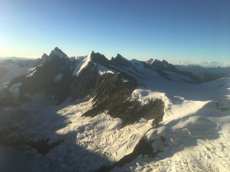
In mountaineering, the six great north faces of the Alps (also called the six 'classic north faces') are known for their difficulty and great height. Three of these north faces—the Eiger, the Matterhorn and the Grandes Jorasses—are considerably harder to climb than the others. I thought I would give a go at these 3 mountains...not through their famous north face because I do not have the capabilities to do so but through a different route, much less technical but still quite challenging.
This year was the Eiger year and my journey would bring me to Grindelwald, Switzerland.
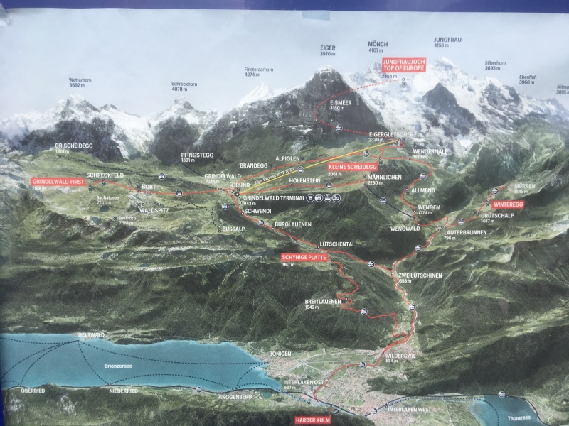
Overview of the valley. Starting point Grindelwald terminal to Eismeer.
The Jungfrau Railway runs 9 kilometres (5.6 mi) from Kleine Scheidegg to the highest railway station in Europe at Jungfraujoch (3,454 m (11,332 ft)), between the Bernese Highlands and the Valais in Switzerland. The railway runs almost entirely within the Jungfrau Tunnel, built into the Eiger and Mönch mountains and containing two stations in the middle of the tunnel, where passengers can disembark to observe the neighbouring mountains through windows built into the mountainside.
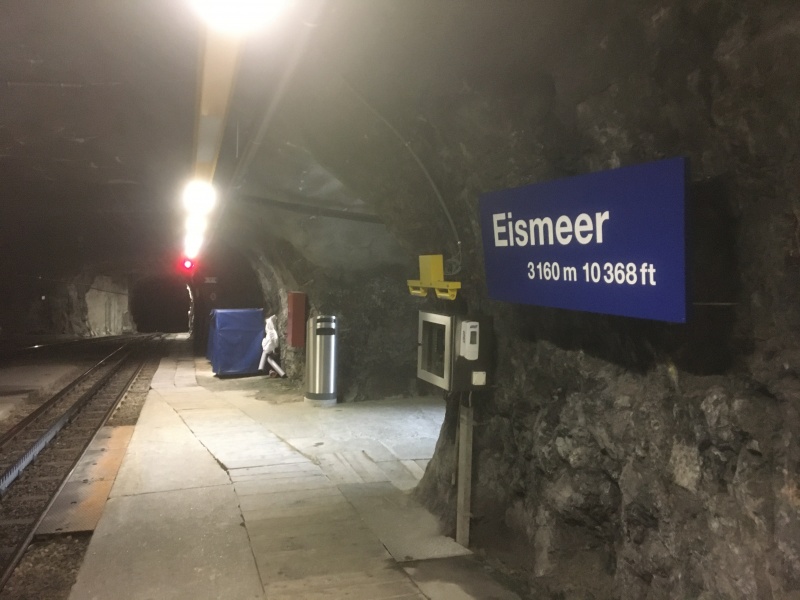
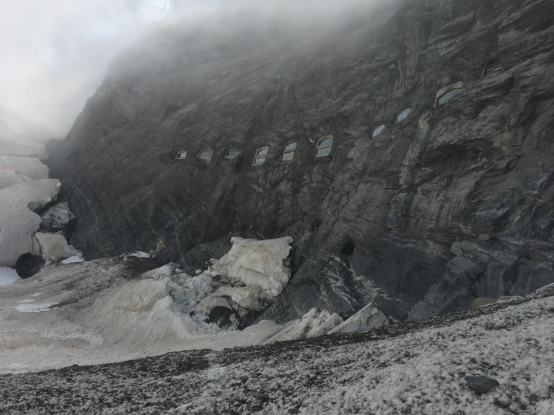
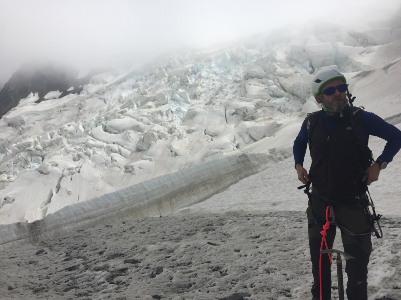
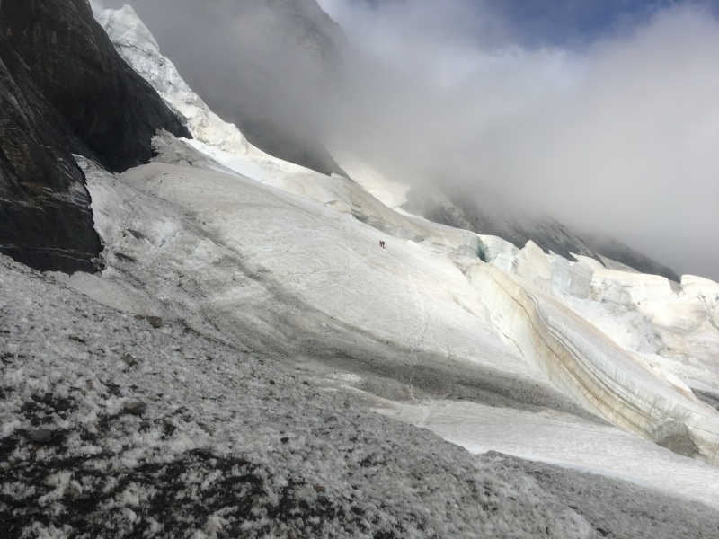
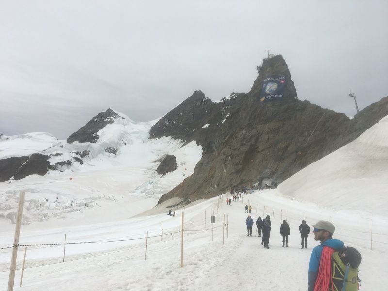
To find the exit at Eismeer station might be the most difficult part of the 1st day.Windows at Eismeer station viewed from outside.Once you manage to get your way through the dark tunnel, you're immediately in the heart of the glacier.We can see a team of 2 people in front of usWarming up wearing my old crampons again
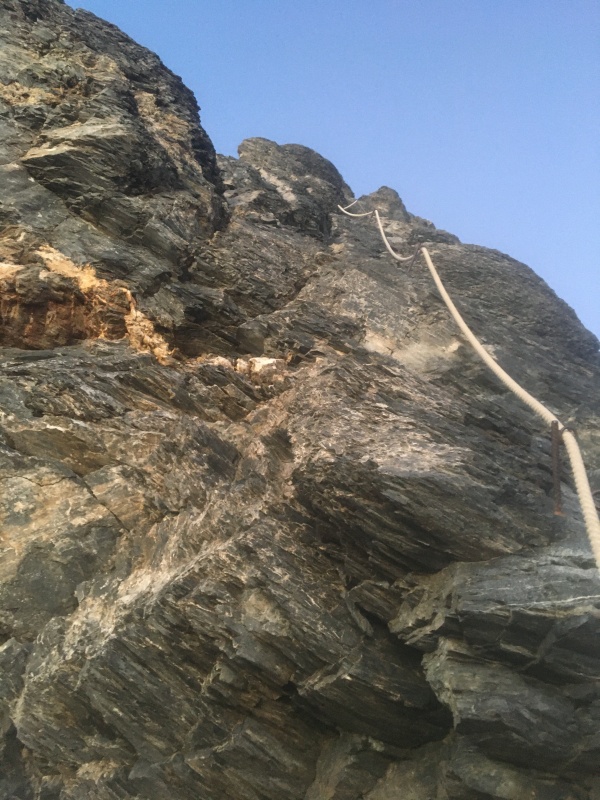
The first day consists of a simple 2 hours walk to the Mittellegi Hut, nothing technical apart from few fixed ropes.
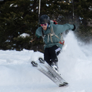
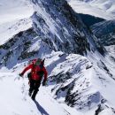
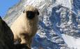
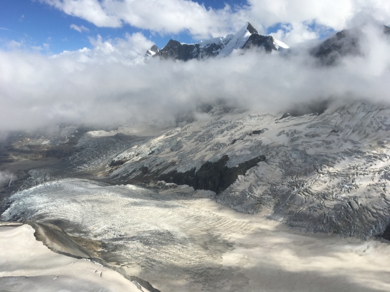
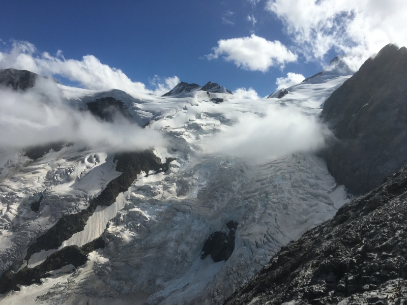
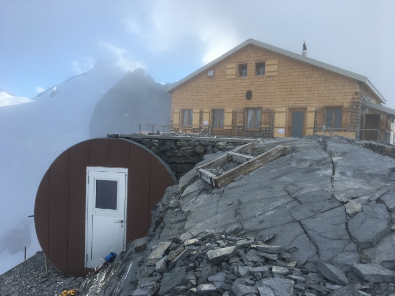
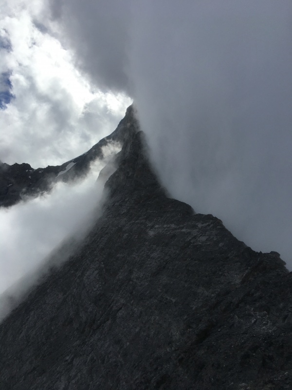
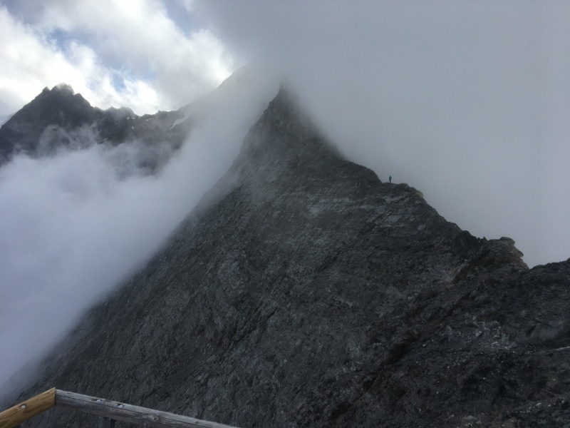
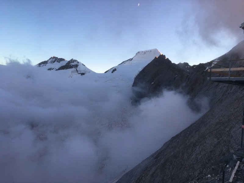
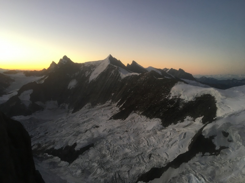
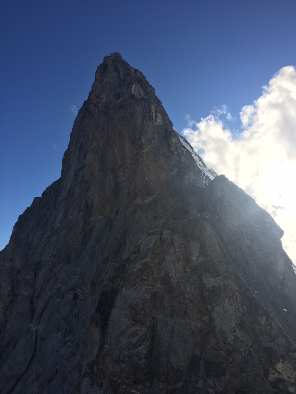
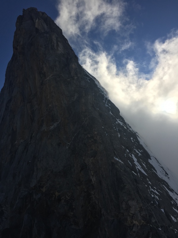
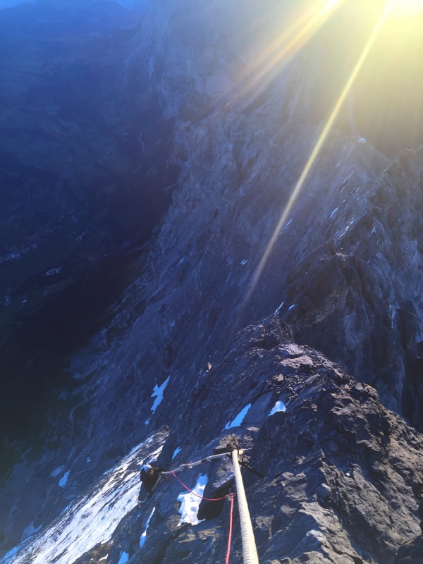
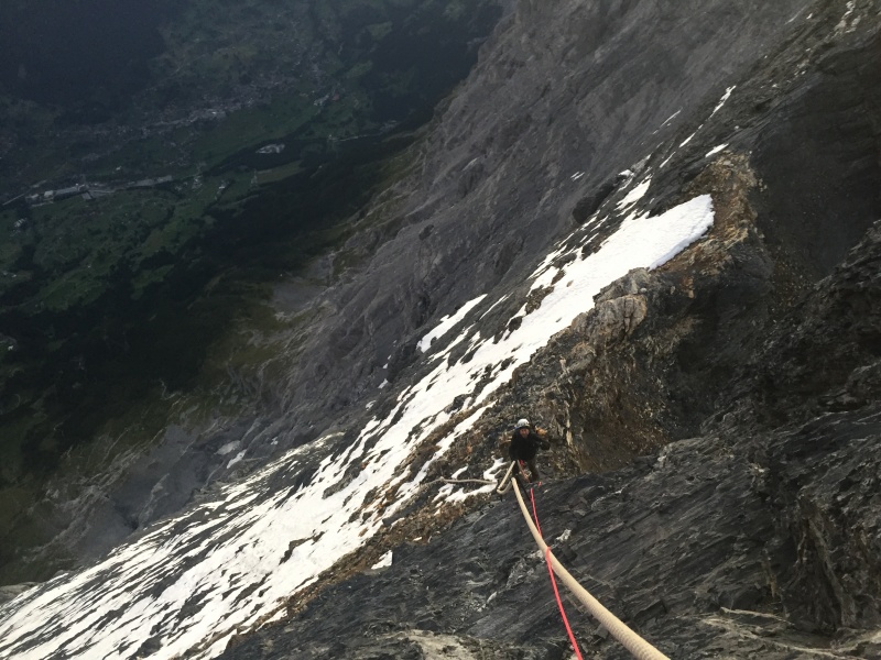
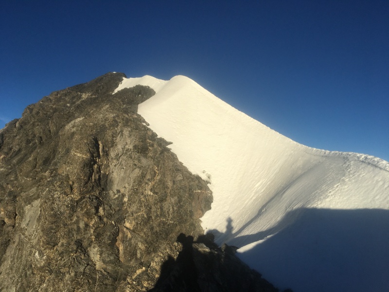
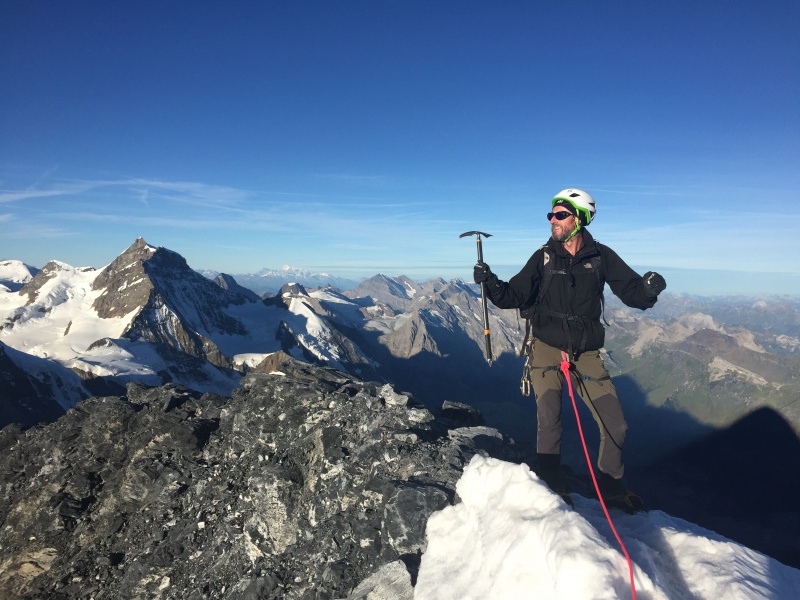
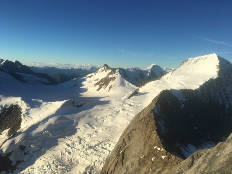
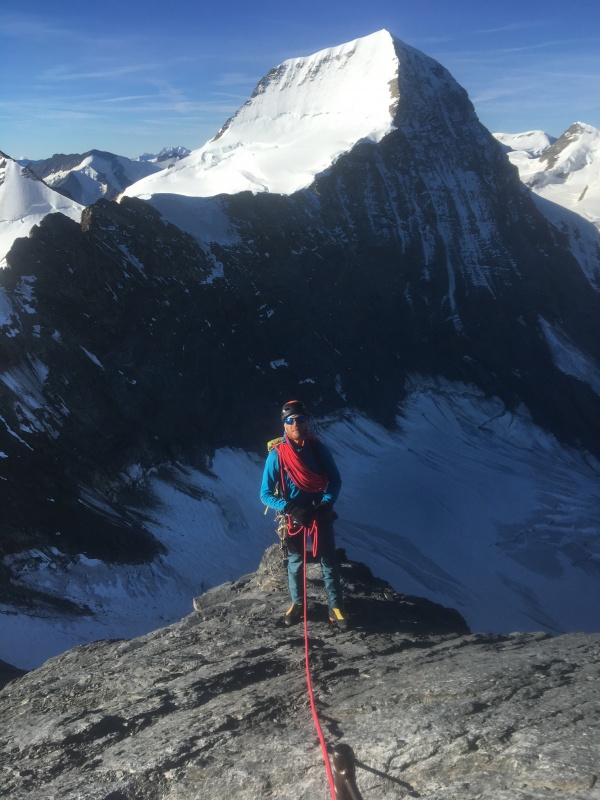
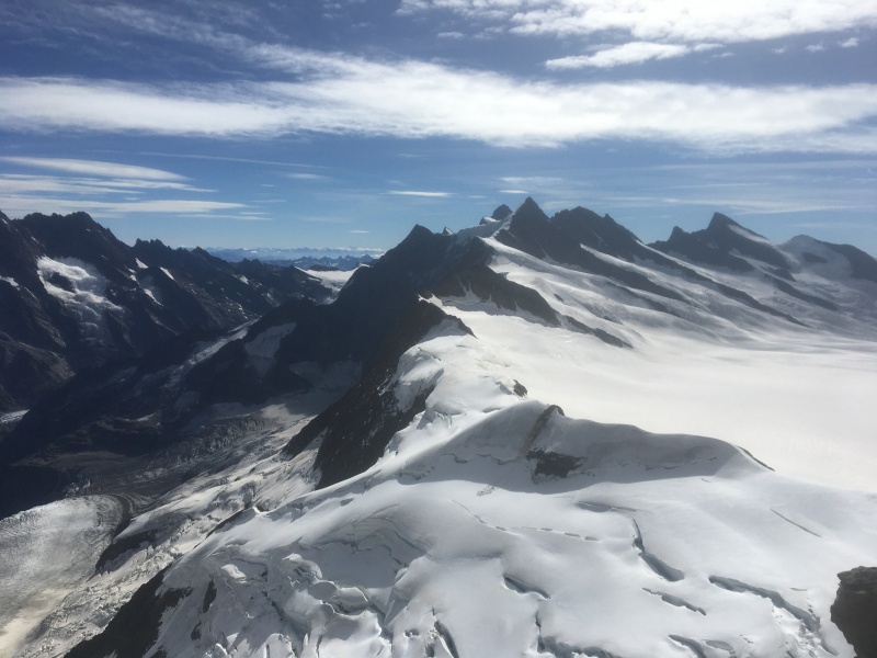
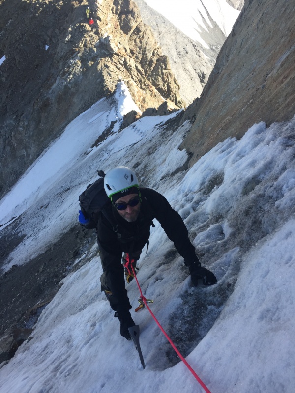
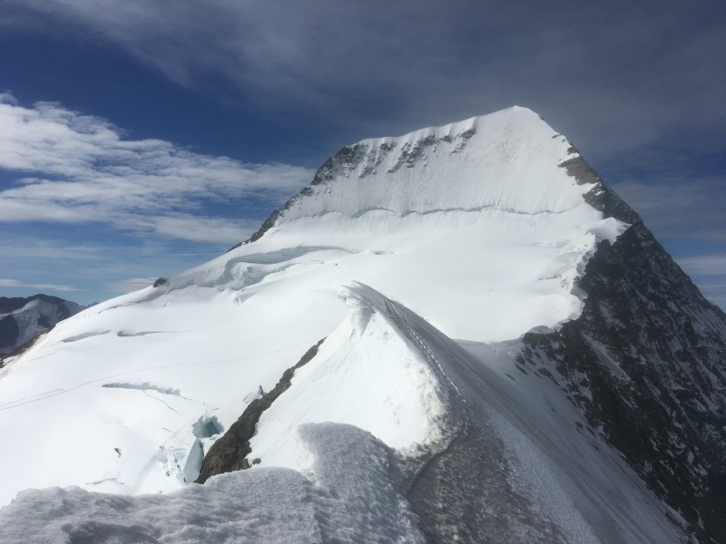
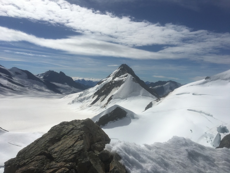
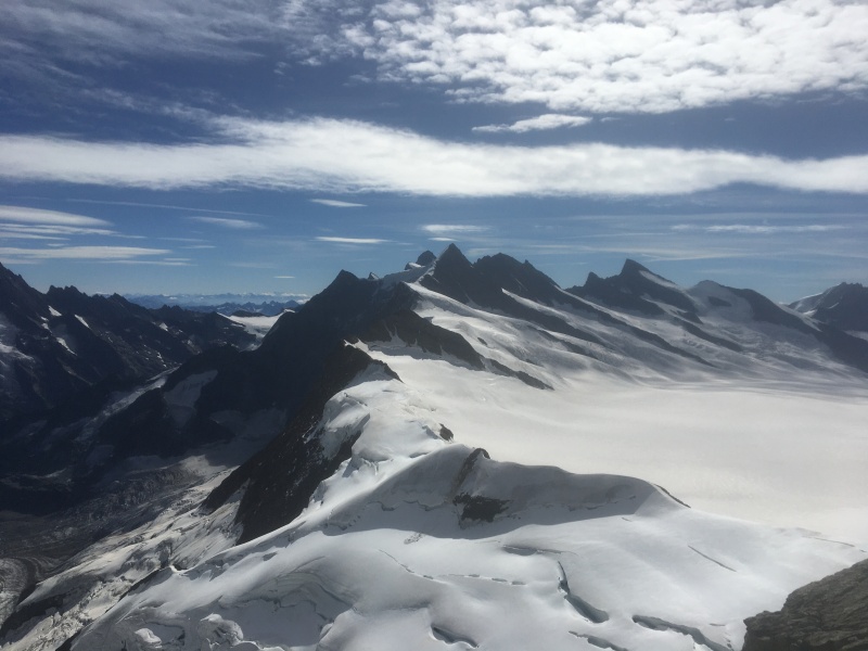
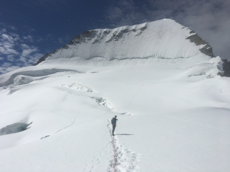
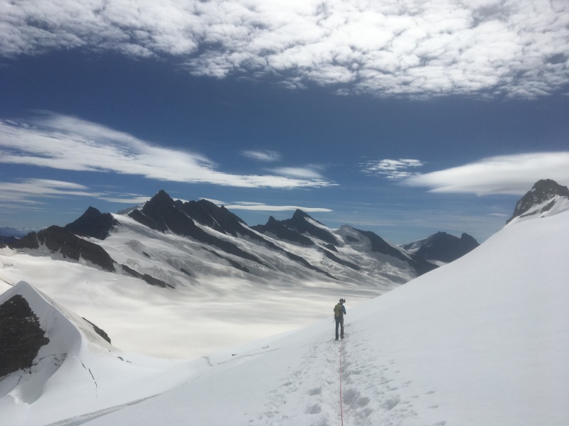
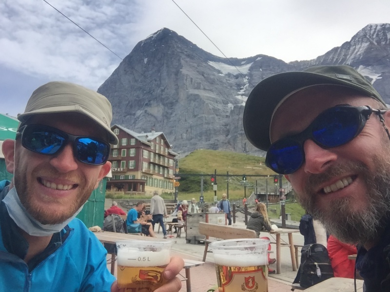
Swiss guides left the fixed rope quite high so that not everybody could reach the hut. If it was too easy they wouldn't have any clients anymore they say...A look down the glacierA look back at our starting point. You could hear loud noise of seracs moving, quite scary.First view of the hutMittellegi Hut. We slept in the small barrel as we brought our food and gas with us. I was freezing but thanks to the Covid, we got the entire space for ourselvesFirst sight of the ridge leading to the summitThis 1st day was quite foggy at the hut so we could barely have an understanding of the difficulties ahead of us.View of the Monch (13,474 ft) with its flat topLooking back early morning. We left at 5am this morning to get in front of the other teams. The fog disappeared overnight and temperatures were much warmer than the night beforeIf you don't like fixed ropes, don't come to EigerWhen you realize it's gonna be a long day...And when you managed to pass one, there is always a second one hidden behind. It is so steep that you can't have an overview of the summit or the difficulties ahead.Yes, there is a bit of exposure and you need to be very stable on your legs even if you are roped.Ridge leading to the topImprovising a quick dance at the summit! We reached the summit at 7.40am. I was told the descent was long and difficult, the summit being only 30% of the entire day.View from the top looking SW. You can have a glimpse of the ridge we have to follow down and then up again towards the base of MonchOverview of part of the Bernese AlpsImpressive glacier with lots of crevassesPosing in front of MonchLooking NEStarting our descent towards Jungfraujoch. A succession of small peaks can be seen on the way up after the saddle.Going up again just after the saddle. South face of Eiger in the backgroundIcy sections were short but quite challenging, need to work more on that aspect.Follow the ridge...technical difficulties are almost past usLooking southHere we are at the base of Monch, just a pleasure to walk on a snowy terrain without watching your footsteps, relaxing!Is that Antartica? Going towards Monch hut and JungfraujochBack to civilization at Jungfraujoch. The train will take us back down to GrindelwaldBack at the famous Hotel Bellevue in Kleine Scheidegg for a well deserved beer. For info, in the summer of 1974, Clint Eastwood and his cast and crew stayed at the Hotel while filming The Eiger Sanction (1975). Several scenes were filmed in and around the hotel.[12]
The 2008 film North Face, about Toni Kurz and Andreas Hinterstoisser's 1936 attempt to climb the Eiger north face, was shot to a great extent at the Hotel Bellevue des Alpes. Footage of the mountain's profile was also shot from Kleine Scheidegg's vantage point
All in all, fantastic experience up in the mountain. It took us a bit more than 7 hours that day.
My GPS Tracks on Google Maps (made from a .GPX file upload):
In about 2010 my family took a trip there and we went up to jungfraujoch. We got to see the glacier and the extremeness of the alps and it is still something that is inspiring me to pursue harder and harder mountaineering. This is an awesome trip! Nice job!
Great pictures! I just watched the movie "Beckoning Silence" two nights ago (Joe Simpson retelling the story of the failed 1936 attempt on the North face). This looks much more enjoyable :) Great to see some different views of the mountain. Gorgeous!
When I climbed the Eiger back in 2018, there wasn't a fixed rope in that section. It was partially iced, so it was a bit delicate, and probably the most difficult climbing of the route. Congratulations on your summit!
I wouldn't have expected all of the fixed ropes. I guess the route has really become popular. I hope to get back over there some day.
Caution: The information contained in this report may not be accurate and should not be the only resource used in preparation for your climb. Failure to have the necessary experience, physical conditioning, supplies or equipment can result in injury or death. 14ers.com and the author(s) of this report provide no warranties, either express or implied, that the information provided is accurate or reliable. By using the information provided, you agree to indemnify and hold harmless 14ers.com and the report author(s) with respect to any claims and demands against them, including any attorney fees and expenses. Please read the 14ers.com Safety and Disclaimer pages for more information.
Please respect private property: 14ers.com supports the rights of private landowners to determine how and by whom their land will be used. In Colorado, it is your responsibility to determine if land is private and to obtain the appropriate permission before entering the property.


")
")
")
")
")
")
")
")
")
")
")
")
")
")
")
")
")
")
")
")
")
")
")
")
")
")
")
")
")
")
")
")
")
")
")
")
")
")
")
")
")
")
")
")
")