Download Agreement, Release, and Acknowledgement of Risk:
You (the person requesting this file download) fully understand mountain climbing ("Activity") involves risks and dangers of serious bodily injury, including permanent disability, paralysis, and death ("Risks") and you fully accept and assume all such risks and all responsibility for losses, costs, and damages you incur as a result of your participation in this Activity.
You acknowledge that information in the file you have chosen to download may not be accurate and may contain errors. You agree to assume all risks when using this information and agree to release and discharge 14ers.com, 14ers Inc. and the author(s) of such information (collectively, the "Released Parties").
You hereby discharge the Released Parties from all damages, actions, claims and liabilities of any nature, specifically including, but not limited to, damages, actions, claims and liabilities arising from or related to the negligence of the Released Parties. You further agree to indemnify, hold harmless and defend 14ers.com, 14ers Inc. and each of the other Released Parties from and against any loss, damage, liability and expense, including costs and attorney fees, incurred by 14ers.com, 14ers Inc. or any of the other Released Parties as a result of you using information provided on the 14ers.com or 14ers Inc. websites.
You have read this agreement, fully understand its terms and intend it to be a complete and unconditional release of all liability to the greatest extent allowed by law and agree that if any portion of this agreement is held to be invalid the balance, notwithstanding, shall continue in full force and effect.
By clicking "OK" you agree to these terms. If you DO NOT agree, click "Cancel"...
Is this an awful idea? Is it just plain stupid to start from here? My rough estimate (haha) only puts this route at 5.5ish miles to the summit......
To answer those questions, maybe. But sometimes doing a route that I can find little beta on pays off.
Silverheels is one of those peaks that I've looked at for years upon years. Every drive on 285. Every outing in the 10 Mile and Mosquito ranges. It has always demanded my attention for whatever reason. To add fuel to the fire, James and I got kind of close to it in January while attempting Hoosier Ridge. After looking at the north face and researching that route, I tried to figure out a possibly less intense route to take. I never like the idea of ascending a ridge just to branch off towards an objective. I want direct!
Fritz suggests the east bowl and it looks like a great short route (6-7 miles maybe?) The day before our planned summit day, James and I went up to Pennsylvania for a quick romp and for some recon photos. But, that would be too easy. Winds and clouds destroyed our hopes of getting good recon photos of Silverheels. Great!
Wait, what's this? A few breaks in the wind get me some successful zoom lens photos! And wow, that upslope storm has filled in the SW Face quite well. This option quickly gets bumped up to the top of the list. The East face is still on my mind and on our way back to the city, I get some very reliable photos of the east bowl. Once back home, I take a look at the photos and begin to have concerns about the east bowl. Looks like there have been some slides on that south face that needs to be ridden under while on the east bowl. Not to mention lots of cross loading. With the snowpack this season, those risks are not worth taking.
So it's settled, we board the SW face. But how do we get up there? Ummmm, can't find anything about it on the dot com. Fritz's book has no mention. Is there any proof of a trail or road in that area on CalTopo? Ah, would ya look at that! There are a few dotted lines over there! After a very rough track create on GEarth, looks like its only about 5.5 miles from the Beaver Creek Trailhead (I think I found the name for it while cross referencing what I found on CalTopo with AllTrails). 11 miles RT sounds like a reasonable day.
I talked to Jarrett on Thursday or Friday to tell our planned summit on Sunday and he was easily convinced. I was shocked that he took my word for it. Maybe he trusts my judgement? More likely that he just wants to board a new summit, Pete.
Mileage: 13.98
Elevation Gain: 3674
Trailhead: Beaver Creek Trail
RT Time: 7h 35m
Start Time: 8:49am
Partners: James and Jarrett
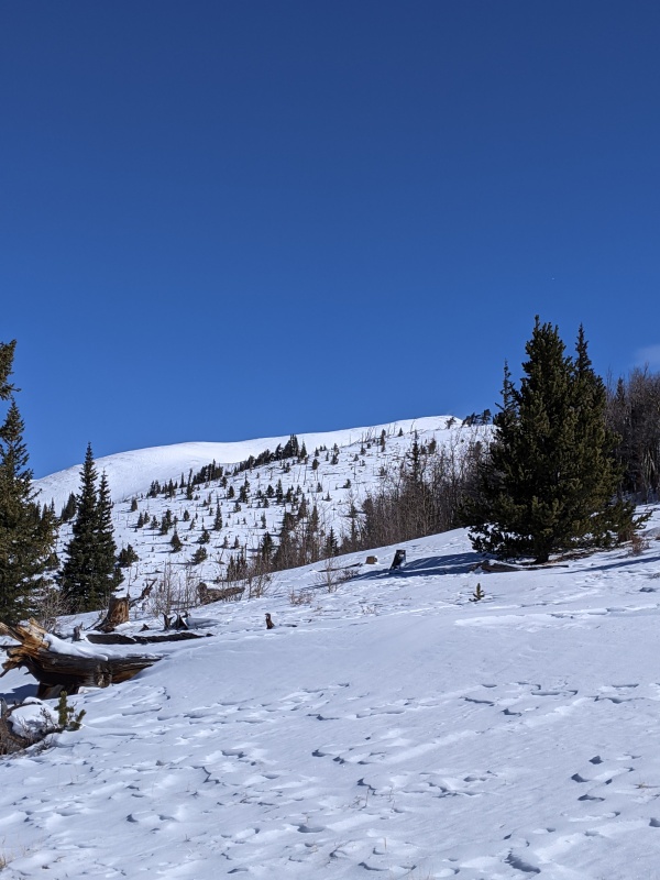
Long flat approach (3 miles until the first turn off)
First view of the summit proved my photos from the day before were correct. The SW is covered!
If any skiers are planning on doing this route, don't put skins on for the first 3 miles. That is if you're good and confident at skating. I am a confident split-skier but thats more of an afternoon thing for me.
The flat miles flew by as Jarrett and I hadn't seen each other since last June. Lots of nonsense to catch up on.
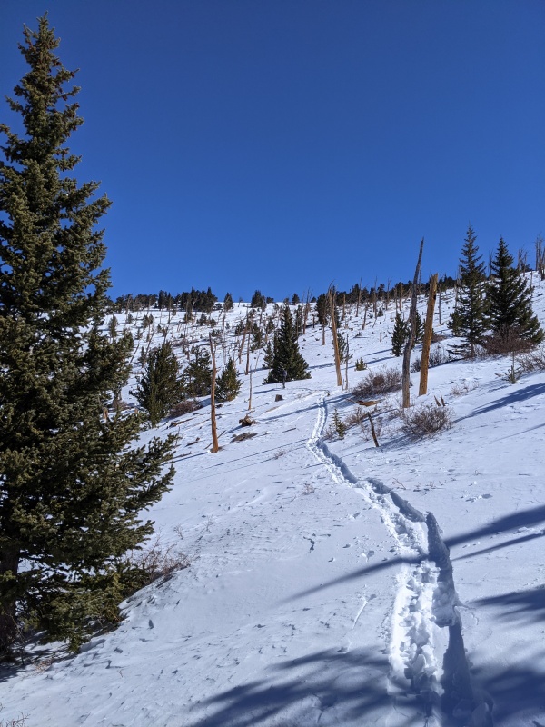
We goofed the turn off a bit. The road we took off the main road does a loop and instead of taking the first turn off, we went for the 2nd one. I still don't know why. It might have saved us an extra mile, or maybe only a half. Either way, the turn off was 184. Lots of snowmobile tracks up that was so skinning was easy.
184 Turn off
Just a couple ups n downs
You still there?
Up ahead as usual
Wish I got more photos of these trees
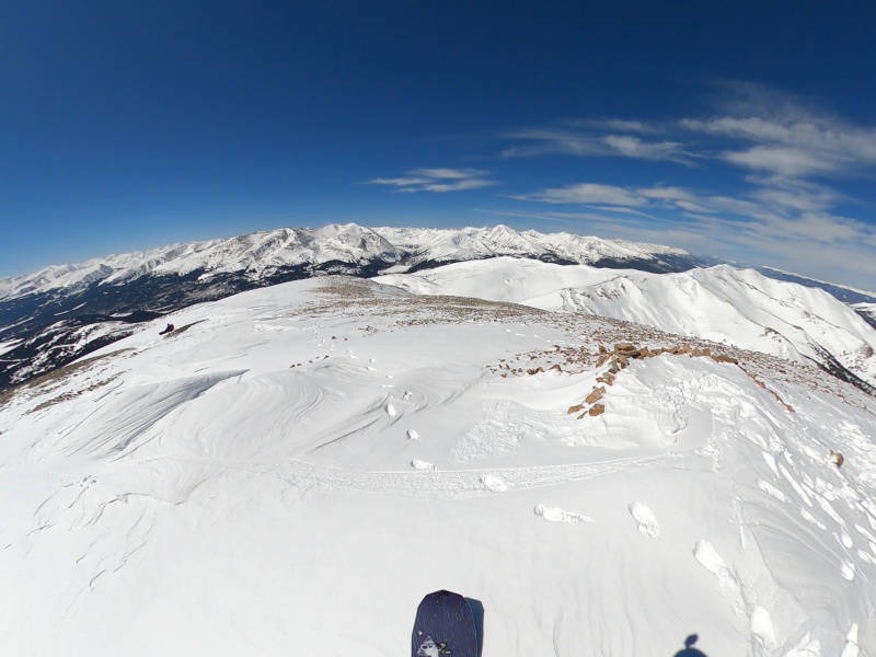
Okay Pete, I think this was a good idea.
This was the classic so close but so far moment. Seeing the line really helped raise the crew moral that the wind was trying to destroy.
A little bit of this
A lot of that
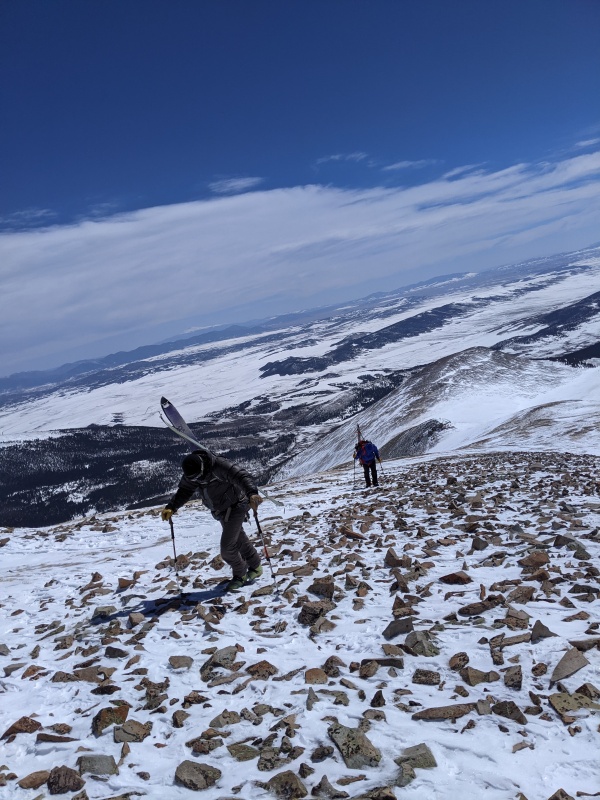
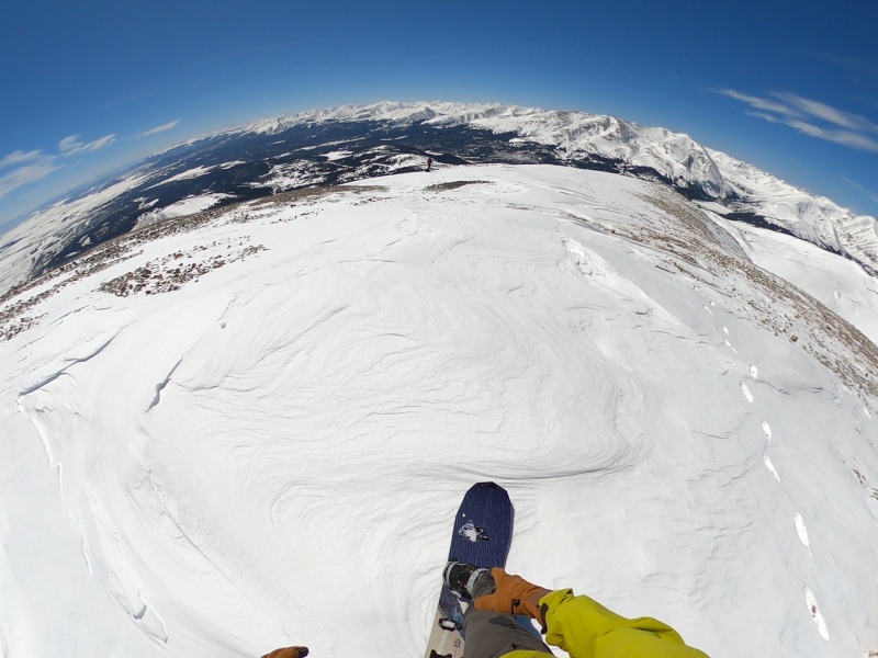
Up, up, down, up, rock, rock, snow, rock, snow, snow, wind, wind, summit, wind, wait, were on the summit?!?!??
J Q
Not much time spent of the summit. With the combination of wind and a longer approach than I had estimated, we all wanted to strap in and board. And get out of the wind.
Front Range gang looking strong after that up-slope
Summit strap in
Tracks from a previous party
Descent begins
Summit turns were smooth. Before getting to the bowl, there were a few rock sections to thread through but nothing we weren't used to.
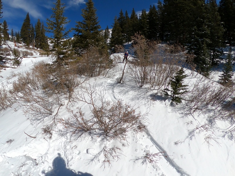
Regroup
Without anyone saying it, we all met up for a nice break away from the summit gusts. Much needed.
James hates me for not getting more videos of him. Sorry, man.
Down in the gut. Variable conditions but fun and safe.
I would love to see this exit gully on a bigger snow year.
Adventure boarding
No skins needed for the ski back
One final look at the summit before skiing back to the cars.
This was one of those silly ideas that worked out much more goodlier than expected. Snow was fantastic, route was long but easy, and weather was nearly perfect. Wind was annoying at times but things could have been much worse for March.
My GPS Tracks on Google Maps (made from a .GPX file upload):
Caution: The information contained in this report may not be accurate and should not be the only resource used in preparation for your climb. Failure to have the necessary experience, physical conditioning, supplies or equipment can result in injury or death. 14ers.com and the author(s) of this report provide no warranties, either express or implied, that the information provided is accurate or reliable. By using the information provided, you agree to indemnify and hold harmless 14ers.com and the report author(s) with respect to any claims and demands against them, including any attorney fees and expenses. Please read the 14ers.com Safety and Disclaimer pages for more information.
Please respect private property: 14ers.com supports the rights of private landowners to determine how and by whom their land will be used. In Colorado, it is your responsibility to determine if land is private and to obtain the appropriate permission before entering the property.


")
")
")
")
")
")
")
")
")
")
")
")
")
")
")
")
")
")
")
")
")