Download Agreement, Release, and Acknowledgement of Risk:
You (the person requesting this file download) fully understand mountain climbing ("Activity") involves risks and dangers of serious bodily injury, including permanent disability, paralysis, and death ("Risks") and you fully accept and assume all such risks and all responsibility for losses, costs, and damages you incur as a result of your participation in this Activity.
You acknowledge that information in the file you have chosen to download may not be accurate and may contain errors. You agree to assume all risks when using this information and agree to release and discharge 14ers.com, 14ers Inc. and the author(s) of such information (collectively, the "Released Parties").
You hereby discharge the Released Parties from all damages, actions, claims and liabilities of any nature, specifically including, but not limited to, damages, actions, claims and liabilities arising from or related to the negligence of the Released Parties. You further agree to indemnify, hold harmless and defend 14ers.com, 14ers Inc. and each of the other Released Parties from and against any loss, damage, liability and expense, including costs and attorney fees, incurred by 14ers.com, 14ers Inc. or any of the other Released Parties as a result of you using information provided on the 14ers.com or 14ers Inc. websites.
You have read this agreement, fully understand its terms and intend it to be a complete and unconditional release of all liability to the greatest extent allowed by law and agree that if any portion of this agreement is held to be invalid the balance, notwithstanding, shall continue in full force and effect.
By clicking "OK" you agree to these terms. If you DO NOT agree, click "Cancel"...
I like hiking up and down the Lake Como Road. I see beauty as the scenery changes with every switchback. I feel accomplishment and purpose as my legs burn while pushing me upward or slowing my descent. I find peace and relaxation as my mind wanders. I sense a spiritual presence as the clouds changes patterns and colors.
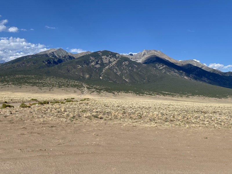
It’s a good thing that I like the Lake Como Road, because here I was again. My first hike on the Lake Como road was over 20 years ago. My friend and I started backpacking from 8300’ at 5am. Unfortunately, the altitude didn’t agree with me that day and I never made it past our camp just before the lake. My friend kept hiking and summitted Blanca and Ellingwood and we had a pleasant, slow hike out the next morning. In August 2015, I was able to return, this time with a 4am start for a day hike because bear/human problems at Lake Como campsites discouraged a backpacking trip. I summited Blanca at noon, but clouds were already building. While climbing down to the Ellingwood saddle, thunder rumbles got closer and I watched a woman’s hair start to lift up and then go sideways. Ellingwood would need to wait for a static-free day. Cooled by intermittent rain, I enjoyed the hike back down to 8400’ as I wondered when I might come back. I thought it would be best to wait until I was ready to climb Little Bear Peak on the same trip as Ellingwood.
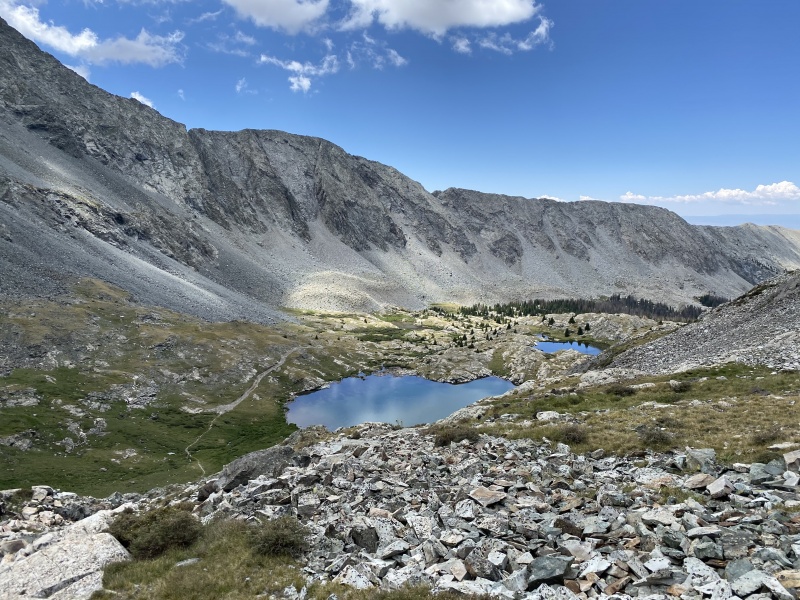
Lake Como Road and Little Bear Peak.
Fast forward to 2020. My fitness, skills and confidence had improved to allow climbs up Mt Wilson and Pyramid Peak earlier this summer. The forecast suggested that the monsoon was turned off again after heavy rain the prior weekend. I continued my route research and aimed for a third hike on the Lake Como Road.
Lake Como Road: July 29, 2020
I finished working early and left Denver at 2:00pm. Heading south on I-25 gave me plenty of time to think about my trip goals: backpack into Lake Como, avoid bear problems, and complete the Sangre de Cristo section of my fourteener list with Little Bear Peak, #50, and Ellingwood Point, #51. So many trip reports talk about the Lake Como Road with words like “nasty”, “miserable” and “sucks”. These words don't match up with my previous experiences. Was my memory selective? Would my first backpacking trip of the summer be “miserable”? I spent more time thinking about the Lake Como Road than I did Little Bear Peak or Ellingwood Point.
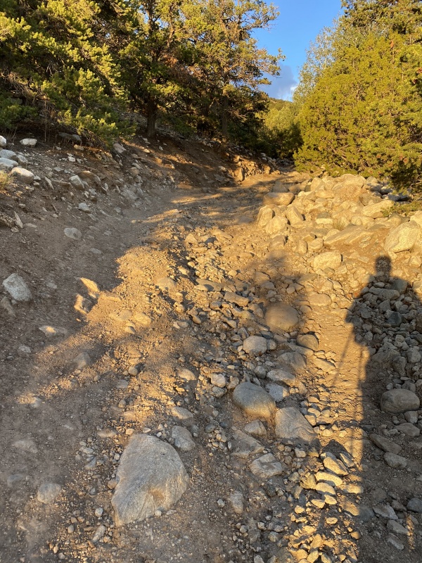
I was leaving the pavement at 6:00pm, driving up the smooth sandy road with clear skies above Little Bear and puffy cumulus clouds to the north. As I passed by parked Corollas, fifth wheel campers and vans the sand turned to gravel and steepened. I drive an older Toyota Sequoia, but I’m fairly conservative and I enjoy the full experience of hiking from the piñon pines to treeline, so after I passed several parked Honda CR-V’s and then Subaru’s, I pulled over just above 8500’.
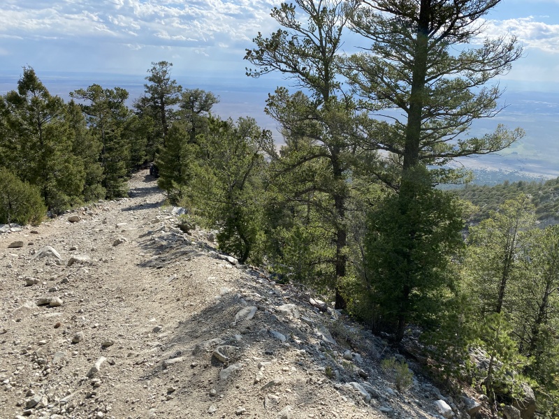
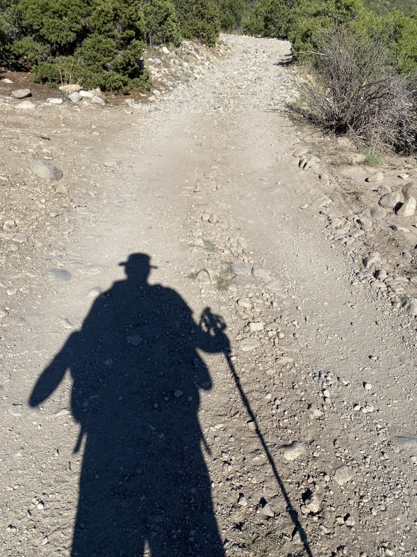
Starting up the Lake Como Road.Smooth road with all types of vehicles.
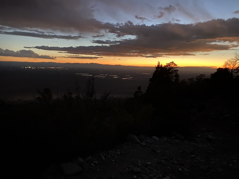
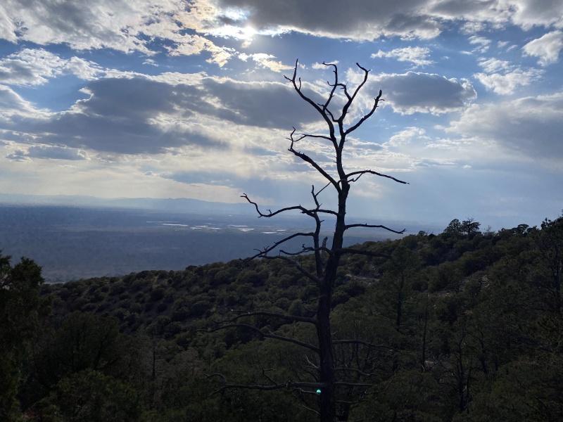
By 6:30, I was hiking up the cobbles as the clouds continued to put on an art show with shifting pigments and textures as the sun sank. After sunset, beauty continued to surround me with forest shadows, distant creek murmurs and strange headlamp reflections in the many puddles covering the entire width of the road. With a modest pace and evening cooling, at no point did I feel hot, let alone “miserable”; the word “invigorated” seemed more appropriate. At 10:00, I was setting up camp beneath the nearly full moon about 100 yards before Lake Como. At 11:00 I had packed tomorrow's summit bag (except for the food in my bear canister) and was trying to get to sleep.
Starting the hike on cobbles.Hiking on more variable sand/gravel/rocks.
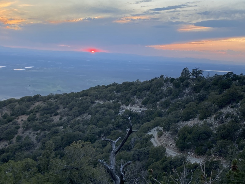
Sunlight.Twilight.Moonlight.
Little Bear Peak: July 30, 2020
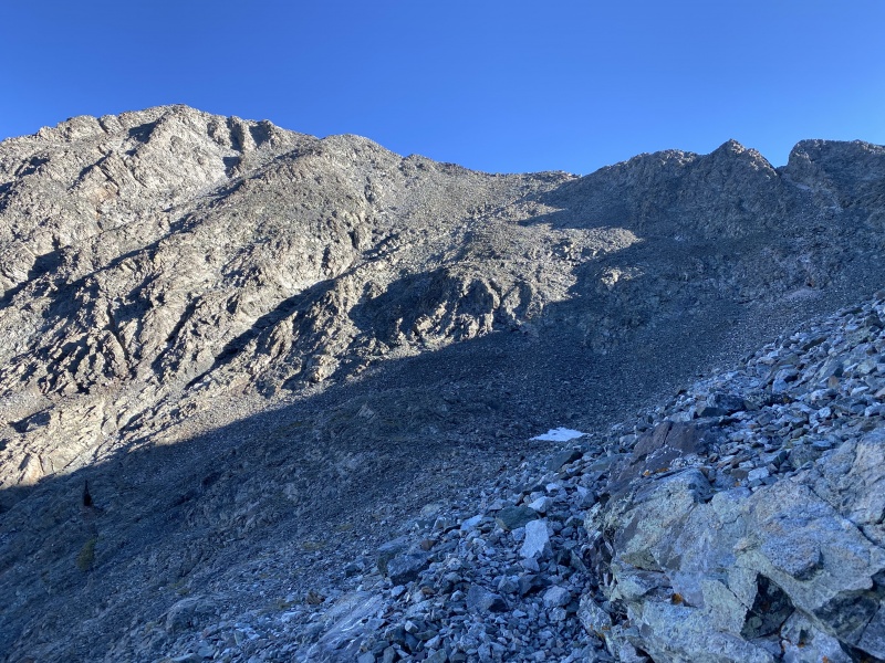
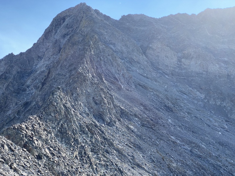
At 6:45am, I was back on the Lake Como Road, strolling past the lake, admiring the north face of Little Bear Peak. Shortly after the lake, I turned left and started ascending the couloir toward the notch in the west ridge. The hike up was steep and loose, but not difficult. By staying on the left (west) side, I felt relatively protected from rockfall; I was glad that this Thursday saw me sharing the couloir with only one other pair of climbers.
On the Lake Como Road to Little Bear.Leaving the road to ascend Little Bear's West Ridge.
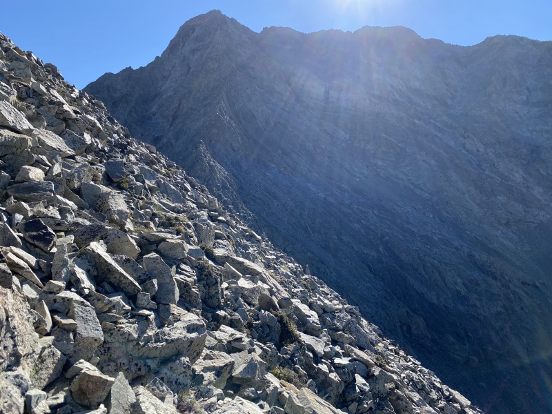
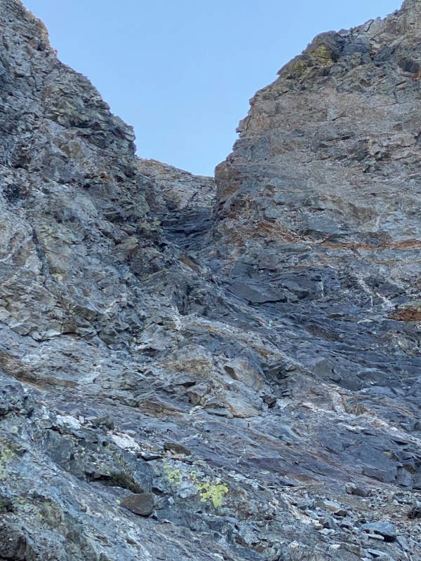
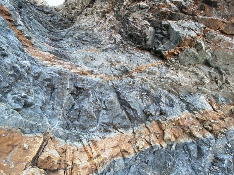
I was excited to see the backside of the peak and began the traverse toward the Southwest Face. I met one group that told me that they had just placed an orange rope in the hourglass and another group told me “mostly stay left, except for one place where you just go up the middle”. Soon, I was staying left as I climbed up black rock with orange bands and white veins to reach the narrowest part of the hourglass.
Traversing toward the Southwest Face.Ascending the lower part of the hourglass.
Unfortunately, the previous weekend’s big rains were still resulting in water covering the narrowest section. I tried the left side and made it up eight feet before running out of comfortable handholds. I tried the right side and made it up five feet before running out of footholds suitable for my boots—I felt like one more foothold would have been enough to get past the steepest point. Was this the “one place” to go up the middle? Maybe, but I voted against testing my traction in the flowing water. Then I stared at the thin orange rope. Knowing that the rope had just been installed this morning, I was tempted to try to use it, but decided this was no place for experimenting with unfamiliar rope maneuvers. Looking up the hourglass, I was intimidated by the size of the area above and how any falling rock would funnel into this one location. Certainly, this was not a place to dilly-dally. But so far, I hadn’t experienced any rockfall and based on tracking who had passed me, I thought there was only one group above me. So, I thought I had enough time: one more try on the left side; then one more try on the right side; each time getting no further than before.
Narrowest section of hourglass: left side.Narrowest section of hourglass: middle.
Reluctantly, I decided this section was beyond my solo ability and it was time to turn around. Was this the end of my fourteener quest that started forty years ago? Oh well, at least I could climb Ellingwood tomorrow and grow my list to #50 of 58. I sent a message back to my wife so she wouldn’t worry if she was tracking my progress via Garmin and saw 30 minutes of no progress. Hopefully, she would be pleased that judgement overcame obsession. Halfway back to the notch on the ridge, I was already contemplating what it would take to successfully climb the hourglass. I put those thoughts aside to focus on avoiding loose rocks as I downclimbed the couloir. Back on the Lake Como Road at 2:00, I was in my tent napping at 2:45.
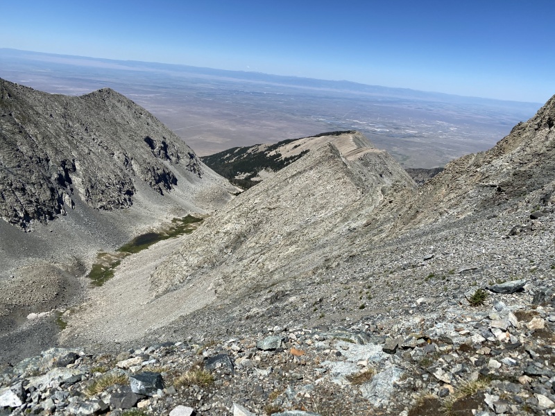
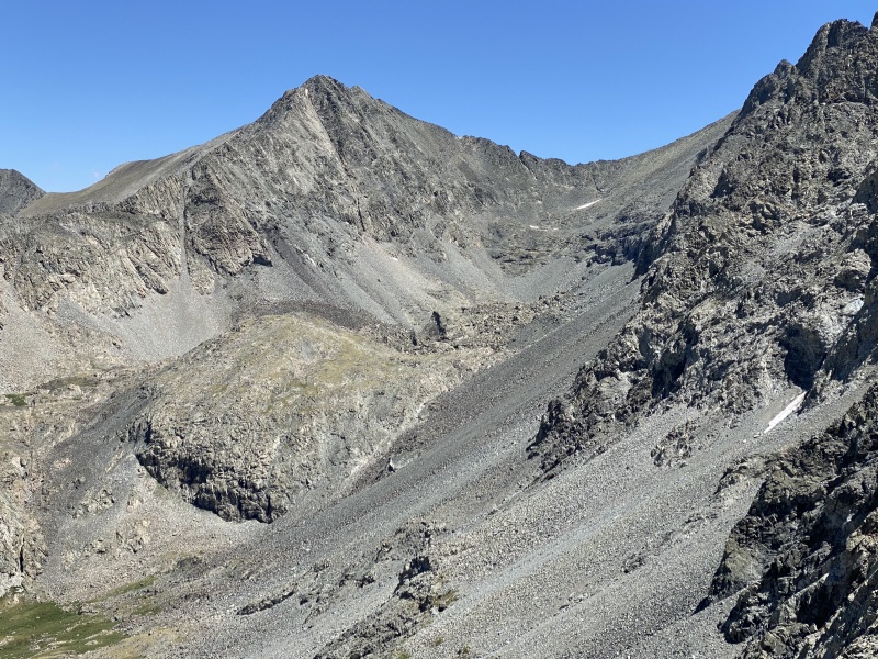
South side of the ridge: traversing back after turning around.North side of the ridge looking at Ellingwood Point: tomorrow's consolation prize?
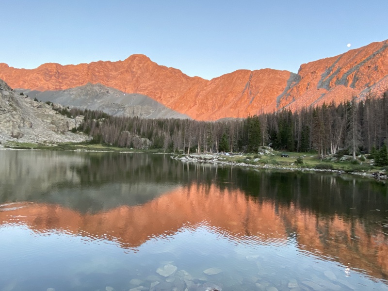
Rejuvenated by sleep and dinner, I relaxed at the lake while filtering the next day’s water and enjoyed the reflecting colors on the lake as the moon rose and the sun set. I wasn’t sure how, but I felt optimistic that I might be back on the Lake Como Road in a future year to summit Little Bear Peak.
Lake Como Alpenglow: tonight's consolation prize!
Ellingwood Point: July 31, 2020
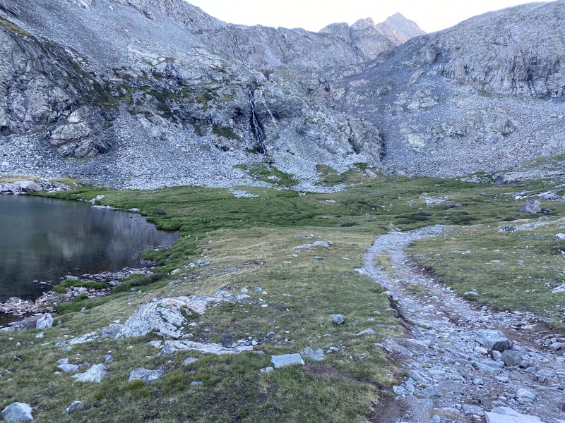
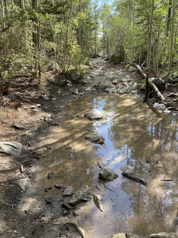
At 6:30am, I was back on the Lake Como Road, hiking towards my consolation prize for this trip—Ellingwood Point. There were still many places where puddles covered the road. Where the road ended, a well maintained CFI trail began traveling up a cliff alongside a waterfall and continuing past several lakes. Eventually, I branched off the Blanca Peak trail to start a mix of trail and rock hopping up to Ellingwood Point.
On the Lake Como Road to Ellingwood Point.Last section of road.
Leaving the Blanca trail to ascend Ellingwood's South Face.
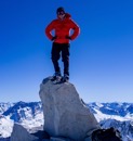
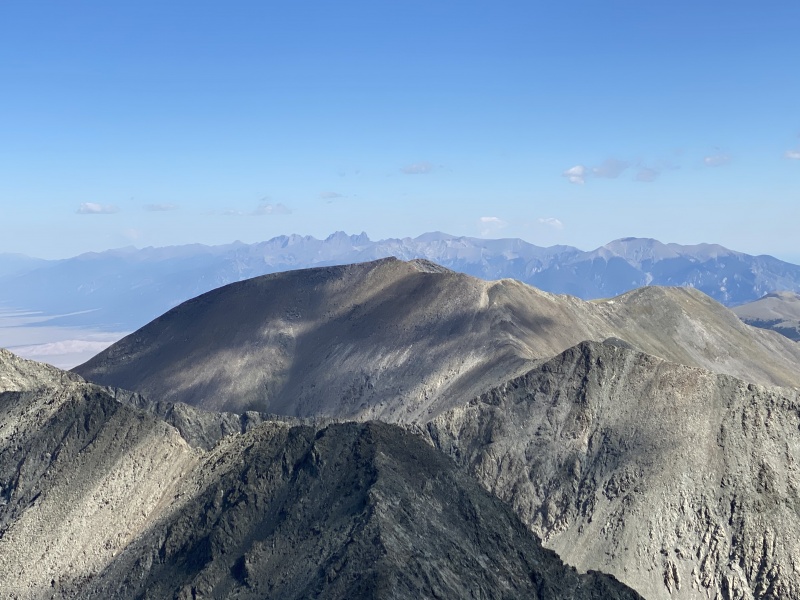
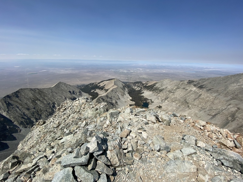
From the summit, I admired the views and felt pleased that I had climbed my 50th Colorado 14er. I reflected on past climbs up nearby Mt Lindsey and Blanca Peak and the distant Crestones. However, it was hard to ignore the other dramatic summit just across the valley. I set a new goal to return to climb Little Bear Peak and thought that maybe I will still be able to get to #58.
Ellingwood Summit View: Lindsey and Blanca.Ellingwood Summit View: Crestones.Ellingwood Summit View: Little Bear. Next year?
Descending was uneventful with no thunder or static electricity this trip and I was back in camp at 1:30 for lunch and a short nap.
Descending to Blue Lakes to regain the Lake Como Road.
Lake Como Road: July 31, 2020
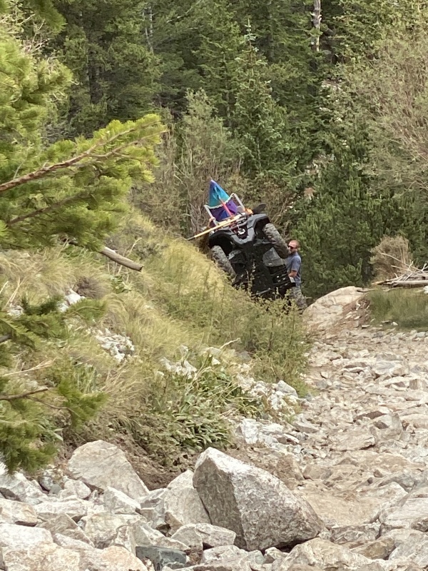
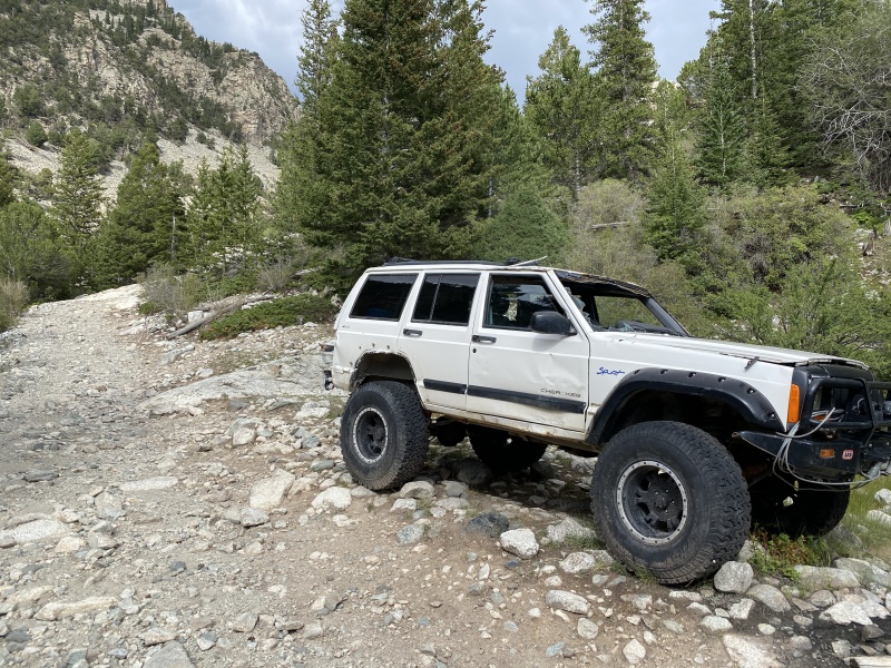
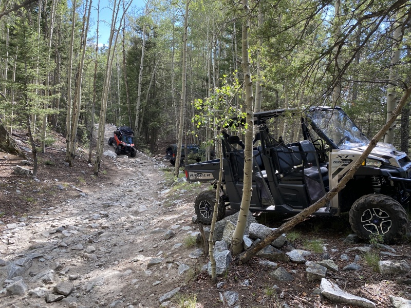
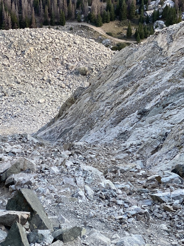
By 3:30, I was packed up and back on the road/trail. I won't disagree with others who think that the Lake Como Road can be a bit long and repetitive, but that's part of what I like about the road--more time to enjoy the hike. On the Lake Como Road, especially on a Friday afternoon, I am entertained seeing the variety of gear that comes up the road with hikers and drivers. On the Lake Como road, I am relaxed by the touch of the breeze, the sound of running water and the sights of forest, mountain, valley and sky. On the Lake Como road, there’s plenty of time for thinking. I thought about retirement, family, the pandemic and future travels. Sometimes, by brain just idled. Sometimes, I thought about what I could do differently next time to be able to climb the hourglass and reach the summit of Little Bear Peak.
ATV with kayak rack struggling up Jaws 2.Jeep Cherokee abandoned after turning around (and maybe over) at Jaws 1.UTV cruising through the forest.
While hiking down, I started to make a list of things that might increase my odds of future summit success:
Get more details on route from hourglass to summit
Understand exactly how to get through the narrowest part of the hourglass
Improve my climbing skills
Find grippier footwear
Lighten the load for backpacking and summiting
Arrive earlier at Lake Como and get better sleep
Drive higher up the road
Consider non-hourglass route or snow climb the hourglass
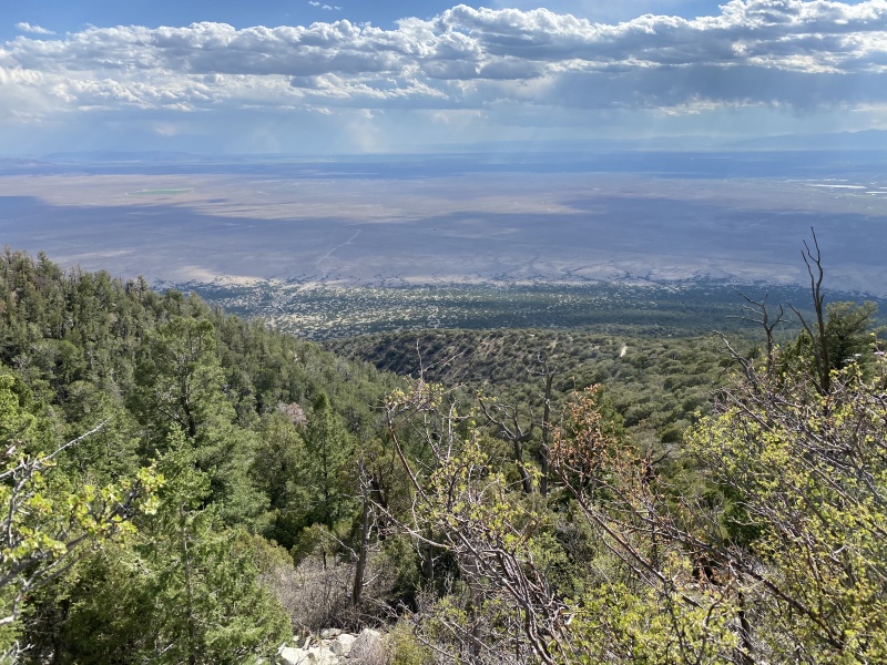
The mix of thoughts, trees and clouds made the descent seem to go by quickly.
Descending with trees.Descending with clouds.
I was back at my truck at 7:00pm and started the bouncy drive down to the valley floor. As I looked back at the Blanca Massif, I looked forward to coming back next year to climb Little Bear and have a fourth hike on the Lake Como Road.
Looking back at Lake Como Road and Little Bear. Until next time.
The next week, back in Denver, I dove into more internet research on climbing the hourglass. I was able to verify that the wet, narrow spot where I turned around was indeed the crux of the climb. I also confirmed that, when dry, this was the place to go straight up the middle. Most importantly, I investigated approach shoes. As I tested La Sportiva options at REI, I found that a TX Guide shoe would hold all my weight with the ball of my foot placed on one small stone, whereas my hiking boots just bent around the stone to touch the floor; I was sold. With more information and new gear, I thought maybe I would go back sooner rather than later. Seeing a favorable forecast and seeing that the last two weeks had been very dry, I decided to head back to the Lake Como Road to make another attempt to ascend Little Bear.
Lake Como Road: August 13, 2020
I was able to leave Thursday morning and was driving up the Lake Como Road by 3:45pm. This time, I drove slightly further to 8700’ before deciding I had bounced enough. With my approach shoes hanging from my pack, I started up the road at 4:30.
Returning for a fourth hike up the Lake Como Road. Sooner than expected.Approach shoe shadows--ready to try again in the hourglass..
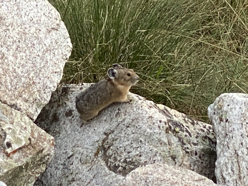
Once again, I enjoyed watching the changing clouds over the valley and the shifting shadows in the forest. On this trip, the road had nearly dried out. I thought a dry road might meant a dry hourglass too. I had enough daylight to watch many pikas bringing in their hay.
Ascending with trees and clouds.
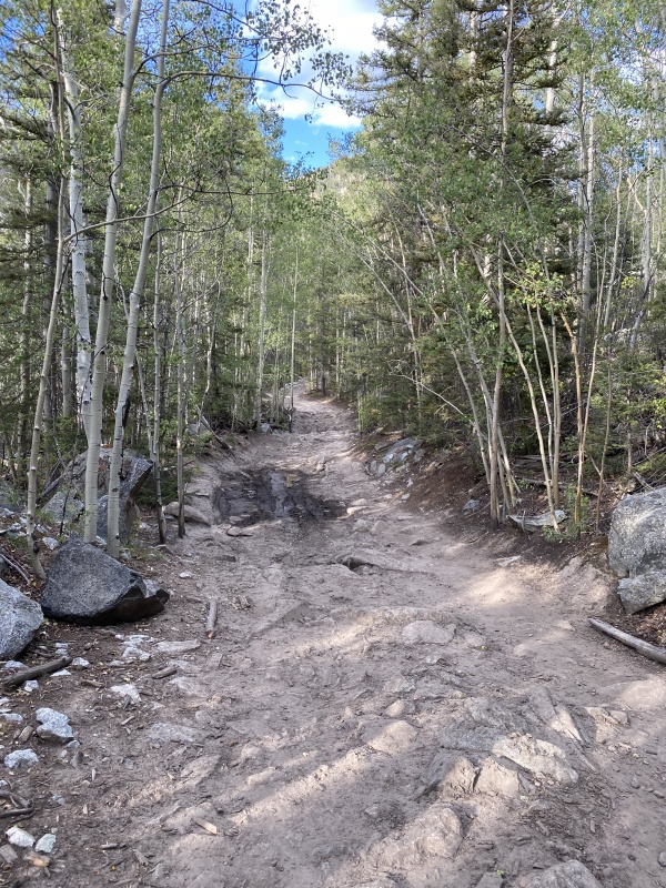
Today's dried out road through the forest.Similar location two weeks ago.
Ready to harvest the next stack of hay. PikaSteve's cousin?
I arrived at my campsite at 7:30, set up my tent and walked 100 yards further to sit at Lake Como. As I watched the light fade on Little Bear Peak, I visualized my new approach shoes gripping tightly and hoped for limited people, limited rockfall hazards and limited water in the hourglass.
Little Bear Peak: August 14, 2020
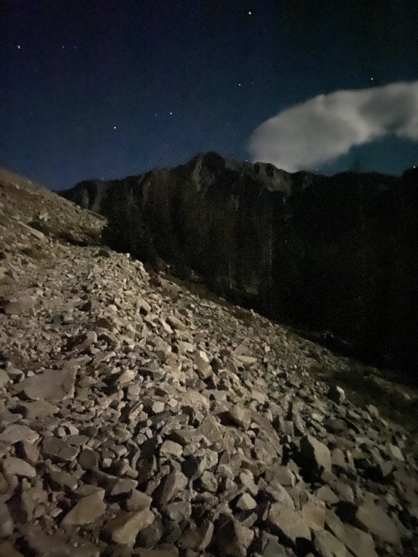
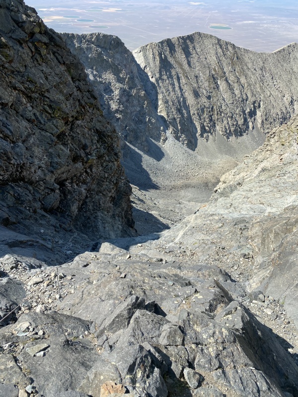
In addition to hiking on a weekday, I thought getting a late 700am start from camp (on a day with a perfect weather forecast) would help reduce the number of people climbing above me in the West Ridge couloir and, most importantly, in the hourglass. Whether due to good luck or smart strategy, this plan generally worked well. As I moved up to the West Ridge, this time I stayed on the right (east) side where solid rock at the edge met the loose rock in the couloir. My advice: avoid the loose middle; either edge is OK—just choose the side that limits rockfall danger from any group above you; and of course, wear a helmet. Once on the south side of the ridge, the hourglass loomed in the shadows ahead. By 10:00, I had finished the traverse and was looking up at the obstacle that I could not overcome on my earlier trip.
Halfway up the West Ridge couloir.Halfway across the West Ridge traverse to the hourglass.
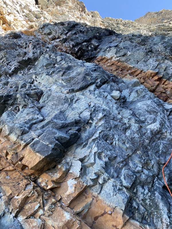
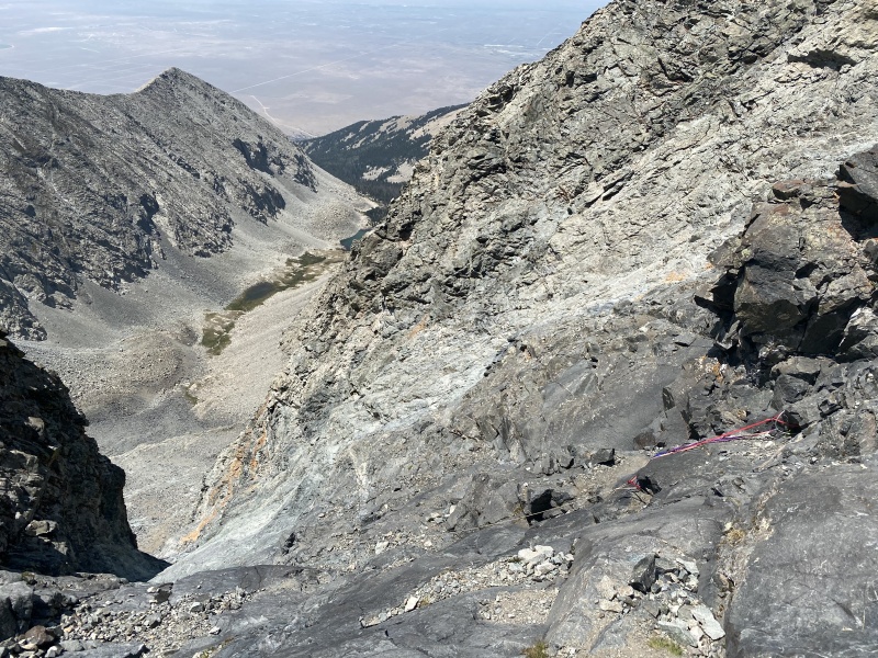
With sticky approach shoes, I quickly ascended the lower section of firm rock to the narrowest part of the hourglass, where I had turned around two weeks ago. Instead of a wide flow, there were only a few tiny trickles of water. The orange rope from two weeks ago was already 20 feet shorter with frayed sections visible further up. No one had passed me recently and I did not hear any sounds from above. I took a deep breath and headed straight up the middle with my new shoes easily holding my weight on tiny ledges. After only a few handholds and footholds, adrenaline was flowing, the steepest section was behind me, and it became easy to smear my Vibram soles against the smooth rock, avoiding scattered loose rocks and quickly gaining elevation until just below the fixed rope anchor point.
Ascending the lower hourglass.Narrowest section of the hourglass: crux is to climb from lower to upper orange band.
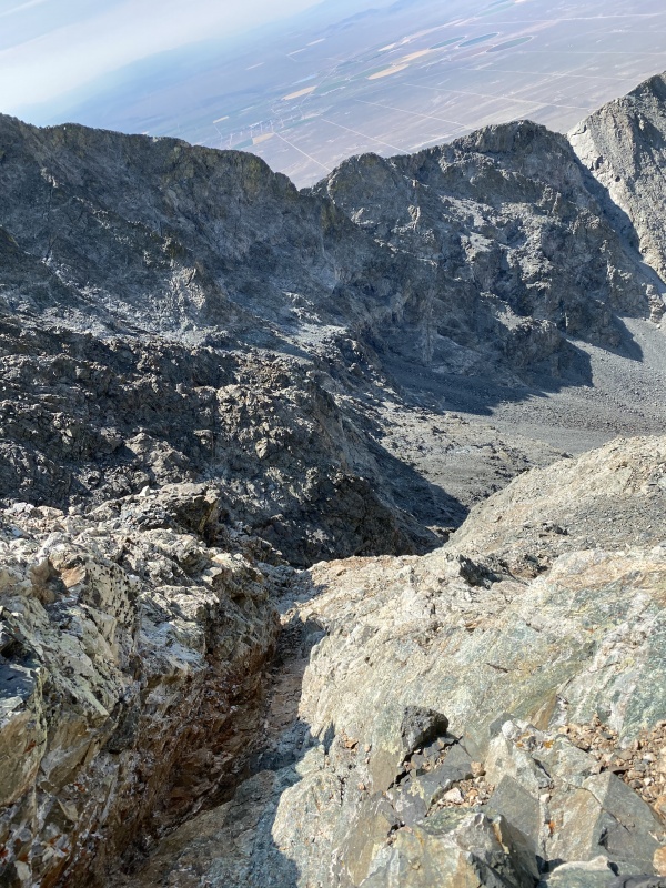
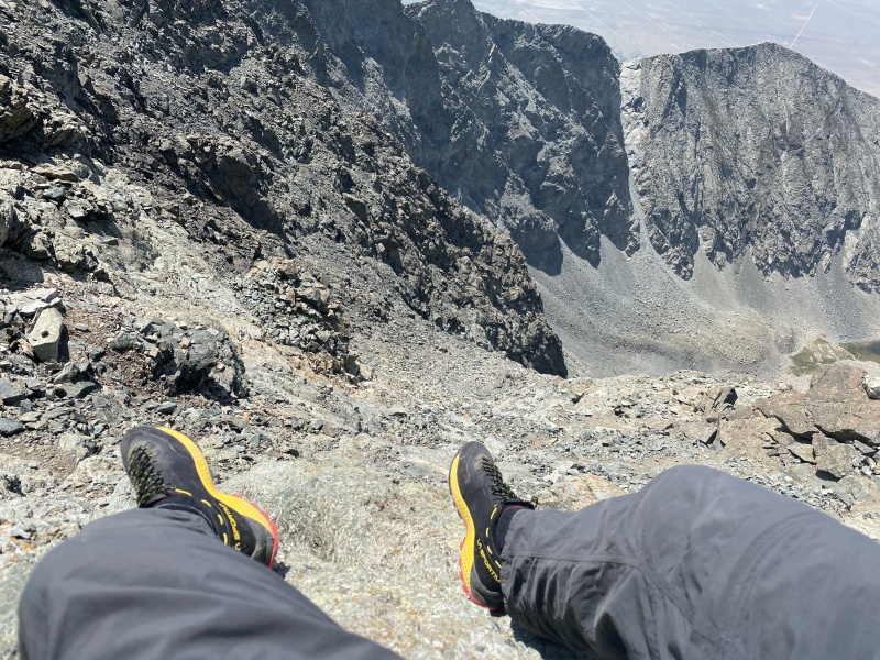
Here, I started to hear a group climbing down, so I waited beneath the protective shadow of a large overhanging rock until they were past the narrowest funnel point of the hourglass. Then I worked my way up and left (west) as the climbing difficulty decreased and the loose rock hazards increased. There was one long chute that presented an unexpected obstacle—I patiently followed it down to find an easier place to get up and over (in hindsight, I could have just kept following it up to reach an easier place to cross). From here, I continued to carefully hike up over loose rocks. I had the summit to myself at 11:15.
Waiting for funnel point to clear; just west of the rope anchor.Further up--chute on west side of southwest face.
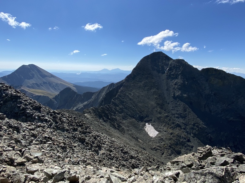
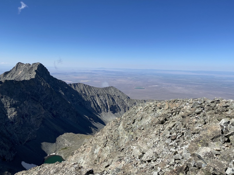
Summit View: Ellingwood and Blanca.Summit View: Lake Como and San Luis Valley.
At noon, I was still alone as I started my descent on the other (east) side of the southwest face. On my way down, neither my hands nor feet dislodged anything, but, a few times, my fifth point of contact knocked down some rocks. As the rocks continued to bounce and gain speed, I called out “rock, rock, rock” and made a mental note to stop scraping my butt while moving. As I neared the fixed rope anchor, I heard some noises above me and realized that while lounging on the summit I hadn’t seen another climber who came up the west side and was now descending. All of a sudden, I had potential danger following me down.
The considerate climber volunteered to wait until I had exited the funnel. The potential for rockfall from above and the sight of steep, smooth rocks below started another dose of adrenaline. With a mix of walking and crab-walking, soon I was at the crux where I faced inward for three or four footholds then quickly stepped off to the west side, out of the most dangerous rockfall zone. I yelled upwards “Clear” to the climber above and then quickly kept moving down and sideways until I was totally clear of the hourglass. As I took a snack break, I was thankful that I had only seen a few other climbers today and none of them had knocked down rocks from any of their points of contact. With my new shoes, with negligible water flowing and with limited rockfall hazard, I had really enjoyed climbing up and down the hourglass. Retracing my steps from two weeks ago, I was back in camp at 4:00.
Descending east of the rope anchor: loose rocks on top of smooth rocks.Little Bear Success: "It's gotta be the shoes".
Lake Como Road: August 14, 2020
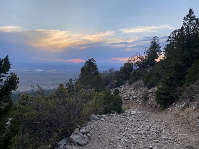
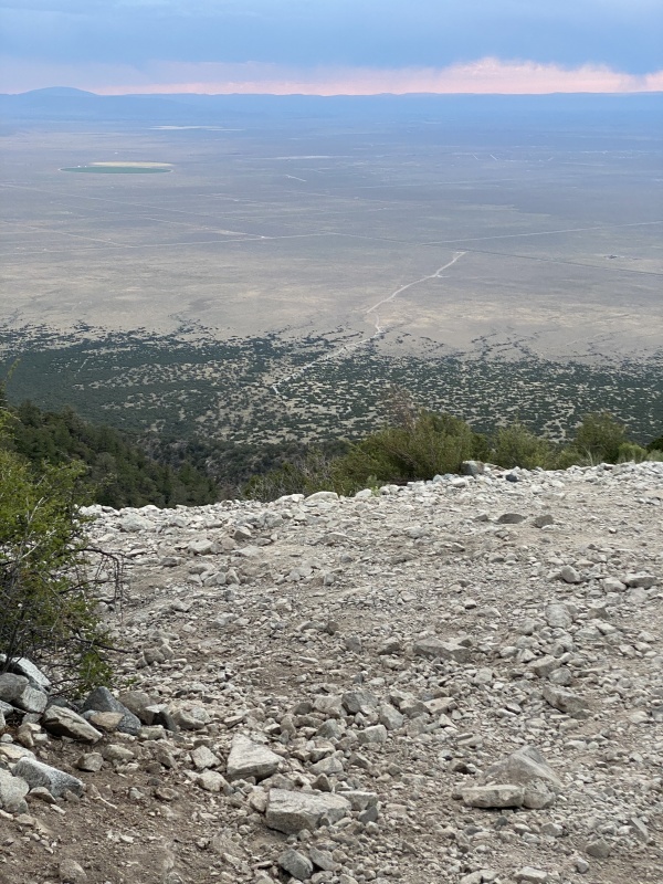
After napping, water filtering and taking down camp, I was back on the Lake Como Road at 6:00. This was great timing to benefit from cooler temperatures and enjoy the sunset show while hiking back to the truck. As I slowly descended back toward the San Luis Valley floor, once again, I enjoyed the quiet time to let my mind wander. I thought about retirement and consulting projects. I thought about what my family would do when the pandemic was over. I thought about future and past fourteener trips—some with successful summits and some with successful turnarounds. I had a bit of a “runner’s high” as my legs continued their braking as the valley floor got closer and closer. I thought about writing a trip report and possible titles. As I watched the sky light up at dusk, I thought this was the opposite of “miserable” or "nasty" or "sucks". I wondered why so many people say they dislike the Lake Como Road. I knew my contrarian opinion would be the title for my trip report.
Hiking the Lake Como Road.Liking the Lake Como Road.I like the Lake Como Road.
All of these trip reports highlight the importance of communicating and coordinating with your own party and other parties to minimize rockfall hazards
Moose Danger: https://www.youtube.com/watch?v=iMu6T29mqBw (long unedited video; up crux at 6:30 mark; down chute/chimney at 31:00; down smooth rock above crux with lots of loose rock at 46:00)
Matt Conklin: https://www.youtube.com/watch?v=SIMCLVqsQso (starts at the narrowest part of the hourglass; Gopro video may make you dizzy, but gives great view of footholds)
FreedivejeepHD: https://www.youtube.com/watch?v=-kUJNkY4V3c (good info if you are thinking of driving up the road; my last trip, I drove to the same elevation as the Mercedes)
Thumbnails for uploaded photos (click to open slideshow):
Lake Como Road is a polarizing one. I don't fit into either camp, personally. I've been up there four times, twice in winter, and while it's a road that's about all that can be said about it. I've hiked worse and I've hiked better. Considering a huge number of the peaks I've done make Lake Como Road look like an airport moving walkway, I'll take it as is. It could be a lot worse!
Congratulations on accomplishing your goal of little bear.
Thanks for the positive notes about this road, and the 'successful turnarounds' comment.
I still have this road hike in my future as we went into blanca basin for our little bear adventure.
Now I will be looking forward to the miles of meditation.
...for the feedback. One additional comment: the four wheeling crowd that I ran into on my trips all seemed very well behaved; most groups with UTV's seemed to be family groups with at least two generations.
Some tips for other como road drivers:
-Buy a portable compressor and air your tires down, it makes a world of difference on that road. You'll get more traction, less bumps and will be less likely to puncture a tire since the tires conform to the ground better. ~20 psi seems to work well for most standard 4x4s (Tacoma/4runner/etc) add psi if your rig is heavier
-Slow and 4Low - even though the road isn't that steep you'll have more control over your speed in 4Low so you don't smash into rocks and put less stress on your engine and transmission
-4Low on the way down + 1st gear so you don't burn out your brakes
-Uphill drivers have the right of way but common sense says if you are near a pull off then just be considerate
Nice account, thanks for sharing it 5/13/2021 8:42pm
Really enjoyed hiking/climbing with you vicariously. Your account is engaging and informative, and very much appreciated! I don't know if I'd say I "like" Lake Como Road, but I did enjoy it for the most part my one visit. Looking forward to another run at it this summer.
I also appreciate that I'm not the only one to post TRs nine months after the actual experience. This one was worth the wait. The mountains are timeless.
...DeTour and Tygr for your feedback and for your trip reports. I finally completed a trip report on Capitol Peak from last September and will now turn my focus to getting ready for more adventures this summer.
Caution: The information contained in this report may not be accurate and should not be the only resource used in preparation for your climb. Failure to have the necessary experience, physical conditioning, supplies or equipment can result in injury or death. 14ers.com and the author(s) of this report provide no warranties, either express or implied, that the information provided is accurate or reliable. By using the information provided, you agree to indemnify and hold harmless 14ers.com and the report author(s) with respect to any claims and demands against them, including any attorney fees and expenses. Please read the 14ers.com Safety and Disclaimer pages for more information.
Please respect private property: 14ers.com supports the rights of private landowners to determine how and by whom their land will be used. In Colorado, it is your responsibility to determine if land is private and to obtain the appropriate permission before entering the property.


")
")
")
")
")
")
")
")
")
")
")
")
")
")
")
")
")
")
")
")
")
")
")
")
")
")
")
")
")
")
")
")
")
")
")
")
")
")
")
")
")
")
")
")
")
")
")
")
")