Download Agreement, Release, and Acknowledgement of Risk:
You (the person requesting this file download) fully understand mountain climbing ("Activity") involves risks and dangers of serious bodily injury, including permanent disability, paralysis, and death ("Risks") and you fully accept and assume all such risks and all responsibility for losses, costs, and damages you incur as a result of your participation in this Activity.
You acknowledge that information in the file you have chosen to download may not be accurate and may contain errors. You agree to assume all risks when using this information and agree to release and discharge 14ers.com, 14ers Inc. and the author(s) of such information (collectively, the "Released Parties").
You hereby discharge the Released Parties from all damages, actions, claims and liabilities of any nature, specifically including, but not limited to, damages, actions, claims and liabilities arising from or related to the negligence of the Released Parties. You further agree to indemnify, hold harmless and defend 14ers.com, 14ers Inc. and each of the other Released Parties from and against any loss, damage, liability and expense, including costs and attorney fees, incurred by 14ers.com, 14ers Inc. or any of the other Released Parties as a result of you using information provided on the 14ers.com or 14ers Inc. websites.
You have read this agreement, fully understand its terms and intend it to be a complete and unconditional release of all liability to the greatest extent allowed by law and agree that if any portion of this agreement is held to be invalid the balance, notwithstanding, shall continue in full force and effect.
By clicking "OK" you agree to these terms. If you DO NOT agree, click "Cancel"...
Castleabra had been on my target list for several years, but it always got bumped. It was my last remaining peak above 13,800 feet and it bugged me that I had not hiked it. The south side approach always appealed to me and bringing my old truck out of retirement would finally make it happen in 2020.
I drove from the Texas Creek TH in Taylor Park after climbing Magdalene Mountain and camped at the Twin Lakes TH off Pearl Pass Road. The road to this point was easy 4WD, but definitely not suitable for AWD/Subarus. I only remember a spot or two where I had to be careful about tire placement. There was a couple in their jeep at the trailhead when I arrived, we exchanged pleasantries and after they departed I set up my tent. I did not see another soul until I passed a truck on the drive out down Pearl Pass Road the next day. It's always neat to have the whole place to yourself.
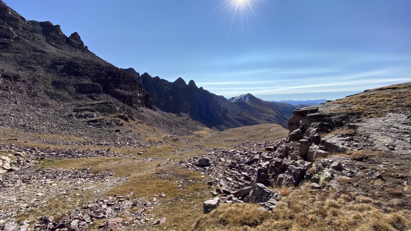
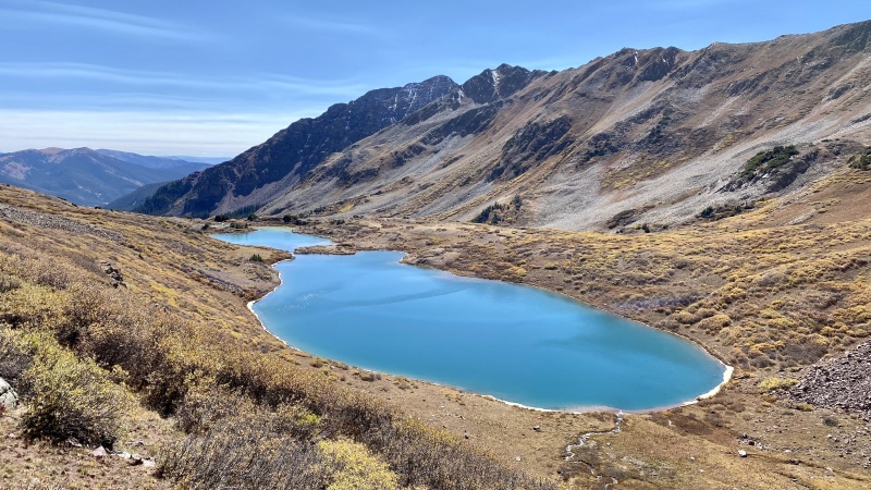
I forget what time I started, but it was not super early, after sunrise for sure. From the trailhead I hiked northeast parallel to Pearl Pass road before joining the road. You avoid two creek crossings this way, the one entering the trailhead and one just before you join the road. That left one creek crossing before leaving Pearl Pass road and hiking up Cumberland Basin. The crossing is shallow and rock-hoppable in the fall. I had no issue following the trail up Cumberland Basin, but I could see it being more difficult in the dark. Nothing too interesting in Cumberland Basin. There are some beaver ponds lower down, but not much else. The final part up to Castleabra is loose and a bit annoying, but it is over pretty fast and you are rewarded with excellent views of Castle Peak and its rugged south ridge that leads to Pearl Pass. The ridge proper from Castleabra to Unnamed 13500 goes at loose class 3 I believe, but in the interest of saving some time and avoiding difficult loose rock, I decided to drop down and do a lower traverse. I rejoined the ridgeline just past the saddle where the rock quality improves considerably. The scrambling up 13500 was enjoyable from here. The plan had been to get Unnamed 13162 as well, but after looking over the ridge and being behind schedule it was not in the cards and I decided to work my way down the south ridge of 13550 towards the saddle above Twin Lakes. I probably should have taken a closer look at the ridge when I was hiking up Cumberland Basin, but I figured worst case I could always re-ascend and descend around the difficulties. It's starts off gentle and then hits a ledgy-cliffy area. I was able to pick my way down through the ledges about halfway before having to traverse to the right back towards the ridge proper. Fortunately, I discovered a narrow loose gully that led directly into the a much larger gully that would deposit me where I needed to be. There was some serious scree surfing to be had if you are into that kind of thing. The difficulties and looseness relented once was I was on top of my crossover point on the ridge. From there down to the lakes it was nonstop picture taking. The lakes were much more stunning than I expected. If you are not into peak bagging, I recommend the hike up the Twin Lakes Trail to see these beauties. After taking a ton of photos, I descended the cruiser Twin Lakes Trail back to Twin Lakes trailhead and drove back to Boulder.
GPX download available below. I hope you enjoy the photos!
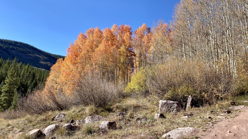
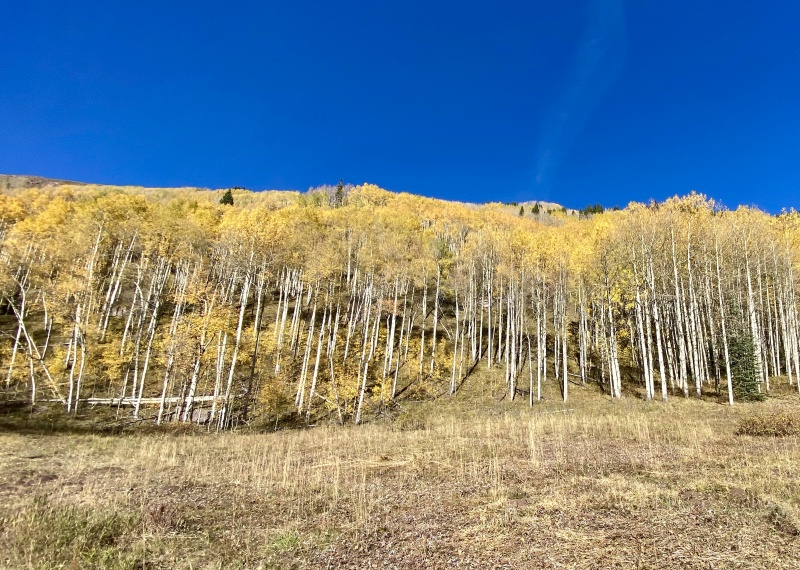
PHOTO TOUR
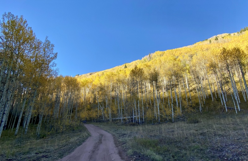
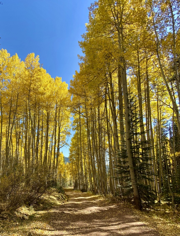
Pearl Pass Road.
Pearl Pass Road.
Pearl Pass Road.
Baby is 24 years old and she has retired a couple times already (14ers - Castle Peak and Centennials - Hagerman Peak), this will be her third and final retirement from 4wd trailhead driving...or will it?
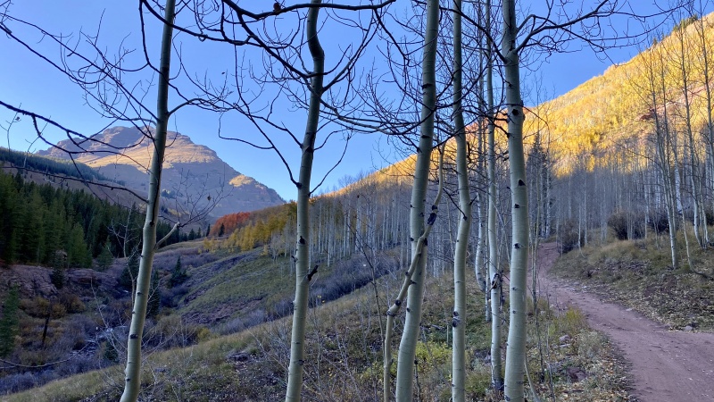
Cumberland Basin.
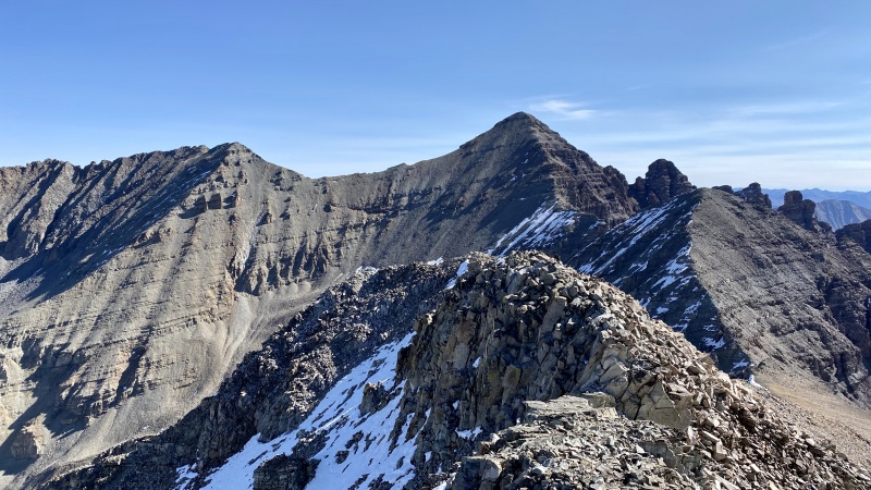
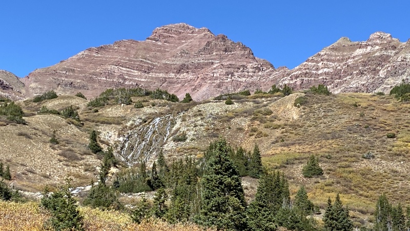
View of 14er Castle Peak from atop Castleabra.
View of 13,550 from atop Castleabra.
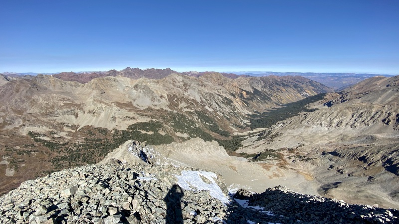
View of Conundrum Creek Basin from atop Castleabra.
View of Castleabra and Castle Peak from atop 13,550.
View of Castle Peak from atop 13,550.
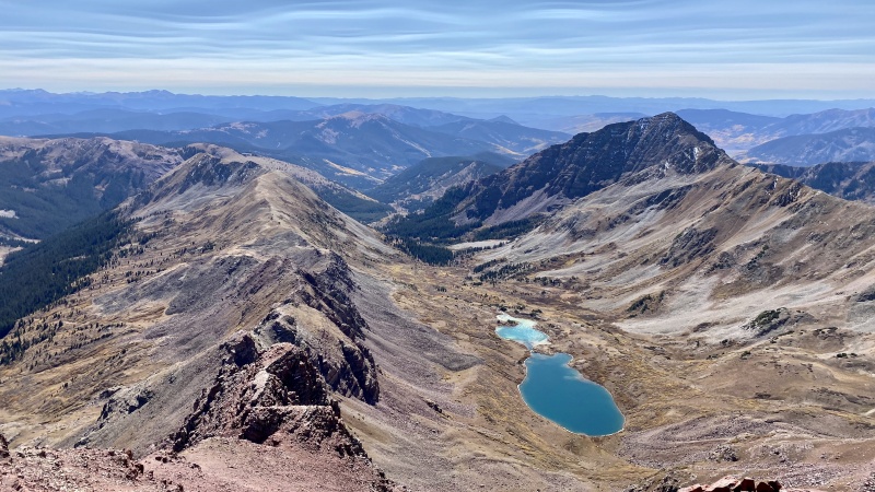
View of Twin Lakes from atop 13,550.
Rock inside a rock inside a rock.
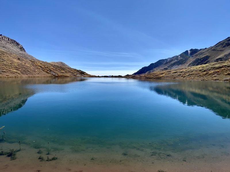
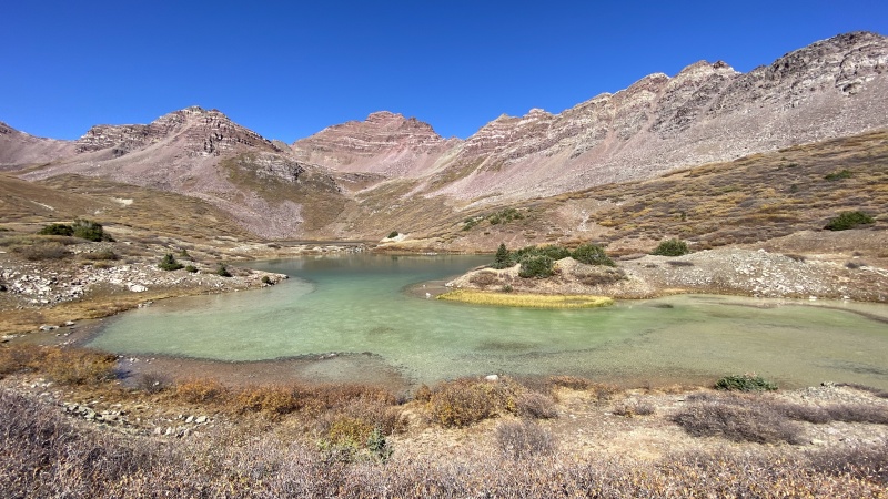
Twin Lakes.
Upper Twin Lake.
Upper Twin Lake.
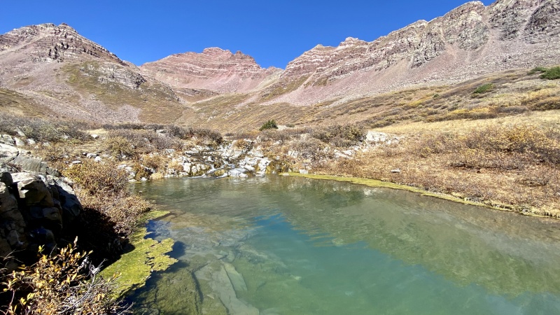
Inflow from upper to lower lake.
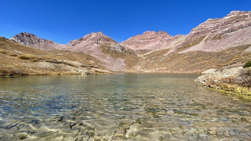
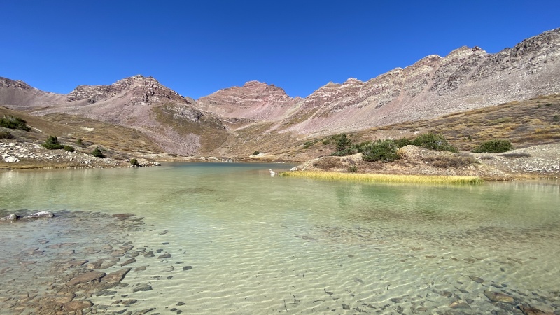
Lower Twin Lake.
Lower Twin Lake.
Lower Twin Lake.
Lower Twin Lake.
Waterfall beneath the lower lake.
Pearl Pass Road.
Pearl Pass Road.
Pearl Pass Road.
Pearl Pass Road.
My GPS Tracks on Google Maps (made from a .GPX file upload):
Castleabra from Conundrum Creek is definitely a nasty slog, so your route from Cumberland Basin is the way to go. I wish I'd known that when my sons and I did Castleabra!
While 13,550 is not bad from Conundrum Creek, it includes lot of willows you have to bash through, so Cumberland Basin is a better approach for it as well.
This is a total long-shot considering this post is a few years old, but do you recall anything about the road between your campsite and Cumberland Basin? Could you have kept driving that portion without major issues?
My recollection is that was a mellow section. I did skip the creek crossing between the trailhead though.
Caution: The information contained in this report may not be accurate and should not be the only resource used in preparation for your climb. Failure to have the necessary experience, physical conditioning, supplies or equipment can result in injury or death. 14ers.com and the author(s) of this report provide no warranties, either express or implied, that the information provided is accurate or reliable. By using the information provided, you agree to indemnify and hold harmless 14ers.com and the report author(s) with respect to any claims and demands against them, including any attorney fees and expenses. Please read the 14ers.com Safety and Disclaimer pages for more information.
Please respect private property: 14ers.com supports the rights of private landowners to determine how and by whom their land will be used. In Colorado, it is your responsibility to determine if land is private and to obtain the appropriate permission before entering the property.


")
")
")
")
")
")
")
")
")
")
")
")
")
")
")
")
")
")
")
")
")
")
")
")
")