| Report Type | Full |
| Peak(s) |
Blanca Peak - 14,350 feet Ellingwood Point - 14,057 feet Little Bear Peak - 14,041 feet |
| Date Posted | 07/10/2021 |
| Modified | 07/11/2021 |
| Date Climbed | 07/04/2021 |
| Author | palmerb |
| Blanca - Ellingwood - and attempted Little Bear |
|---|
|
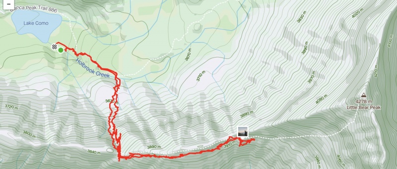
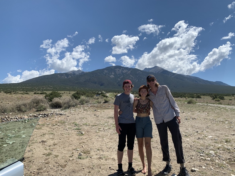
Day 1 Saturday, July 3 -Lake Como Road- Driving from Kansas City, my climbing party of 5 arrived at Lake Como road (our Volkswagon Bug parked near the "corolla" parking lot at 7,900ft) and began our trek around 11:00 am. I'd ascended the road once previously in June of 2020 and immediately noticed the stark difference, being the fourth of July weekend. Within the first two miles, we were probably passed by at least two dozen modified off-road vehicles. Though I didn't mind observing the incredibly pimped-out vehicles, I could see their presence being quite bothersome for some and worth considering when deciding between Zapata and Como. However, with that said, when I hiked up the road in June of 2020 I only saw a few vehicles the entire time. 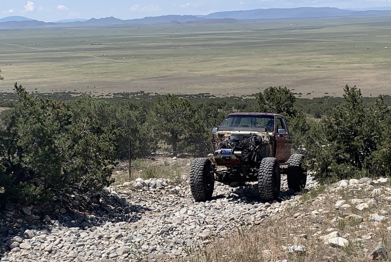
After about half an hour on Como, our group quickly realized the sun would be one of our greatest oppositions for the day. The first 2.5ish miles feature very little shade and considering the first water source is about 4.7 miles up the road water is undeniably crucial for this road at this time of year. Being that we were all from Kansas City (about 1,000ft elevation) and had only just arrived in Colorado with zero acclimation time, we probably all brought more water than your average Colorado resident would. For me, this was 3 liters from the trailhead with potential for a max of 4-liter capacity. I've learned from friends and experience that water is the fastest way to get oxygen into your blood and therefore always bring a ton to minimize the stress the Altitude puts on my body. This capacity ended up being perfect for both Como and the peaks later on. 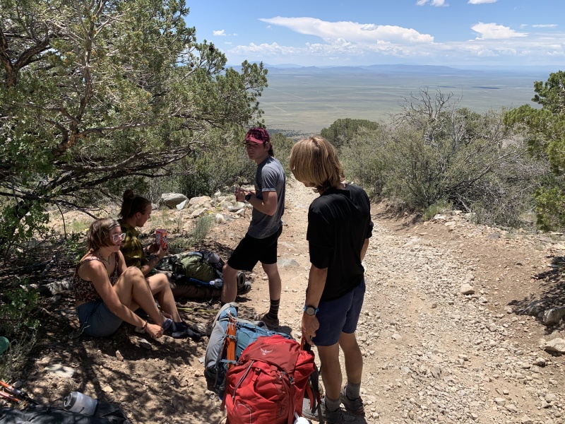
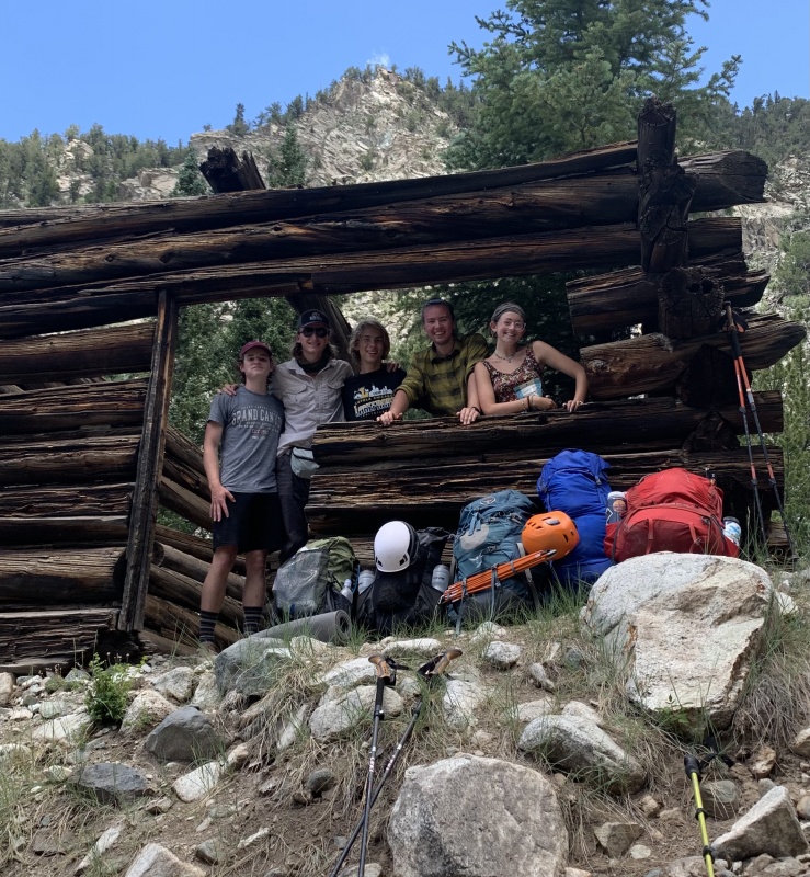
Around mile 3.4 (10,100ft) we finally reached the beginning of the coniferous forest with Spruce and some Aspen trees you'd typically expect from a Colorado Rockies mountain. The environmental change (shade) and temperature change were a great relief and really lightened all our moods. 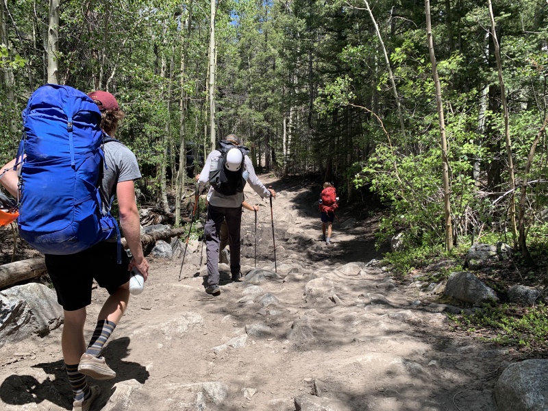 Soon after we reached Jaws 1 and the dilapidated cabins from the Gold Mining Camp called Commodore. Once you've reached these two places your on the final uphill stretch before the water crossing at Holbrook Creek. According to our 5 GPS devices, this creek is 4.8 miles from the corolla parking lot and 2 miles from the lake. As a side note, we did not see the once-abandoned Jeep Cherokee on the side of the road that has been somewhat of a marker in years past. 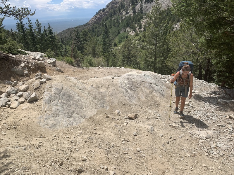
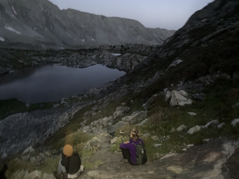
Soon after we reached Lake Como to a somewhat surprising load of people. There were a plethora of modified off-road vehicles, some of which played music on their speakers making somewhat of a ruckus. However, we hiked across to the East side of the lake where we set up camp amongst many other backpackers. Though there was the occasional rumble of a vehicle going by the road, for the most part, this side of Como was very peaceful. 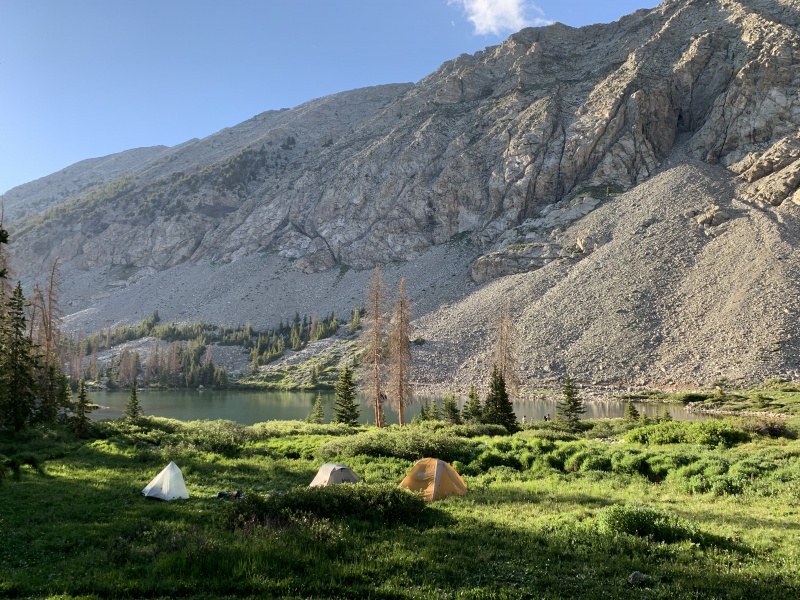
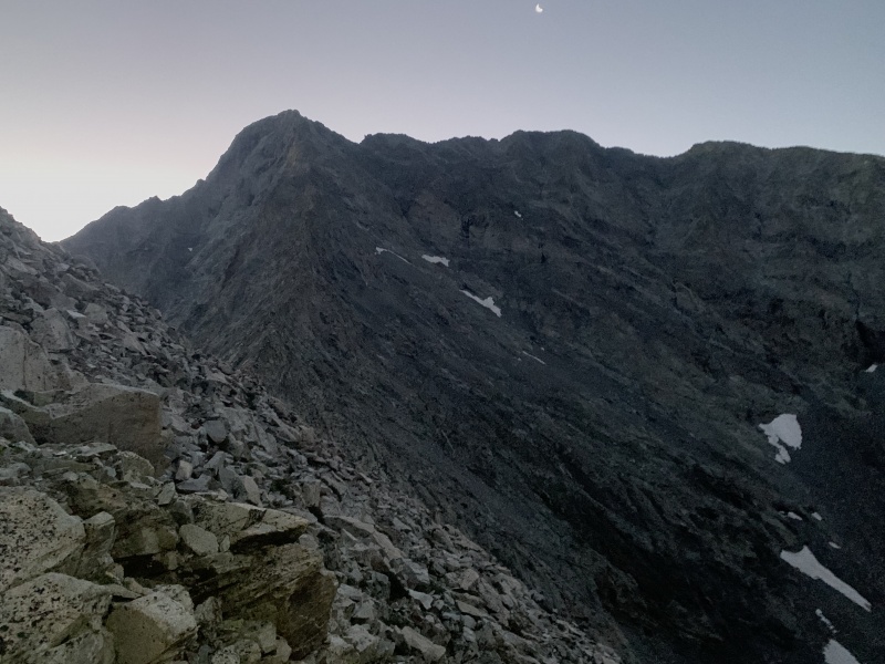
I will say that there were a ton of mosquitoes at Como In July, far more than I remember being present in early June of 2020. For most of my friends, this was a major displeasure however, I was wearing prAna Stretch Zion pants, a very breathable long-sleeve Craghoppers top, and buff (all treated with a good bit of Sawyer Permetherin and some with a factory insect repellent). I suffered only 1 mosquito bite on my butt while I was taking a dump in the woods and that was all. So there's an ad for Sawyer's Permetherin I guess. Day 2 Sunday, July 4th -Blanca via NW Ridge, Blanca-Ellingwood Traverse, and Descent on Ellingwood's South Face After a midnight rainstorm, we all woke up promptly at 4 am and were hiking out of from basecamp by 4:30 am for our ascent up Blanca. Though not completely necessary to wake so early, I've found it's far more fun to watch the sunrise above tree-line as you hike and avoid the heavy evening crowds (especially on Fourth of July Weekend). As a note, all our GPS devices seemingly way overreported the distances traveled compared to what the maps say the distance actually is. However, for both Como and the mountain ascents, the reported mapped distances (as on 14ers.com or hiking project) seem far shorter than what it feels like when hiking. 
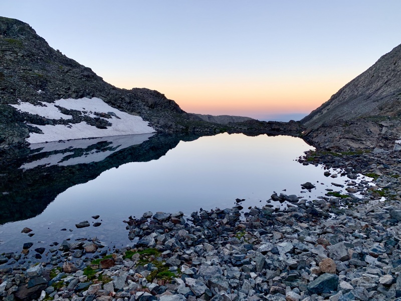
The hike up to the NW ridge starts out on more of the 4-wheel drive road up above the treeline but the road section quickly ends after reaching the alpine tundra. The trail passes about six lakes and progressively becomes rockier and rockier. Though 99% of the rocks seemed to be stable as the trail is quite well-traveled. The crater Lake at roughly 12,700 ft lies Crater Lake, the last water source before the Blanca Summit. As for us, we topped out all our water a couple of lakes earlier as we knew we'd be without water for a good bit of time ascending Blanca, traversing to Ellingwood, and then descending back to the NW ridge trail. By this point, I'd already consumed 4Liters of water in the morning to postpone altitude complications for as long as possible given our short acclimation period. 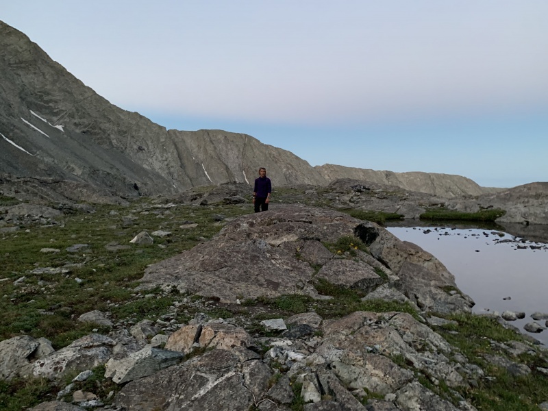
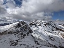
The view after reaching the ridge is truly breathtaking. I won't post any photos of it as to not spoil the beauty but I will say, it's a stark difference from the view of the San Luis Valley to the West. After reaching the Cairn on the ridge we began our final ascent up to Blanca. There is no distinct route up but there are some scattered Cairns suggesting a general route. I think this can easily be a class two but there are definitely some Class 3 moves you may find yourself on if you veer slightly off course. As for temperatures, it was surprisingly warm. We were all in our fleeces and warm at that. Even camping the night before was probably no colder than 40 degrees. 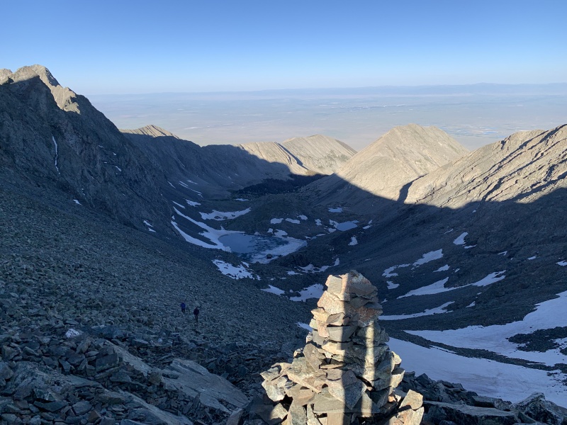
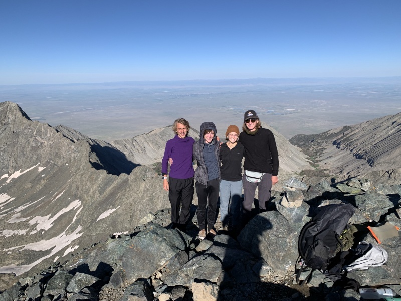
To my surprise, we were the first summit of the day on July 4th. We only stayed up top for about 15 minutes before heading down as many people were on the way up the ridge and we didn't want to crowd the summit. If your summiting on a weekend (especially 3 days) I'd highly recommend getting as early a start as possible to avoid the crowds. On the way down we passed at least a dozen people climbing the ridge saw many more on the way. 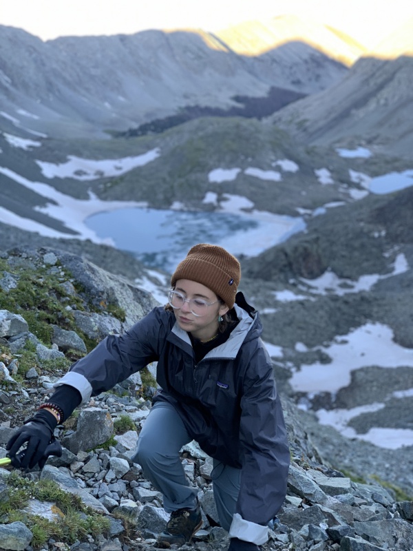
Ellingwood Traverse and South Face Descent After descending back down Blanca our group split and Peter and I decided to take on the Ellingwood-Blanca Traverse. Peter had run out of water so we split my spare two liters and hoped it would be enough to get us up Ellingwood and back to the lakes. I think bringing plenty of water if your summiting both and are from out of state (low elevation) bringing plenty of water is crucial. Peter and I parted from the group and began our traverse to Ellingwood. Starting from the large cairn on the ridge, where the trail splits to Blanca or Ellingwood, we began following a trail of cairns guiding us. To my slight surprise, the trail dipped about 50 to even 100 ft below the actual ridge and continued that spacing for most of the traverse until the last few hundred yards. Most of the other people on the ridge also followed this route though a select few could be seen traversing on the true ridge (instigating a little fear of falling rocks to those below). For this reason, I would highly recommend bringing a helmet for this route. Peter and I decided not to bring ours though in retrospect strongly regretted that decision. About halfway through I remember there being one somewhat technical move that frightened me a little. However, the exposure was only about 10-15 ft and it had a couple of solid hand and footholds. Besides that, the traverse was a good bit easier than expected with the greatest obstacles being loose rock, navigation, and the elevation gain. Ultimately, from Blanca, the Ellingwood traverse looks far more intimidating than it felt. It really wasn't that much more difficult than Blanca but definitely deserves respect and adequate planning prior. I'm sure that if you stayed on the very top of the ridge the route would be far more difficult. 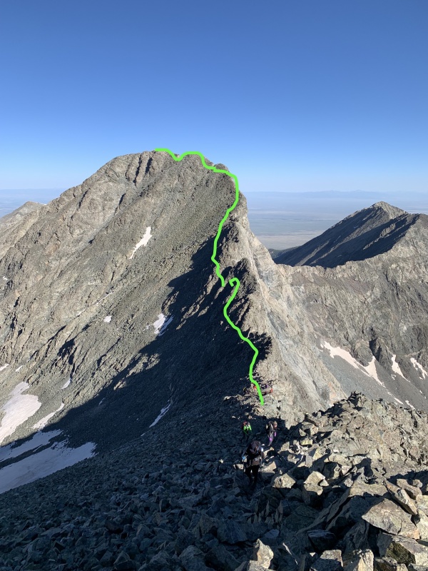
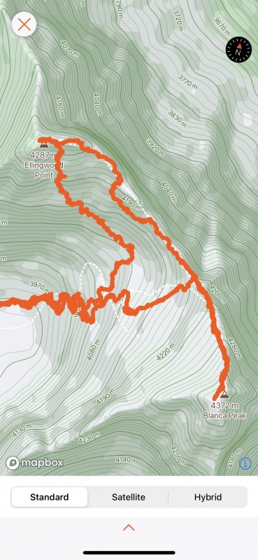

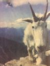
Around 9:20 am we summited Ellingwood only to find a Furry already at the top. We stayed at the summit for about 15 minutes before beginning our descent back down. We didn't want to go back down the same way we came up via the traverse so we chose to try out the South Face, "trail", down Ellingwood. I'd also considered trying the Southwest ridge but didn't have and GPS data for that route and chose to just choose the shorter, "Difficult Class 2" route down. This turned out to be far more frightening than the class 3 traverse as there were very few cairns making navigation difficult and loose rocks upon loose rocks upon loose rocks. Peter and I hiked all the way back to the NW Ridge with about a 30 ft buffer between us to prevent knocking rocks down onto each other. There were many times where we had no idea if we were even on the route and were choosing whatever route looked somewhat travelable. About halfway down we found some more distinct cairns and became comfortable with the descent again, soon arriving back at the NW ridge trail. In retrospect, I'd easily have chosen the more well-traveled class-3 traverse than the South Face route as it was far easier to navigate and contained much less loose rock though slightly more technical. As a note, the South Face took about 45 minutes total to descend. 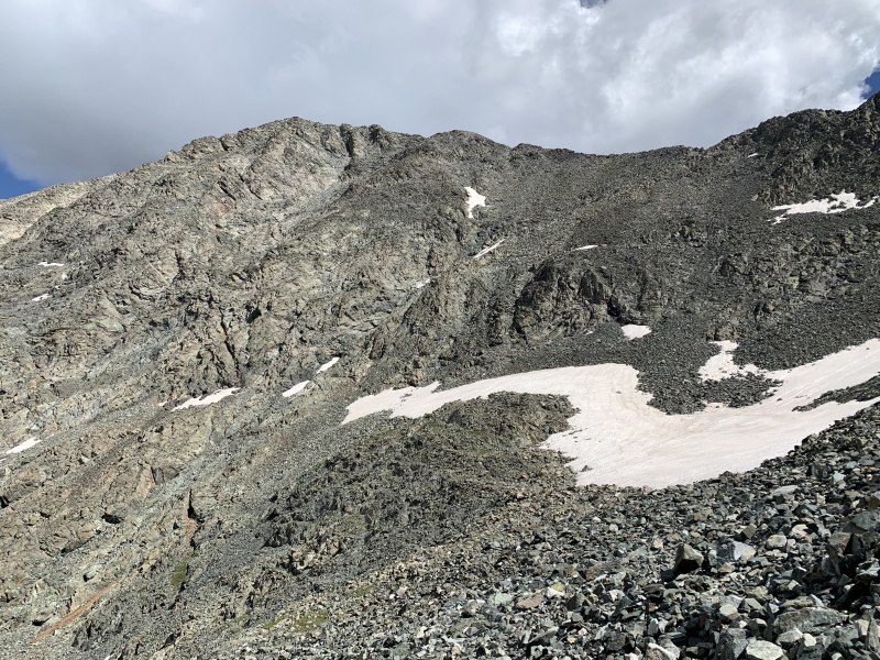


After arriving back at the NW ridge it was a speedy hike back down to the campground at Lake Como. After joining back with the NW Ridge trail the hike took us about an hour and 10 minutes. As a now group of 3 (a couple of friends left early), we decided to spend the rest of the day chilling at Lake Como with loose plans to explore Little Bear the following morning. We spent the entire afternoon resting, taking short walks, meeting and conversing with nearby hikers, and hanging out around the campsite. Though we had plenty of time, it never felt boring as we were surrounded by the immense beauty of the mountains and so many wonderful people. I'd highly recommend setting aside some time to relax and "soak up the experience" at Lake Como if you have the time. Keep in mind there's a good chance you'll encounter some afternoon storms though we never really did. 

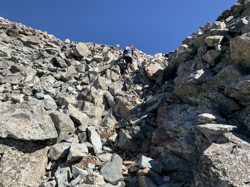
Day 3 Monday, July 5th -Little Bear half attempt and Back Home- Waking up at 3:50 am, I had a little moment where I questioned whether I really wanted to go hike around Little Bear. However, I managed to hype myself up, even though I couldn't convince either of my friends to go with me, and began my hike at 4:07 am promptly. Using photos from 14ers.com I ascended the tallus and reached the base of the gully fairly quickly. The gully proved to be far more difficult than I'd expected. It felt far more dangerous and was easily the most challenging feature of the entire trip. I think this was largely due to how dark it was as my descent back was far easier and less frightening. The main fear I suffered from was the loose rock. At moments I'd encounter one loose large boulder holding up an immense quantity of smaller rocks. I found that hugging the sides of the gully as I ascended felt far safer as I didn't have to deal with the loose rock. By about 4:50 am (45 minutes) I'd ascended the notch and was on my way towards the hourglass. 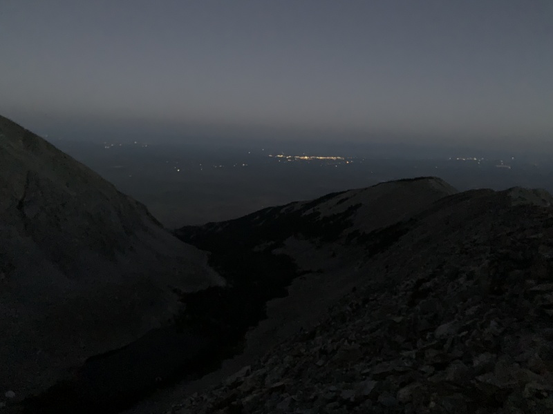
From the saddle, I began following the loose cairn route as far as I could though by now I knew I didn't have enough time to summit and knew it was probably for the better. Though my curious self continued on down the route occasionally peeking over the ridge at the Blue Lakes below Blanca. The Cairn/ridge route finding section really wasn't that bad at all. I didn't need to use my GPS as I'd just bounce from cairn to cairn, stopping at each one and spending a couple of moments searching ahead for the next cairn or best route. This section has a bad reputation as being less than desirable though I found the light challenge of the terrain quite enjoyable. Around 5:40 I turned around only a few hundred yards from the hourglass as my friends had planned on leaving camp by 7am to descend back down to the car and begin the 11-hour drive to Kansas City. 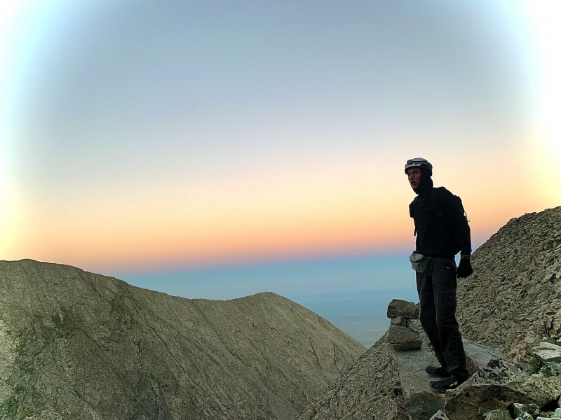
I reluctantly turned around at about 5:40am and song began my descent of the gully. This time I found it far easier to navigate with the sunlight. I also found that starting out the first 50ft hugging the east side and then switching to the west side made the gully far easier. The West side seemed to be far more stable and I could always climb on the rock wall if I felt the gully was too loose. This can be seen in my GPS data of the gully section (the route down is on the left) 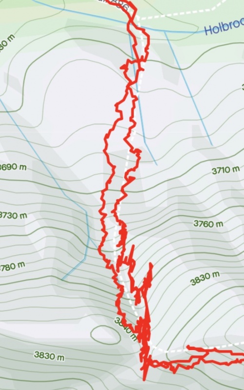
After descending the gully and tallus in about 30 minutes I quickly hiked back to camp (arriving around 6:48 am) and we packed up to hike back down to car parked at the very base of Sacred White Shell Mountain. It's worth noting that I saw not a single other person for the entirety of my hike on the Little Bear route though it was a Monday. 
Our hike back down Lake Como rd only took about 2 hours 45 minutes compared to our 4 hour 40 minute hike to Lake Como 2 days prior. Leaving at 7:30 gave us plenty of time to get down before the sun got too hot. 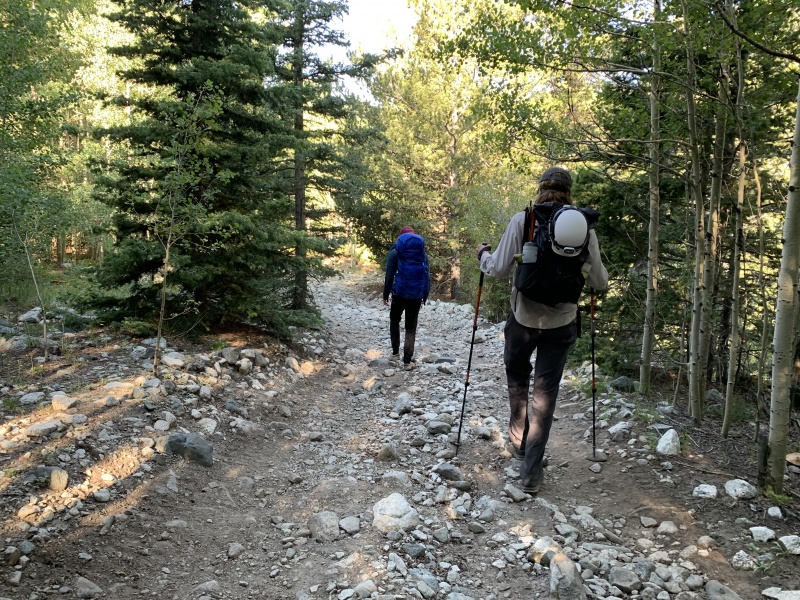
Some key points:
Thumbnails for uploaded photos (click to open slideshow): ")
")
")
")
")
")
")
")
")
")
")
")
")
")
")
")
")
")
")
")
")
")
")
")
")
")
")
")
")
")
")
")
")
")
")
")
")
")
")
")
|
| Comments or Questions | |||||||||
|---|---|---|---|---|---|---|---|---|---|
|
Caution: The information contained in this report may not be accurate and should not be the only resource used in preparation for your climb. Failure to have the necessary experience, physical conditioning, supplies or equipment can result in injury or death. 14ers.com and the author(s) of this report provide no warranties, either express or implied, that the information provided is accurate or reliable. By using the information provided, you agree to indemnify and hold harmless 14ers.com and the report author(s) with respect to any claims and demands against them, including any attorney fees and expenses. Please read the 14ers.com Safety and Disclaimer pages for more information.
Please respect private property: 14ers.com supports the rights of private landowners to determine how and by whom their land will be used. In Colorado, it is your responsibility to determine if land is private and to obtain the appropriate permission before entering the property.