| Report Type | Full |
| Peak(s) |
Mt. Princeton - 14,200 feet |
| Date Posted | 07/22/2021 |
| Date Climbed | 07/17/2021 |
| Author | Vacas Valley |
| Redemption on Princeton's Southwest Ridge (AKA: Grouse Canyon) |
|---|
|
So I saved Princeton as my last 14er to do in the Sawatch mainly because the standard route looked too boring/not interesting. I'm always looking for alternate routes to do on ANY 14er. Digging through trip reports, I came across "Princeton's Back Door" by PKR 2007, trip report included. Colorado 14ers • Trip Report - Southwest Ridge via Grouse Canyon... Princeton's back door., So I started doing more research on the "route" and found pretty much nothing (other than a couple reports dated many years apart, SnowAlien, "Bounty on Princeton", Colorado 14ers • Trip Report - Bounty on Princeton (Grouse Canyon route) - 2012 and JQDivide, "Grouse Canyon" Colorado 14ers • Trip Report - Grouse Canyon - 2016 ). I saved the images from "Back door" and convinced my climbing partner (Backwood Joe) that we should summit Princeton in this manner, it'd be great training for Orizaba (Dec. 2021). In November 2020 we headed out to find the "trailhead". By the time we arrived it was dark and never ended up finding the "TH", so we parked somewhere along the road and proceeded with our normal "night before a 14er shenanigans". We hit the road at 4am and completely missed the turn-off to the "TH", but did stumble upon a super old cemetery. 2.5 hours later and just under 4 miles we finally came across the turn-off, I think the fact that the sun was coming out helped us a bit. I never claim to be a master at route-finding, but anyways by 7am we were on the Grouse Canyon trail, if you want to call it that. Overgrown, not maintained and not to mention the snow/slush we were contending with, further hiding the "trail". Basically, you just follow the creek until you reach what they call the "Rocky Gate" then take a hard right turn up into the aspen grove. 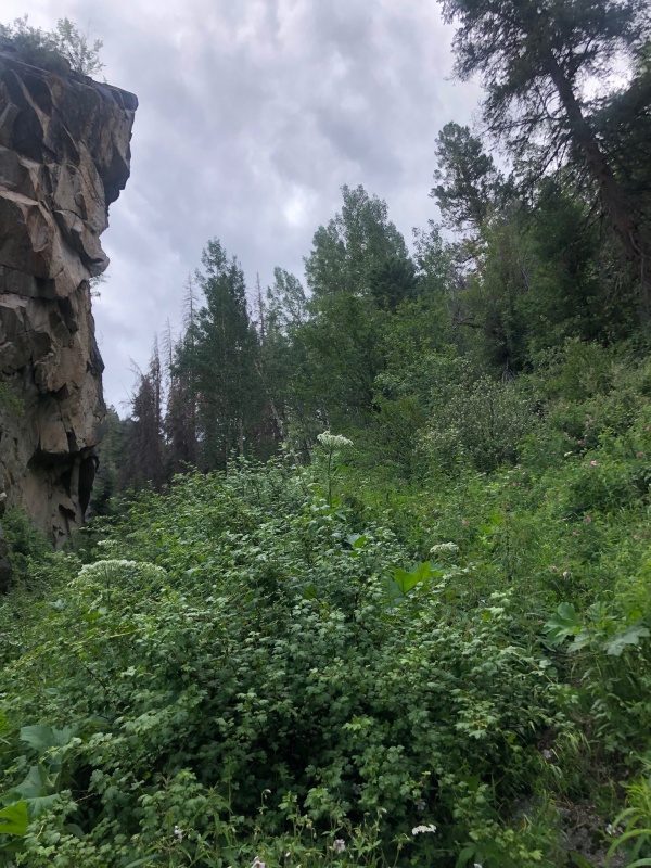
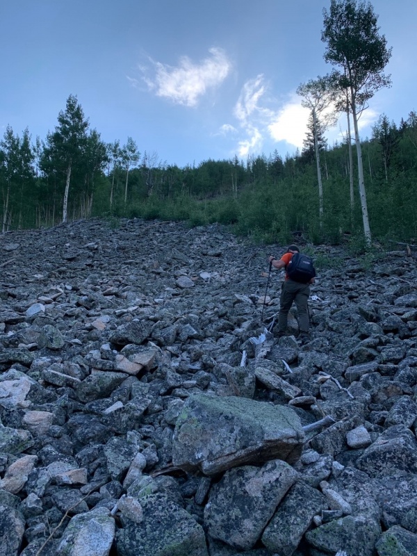
This is where any remnants of a "trail" or cairns disappear. As we ascended further up into the bushwhack, we felt like something was wrong, then we looked across the canyon and saw a beautiful trail cutting across an avalanche slope. Decided to cross over the canyon and meet up with the trail. Bad decision. We followed this all the way up to tree line, in the WRONG canyon. By this time we realized we were way off course and it was 11:30, we had hiked about 9miles and 8hrs, and decided today will be a recon-mission, no summit for us. With the sun going down around 4:30 it wouldn't be prudent to attempt to summit. We ate some lunch and reflected on what went wrong, which wasn't hard to do. Onto the redemption part of the story. After a lot more research I found a GPX file I could use as a gauge, albeit it was a snow ascent. I called up Backwood Joe and told this time we'll make it, so we enlisted a friend of mine, Tom, whom I'd never been on a hike with and set our date for July 17th. We camped out at the same location on the road as last time, because we realized it was only .2 miles from the turn-off on the road to the "TH", also it was much flatter with more space for our typical shenanigans. The alarm went off at 3am for a 4am start time. We cruised up the canyon along the creek, still trying to follow the "trail", which was hiding somewhere in the overgrown brush. 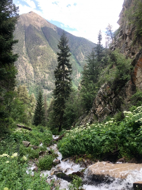
As we hiked up the canyon we kept a lookout for the "Rocky Gate", but in the pre-dawn darkness we couldn't see a thing. From here we consulted the GPX file and decided this is pretty close to the point where its time to head uphill in a north-east direction. About an hour later we popped out of the bushwhack to find a talus field (this was not the one in PKR's trip report, we found out later) heading up to the southern most part of the ridge. 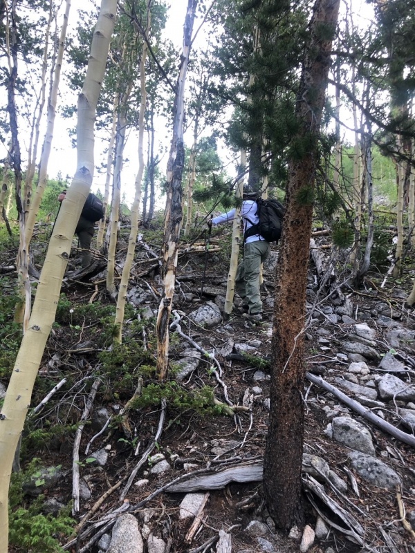
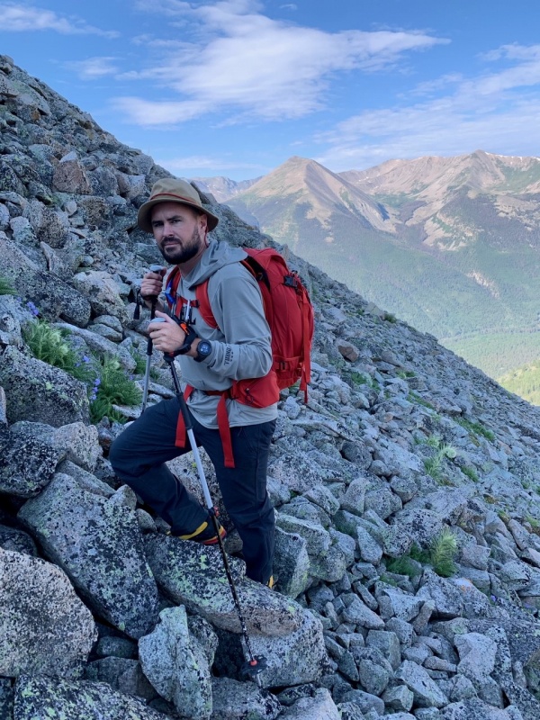
We gained the Southwest Ridge a little after 9am, took a snack break, and were just happy that the route-finding and bushwhacking was over, or so we thought. But I will save that detail for later in the story. At this point we were just over 12K, with the "standard route" gaining the ridge at just over 13K. The headwall in the next picture was our first obstacle, not having any beta on this, we had to get to the base before we made a decision on how to best overcome the wall. Needless to say, it was pretty much a straightforward class 2 scramble up and over. 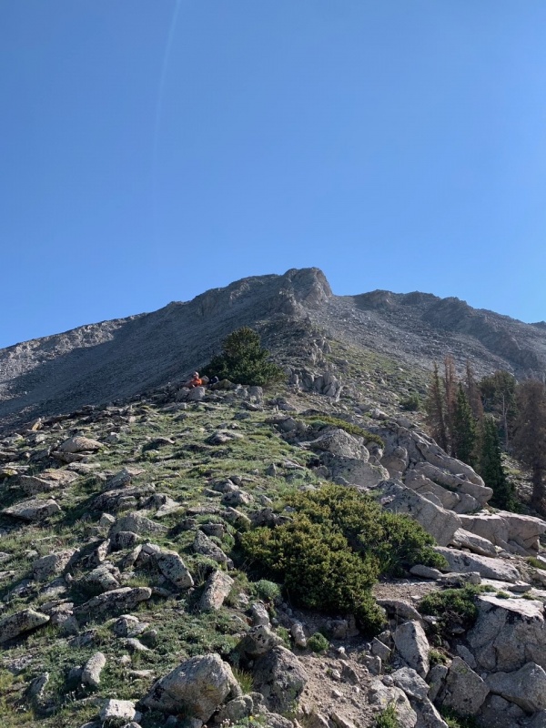
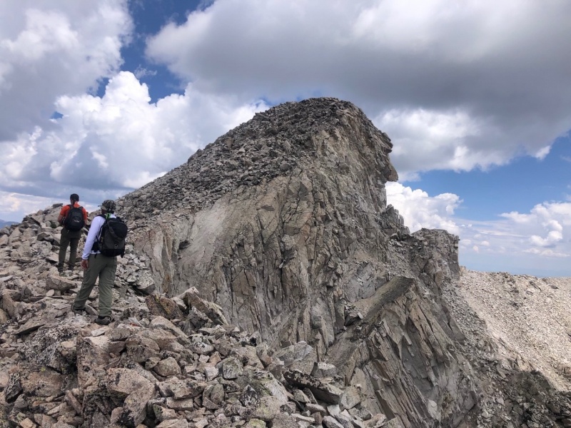
As you can see, the weather looks great at this point, although they did call for afternoon (3pm) showers and lighting. Nothing too concerning at this moment, just a few small white clouds in the sky, so we continued moving on the ridge. As we headed toward the Class 3 crux mentioned in PKR's report we found the ridge to be a very pleasant stroll over alpine grass, but that would be the only section of our entire route like that. 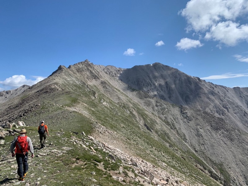
From this point you could see the remainder of the route. First, up and over the Class 3 section at the notch, onto Pt. 13,971, and then to Princeton. Class 3 section was very straight forward and maybe has just one move of class 3. Once on the other side, we chose to eat lunch and assess the weather, it was now a little after 11am. As we watched the clouds roll in around us we decided that after lunch we will continue on to Pt. 13,971 and make a final decision whether to go for the summit or turn around due to incoming storm. 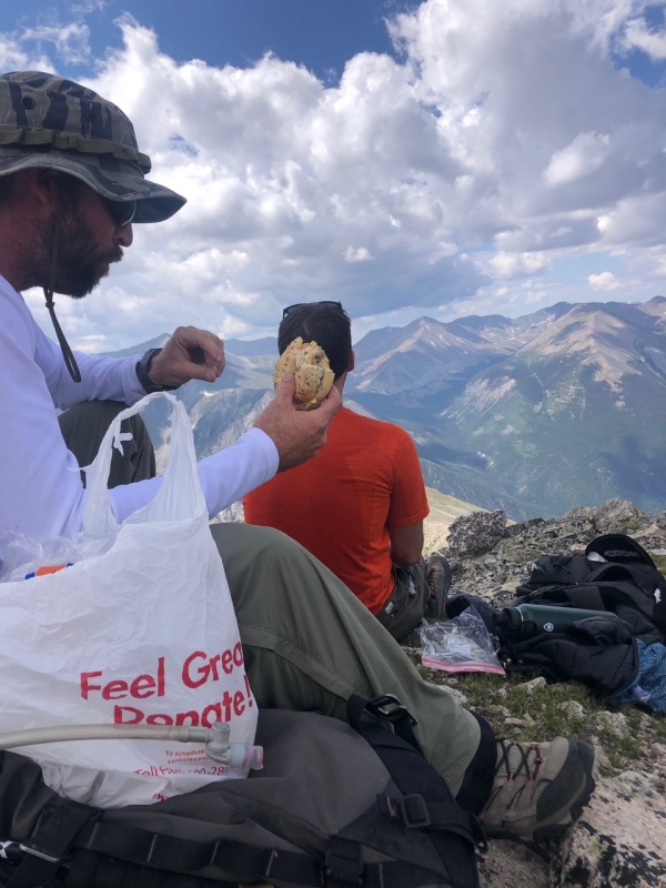
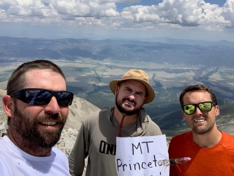
As we were ascending the high point the clouds grew increasingly larger and darker, but still no sight of rain in the distance. Once we arrived on top, and saw the distance to Princeton we chose to go for it. Arrived on the summit at 12:50, took some pics, had a summit beer and beelined down the ridge the way we came as the weather was quickly approaching. 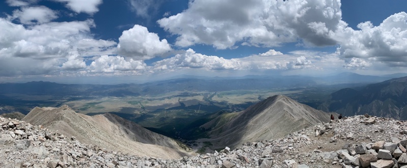
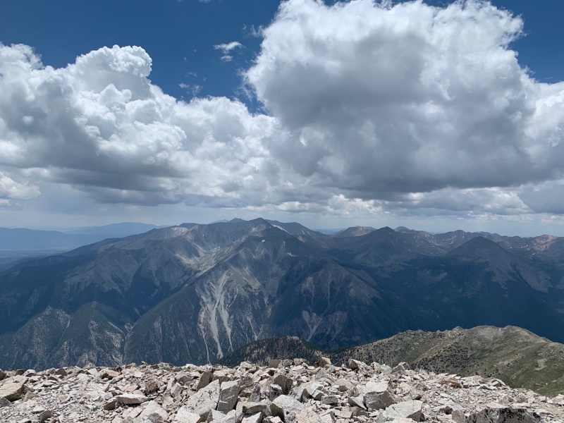
Not 10 mins. after leaving the summit here comes the rain/graupel. Bad place to be when the weather shows up like that!! We could hear thunder getting closer as we moved as fast as we could on the slippery talus that makes up the ridge, not stopping to put rain gear on or take pictures, sorry. We got over Pt. 13,971 and approaching the Class 3 section when we saw our first strike of lightening. The rocks were too unpredictable and wet to make safe passage through the crux, so our only other option was to get down to tree line as fast as we could safely. We took a hard right into a scree/talus gully behind the crux section and headed towards the trees about 1200' below. This section was completely unstable, steep, and wet but we knew we had to get under some cover. As lighting and thunder crashed around us we basically tumbled all the way down the gully receiving minor cuts and bruises from rolling talus and scree. 45mins. and a couple cart wheels later we were at tree line and lo and behold the sky opens up and the sun comes out. 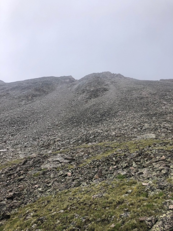
The way out is basically the reverse of the way in. We hugged the base of the southwest ridge until it was time to cut right into the aspen grove and head towards the Grouse Canyon trail. It was fairly uneventful other than getting more soaked as we bushwhacked thru aspens and the waist high foliage along the creek. Arrived back at the vehicles in 4.5 hours and were just glad to get out of our wet clothes. Back at the vehicles we reflected on the day and this amazing route, which I would recommend to anyone that's up for a challenge in route-finding and enjoys alternate direct climbs. We only saw 2 people all day and that was when we gained the summit, they climbed the normal route. I will say, this is not a climb to be taken lightly or come down with summit fever like we did, especially if the weather is questionable. Even if the forecast doesn't call for rain until late afternoon (as in our case), this is Colorado after all and the weather can and will change every 5 mins. I hope you enjoyed the report (this is my 1st one), and maybe you can find some nuggets of good info you can glean from this for your own adventure. Be safe out there, know your limits, watch the weather and enjoy Colorado's magnificent Rockies. Thumbnails for uploaded photos (click to open slideshow): ")
")
")
")
")
")
")
")
")
")
")
")
")
|
| Comments or Questions | ||||||
|---|---|---|---|---|---|---|
|
Caution: The information contained in this report may not be accurate and should not be the only resource used in preparation for your climb. Failure to have the necessary experience, physical conditioning, supplies or equipment can result in injury or death. 14ers.com and the author(s) of this report provide no warranties, either express or implied, that the information provided is accurate or reliable. By using the information provided, you agree to indemnify and hold harmless 14ers.com and the report author(s) with respect to any claims and demands against them, including any attorney fees and expenses. Please read the 14ers.com Safety and Disclaimer pages for more information.
Please respect private property: 14ers.com supports the rights of private landowners to determine how and by whom their land will be used. In Colorado, it is your responsibility to determine if land is private and to obtain the appropriate permission before entering the property.