| Report Type | Full |
| Peak(s) |
Mt. Sneffels - 14,155 feet |
| Date Posted | 08/17/2021 |
| Date Climbed | 07/26/2021 |
| Author | Beekman |
| Mt. Sneffels via the SW Ridge from Blue Lakes Trail |
|---|
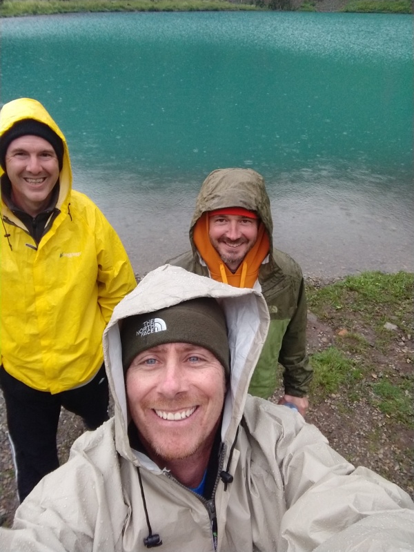
Peak: Mt. SneffelsRoute: Southwest Ridge from Blue Lakes Trailhead for the accent and descend down the standard route and back to a basecamp at Blue Lakes.Team: Mike, TrisStats: 13.8 miles - 4,446 verticalI was a little disappointed in the available information I could find on this route (I typically like to review a dozen trip reports and a few YouTube videos before I hit the trail) so I thought I would add a trip report just to put a little more beta out there. I was also very surprised by how exposed parts of this route were for being a class 3. I found it more challenging and uncomfortable than many routes that are classified as more difficult (Sunlight, Little Bear, Kelso Ridge, K2, Sawtooth, etc.). At first I thought I might have been off route, but after reviewing trip reports I feel like we were still on route. Maybe I was just not mentally prepared thinking it was only a class three. I guess it does not matter now. With it in hind sight it is likely my favorite 14er and route. Prep time:Based on all the information gathered it seemed like the only way to go was the southwest ridge from Blue lakes. The trail is so much more beautiful, less scree, a little scrambling, less people, what's not to love. The forecast called for severe thunder storms every day. There was a flash flood warning in effect. If I have learned one thing about hiking about tree line is the mountains create their own weather. No matter what the forecast says be prepared for anything. The only change up I made to my gear is I ditched the light weight poncho and tossed in my full rain suit, just in case. I also took my backpacking towel, it's nice to have when you are getting into your tent when it's pouring. Day 1: The road trip to Ridgeway and the hike to Blue LakesWe left the Denver metro early on Sunday and headed toward Ridgeway. The strategy of heading out on Sunday to go against the flow of traffic worked flawlessly. The road closures for weekday construction were open and we made good time. A quick stop in Bailey for some breakfast and another in Montrose for lunch put us at the trailhead a little after noon, a couple hours ahead of schedule already. The trail to Blue Lakes trailhead is a little rough in spots, but could easily be navigated with about any vehicle and a decent driver. At the parking lot there were three large parking lots, and they were all very busy, but we found several parking spots open and snagged one close to the trailhead. As we got out and I lifted my pack and it felt wet, in fact the entire waist strap and back pad were soaked. I started to check for the source of the liquid and found my lid on my water bottle was not secure. My water was empty, the entire 6 cups were now saturating the material of my pack. Luckily Mike and Tris had extra water and I had my filter, so the only issue was hauling a little over 3 pounds of additional water up the trail and staring of the hike with a wet back. At the trail head we were greeted by the forest service (San Juan Mountain Association). They were going over leave no trace with hikers, handing out shovels, asking if we had rain gear and warning of the flash floods in the forecast. As we headed down the trail they left us with one last final word of encouragement "don't fall off any ledges, search and rescue has been busy up here....". 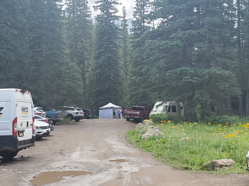
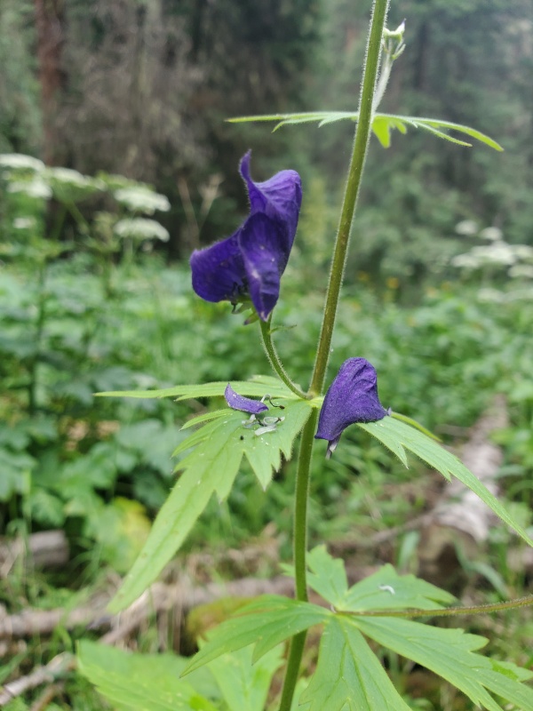
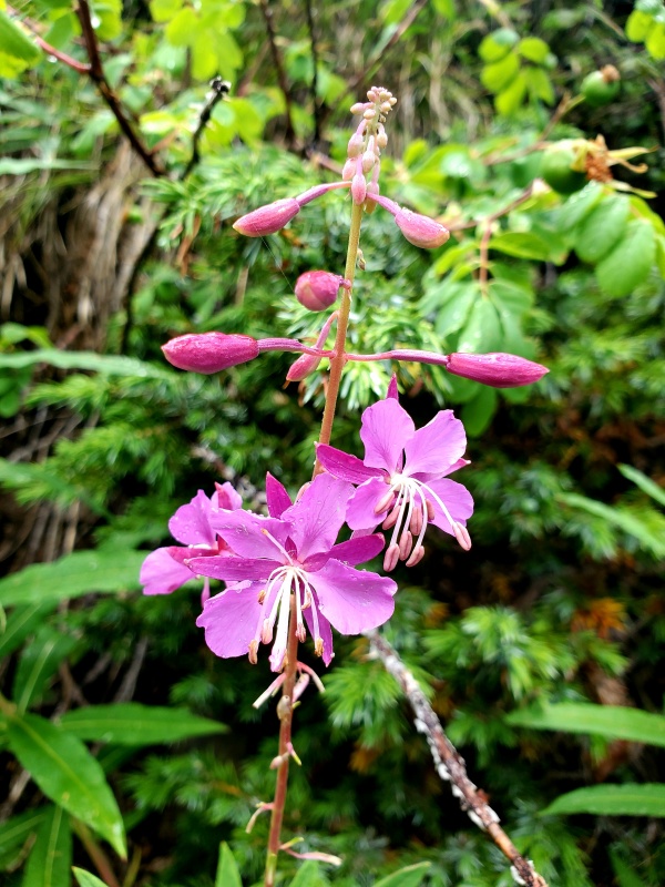
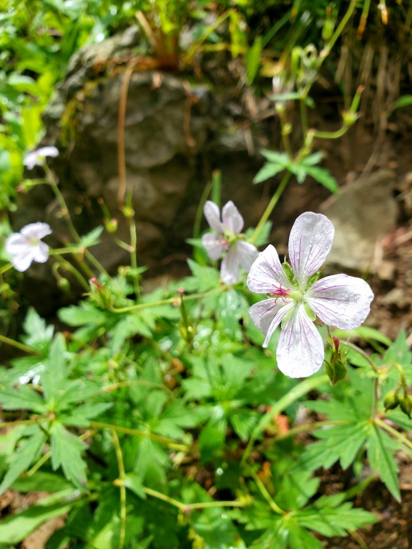
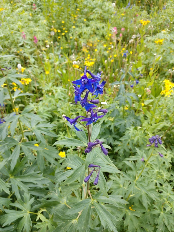
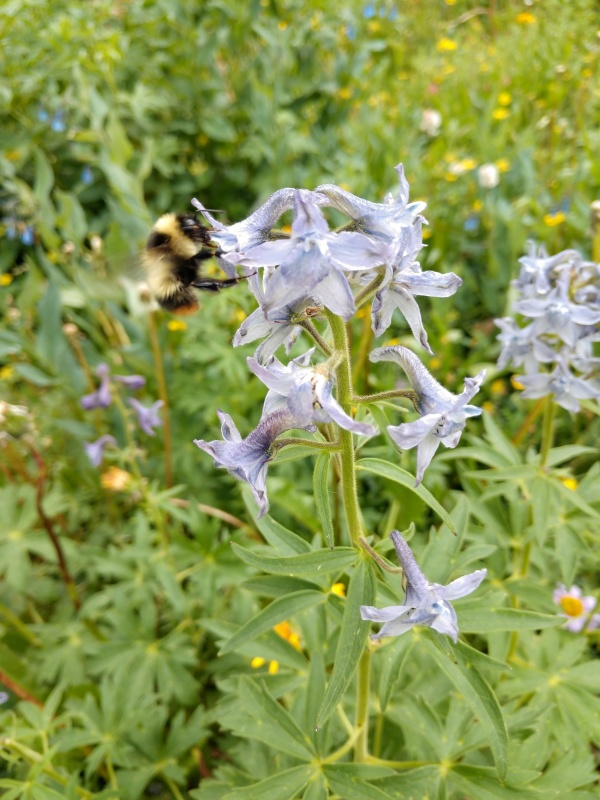
At 12:50 we started heading down the trail. The trail was very steep right out of the parking lot as expected. The vegetation was very lush, wild flowers everywhere. It was hot and humid from all of the recent rain. We just kept moving slow taking lots of breaks enjoying the beautiful trail. For the number of cars in the parking lot we saw very few people on the trail. This had us a little concerned. Was this going to be like Willow lake last year? When we arrive at Blue lake is there going to be a small city of tents? 
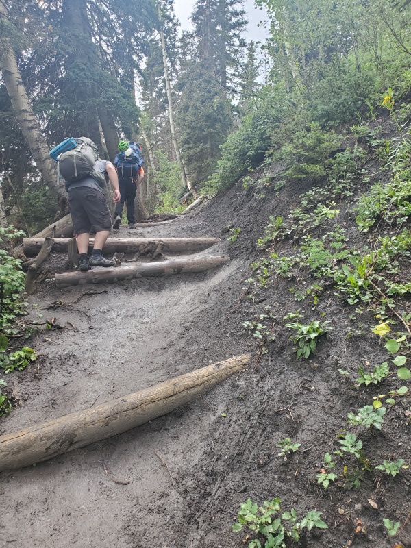
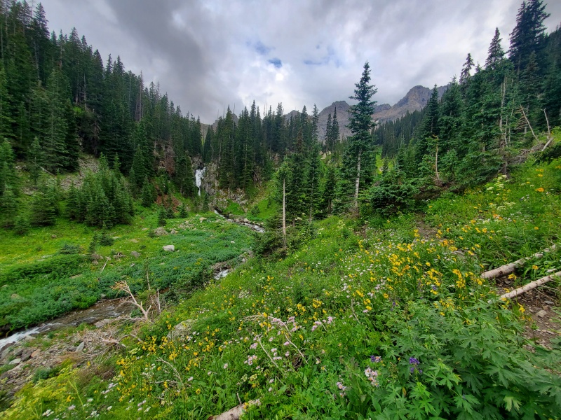
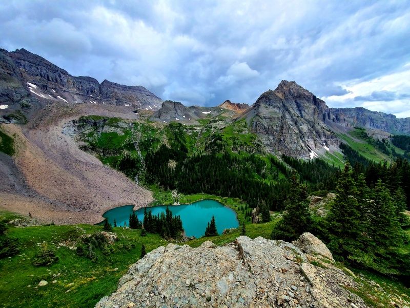
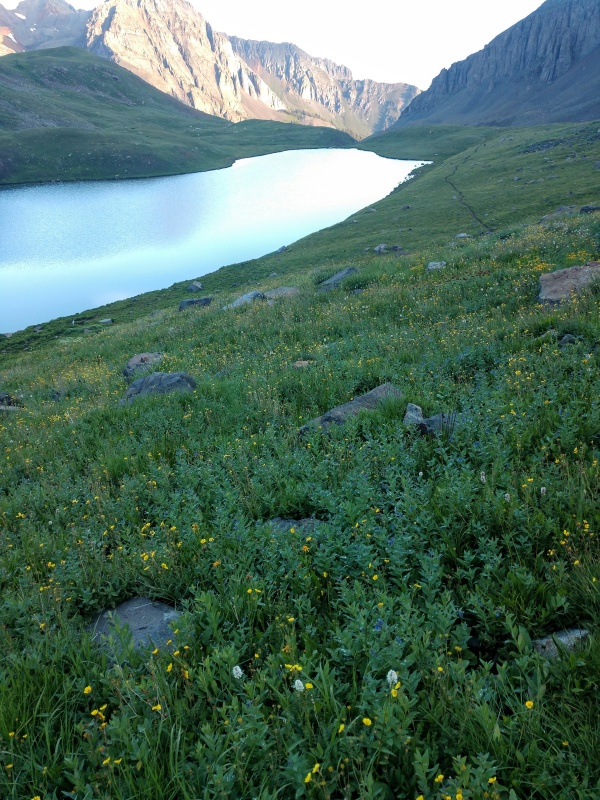
At 2:45 we hit the crossing of the creek. There were several loose logs and rocks to aid in crossing. It would have been simple with a few hiking poles to keep your balance, without them it did require a little focus. Shortly after this the trail leveled out and we were able to start picking up some time. It was just in time too, because you could see a decent rainstorm coming from across the valley and hear the crack of thunder over the ridge. A little after 3:30 we hit the trail split to Blue Lake and the pass. Somehow we averted the storms, they must have moved in a different direction. We only received a sprinkle and now had soft cloud cover. There were several good camp sites all around and only a few were occupied. It was going to be easy to find a spot that was not within earshot or sight of another tent. Our packs hit the ground and with no immediate danger of storms we took a few minutes to explore and find the best spot to set up camp. At the lower Blue Lake we found where all of the vehicle traffic was headed, there were lots of day hikers enjoying the lake, most of them were wrapping op for the day and getting ready to head down. We decided on a location for camp just before the trail junction. 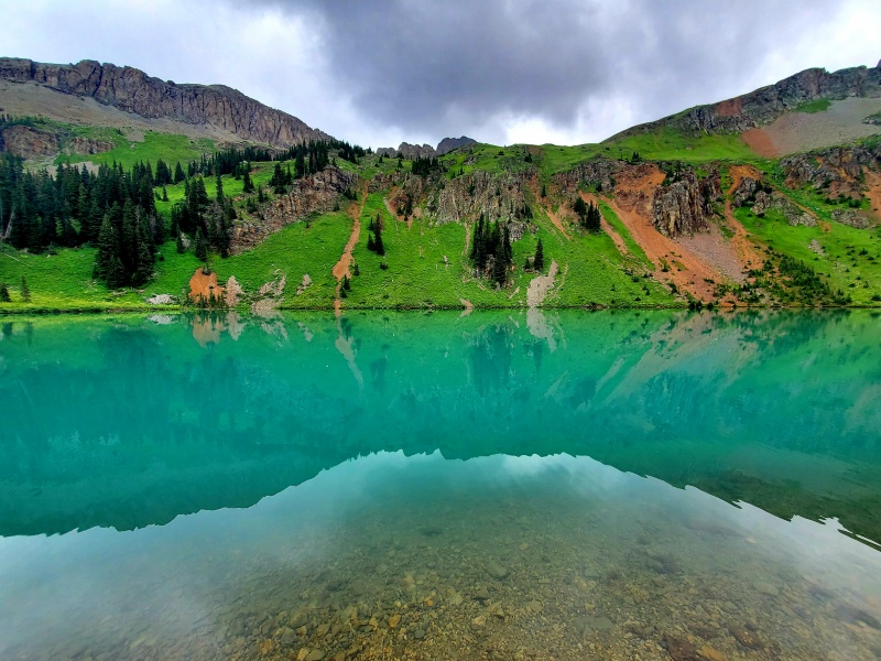
After camp was set up we decided to scout the beginning of the trail after the junction. There were so many social trails it didn't appear very clear and the river crossing didn't look great, not something we really wanted to navigate in the dark tomorrow. After we felt comfortable with the trail and crossing we started to filter water and make some dinner. I am on the tail end of a whole 30 diet, so finding backpacking food was a challenge, and I realized at camp that I didn't do a great job. Both of my dinners had rice......oops. 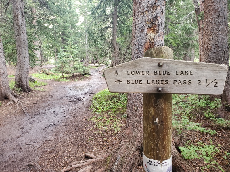
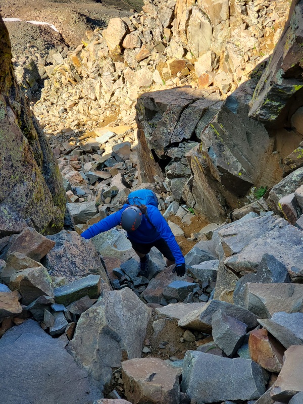
Day 2: The hike up Blue Lakes Pass and Mt. SneffelsI woke up at 4am, 15 minutes before my alarm. Headed over and dropped the bear bags, brought them back to camp and packed up my bag for the day. Then I started my coffee and breakfast and woke up Mike and Tris. By 5:15 we had the bear bag back up and were on the trail. I was surprised, not seen a single headlamp out in front of us yet. The river crossing was much easier than it had appeared, the rocks looked wet but still had plenty of traction. After the river crossing we realized maybe we should have spent a little more time in the daylight the day before exploring the trail. The trail we were on quickly disappeared into a vertical rock outcropping, here we were greeted by a couple other hikers asking if we knew where the trail was. My GPS didn't have a good enough satellite signal to let me know which side of the trail we were on, so we just went up the rocks (up is always the right direction, and knowing we were off trail I wanted to stick to the rocks so we didn't damage vegetation). At the top we found the trail again and it became obvious that it went across the creek again and we missed the switchback because there was a tent in the middle of the trail. As we climbed out of the valley we occasionally would get a glimpse of lower blue lake through the trees in the moon light. Tring to make good time we went right past the overlook where everyone takes pictures. The two people we ran into were well ahead of us, and we still had not seen anyone else on the trail. 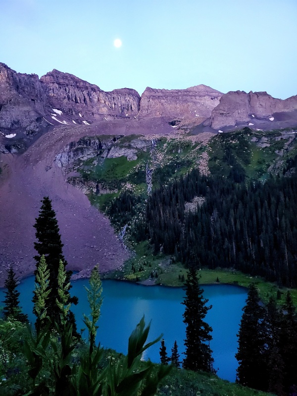
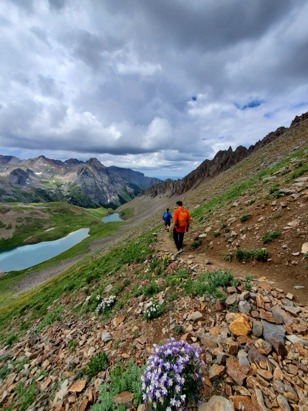
Climbing up the basin to the middle lake was a nice hike and the rest of the trail was not difficult to follow. By 6:15 we were already headed up the switchbacks on Blue Lakes Pass, making great time. Even better all of the hikers we have seen stopped at the middle lake and started to set up camera equipment. There was one solo hiker that was heading quickly up the pass ahead of us, we would soon see he too was doing the SW ridge. The sun was now starting to kiss the peaks on the other side of the valley and by the angle we could tell we were not going to be in the sun until we reached the top of the pass.
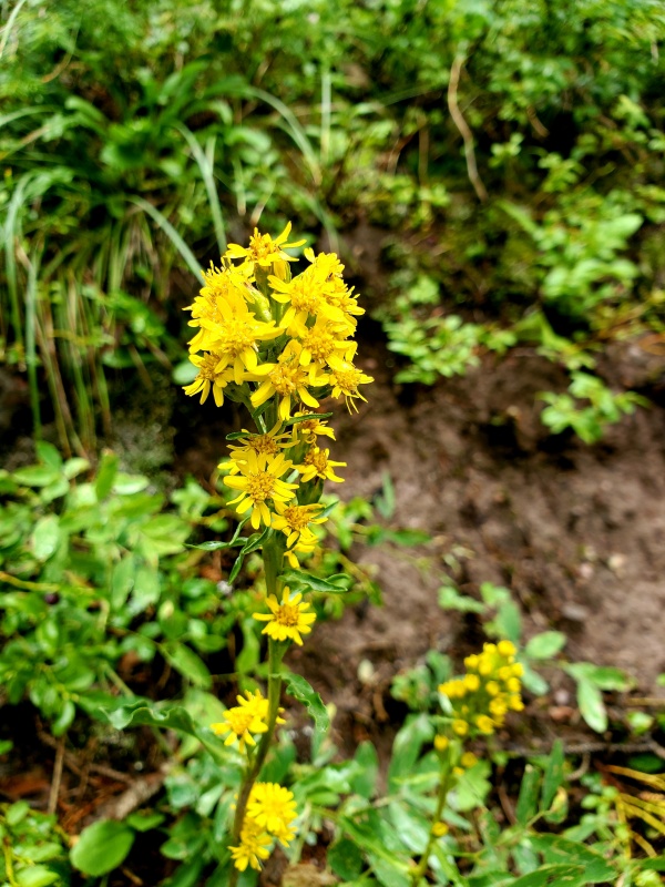
The switchbacks going up Blue Lakes Pass were in good shape, a couple locations had been washed out by a mud slide, but still easy to navigate. Lots of wild flowers, amazing views and a good slope. We were going up very slow stopping every few switchbacks to catch our breath. Couldn't help but thinking how nice this trail was compared to the field of scree at the angle of repose that is the standard route to gain the same vertical on the other side of the pass. We noticed a family of 4 starting up the pass a few switchbacks below us. They were moving quick and would catch us soon.
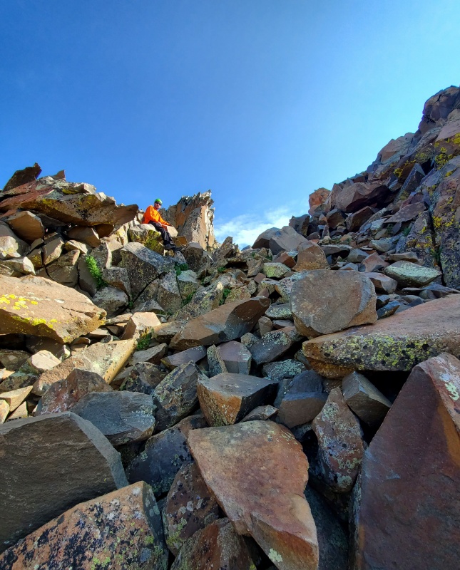
At 8:15 we had made the top of the pass. Just about where we thought we would be. Only a mile of light scrambling and 1,100 feet from here to the summit. We took about a 30 minute break here and enjoyed the sun, drank some water and reviewed pictures of the route. This is where the fun begins, time to put on the helmets. Everything fun requires a helmet. The family was only a switchback or two behind us now.
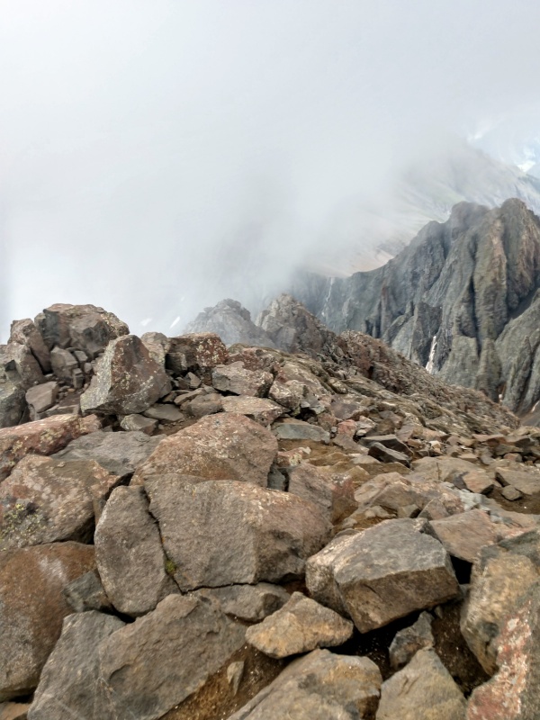
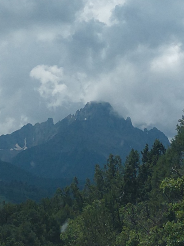
From the pass the start of the route was very straight forward. Just stick tight to the first set of pinnacles on the climbers left. The rock was not as loose as I thought is was going to be. Nothing real technical, but a good class 3 scramble up some pretty solid boulders. There were a couple options going up the gullies that would all keep you in class 3 rock. Once we reached the notch in the ridge line at 13,500' where you start to descend, it was not real easy to identify, but the rocks in photo #17 of Bill's route description helped out. 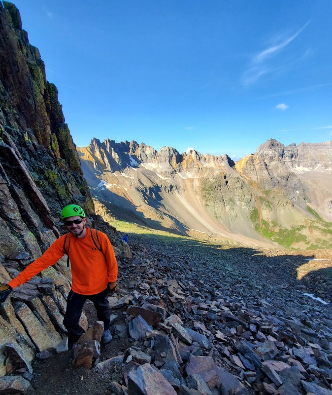
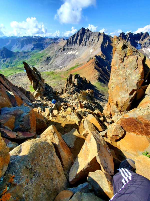
After you hit the notch we were supposed to descend about 30 feet and head up the next gully on the left to avoid some steep rock. This is the first location is where I would say we encountered some areas I would consider class 4 rock, at the time I was not sure if it was because we were slightly off route. After we returned I looked at our pictures and the route and I am very sure we were still on route at this point. I am guessing they didn't earn the title of class 4 because the exposure was not terrible but they defiantly required a couple good bouldering moves to get up. We started to have the conversation if we would be going back down this way or go down the standard route and deal with adding another 500' in elevation to our day getting back on top of Blue Lakes Pass. 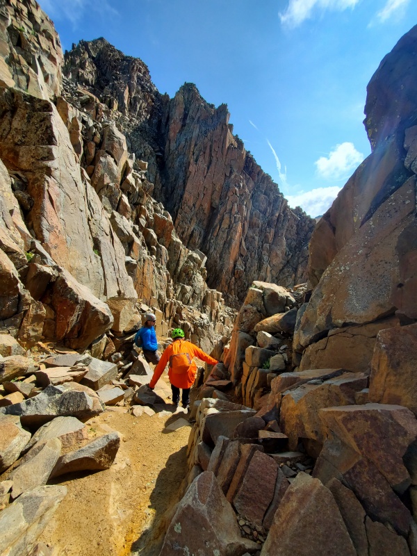

As we exited the gully it was nice to see the kissing camels formation. They are such a unique feature and they let us know we were still on route, what a relief. The formation was much smaller than I expected, I guess I had not seen a picture with anyone in them for scale reference, but they are only about 15' tall. At the camels we followed a little trail that put us back on the ridge. 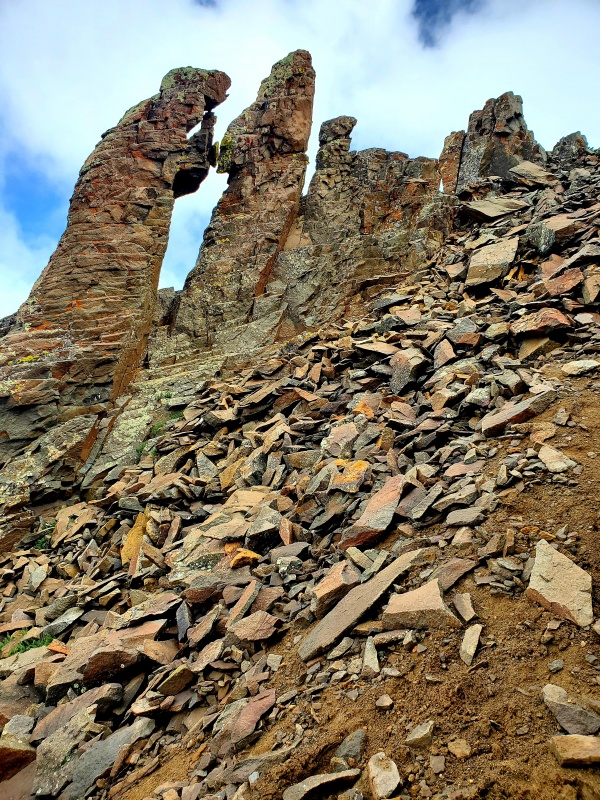
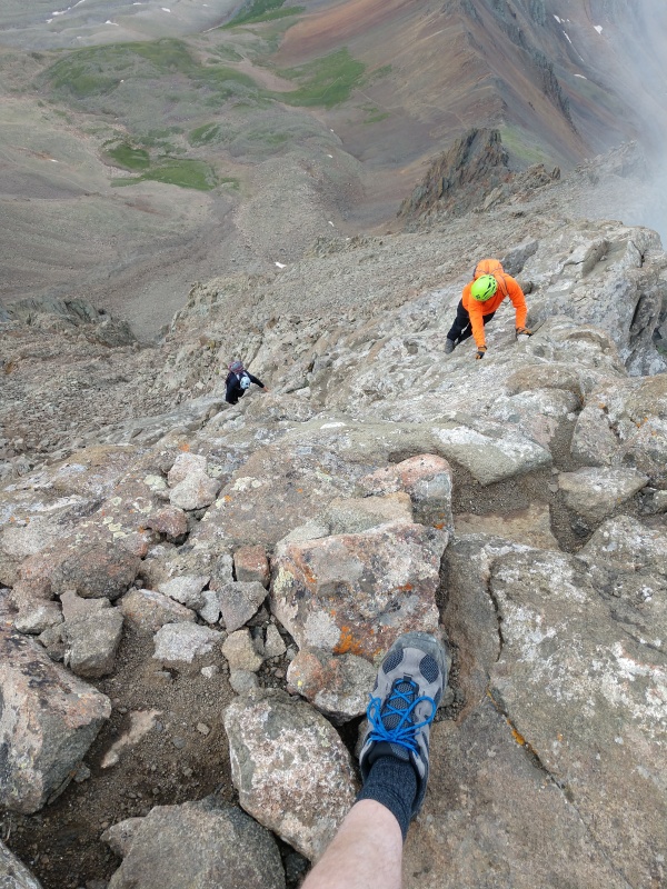
You are supposed to stay to the climber's right of the ridge, or on the ridge. There were what looked like several cairns and a trail keeping you down below the ridge line. In hind sight we should have gained the ridge much sooner. Traveling below the ridge was easy for a couple hundred yards, then the mountain transformed into very solid rock, but very steep rock. We just opted to push straight up to regain the ridge line. The rock was solid and didn't require any real rock climbing moves to advance, but the exposure was much more than we expected. There is a saying to "Burn the boats" it has been used by several commanders throughout history when they land in hostile territory. They burn the boats knowing that their only option is to conquer or parish, there is no turning back. I have never been afraid to turn back before a summit, in fact I have several times, but this was different and it would be the first time to "burn the boats." With the steep downclimb below us, the clouds and rain moving in that would only make the rock more slick, the short distance to the summit and the option to downclimb the standard route, there was only one option now, it was time to burn the boats. When in doubt run it out. After regaining the ridge the exposure was a little more, but I was so much more comfortable, when you are on a solid ridgeline the risk of rockfall goes down and you have so many more options for holds.
Pushing up the ridgeline my head was down constantly looking for good holds and advancing forward, then in a very short time realized we were on the summit as I heard Mike holler a few yards ahead of me. The view of the Blue Lakes was a little disappointing because they were covered in clouds. We did have a good view of Yankee Boy Basin. The summit was small, but we had it to ourselves. It was much later in the day then we had planned and clouds were everywhere so we only had a short stop on the summit before we started down the standard route. 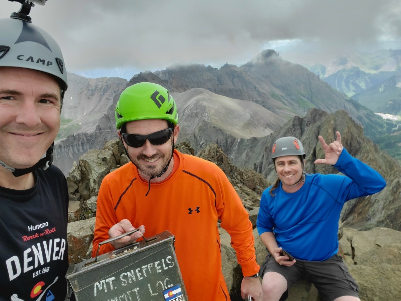
Finding the exit from the summit to the standard route was a little tricky, but only took a couple minutes. Descending the v-notch was very easy, especially with a spotter below. There were solid handholds and a little guidance to know which direction your next foothold is really helps, but it's only one or two moves to descend. It was nice to know this was going to be the most difficult part of our return hike to camp (and a little disappointing). Just after the V-notch we ran into a father daughter team that were getting headed up. They were part of the family that was right behind us coming up Blue Lakes Pass, this confirms another report we had read stating the amount of time it takes to do the standard route from the top of Blue Lakes Pass is about the same amount of time as the SW ridge. It was his second 14er and her first, very impressive. 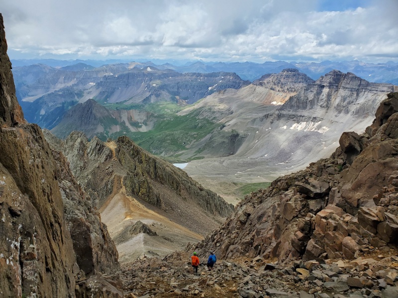
Once we reached the bottom of lavender corridor on the decent we opted to plunge step and slide down the scree. Another reminder of how glad I am we didn't go up this way. The 500' gain back to the top of Blue Lakes Pass was much less miserable than I thought it was going to be and we made short work of it. At the top of Blue Lakes Pass we ran into the mom of the father daughter team at the summit. We gave her a status update on the rest of her family and continued down. 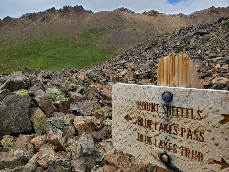
Coming down the switchbacks on the Blue Lakes side of Blue Lakes pass we ran into a few groups of hikers that were going up (this is a little after 2pm). We were back at camp by 3:15, a long day for such a short hike, but we were taking our time. A squirrel was in our bear bag when we retuned to camp, he had chewed the drawstring in half, and just his tail was sticking out of the top of the bear bag, still hanging in the tree. I think he was more pissed at us for interrupting his meal then we were at him for damaging a stuff sack and ruining some trail mix. I guess this is another advantage of bear canisters vs hanging. Tris and Mike cracked open a couple celebratory drinks at camp and we got on our rain gear and headed over to the lake as the rain started to come down. 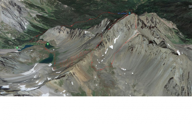


Day 3: The Journey HomeThe plan we to go home on day 4, but we almost always have an extra day planned on these trips in case we have issues. Today we didn't really have much planned. We got up late (I slept in until 6:15), made some food and headed over to lower Blue Lake to take do some fishing. The fish would not bite anything and we heard the fishing was much better at the middle lake, but we didn't really feel like hiking up there. A little after 11 we decided to call it a day and head home, the morning had been dry and we thought it would be nice to pack up a dry camp. We always make good time on the hike out, we covered the 3.2 miles in just a little over and hour. I heard great things about the Orvis Hot Springs and had never been, they have an option for a one hour soak for a discount. With the long drive ahead we decided to take a quick dip. I would highly recommend this, keeping it under an hour was a challenge. On the way home we ran into a couple road closures from mud slides adding a couple hours to the already long drive, putting us home a little after midnight. Great friends, great time and a new favorite mountain. Thumbnails for uploaded photos (click to open slideshow): ")
")
")
")
")
")
")
")
")
")
")
")
")
")
")
")
")
")
")
")
")
")
")
")
")
")
")
")
")
")
")
")
")
")
")
")
")
")
")
")
")
")
")
")
")
")
")
")
")
|
| Comments or Questions | |||||||||
|---|---|---|---|---|---|---|---|---|---|
|
Caution: The information contained in this report may not be accurate and should not be the only resource used in preparation for your climb. Failure to have the necessary experience, physical conditioning, supplies or equipment can result in injury or death. 14ers.com and the author(s) of this report provide no warranties, either express or implied, that the information provided is accurate or reliable. By using the information provided, you agree to indemnify and hold harmless 14ers.com and the report author(s) with respect to any claims and demands against them, including any attorney fees and expenses. Please read the 14ers.com Safety and Disclaimer pages for more information.
Please respect private property: 14ers.com supports the rights of private landowners to determine how and by whom their land will be used. In Colorado, it is your responsibility to determine if land is private and to obtain the appropriate permission before entering the property.