| Report Type | Full |
| Peak(s) |
Mt. Sneffels - 14,155 feet Sunlight Peak - 14,061 feet Windom Peak - 14,089 feet Mt. Eolus - 14,087 feet North Eolus - 14,042 feet Wilson Peak - 14,021 feet |
| Date Posted | 08/09/2021 |
| Modified | 08/11/2021 |
| Date Climbed | 07/17/2021 |
| Author | triordie |
| Additional Members | mikec |
| Six days of fun in San Juans |
|---|
|
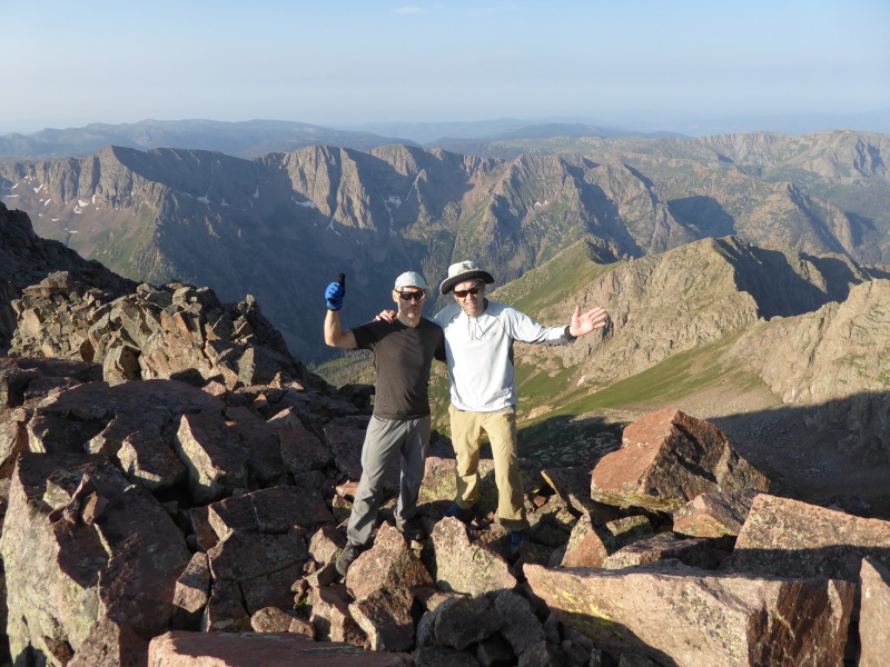
Trip to Chicago basin via Purgatory trail plus some extras in San Juans The group: Victor (triordie), Mike (mikec), Alex The schedule: Day 1: Sneffels (warm up hike), drive to Purgatory trailhead, backpack to Animas river crossing Day 2: Finish backpacking to Chicago Basin Day 3: Sunlight and Windom Day 4: Eolus and N. Eolus, backpack back to Animas river bridge Day 5: Finish backpacking to Purgatory trailhead, drive to Silver Pick (Rock of Ages) trailhead Day 6: Wilson Peak, drive out The report: Day 0: I flew to Denver very late on 7/15, Mike picked me up right at midnight, we spent a night at his house in Evergreen. Later in the morning (7/16), we stopped at Walmart in Frisco (over Mike's repeated and very loud objections) to stock up on groceries, had lunch in Glenwood Springs and drover to Montrose to pick up Alex, who flew directly there. Drove to Ouray, turned towards Sneffels trailhead, found out that there is some Powerbar 150 event and all campsites are full, but were able to find a Jeep road at the end of which we pitched our tents. Day 1. (7/17) With a late start (7 am) we parked a little below the outhouse (to have close to 3,000 ft el. gain) and headed towards Sneffels SW ridge. Once at the saddle, we turned right and soon started scrambling. The feature of the route, the "kissing camels" appeared shorty. 


We were caught by a young lady in ultralight running clothing (Peggy), who ran (!) from the other side (Blue Lakes trailhead). Some people are very fast indeed! After some fun scrambling, we joined lots of people on the crowded summit. We decided to descend the "standard" route which seemed (and was) faster despite being loose. From the summit down, one gully was still blocked by snow which necessitates some class 3 moves to bypass it. 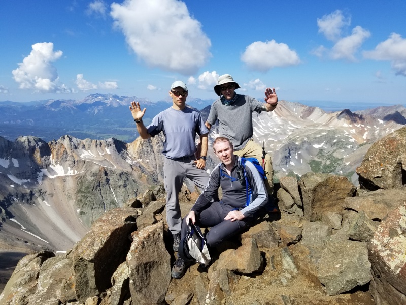

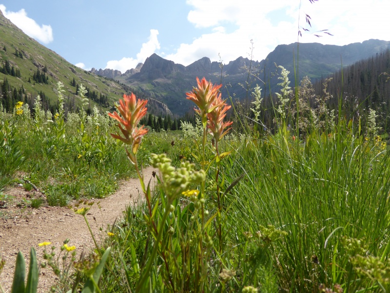
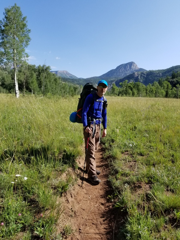
We got back to the car at almost exactly 5 hrs and 6.5 miles. Then, we drove to Silverton, had lunch, and drove to Purgatory trailhead. We were able to take the last official spot by the lake. It took us almost an hour to pack the backpacks, check all the food, gear, etc. We started on the great purgatory trail a little after 4 pm. Despite the cloudy skies, the rain never came. We enjoyed a fairly cool afternoon at the Purgatory flats and then in the Cascade creek canyon.
In just under 2 hrs we made it to the Animas river (a little over 4.5 miles). There are lots of great camping spots on both sides of the river, the one on the north side was taken by llamas, so we picked a spot past the bridge on the south side.
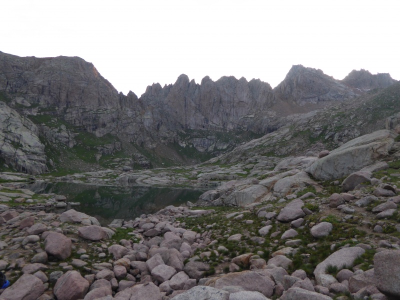
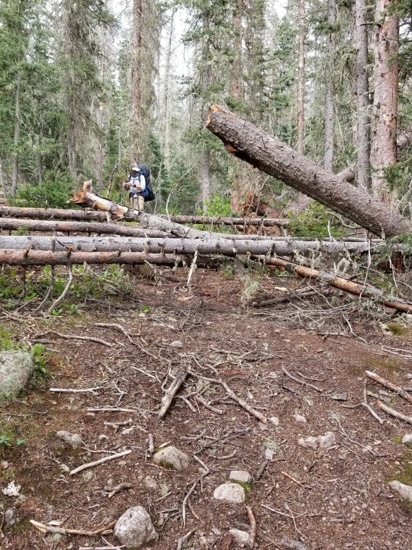
Day 2 (7/18): We started out just after 8 am with the goal of beating the train crowd from Durango. Here I did a bad miscalculation - we did beat the time of train arrival, but many groups from the train were faster than us and passed us along the way. The initial 5 miles along Animas river is great. there are some potential camping sites along the way, although not so many good options in the middle. Once on the Needle creek trail to Chicago basin, the trail steepens and there is lots of downed trees at the last mile or so (more on it later). It took us almost 5.5 hrs to get to our camping spot, the basin was fairly packed so we could not be too picky. I hiked up a couple of minutes up the trail to see the view of the high peaks - our goal for the following day. 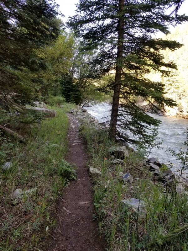


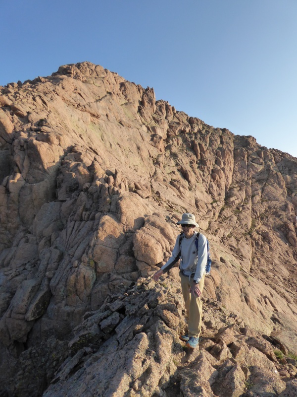
Day 3 (7/19): It rained a lot most of the night. We put our alarms for 4 am, but decided to sleep a little more to give time for the rocks to dry. Eventually, we left the camp just before 5 am. The trail was not too wet, and we reached Twin Lakes in about 1.5 hrs. We turned right towards Windom/Sunlight. Alex went directly to Windom, Mike and I started towards Sunlight first. The slope up to Sunlight saddle was not too bad and before long we started scrambling towards the summit. 

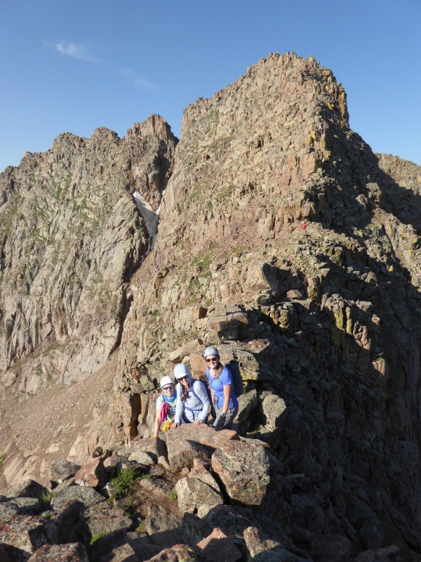
Right before the final stretch we met three young ladies, Cary, Kelly, and Sarah, who were also on their way to Sunlight. They were closing on their 14ers list in style. We summited together and took our turns jumping one by one to the summit blocks. Getting up there was not too hard, but jumping back down gave me some pause - I do not remember it being so sketchy when I was there six years ago. Getting old, I guess. 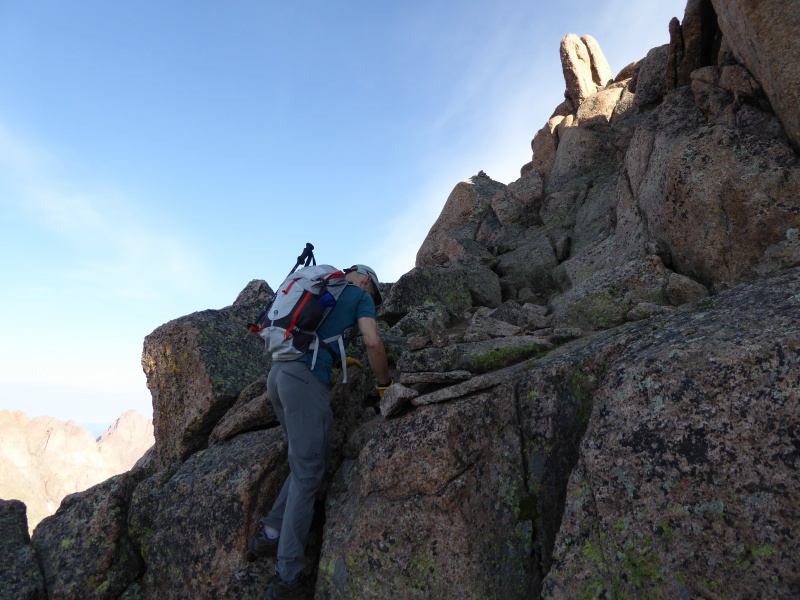


Mike and I started down and then up to Windom, trying to cut to the Windom ridge from the Windom/Sunlight basin without losing too much elevation and distance. Getting to the ridge was no problem. However, getting to Windom was a slog. It is rated 2+, but the trail is hard to follow and we ended up just scrambling the boulders at the ridge straight up (class 3). All in all, getting to the top of Windom is not as difficult as to Sunlight or Eolus, but overall energy expenditure will be the highest here. We got to the summit of Windom after just under 1 hr from reaching the ridge. Alex was waiting for us there.
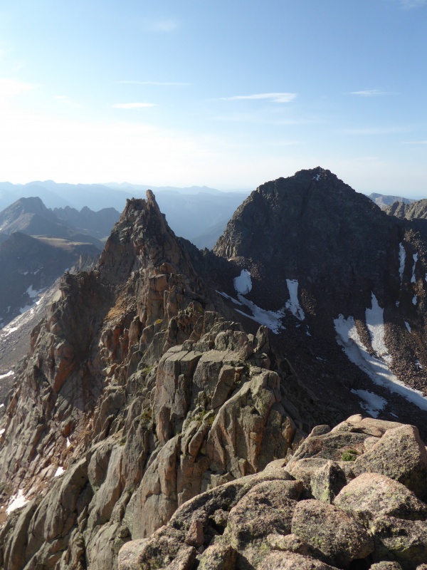
The descend was less painful than the ascend (surprise!), we met the three ladies from Sunlight who were closing on Windom right behind us. The weather was beautiful, and we got to the camp around 1 pm. Very close to 8 miles and 8 hrs total for the day. Day 4: (7/20): Nice and quiet morning, Mike and I woke up at 4.30 am and started towards the Eoluses (or is it Eoli?) right before 5 am. Once we hit the turn off at the Twin lakes, the sun started hitting our targets for the day. After some uneventful climbing we go to the Eolus - N. Eolus saddle. We decided to try Eolus first, and following the recent report of Will_E we wanted to try the N ridge of Eolus. The catwalk is so wide that is tempting to call it Phat Cat walk. We had to wait for a large group of people that were ahead of us. Once at the beginning of the ridge, the first difficulty is immediate - a low class 5 move to get to the huge boulder. We looked at it from left (where the standard route is) and right and realized that after the first two boulders you get into a deep notch after which you have to re-climb the ridge again. So we opted going to the right side, traversed for 30 or so feet and climbed a steep, class 4 gully to gain the ridge after the initial notch. From there on we stayed on the ridge where the climbing was mostly class 3 with one or two class 4 moves, if that. 
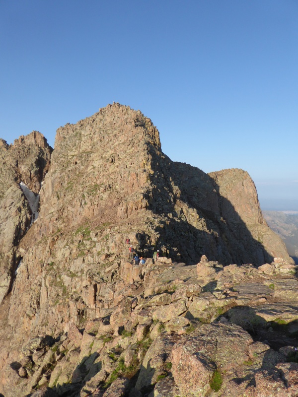

The rock on the ridge was surprisingly solid, and after about 15 min of scrambling we were at the summit of Eolus. There we saw again the three ladies from the day before - Carry, Kelly and Sarah -who woke up at 1 am (!) and summited Eolus (after N Eolus) early to meet sunrise on the summit. that's dedication for you! We descended to the saddle together after which Mike and I went to N Eolus summit. 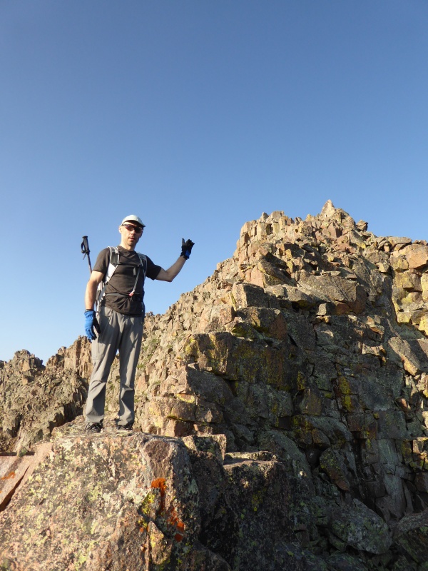

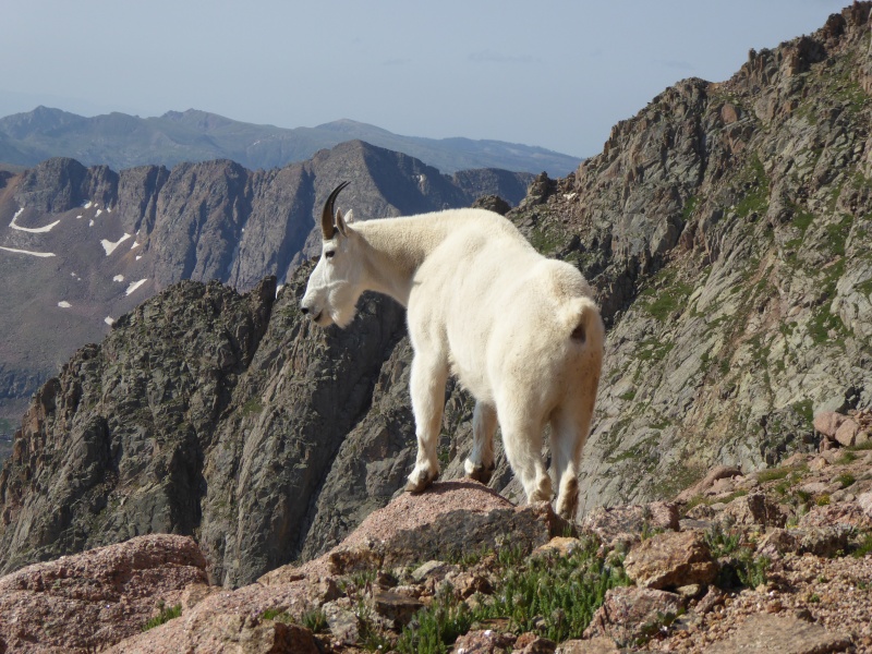
The summit of N Eolus from the saddle is only about 10 min up of enjoyable class 3 scrambling on the best rock in Chicago basin. Getting down to the saddle took only 5 min, and we were going back to camp in no time. A little below the saddle we saw an imposing mountain goat with an immaculate fur. The goat was not paying much attention to hikers. Mike said "He looks confused". I said "No, he looks like he owns the mountain which he probably does". Just before the camp, I looked back at the high peaks. After the second time in the basin, I would love to return one day, but one can never tell what life has in store for you. I tried to imprint that last view into my memory. Chicago basin is a special place. 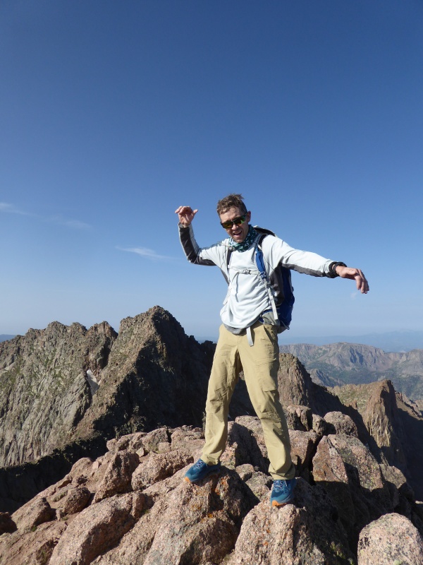
The Eolus hike was much easier than Sunlight/Windom. It took us 6 hrs on the dot for about the same 8 miles. Of course, the elevation gain is much lower as one does not have to lose much elevation between the Eoluses. The forecast for the afternoon was 90% chance of rain. the weather was moving in, so we decided to break camp as quickly as possible to beat the weather. It took us 1.5 hrs to pack everything and have lunch, and just like that, we were going down towards Animas river. The rain caught up to us pretty quickly. We stopped to put the rain jackets and pack covers, but were too lazy to put the rain pants (I did not have waterproof shoes anyway). We did not get soaked but our feet got pretty wet. Plus, we had to deal with downed trees. For the chuckles, we decided to count how many of them there were - we counted 163 downed trees on the main trail! (do not hold me to that number, but it's somewhere in that vicinity). Some big, some small, some easy to climb over, some not so much. That and the rain explained while our time down to the river was not much faster that up. Eventually, after 11 miles, we came to the Animas river bridge near Cascade creek. Our campsite from three days ago was taken, so we set our camp in a different place. My watch showed 47000 steps for the day (8 miles of climbing, 11 miles of backpacking, plus some around camp). A big day! 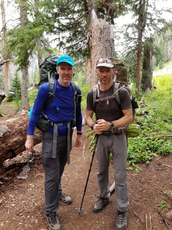
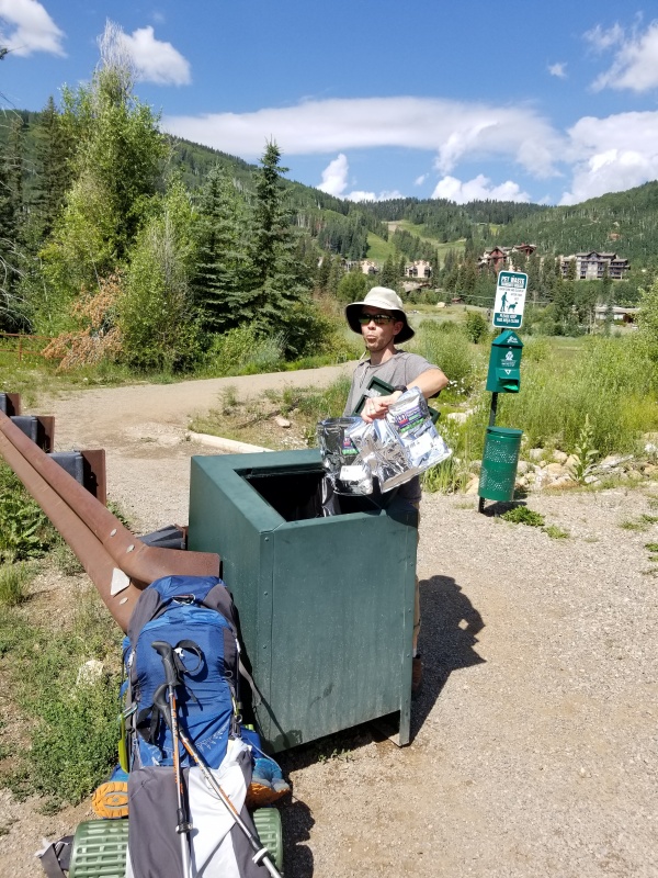
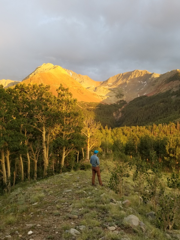
Day 5 (7/21): The trek from Animas river back up to Purgatory trailhead was uneventful. It is up but not at high altitude, the trail goes via the cool Cascade creek canyon, then through Purgatory flats with all sorts of wildflowers blooming, and then, finally, through the aspen forest to the trailhead parking (there we met tons of day hikers). The 4.5 mile stretch took us about 2.5 hrs - we were not in any hurry that day. Mike disposed of his human waste that he hauled out of Chicago Basin - that's what I call caring about environment! We drove to Silverton, had pizza in a brewery, than drove to Telluride, walked around a little and drove and set up camp at one of the designated spots near the Silver Pick (Rock of Ages) trailhead. Sunset was beautiful! 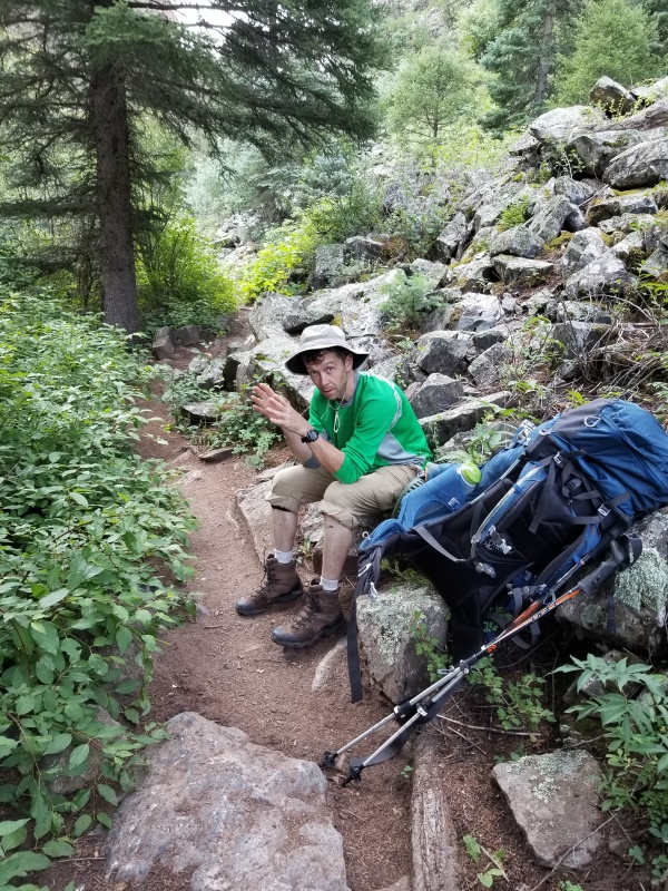
Day 6: (7/22): We started toward Rock of Ages saddle (4.1 miles from TH) at about 4 am. The trail went initially through forest but pretty soon we were walking on an old mining road. By the time it was light we came to an old mining building and there there were two trails - one up to the right, one to the left skirting a small knoll, It was not clear from the route description which trail to take. We took the right branch but due to some mud slides the trail disappeared very quickly. We traversed along the horribly loose slope until we found some semblance of a trail. Eventually, we realized that several sections of the trail were taken down by mud slides/ melting snow. Fortunately, the saddle was visible and from there we were able to visually "back-track" the trail up above us and just scrambled on some loose terrain to it. Once on the saddle, the terrain was familiar, as Alex and I climbed Wilson peak from Navajo Lake five years ago. The trail to Wilson peak from rock of ages saddle is easy to follow, and the short but nice section of class 3 climbing at the end has some loose rock, but nothing worth mentioning. We enjoyed the summit views among blue skies. 
On the way back we briefly contemplated going to Mt Wilson and back (Mike has not done it yet), but that seemed like at least extra 3 hrs and some weather was moving in, so we just went back to the car. Next time. The road back seemed never-ending. I am going out on a limb to say that the Rock of Ages approach is perhaps the least interesting hike in San Juans. I found very little redeeming qualities to the route most of which is on small-stone old mining roads and trails. Perhaps one can appreciate the efforts of the miners but, in all honesty, I would rather hike three extra hours to enjoy Woods lake, Navajo lake, or Killpacker basin approaches. But Mike got his summit out of it, and after 10+ miles RT and 8 hrs we were back. Great trip overall, in retrospect, going from Purgatory to Chicago Basin is not that big of a deal. Breaking it into two days (evening-morning) like we did made it even easier. With the train not any longer available for backpackers from Silverton, this is a viable route. We were somewhat hampered by not having a lot of ultralight gear, but even then it was doable. San Juans are great, always a pleasure to be there. Happy climbing, everyone! Thumbnails for uploaded photos (click to open slideshow): ")
")
")
")
")
")
")
")
")
")
")
")
")
")
")
")
")
")
")
")
")
")
")
")
")
")
")
")
")
")
")
")
")
")
")
")
")
")
")
")
")
")
")
")
")
")
")
")
")
|
| Comments or Questions |
|---|
|
|
Caution: The information contained in this report may not be accurate and should not be the only resource used in preparation for your climb. Failure to have the necessary experience, physical conditioning, supplies or equipment can result in injury or death. 14ers.com and the author(s) of this report provide no warranties, either express or implied, that the information provided is accurate or reliable. By using the information provided, you agree to indemnify and hold harmless 14ers.com and the report author(s) with respect to any claims and demands against them, including any attorney fees and expenses. Please read the 14ers.com Safety and Disclaimer pages for more information.
Please respect private property: 14ers.com supports the rights of private landowners to determine how and by whom their land will be used. In Colorado, it is your responsibility to determine if land is private and to obtain the appropriate permission before entering the property.


