| Report Type | Full |
| Peak(s) |
Mt. Sneffels - 14,155 feet El Diente Peak - 14,175 feet Mt. Wilson - 14,256 feet Wilson Peak - 14,021 feet San Luis Peak - 14,023 feet |
| Date Posted | 09/07/2021 |
| Date Climbed | 09/05/2021 |
| Author | trkl9 |
| The Wilson Trifecta featuring Sneffels and San Luis |
|---|
|
The Wilson Trifecta featuring Sneffels and San Luis (Sept 3-6 2021) For the last couple of years around the beginning of September I try my best to get to far away places with the sole purpose of peak bagging in the high country. Still have some 14er summits that I need to grab in the San Juans so off I went for a little fresh mountain air. This year's itinerary would bring tougher challenges and included summits of Mt. Sneffels, El Diente Peak, Mt. Wilson, Wilson Peak and San Luis Peak with one of the 4 great 14er traverses. Overview: Day 1 - Mount Sneffels; Day 2 - El Diente, Mount Wilson, Wilson Peak; Day 3 - San Luis. Day 1: Mount Sneffels (#38) Route: Blue lakes approach --> Blue lakes pass --> Southwest Ridge ascent --> South Slopes descent --> Blue lakes pass -> Trailhead Distance: 13.39 miles Vert: 5,045 feet Time: 8 hours 4 minutes 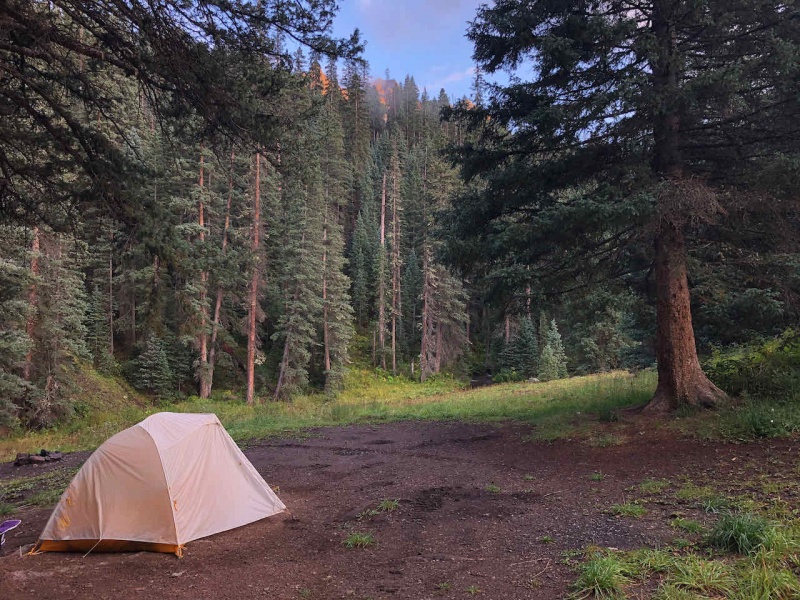
Arrived at the Blue Lakes trailhead around 5pm the night before and found a primo camping spot nearby. Only a short walk to the trail. This approach on the south and west side of Sneffels provides some awesome mountain scenery and the bluest lakes I've ever seen. I would highly recommend this route if you're okay with a little more distance and elevation gain. Started early for this one at around 4:45am. It had been super rainy the past two days so the trail was wet and running with water in some spots. Walked through the dark about 4.5 miles to upper blue lake before the sun started to show the beautiful scenery. From the base of upper blue lake, it is approx 1,200' feet to gain blue lakes pass. Steep but there is an awesome trail that switchbacks the whole way. Made it up to Blue Lakes Pass around 7:30am. 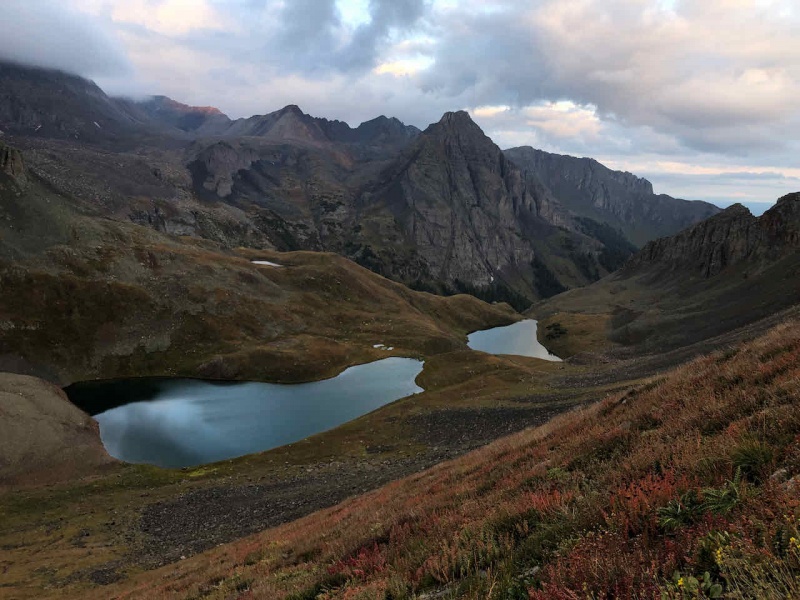
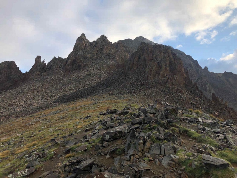
Took a left at Blue Lakes Pass to the SW ridge. Followed the route description and had no issues. Rock wasn't too wet and made for a nice little scramble to the top. About 1,100 feet to the top over some class 3 terrain. Passed two others on the ridge but other than that, not a soul on my route so far. Clouds and minimal wind made for a scenic and serene experience on the ridge. 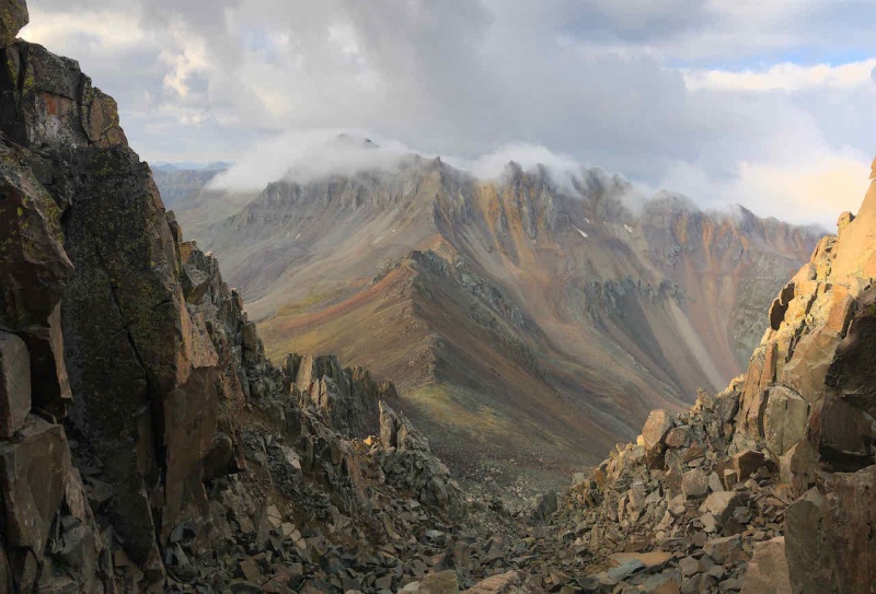
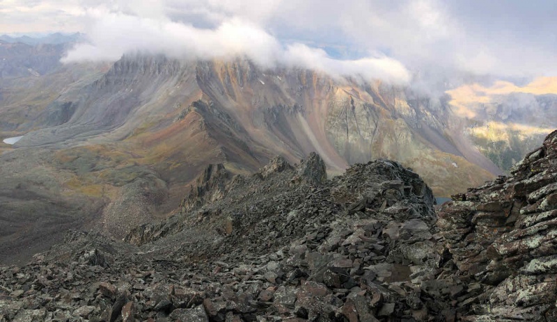
Summited Mount Sneffels at 830am. Clouds would come and go and made for amazing scenery at the top. I had the summit to myself for 25 minutes before another group made it up. Soaked in the solitude. Learning to appreciate and live in these moments while I have them. 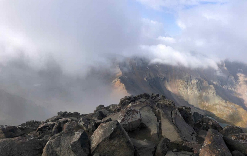

After 25 minutes of solitude, my descent route took me down the standard route and then ascended the 400' back up the Blue Lakes Pass. 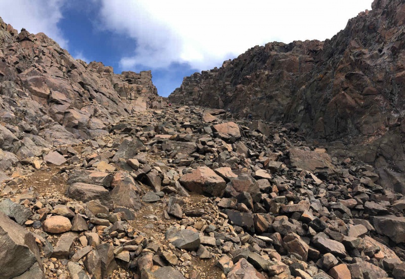
Passed a ton of people making the ascent up the standard route. The south slopes was a steep scree fest and not enjoyable, I much prefer the ridge and stable rock. Ran into an old friend of mine down the slope which was awesome. Small world. Descended down to ~12,700 and cut across back to the trail up to Blue Lakes pass. 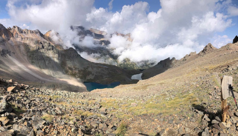
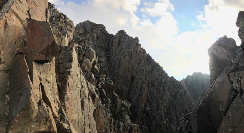
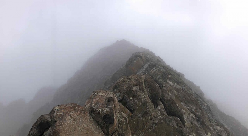
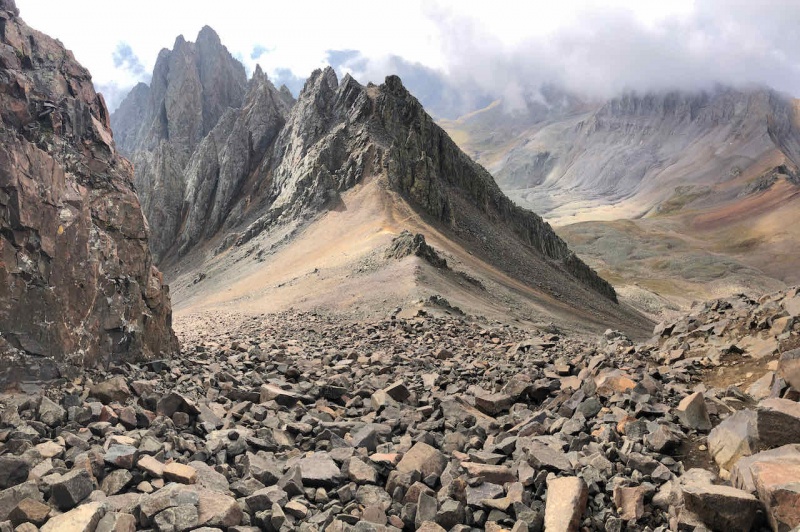
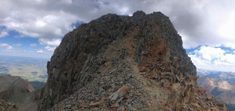
Followed the trail all the way back to the trailhead. An amazing first day. Packed up and drove the next trailhead for an eventful and spectacular day 2. Day 2: The Wilson Trifecta (#39,40,41) Route: Kilpacker TH --> El Diente S. slopes --> El Diente-Wilson Traverse --> Mt Wilson North Slopes --> Wilson Peak SW Ridge --> Navajo Basin --> Kilpacker TH Distance: 18.68 miles Vert: 6,500 feet Time: 13 hours 47 minutes THE MAIN EVENT. This was the route that I had really come down to the San Juans for. I originally planned to just do the traverse and hit Wilson peak the following day via Rock of Ages but I ended up running into another solo climber who was doing all three so, naturally, I agreed to make it an epic day. I will put my GPX on this report for those who like to physically beat down their bodies. 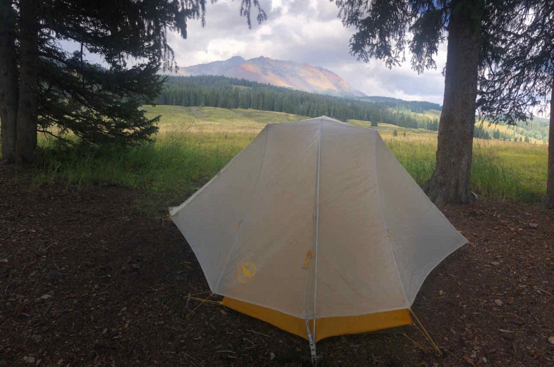
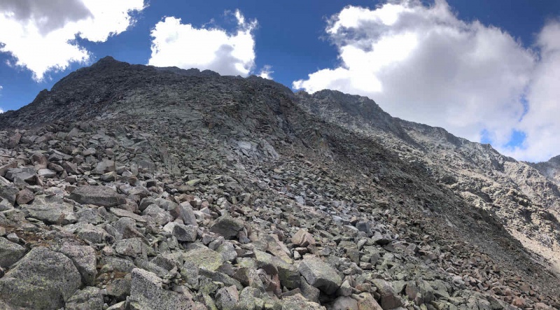
A busy trailhead on Labor Day weekend. A lot of hustle and bustle around 3 AM. I rolled out of my tent at 4am and was on the trail be 430am. Was gonna be a long day but the weather forecast was excellent. Easy, flat trail until about 3-4 miles in. From miles 3-9 on this route, I essential gained 6,000 vertical feet.. Yikes. The trail takes you to the Kilpacker basin. Followed the route description exactly. Turned off for El Diente at ~12,600'. Route finding to the "grey gully" was relatively straight forward. I did have to double check to make sure I was in the right spot in the gully. There were people going every which way. I think I found the right one but just study the route and use your best judgement. 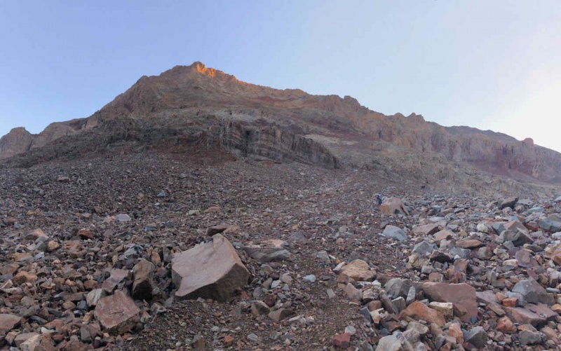

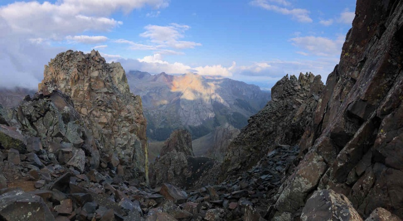
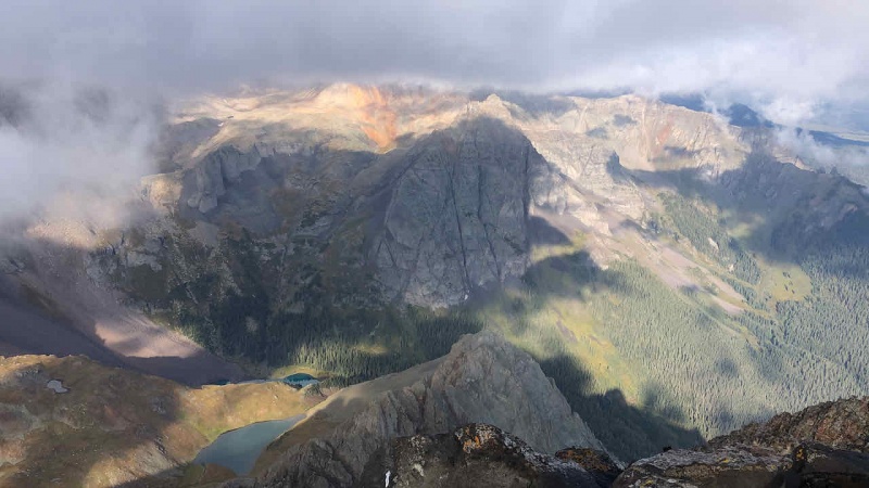
Summited El Diente at 815am, around 4 hours from the TH. Clear skies and a handful of people at the top. Enjoyed the view for only about 10 minutes, then back down a ways to the organ pipes and off to the traverse to Mt. Wilson. 
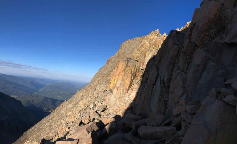
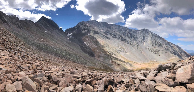
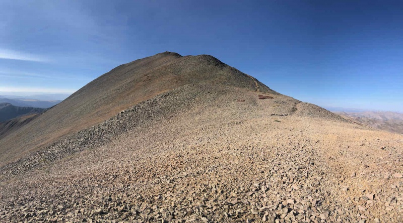
Off the summit by 830am. Descended the same route to the organ pipes and then across on the route to the traverse. To be honest, I was a little worried about the traverse and route finding. I ended up loving it and it was pretty well marked. Study up on the route if you go and save the route descriptions. Finding another person to stick with was a TON of help as we helped each other route find along the way. 
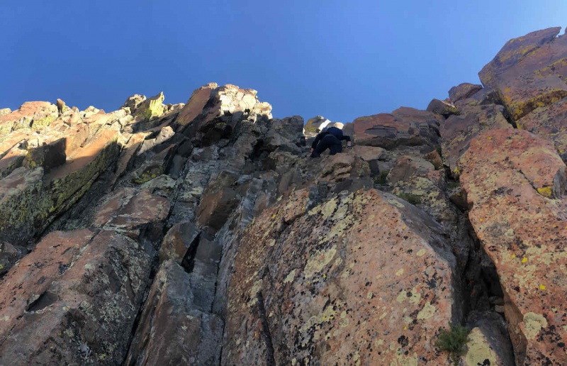


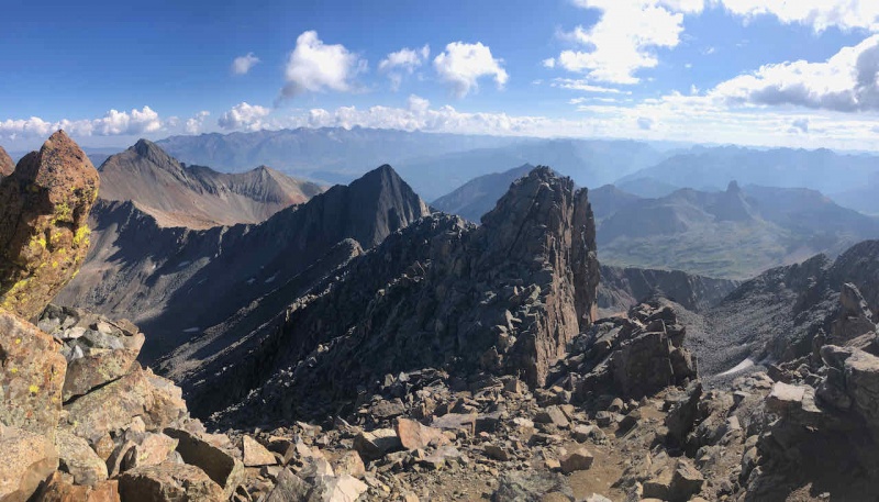
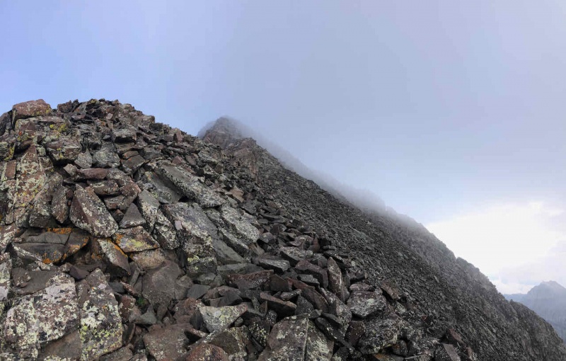
One last class 4 pitch to the top. Made the Summit of Mt Wilson at 1015am and a little over 7 miles in. Took about 1.5 hours to cross the traverse, pretty good if you ask me. Really small summit with 7 people on it. Stayed for a short while and took in the views before the next objective. 
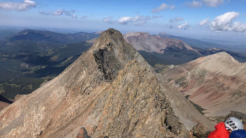
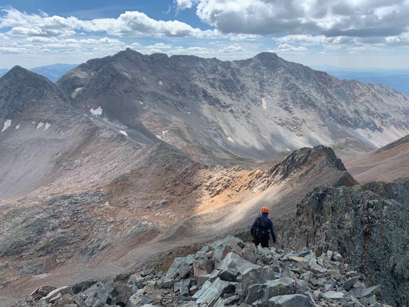
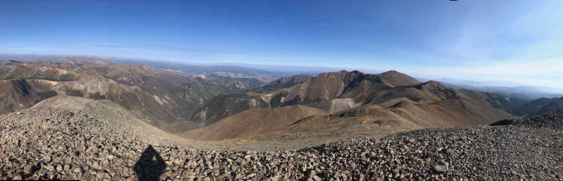
Left the Mt Wilson summit by 1030am. Descended the standard North slopes route into the Navajo basin. 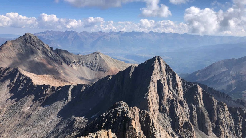

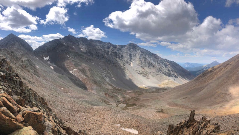
We descended down to ~13,000' and instead of going down to the valley and losing another 800 feet, we skirted below the summit of Gladstone and its connecting ridge to a point where it connects back with the trail to the pass to Rock of Ages. 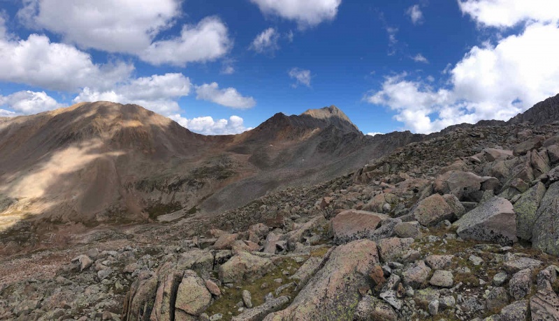
Continued to skirt the slope, made it to the Rock of Ages Saddle at ~13,000 feet around 1230pm. Weather still great. 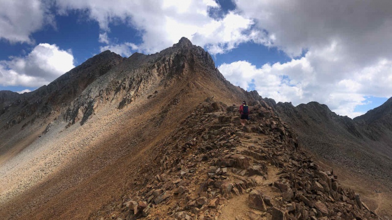

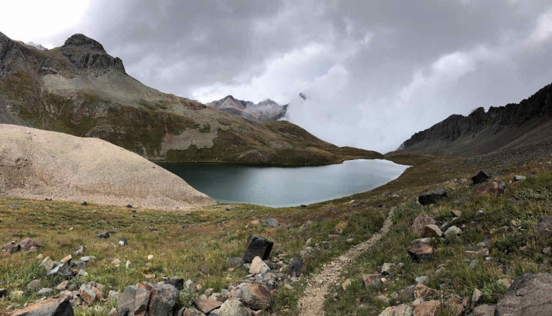
Summited Wilson Peak at 150pm. What a view, what a traverse over to this point. 9 miles and 9 hours into it over some fairly technical terrain. Enjoyed the views and took time to refuel for the LONG journey back to the Kilpacker TH. 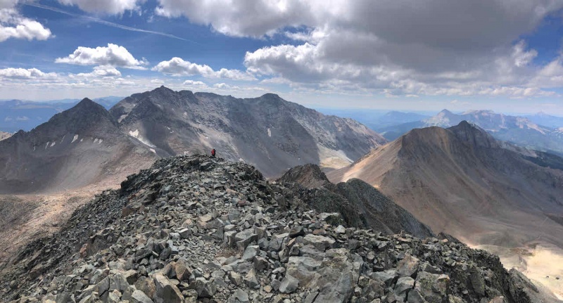
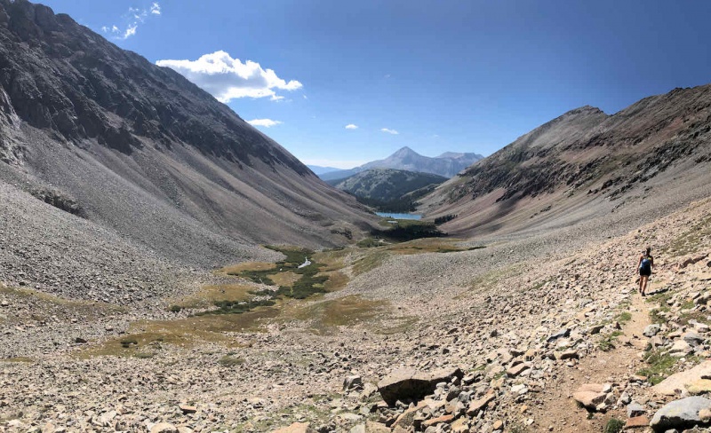
Another 8 miles after the last photo, we finally made it back to the trailhead just after 6 pm. WHAT A DAY. The most epic day I've had out here. Truly blessed that I can experience the mountains like this. Thanks for the awesome adventure to my hiking buddy, Katie! Day 3: Rest and Travel Day I had originally planned to do Wilson Peak the following day but since I knocked it out, I stayed the night at the Kilpacker TH. The next day I used as a travel day back towards San Luis Peak. Over 5 hours from Kilpacker to the Stewart Creek TH but it was on my way home back to Fort Collins anyway. Saved the easiest peak for last. 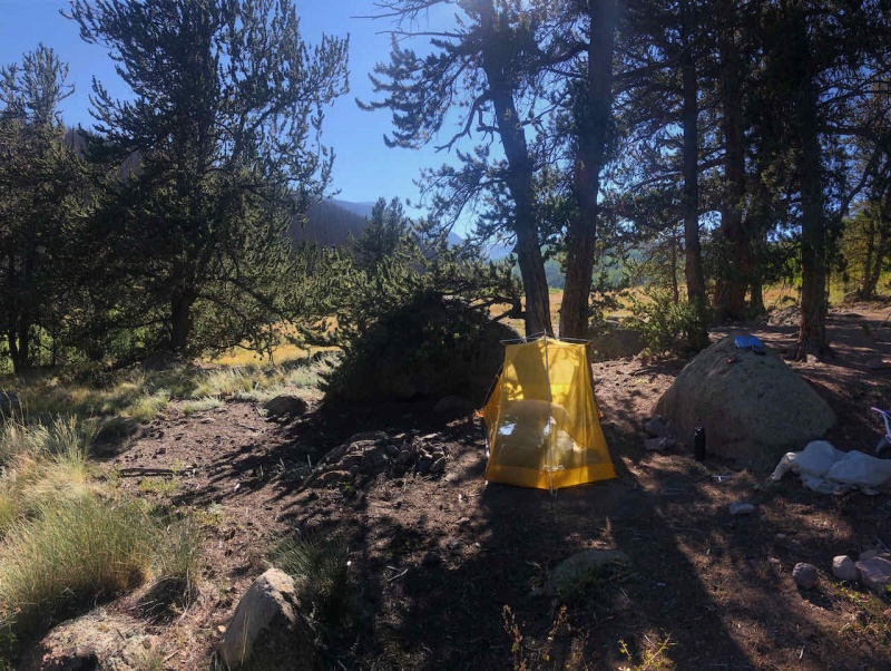
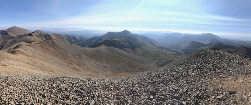
Day 4: San Luis Peak (#42) Distance 13.31 miles Vert: 3,500 feet Time: 5 hrs 30 minutes Rolled out of my tent at 600am, on the trail by 6:30am with the sun starting to rise. Legs were sore but just this one last objective before heading home. 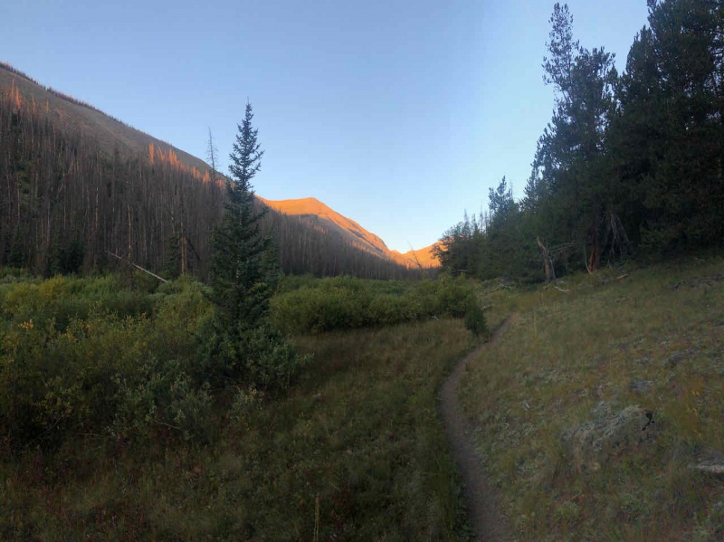

You can feel how remote this peak is. Literally the middle of nowhere with 50+ miles to the nearest town. Had two moose sightings on my way up, one bull, one cow just hanging out in the willows along the trail. 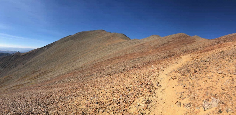
Summited San Luis peak at 915am, just over 2.5 hours to the top over easy class 1 terrain. Cold at the top that morning. 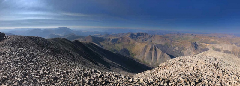
Spent 30 minutes up top. Soaking in the views on the last peak for this trip before heading down. Back to the trailhead before 12pm. Packed up and returned home for a long drive back to Fort Collins. Trip Details 3 day total hiking/climbing Distance: 45.38 miles Vert: 15,045 feet Time: 27 hrs, 22 min on trail If you've made it this far, thanks for reading. Another fantastic trip to the San Juan range. Words cannot describe how great this experience was for me. I have built a lot of experience and confidence in the mountains over the last 3.5 years that has led me to this point. Hoping to finish all 58 in the next year or two if I can. Until next time, I'll be shifting my focus to completing the Elk range 14ers, Little bear and the Crestones. Thumbnails for uploaded photos (click to open slideshow): ")
")
")
")
")
")
")
")
")
")
")
")
")
")
")
")
")
")
")
")
")
")
")
")
")
")
")
")
")
")
")
")
")
")
")
")
")
")
")
")
")
")
")
")
")
")
")
")
|
| Comments or Questions | |||
|---|---|---|---|
|
Caution: The information contained in this report may not be accurate and should not be the only resource used in preparation for your climb. Failure to have the necessary experience, physical conditioning, supplies or equipment can result in injury or death. 14ers.com and the author(s) of this report provide no warranties, either express or implied, that the information provided is accurate or reliable. By using the information provided, you agree to indemnify and hold harmless 14ers.com and the report author(s) with respect to any claims and demands against them, including any attorney fees and expenses. Please read the 14ers.com Safety and Disclaimer pages for more information.
Please respect private property: 14ers.com supports the rights of private landowners to determine how and by whom their land will be used. In Colorado, it is your responsibility to determine if land is private and to obtain the appropriate permission before entering the property.