I happened upon the idea for this 25.3 mile loop from an old @Doggler trip report (in which he was training for an upcoming race). His original trip report gives a good rundown of some of the logistics and I recommend checking that out if you attempt this route: http://seanoday.blogspot.com/2012/06/little-browns-creek-mountain-marathon.html
I am in no way or shape a runner of any kind, nor a model of fitness, nor mountaineering. However, I do enjoy pushing my skills and endurance a little further on each trip to Colorado from Mississippi, and this loop seemed doable albeit a little outside of my comfort zone. The loop begins by summiting Antero via Little Brown's creek, joining up Antero's standard route, then leaving the route and bushwacking over to Tabeguache/Shavano, then returning via the standard Tab/Shav followed by a long trek back to the car via Colorado trail. It was a beautiful early fall day and I timed the changing of the leaves in the Sawatch just right.
Since it was early fall and the weather was permitting, my goal was really just to complete the loop in one long day. Doggler completed the trip in an ~11-12 hours run/fastpack. Since knew I would be fast-walking/slow-walking, my goal was to make it back to the Colorado trail turn by dark, which would have me completing the trip in ~16-17 hours. I did get below tree-line by dark, but ended up finishing in ~20 hrs total (started at 4am and returned around midnight). Now that I think about it, Centennial Cronin peak could also be added to this loop for good measure.


I love long solo trips such as this when the weather is good, but I probably pack heavier than most would for this distance. I started with 2.5L of water and was able to filter at a creek crossing in the bushwacking section between Antero standard route and Tabeguache. I didn't take any pictures after descending Antero because I was HUSTLING over to Tab. I knew I was really pushing the clock at that point: It took ~5 hrs to summit Antero from Little Browns creek trailhead and make it back down to the turn-off, which I estimated to be about 1/3 of my trip time (not quite). There is a lot of literal bushwacking (and puddle jumping) as you end up going through a miserable maze of willows. Awaiting you on the other side of those is an extremely steep gully that puts you on the saddle between Carbonate mountain and Tabeguache. This was by far the most miserable part of the day, with snow and ice covering the mud below on most of it and daylight waning with every rest break I took. I spent at least an hour in that gully, which I measured at just over half a mile on google maps :(


After reaching the saddle however, the traverse over to Tab and the ridge walk over to Shavano were relatively smooth sailing and I almost made it below the treeline and headed back toward the Shavano campground as the darkness closed in. I believe it was a roughly 6.5 hour walk back to my car from the top of Shavano (half on Shavano standard and half on the Colorado trail). I was quite delirious at times and wanted to do nothing more than lay down next to the trail and sort it out in the morning. I trudged on and reached my car around 12:30 am and crashed in the back of my Highlander until I was awakened by the sun warming the entire valley the next day.


As far as weather, I ran into a some morning clouds and a few snow flurries on the ascent when I was nearing the join-up of Antero's standard route, but weather was very cooperative the rest of the day, which definitely made this trip doable. I know that I was fortunate and that this is not always the case.
I believe these three were the #24-26 on my 14er checklist. Although it was more about a fun adventure and pushing myself beyond my comfort level, it is really nice to be able to group 2-3 peaks together in one big loop! I only get to come to Colorado once a year, so I like to maximize my time and spend as much time as I can on my feet. I have done fun loops in the past, but usually on adjacent peaks that are often done together and tend to be easier. This trip is a great memory because of both the mileage and the array of fall colors I was blessed to see in early October. I did a similar thing with Stewart peak and San Luis peak two days later that was equally as beautiful and challenging (maybe I'll do a trip report from that one at some point). I really hope I can come back in the fall and do another adventure like this in the near future.
Thank you to Doggler for the inspiration for this trip and thank you to others (whom I'm sure most people in this community know) that have a great sense of adventure and are passionate about inventing new ways to link together peaks are off the beaten path.

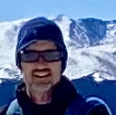
If you look closely, you can see Antero in the very far back right, Tab/Shav in the middle, as well as the descent of shavano through the trees in the very middle of the screen.
")
")
")
")
")
")
")