| Report Type | Full |
| Peak(s) |
Mt. Eolus - 14,087 feet North Eolus - 14,042 feet Sunlight Peak - 14,061 feet Windom Peak - 14,089 feet |
| Date Posted | 08/15/2022 |
| Date Climbed | 09/11/2021 |
| Author | channaford |
| Chicago Basin in a day from Purgatory |
|---|
|
A Long Day Out A descriptive review of my best day out in the alpine, possibly ever. I've included route beta, a gear overview, plus my thoughts on the route/day and a thank you to all the fellow hikers I met along the way that helped me out, either with encouragement/excitement, or just good company. To start, I recognize that it's been a while since I did this, almost a year. A trip report written in mid September 2021 would be more detailed and undoubtably more comprehensive. However, I haven't been one to catalog my adventures much and find myself needing a justification for putting myself out there in a public forum, even here at 14ers.com. There has to be some reason I'm putting effort into this aside from mere vanity, right? I finally got around to documenting this trip for a few reasons, but mostly because as I look back, I had an amazing time out in the mountains and did something that really pushed me, something where the end result was truly uncertain when I woke up that morning. I want other people like me, a semi-serious ultra runner, to experience what I did out in the San Juans that day. When researching the route, I read Anton and Matt Mahony's trip reports, which were useful, but didn't give me a great barometer for how difficult this really would be. These are people who've podiumed and won classic 100's, people who've completed Nolan's. These were not regular people. So here's a trip report about this objective from a regular person. I hope more people try this route and if my trip report can help with that, then it's worthwhile. The first time I heard about the Chicago Basin 14ers was through an ancient trip report with mentions of long train rides, heavy packs, and lots of camping. Over the years, I've come to hate camping more and more, so I'm always looking to avoid it if at all possible. These peaks were always on my list, but when I came across Anton Krupicka's trip report of running these from Purgatory...well, that sold me. I read everything I could find, and set this as a late-summer goal following a 50-mile race in May. In terms of trip logistics, I have to credit my GF, Sarah, for getting me through the weekend. She drove me from Denver to the Purgatory Resort lot on a Friday night after work, allowing me to partake in some gummies on the ride to ease my nerves and potentially even sleep a little. We eventually arrived and slept in the back of the car. I'd say I got less than two hours of sleep before the alarm went off at 2:30 AM. We were able to hit the trail a little before 3:00 and made our way down the Purgatory flats section. I want to call out this section specifically, because we somehow got lost, even though Sarah had backpacked this route earlier in the season and we both had a GPX track. There were several trail junctions leading to campsites and we lost some time looking at our maps to make sure we were going to end up where we needed to be. Keep an eye on your watch/phone/map through this section, especially in the dark. Around 2 and a half hours in, we reached the junction for the Needleton station, I filtered water from Needle creek, and ditched my bivy with Sarah so she could nap more comfortably in the hammock she brought. This is where the trail really kicked up in elevation gain, and I found poles to be very useful from here on out. 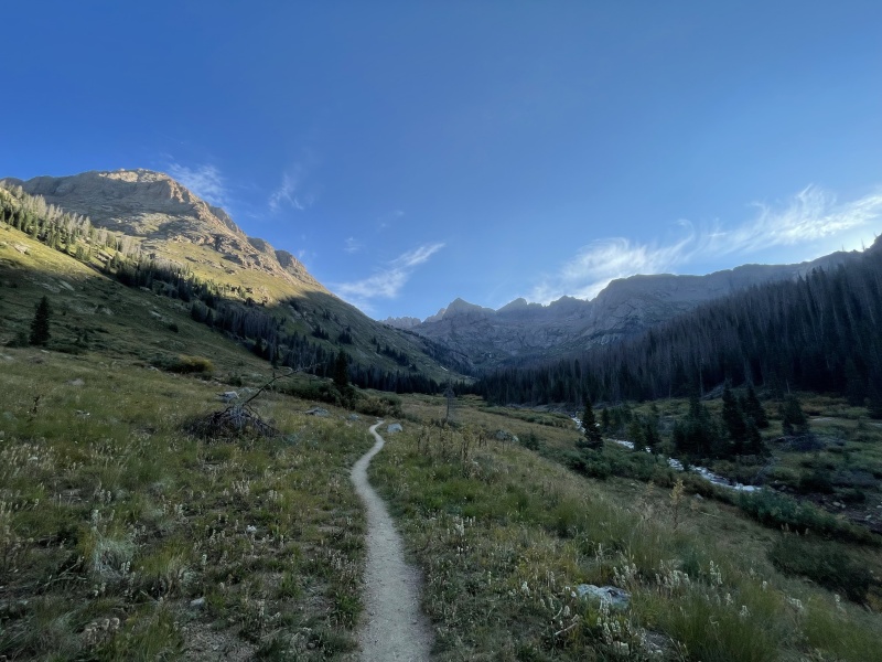
Speaking of gear, I used half-tights, a t-shirt, windbreaker and hat/gloves. The windbreaker was mostly worn above 12,000ft and I found that adequate for the weather. I brought a headlamp, poles, an in-reach (more on that later), filter, puffy, and hardshell. I had the normal mini-maintenance kit with stuff like tape, advil, etc. For navigation, I had a route mapped on my Garmin watch, plus the downloaded area on google maps. I wore my most trusted trail shoes (La Sportiva Jackal), which, of all the shoes I own, are the least likely to leave me with blisters. After 5.5 hours, I was filtering once again at Twin Lakes and preparing to slog up the Eolus group. I had it in my mind that I could potentially try a 4th/low 5th ridge up Eolus to add some excitement, however I ended up prioritizing the extra trip to the lakes and security of a well-traveled route. If I were to ever do this again, I think I'd get a little more creative with the route. 
After a quick stop to filter at Twin Lakes, I headed left (West) to hit up the Eolus group. The steep trail up to the saddle seemed relentless, and was somehow the most taxing climb of the day. I chose to hit North Eolus first as it was a very quick jaunt up to the pseudo-summit. 6:10 on the clock and I had my first peak down. Crossing the Catwalk was enjoyable, and as usual was less intense than advertised. Next up were the series of ledges that were well-cairned. These ledges held a lot of loose dirt and rock, so navigating them delicately was a priority and a helmet here is certainly appreciated. 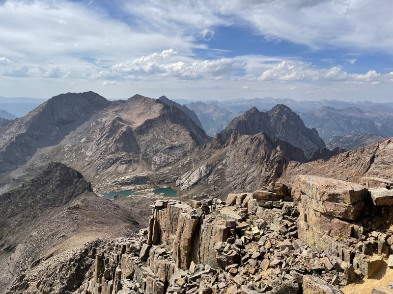
After retracing my steps from the top of Eolus, I was back down to Twin Lakes again with about 6:50 elapsed so far. This was the decision point for me to continue or not, but I fortunately didn't have to think too hard. The day was going surprisingly well and my sprits were high (this would change). I decided to tackle Sunlight for my third peak of the day, wanting to get the more technical stuff out of the way while I was still feeling good. Route finding up the drainage basin was a bit confusing, but of low consequence. As long as you hit the gully, you're good. Speaking of that gully...wow that thing is loose and steep. I found myself having to rock hop up the gully, dancing between embedded rocks in order to maintain my footing. For reference, I've run the Mt Marathon course, and this gully is the closest thing I've found in Colorado that compares when it comes to the brutal combination of steep and loose terrain. At least...this is what sticks out most in my memory from that peak. After hitting the saddle between Sunlight and the Spire, the rest was exceptionally fun scrambling in an environment that reminded me a lot of South Platte granite. The summit block lived up to the hype in my opinion, with some delicate smearing up the first boulder followed by a quick mantle move onto the block itself. Descending off the block required a bit of a hop and weight transfer, which was pretty unnerving considering my legs were well past cooked by this point. All went well, fortunately, and I began the descent of Sunlight with Windom in my sights. 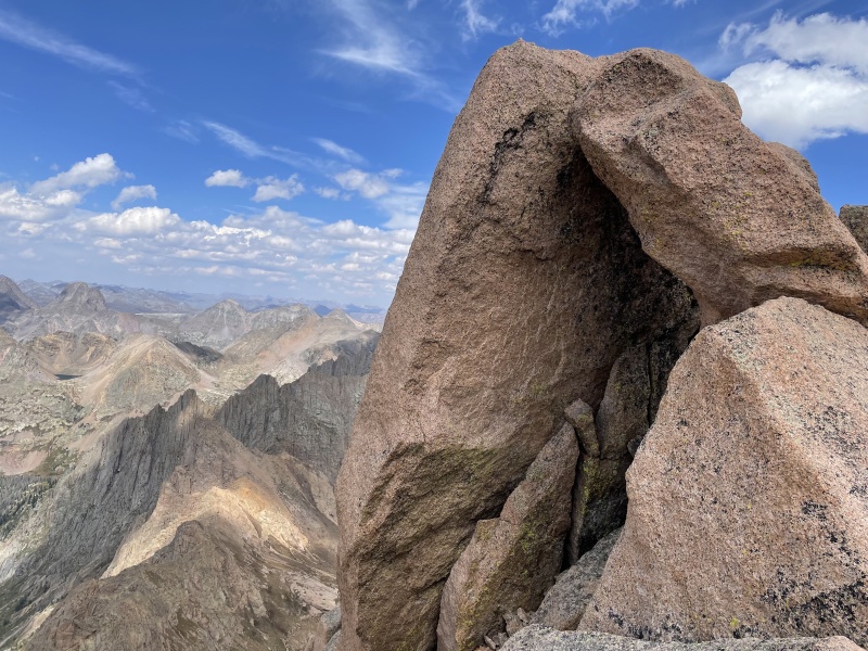
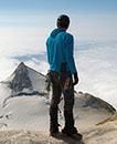
Peering out toward Windom (seen on the left) from near the top of Sunlight While descending Sunlight, I ended up following a pair of hikers down who were camping in the basin. One of them had not summited Windom yet and joined me for the final (but not final) climb of my very long day. Even though my spirits were still high, the climb up Windom was a slog and a bit more technical towards the top than I was anticipating. Nevertheless, we made it and I finally let out a sigh of relief, knowing that all I had to do was make it back to the car, and that I soon would have Sarah's help. 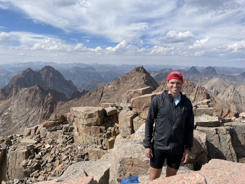
My new climbing partner and I made quick work of the descent off of Windom, which was made even easier by great conversation. I do so much of my running and training solo, that sometimes I forget how nice it is to share some trail miles, even with someone you've never met before. Upon getting back beneath Twin Lakes, I was able to filter again, and got into a very one-sided conversation with a woman where I gave her a ton of unsolicited advice about how much water one needs while hiking. To that woman, if you're reading, I apologize for being so weird and mansplaining the concept of water to you. In my defense, I was 9 hours into my day and both on top of the world and exhausted at the same time, but still, not cool, past me. 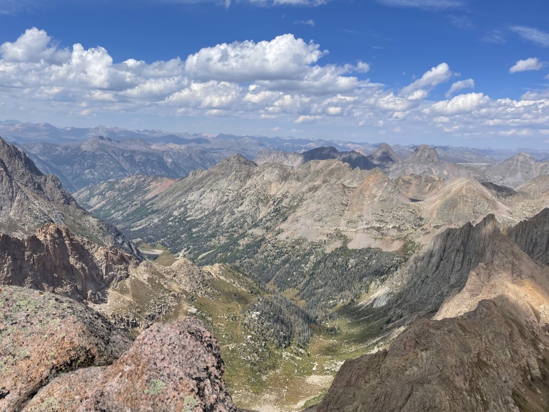
The run down from twin lakes to Needleton was one of the best feelings I've ever experienced in the mountains. I found myself extremely grateful for everything my body was able to do, for the amazing state I get to live in, as well as my job and support network, which allow me to take time like this to pursue the things I'm passionate about. I was jamming out to some Taylor Swift while I ran (for the first time in what was now a 9+ hour day) and making great time back to the train junction. The views of Chicago Basin were spectacular and by the time I was back at Needleton, I was so excited to "only" have 10 miles to go.
On the run out of Chicago Basin Upon returning to Sarah's makeshift camp, things started to go awry. I immediately got into her hammock while she went to filter water. Looking back, this was a big tactical error on my part and has informed my "never stop" mindset since. After about 5 minutes in the hammock, by body started to cool down rapidly, so I got my puffy out and used it like a blanket. After about 15 minutes, I was shivering and struggling to stay warm. Eventually I hauled myself out of the hammock to check on Sarah, but at that point, the damage was done. My body was shutting down for the day because I allowed it to stop. Afterward I learned why it took Sarah approximately 30 minutes to filter water. Apparently, a camper had asked to use our in-reach to message his wife about not returning to Denver on time. He had misinterpreted the train schedule and missed his departure out of Needleton. He also needed extra food from us, as well as our water filter (he apparently let his float down the river after knocking it off a rock). After getting him all set, Sarah returned to her makeshift camp to find that my mood has swung from 100 to 0 in a flash. This is where the day got difficult. Full disclosure, I can get moody and temperamental when things don't go well in the mountains. My mental game out there is certainly something that I'm still working on. I'm good at suffering, though I wish I was more fun to be around while doing it. The last 10 miles were mostly a walk, with me noticing every annoying detail of the trail and starting to believe that big white boulders were actually tents. Sarah was able to handle me fairly well, and we eventually decided it would be best for me to put in music and just "chase" her up the trail. It was getting dark at this point so I put on my headlamp, got some music going, and started to repeat my mantra for when things get tough: "this is why I do this" The switchbacks up the final climb back to Purgatory seemed relentless, but like all things, they did eventually relent and we made it back to the car. My total elapsed time was just under 18 hours. Final thoughts: This is a great route. It's got views, technicality, distance, and the added mental challenge of putting oneself deep into the backcountry. If I were to do it again, I wouldn't change much in my preparation. I think an early September push is perfect and gives you a great chance at clear skies all day. Gear-wise, I appreciated poles, and thought trailrunners were adequate for all of the technical portions. Also, there are good opportunities for water along the route (just don't filter the Animas). All in all, my day ended up being 43 miles, with 11,600ft of climbing according to Strava. I'd say that more people can do this than they think, and it's a great way to spend the day! Thank you all for reading! Please feel free to ask any questions you might have and I'll try to answer if I can. Thumbnails for uploaded photos (click to open slideshow): ")
")
")
")
")
")
")
")
")
|
| Comments or Questions | |||||||||||||||
|---|---|---|---|---|---|---|---|---|---|---|---|---|---|---|---|
|
Caution: The information contained in this report may not be accurate and should not be the only resource used in preparation for your climb. Failure to have the necessary experience, physical conditioning, supplies or equipment can result in injury or death. 14ers.com and the author(s) of this report provide no warranties, either express or implied, that the information provided is accurate or reliable. By using the information provided, you agree to indemnify and hold harmless 14ers.com and the report author(s) with respect to any claims and demands against them, including any attorney fees and expenses. Please read the 14ers.com Safety and Disclaimer pages for more information.
Please respect private property: 14ers.com supports the rights of private landowners to determine how and by whom their land will be used. In Colorado, it is your responsibility to determine if land is private and to obtain the appropriate permission before entering the property.