| Report Type | Full |
| Peak(s) |
Sunlight Peak - 14,061 feet Windom Peak - 14,089 feet Mt. Eolus - 14,087 feet North Eolus - 14,042 feet |
| Date Posted | 06/26/2022 |
| Date Climbed | 08/12/2021 |
| Author | PikaSteve |
| 14ers 402 Senior Project |
|---|
|
14ers 402 Senior Project 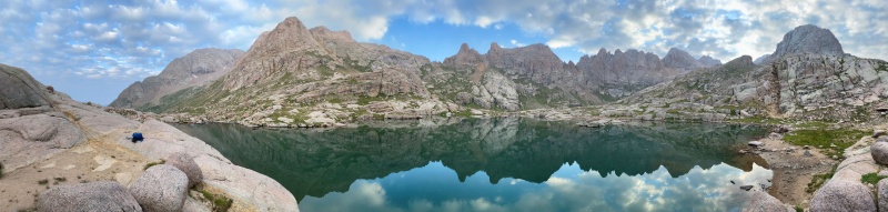
Note: this trip report from August 2021 doesn’t present any new information, but hopefully provides some encouragement and perspective to other slow folks, shares some photos from a magical, remote place, and links to some helpful resources. Over 40 years, I’ve been making progress towards climbing all of Colorado’s 14ers. 2020 marked a big step up in difficulty, climbing all but one of the class 4 14ers in what I considered to be a 14ers 401 class. For 2021, all that remained to finish my 14er graduation was a 14ers 402 senior project in Chicago Basin to climb Sunlight Peak along with Windom Peak, Mt Eolus and North Eolus. At 56, despite what AARP may say, I don’t consider myself to be a senior citizen. But I am slow in the mountains. Slow on the approach. Slow on the ascent. Just as slow on the descent. And slow to write a trip report. But slowness can be overcome with patience, persistence, and planning. 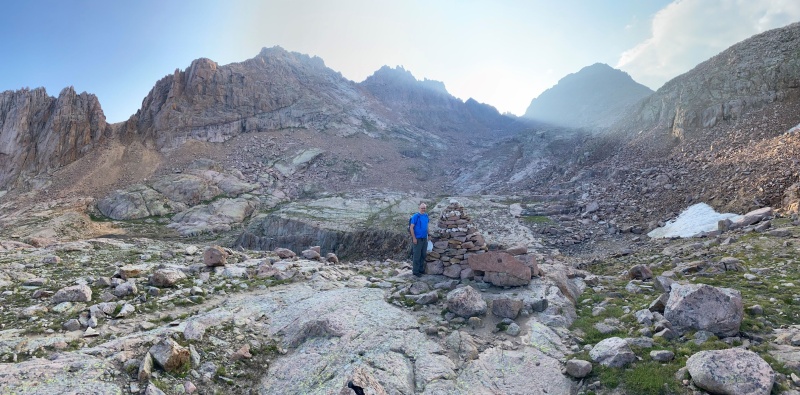
I started my senior project planning in early June, first trying to understand the complexities of the railroad schedule for backpackers. [2021 summary: only one diesel train per day to Needleton for backpackers; must depart/return from/to Durango; limited backpacking parties per day; reservations by phone only.] Then, I looked at as many trip reports and condition reports as possible to try to find the sweet spot on the calendar after the snow melts, with a low chance of monsoon rain and before autumn snow might arrive. My conclusion—there is no sweet spot. I decided to make Tuesday to Friday train reservations for the second and third weeks of August. If weather didn’t look favorable for the first reservation, I would delay by a week—being semi-retired provides more flexibility than I used to have. My plan paid off with a break in the monsoon just after downed trees were cleared from the trail on August 7th and just before an initial snowstorm on August 20th. [June 2022 note: I have heard rumors of August 2022 train reservations already becoming scarce; also, there is a new policy where even diesel trains can be cancelled on days with Red Flag fire danger. See resources section at end of report for some trip planning references.] On the Friday before the first reservation, I checked the extended weather forecast and was pleased to see that the coming week was expected to have a break in the monsoon from Monday to Thursday, with almost zero probability for rain on Wednesday. On Monday, I drove from Denver to Durango arriving in the afternoon in time to pick up my train tickets and cancel my second reservation for the following week. Durango to Needleton to Chicago Basin: August 10, 2021 I left the motel very early to avoid any risk of being late. I waited patiently by the train until the conductor opened the baggage car door and hoisted my backpack inside. I was excited to get going, but had no option but to wait for an “All Aboard” call followed by a 2.5 hour ride to Needleton. Backpackers ride in an open gondola car just behind the baggage car and diesel engine. Being outside was chilly, but I knew that every nose on the train would appreciate the ventilation on the return trip. I’ve been on the Durango and Silverton Narrow Gauge Railroad a few times before, but never as a backpacker and never with a smartphone. Like everyone else, I enjoyed taking too many photos. 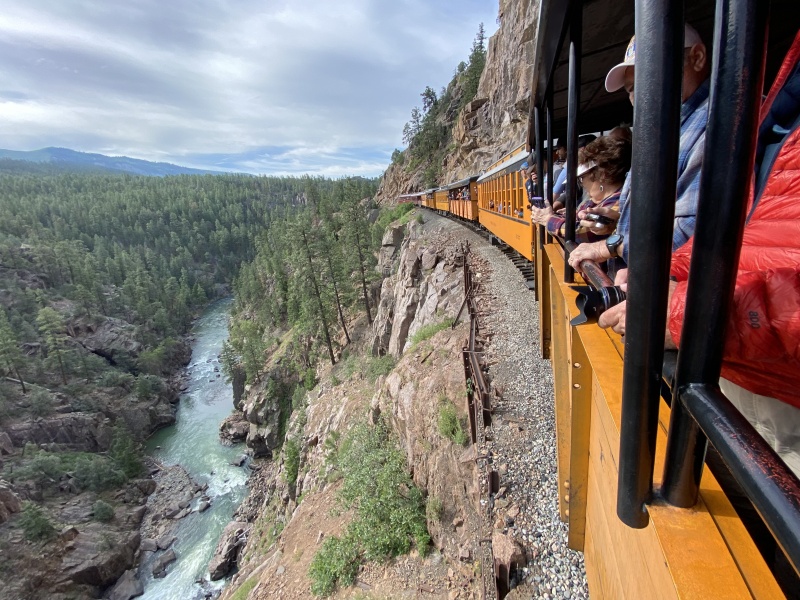
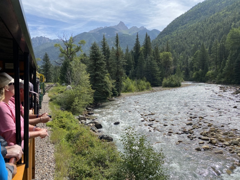
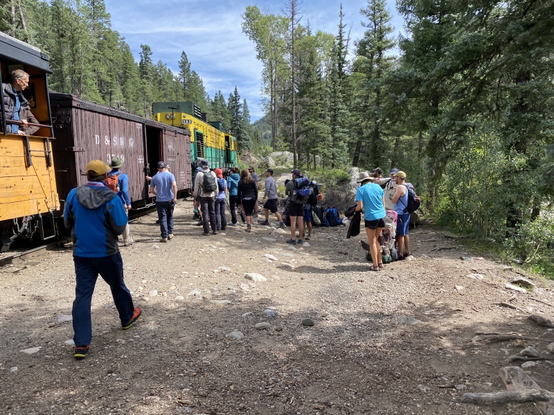
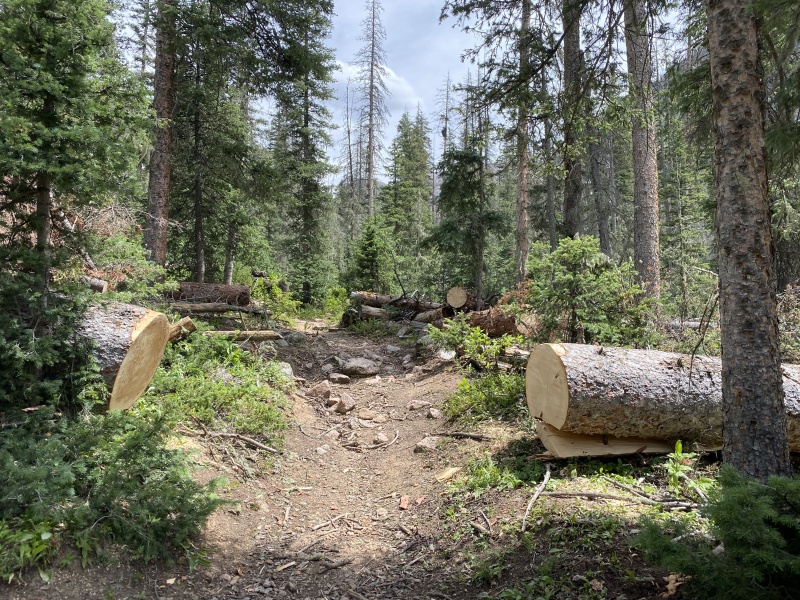
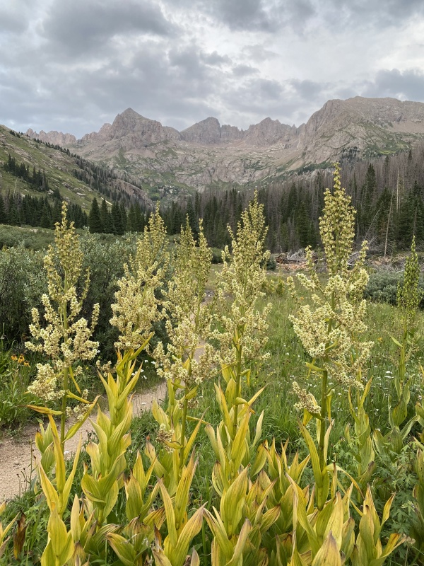
The train pulled into Needleton at 8200’ elevation at 10:30. Offloading my backpack from the baggage car, I was already getting warm. I adjusted layers to shorts and t-shirt and proceeded across the suspension bridge. Within 30 minutes, I was in my traditional caboose position behind all other train passengers and was enjoying the wilderness solitude and creek-side scenery. I wasn’t completely alone. A steady flow of downhill groups and an occasional Purgatory party swooshed past me. I was feeling fortunate in my choice of dates as there weren’t any mosquitos, the skies weren't too smoky and all the fallen trees had recently been cleared from the trail. In the upper parts of the Needle Creek drainage, I estimated that over 70% of the trees were needle-less, so deadfall will likely continue to be a yearly challenge. As the trail started to flatten out, I exited the trees and rounded a corner to dramatic views of the highest summits. This seemed like a fine place to set up camp especially since I was concerned that any higher camp sites might already be occupied by faster folks. 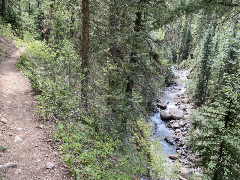
While setting up camp, I was greeted by two mountain goat mommas and their kids. They left some droppings to let me know that I was a visitor in their territory, but quickly moved on to inspect the next campsite. After a nap and dinner, I went for a sunset walk to admire the Needle Mountain summits. Returning to camp, I organized my summit bag and clothes for tomorrow, set my alarm for 4:30 and quickly fell asleep. 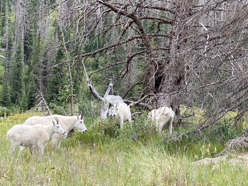
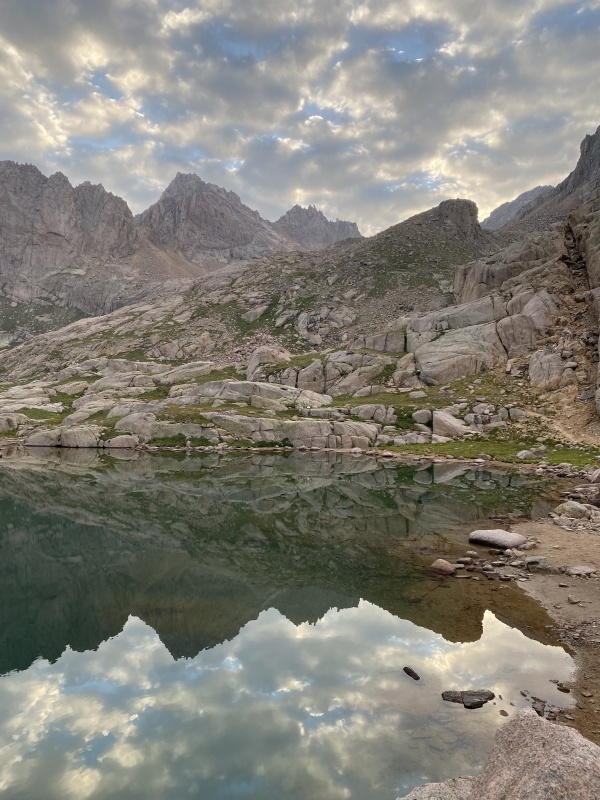
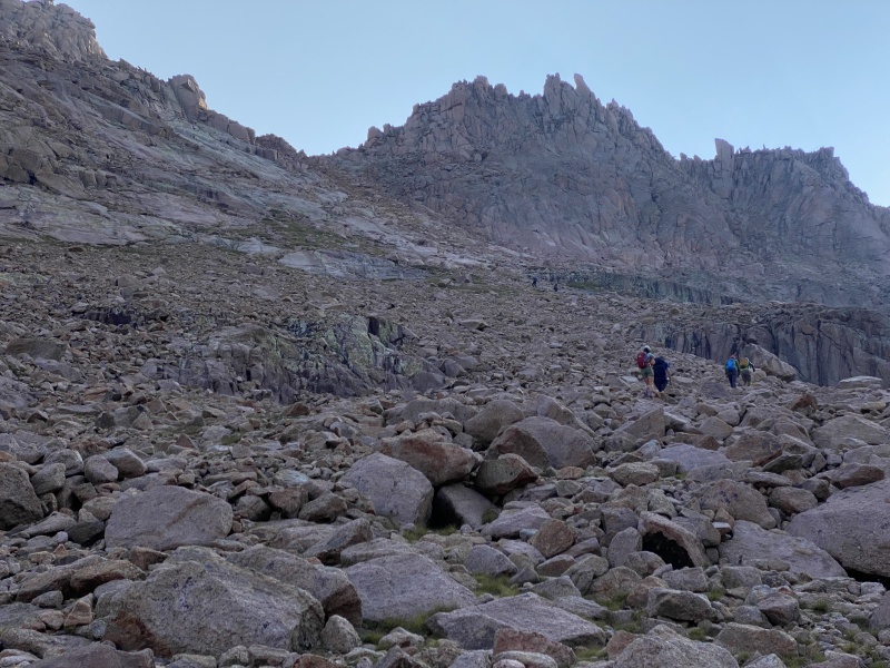
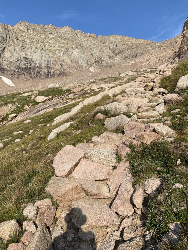
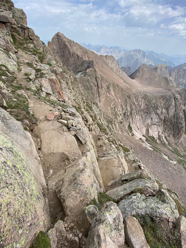
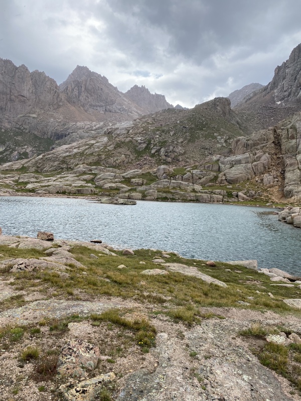
Windom, South Windom, Jupiter Sunlight Peak and Windom Peak: August 11, 2021 I was on the trail by headlamp at 5:00, after getting the day's food out of the tree and putting my sleeping bag into my hanging pack. It was nice to have a fairly flat mile for getting warmed up, passing many campsites along the trail until branching off toward Twin Lakes. Although steep, the trail was easygoing thanks to the many steps and switchbacks constructed by the Colorado Fourteeners Initiative. I paused for a break at Twin Lakes as the sun started to light up the clouds above Sunlight Peak. The feeling of connection to the light, sky, mountains, rocks, and lake gave me the spiritual high that I often find in the mountains. 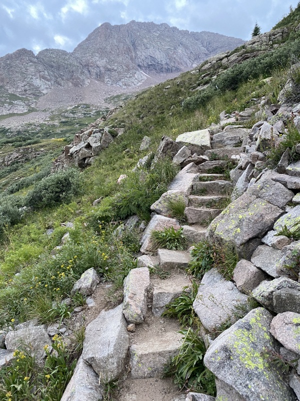
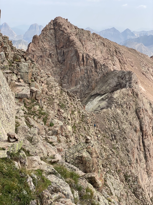
Proceeding beyond the lakes on more CFI improved trail, rays of sunshine and smoke spilled over the saddle between Sunlight Spire and Windom Peak while large cairns marked the path to the base of the red slope leading to the saddle between Sunlight Peak and Sunlight Spire. The red slope reminded me of the climb from Lake Como to the Little Bear ridge, maybe with less loose rock. From the top of the saddle, the route was convoluted, but still seemed easy to follow, maybe because I could copy the route of the many descending climbers who had passed me on my way up. 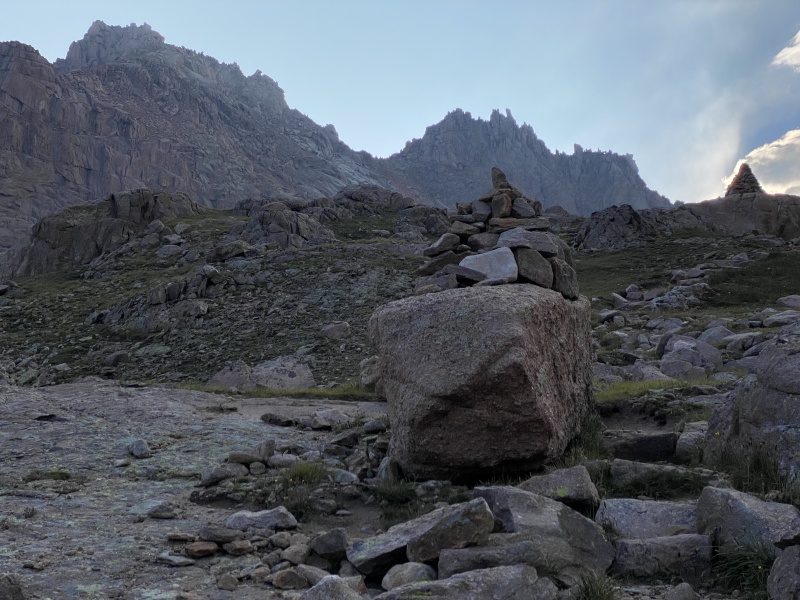
I had the summit to myself for a minute before another large group caught up to me. After tightening my shoe laces and taking several deep breaths, I started up the final stack of jumbled blocks above the main summit. Standing on the second to last block, I carefully turned around and scooted my butt onto the highest block. Between short breaths, I quickly took some photos. Surging adrenaline means I didn’t have much memory of ascending or dismounting the summit blocks other than each time I made a long step or a quick jump, my approach shoes provided plenty of friction. 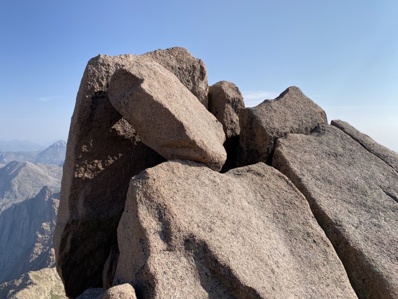
Safely down on the main summit, my body processed the adrenaline surge while my mind marveled at the shapes of nearby and faraway mountains. I snacked while watching the steady show of people moving up the final stack of blocks. It seemed that about 1/3 of folks were content to have reached Sunlight’s benchmark while 1/3 went to the highest block and an in-between 1/3 were talked into trying to reach the topmost block but changed their mind partway up. Returning to the saddle was very enjoyable, lowering myself through a window onto an exposed landing, dropping down rounded blocks and traversing ledges on the steep slope back to the saddle below Sunlight Spire. From here, I appreciated having poles while descending until eventually starting to contour toward the base of Windom's west ridge. Up to this point, most of the hiking had been on trail, rock steps, dirt slopes and firm slabs. 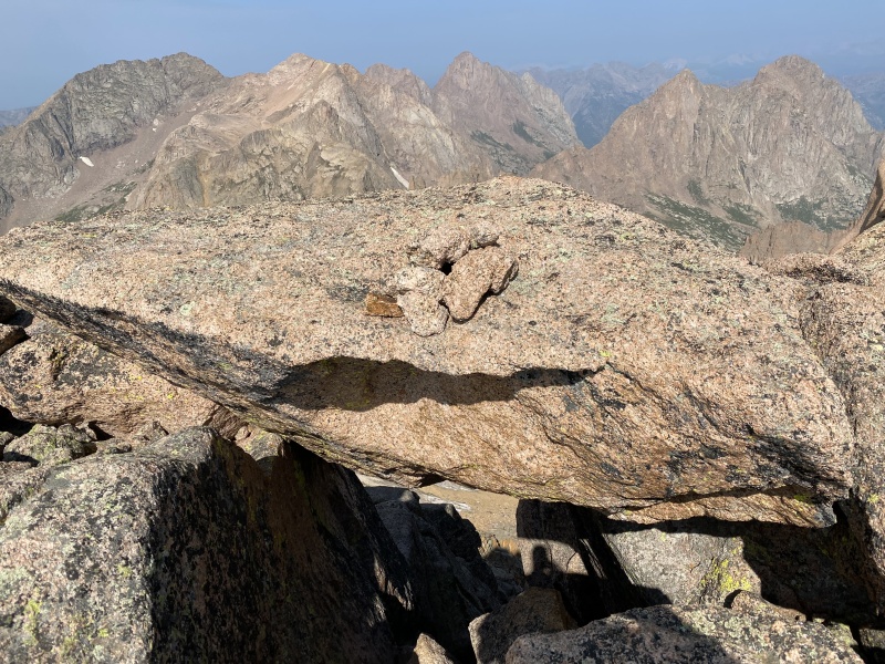
Unfortunately, once leaving the Sunlight route to head towards Windom, the path transitioned to my least favorite type of hiking—wobbly talus. With unstable footing and some post-adrenaline energy dropoff, my pace decreased significantly even by my slow standards. Ascending Windom’s west ridge, the route revealed its Class 2+ rating, requiring clambering over progressively larger rocks while advancing to the top. At 1:00, I finally reached the large angular summit blocks of Windom Peak. I was pleased that the rain-free forecast was accurate and I was able to reach the top without hearing any thunder. I took another long summit break and soaked in the spirituality of the mountains. Being slow meant that I had the summit to myself except for the brief appearance of a solo hiker who had started his day at Purgatory. I was completely alone on my long, wobbly return down to Twin Lakes. 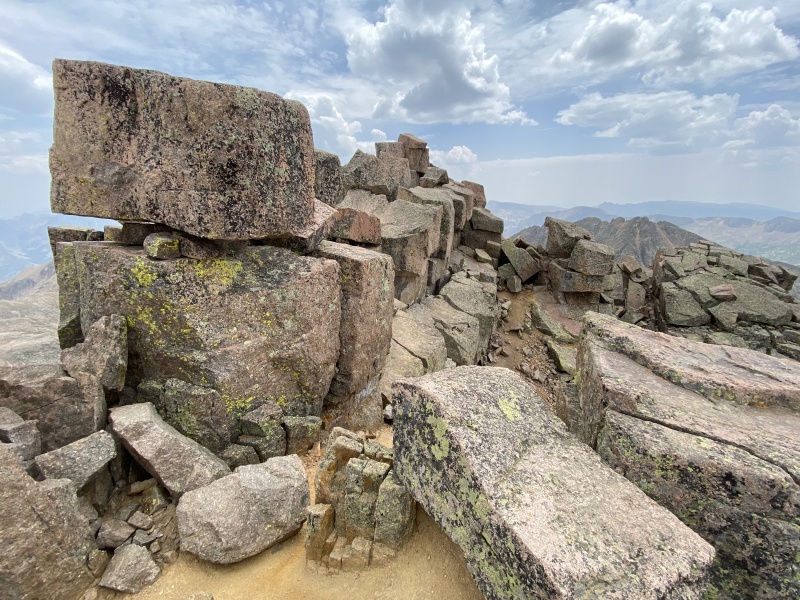
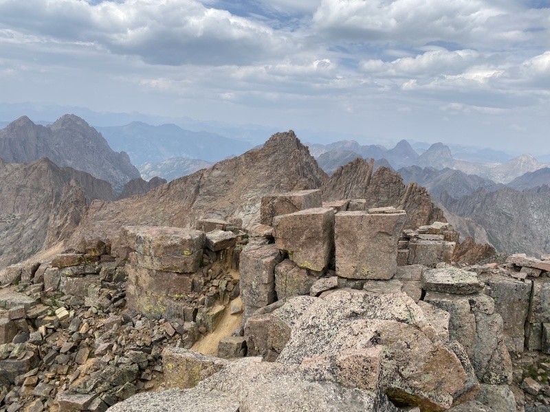
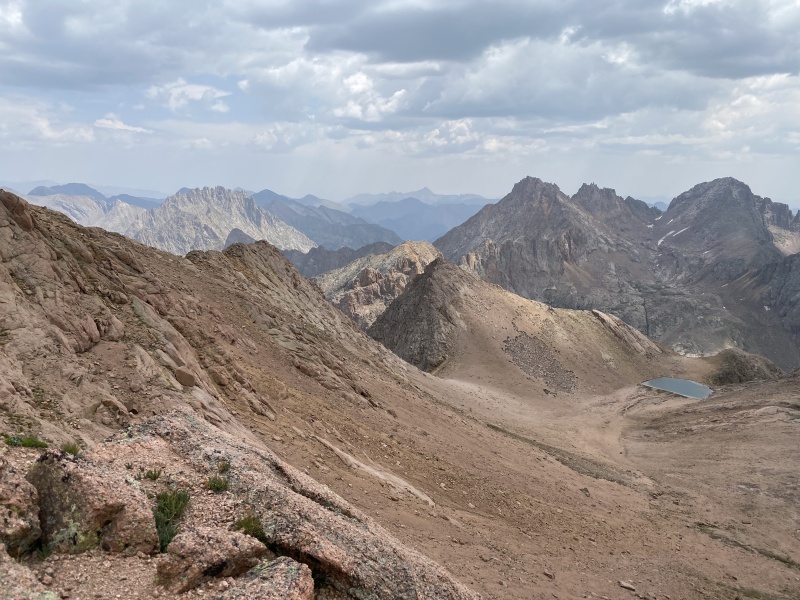
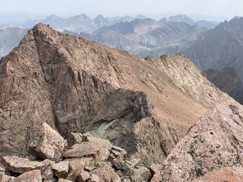
and North Eolus; Twin Lakes right; Chicago Basin campsite left 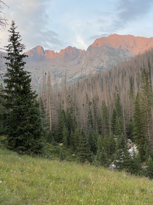
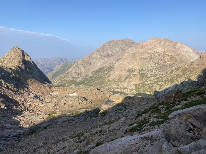
South Windom and Jupiter As I slowly made my way back to camp, I thought about how to summarize my long day in one sentence: "Mountain beauty fuels Sunlight energy before batteries drained by Windom power outage". Returning to camp at 6:00, I slowly filtered water and cooked my freeze dried dinner. After such a long day, I wasn’t sure how long it would take to renew my energy, so I set my alarm to “sleep in” until 5:00. Mt Eolus and North Eolus: August 12, 2021 Leaving camp at 5:30, my batteries felt fully recharged and I was further uplifted by another show of mysterious morning light and clouds at Twin Lakes. 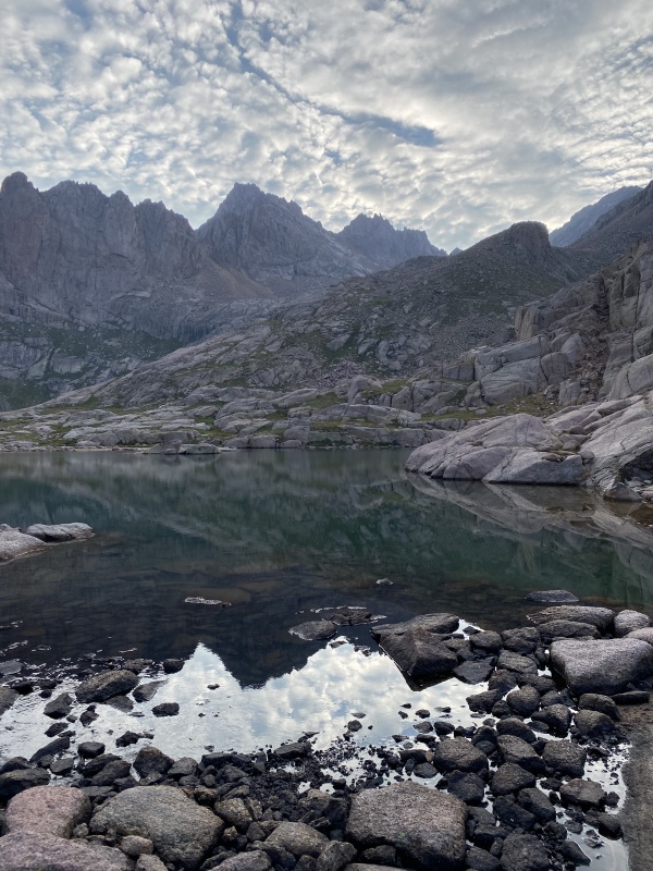
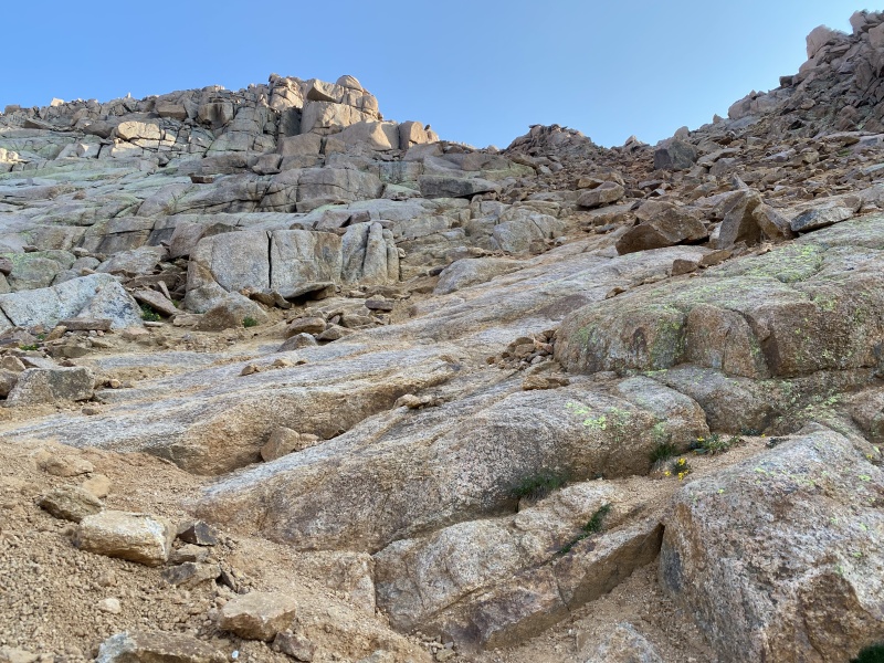
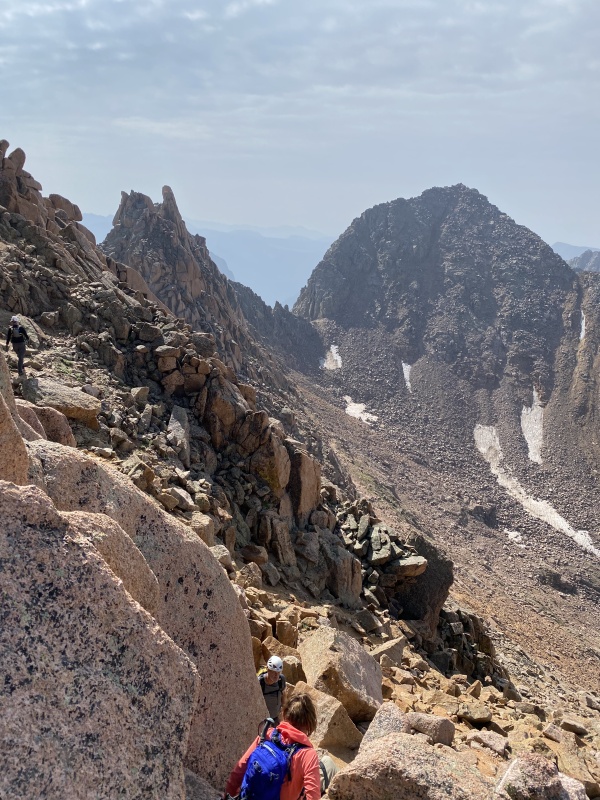
The trail toward Mount Eolus has also been improved by the Colorado Fourteeners Initiative with well-defined steps to 13,000’. From here the route ramps up solid slabs to the northeast and then curves north. 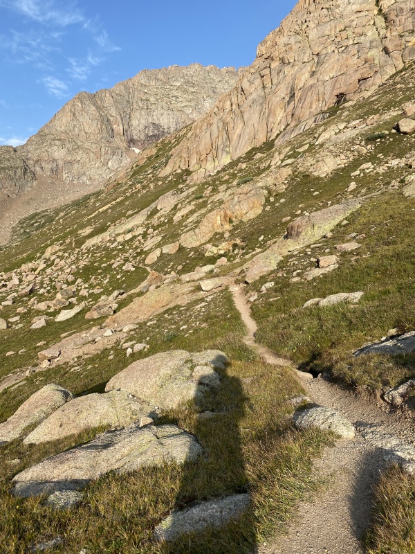
Unfortunately, at the top of the ramp, I started climbing up toward the catwalk too soon. I had to retrace my steps and then curve further north before I could see the now obvious low point on the ridge below North Eolus. I enjoyed climbing the short crack to the saddle and then turned left to cross the catwalk to Mount Eolus. Although the rock is solid and several feet wide, the exposure on both sides was freaking me out, so I switched to a bear crawl for many segments. This produced another adrenaline surge which may have impaired my route finding for the final climb. 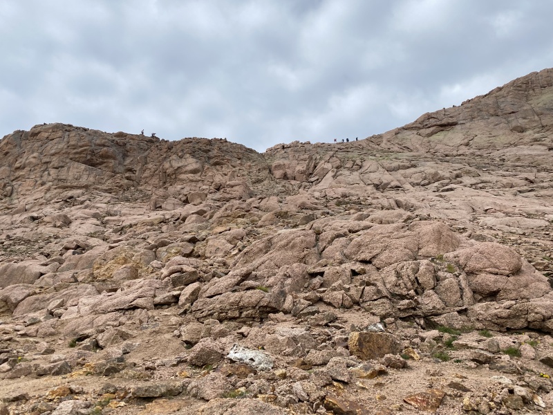
Zigzagging up the east face, I was generally on the proper route, but in some places, I went up difficult cracks only to look down and see much easier ways to connect the ledges just a few feet to either side. I was much slower going up than I would be going down. 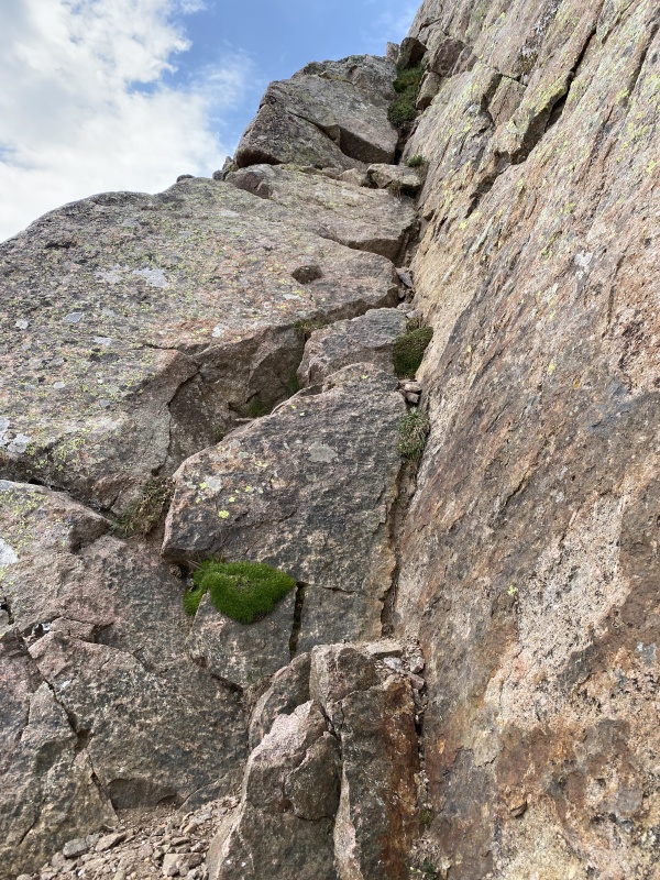
Atop Mount Eolus, my slow pace again resulted in me having the summit to myself, allowing peaceful snacking and relaxing while quietly admiring the peaks in the core of the San Juan mountains. 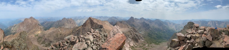
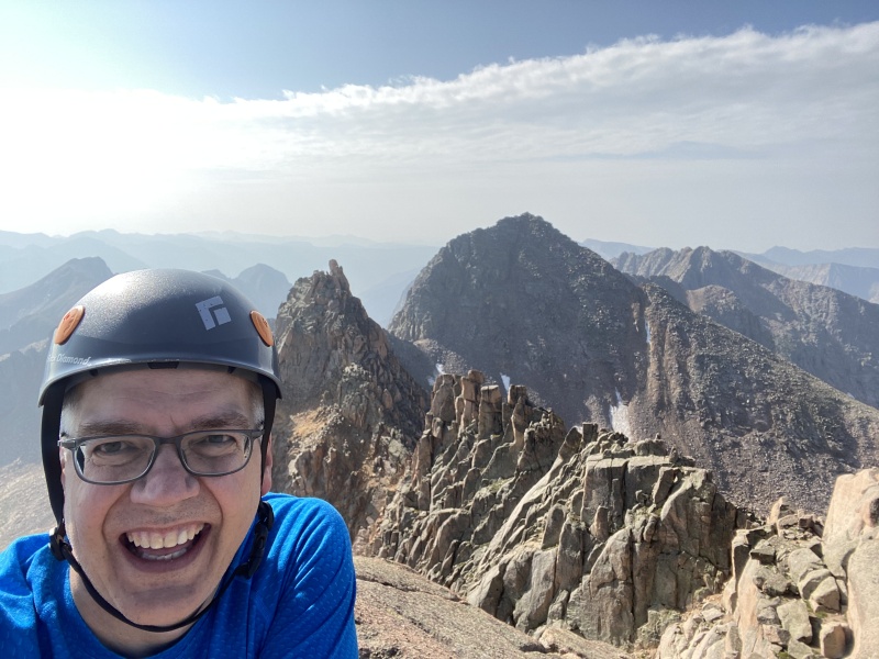
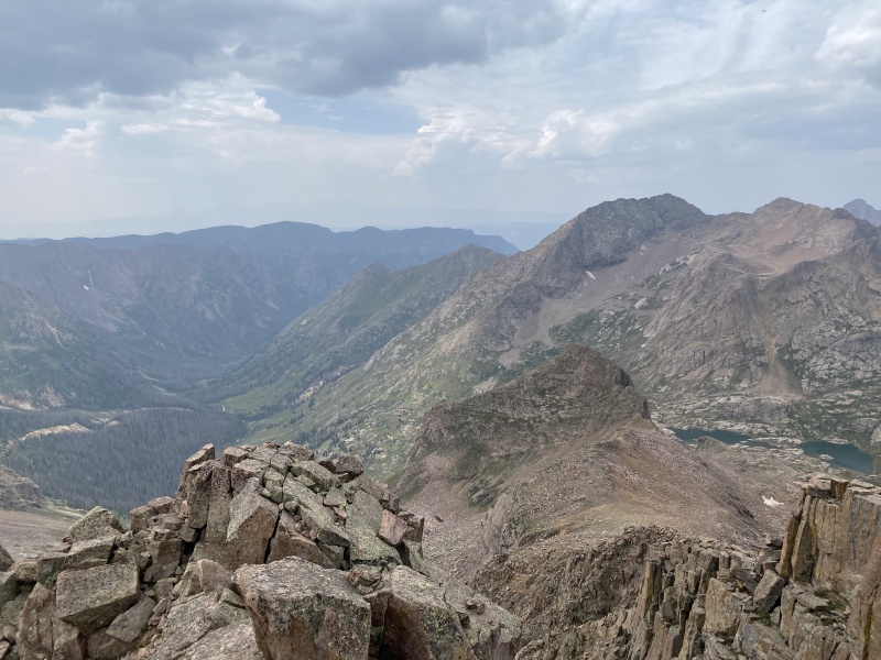
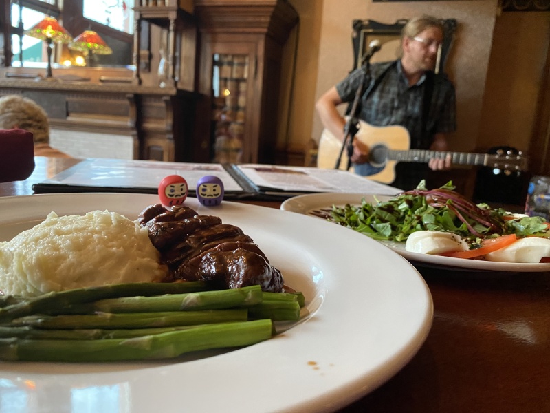
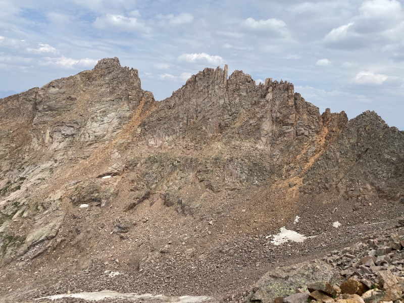
Grippy rock made for a fun short climb up North Eolus. There was plenty of exposure, but only on one side. Colorado 14er summit number 58. WooHoo. My subdued celebration consisted of taking photos, eating chocolate, and using the weak cell signal to phone home. I also posed with my one-eyed daruma doll on the summit benchmark. According to Japanese tradition, the first eye of the doll is colored in when a goal is set, and the second eye is colored in when the goal is achieved. The second eye would wait until I was safely back to the train tracks. I felt a sense of achievement looking back at the pointy summit of Sunlight Peak and the long ridge of Windom Peak, but I must admit that my eyes wandered to Rio Grande Pyramid and then the clouds shifted slightly and the sun sparkled on Jagged Mountain. I am always amazed by the diversity of mountains to be experienced in the Centennial State. 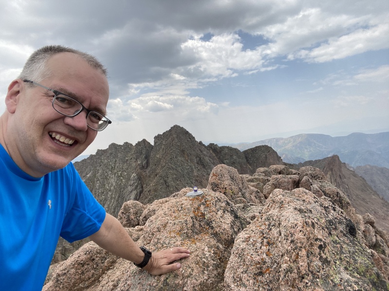
Jagged Mountain and Rio Grande Pyramid) A few pikas visited me while descending, adding to my celebratory mood as I enjoyed the talus-free descent. Some thunder got started just after 1:30—still much later than typical monsoon season days in Chicago Basin. There was only a small shower and skies were clearing when I got back to camp at 4:00. Again, I felt fortunate in my calendar choice. 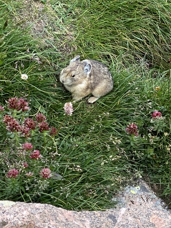
Chicago Basin to Needleton to Durango: August 13, 2021 I took my time exiting the tent after my alarm went off at 8:00. I relaxed in the sun while eating breakfast and slowly packing up camp. At 10:00 I started the quad-straining return to Needleton where I soaked my feet in the Animas River and colored the second eyes of my daruma dolls. As the flies kept trying to bite me, I tried to be patient while waiting for the train. Final celebrations included drinking beer on the train [pro-tips: don’t be slow to get to the dining car; if they run out of beer, tip well and ask them to get more from the first class car], eating elk tenderloin at the Strater Hotel in Durango, and, back in Denver, making a finisher donation to the Colorado Fourteeners Initiative. 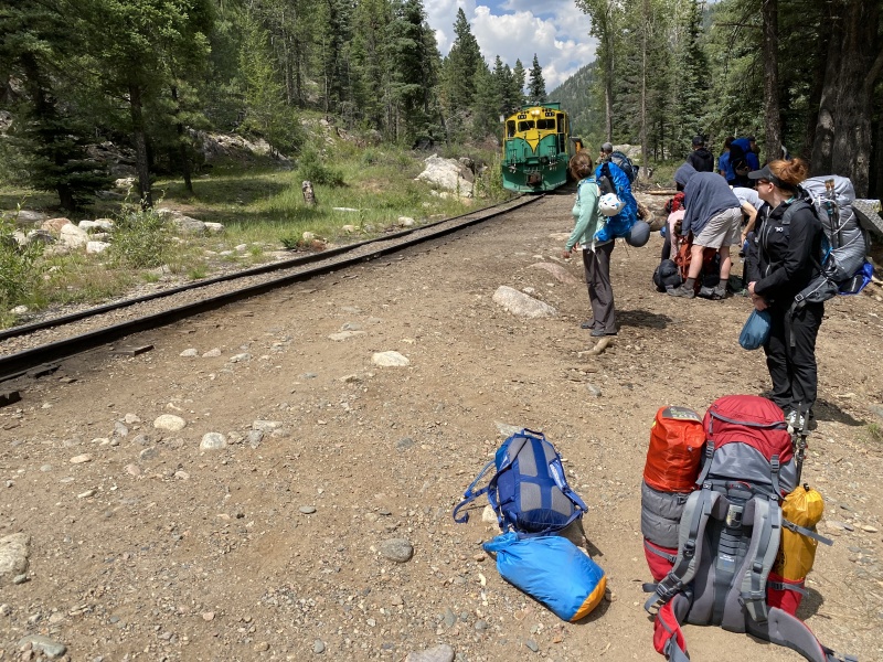
It’s been a long, slow journey to finishing the list of 58, but slow isn’t always a bad thing in the mountains: more time to enjoy the views, more time to feel the burn, more time to reflect after hikes, more time to look forward to the next hike. 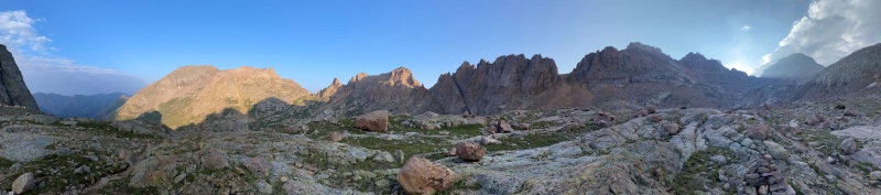
Chicago Basin Planning Resources I looked through many trip reports and condition reports while preparing for my trip. The most comprehensive trip report for planning was:
As I continued my trip planning in July, an equally helpful report appeared:
Train reservation details continue to change each year:
My key planning decisions that worked well:
My key planning decisions that I partially regretted were related to weight: mostly too much food and too much clothing, but different weather would have made me thankful to have the extras. Overall, the previous year’s 14ers 401 experiences had prepared me well for this14ers 402 senior project. For me, the hardest parts of the trip, starting with the hardest, were:
For reference, here are my “speed” statistics. I did not pass a single group during the trip.
14ers 401 trip reports prior to this 14ers 402 senior project:
Special thanks to the Colorado Fourteeners Initiative. I encourage all finishers to consider a special finisher gift to CFI to celebrate their achievement: Many thanks to Bill Middlebrook and the 14ers.com community for sharing so much information, enthusiasm, and encouragement. I am amazed at the amount of mountaineering knowledge and computer expertise that Bill puts into this site. 
Thumbnails for uploaded photos (click to open slideshow): ")
")
")
")
")
")
")
")
")
")
")
")
")
")
")
")
")
")
")
")
")
")
")
")
")
")
")
")
")
")
")
")
")
")
")
")
")
")
")
")
")
|
| Comments or Questions | ||||||||||||
|---|---|---|---|---|---|---|---|---|---|---|---|---|
|
Caution: The information contained in this report may not be accurate and should not be the only resource used in preparation for your climb. Failure to have the necessary experience, physical conditioning, supplies or equipment can result in injury or death. 14ers.com and the author(s) of this report provide no warranties, either express or implied, that the information provided is accurate or reliable. By using the information provided, you agree to indemnify and hold harmless 14ers.com and the report author(s) with respect to any claims and demands against them, including any attorney fees and expenses. Please read the 14ers.com Safety and Disclaimer pages for more information.
Please respect private property: 14ers.com supports the rights of private landowners to determine how and by whom their land will be used. In Colorado, it is your responsibility to determine if land is private and to obtain the appropriate permission before entering the property.