| Report Type | Full |
| Peak(s) |
Mt. Wilson - 14,256 feet Wilson Peak - 14,021 feet El Diente Peak - 14,175 feet |
| Date Posted | 08/24/2022 |
| Date Climbed | 08/17/2022 |
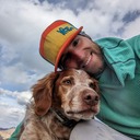
| Author | Alpine Addict |
| Wilson Group via El Diente North Buttress |
|---|
|
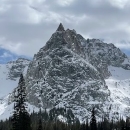
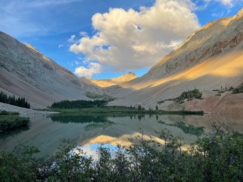
Introduction I'm a Colorado native whose been climbing 14ers for nearly a decade and steadily making progress towards completing them all. Before starting this trip, I had completed 40 of the 14ers and was eager to tackle some new ones, which meant driving a long ways. After looking at the list of 18 peaks remaining, me and my dad decided to head down to the San Juans to attempt the Wilson group. We completed Capitol Peak last year and figured that it would be fun to try some more class 4 climbing. My dad heard from a friend that the traverse between Wilson and El Diente was the hardest route he remembered from completing all of the 14ers, so we figured it would be challenging but nothing we couldn't handle. The hardest part of planning our trip was that the weather didn't look particularly favorable besides a potentially sunny day on Thursday. Since this is the week that worked for both of our schedules, we decided to try and climb Wilson Peak on Wednesday, when the weather looked worse, and attempt the traverse on Thursday. There are lots of different approach options for the Wilson group, and after consideration, we decided to come from the Woods Lake approach and camp at Navajo Lake. To help ensure we would stay on route, I downloaded all of the route descriptions with photos to my phone for offline use with the 14ers.com app. Originally we planned to do the North Slopes route on El Diente, but after realizing that the route becomes a steep scree field in late summer, we decided that either the South Slopes or North Buttress would be best. The North Buttress would be the most direct route since we planned to camp at Navajo Lake, but it seemed that the South Slopes would be the easiest route. The problem with the South Slopes is that it would add a lot of unnecessary mileage from camping at Navajo Lake and complicate which direction to do the traverse. The rough plan was to do the traverse from Wilson to El Diente and descend the South Slopes, but the North Buttress still sounded appealing. Day 1 - Woods Lake Approach As we drove towards the San Juans, we couldn't see any of the mountains because they were all shrouded in clouds and intense rain. We started the approach in rain and the entire trail was absolutely soaked with slippery mud and pools of water. The San Juans had clearly been getting drenched with rain the last few days and we just hoped things would clear off enough to get all the peaks in. Eventually the rain stopped and we were hiking through dense fog with a visibility of around 20 feet. I really hoped to get a view of El Diente from the high pass on the approach, but the dense fog kept my expectations low that we would see anything that day. Finally, as the climb steepened towards treeline, things started to clear and we got an incredible view of the sea of clouds around us. 

After soaking in the refreshing clear blue skies, we caught a glimpse of El Diente and Gladstone Peak still shrouded in clouds. The clear skies made me hopeful that the weather would be good enough the next day to do the traverse so that we would have a shorter climb up Wilson Peak on Thursday before packing out. Finally we reached the lake and found most of the campsites empty, which was refreshing given how crowded lakes around 14ers usually are. 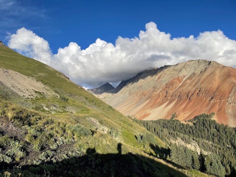
Day 2 - Wilson Peak I woke up in camp the next morning expecting a clear sunny day, and instead I found the valley completely immersed in clouds threatening heavy rain. Given the poor weather, we set off towards the Rock of Ages saddle to climb Wilson Peak. On the way over, I tried to catch a glimpse of the North Buttress of El Diente, but it was completely shaded in clouds. We also noticed a trail crew working on the trail up Mt Wilson, which was surprising given how few people seemed to be camped at the lake. After reaching the Rock of Ages saddle, I felt a light drizzle, which made me happy we decided to wait on the traverse. Once my dad made it up to the saddle, we put our helmets on and geared up to start scrambling on the Southwest Ridge. 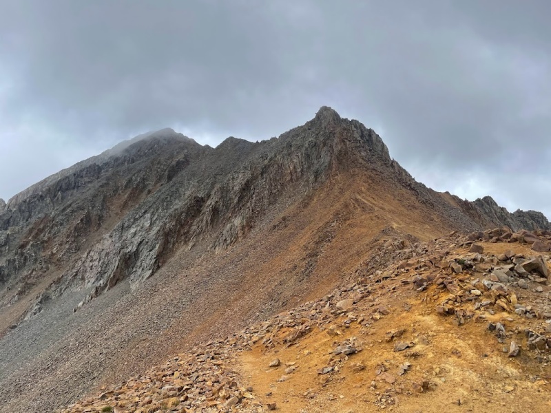
Once we reached the saddle with Glastone Peak, we were confused about exactly where the route continued. First, we started climbing up the rock directly towards the ridge, but realized we weren't on track since the climbing started veering towards class 4. We then decided to reroute by descending the steep loose dirt beneath the saddle to reach what appeared to be a trail beneath the steeper, rocky terrain on the ridge. Descending the steep, loose terrain didn't seem like the right move either, but it got us where we needed to be, and soon enough we were back on trail. We later realized on the way down that the actual trail traverses along the steeper rock bands beneath the ridge. We made our way up the loose rock on the ridge until finally we came to the false summit, where we were climbing in the clouds. Looking towards the true summit looked intimidating with the low visibility and the rockier class 3 terrain. 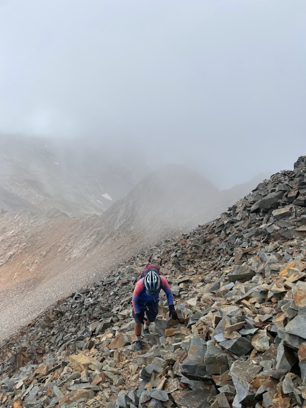
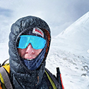
Looking towards the summit, I was pretty sure the route went to the left of the knife ridge since the right side was just a cliff. My dad took a look at the downclimb to the saddle between the false and real summit and said "there's no way this is right". Even though I was confident, I decided to double check the route on my phone and confirmed we had to descend left of the ridge. The rock was already wet from light rain, which combined with the poor visibility made the route seem much more complicated. Once we descended the sketchy rock to the saddle, and prepared to ascend the final portion, it started hailing and raining heavier. The first notion in my mind was to panic due to the bad weather and sketchy terrain we were on, but I quickly regained focus and realized that the only true danger would be responding poorly to the situation. We then put on our rain gear, but realized to summit we would have to climb class 3 in soaking wet rock. I was confident in my ability to summit, but I worried about my 60 year old dad slipping on the wet rock. I knew that if I headed up to the summit, he would follow, so I decided that I was willing to sacrifice the summit to make sure we both made it down safely. Despite my concerns, he was convinced we could make it to the summit since it was so close at this point. At first I was reluctant, but I knew that we could summit if we just proceeded calmly and were careful with our handholds. So we headed up further into the mist and shortly emerged at the goal which seemed so impossible just minutes ago. Looking off into the distance, the clouds briefly cleared up enough that I could see where we had come from, giving me greater confidence for the decent. Of course we first had to snap some quick pictures on the summit to capture the moment before heading down. 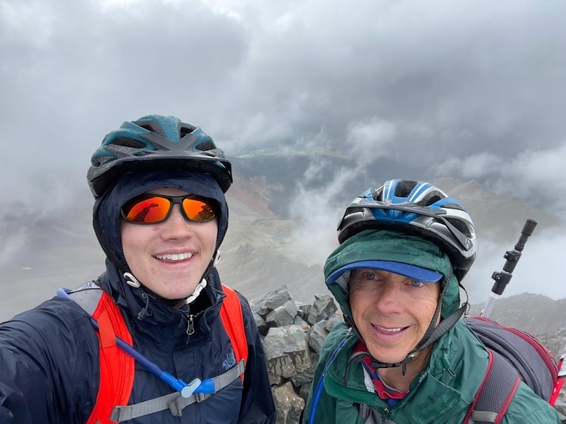
The approach for the decent was the same for the ascent - stay calm and carefully downclimb, testing each hold. As we slowly made our way down, I was amazed to see another climber quickly climbing up from the false summit towards us. I briefly chatted with him and learned he had completed the El Diente - Wilson traverse earlier in the day in similar conditions, which gave me a new burst of confidence that we could at least handle the class 3 downclimb. We hadn't even returned to the false summit before he came racing by on the way down with some very impressive climbing skills. Once we returned to the false summit, I gazed in clarity at what had been previously shrouded in the mist and appreciated our decision to finish the ascent. 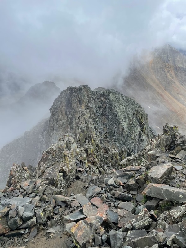
We took our time on the way down until we finally reached the Rock of Ages saddle where class 3 climbing would be behind us for the day. For the first time on our trip, I caught sight of the impressive El Diente - Wilson ridge and was both intimidated and inspired for tomorrow's task. I also assessed the North Buttress and convinced my dad that we could handle the climbing there if the weather conditions were better tomorrow. 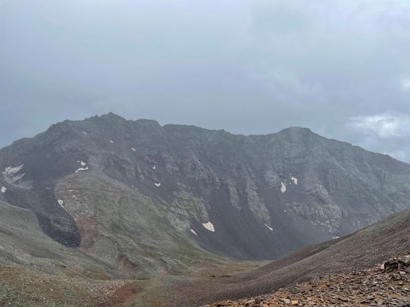
While we hoped to take a brake and eat something, the rain increased, so we decided to make our way towards camp to try and avoid being completely soaked. On our way towards camp, a cloud strangely rushed up the valley towards us from below with strong, cold winds. Soon enough, the clouds began dumping rain across the valley and we started to get soaked. It was raining so hard that the trail towards the lake became a river with large pools of water in flatter spots. When we finally made it back to our campsite, I noticed a huge pool of water at the entrance of my tent, and I just hoped that nothing inside of the tent was wet. We decided to wait for the rain to stop before getting in our tents to avoid getting everything inside wet, so we patiently waited around an hour shivering under the trees, dreaming of warm sunshine. Once the rain finally stopped, we decided to go in our tents where I thankfully learned that everything inside of the tent was dry. However, I soon realized that everything in my day pack was absolutely soaked including every single jacket I had brought on the trip. In hindsight, I should've brought my rain cover in the daypack, but I wasn't used to such heavy, prolonged rain in Colorado given the excessively dry summers we've had the past few years. To further complicate matters, I realized my rain jacket and pants had lost most of their waterproofing over years of use and found that everything I was wearing underneath was also wet. Thankfully I had a dry set of clothes and socks to use, but I realized that I couldn't afford to get anything else wet at this point. After shivering intensely, I finally buried myself in my sleeping bag and began to slowly reheat. After a few hours, I was finally comfortable again and started talking to my dad about tomorrow's plans. He was doubtful we could do the traverse given how wet all of our equipment was, but I remained optimistic that tomorrow would be clear skies in the morning. While making dinner, I noticed the skies were already clearing and I grew more optimistic about tomorrow's chances. Before going to bed, I noticed the stars shining brightly above and was encouraged tomorrow would be our day. Day 3 - El Diente to Wilson Traverse I woke up in the morning to the sight of a clear day and excitedly started to collect my things together. However, I realized that nothing dried at all from the previous night and everything was still soaked. Despite this setback, I figured that we could hang our jackets on the outside of our packs to dry as we hiked. After breakfast, the sun slowly emerged over the hill and we quickly rushed to embrace its warmth and start to dry our gear. While it was temping to just stand in the sun all morning, I realized we had a long day ahead of us and needed to get moving. So we set out from camp with high hopes and approached the base of El Diente's North Buttress. 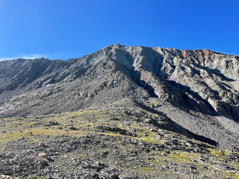
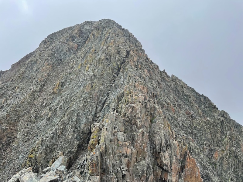
I knew the hardest parts of the route would be closest to the summit, with many challenges still lower down, so I prepared myself for lots of exposure and careful route finding. The route description outlines six sections of the buttress, marked by benches or flatter terrain between each section. The boulder field at the start is fairly obvious, since you just have to continue towards the base of the buttress that leads directly to the summit. After getting to the base of the buttress, we angled to climber's right to avoid some of the more direct class 4 climbing. We kept the climbing to class 3 with not too difficult route finding, and were surprised at how many cairns were placed on the route. Each time I thought we might be getting off course, I would come across a cairn that reassured me we were right on track. We stayed towards the right side of the ridge on similar terrain for the most part until the ridge began to narrow. 
The next section of the route is called the "V" snowfield. However, the snowfield melted so we made our way on what appeared to be the best route up. Where the snow melted were smooth slabs of rock that appeared more solid than the surrounding boulders, so we made our way up the slabs until we reached steeper terrain above. We started up a class 4 section, but I couldn't tell where it ended, so we decided to backtrack and make our way left across the ledges above the "V" to find slightly easier climbing. At this point, the ridge narrows significantly into a catwalk with more exposed moves. There might be a way around the catwalk on the left, but we found it best to stay directly on the catwalk until we approached the final section towards the summit. 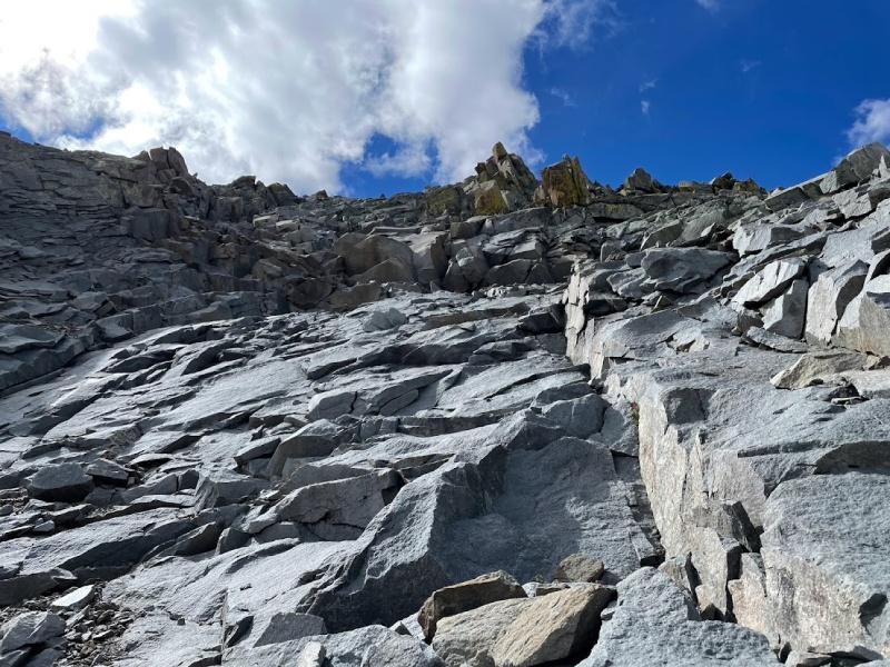
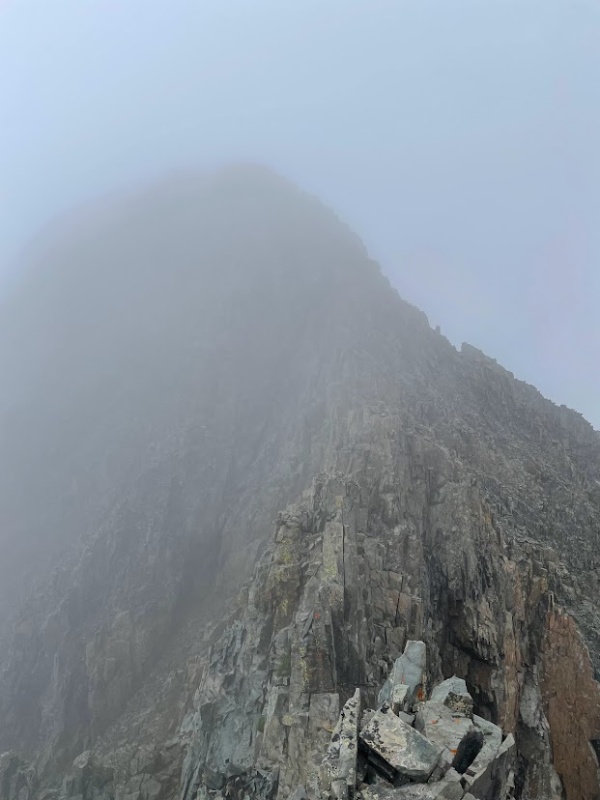
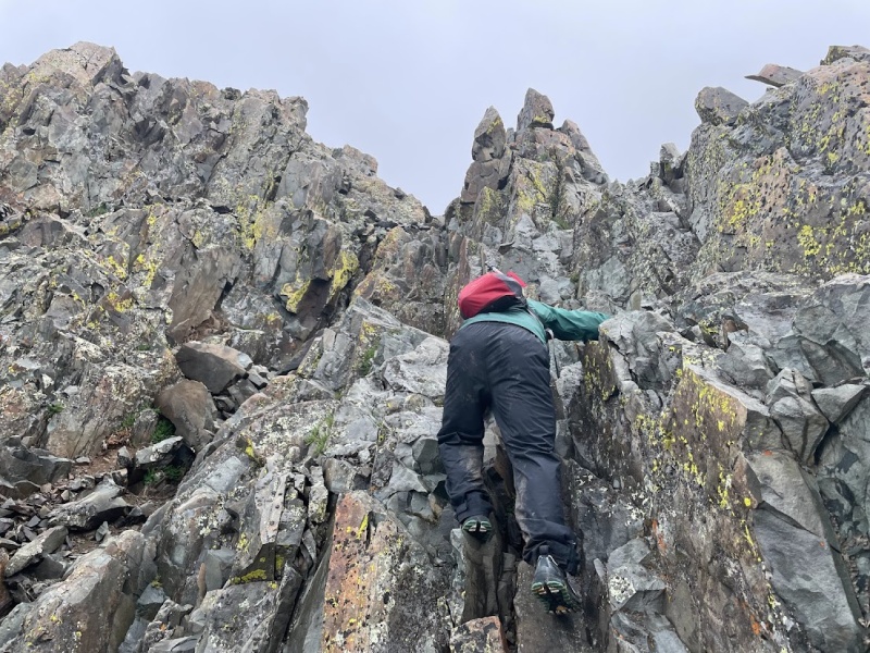
The remaining section to the summit after the catwalk involves mandatory class 4 climbing and more loose rock than the previous sections. The route description on 14ers.com describes a few options to tackle the final section, and we decided to go with the chimney options in photo #14. The chimneys themselves weren't too challenging, but the class 3 slabs to get there involved lots of exposure. After climbing the chimneys, we continued on loose rock towards the summit as shown in photo #17 of the route description. I took the option to the left; however, I encountered a challenging class 4 move to exit the buttress and enter the summit ridge. I told my dad to try a different way and he quickly made it up the option to the right and was standing over me. I decided to finish the class 4 move which involved pressing my back into one side of the chimney and keeping tension with my legs on the other side. Being careful to keep tension, I shuffled my way up until I made it onto the summit ridge. 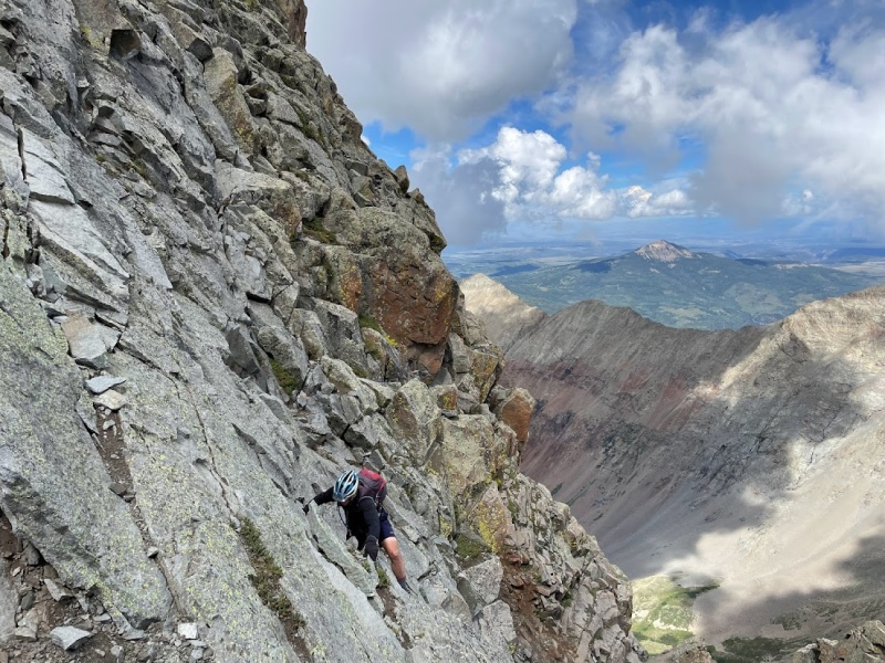
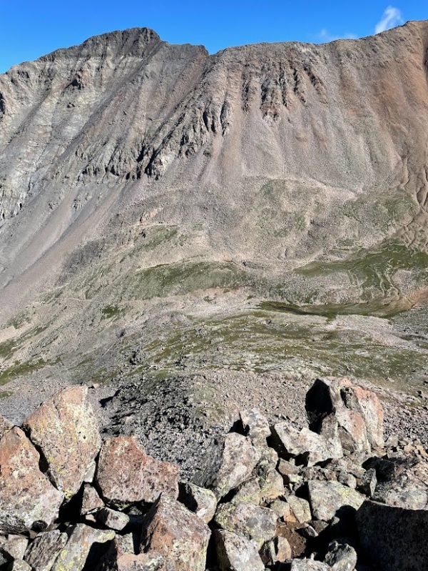
We relaxed knowing we were off the buttress, but quickly regained focus looking at the long traverse to Mt Wilson ahead. First we enjoyed the summit of El Diente which is just a small boulder, hardly big enough for 2 people to stand on. Looking towards Mt Wilson, I thought the most challenging parts of the climb were behind us, but I would soon come to respect that its one of the 4 Great Traverses for a reason. 
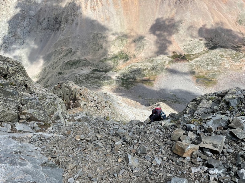
We descended from El Diente in a gulley to the left to begin our journey towards Mt Wilson. The route continues on the north side of the ridge for a little while, before descending a ways on the south side below the organ pipes. At this point, I was really happy we decided to climb the North Buttress since descending the South Slopes would mean backtracking on the ridge. Nothing on the organ pipes seemed too bad, but still required careful concentration due to all of the loose rock and route finding. After exiting the organ pipes, we approached the gendarmes section. At first, the gendarmes seemed a lot like the organ pipes, until we came across steep ledges of rock with lots of exposure. One move in the middle of the gendarmes section involves a complicated climbing move right over a cliff, where a fall would almost certainly be fatal. There aren't many good handholds for that particular move, so I did my best to shift all my weight towards the rocks away from the cliffs. My dad was reluctant to climb over the ledge, but realized it was the only way and he confidently made his way around. 
After the gendarmes, the route climbs back up onto the spine of the ridge where the climbing relaxes in difficulty for a little while. The hardest seemed to be behind us once again, until we gazed down at a saddle in the ridge with lots of tricky moves. We carefully made our way down the spine of the ridge towards the saddle, experiencing some of the most exposure we had all day. One section involved downclimbing over a 1,000+ foot cliff, and although the climbing itself wasn't overly technical, the sheer exposure was sure to keep us laser focused. Finally, upon reaching the saddle we looked up at the final hump in the ridge before the summit of Wilson. 
The route up the hump in the ridge didn't appear very obvious, so I pulled out my phone and compared it to the route photos. I then realized we needed to head down first where I caught sight of a cairn marking the way. Ascending this portion involved more careful route finding, and although the rock was solid, it was steep and exposed where it wouldn't be hard to accidentally start low 5th class sections. Finally, once we made it to the summit of the hump we stared at the final portion towards Mt Wilson. Once again, we had to downclimb with exposure from the hump until we reached the last saddle on the ridge. 
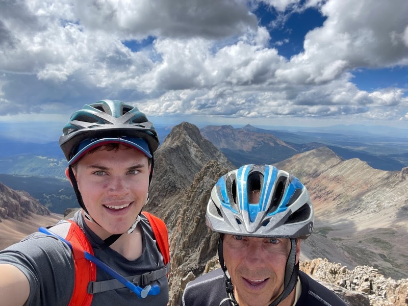
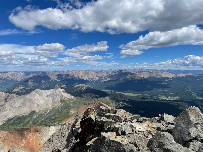
At last we were looking at the last few moves to summit Mt Wilson, which of course are exposed and difficult class 4. At this point, we were accustomed to class 4 and exposure, but we still kept focused on searched for the best way over the tricky blocks on the ridge towards the summit. I first looked at going over them, which seemed overly complicated. Then I looked at going to the right, which seemed overly exposed. Then finally, I found easiest passage on the left, still with plenty of exposure, but at least easier climbing. Exuberantly we stood on the summit of Wilson looking back towards the serpent-like ridge towards El Diente. We also got a great view of Lizard Head peak, which is understandably one of the most difficult peaks in Colorado with its sheer cliffs. 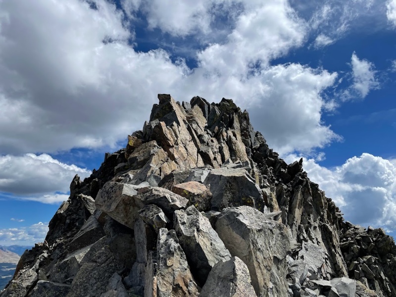
While the view and nice weather could've kept us on the summit all day, we figured it would be best to start our descent off Mt Wilson while we were still focused. Carefully retracing our route on the way up, we made it down the summit blocks and began our descent down the North Slopes. From here forwards, it was mostly class 2 and 3 boulder scrambling and we finally didn't have to worry about another crux section looming ahead. Now my mind drifted into thinking about taking down camp at the lake and quickly getting started on the pack out since we would almost certainly be getting back to the car after dark. Once we finished descending the North Slopes of Mt Wilson, I decided to run back to Navajo Lake to start packing up camp while my dad took his time on the way back. While packing up camp, I surprisingly found that most of our stuff was still wet despite a sunny and warm day. Once he made it back, we finished packing up camp and set out for the initial climb of the Woods Lake approach. After ascending back up to the pass, I took a look back at El Diente and was impressed at our accomplishment for the day. On the way back we enjoyed the sunset and eventually pulled out our headlamps to continue the trek in the dark. We finally arrived back at the car before 10 PM and settled in for a 6 hour drive home over night, which finally brought us home by 4 AM to get some much needed sleep. 
Main Takeaways With 43 of the 58 fourteeners now completed, I think that the El Diente - Wilson traverse is the hardest climb of my journey towards completing all of the 14ers in the state. Capitol Peak certainly has lots of exposure, but I felt that the route finding was fairly straightforward and the technical portion of the climb from K2 to the summit doesn't last near as long as the time spent climbing El Diente and then traversing to Mt Wilson. The North Buttress of El Diente took us around 3 hours to complete from the base of the buttress and the traverse from El Diente to Mt Wilson took us around 3.5 hours to complete. With the descent off the top of Mt Wilson added, that's around 7 hours of careful route finding and heavy focus. For comparison, a year earlier we spent around 4 hours going out from K2 to the summit of Capitol and back. In addition to much more time spent on technical climbing, I felt that the crux parts of the El Diente - Wilson traverse were more difficult than the crux parts of Capitol Peak. For those reasons, I would say El Diente and Mt Wilson are the hardest 14ers I've completed so far. I still have Pyramid, the Bells, the Crestones, Little Bear, and the Chicago Basin group left to complete, but for now I think that the Wilson group remains the most challenging. I would definitely recommend the North Buttress route to anyone planning on camping at Navajo Lake. The North Buttress does require good route finding skills and being comfortable with class 4, but if you meet those criteria then I think it's a great way to tackle the traverse. For the most part, just keep following the ridge all the way to the summit until you reach the catwalk and the final push to the summit. The "V" snowfield was also trickier to navigate without the snow, but the rock is very solid and nothing more challenging than what lies ahead. Most importantly, if anything seems too difficult, just remind yourself that it's fine to backtrack and reroute if necessary. With 1 of the 4 Great Traverses completed, I'm curious how the remaining 3 would be. The common consensus seems to be that El Diente - Wilson is the easiest with the Crestone traverse up next, so I'll have to consider if I want to do the remaining 3. For the most part, I felt confident with the climbing on El Diente - Wilson, but the exposure certainly added to the challenge. I'll admit, I had to push myself, especially in the route finding sense, but I enjoyed the challenge and developed a much greater appreciation for what people accomplish in the mountains. It's hard for me to imagine someone doing the same traverse in the winter, but I already found a trip report of someone doing exactly that. Thumbnails for uploaded photos (click to open slideshow): ")
")
")
")
")
")
")
")
")
")
")
")
")
")
")
")
")
")
")
")
")
")
")
")
")
")
")
")
")
")
")
")
")
|
| Comments or Questions | |||||||||||||||||||||
|---|---|---|---|---|---|---|---|---|---|---|---|---|---|---|---|---|---|---|---|---|---|
|
Caution: The information contained in this report may not be accurate and should not be the only resource used in preparation for your climb. Failure to have the necessary experience, physical conditioning, supplies or equipment can result in injury or death. 14ers.com and the author(s) of this report provide no warranties, either express or implied, that the information provided is accurate or reliable. By using the information provided, you agree to indemnify and hold harmless 14ers.com and the report author(s) with respect to any claims and demands against them, including any attorney fees and expenses. Please read the 14ers.com Safety and Disclaimer pages for more information.
Please respect private property: 14ers.com supports the rights of private landowners to determine how and by whom their land will be used. In Colorado, it is your responsibility to determine if land is private and to obtain the appropriate permission before entering the property.