| Report Type | Full |
| Peak(s) |
Elk Tooth - 12,848 feet |
| Date Posted | 09/20/2022 |
| Date Climbed | 09/17/2022 |
| Author | 123tqb |
| Gathering Beta |
|---|
|
Beta Gathering
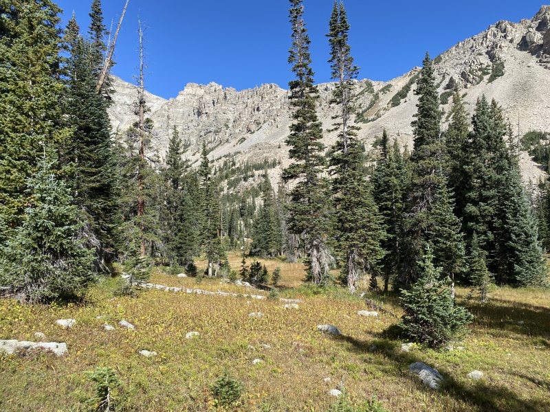
I started the day trying to decide what I was going to climb. I originally thought that I'd drive up to the Fourth of July Trailhead to scope out Mt. Neva's North Ridge, and have the Arapaho Traverse as a backup option. Upon getting to Nederland High School the plan fell through: the parking lot was completely full at 7:45, and there was a slim chance of me getting in anytime soon. I wracked my brain for other nearby options, remembering that I'd been wanting to check out the northern Indian Peaks for a while. I'd wanted to get some new beta for a winter ascent of the Elk Tooth, since the standard route typically involved ascending an avy slope. There seemed to be a low-angle approach from Wild Basin, but I had no idea if it went at a reasonable difficulty. Today was the day! Having done literally zero research on the route except for a vague recollection of a Caltopo map from the previous winter's planning, I decided to head to the Beaver Reservoir Trailhead. I arrived at 8:30 or so, deciding (wrongly) to give the 4x4 road a try in the family Honda Civic. I stopped about 0.3mi up the road due to some moves that my no-clearance car couldn't handle (go figure!). I started hiking somewhere around 9:00, knowing full well that I was far from an alpine start and would have to make up some time. And so, I decided to jog. Not too much later, 4mi in and already sore, I arrived at the Middle Saint Vrain Trailhead, where I probably should have started my hike for the day. 
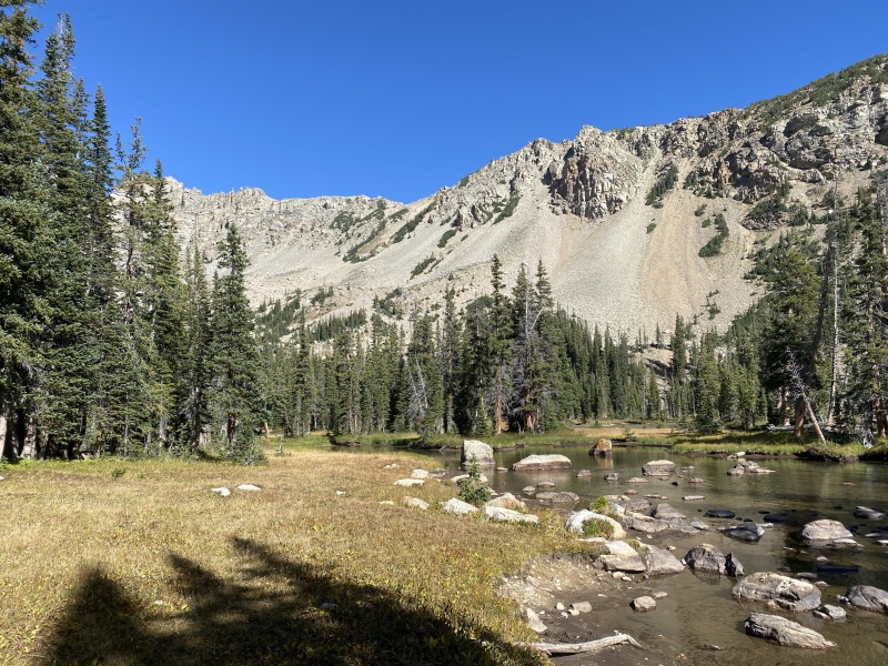
I wasn't taking a lot of pictures at this point due to both being surrounded by uninteresting forest and hurting far too much for it to be the beginning of the day! At some point along the Buchanan Pass Trail I stopped to get a snack, where I talked to a pair of backpackers about my plans. They suggested I check out the scree field that I would pass just before the trail crossed the stream, which I definitely kept note of. The St. Vrain Glacier Trail was hidden pretty well by dew-covered plants and littered with mud puddles. Eventually I halted my run at the aforementioned scree field, the bridge just ahead. 

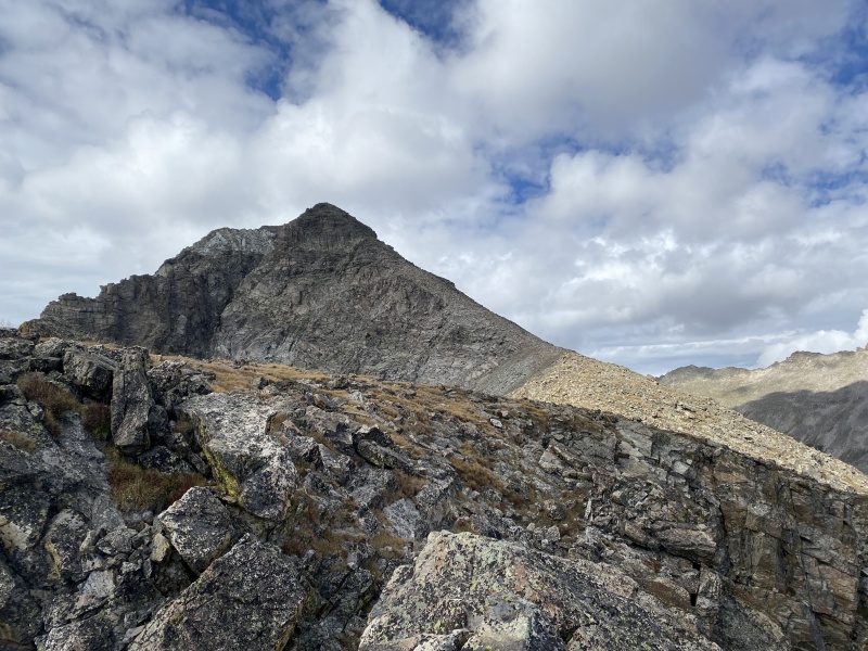
From the scree field I could make out a gully that I wanted to climb, one that seemed lower-angle and not quite as loose as the others. I could also see the gully that was described on Mountain Project for the route, and it looked miserable! I could have made my way across talus to the base of the intended gully, but instead I opted to take the trail a bit further. A meadow appeared just past the large, beautiful beaver pond, running parallel to the gully, so I made my way across it. I passed an illegal camp site at the point I decided to cross the stream. Now stepping off the grass and onto the rock I could make out a few people above me, in the same gully I'd been eyeing. And here I thought I was going to be alone all day! 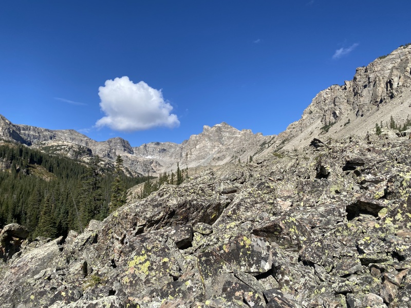


Turned out the other group was also intending to climb the Elk Tooth! Mountain Project described a different approach and a rating of Class 3. I happened to read somewhere that this variation was more like Class 4 / 5.0, so I let them know once I got to them. They said they might turn around if they discovered that to be the case, and we wished each other luck on the remainder of the route. I continued up the gully ahead of them, trying my best not to kick down any rocks (with quite a few slip-ups, sorry!). It wasn't long before I was at the top of the gully, which unfortunately wasn't exactly the spot I'd hoped (I wanted to check out the saddle between the Elk Tooth and St. Vrain Mountain to make sure it was doable in the winter). 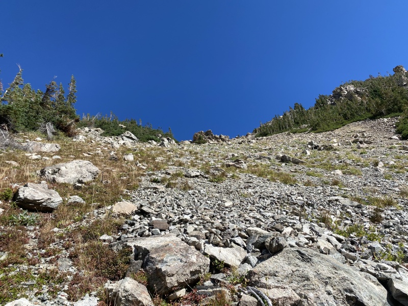

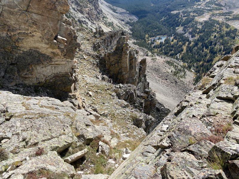
A quick hike up and the routefinding began. I took some Class 2+ slabs on the climber's left side (south) of the ridge to get around the first difficulty. There was a bit of exposure involved from here, but nothing too tricky. It was all smooth sailing—mostly on the south side but switching briefly north in one spot—until I came upon a low-angle dihedral of sorts. From here I just continued up, not encountering anything I considered above Class 4. Looking back I saw that there may have been an option to keep the difficulty even lower, if I decided to come back the way I came. I followed a ledge system, still generally on the south side of the crest, until it led me up to a flat platform, where the standard route meets the ridge. 


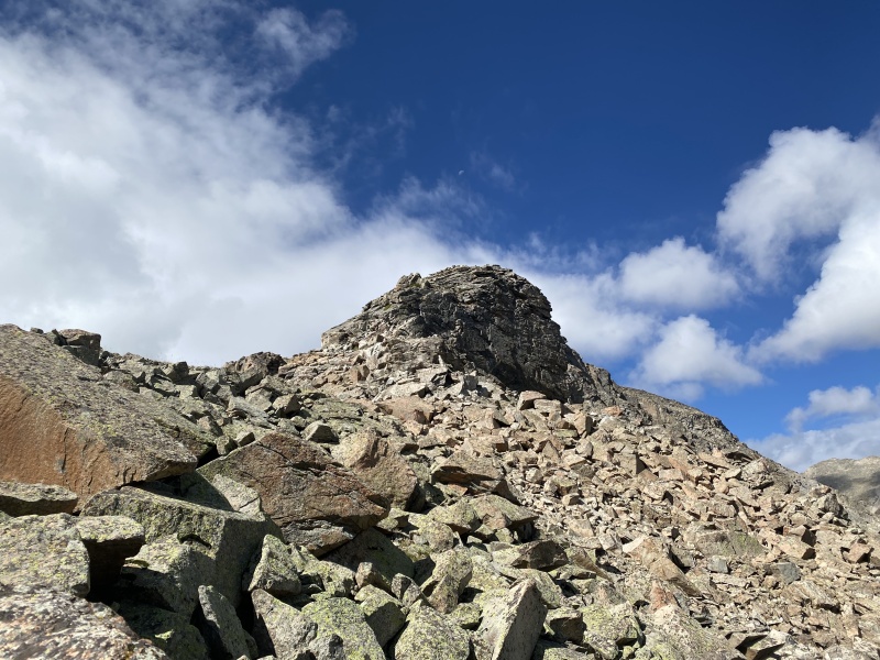
The route changed up from here on out. Now I stuck to climber's right (north), which I felt never exceeded Class 2 despite the route description. It was easy cruising to the summit, with only a bit of uneasy footing due to recent snow but nothing I deemed dangerous. There was one part that I felt could maybe be considered Class 3, but it was a stretch. I made it to the summit around noon. There were a few gray clouds in the sky, but the satellite weather report I had gotten told me there wasn't a lot to worry about. It was breezy and shoulder season, so a bit chilly, but still a wonderful time on the summit. 
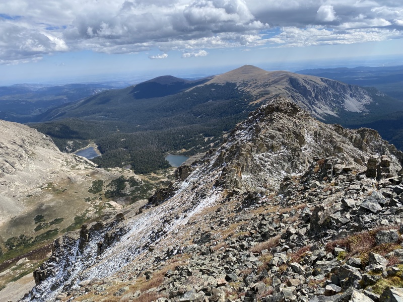


I considered pushing on to Ogalalla Peak, but I decided that 18mi was enough for the day! As much as I'd love to get some more Class 4 in, the weather and my fitness level advised me that would be a bad idea. Maybe I'd get the chance to tackle it this winter! Feeling sufficiently rested up I turned around and did it all in reverse. I strongly considered dipping out at the standard route's gully, but decided instead to get another good look at the crux portion of the ridge prior. Doing everything backwards I was able to do the majority of the ridge directly, until I came back to the crux dihedral that I'd encountered earlier. I found myself in definite Class 4 terrain, if not low Class 5. I felt perfectly comfortable doing it on dry rock in good shoes, but it's avoidable and so I'd recommend trying to avoid my mistake in the future. I missed the Class 3 ledges due to not recognizing them from above. Again, nothing I did seemed excessively dangerous. What I did find in this section was an apparent Class 3 bypass, which I had noticed earlier. It felt considerably easier to me even while downclimbing! 


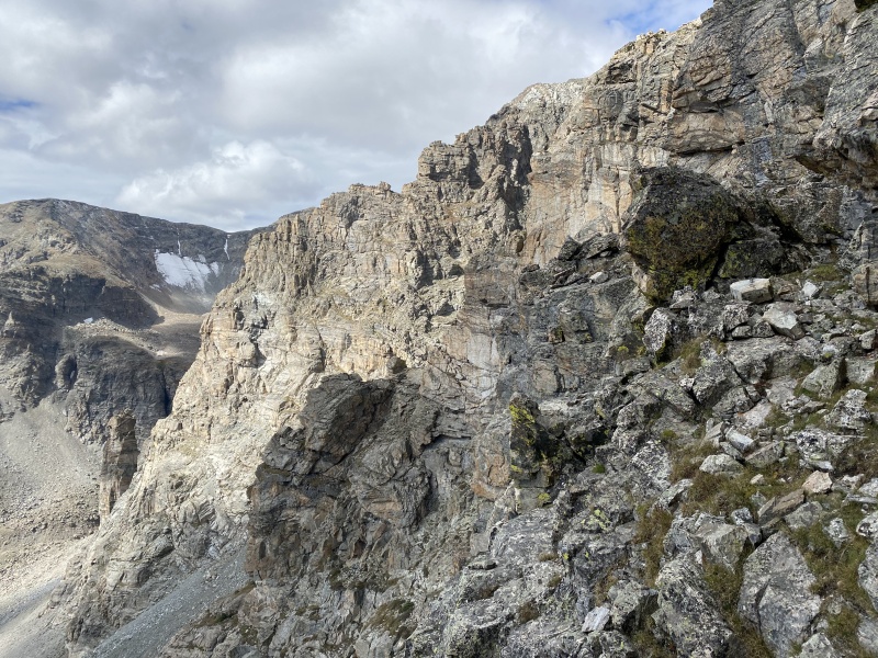
Everything else went quick. I came back by the group I'd talked to earlier, who had turned around once they made it to the crux. After a quick chat about the route I went on my way. I had decided that I was going to continue on the ridge all the way to the true saddle, just so I could suss out the avalanche concern of the route if I were to do it in winter. The outcome: perfectly safe, and promising. I continued along the connecting ridge through trees and bushes, above the cliffs below. I thought about sticking to the ridge and meeting the Saint Vrain Mountain Trail, but threw the idea of more elevation gain out the window when I came upon a nice-looking (key word: looking) gully that led all the way down to the creek. It was so loose! I scree surfed nearly to the creek, where I talus-hopped back to the scree field the two backpackers had talked about earlier in the day. Talk about full-circle! I began to hobble-run back to the car, a good 7mi away, happy to be back on trail even with hurting legs. 


Thumbnails for uploaded photos (click to open slideshow): ")
")
")
")
")
")
")
")
")
")
")
")
")
")
")
")
")
")
")
")
")
")
")
")
")
")
")
")
")
")
")
")
")
")
|
| Comments or Questions |
|---|
|
|
Caution: The information contained in this report may not be accurate and should not be the only resource used in preparation for your climb. Failure to have the necessary experience, physical conditioning, supplies or equipment can result in injury or death. 14ers.com and the author(s) of this report provide no warranties, either express or implied, that the information provided is accurate or reliable. By using the information provided, you agree to indemnify and hold harmless 14ers.com and the report author(s) with respect to any claims and demands against them, including any attorney fees and expenses. Please read the 14ers.com Safety and Disclaimer pages for more information.
Please respect private property: 14ers.com supports the rights of private landowners to determine how and by whom their land will be used. In Colorado, it is your responsibility to determine if land is private and to obtain the appropriate permission before entering the property.

