Download Agreement, Release, and Acknowledgement of Risk:
You (the person requesting this file download) fully understand mountain climbing ("Activity") involves risks and dangers of serious bodily injury, including permanent disability, paralysis, and death ("Risks") and you fully accept and assume all such risks and all responsibility for losses, costs, and damages you incur as a result of your participation in this Activity.
You acknowledge that information in the file you have chosen to download may not be accurate and may contain errors. You agree to assume all risks when using this information and agree to release and discharge 14ers.com, 14ers Inc. and the author(s) of such information (collectively, the "Released Parties").
You hereby discharge the Released Parties from all damages, actions, claims and liabilities of any nature, specifically including, but not limited to, damages, actions, claims and liabilities arising from or related to the negligence of the Released Parties. You further agree to indemnify, hold harmless and defend 14ers.com, 14ers Inc. and each of the other Released Parties from and against any loss, damage, liability and expense, including costs and attorney fees, incurred by 14ers.com, 14ers Inc. or any of the other Released Parties as a result of you using information provided on the 14ers.com or 14ers Inc. websites.
You have read this agreement, fully understand its terms and intend it to be a complete and unconditional release of all liability to the greatest extent allowed by law and agree that if any portion of this agreement is held to be invalid the balance, notwithstanding, shall continue in full force and effect.
By clicking "OK" you agree to these terms. If you DO NOT agree, click "Cancel"...
We hit Crested Butte at the best time for crowd avoidance, meaning also a less scenic time: after the splendor of the wildflowers and before the glory of autumn. Neither Ben nor I had much expectation for White Rock and White Benchmark; we anticipated a bushwhack and scree slog and had reluctantly decided on this itinerary because of poor weather in the Weminuche. The outing turned out both better and nearly - but thankfully not - tragically worse than we could imagine.
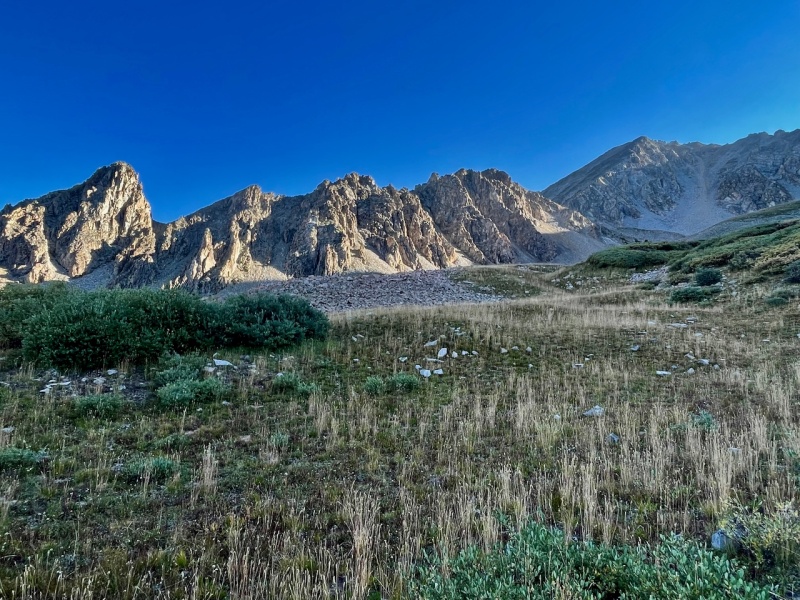
I had Derek Wolfe's Guide to the Elk Mountains as a reference and we left the trail for Queen's basin shortly after our second creek crossing. We likely should have done so just before that crossing, as we trended back that direction as we negotiated the steep, thickly forested slope. As the trees thinned, we followed a dry watercourse up grassy terrain into Queen's basin.
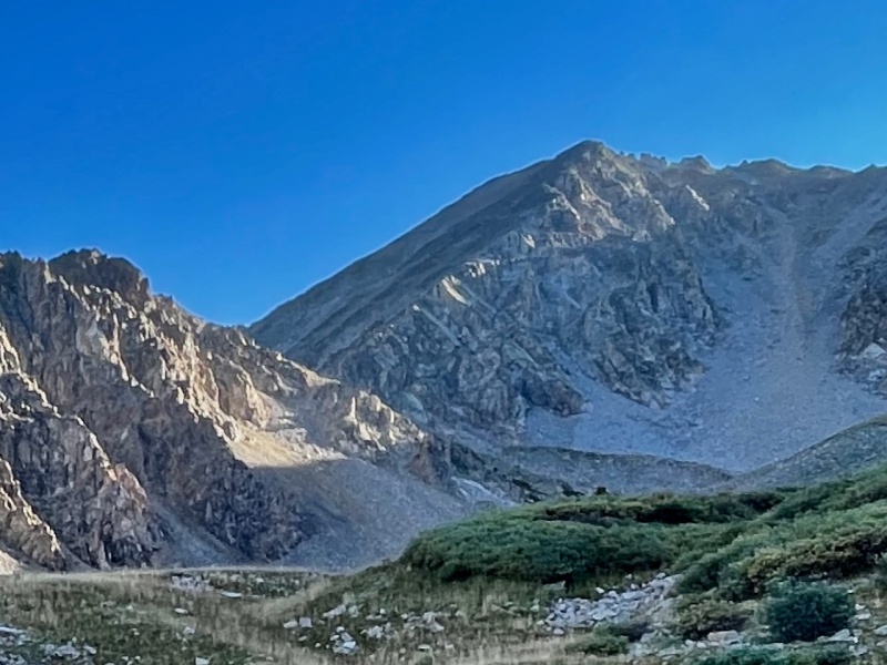
Queen's basin and White Rock, right of center. We walked up toward the gap between the ridge in the foreground and White Rock's west ridge.
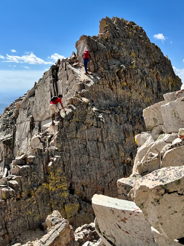
Ben, having spent all summer doing long races, easily outpaced me, and Carmine, having spent all summer hiking with other teenagers, easily kept pace with me, and I called a brunch break on the small grassy hillock below the west ridge of White Rock. While we munched away, I pointed out some slabs that seemed to offer a bit of a shortcut up the ridge. Our original intent had been to veer left (north) to gain the ridge at its low point, but we all agreed some solid-looking class 3 rock was more attractive than a scree shuffle. Unfortunately, neither Ben nor I took a pic of this, so I cropped the prior pic to show the route; it's a bit pixelated.
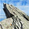
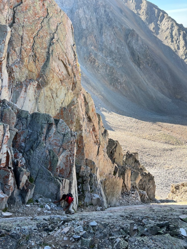
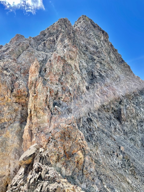
White Rock.. After easy class 3 on solid blocks, we hit a long left-angled slab to the ridge (I think the higher of the two, between the sunlit rocks)..
The slab presented more difficult terrain: definitely class 4 and, at Ben's prodding, I agreed I'd taken Carmine onto his first class 5. But the slab was solid, offering good friction and also slanting inward to a rock wall. Where the slab met the wall, a continuous crack offered secure finger holds.
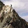
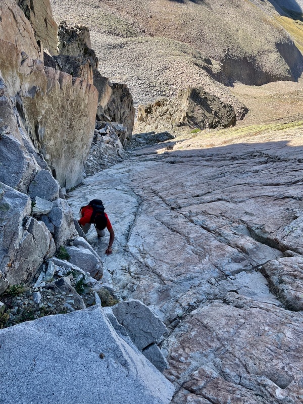
Carmine on the upper portion of the slab. (Photo by Ben.)
Another view of the slab.
This section proved to be the most fun rock of the day. Topping out on west ridge about one third of the way up, we looked down and reaffirmed our route choice. The terrain looked to be a miserable morass of junky talus. Ahead, the way to the summit looked like we'd expected, but turned out not to be too tedious. From here, it took exactly a half hour to the summit.
The rest of the way to the summit of White Rock, from where we popped out onto the west ridge.
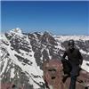
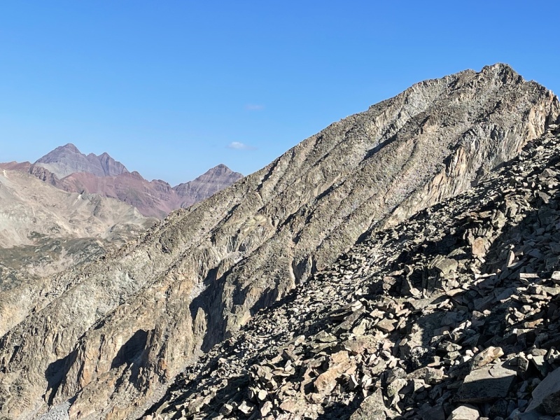
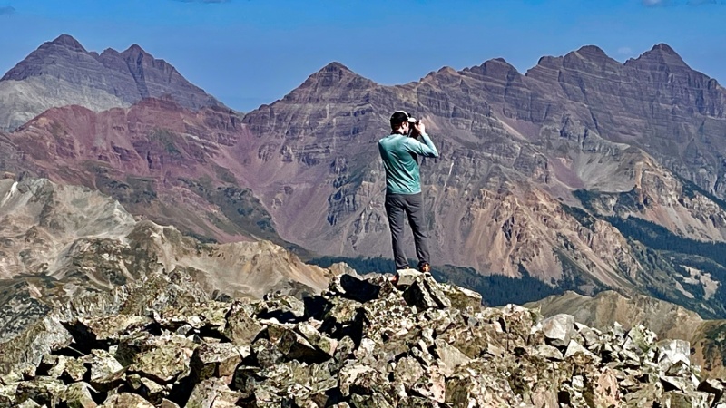
We snacked a bit more on the summit and soaked in the views of the more famous Elk peaks to the north. Admiring the long, pointy ridge to Pyramid peak, Ben and I recalled our "minimidal" traverse with Rick years back, going from 13130 to Thunder Pyramid, but omitting THE Pyramid at the end of the day. What slackers we were! We both blame Rick.
The Maroon Bells, and "megamidal" ridge leading to Pyramid, far right.
With no real beta on the ridge, Ben and I had planned to drop to the east. Carmine wanted to try the ridge and we agreed to do so, with the understanding that we'd backtrack and drop off whenever it became too dangerous. Leaving White Rock Mountain to embark on the traverse to White Benchmark, we immediately encountered the namesake white rocks, which we'd not encountered on our ascent. Glaring against the blue sky, they have all the strength of sticks of chalk used on blackboards.
Looking back at the descent from the summit (orange rock), skirting the first white tuft tower and taking a line down from it.
Soon after this part, we found ourselves back on the ridge proper, with rock of noticeably better quality. We made quick time and found ourselves on a cool natural staircase.
For any fellow Gen Xers, I felt like Qbert here. Photo by Ben.
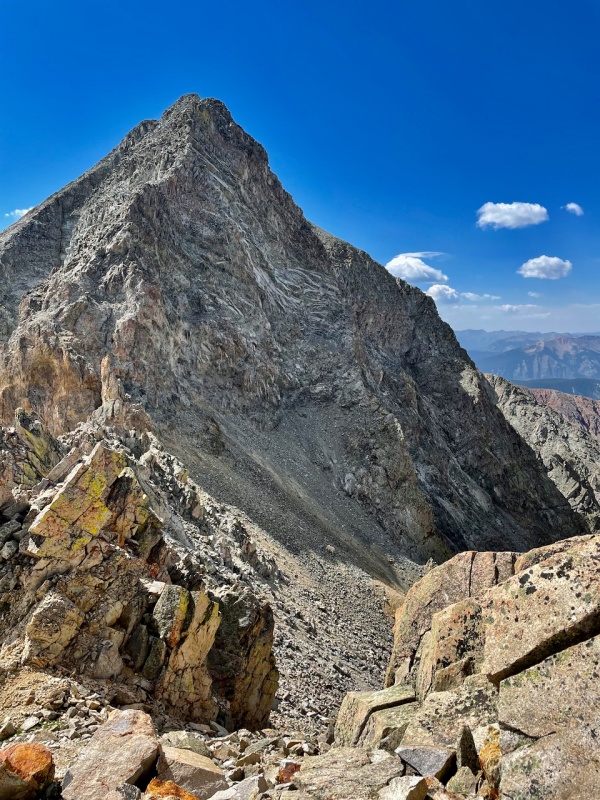
I was surprised at how solid most of the rock was. Even stuff that looked loose was not that bad.Still, we should have worn helmets for this route. Soon, we came to what felt like the summit pitch, but checking the gps, we realized we were only halfway.
I thought the high point in the background was the summit. Nope.
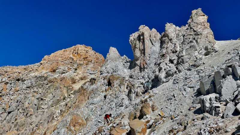
We paused to consider our course, which would end up curling to the right of "finger" in the foreground left and then up the scruffy ramp beyond it. With the sun now shifting to the south, we were now walking into it, so it was hard to get a good up-close shot of this portion. So I'm not sure if this next image helps much or not.
A close up of the "finger," which we bypassed at right and climbed above from a notch behind it.
To reach that little finger, we had to negotiate terrain that was thankfully much more stable than it appeared.
White Rock summit far left, with Carmine and Ben as we near the "finger." Nobody offering the middle one yet!
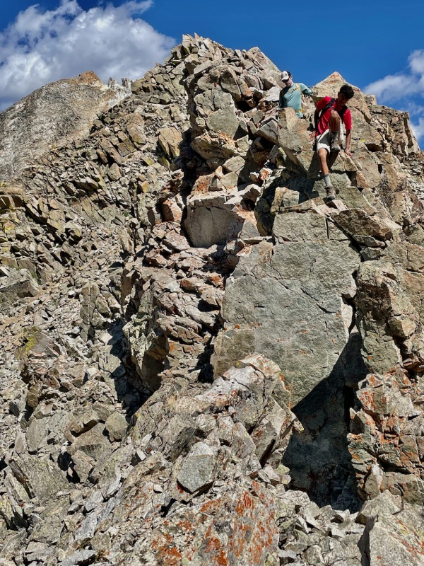
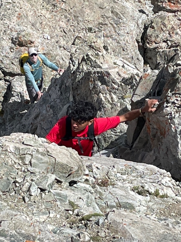
After wrapping around the finger on its right, we found ourselves in a tight notch. Climbing out of it involved nothing more than class 3 terrain, but we took care with our placement because of the detritus scattered beneath and atop the large blocks.
Carmine and Ben scrambling from the notch on rubble-strewn blocks.
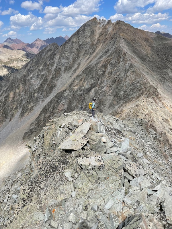
When we were not focusing our attention on the rocks at our hands or our feet, the views ahead and behind kept our interest. Toil and beauty, the marriage that make the mountains so rewarding.
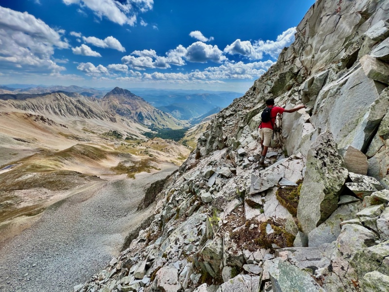
Teocalli to the south (the next day's objective) as Carmine treks a bit onto the east face to avoid some difficulties along the spine of the ridge. By Ben.Looking back to White Rock, about an hour and a half after we left it.
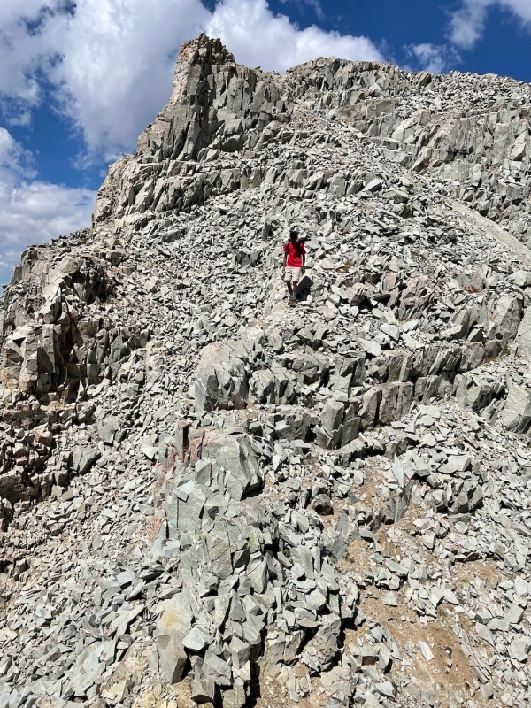
From here, we were close to the summit, with only one last downclimb before it.
Carmine descending the final false summit to White BM.
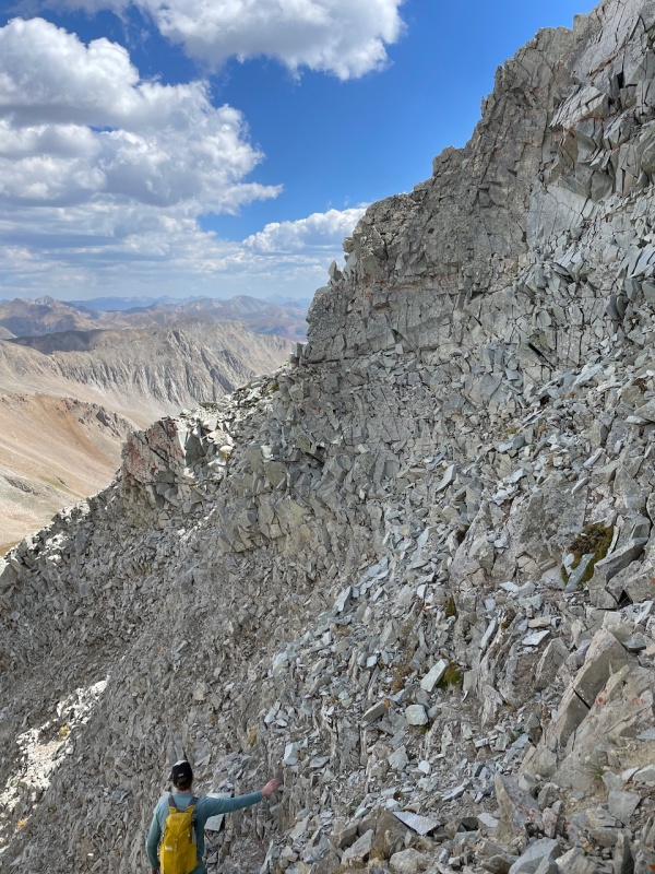
Ben gazing in the distance on the summit pitch of White BM, a real pile of crap.
In keeping with our juvenile jokes about the "BM," the rock here abruptly became as shitty as it appeared. Still leading the traverse, I grabbed hold of a stone edge with my left hand, preparing to continue scrambling up the ridge, when the whole of what I held came loose: a large sheet nearly chest high. Ben had moved out along a ledge to the left, but when I turned as the rock tore loose from the mountainside, I saw Carmine standing directly beneath me. Reacting quickly, he darted upward and to his right. The rock teetered on an edge, then smashed into two large fragments that clattered harmlessly downward. I felt immensely grateful that Carmine had avoided injury and/or death, guilt and anger at myself for nearly killing him, and also bewilderment, because my intended path had seemed viable: the rock had appeared more solid than much of the stuff we'd clambered over gingerly on the traverse.
Shaken, I didn't take any more photos between this spot and the summit. Form the spot of the near accident, we followed Ben's lead out along the east face, which reclined at a lower angle than the ridgeline. Meandering up the ledges, it took us about 25 minutes to reach the summit, for roughly 2.5 hours total on the traverse. We lingered on the summit of White Benchmark for the balance of an hour, until the skies became less friendly, and then picked our way down the southwest flank to rejoin the route we'd taken up Queen's basin, and keeping close to the water course as we entered the trees below it.
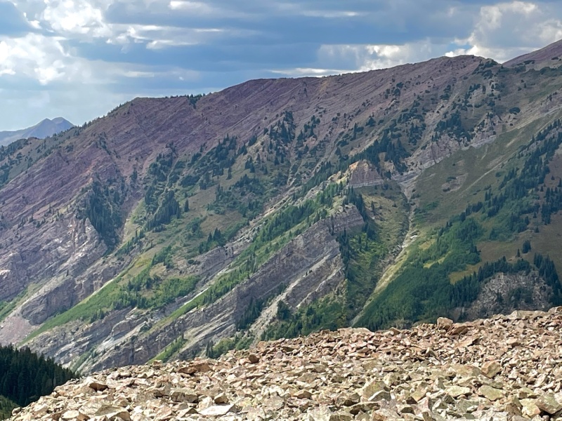
View southwest from the summit of White Benchmark.
All in all, a beautiful and rewarding day outdoors. Overall, my impression of the traverse was that it was not that bad: not as rough or as long as many others I've done. Yet, it nearly proved disastrous. Experience can mitigate but never negate the inherent dangers in this wonderful pastime.
Thumbnails for uploaded photos (click to open slideshow):
I thought that stood for "Best Mountain"?
Ha!
Some past peak bagger discussions when asked, what is the best or worst mountain you've climbed in Colorado and I think BM is top dog. Do you agree?
That's a good question, Amy; I'd not thought of it. I've long considered Columbia the worst mountain in CO, but not really compared the various 13ers to it. For sure, White BM is not great, but another Elk is in the running, too - Star is no star.
Great TR. I forgot so much about the route on these two peaks, and I guess my brain purposefully blocked out the horrible rock. Cool to see the route entirely from Queens Basin, I ended up dropping down in the east side towards Brush Creek to bypass some difficulties in a high snow year summer.
Caution: The information contained in this report may not be accurate and should not be the only resource used in preparation for your climb. Failure to have the necessary experience, physical conditioning, supplies or equipment can result in injury or death. 14ers.com and the author(s) of this report provide no warranties, either express or implied, that the information provided is accurate or reliable. By using the information provided, you agree to indemnify and hold harmless 14ers.com and the report author(s) with respect to any claims and demands against them, including any attorney fees and expenses. Please read the 14ers.com Safety and Disclaimer pages for more information.
Please respect private property: 14ers.com supports the rights of private landowners to determine how and by whom their land will be used. In Colorado, it is your responsibility to determine if land is private and to obtain the appropriate permission before entering the property.
")
")
")
")
")
")
")
")
")
")
")
")
")
")
")
")
")