| Report Type | Full |
| Peak(s) |
Grand Turk - 13,167 feet Sultan Mountain - 13,375 feet Spencer Peak - 13,080 feet |
| Date Posted | 01/22/2023 |
| Date Climbed | 10/28/2022 |
| Author | Marmot72 |
| Silverton shoulder season solitude |
|---|
|
Silverton and Ouray are my favorite mountain towns, but I'm not fond of how crowded they have become in the summer from June to nearly October over the last decade. Family stuff has kept me from the hills much more than I'd have liked this year, so I was happy to drive to Silverton in late October, taking advantage of a small window of unemployment between leaving one company and joining another. We'd had a great experience at the Avon in Silverton the past spring break with the kids, and I booked a room for this solo venture, not relishing camping in the freezing temps. I reached the Little Molas lake area at the right time for some breathtaking alpenglow. 
To my surprise, I was able to drive to the Little Molas trailhead in my 2wd low clearance Lexus hybrid, which I'd taken to save gas costs. There was only a small cover of snow on the road, and on the trail as well. I left the trail where it banked a hard left to stretch out due west from its prior northwesterly direction, because I was curious about W Turkshead, and thought maybe I could make a loop by going over that peak first. Unless you intend to try such a route in dry conditions or with a rope, then be sure to leave the trail just a bit sooner, where a sort of dike comes down and you can see the basin straight ahead. 
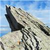
I walked up the gentle slopes straight for the Ottoman. With a clear, windless day, I felt happy to add some optional scrambling to the itinerary. As I neared the rock formation, I decided to first see if a reasonable route might go up the gray face that has a shadow cast on it by the gray pillar between it and the pink rock ring below it, as shown below. I also considered that it might go easier around to the right of the pink rocks. 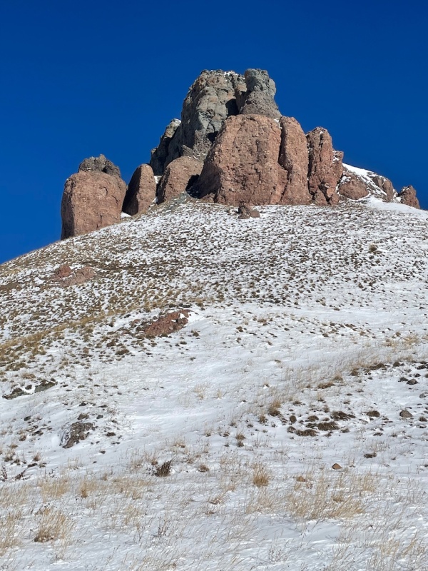
The first option didn't pan out - the option of stemming with my back to the pillar to climb up the rock face looked exhilarating, and I had no good idea of how tough the climbing would be above it. After admiring the pitch for a minute or two and reminding myself that my young days are well behind me, with youngsters depending on me, I headed back. 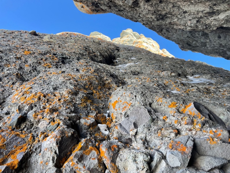
I didn't want to give up on this side of the hill yet, though. So, instead of checking out what looked easier on the east side, I glanced at my topo, which showed nothing to suggest it was any easier, and kept moving northward, looking for another weakness upward. 
Another option came soon enough, and as the way ahead looked dubious, I eagerly ascended the narrowing gully. It looked so easy from the start - just some basic class 3, I thought, but it quickly proved more difficult than that. I found myself stemming at a horizontal to the gully and, unfortunately, did not think to snap a photo. So all I have is the one from below, which looks a lot less formidable. The rock quality for the first half was exceptional for San Juans standards - some solid conglomerate down low. 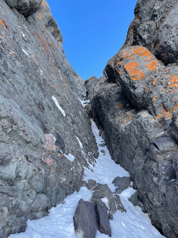
Abruptly, I stood on top, in the sun, feeling the surge of joy that is unique to the experience of popping over the edge onto a summit. The way ahead to the summit of W Turkshead looked like a simple stroll. I sat to enjoy a snack and some water, picturing myself on the top in about 40 minutes. Energized by the vittles and the beauty of the day, I pressed ahead along the ridge. In very short time, I took in this view ahead. 
To my chagrin, I found a "no-go notch." Maybe in dry conditions, one can find a feasible down climb. I tacked right, downward, scanning for an easier descent into the notch, but didn't find anything I liked. 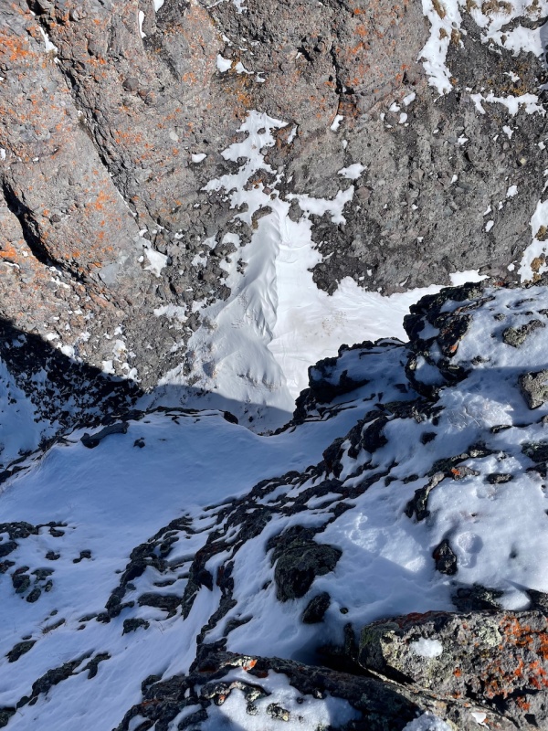
Backtracking was in order, then traversing the east side to find an agreeable place to drop into the valley. I decided I had spent enough time and energy for the "extra credit:" once in the valley, the Sultan and Turk were on the docket, and W Turkshead could be an add-on or not afterward. I found a nice gully that was already filled in nicely this early in the season, and so took a picture for any skiers who like to drop in from unranked points on twelvers. It was just steep enough that I felt obliged to don the microspikes, but the snow was not so hard that I wanted my ice ax. 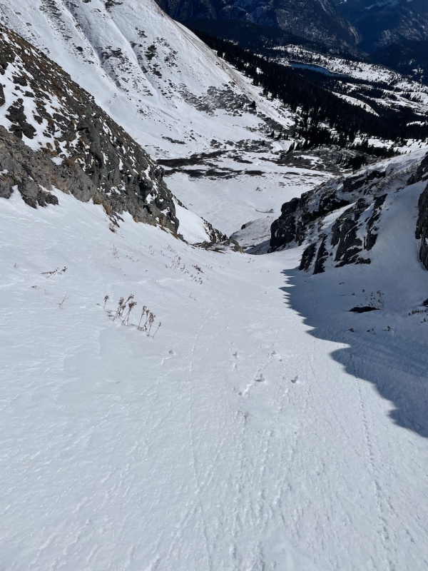
Now I just walked up the valley, with unranked 12,899 looming directly ahead. The route goes right of it, up the slopes of unranked Spencer, 13,087. At some point, I found the snowshoes necessary. 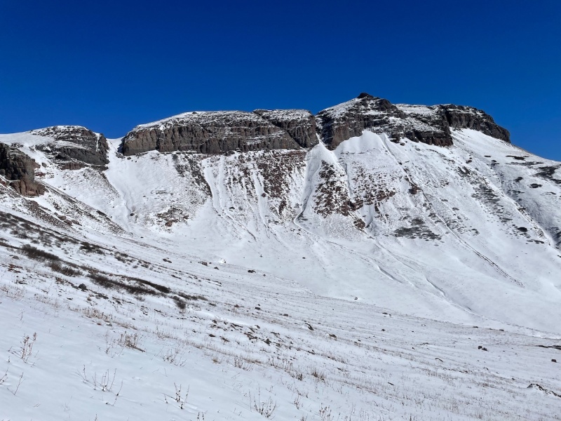
As I moved up the valley, I continued to move right/eastward. I didn't find the trail on the way up, as I was too far to the west from my side trip, but I found it on the way down on the return. Finally, Spencer came into view. The sky remained cloudless and I moved on eagerly. 
Spencer granted some stupendous views, and I dallied on the summit, transfixed by the Grenadiers to the SE and Vermillion Group to the WNW. The sun was high as it was a bit after 1 pm, so none of the photos turned out particularly well. A path from a prior snowshoer had aided my progress up Spencer, and it continued down the far side. Suddenly feeling a bit impatient to actually stand on a ranked summit, I followed it. The tracks cut a strong path to traverse beneath the turban of the Grand Turk, so I opted to follow it onto the Sultan, and collect the Turk on the way back. It was in this area that I heard several pika from the snow-covered rock field below. Also I began following a set of cat prints alongside the snowshoe track. In several spots, the snowshoe steps had disappeared, but faint kitty prints remained - so, unlike the chicken and the egg, we know who came here first. 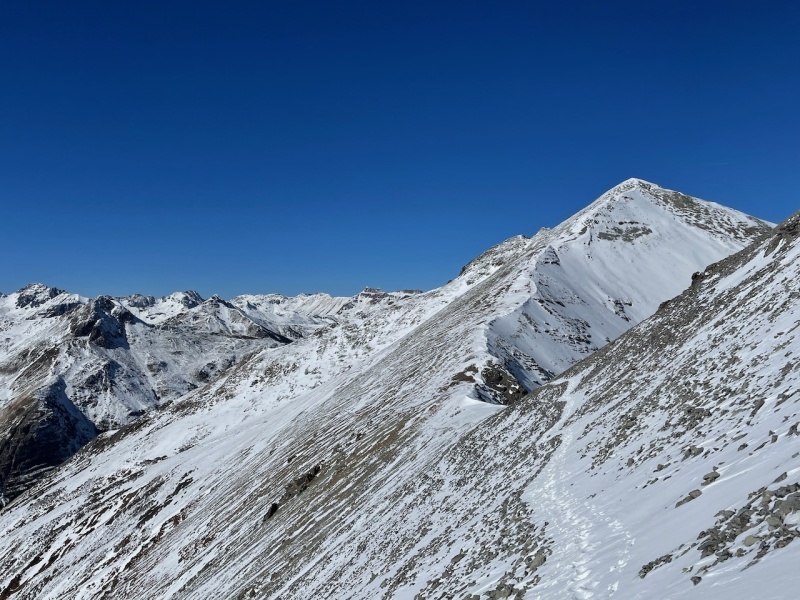
The favorable conditions made for quick work up the Sultan and I found myself on top only an hour after leaving Spencer. Pilot Knob struck an arresting pose, but again, the light was all wrong. I didn't linger on the summit, but backtracked to get to the Grand Turk, not particularly wanting to be out past sunset. The return to the saddle with Grand Turk was uneventful. 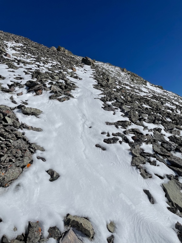
As I followed the snow line upward that marked the trail amid the talus, the aspect of the Grand Turk became much more rounded, appropriately, like a turban. 
I summited Grand Turk at 4 pm and absorbed the views, with the sun lower in the sky, casting long shadows. Vestal and the Trinities, favorites of mine from a day 10 years ago, captured my attention. The light still was wrong and I weighed the idea of waiting for sunset to get better pictures against the idea of hiking down in the cold darkness. I had the picture from the morning, so my desire a return to Silverton and warm food won out. The notion of tacking on W Turkshead, the big diversion of the morning, was not considered. Moving quickly back over Spencer, I found the trail in the upper valley, which speeded me on my way. About midway down the valley, I found it necessary to stop and put the snowshoes on once more. 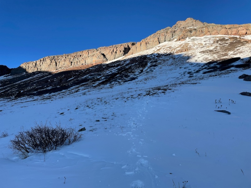
Back at Silverton, after a delicious meal at the Eureka Station, enhanced by interesting conversation with a couple on a road trip of the western US, I headed back to my comfy bed at the The Avon, where my friendly host awaited me. 
Hope you enjoyed reading. Thumbnails for uploaded photos (click to open slideshow): ")
")
")
")
")
")
")
")
")
")
")
")
")
")
")
")
")
")
|
| Comments or Questions | |||||||||
|---|---|---|---|---|---|---|---|---|---|
|
Caution: The information contained in this report may not be accurate and should not be the only resource used in preparation for your climb. Failure to have the necessary experience, physical conditioning, supplies or equipment can result in injury or death. 14ers.com and the author(s) of this report provide no warranties, either express or implied, that the information provided is accurate or reliable. By using the information provided, you agree to indemnify and hold harmless 14ers.com and the report author(s) with respect to any claims and demands against them, including any attorney fees and expenses. Please read the 14ers.com Safety and Disclaimer pages for more information.
Please respect private property: 14ers.com supports the rights of private landowners to determine how and by whom their land will be used. In Colorado, it is your responsibility to determine if land is private and to obtain the appropriate permission before entering the property.