Download Agreement, Release, and Acknowledgement of Risk:
You (the person requesting this file download) fully understand mountain climbing ("Activity") involves risks and dangers of serious bodily injury, including permanent disability, paralysis, and death ("Risks") and you fully accept and assume all such risks and all responsibility for losses, costs, and damages you incur as a result of your participation in this Activity.
You acknowledge that information in the file you have chosen to download may not be accurate and may contain errors. You agree to assume all risks when using this information and agree to release and discharge 14ers.com, 14ers Inc. and the author(s) of such information (collectively, the "Released Parties").
You hereby discharge the Released Parties from all damages, actions, claims and liabilities of any nature, specifically including, but not limited to, damages, actions, claims and liabilities arising from or related to the negligence of the Released Parties. You further agree to indemnify, hold harmless and defend 14ers.com, 14ers Inc. and each of the other Released Parties from and against any loss, damage, liability and expense, including costs and attorney fees, incurred by 14ers.com, 14ers Inc. or any of the other Released Parties as a result of you using information provided on the 14ers.com or 14ers Inc. websites.
You have read this agreement, fully understand its terms and intend it to be a complete and unconditional release of all liability to the greatest extent allowed by law and agree that if any portion of this agreement is held to be invalid the balance, notwithstanding, shall continue in full force and effect.
By clicking "OK" you agree to these terms. If you DO NOT agree, click "Cancel"...
Distance: somewhere between 14.5 -18 miles (track on watch said 14.5, uploaded same track to caltopo and it said over 18...who knows)
Gain: 6000
Difficulty: Class 4
I'm going to be honest: I'm not particularly attached to hiking 14ers in the winter. Don't get me wrong, I love getting out in the colder seasons. Everything's more interesting: the trail, the trees, the scenery...everything. Even the *ahem* boring peaks get a buff in the snow. But the frozen list holds no appeal to me. I'd rather get out and tag a new 13er than repeat a 14er just for a little blue snowflake next to it.
...Except for a select few, and the Needle is very much one of those. When Rose mentioned tackling the Needle last year, my curiosity was piqued. Unfortunately, our schedules didn't align, so I wasn't able to join for her summit bid last winter. She was denied the summit, and for Rose, the frozen Needle was delayed a year. This, of course, was good news for me, as it reopened the possibility of getting in there and giving it a shot. This year, snow totals in the Sangres had been low, and weather was looking absolutely prime for the Christmas weekend. It made sense to make a summit bid before the inevitability of more snow complicated the climb.
Suddenly, winter found a new way to make climbs harder, in the form of -15 degree temperatures and flights cancelled all over the country. My sister and her husband, who were in town from Vancouver, B.C., had their flights cancelled on the 23rd and rescheduled for Christmas day. This delayed our plans by a couple of days, and instead of a Christmas Day report, this is now a Boxing Day report. If you're sad about that (like me), there's only one thing to blame:
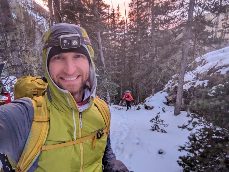
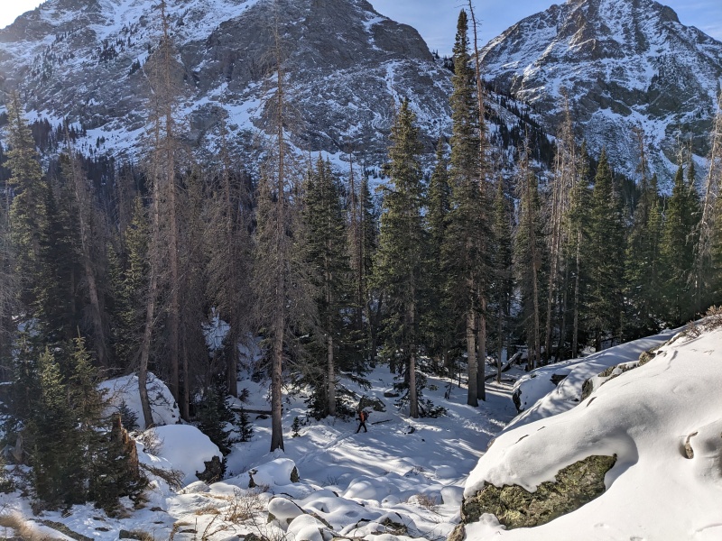
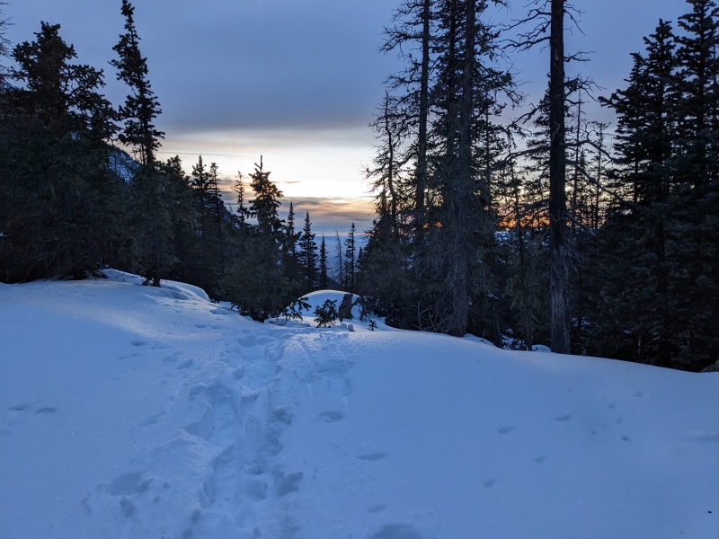
The morning (well, if you count a 12:20 AM alarm "morning") of the 26th rolled around, and we met up at the Cottonwood Creek trailhead at 3:30 AM. We strapped every conceivable piece of gear to our backpacks, not knowing what conditions would be and what we'd need, and headed off. Right off the bat, Rose started to have some nausea and dizziness. We took a few breaks in the first few miles to help alleviate some of the symptoms, and they mercifully subsided somewhat after a couple of hours, but they never fully went away. The first couple of miles of the trail was largely dry. After that, there was 4-8 inches of snow, but someone had put a booter in all the way to Cottonwood Lake, which saved us a lot of staring at our GPS tracks and trailbreaking. We weren't moving super fast, especially with Rose's ailments, but made it to the slabs shortly after we were able to turn off the headlamps.
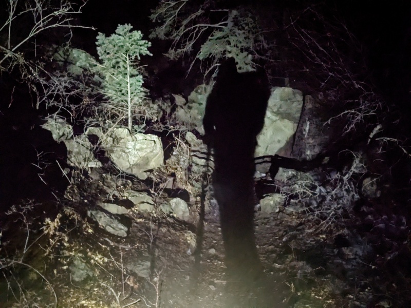
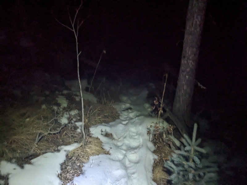
Ghost hiker!
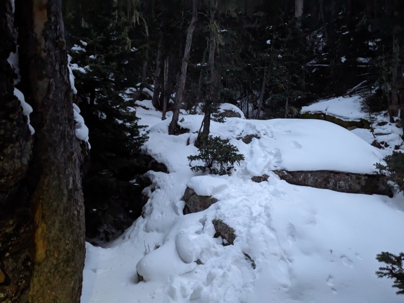
Early morning trail conditions. Thank you, mysterious person, for stomping down the snow for us!
Getting deeper as we went, but never got much more than this.
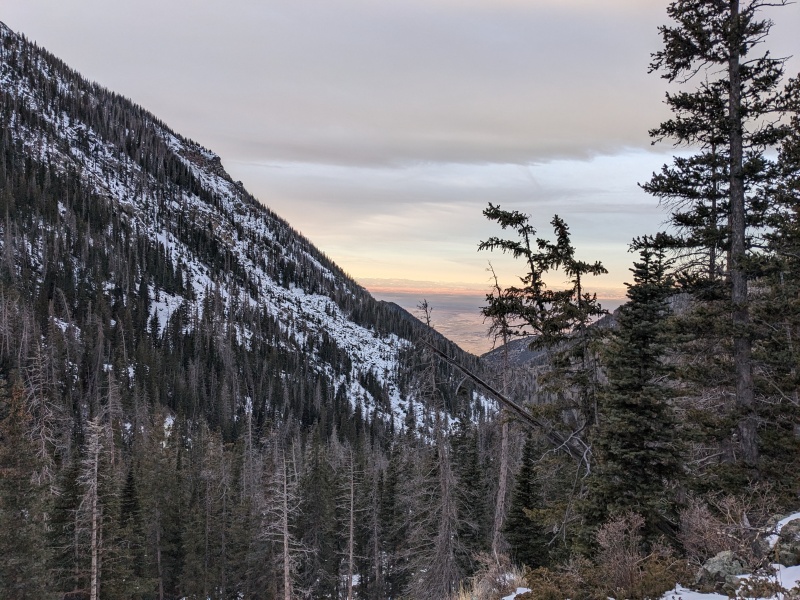
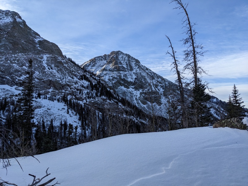
Cotton candy sky...maybe we should rename this trail
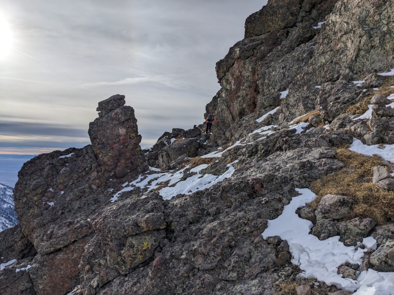
Once at the slabs, we dispatched the first section, then carefully scrambled up the snow-covered rock domes. The snow made them quite slick, as did the ice hidden under the snow in certain areas, but we managed with just boots. Other than a couple of short sections, the slabs were more annoying than dangerous. All it meant was a foot would slide out to the side randomly, like sort of a involuntary, snow-induced stanky leg. No falls though, and we powered on.
Too tired to properly smile
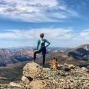
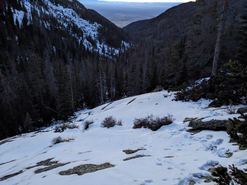
Looking out to the SLV. Love the views of the valley from the western approaches on Sangres peaks. Really puts the elevation change into perspective
Somewhere at or below or above the slabs. Everything blends together
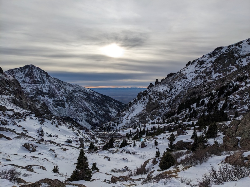
Starting the trek up toward the valley leading to Cottonwood Lake
God bless you, footprint man, for finding all of the talus-y trapdoors under the snow for me
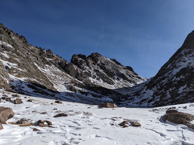
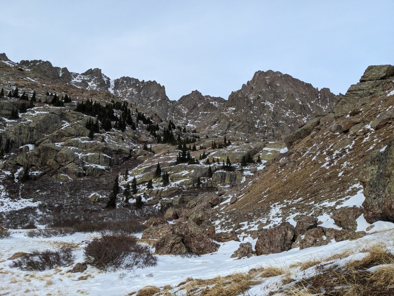
Eventually, we popped out below the willows and got our first look of the Needle and Peak. We were pleasantly surprised to see how dry the south-facing aspects were, and this made us optimistic that the climb would be little more than a colder summer summit.
Around this time, Rose admitted that we were going two very different speeds today. She told me that we could split and go separately, as we both agreed that summiting the peak wasn't going to be the treacherous ordeal it sometimes is this time of year. At first I declined and we stuck together, but after another hour and a half, we rehashed the conversation and decided it was time to venture off separately. I don't typically condone splitting up in winter, but today was an exception, due in large part to the warm temps and the friendly conditions we could see up high. Plus, we were both confident in our solo abilities. Most of the time splitting up isn't the right choice, but sometimes it is. Such is life.
First view of the worst gun in Halo
Peak N' Needle
After we separated, I followed Senor Bootpack's steps until they met with the Peak's access trail, then turned right. The tundra was windswept, though drifted in spots. At least the navigation's easy. A few minutes later the frozen lake materialized to my right, and I skirted around it and headed up toward Broken Hand Pass. The pass was a mixture of snow, scree, and grass, and though slippery, went quickly.
Around the split point, looking at the area near the willows.
Along the Peak access trail, with the lake in view to the right and Broken Hand Peak looming above
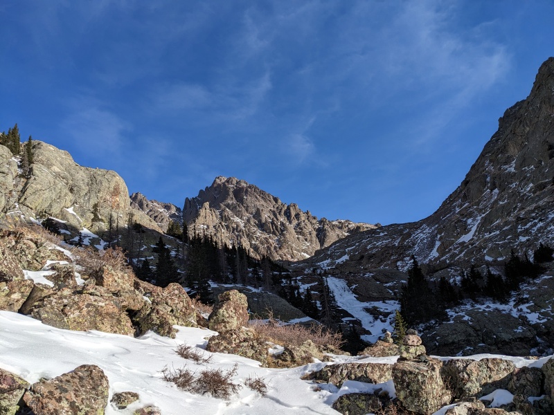
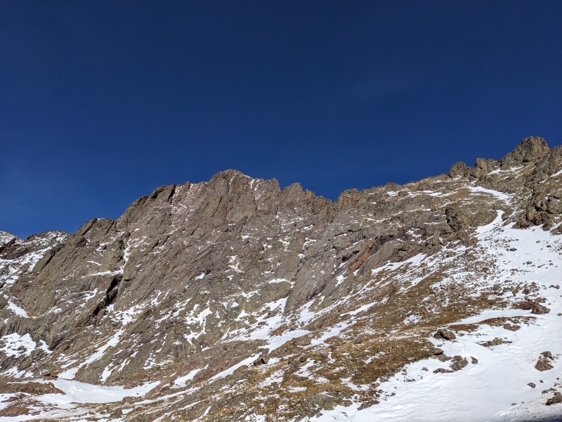
Partway up the pass, with the South Face finally in view
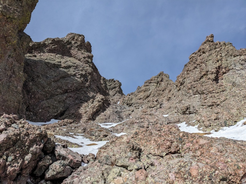
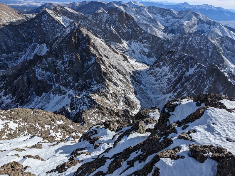
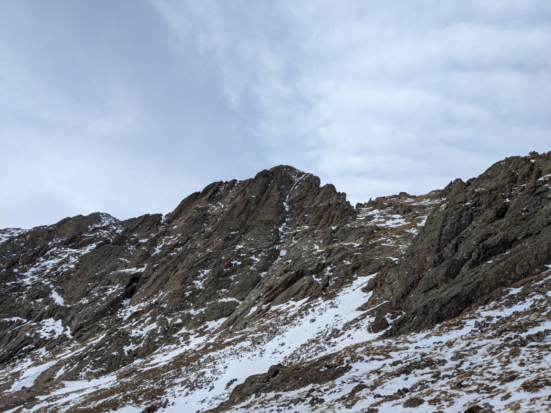
Full view of the South Face. The East Gully is on the right with scattered snow that opens up to the large bowl at the top
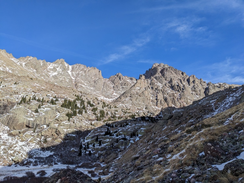
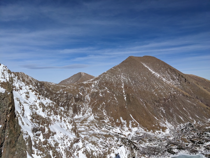
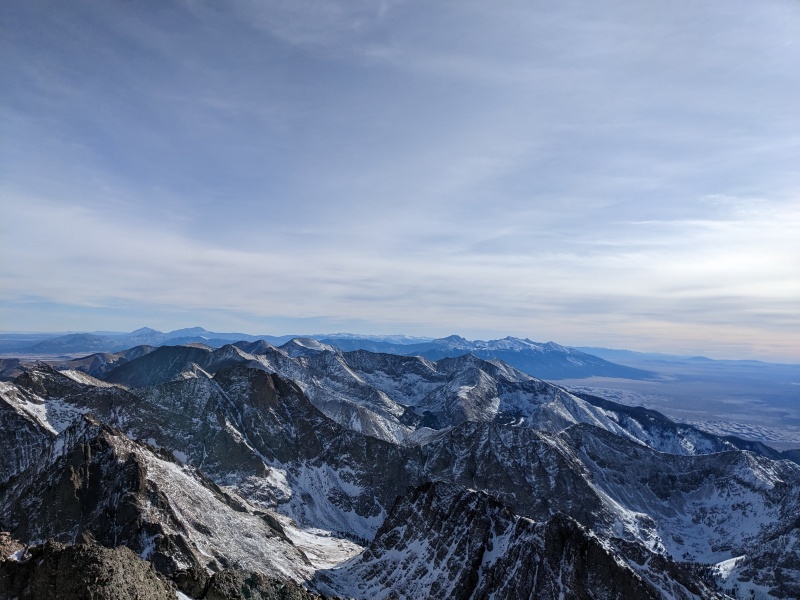
I veered left as I approached the pass and snuck out a bit more elevation gain before reaching the ridge. Once I did, views of the Colony Lakes area expanded in front of me. I know I was seeing the southern aspects of the peaks, but Humboldt and Colony Baldy were almost completely dry. I turned left and zig-zagged up rocks and grass, which culminated in a short downclimb before reaching the base of the East Gully. I was able to spot Rose down below, still moving and making progress. Thank God for the super bright Norrona jacket...can see that thing from space!
I feel like the peak in the background is mocking my hairline...
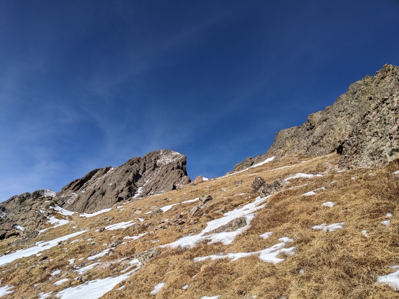
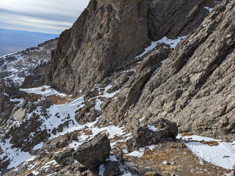
Traverse to the gully. The trail is visible, but had just enough snow to be a chore.
The moment of truth; I looked up the gully and saw mostly rock. Good! Even though I had eyes on it from a distance, you never really know how much of a factor the snow will be on the climb until you actually get on it. We were lucky. For my ascent, I was able to climb on rock about 95% of the time, though I ventured onto snow a bit more on the descent.
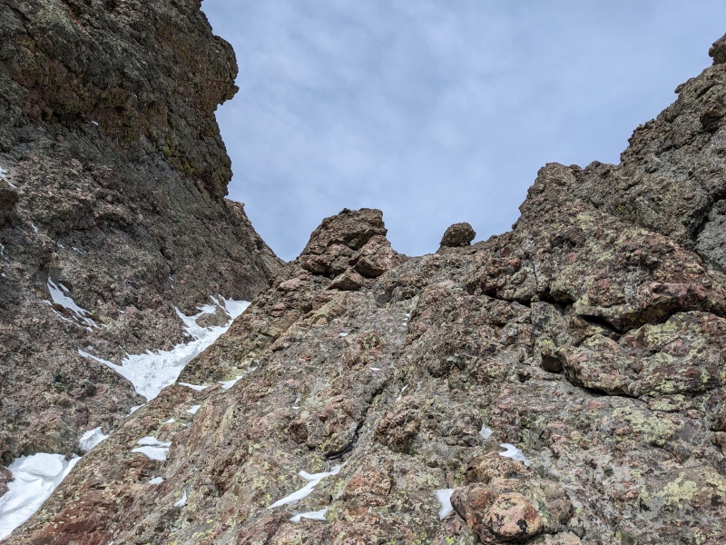
Most of the scrambling in the East Gully is easy 3rd class. The first few hundred feet are brainless, though tiring, as my calves decided that 5500 feet of gain was enough for the day. My brain yelled at them until they acquiesced and trudged onward. The steeper scrambling right above the optional gully crossover was dry as well, and I guess may be easy fourth class. It didn't feel like it on the ascent, but it did on the descent, so yeah I suppose it gets the grade. A few minutes later and I reached the top of the steeper section, with just a few hundred vertical between me and the summit.
Looking up the gully
On the steeper section
At the top of the steep scramble, looking down the whole gully. Generally speaking, dry rock could be found on climber's right
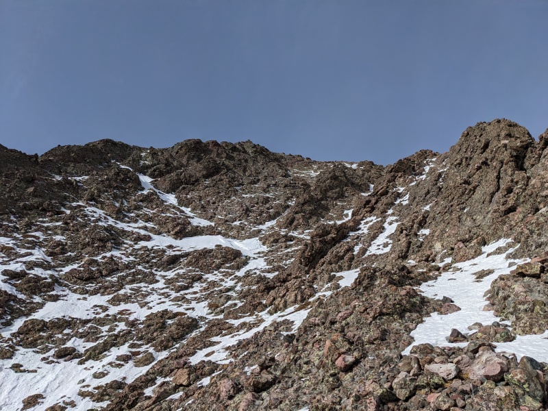
As the gully opened up into the face, so did the options to climb. I opted to head left and take a more direct route to the high point, which forced some slightly harder moves. Staying right and hitting the ridge a little lower was certainly easier, and what I did on the descent. After a few more minutes of climbing, I topped out, spun around and took a picture to make sure I'd descend the correct gully (ask me how I know...), and hopped the last few feet of rocks to the summit!
Last pitch in the now wide-open East Gully
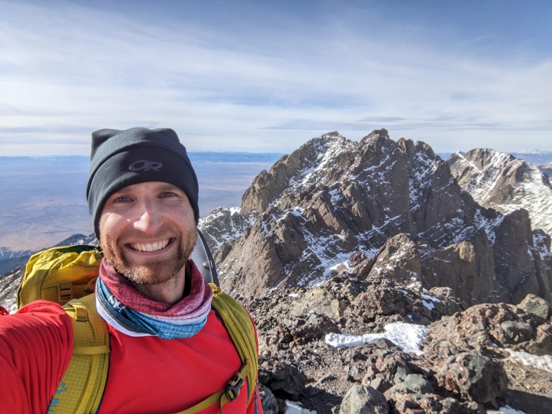
Summit! Guess I could muster a real smile this time...
South toward Blanca Group
This was the most pleasant winter summit I've ever had. It didn't feel like winter up there. Warm temps, no wind, no chill in the air. I was in my baselayer with no gloves and was very comfortable. We take days like this! I called my wife, told her I summited successfully but had split with Rose, and gave her a horribly inaccurate estimate as to when I'd be back to my car. I stayed for a few extra minutes, then decided it was time to descend to hopefully get below the slabs on the trail before nightfall.
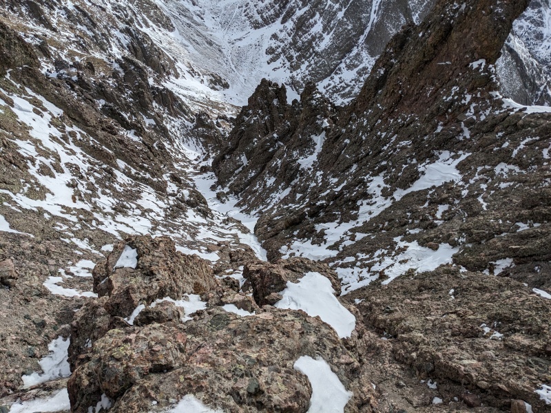
Picture I took at the top of the East Gully showing the way down. If this ain't your view, you're about to go down the wrong gully.
Descending the gully wasn't too bad. I found most of the snow to be supportive and used that to my advantage, plunge stepping where deep enough, then transitioning to rock at more consequential or drier areas. It took some care, but about 40 minutes after leaving the summit I made it back to the base of the gully.
Looking at entrance/exit to East Gully
As I embarked on the traverse back to Broken Hand Pass, I sent my wife a text letting her know I was off the hard parts. I then ran into Rose a few minutes from the entrance to the East Gully. I assured her the summit was very reachable and the gully was in solid climbing conditions. We made plans to text each other when we reached certain milestones to make sure we were safe. She also provided a horribly inaccurate guess as to when she'd reach the summit (theme of the day...horribly inaccurate time guesses by us) and departed. I continued along the snowy trail toward Broken Hand Pass and reached in a few more minutes.
Parting shot of Rose heading up
Looking down the snow-laden trail to Broken Hand Pass
Even though I'd told my wife I was off the dangerous stuff, the real challenge came in the next hour of hiking. I expected that once I reached the pass, I'd cruise down to the trail and make good time out to the car. That didn't really happen, now did it? Because nothing is ever as easy as you'd like it to be. I fell what felt like 15 times trying to descend Broken Hand Pass on the slippery, snow-dusted grass. I could have put spikes on...but I didn't because reasons. Slipping and sliding and falling down is not really the quickest way down a mountain. Also what is not the quickest way down a mountain is trying to take a short cut I was convinced would go that would shave off a quarter of a mile of the trail toward the Peak access/Cottonwood Creek junction. As it turns out, I put myself into talus trapdoor hell. Every step was a question of how far my foot would sink in before meeting resistance, and sometimes that resistance wouldn't come until my shin bonked a boulder hidden under the rock. This shortcut ended up being a massive longcut, and I had to fight every step to get back to where our tracks were. I made it eventually, but not without some bruises to both my legs and ego.
Nearing the bottom of the Pass. Rose is visible up there somewhere with a better camera. I could see her partway up the gully
Yeah somehow I thought going straight through that instead of staying on the trenched trail was a good idea...
Looks less snowing from this side....well it's not
At long last, I reached the trail and the Needle disappeared behind the hillside. My foray into the snowy talus jungle sapped a lot of time and energy from me, so reaching the slabs before dark was now no longer a sure thing. I descended the frequently rocky and uneven trail as quickly as I could, which is to say not that fast. As I reached the upper slabs, the light seemed to linger a little longer than it should, as if to get me down before needing the headlamp. I made it to the most difficult slab, elected not to put on my spikes, and instead butt-scooted the toughest 10 feet to reach the trail at the bottom of the valley. I flicked on the headlamp and put on autopilot down the trail. The lack of sleep the night before (a solid hour at the most) was catching up with me, and I kept thinking every pile of snow on the side of the trail was a labrador. Sadly, none were actual labradors, as I bet a labrador would have made the death march out in the dark much more fun. Or better yet, my two dogs, Fawkes and Kingsley, mountain beasts in their own right. But nope, it was just me. Though it seemed like it wouldn't, eventually the snow yielded to dry trail, and that trail brought me to my car, a full hour and a half after I told my wife I expected to be done.
Above the last sketchy slab
Looking back up the slab and my butt scoot bypass
Upon reaching the car, I texted Rose that I made it and encouraged her to grind it out. She did, though from where I last saw her took her an hour longer than she expected to reach the summit. She had to descend the gully in the dark, but she made it too, safe and sound. Congrats to her on surpassing the 3/4 mark of the winter 14ers!
This peak was a lesson in planning; some good, some bad. The good: we teamed up, we picked an optimal weather day with optimal snow conditions, and we picked an early start time to give us the best chance at getting most of the hike done in the day. The bad: despite our planning, every time estimate we predicted was wildly wrong; we probably could have started even earlier if we knew we would be slow; and we brought every piece of gear we own and used none. Such is life.
Did we make it? Yes. Was it perfect? No. But this is the kind of day I'll daydream about at 8am every Monday.
My GPS Tracks on Google Maps (made from a .GPX file upload):
Loved the write up!!! And sorry to hear of the airline cancellation. That seems to be the MO this season. Crazy how dry it is up there. Now I know why (from your great shots) that the Sangres have been green for a while. Hoping to use your excellent track to head up the Peak either tomorrow or Saturday. Congrats on a cold summit, Yak!!!
Write ups. The absence of my white face in summit shot was an upgrade.
I was surprised you relented and called the east gully c4. I know you werent all in on the rating. I still call it c3 but Ive never descended it. Usually you rate stuff easier than me.
Anyway, nice to vicariously be along for the journey.
A buddy of mine and I hit the weather window the day after and appreciated your and Rose's efforts. Rose slept out (or walked through the night?) because we saw her at ~9am the next day on the slabs as we were headed up. We ended up going climbers left up the more summer route through the willows. I don't know if it was better, but it was different.
@kiefer thanks! Hope you managed to get up as well!
@steph everyone knows the best weapon was the torque bow from GoW
@tom that would be a helpful policy!
@brian Colorado misses you!
@astranko congrats on getting it! I'm sure your way through the willows was better...couldn't have been worse.
@jay thank you! Not tougher, just younger and dumber lol
Caution: The information contained in this report may not be accurate and should not be the only resource used in preparation for your climb. Failure to have the necessary experience, physical conditioning, supplies or equipment can result in injury or death. 14ers.com and the author(s) of this report provide no warranties, either express or implied, that the information provided is accurate or reliable. By using the information provided, you agree to indemnify and hold harmless 14ers.com and the report author(s) with respect to any claims and demands against them, including any attorney fees and expenses. Please read the 14ers.com Safety and Disclaimer pages for more information.
Please respect private property: 14ers.com supports the rights of private landowners to determine how and by whom their land will be used. In Colorado, it is your responsibility to determine if land is private and to obtain the appropriate permission before entering the property.


")
")
")
")
")
")
")
")
")
")
")
")
")
")
")
")
")
")
")
")
")
")
")
")
")
")
")
")
")
")
")
")
")