Download Agreement, Release, and Acknowledgement of Risk:
You (the person requesting this file download) fully understand mountain climbing ("Activity") involves risks and dangers of serious bodily injury, including permanent disability, paralysis, and death ("Risks") and you fully accept and assume all such risks and all responsibility for losses, costs, and damages you incur as a result of your participation in this Activity.
You acknowledge that information in the file you have chosen to download may not be accurate and may contain errors. You agree to assume all risks when using this information and agree to release and discharge 14ers.com, 14ers Inc. and the author(s) of such information (collectively, the "Released Parties").
You hereby discharge the Released Parties from all damages, actions, claims and liabilities of any nature, specifically including, but not limited to, damages, actions, claims and liabilities arising from or related to the negligence of the Released Parties. You further agree to indemnify, hold harmless and defend 14ers.com, 14ers Inc. and each of the other Released Parties from and against any loss, damage, liability and expense, including costs and attorney fees, incurred by 14ers.com, 14ers Inc. or any of the other Released Parties as a result of you using information provided on the 14ers.com or 14ers Inc. websites.
You have read this agreement, fully understand its terms and intend it to be a complete and unconditional release of all liability to the greatest extent allowed by law and agree that if any portion of this agreement is held to be invalid the balance, notwithstanding, shall continue in full force and effect.
By clicking "OK" you agree to these terms. If you DO NOT agree, click "Cancel"...
I wanted to ski in Silverton since the first time I drove through in the middle of summer over a decade ago. Fast forward to now and I find myself living in Durango with a ski partner who has been exploring the area for 30 years. He mentioned he'd be skiing in Silverton with an Eagle friend and invited me to join. I cleared my schedule and let him know I'd come up to which he briefly explained it would be a big day and we'd start skiing about 0530. I failed to fully comprehend just what a "big day" entailed.
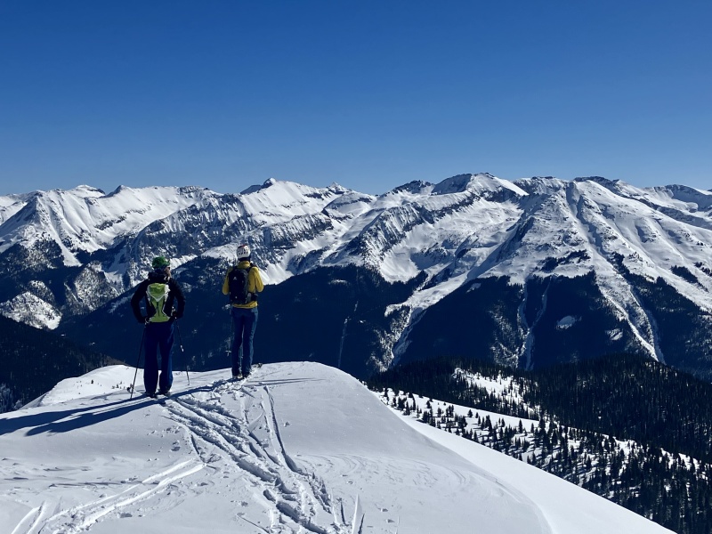
I left Durango at 0415 nearly plowing into an elk just a moment after turning onto 550. Coffee rendered redundant. Upon arriving in Silverton at 0515, Scott and Chris were already up and dressed. They briefed me on the plan of summiting and skiing the Silverton Big 5 - Sultan, Anvil, Hancock, Macomber and Kendall. Looking at about15000ft. I checked to make sure I had my big boy pants on but wasn't sure they were big enough.
Sultan
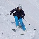
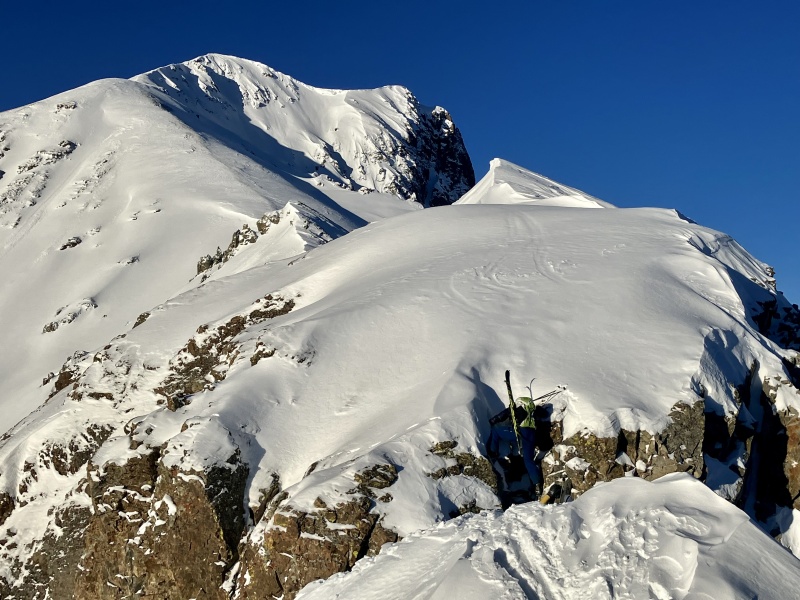
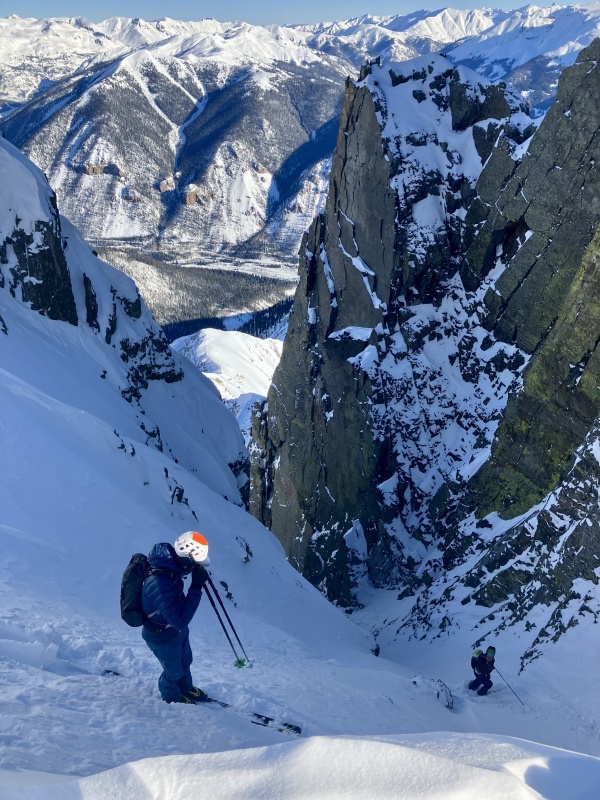
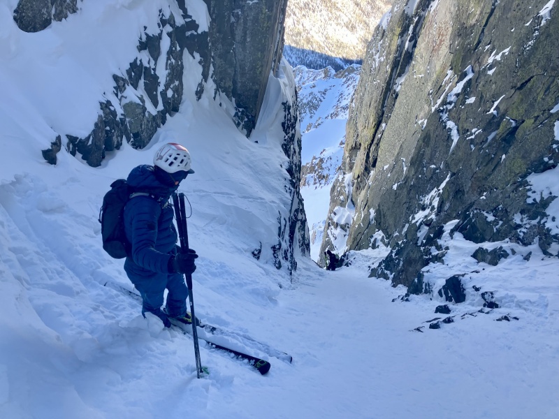
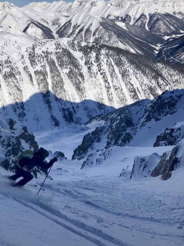
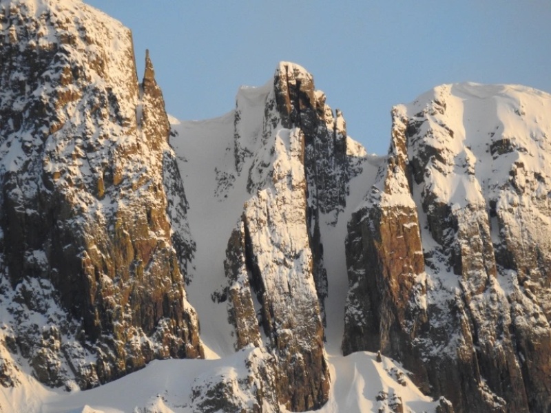
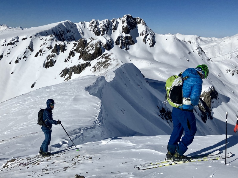
We started in -6 deg darkness climbing toward Sultan on an old skin track that terminated near treeline where we picked up the ridge. As we ascended Scott casually asks if we're comfortable with a little 5.4 section. Spice is nice. A small notch in the ridge required a short climb not made any easier in ski boots. We summited at 0830 to a sublime day and continued on along the ridge to the first line of the day. I had no idea what to expect as Scott asked, "Brent, you comfortable with this?" I then peeked over the edge of "the elevator shaft". It had a corniced entry into a steep, narrow couloir that dove down around 50 deg into the abyss. Comfort's relative right? I threw on my puffy and helmet and we each took turns side stepping down the cornice into the frigid couloir. Scott went down the thin, tight gut first sloughing loose snow and encountered a down climb in the choke. Chris and I waited above until he made it through and took cover below as each of us created sloughs of our own before carefully descending the rocky step. There we found supportable recycled powder. We party skied a couple thousand feet to the valley floor.
Sultan ridge notchDropping into the elevator shaftScott above the choke downclimbDifferent world below the chokeThe elevators... we descended the right one.Squiggles for days
Anvil
We crossed the street after mending some skin issues and started up the sunny south side of objective 2 of 5 - Anvil. Before long we were bootpacking and I came to learn that I must've been the heaviest because I repeatedly post-holed in the steps kicked by Chris and Scott ahead of me. The effort took a toll. I fell a ways behind and summited a few minutes after them at just before noon. From the summit we could see Chris's food packed stash car far below at the bottom of a skied out chute. We took mogul turns to the bottom and refueled in the sun for a few minutes.
Pondering the possibilities
Hancock
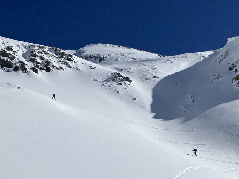
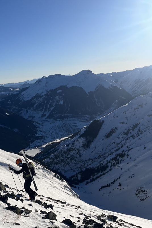
A realization sunk in that we were a little behind schedule and the moment we started moving again my legs already felt heavy. I considered bailing right then but mercifully the ascent into Hancock Gulch below Storm Peak was along an established low angle skin track in the trees. It's just a beautiful, revitalizing setting. Nonetheless I started feeling sapped again along the final ridge summiting nearly 9 hours into the day. We discussed descent options. Originally the plan was to descend down into Boulder Gulch right off the summit. CAIC's avy forecast was low but the face looked like it had a lot of wind loading. We traversed down ridge to the north, navigated the cornice above the face and skied down to a pinner below Storm. It ended up holding the best snow of the day.
Hancock GulchEast face of Hancock from the summit
Macomber
It was a roundabout way of skiing off Hancock and I had no idea where we were going from there as we descended down delightful snow into Boulder Gulch. Suddenly Scott pulls up and announces skins back on. Oof, I thought. I was feeling the bonk train coming. We skinned about 3/4 of the way up Macomber before starting to bootpack on scree. I fell way behind. Altitude had never affected me before but it seemed to this day. I finally topped out at 1645 way behind Scott and Chris. We skied down and out of Boulder Gulch through some less than delightful willows and melt-freeze crust as the sun began to set. I knew they were still on a mission to complete the 5 so there we parted ways.
Bootpacking Macomber
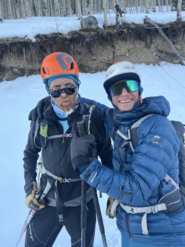
Chris and Scott went on to summit and ski Kendall in the dark finishing around 2130 after 15.5 hours, 16,880 ft of climbing and 32 miles. The day kicked my ass but I can't think of a better way of being introduced to the skiing around Silverton. Grateful and humbled to have joined them.
Thumbnails for uploaded photos (click to open slideshow):
I'm looking forward to skiing Silverton 13ers in the spring , just on separate days
Sultan is close to #1 on that list. My impression is that it combines best with Turk and doesn't require a rocky step downclimb?
Kendalls have the prominence of the Bells, now both of them ranked, and I only skied one of them, oof. What a huge day to get them all! Massive kudos!
p.s. I miss Baldwin's Instagram
Caution: The information contained in this report may not be accurate and should not be the only resource used in preparation for your climb. Failure to have the necessary experience, physical conditioning, supplies or equipment can result in injury or death. 14ers.com and the author(s) of this report provide no warranties, either express or implied, that the information provided is accurate or reliable. By using the information provided, you agree to indemnify and hold harmless 14ers.com and the report author(s) with respect to any claims and demands against them, including any attorney fees and expenses. Please read the 14ers.com Safety and Disclaimer pages for more information.
Please respect private property: 14ers.com supports the rights of private landowners to determine how and by whom their land will be used. In Colorado, it is your responsibility to determine if land is private and to obtain the appropriate permission before entering the property.

")
")
")
")
")
")
")
")
")
")
")
")