Download Agreement, Release, and Acknowledgement of Risk:
You (the person requesting this file download) fully understand mountain climbing ("Activity") involves risks and dangers of serious bodily injury, including permanent disability, paralysis, and death ("Risks") and you fully accept and assume all such risks and all responsibility for losses, costs, and damages you incur as a result of your participation in this Activity.
You acknowledge that information in the file you have chosen to download may not be accurate and may contain errors. You agree to assume all risks when using this information and agree to release and discharge 14ers.com, 14ers Inc. and the author(s) of such information (collectively, the "Released Parties").
You hereby discharge the Released Parties from all damages, actions, claims and liabilities of any nature, specifically including, but not limited to, damages, actions, claims and liabilities arising from or related to the negligence of the Released Parties. You further agree to indemnify, hold harmless and defend 14ers.com, 14ers Inc. and each of the other Released Parties from and against any loss, damage, liability and expense, including costs and attorney fees, incurred by 14ers.com, 14ers Inc. or any of the other Released Parties as a result of you using information provided on the 14ers.com or 14ers Inc. websites.
You have read this agreement, fully understand its terms and intend it to be a complete and unconditional release of all liability to the greatest extent allowed by law and agree that if any portion of this agreement is held to be invalid the balance, notwithstanding, shall continue in full force and effect.
By clicking "OK" you agree to these terms. If you DO NOT agree, click "Cancel"...
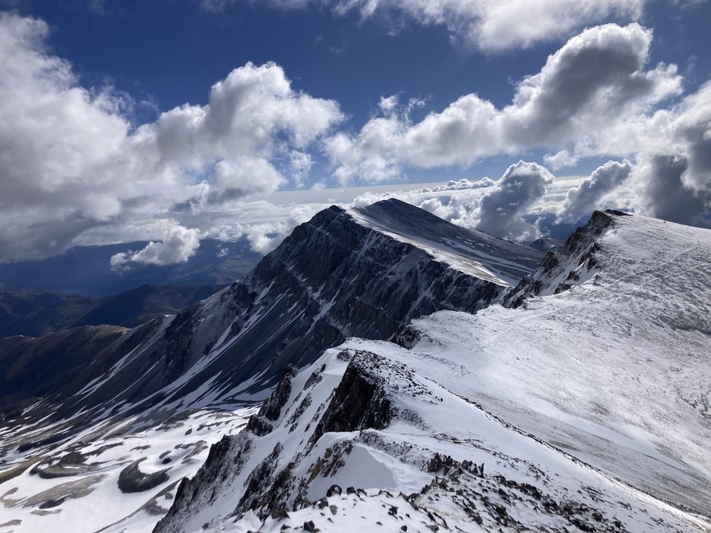
After finishing classes on Friday afternoon, I took the long but pleasantly uneventful drive out to Lake City from Fort Collins. Knowing I had a long day planned with potentially unfavorable weather, I opted to begin hiking at the fine hour of 4:30 am. Storms from the previous night had left a light dusting of snow as I ascended up Sundog.
Heading up Sundog's north ridge
After summiting Sundog, I traversed over to Sunshine. En route, the clouds finally gave way to reveal the peaks to the south.
Sunrise on Half, Quarter, and friends
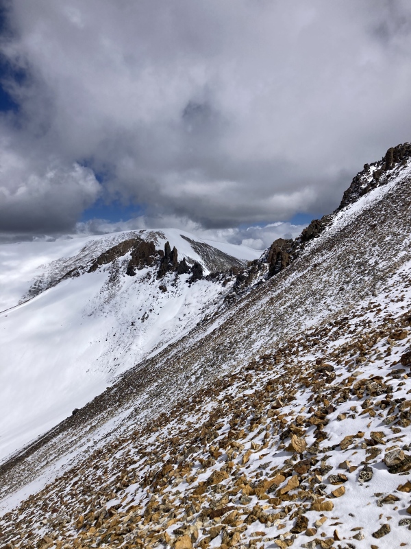
After summiting Sunshine, I traversed to Redcloud, 13832, and 13811. This section was relatively straightforward and trails helped speed progress.
13832 from the saddle with RedcloudLooking out to 13811 from 1383213832 from 13811
Once I had returned to the Redcloud-13832 saddle, I began to make my way north along the ridge to Cooper Creak Peak. This mostly involved sidehilling (made less fun by the snow) and traversing around various rotten towers. The final push up Cooper was mellow and pleasant.
Heading towards Cooper Creek Peak from the Redcloud-13832 saddleLook back at the volcanic towers between 13832 and Cooper Creek Peak
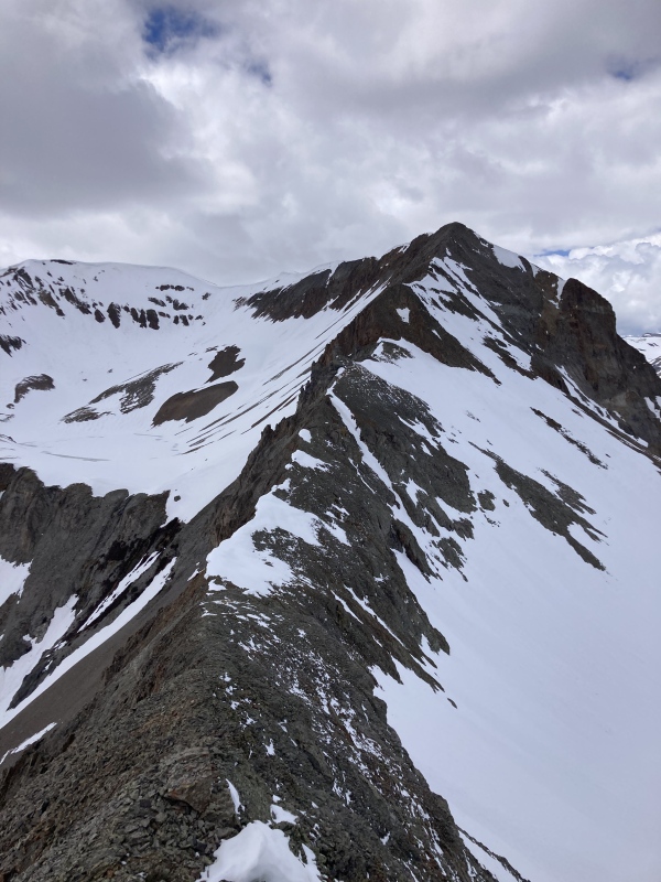
Once on Cooper, the traverse to Every was very straightforward. The traverse over to Gudy however was far more involved. The crux of this section was a class 3 headwall on relatively solid rock.
Looking over to Gudy Peak from Every Mountain's ridgeGetting closer to the class 3 headwallClass 3 headwall up closeSummit ridge of Gudy
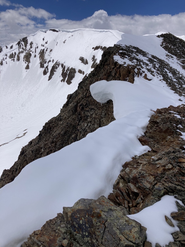
From Gudy, CT was a short and pleasant climb. Summiting 13540 proved to be the hardest section of the day. Once again, I first had to climb a headwall of class 3 rock (much less stable this time) followed directly by multiple cornices along the ridge. While the rock quality wasn't awful it certainly would be much less fun had this section been class 4.
13540 from the ridge of CT PeakRotten ridge of 13540Final summit push up 13540
After summiting 13540, I went and grabbed 13427 with little fuss and glissaded most of the way back down to the road.
Sunshine, Redcloud, and Sundog from the road
Overall, a very pleasant day! The snow was generally supportive, making the multiple cornices I had to climb much more pleasant and the weather ended up being an optimal level of cloudy without storming. Certainly a nice way to link up 11 peaks!
My GPS Tracks on Google Maps (made from a .GPX file upload):
I haven't been over to the Telluride area yet so I personally can't say, but it seems mostly to be due to melting. Some areas were still really deep, but pretty consolidated due to the freeze-thaw.
A year or so back, the road from Lake City to Burrows Park TH (where trails to Handies as well as Redcloud/Sunshine both begin) was pretty washed out.
What is the condition of the road between these points like now? Did BLM repair it at all? Any spots to worry about? Better spots to park and hike up to this trailhead if needed? Just trying to find out as much detailed info about this before I head out, as it's a long trip from where I'm at in SW Colorado and want to make sure trip out there is worth the drive.
Yes, it is still very washed out. My Subaru made it but a 2WD vehicle most likely wouldn't. No tricky spots, in particular, just large puddles and ruts. Not sure about alternate trailheads, unfortunately.
I made it with little fuss in my non-lifted forester so you should be good.
Caution: The information contained in this report may not be accurate and should not be the only resource used in preparation for your climb. Failure to have the necessary experience, physical conditioning, supplies or equipment can result in injury or death. 14ers.com and the author(s) of this report provide no warranties, either express or implied, that the information provided is accurate or reliable. By using the information provided, you agree to indemnify and hold harmless 14ers.com and the report author(s) with respect to any claims and demands against them, including any attorney fees and expenses. Please read the 14ers.com Safety and Disclaimer pages for more information.
Please respect private property: 14ers.com supports the rights of private landowners to determine how and by whom their land will be used. In Colorado, it is your responsibility to determine if land is private and to obtain the appropriate permission before entering the property.


")
")
")
")
")
")
")
")
")
")
")
")
")
")
")
")
")
")
")
")


