Download Agreement, Release, and Acknowledgement of Risk:
You (the person requesting this file download) fully understand mountain climbing ("Activity") involves risks and dangers of serious bodily injury, including permanent disability, paralysis, and death ("Risks") and you fully accept and assume all such risks and all responsibility for losses, costs, and damages you incur as a result of your participation in this Activity.
You acknowledge that information in the file you have chosen to download may not be accurate and may contain errors. You agree to assume all risks when using this information and agree to release and discharge 14ers.com, 14ers Inc. and the author(s) of such information (collectively, the "Released Parties").
You hereby discharge the Released Parties from all damages, actions, claims and liabilities of any nature, specifically including, but not limited to, damages, actions, claims and liabilities arising from or related to the negligence of the Released Parties. You further agree to indemnify, hold harmless and defend 14ers.com, 14ers Inc. and each of the other Released Parties from and against any loss, damage, liability and expense, including costs and attorney fees, incurred by 14ers.com, 14ers Inc. or any of the other Released Parties as a result of you using information provided on the 14ers.com or 14ers Inc. websites.
You have read this agreement, fully understand its terms and intend it to be a complete and unconditional release of all liability to the greatest extent allowed by law and agree that if any portion of this agreement is held to be invalid the balance, notwithstanding, shall continue in full force and effect.
By clicking "OK" you agree to these terms. If you DO NOT agree, click "Cancel"...
This trip is from several years ago and I just never finished the report. A recent forum discussion inspired me to finish it, and maybe someone will find it useful since this route will likely be in all summer for those with the proper gear... The original plan for this outing had been to climb El Diente by the standard route (North Slope), traverse to Mt. Wilson and then return to Navajo Lake by going down the North Slope of Wilson. Things did not go as plan, but it was still a great day in the mountains.
Day of Climb: September 1st, 2019
Trailhead: Navajo Basin
Peak: El Diente
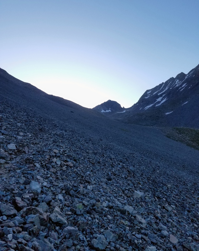
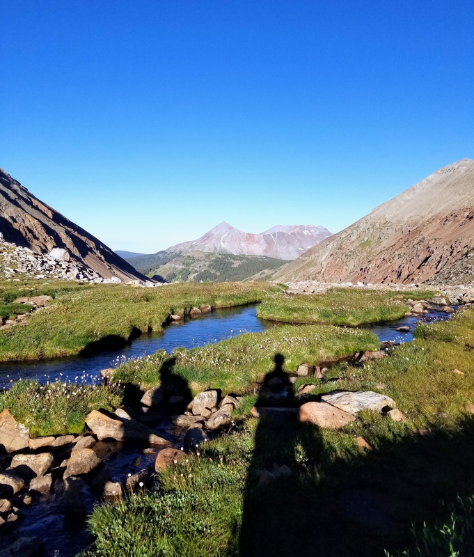
Our day started just before sunrise from a camp slightly west of Navajo Lake. My group of 3 followed a nice trail to the lake and then we continued around the left side of it. After passing the lake we walked through a shrubby area and then crossed a talus slope leading us to the upper basin. This was about 1.5 miles from the lake and the turn off for the North Slope.
Navajo Lake.Talus slope.Looking back at lake from talus slope.Upper basin.
Immediately after looking up and seeing the conditions of the North Slope we knew we were screwed. Starting about a 1/4 of the way up it was almost completely snow covered and we had not brought crampons or axes. We didn't even have microspikes. It had never dawned on me that we might need crampons to climb the standard route for El Diente in September.
In my defense though, I was 3 months into my weekend warrior climbing project. My goal had been to climb every weekend from the beginning of June until finishing the 38 remaining 14ers on my list while working 55 to 60 hours per week. So, by this point of the project I was pretty exhausted and did zero research for this climb. It was a bad habit I was forming, I know, but I just didn't have the free time, and in those days I didn't frequent this site much either. Between work, climbing and twice a day dog walks I was averaging over 100 miles per week walking which left little time and energy for anything else. I did usually at least download a gpx track for each climb.
At first glance, the snow filled North Slope looked unclimbable without the proper gear and I was sure our day was done. I was really bummed. I knew it would be tough to complete my project before the end of summer without getting these in today. After discussing a few options we decided to just go for it and hoped the snow would be supportive. We really didn't have a good alternative so we continued on.
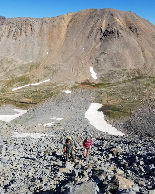
We entered the couloir after crossing a rockfall debris field and then climbed a large snowfield skirting the edge.
Initial snowfield.
Then it was a talus hop.
Bottom 1/4 of couloir.
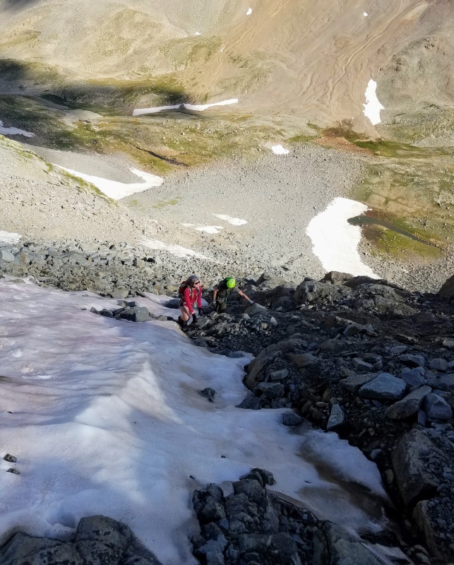
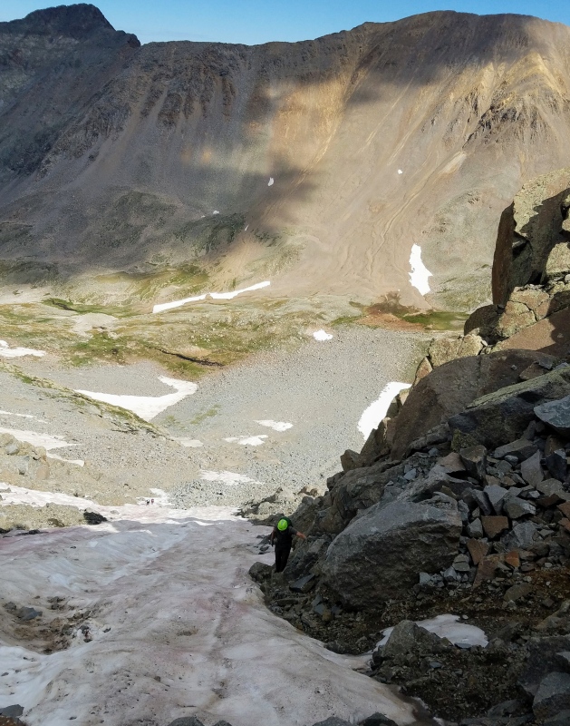
We worked our way up through a mix of talus and scree. This bottom 1/4 of the couloir was completely melted out. It didn't take long to reach the snow and to our dismay it was completely bulletproof. There was no way we'd be climbing the snow in trail runners. The extreme left of the couloir was mostly melted out so we continued that way hoping it would remain clear of snow.
Start of bulletproof snow.Looking up couloir from about halfway.
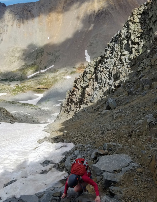
Climbing along the fringe of the couloir was very slow and tedious. Fortunately, rockfall was not really an issue as long as we were careful. We did, however, see someone dislodge a refrigerator size boulder from near the top of the buttress route. That was quite an amazing sight watching it careen down the mountain busting into dozens of pieces with explosive noises. Everytime I see someone say the buttress route is solid I think of this and the huge pile of rubble below the route
At this point, we then saw 2 climbers below working their way up the couloir in crampons. They were the smart ones! Despite us having a huge head start, they quickly passed and finished well before us with ease.
Skirting the snow. Zoom in to see 2 climbers in crampons.Snow climbers were gaining on us.
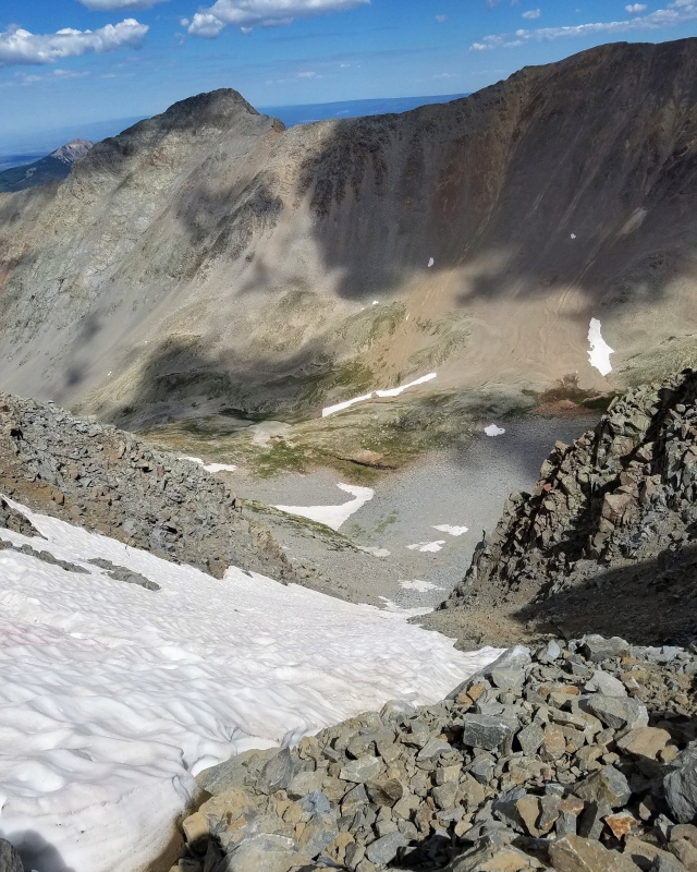
As we neared the top of the couloir we could see the headwall. My gpx track had us exiting to the right of the headwall so we looked for a good place to safely cross. I probed the snow in several locations and even got halfway across at a few places, but each time I turned back fearful of slipping and going for the longest glissade of my life. The snow was like a skating rink. We then reluctantly opted to continue towards the headwall and hoped we'd find another way.
Approaching the headwall.Looking down from just below the headwall.
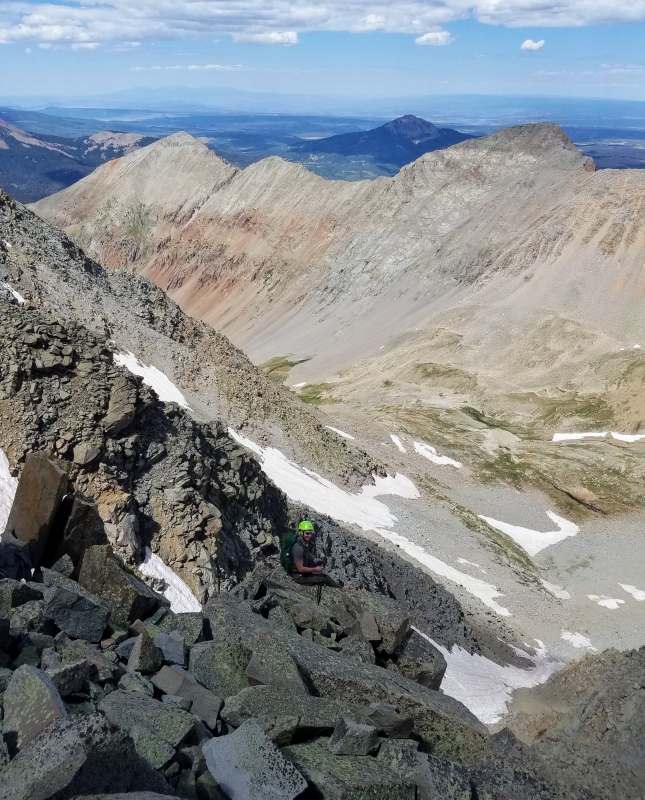
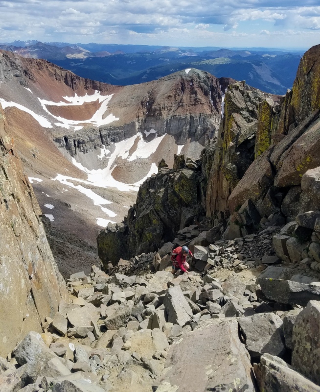
At the base of the headwall we still couldn't find a way to reach the exit ramp to the ridge. So, with no other choice we exited the couloir to climbers left and started looking for an alternate route to the ridge.
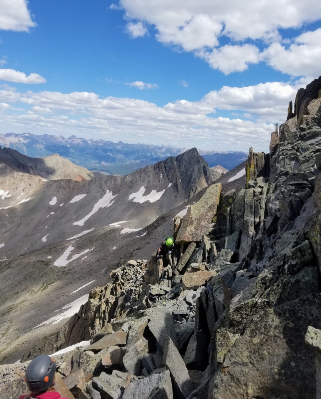
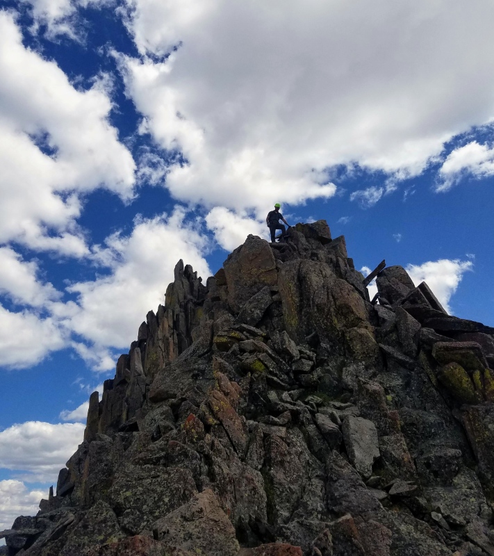
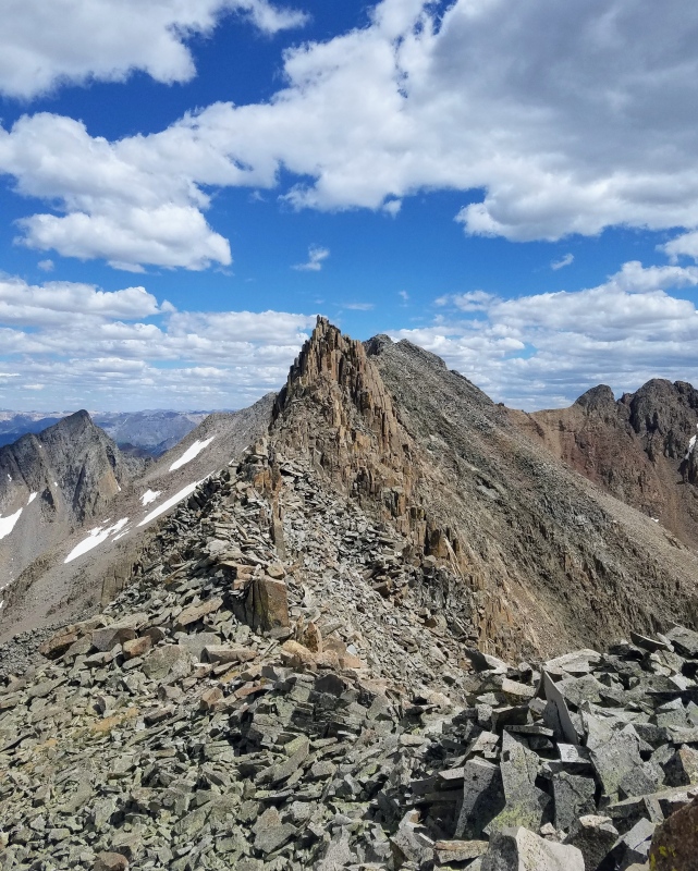
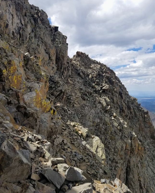
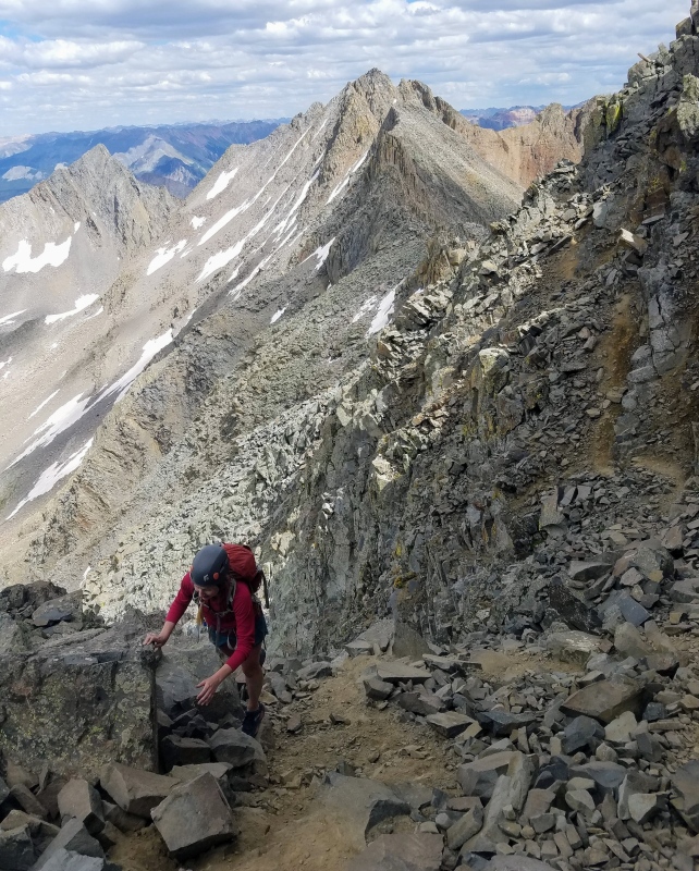
Luckily, we found plenty of solid rock here and some fun climbing. With some creative route finding we were able to successfully meander up through some class 3/4 stuff and make our way to the ridge. We met the ridge near some pillars which we descended and then joined the standard traverse route.
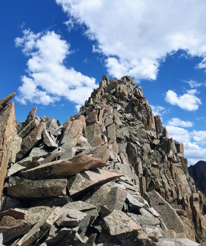
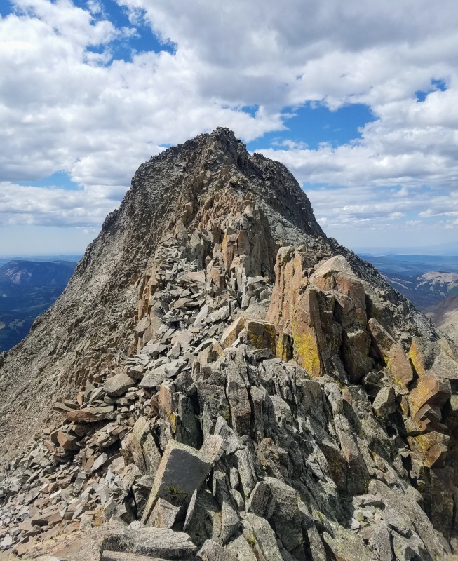
Another look down from near the headwall.Exiting the North Slope.Climbing towards the ridge.Ridge proper and El Diente.Large pillar on the ridgeDescending pillarA look down the North Slope from above the headwall on the ridge.
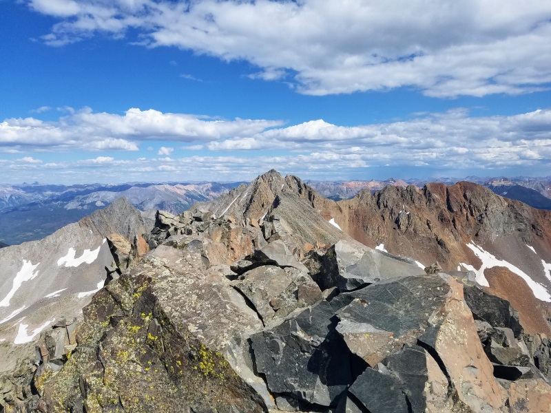
The rest of the climb went smoothly and we quickly reached the top. It had taken much longer than planned, but we were happy to summit despite the challenges we encountered because of our poor planning.
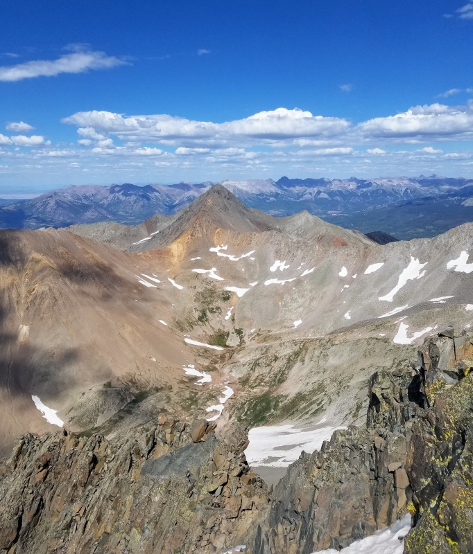
El DienteA look backGully on south side leading back to the ridge.Climbing to the notch on the north side.Just below the summit.Summit!Wilson Peak
At the summit, the decision was made to forego the traverse and return to our camp. This route had taken much longer than expected and we just didn't think we had the time. There really was no other good way though for us to get back to Navajo Lake. After ruling out the traverse we descended the South Slope and then had a really bad idea to bushwack around the base of El Diente. This took forever and I definitely don't recommend it. We made it though, but since it was after dark we camped another night and returned to our vehicles the next morning.
3 days wasted on El Diente was not ideal for finishing my weekend warrior project. This was especially true since I would be climbing El Diente again with the traverse, but I had every weekend already booked with other climbs until the middle of October. Luckily though, we had a beautiful fall, the snow came late and I got the El Diente to Wilson traverse done and finished my project.
Thumbnails for uploaded photos (click to open slideshow):
Imo this route w/o snow is the worst standard 14er route in the state, and it sounds like the snow made it harder since you didnt have crampons. Well done on a beautiful mountain. Thanks for a good report and be safe!
Loved this report, great job and congratulations. Very useful info.
Caution: The information contained in this report may not be accurate and should not be the only resource used in preparation for your climb. Failure to have the necessary experience, physical conditioning, supplies or equipment can result in injury or death. 14ers.com and the author(s) of this report provide no warranties, either express or implied, that the information provided is accurate or reliable. By using the information provided, you agree to indemnify and hold harmless 14ers.com and the report author(s) with respect to any claims and demands against them, including any attorney fees and expenses. Please read the 14ers.com Safety and Disclaimer pages for more information.
Please respect private property: 14ers.com supports the rights of private landowners to determine how and by whom their land will be used. In Colorado, it is your responsibility to determine if land is private and to obtain the appropriate permission before entering the property.


")
")
")
")
")
")
")
")
")
")
")
")
")
")
")
")
")
")
")
")
")
")
")
")
")
")
")
")
")
")