| Report Type | Full |
| Peak(s) |
Torreys Peak - 14,272 feet |
| Date Posted | 06/24/2023 |
| Date Climbed | 06/17/2023 |
| Author | 123tqb |
| A King (or rather, Emperor) Line |
|---|
|
A King (or rather, Emperor) Line
To be completely honest, the crux of the day was the 4x4 road on the way up Grizzly Gulch. Evan and I had camped on the Stevens Gulch road the night before, which was terrific considering our still-early wake up time of 3:30. Cob met us down in Bakerville, and together we headed up the road, which I'm glad we had Evan's Jeep for. There were some tricky sections, mostly up towards the trailhead, but most of the challenge was that the road was pretty muddy. We started our (minimal) approach at about 5:30 with an optimistic outlook. 
The river crossing was the second crux of the day, all before we even touched any snow! The logs were pretty icy from the freeze the night before, so it was careful treading across the makeshift bridge. Of course, the snow wasn't too far away, and we were standing in refrozen avy debris before we knew it. There was one party ahead of us, taking some photos of the mountain goats off in the rocks to climber's left. 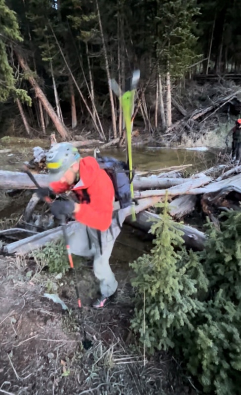
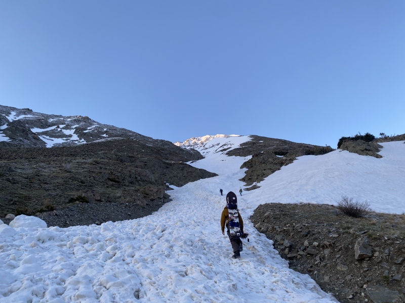

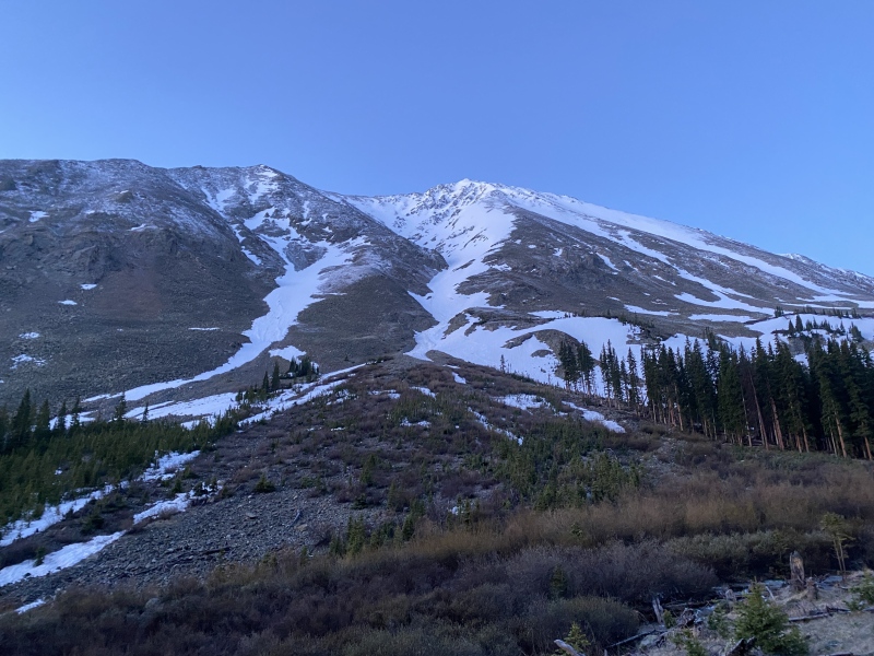
The snow was good for climbing, and there were already some steps put in by the group ahead of us, so progress was quick. Before long we caught up with the guys ahead of us, and offered to break trail for a bit. We kicked steps up until about halfway up the couloir, where we decided to take a snack break and discuss our options for ascent and descent. Talking with the other guys, they recommended going up and right, where we'd catch a ridge (~13,600') that lead to the summit. 

We switched off leads for the climb, eventually reaching the ridgeline. The steepness of the climb was probably about 45°. The weather so far had been bluebird, although we knew that'd change later in the day. As I headed up between the rocks and the snow, the clouds blew in, bringing us from as perfect as it can get to whiteout in a matter of seconds. Seeing the storm roll in from Summit County I hadn't seen any lightning, and there wasn't any precipitation at first, so we figured it was probably safe to continue. 


We made it to the summit at about 9:30, where we decided to take a good rest, eat some food, drink some water, and take what must be one of the douchiest photos of all time. By the time we were about to leave, a hiker had summited ("no don't go that way, there's only steep couloirs and scrambling that way, go back towards the saddle please!") and another party of skiers had arrived from Emperor. The party originally ahead of us let us go first, so we skied over to the top of the couloir from the summit. It was about here that we dropped one of our walkie talkies, which ended up in the hands of Wildernessjane all the way over in Tuning Fork two days later! We skied down in pretty tough visibility, but the snow was AWESOME! Powder? In June? What a year! 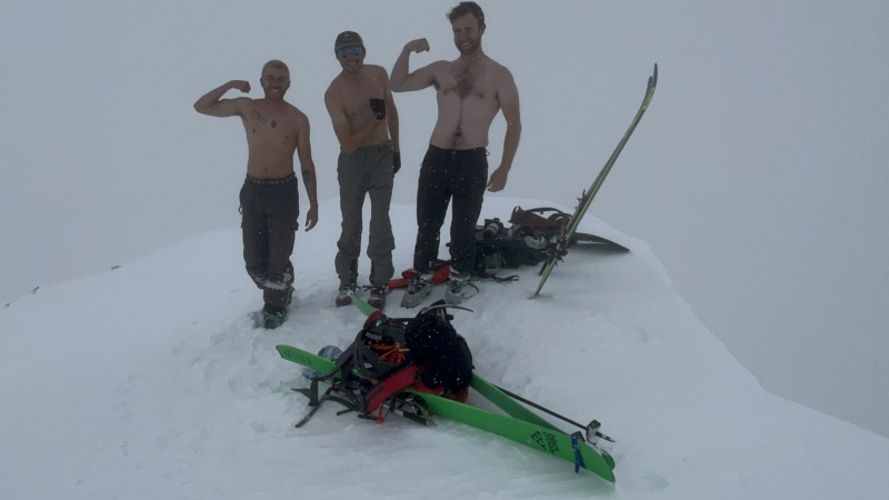


We were back to the car by 10:30. The snow towards the bottom had gotten gloppy, but overall an absolute blast of a ski line! This'll be a day to remember for sure. Thumbnails for uploaded photos (click to open slideshow): ")
")
")
")
")
")
")
")
")
")
")
")
")
")
")
|
| Comments or Questions |
|---|
|
|
Caution: The information contained in this report may not be accurate and should not be the only resource used in preparation for your climb. Failure to have the necessary experience, physical conditioning, supplies or equipment can result in injury or death. 14ers.com and the author(s) of this report provide no warranties, either express or implied, that the information provided is accurate or reliable. By using the information provided, you agree to indemnify and hold harmless 14ers.com and the report author(s) with respect to any claims and demands against them, including any attorney fees and expenses. Please read the 14ers.com Safety and Disclaimer pages for more information.
Please respect private property: 14ers.com supports the rights of private landowners to determine how and by whom their land will be used. In Colorado, it is your responsibility to determine if land is private and to obtain the appropriate permission before entering the property.

