| Report Type | Full |
| Peak(s) |
Mt. of the Holy Cross - 14,007 feet |
| Date Posted | 07/12/2023 |
| Date Climbed | 07/11/2023 |
| Author | bagelbattalion |
| 14er #1 - Owner of a Lonely Odyssey |
|---|
After my recent graduation from college and the realization I had not summited a single 14er in the entirety of my youth living in Eagle County, I decided now was the time to change that before I moved off to a far away city. Mount of the Holy Cross, looming in Eagle County all the while I was growing up, seemed like a good place to start. After some extensive digging around 14ers.com, the r/14ers reddit, and any additional beta I could get on YouTube, I settled that it would be exactly the challenge I needed to end off my summer trip home. Having just completed trips with long hiking mileage to Acadia, Shenandoah, the Smokies, Bryce, and Zion, I felt up to the task. So on the morning of July 11th, at 4:00am, I clambered into the only vehicle available to me for the day trip - a 2006 Honda Odyssey with 285,000 miles to its name. This beast has seen pretty much every road in Colorado that it can remotely get its wheels on, so I had to imagine the 2WD Tigiwon/Notch road would be no great challenge to it. As I headed down I-70 towards Minturn, Owner of a Lonely Heart by Yes popped on the speakers. This ended up quite fitting as I was the only car on the road at the time and thankfully was not holding anyone up as I slowly maneuvered the Odyssey up to the trailhead - it was go time. 
Heading up and over Half Moon pass (for what would be the first, and easier time of the day) with the sun coming up on my back felt truly great - the Holy Cross Wilderness is just another gem in White River National Forest's collection and a reminder of the abundance of adventure I had grown up in. Morale was high as I crested the top of the pass and now had some downhill trail to take care of. 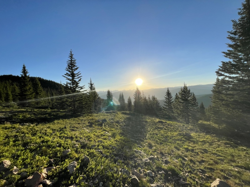

After passing (what I believe to be) a snowshoe hare and a few swift pika, I rounded the corner of the trail on the Half Moon descent to get my first glimpse of the day's goal - the summit bathed in the morning light in all its glory. Walking just a bit further, the waterfall emerged into view below, and I stopped to take it all in. 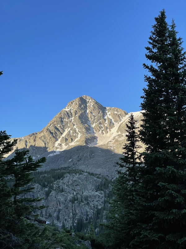

It was just after this point that I was first introduced to the infamous Half Moon switchbacks. I actually don't have any pictures of them to share unfortunately, as on the descent I was giddy to get down and started on the other side of cross creek, and on the re-ascent later...well I wasn't exactly in picture-taking mode that late in the game. Despite the grade and number of them, I wasn't yet thinking of the fact I would have to go back up them - we'll chalk that up to living in the moment! I arrived at the creek crossing and the camping information sign at the bottom of the pass (I've included a picture for people interested in splitting the trip), and saw that 4 of the 10 campsites were occupied as I passed through. The creek crossing was no big issue and would have been easier with a walking stick/some trekking poles. Thinking balanced thoughts, I made my way across the log which looks somewhat precarious, but is actually very stable when you're on it. There are a few rocks that you could step a foot onto as you cross should you lose your balance, but your foot will go a little into the water. Having said that, this was not a scenario or time in the season where it seemed necessary to bring water shoes/wade through. Having now crossed, I began to ascend through a very buggy section of the forest past the final campsite. 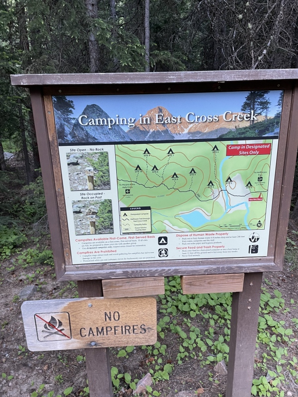

Motoring up through the woods with a quick stop for a snack and bug spray, I broke tree line. It was great relief to no longer be swarmed when stopping for longer than about 10 seconds - mosquitos were pretty persistent for most of the time within the trees today. I took some time to look back on where I'd come from before beginning the start of what would be a pretty long trek up the ridge. One big shoutout here to CFI (I believe they're the all-stars who were behind this) for an outstanding job building this trail, especially from the ridge onwards. The steps are clear and there are many large cairns to keep you on track and heading in the right direction. 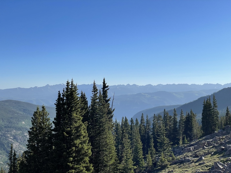
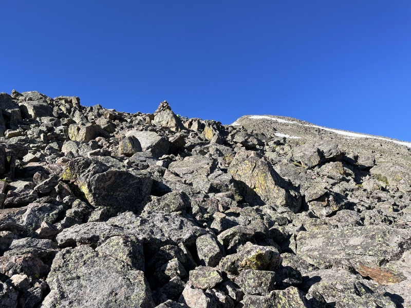
Slowly but surely, I worked up through the rocky ridge, spotting more pika and a few marmots. The trail as mentioned is very well kept and is about 99% uncovered in snow, save one section towards the last segment when you're on the ridge. Skirting it was no issue and you rediscover the trail after what could not have been more than 100 or so feet. Winding up the ridge, I got my first glimpse again of Mount of the Holy Cross ahead, and it renewed my energy. 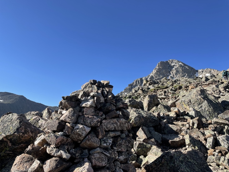
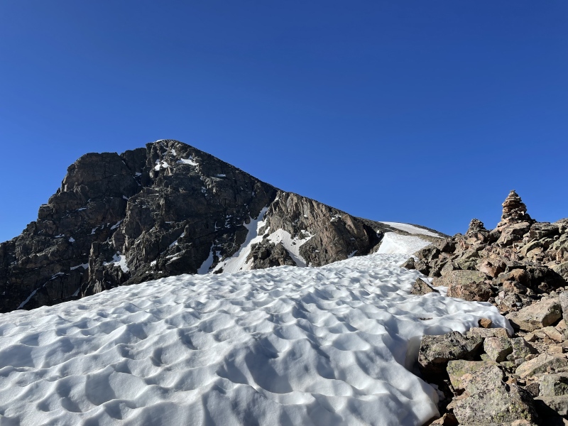
I continued along the ridge which provides stunning views in nearly every direction. Up to your left will be Notch Mountain - I couldn't quite make out anyone in the process of doing Halo Ridge, but heard some people discussing it once I made it to the top. At a little over 13,400 feet, I put on my shell layer as the wind was becoming a little more than breezy. Up to this point however it really was not warranted, and after adding it the wind was not causing any issues. This was also about the same time I came to the start of the final ascent up the ridge. 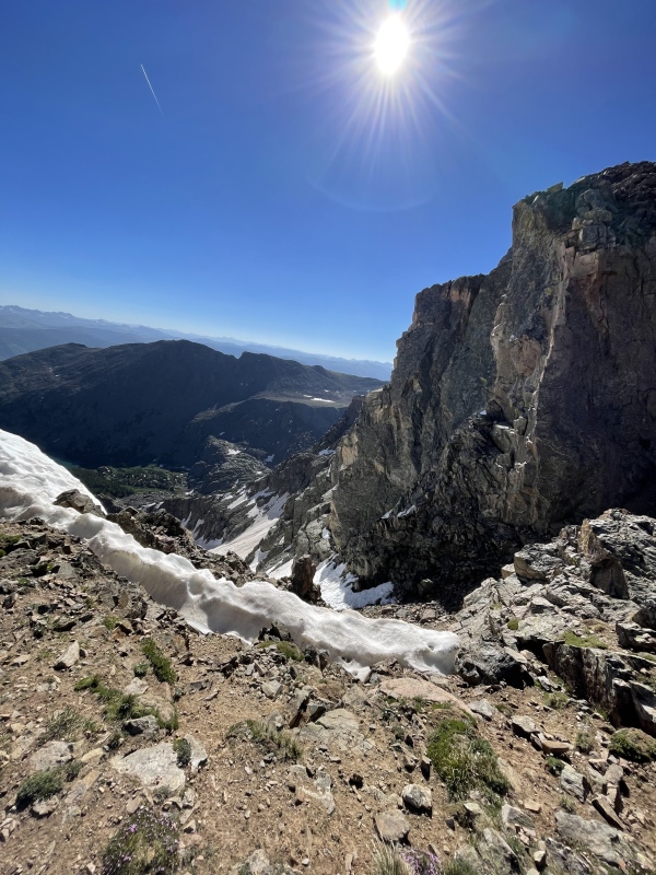
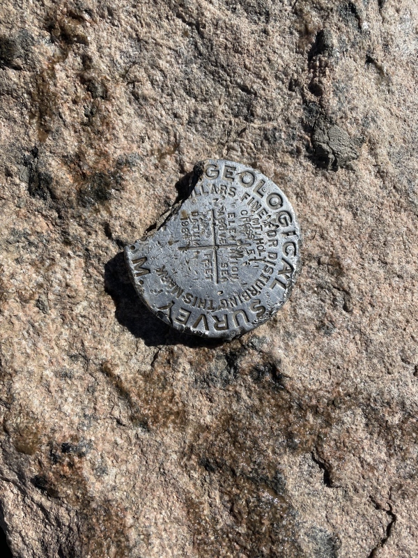
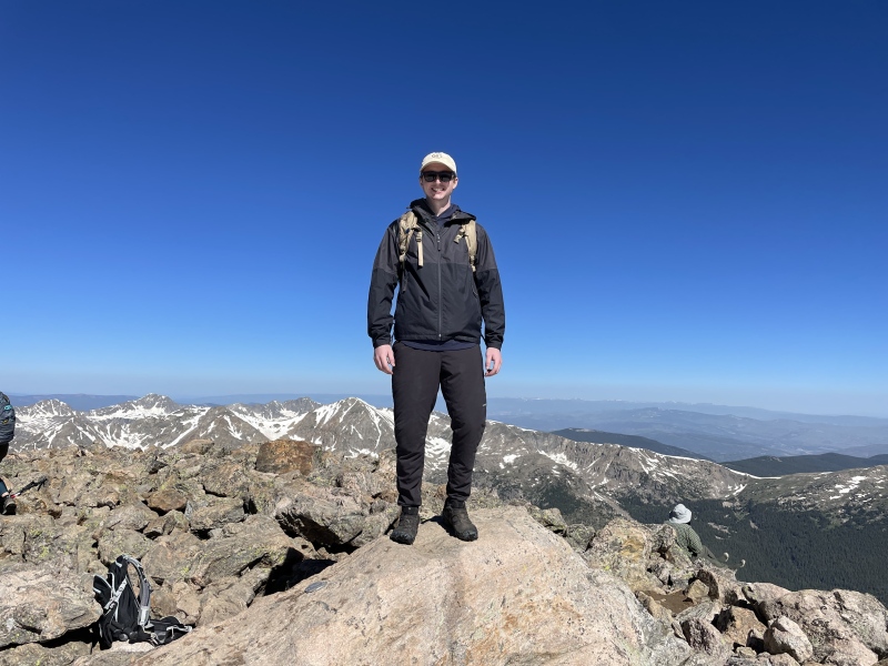
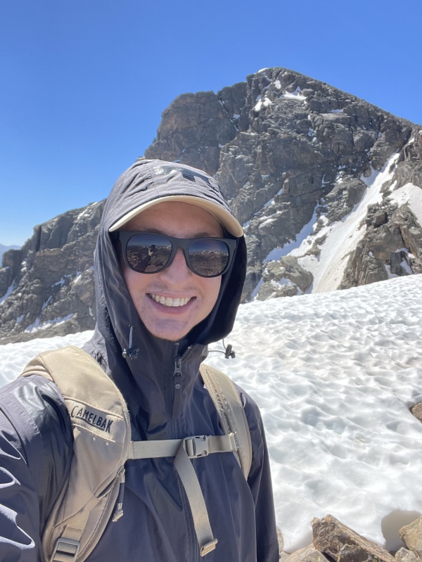
Unfortunately this is another section I don't have pictures of as I had tunnel vision for the top. Like the rest of the trail, CFI has installed very visible cairns (at this stage, they have tall wooden branches sticking up for increased visibility) to guide you towards the top. What I had read online was reinforced - while you can follow these cairns, at a certain point it also becomes a bit of "choose your own adventure" as the trail disappears, and you can add more or less scrambling depending on your desire. Shoutout to one of the hikers I passed who was on his way down that told me I could save a little time by going a bit more direct rather than weaving towards each cairn - this proved correct, was fun, and did not put me too close to the edge. And before I knew it, I came up over one last rock and was at the top! To be honest, I think it took quite a bit to register I had made it and was on the top. While it is no Capitol, Maroon, or Longs, I was hit with a mixture of accomplishment, satisfaction, and gratuity. I summited at approximately 9:40am, so it took a little under 4 hours for me to make it. I took plenty of time to take in the 360 views, spotting the Elk range with the Bell's distinctive silhouette, and to enjoy a well-earned snack. I found the geological seal, and was thankful to have my picture taken by a really nice group of hikers to mark the memory as I was hiking solo. 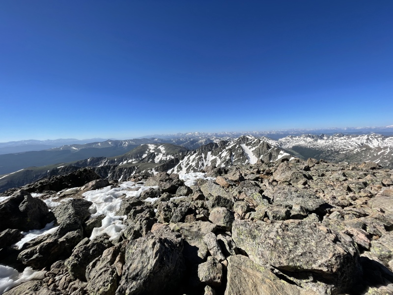
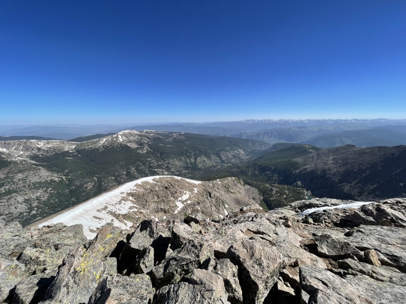

After taking it all in and realizing there was never going to be a time where I would have been fully satisfied with leaving the view, I departed the summit at about 10:15am. I took a similar approach down to the ridge, focusing on aiming towards the cairns rather than always trying to find the trail, and this worked just fine as I rejoined the trail on the ridge line and began to work back down where I had come from. 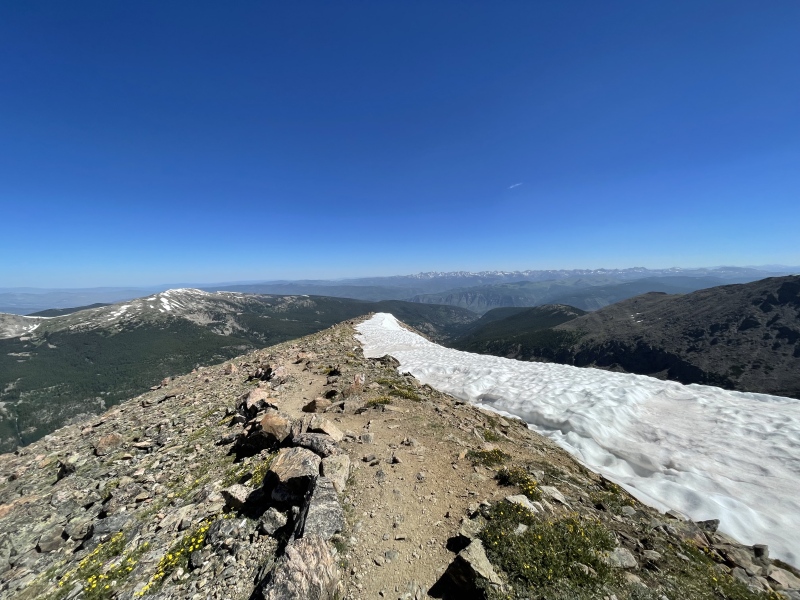
From this point on, you're following the same trail back down to East Cross Creek. While the legs were beginning to take a beating, the views and occasional marmot sighting kept that out of mind until I once again hit tree line to descend towards East Cross Creek. Having once again completed the crossing successfully, it was time to regain the elevation on Half Moon - the segment that was the point of most focus when I had been preparing. It turns out, this is for good reason. Having forgotten just how far I had descended that morning, it didn't take long for the switchbacks to become an all out grit session. Suddenly I had been transported back to the Wall Street switchbacks in Bryce - only this time I wasn't dodging tourists in impractical footwear, and it was not 100 degrees. Taking it about 2 switchbacks at a time moderated the beating, but I was certainly being humbled at this point - there's "in-shape" and there's "in 14er-shape." This was the crux of the day's type 2 fun, and I'm laughing about it while writing this up. At the time I was mentally begging for each switchback to be the last, but once I was back on the road, I was already scheming about which 14er I could attempt next, and when. Once the switchbacks are completed, the grade mostly moderates for the rest of the climb back up Half Moon, save a few segments that kick up for no more than under a tenth of a mile. I took one last look back at Mount of the Holy Cross for the day as I rounded the corner and it fell out of sight. The rest of the hike is straightforward like the start, and once you've crested the top of the pass, it is downhill once again to the trailhead. I arrived with sore legs but an over the moon (no pun intended) attitude at 2pm on the dot, making it a roughly 8 hour day. 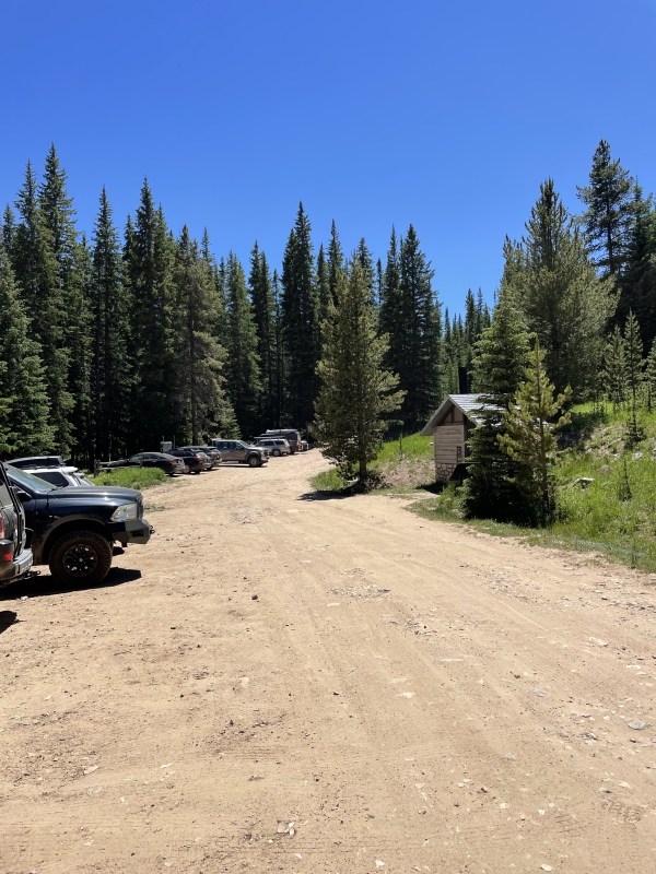
It was once again time to clamber into that Honda Odyssey and head back down Tigiwon to be on my way. The moment I stepped back into the car, all the struggles of the elevation regain gave way to the excitement of having completed the journey - what a fun day it was. Maybe it was the mosquitos or maybe it was the experience, but the 14er bug finally bit me after all these years and I'm excited to be back out on the trail soon - after bagging some more peaks and getting some more experience, I could see Halo Ridge being a goal for a fun return back to Mount of the Holy Cross. If you read this far, thanks for coming along on the journey for 1/58! Thumbnails for uploaded photos (click to open slideshow): ")
")
")
")
")
")
")
")
")
")
")
")
")
")
")
")
")
")
")
")
|
| Comments or Questions | |||||||||
|---|---|---|---|---|---|---|---|---|---|
|
Caution: The information contained in this report may not be accurate and should not be the only resource used in preparation for your climb. Failure to have the necessary experience, physical conditioning, supplies or equipment can result in injury or death. 14ers.com and the author(s) of this report provide no warranties, either express or implied, that the information provided is accurate or reliable. By using the information provided, you agree to indemnify and hold harmless 14ers.com and the report author(s) with respect to any claims and demands against them, including any attorney fees and expenses. Please read the 14ers.com Safety and Disclaimer pages for more information.
Please respect private property: 14ers.com supports the rights of private landowners to determine how and by whom their land will be used. In Colorado, it is your responsibility to determine if land is private and to obtain the appropriate permission before entering the property.


