Download Agreement, Release, and Acknowledgement of Risk:
You (the person requesting this file download) fully understand mountain climbing ("Activity") involves risks and dangers of serious bodily injury, including permanent disability, paralysis, and death ("Risks") and you fully accept and assume all such risks and all responsibility for losses, costs, and damages you incur as a result of your participation in this Activity.
You acknowledge that information in the file you have chosen to download may not be accurate and may contain errors. You agree to assume all risks when using this information and agree to release and discharge 14ers.com, 14ers Inc. and the author(s) of such information (collectively, the "Released Parties").
You hereby discharge the Released Parties from all damages, actions, claims and liabilities of any nature, specifically including, but not limited to, damages, actions, claims and liabilities arising from or related to the negligence of the Released Parties. You further agree to indemnify, hold harmless and defend 14ers.com, 14ers Inc. and each of the other Released Parties from and against any loss, damage, liability and expense, including costs and attorney fees, incurred by 14ers.com, 14ers Inc. or any of the other Released Parties as a result of you using information provided on the 14ers.com or 14ers Inc. websites.
You have read this agreement, fully understand its terms and intend it to be a complete and unconditional release of all liability to the greatest extent allowed by law and agree that if any portion of this agreement is held to be invalid the balance, notwithstanding, shall continue in full force and effect.
By clicking "OK" you agree to these terms. If you DO NOT agree, click "Cancel"...
Peaks: Little Bear Peak, Blanca Peak, Ellingwood Point
Route: Little Bear NW Face, Little Bear-Blanca Traverse, Blanca-Ellingwood Traverse, Ellingwood South Couloir
Mileage: 4.8mi from Lake Como, 8.2mi from Jaws 1
Vertical: 3400ft from Lake Como, 4700ft from Jaws 1
Time: 9.5hrs from Lake Como
Partners: Cob, Max, Kyle
I was super glad Cob invited me along on this trip, as I'd been meaning to do the Little Bear-Blanca Traverse for a while now. I have had strong feelings about the Hourglass ever since first hearing about it, and I wanted to avoid climbing it at all costs. I'm sure it's not nearly as dangerous as I've heard, but from the few horror stories and accidents I've read into, it wasn't something I really wanted to even consider.
So I suggested we do a harder, just-as-loose alternative route on the Northwest Face! The benefit to this route would be, hopefully, that it would be traffic-free, and thus no dinner-plate-sized rocks would be hurled at our faces while we were climbing. Plus, getting to do more Class 5 climbing is always a benefit in my mind.
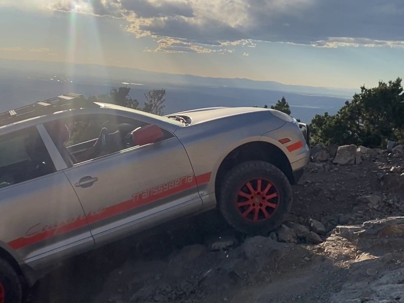
Cob and I started our drive down to the San Luis Valley from A-Basin, where we had just gotten off work. Max and Kyle carpooled from Boulder to meet us. Our timings ended up being a bit different, so Cob and I headed up the Lake Como Road as soon as we arrived. His Porsche Cayenne did amazingly well on the 4x4 portions of the road, and we made it all the way to Jaws 1 before deciding we didn't want to risk breaking the car! That road is seriously rough, I wouldn't consider driving it unless I were in an ATV really...
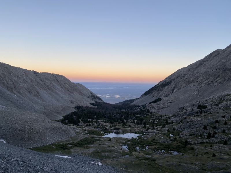
Not only is the 4x4ing fun, but the views are SO COOL!
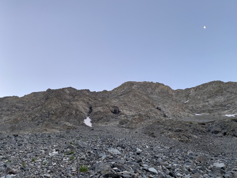
We hiked the remaining 1.7mi to our campsite at Lake Como, where Cob and I set up our tent and proceeded to go to bed. Max and Kyle arrived sometime around 23:00 if I remember correctly, but all that matters is that, when we woke up, we were all in the same spot. Our wake-up time was set for 4:30 to give us enough time for breakfast and water before we headed up for the day. We started actually hiking around 5:00.
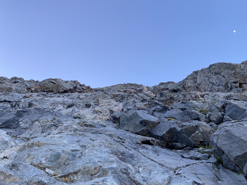
The view of Little Bear from the "road."
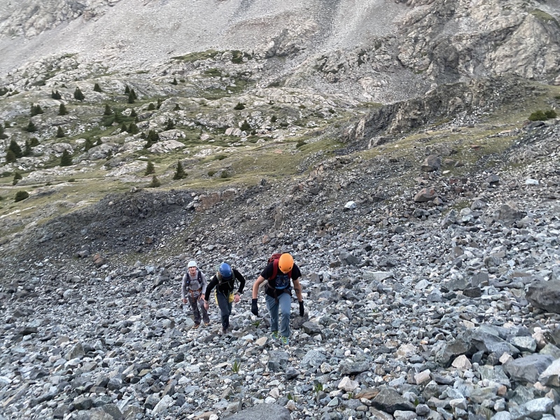
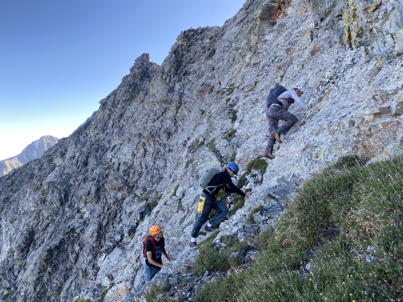
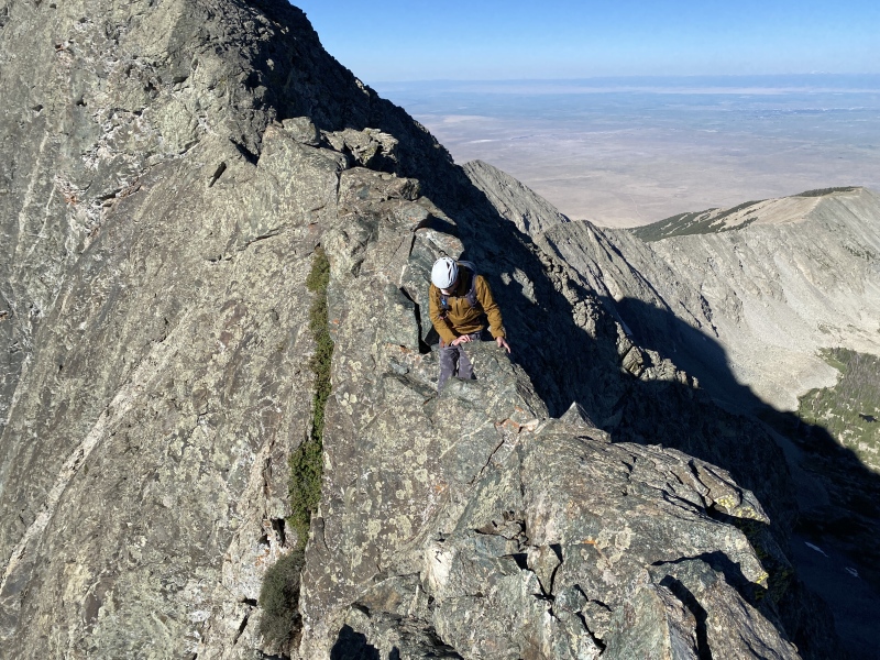
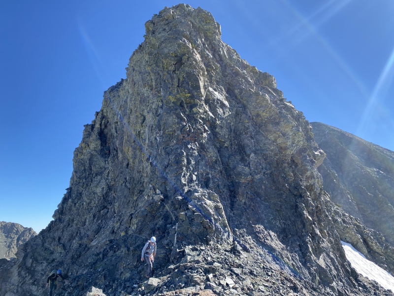
We could see the "Black Hand" from the road, so when we felt like we were close enough we left the road and cut straight up towards it. The scree field was fairly loose, but manageable if we just kept out of each others' fall zones. Before long we were at the base of the climbing, and had to pick a spot to start. I had read a report that mentioned starting to climber's right of the "Black Hand," so we found a left-facing corner that looked to be 5.easy climbing and went for it. It turned out to be exactly that, so we continued. The route-finding was never very hard, in my opinion.
Headed up the loose-ish scree field from the road.The "Black Hand" is in the middle of the photo here.Gorgeous view back down into the San Luis Valley.Traversing from the "Black Hand" to the corner where we started climbing. Ellingwood Point in the background.The view up the corner we started climbing.
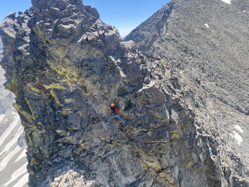
The only hiccup in our progress was when we reached a spot where Max was climbing right above Cob and I, where he told he us it was probably a good idea to spread out and keep out of the fall line. Not a second after he said this, he pulled off a microwave-sized block right into Cob's face! Luckily Cob acted quick and jumped out of the way moments before disaster (the infamous "microwave incident"). A little shaken up, but still confident, we kept on climbing. The first Class 5 portion (which turned out to be the crux) was over once we reached a bit of a ledge, where we traversed climber's left.
Max and Cob, with the crux below us.Traversing from the top of the first Class 5 section to the next corner.
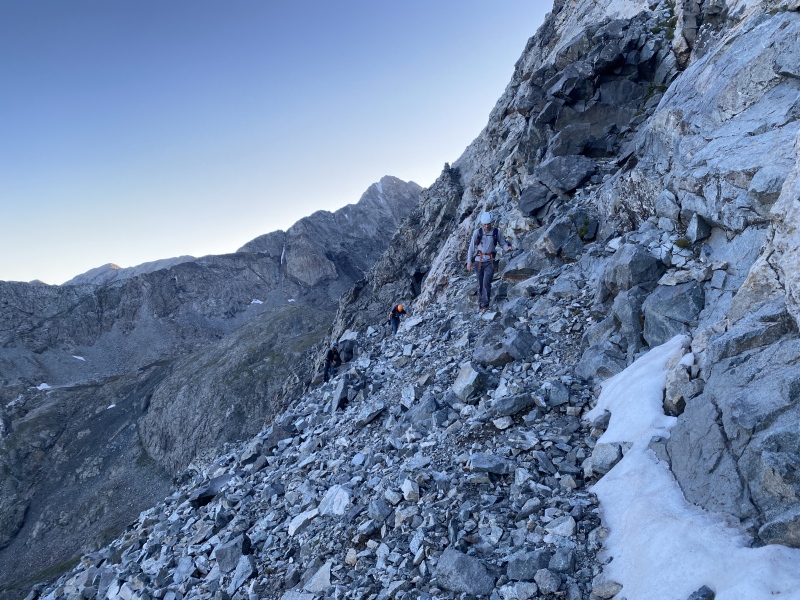
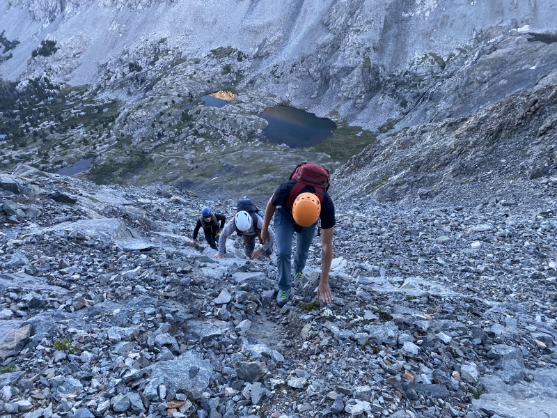
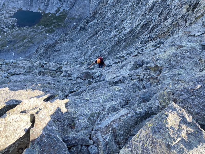
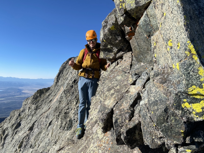
There was one more right-facing, Class 4 corner to climb before we reached the big drainage that leads up to the ridge. This was mostly Class 3 or Class 4 climbing, and as long as we were careful about our steps the majority of the rock stayed pretty much where it was. To exit the drainage there was a bit more easy Class 5, which brought us to the ride crest and the Class 4 headwall leading up to the summit of Little Bear. We summitted at 7:30.
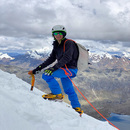
We followed easier ground, aiming for the notch between the summit (right) and the first tower of the traverse (center-left).Moving up the drainage.Just about time to start the final Class 5 pitch to the ridgeline.Cob on our last bit of Class 5 before the summit.A fellow climber starting the traverse, Blanca on the right and Ellingwood Point on the left.Last little bit of Class 4.Cob looking tiny compared to the monstrous Little Bear-Blanca Traverse.
We ate a snack, drank some water, and threw on some more sunscreen, then headed back down what we had just come up. In my opinion, the headwall downclimb was really not that bad, but that could be because we had just done much harder. The first tower, and with it the first difficulty, came fast. The exposure was terrific and terrifying, both at once. Luckily, the rock already seemed to be bomber, and it remained that way for the entire route.
Max and Kyle starting over the first tower.Cob's foot right on the edge of a 1000' cliff!
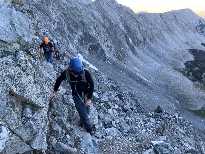
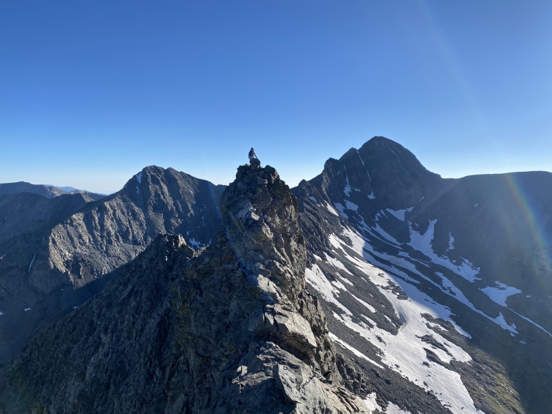
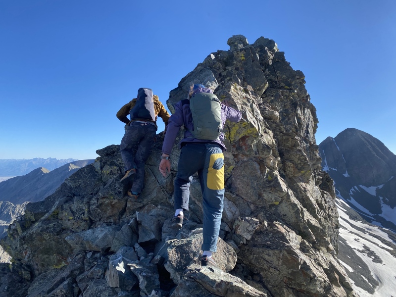
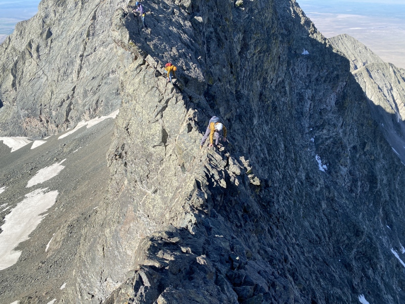
Cob told us to keep going ahead so he could snap some photos, so we added some distance between us. Despite the numerous Class 5 difficulties, the gang seemed to have little problem with them. I certainly didn't think any of them were harder than 5.2, in fact probably none were more difficult than 5.0 if you asked me. The ridge is super straightforward for the most part. We had to dip left at Captain Bivwacko Tower (which should be pretty obvious to anyone trying the route for the first time, since it's the first time you have to leave the ridge proper), but otherwise kept true to the ridgeline.
Max negotiating one of the various knife-edges.Cob catching up, with Captain Bivwacko Tower on the right.
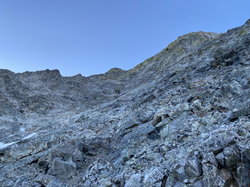
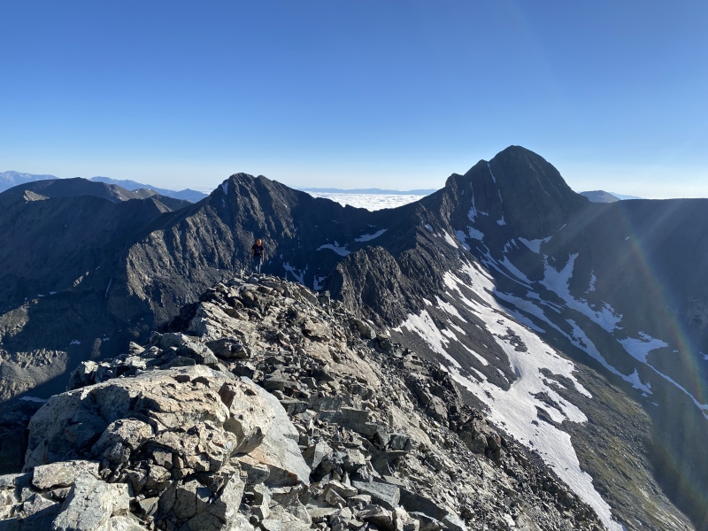
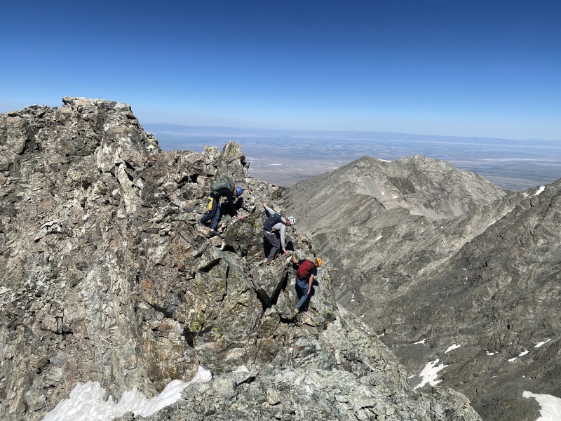
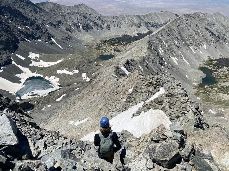
Difficulties came and passed, with an exposed Class 5 move or two, until we eventually came to a huge gendarme that we clearly would not be climbing over. Initially, we dropped to the left to get around it, but found out quick that we would be cliffed out if we continued. We retraced our steps and went right around it instead, now finding cairns and trails again. This led up to another large gendarme, one which would be just some Class 3 to climb up directly. At the top of this false summit, we took our final snack break before completing the traverse and going up Blanca.
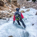
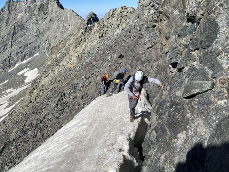
Exposure!Coming back to go around the other side.The only real snow of the route was found on easy ground, thankfully.
What remained was the catwalk, which lived up to its name for being airy and requiring careful steps. At this point the traverse was over and we could now scramble the rest of the way to the summit of Blanca.
Done at last!
The boys were feeling a bit tired at this point, understandably. I suggested that I might want to tack on Ellingwood Point, since we were already right there, and Kyle concurred. Reluctantly Max and Cob gave in to the FOMO and agreed to do just one more traverse. We tried as best as possible to stick to ridge proper, until we pretty much no longer could. There was one pretty hard section (definitely not Class 3) that we ended up doing, but otherwise it was a cake walk after all we'd been through. We summitted one last time and discussed our options. Kyle mentioned that he had heard there was a route down the southwest ridge of Ellingwood Point, and it seemed to go exactly where we were headed anyways, so we took it down.
Down Blanca and up just one more peak.Um yeah, definitely not Class 3.All done!
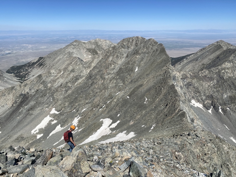
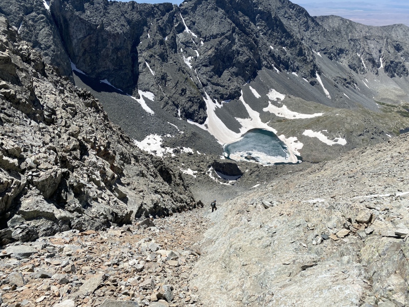
We started down the ridge to find that it was less easy than we imagined. We were already this far down, though, so might as well commit (come on guys, make better decisions)! We came across the first couloir and decided, hey, this doesn't look so bad, so we went down it. Poor decision abound. We sucked it up, nearly got annihilated by a few flying rocks, and trudged down the scree on the side of the couloir. Overall I would not recommend this as a descent. We did eventually make it to the bottom, really beat down and ready to be back at the cars.
This ridge is steeper than we thought. And we'd have to cross snow. Not fun.Kyle cruising down next to the South Couloir.Home free! The trail is right below us.
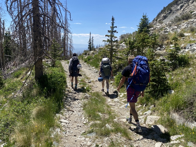
We hiked on back to camp, took a refreshing dip in Lake Como, packed up, and headed out. What a helluva day in the mountains!
The hike out, hot and tired.Taken from SummitPost (summitpost.com), this is the exact route we took up the NW Face of Little Bear.
Thumbnails for uploaded photos (click to open slideshow):
...about the porsche. I routinely mock those vehicles' off road prowess. That ride blew my mind.
The rest of your report impresses, too. Nice day!
How cold was Como? Props for getting in the swim.
No matter how much 4th and 5th class routes I do in the Elks, San Juans, and everywhere else, I still remain in awe of this ridge. I hope I one day possess the skill set and confidence to tick it off the list. Well done.
The hourglass isn't bad, but your route looked like a grand alternative.
@Camden7 from what I've seen in your reports you've absolutely got the skills. Sure it's exposed and scary but super solid rock and not all that hard for a trained alpinist like yourself!
Caution: The information contained in this report may not be accurate and should not be the only resource used in preparation for your climb. Failure to have the necessary experience, physical conditioning, supplies or equipment can result in injury or death. 14ers.com and the author(s) of this report provide no warranties, either express or implied, that the information provided is accurate or reliable. By using the information provided, you agree to indemnify and hold harmless 14ers.com and the report author(s) with respect to any claims and demands against them, including any attorney fees and expenses. Please read the 14ers.com Safety and Disclaimer pages for more information.
Please respect private property: 14ers.com supports the rights of private landowners to determine how and by whom their land will be used. In Colorado, it is your responsibility to determine if land is private and to obtain the appropriate permission before entering the property.


")
")
")
")
")
")
")
")
")
")
")
")
")
")
")
")
")
")
")
")
")
")
")
")
")
")
")
")
")
")
")
")
")
")
")
")
")
")
")
")