Download Agreement, Release, and Acknowledgement of Risk:
You (the person requesting this file download) fully understand mountain climbing ("Activity") involves risks and dangers of serious bodily injury, including permanent disability, paralysis, and death ("Risks") and you fully accept and assume all such risks and all responsibility for losses, costs, and damages you incur as a result of your participation in this Activity.
You acknowledge that information in the file you have chosen to download may not be accurate and may contain errors. You agree to assume all risks when using this information and agree to release and discharge 14ers.com, 14ers Inc. and the author(s) of such information (collectively, the "Released Parties").
You hereby discharge the Released Parties from all damages, actions, claims and liabilities of any nature, specifically including, but not limited to, damages, actions, claims and liabilities arising from or related to the negligence of the Released Parties. You further agree to indemnify, hold harmless and defend 14ers.com, 14ers Inc. and each of the other Released Parties from and against any loss, damage, liability and expense, including costs and attorney fees, incurred by 14ers.com, 14ers Inc. or any of the other Released Parties as a result of you using information provided on the 14ers.com or 14ers Inc. websites.
You have read this agreement, fully understand its terms and intend it to be a complete and unconditional release of all liability to the greatest extent allowed by law and agree that if any portion of this agreement is held to be invalid the balance, notwithstanding, shall continue in full force and effect.
By clicking "OK" you agree to these terms. If you DO NOT agree, click "Cancel"...
We left Denver around 4pm, and GPS quoted us to arrive around 10, but we arrived to the TH around 9:30pm.
We took Monarch Pass out to Parlin and then South on CO-114 (I was very impressed since half the road going in was freshly paved - beautiful drive with the sunset!)
There were lots of hairpins and some bumps, but it was a very easy road to travel on; I am confident most any clearance car could make it. There were two small creek crossings with concrete built in to help vehicles over. Even with all the precipitation we have had this spring, the water depth was only a few inches.
I had read somewhere that people can camp at the trailhead, but we did not think there was ample space. We chose to camp 1/4 mile down the road at the Eddiesville Trailhead, which offered a large field, fire pit and 2 pit toilets.
The hike:
We started at 6:30am at the Stewart Creek Trailhead and had a pleasant, steady climb for five miles along the creek. There were notes of fallen trees on the trailhead, and we encountered about a dozen or so fallen trees that require crouching and/or climbing over to continue on. The views were fantastic and so were the animal sightings - we saw a beaver, tiny garter snake, chipmunks, a ptarmigan and moose tracks! Nature is metal ð¤ð»
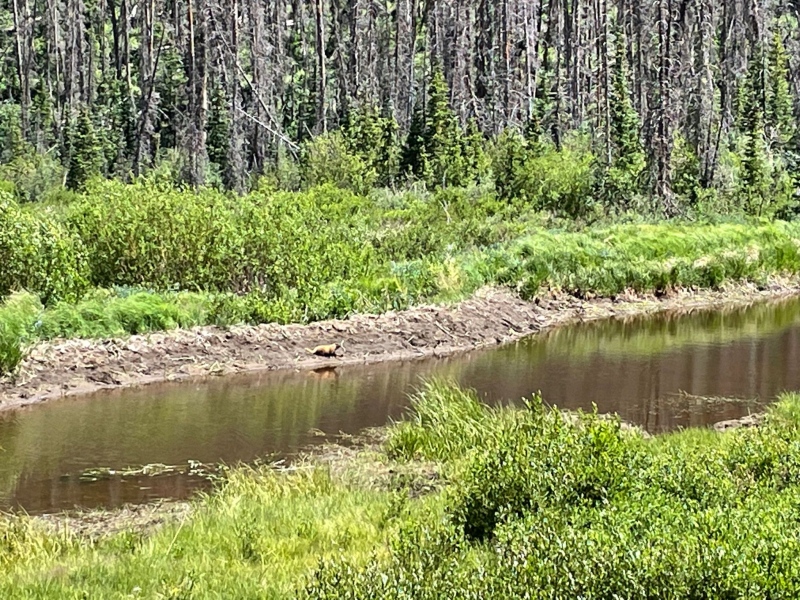
Beaver sighting at one of the many ponds
To note: the trailhead sign states the distance to San Luis Peak is 5.5 miles, however we logged the distance to the summit as ~6.8 miles with our Garmin.
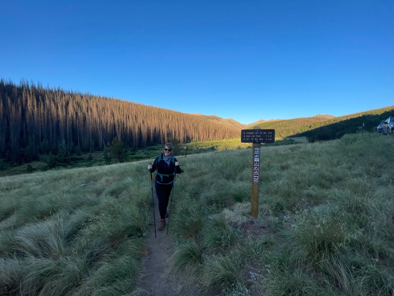
Steward Creek Trailhead
Starting at about five miles, we began our climb out of tree line. The grade became much steeper. The trail was well-maintained to the summit with imbedded stone steps in several places, and the trail was even visible through the talus. Earlier summer reports this year mentioned several snow fields but by late July we had none to cross.
The summit was surprisingly small! We met up with several folks who had hiked up the Southern approach (I have also done the southern approach, however the standard route is much more pleasant despite its longer length, IMO).
The weather was phenomenal, not a gray cloud in site… we had a great day!
Side note: Eddiesville Trailhead is right on the Colorado trail, so we had a chance to share donuts, beer and stories with several thru hikers. ð
Thumbnails for uploaded photos (click to open slideshow):
Comments or Questions
Caution: The information contained in this report may not be accurate and should not be the only resource used in preparation for your climb. Failure to have the necessary experience, physical conditioning, supplies or equipment can result in injury or death. 14ers.com and the author(s) of this report provide no warranties, either express or implied, that the information provided is accurate or reliable. By using the information provided, you agree to indemnify and hold harmless 14ers.com and the report author(s) with respect to any claims and demands against them, including any attorney fees and expenses. Please read the 14ers.com Safety and Disclaimer pages for more information.
Please respect private property: 14ers.com supports the rights of private landowners to determine how and by whom their land will be used. In Colorado, it is your responsibility to determine if land is private and to obtain the appropriate permission before entering the property.
")
")
")

