Download Agreement, Release, and Acknowledgement of Risk:
You (the person requesting this file download) fully understand mountain climbing ("Activity") involves risks and dangers of serious bodily injury, including permanent disability, paralysis, and death ("Risks") and you fully accept and assume all such risks and all responsibility for losses, costs, and damages you incur as a result of your participation in this Activity.
You acknowledge that information in the file you have chosen to download may not be accurate and may contain errors. You agree to assume all risks when using this information and agree to release and discharge 14ers.com, 14ers Inc. and the author(s) of such information (collectively, the "Released Parties").
You hereby discharge the Released Parties from all damages, actions, claims and liabilities of any nature, specifically including, but not limited to, damages, actions, claims and liabilities arising from or related to the negligence of the Released Parties. You further agree to indemnify, hold harmless and defend 14ers.com, 14ers Inc. and each of the other Released Parties from and against any loss, damage, liability and expense, including costs and attorney fees, incurred by 14ers.com, 14ers Inc. or any of the other Released Parties as a result of you using information provided on the 14ers.com or 14ers Inc. websites.
You have read this agreement, fully understand its terms and intend it to be a complete and unconditional release of all liability to the greatest extent allowed by law and agree that if any portion of this agreement is held to be invalid the balance, notwithstanding, shall continue in full force and effect.
By clicking "OK" you agree to these terms. If you DO NOT agree, click "Cancel"...
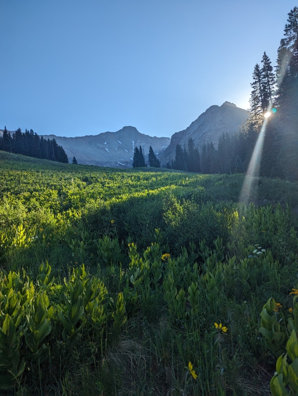
This was my first attempt of El Diente and my sixth fourteener. I hope my report will help others by adding some crucial information that I didn't see in other reports. I'd start out by saying the trail is relatively flat and very easy to follow until you reach the never ending talus field. There are several stream crossings before you exit the forest, but only the last one is a challenge keeping water from getting in over the tops of your boots. You do get some stunning views when you exit the forest.
View of El Diente (on left) as you exit the forest.
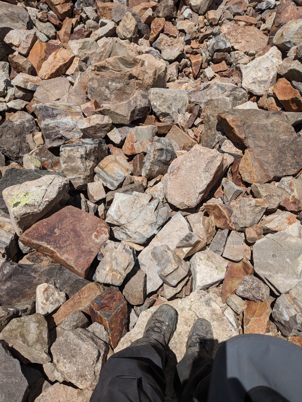
The trail becomes faint and then simply disappears. That wouldn't have been a problem if I had known where to hike and how far to hike before turning left to start my ascent of the summit. I made the mistake of staying too high in the talus field. Trying to pick my way through the larger talus was very time consuming.
Large talus. Don't repeat my mistake!
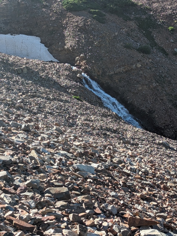
You should stay much lower where the rocks in the talus field are smaller and much easier to negotiate. Your pace slows considerably as you tediously pick your way through the talus. There is a small band of bushes in the middle of the talus field. You should keep below them to stay out of the large talus. You'll also see the Kilpacker creek waterfall on your right.
Kilpacker creek waterfall viewed from about 200 feet above.
Your path should be roughly parallel and within 50-75 yards of Kilpacker creek. My next mistake was turning left when I was about even with the waterfall. In talking with others who were coming down from the summit, I learned that the left turn shouldn't be made until far past the waterfall. I decided to head back to the trailhead at that point as the other hikers said there were two snowfields that had to be negotiated on your way to the summit and I had no crampons. So in summary, stay low and don't turn left until you are well past the waterfalls.
Thumbnails for uploaded photos (click to open slideshow):
Comments or Questions
Caution: The information contained in this report may not be accurate and should not be the only resource used in preparation for your climb. Failure to have the necessary experience, physical conditioning, supplies or equipment can result in injury or death. 14ers.com and the author(s) of this report provide no warranties, either express or implied, that the information provided is accurate or reliable. By using the information provided, you agree to indemnify and hold harmless 14ers.com and the report author(s) with respect to any claims and demands against them, including any attorney fees and expenses. Please read the 14ers.com Safety and Disclaimer pages for more information.
Please respect private property: 14ers.com supports the rights of private landowners to determine how and by whom their land will be used. In Colorado, it is your responsibility to determine if land is private and to obtain the appropriate permission before entering the property.
")
")
")

