Download Agreement, Release, and Acknowledgement of Risk:
You (the person requesting this file download) fully understand mountain climbing ("Activity") involves risks and dangers of serious bodily injury, including permanent disability, paralysis, and death ("Risks") and you fully accept and assume all such risks and all responsibility for losses, costs, and damages you incur as a result of your participation in this Activity.
You acknowledge that information in the file you have chosen to download may not be accurate and may contain errors. You agree to assume all risks when using this information and agree to release and discharge 14ers.com, 14ers Inc. and the author(s) of such information (collectively, the "Released Parties").
You hereby discharge the Released Parties from all damages, actions, claims and liabilities of any nature, specifically including, but not limited to, damages, actions, claims and liabilities arising from or related to the negligence of the Released Parties. You further agree to indemnify, hold harmless and defend 14ers.com, 14ers Inc. and each of the other Released Parties from and against any loss, damage, liability and expense, including costs and attorney fees, incurred by 14ers.com, 14ers Inc. or any of the other Released Parties as a result of you using information provided on the 14ers.com or 14ers Inc. websites.
You have read this agreement, fully understand its terms and intend it to be a complete and unconditional release of all liability to the greatest extent allowed by law and agree that if any portion of this agreement is held to be invalid the balance, notwithstanding, shall continue in full force and effect.
By clicking "OK" you agree to these terms. If you DO NOT agree, click "Cancel"...
Intro: Halfway through my doctorate in Organic Geochemistry on environmental and climatic changes across the K-T boundary, I took a 5 week detour to live on a ship (R/V Neil Armstrong) and go to Baffin Bay to study when and why the Greenland Ice Sheet retreated after the last ice age. This TR is (1) a brief chronolog of our scientific expedition and (2) a report about my sea kayak & 3rd class scramble of Nuuk's iconic island peak Sermitsiaq (3,910 ft) [means: a piece of ice] during my one day there after BADEX. Enjoy!
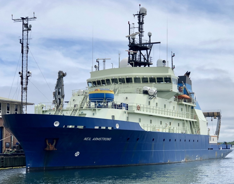
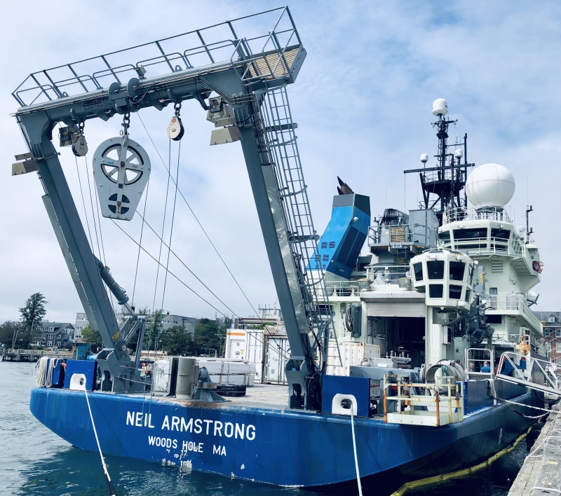
Neil Armstrong at Woods Hole, MA on July 10th, 2023. Ready for 34 days at sea and ~3000 nautical miles of exploration through Baffin Bay.
I've never met anyone aboard. ~21 in science party + 22 mariners.
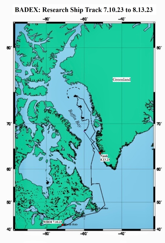
BADEX: The Baffin Bay Deglacial Experiment. I got the last berth on the R/V Neil Armstrong, a 238 ft long, state-of-the-arc science vessel based out of Woods Hole, MA. I found out exactly one month before departure that I was going! Our science mission was to map the seafloor and take extensive seafloor mud & water column samples in five regions from the Labrador Sea up through the eastern side of Baffin Bay (off the coast of W. Greenland).
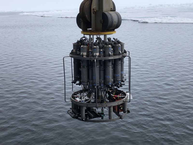
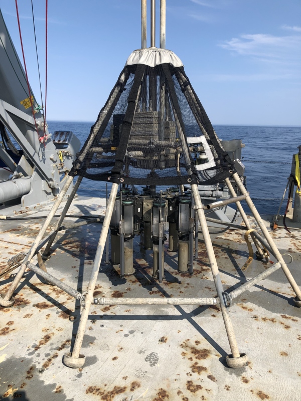
CTD sampler --> estimates temperature / salinity / chlorophyll profiles of the water column and collects water samples at assigned depths. Pumped ~ 100 L at each region, ran through a 300 nanometer glass filter, froze and saved for biomarker analyses later.
Multi-core sampler (high resolution video of seafloor) + top 50 cm of sediments. Echos of the lunar lander...
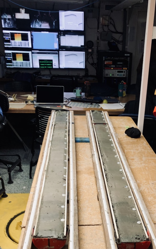
Gravity and piston coring (not shown) of seafloor sediments gives up to ~ 80 feet of seafloor mud, going back to last glacial maximum. In Disko Bay here.
It's all about the mud! Sectioned and described. Also, high resolution sub-bottom profiling with fancy sonar.
Which is older?
Huge tool
Nunataks! (Sharp peaks sculpted by surrounding glacial ice). Last land sighting for almost a month.
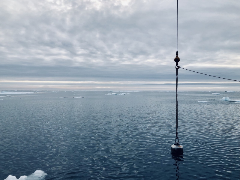
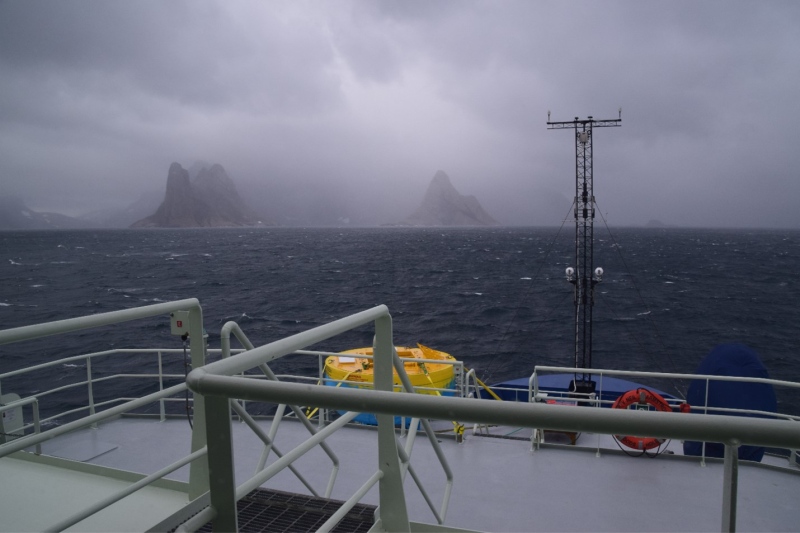
Vast swaths of sea ice pushed us north, close to the 75th parallel in Melville Bay in mid-July.
Glimpses of Baffin Bay:
[As the Arctic melts, my dream crystallizes]
Sleepy time.
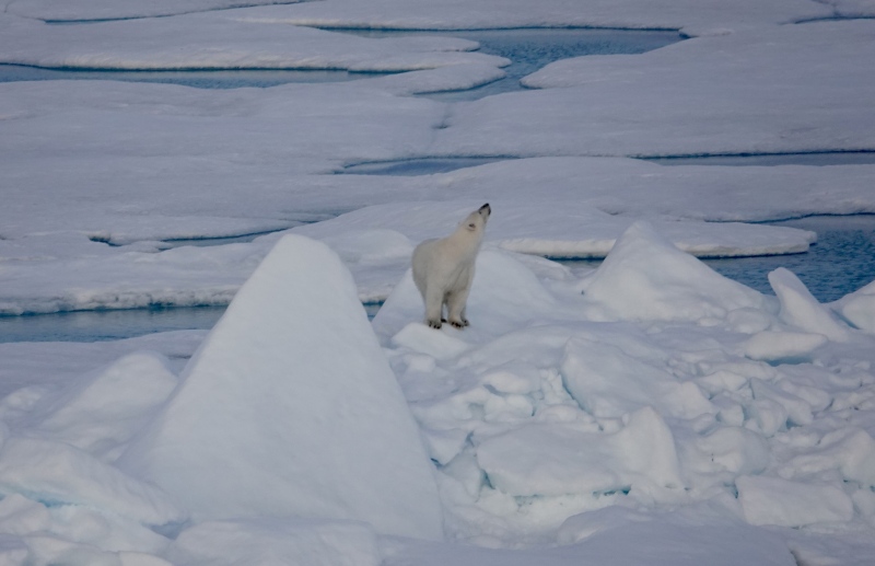
Humans smell tasty...
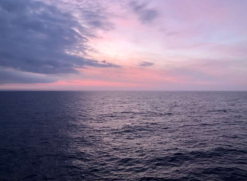
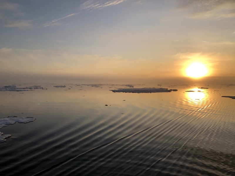
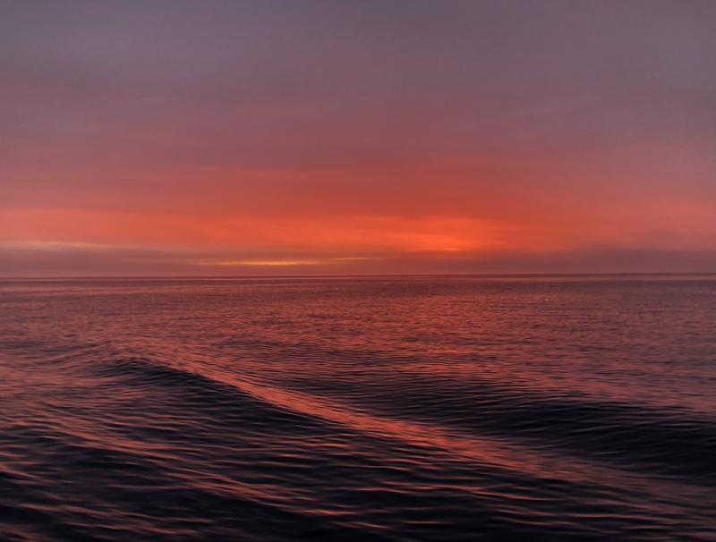
Sunrise from the bridge.
Midnight sun.
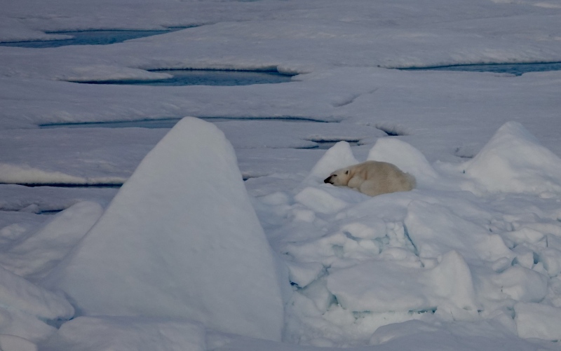
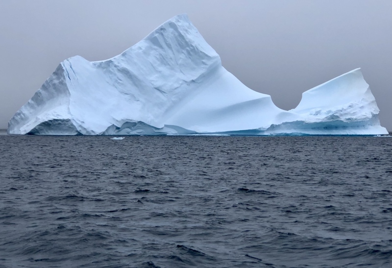
Monster was a few hundred feet above the water line.
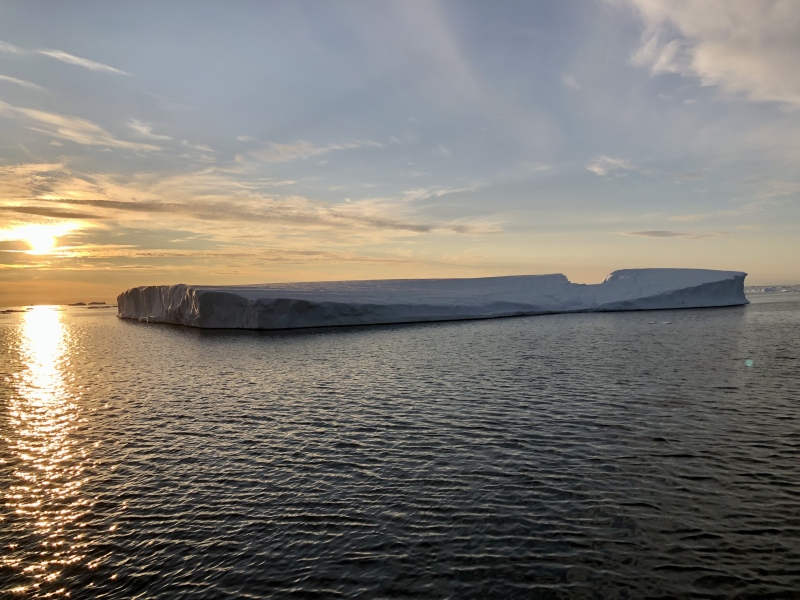
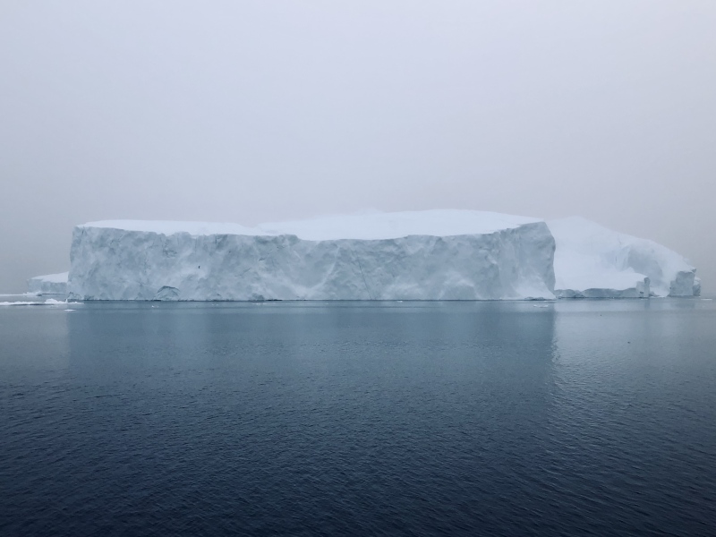
Bergs aren't real.
Sunrise in Uummannaq Bay.
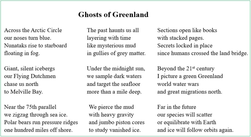
I wrote this on the ship in Baffin Bay.
R/V Neil Armstrong ship track for BADEX. Woods Hole, Ma to Nuuk, Greenland via the Labrador Sea and 4 bays containing giant underwater trough mouth fans off the west coast of Greenland in Baffin Bay.
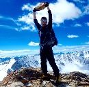
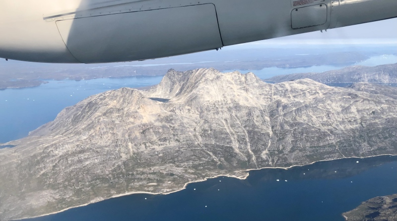
Sermitsiaq, Nuuk's iconic island peak. I stole this photo.
I didn't get paid for this expedition, so technically I was
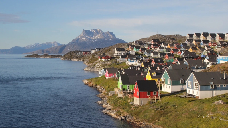
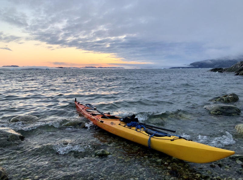
Peak day, 8.14.2023: I only have one full day in Nuuk. As the R/V Armstrong approached Nuuk, there was an extra 8 hours suddenly for two bonus CTD water sampling casts. I pumped ~200 L of water through my filters and collected the samples. I stayed up until 4 am, after working my 30th 12:30 am to 12:30 pm shift in a row! I went to sleep at 7pm that night and woke up at 2am on the 14th. I said goodbye to the ship, ate food, and left at ~3:15 am with my dry bag, drysuit, paddle, and backpack. I crossed Nuuk on foot, about 2.5 miles and reached my friend (Greenland Institute of Natural Resources scientist) Tobias' sea kayak at 4 am, just as the sun rose. No more midnight sun this far south (around 64th north parallel). Thanks for the loaner, man! So key.
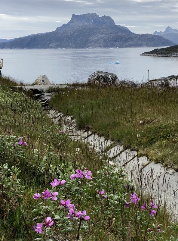
Sermitsiaq with Greenland's national flower (Niviarsiaq) on August 13th.
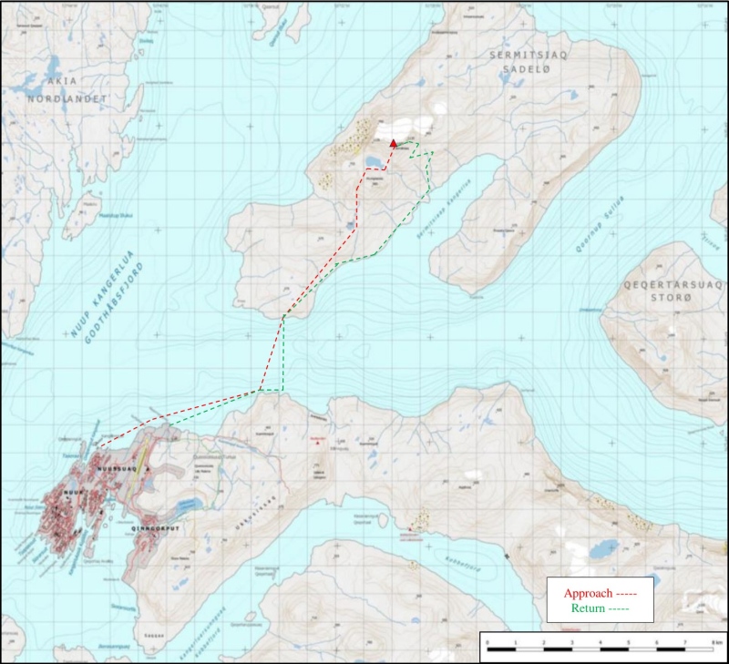
Nuuk to Sermitsiaq peak. Red dashed line is approach, green is return. Tracks are approximate. Didn't bring GPS on trip. Peakbagger map.
First time ever putting on a dry suit, water was ~39°F. It's been a few years since I kayaked! Sermitsiaq island is ~6 miles north-ish, in top right of photo.
Sermitsiaq Island, southeast tip.
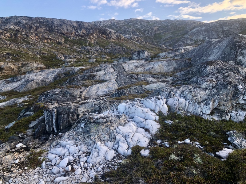
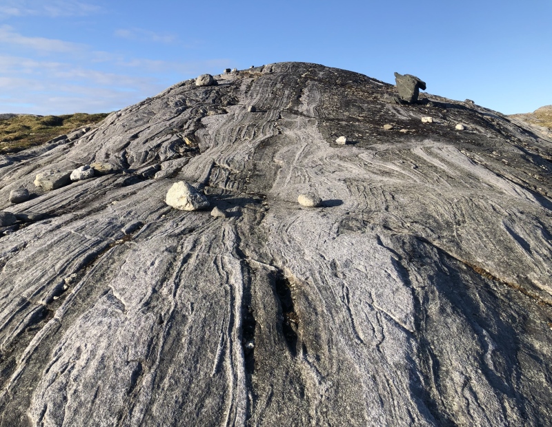
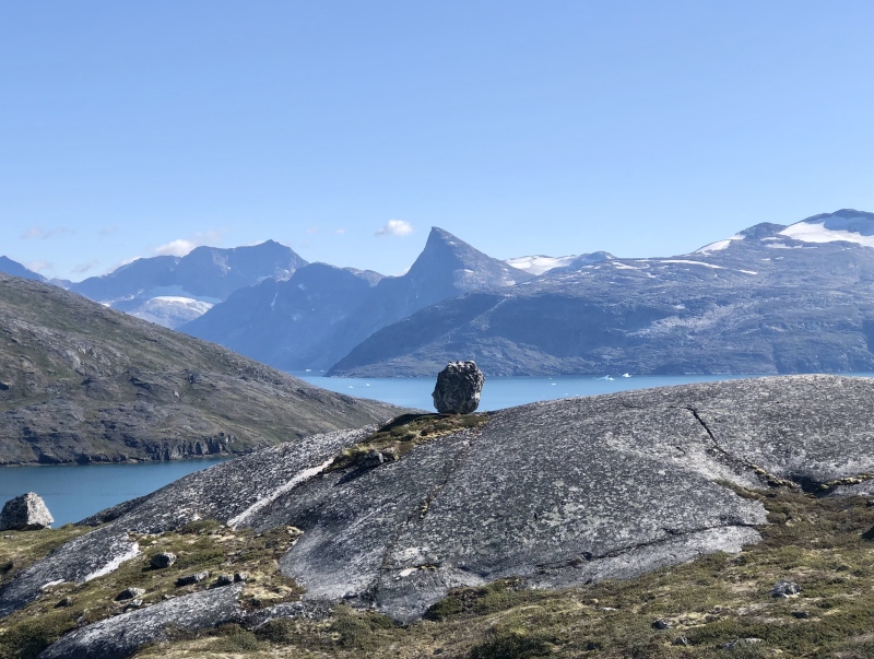
Land of metamorphic fabrics and glacial erratics!
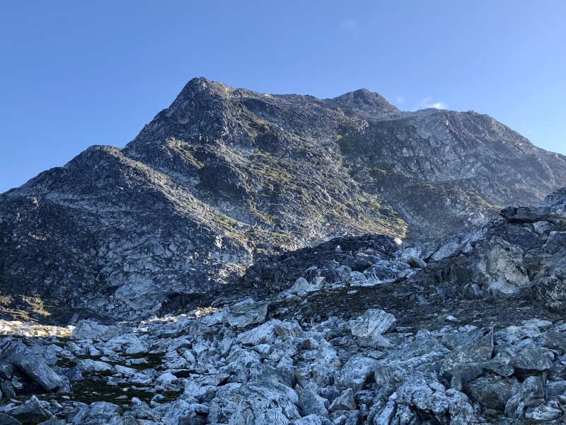
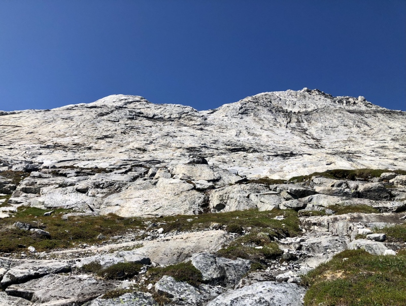
I climbed too high here, could have skirted to lookers right (east) and followed ledges to stay about 500 feet lower.
Drop down to the saddle. Continuing right (east-ish) reaches a higher saddle at around 1500 ft. Elevation guess since I didn't have a high res topo to go on.
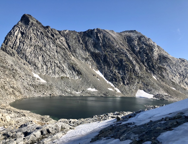
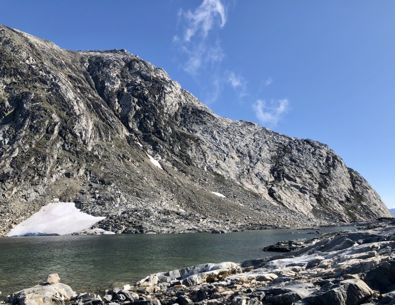
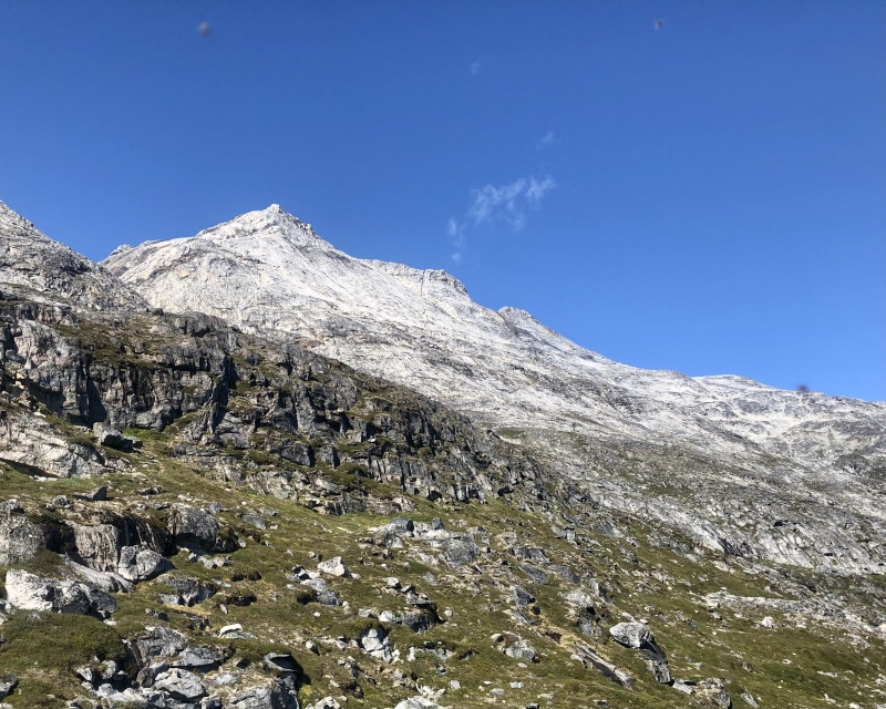
From the low point, I walked up that sunny, right-facing ramp and turned the corner to the south side of the peak. Atungaasaq (985 m) rises separately with Sermitsiaq to form the big mountain 'saddle.'
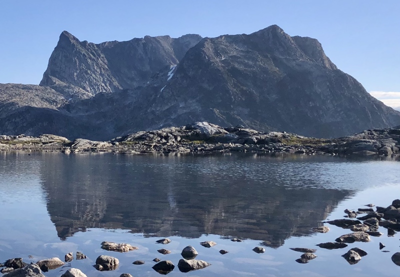
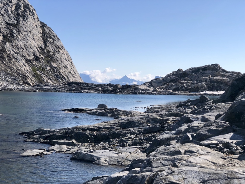
Secret lake between the two peaks! I wrapped around righthand (south) side of lake and climbed class 3 slabs on right side of photo to that East ridge. Left side (southern wall, I think) is said to be about 7 pitches of 5.9.
Greenland deserves a longer visit.
Much longer.
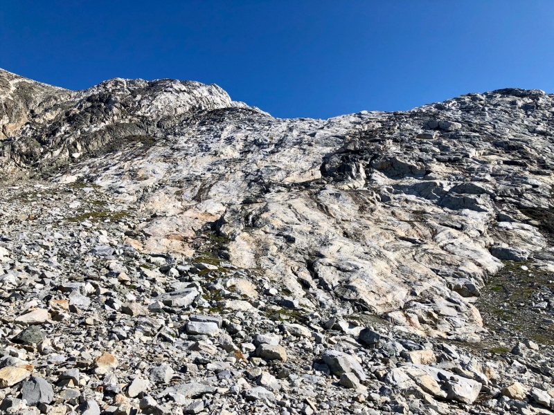
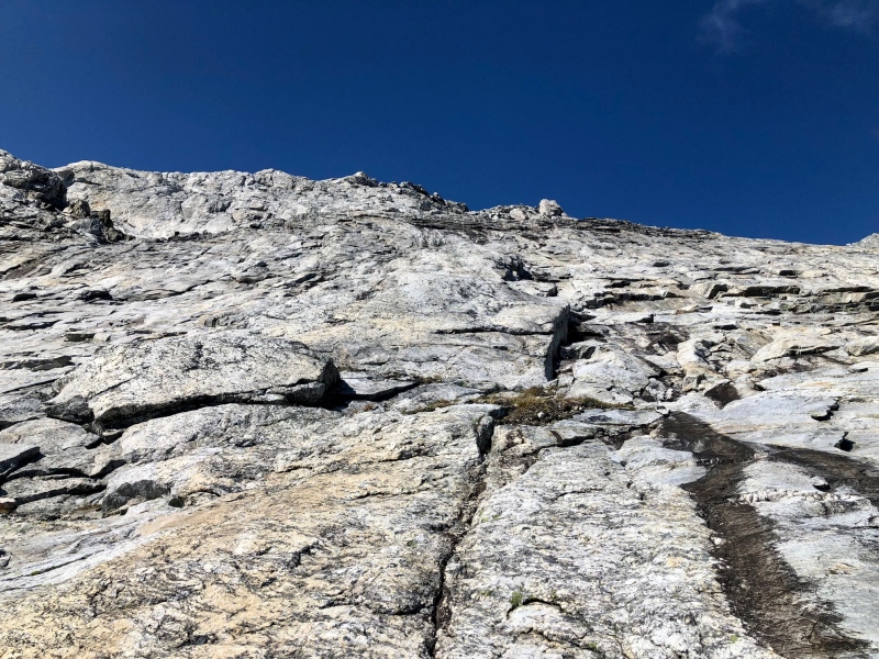
Aformentioned class 3 slabs. Solid metamorphic rock, super fun and grippy. Plenty of class 4 or low class 5 climbing nearby if you want it.
Enhance. Easier to the left (west). Up and right to the ridge stays on good stone.Nunataks! So steep, so sexy. High on the east ridge.
Little scamble finale to summit. Was about 70 degrees today with light wind. Nice weather, maybe too nice. Encountered yellow blazes here.
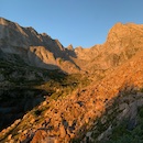
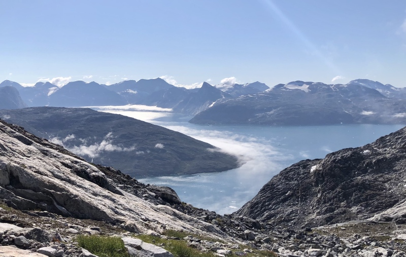
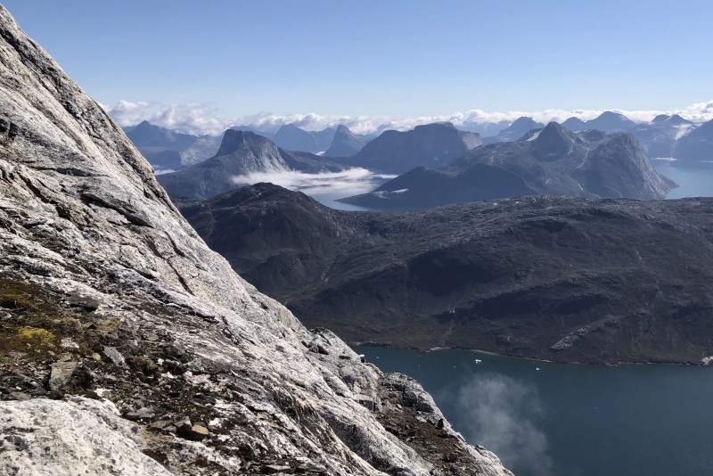
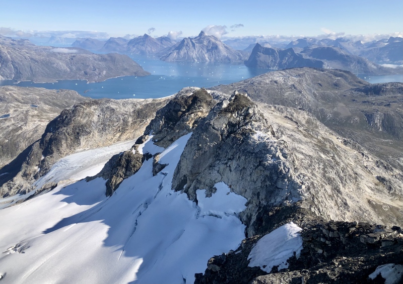
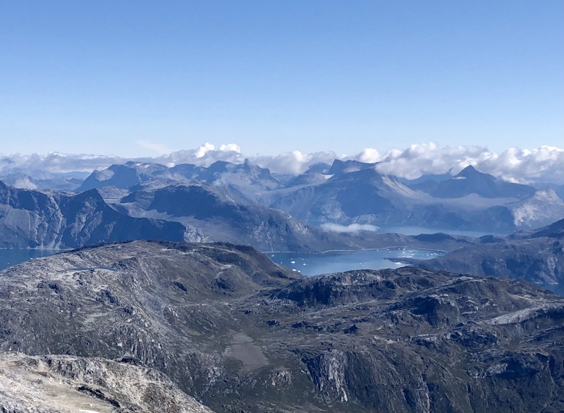
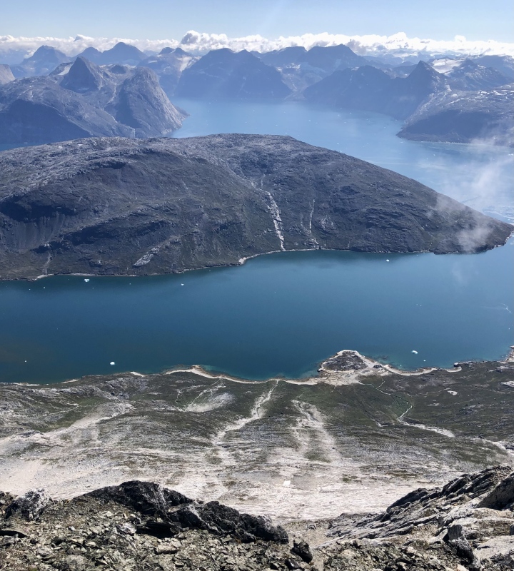
Looking south from near Sermitsiaq summit. Saddle lake, Atungaasaq peak, icy fjords, and Nuuk beyond.
Looking east from Sermitsiaq summit. North-facing glacier, ridge to "standard route" and epic mountains as far as the eye can see, until they run into the Greenland Ice Sheet. Summited a little after noon. Slow today!
I'll be back to Greenland someday...
Standard route, zigzags down class 3 slabs. Approaching from that beach below is likely the most efficient way to climb the peak from Nuuk (via motor boat or sea kayak). Some beta, though elevation gain seems off.
Could walk down 95% without hands in my approach shoes.
Less steep than it looks with solid and sticky stone! A joy except for my leg cramps after 5 weeks at sea, ha.
Sermitsiaq from the southwest, during my ~4 mile hike back along the coast to my kayak. I don't recommend this way. Between the swarming flies, shoreline cliff outs, and ankle-high birch (I think) that hide holes it took about 5 hours to get back to my boat from the summit. Bring a bug net for your head and a water pump!
Did I mention that Greenland is epic?!
Sermitsiaq on 8.15.2023 from my flight to Iceland. View to the west (ish).
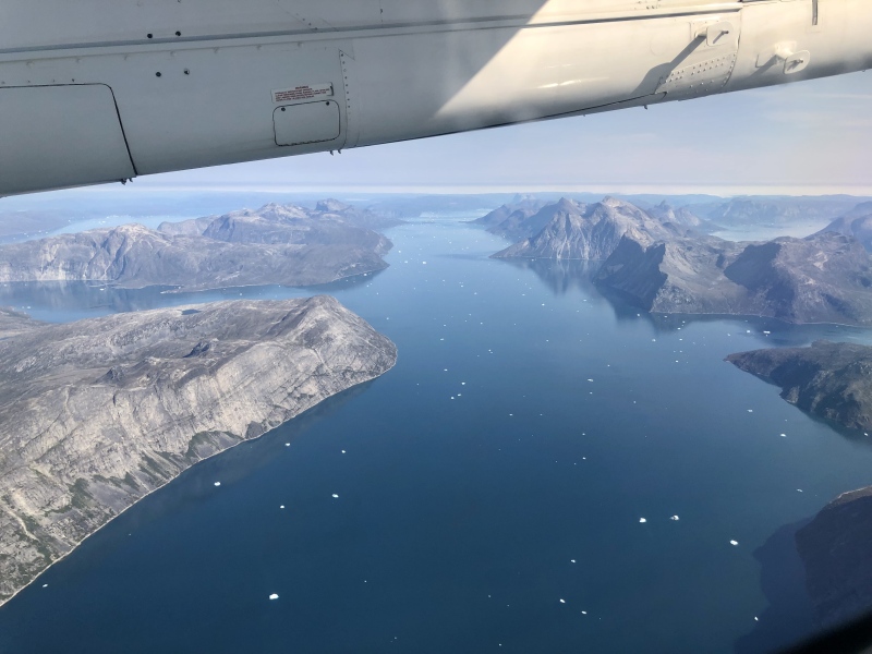
Fjords and Nunataks to the east of Sermitsiaq.
Outro: I got back to Tobias' sea kayak at 6 pm, after a long, slow bushwhack. I've never had leg cramps that sharp, and had to take a bunch of breaks to let them subside (and eat my way through fields of blue berries). Also, I flipped the kayak in the surf as I left the island to return. Fortunately it wasn't during the ~2 mile fjord crossing or in colder air temperatures. It felt refreshing and brackish but I knew I had to get moving as the sun began to drop.
For the peak, I recommend either the standard route with a kayak to Sermitsiaq Island's east side (inside the tuning fork feature), or kayak to the southern tip like I did, but stay low on the east side, go through the saddle, and scramble to the east ridge after wrapping around the saddle lake. My estimated stats were ~10 miles kayaking, ~14 miles hiking, and +/- 4,800 ft. Sermitsiaq is a magical peak and Nuuk is definitely worth a visit, though I'm sure there are more remote hidden gems in Greenland (Nuuk is ~20,000 people). Thank you for reading and feel free to message me if you have questions. Onward! Cheers, Rob
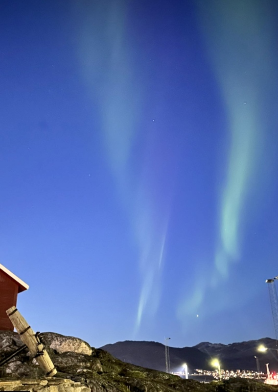
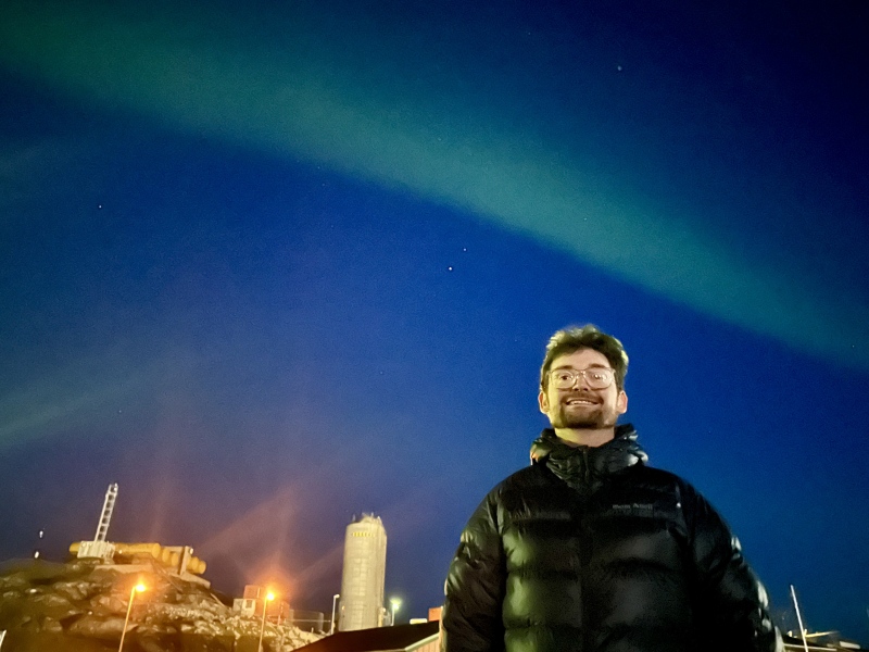
Finally, the Aurora!
Green band over Greenland.
Thumbnails for uploaded photos (click to open slideshow):
Caution: The information contained in this report may not be accurate and should not be the only resource used in preparation for your climb. Failure to have the necessary experience, physical conditioning, supplies or equipment can result in injury or death. 14ers.com and the author(s) of this report provide no warranties, either express or implied, that the information provided is accurate or reliable. By using the information provided, you agree to indemnify and hold harmless 14ers.com and the report author(s) with respect to any claims and demands against them, including any attorney fees and expenses. Please read the 14ers.com Safety and Disclaimer pages for more information.
Please respect private property: 14ers.com supports the rights of private landowners to determine how and by whom their land will be used. In Colorado, it is your responsibility to determine if land is private and to obtain the appropriate permission before entering the property.


")
")
")
")
")
")
")
")
")
")
")
")
")
")
")
")
")
")
")
")
")
")
")
")
")
")
")
")
")
")
")
")
")
")
")
")
")
")
")
")
")
")
")
")
")
")
")
")
")
")